Article

An Interannual Transfer Learning Approach for Crop Classification in the Hetao Irrigation District, China

1
State Key Laboratory of Remote Sensing Science, Aerospace Information Research Institute, Chinese Academy of Sciences, Beijing 100101, China
2
University of Chinese Academy of Sciences, Beijing 100049, China
3
Vlaamse Instelling voor Technologisch Onderzoek (VITO), Boeretang 200, 2400 Mol, Belgium
4
Key Laboratory of Desert and Desertification, Northwest Institute of Eco-Environment and Resources, Chinese Academy of Sciences, Lanzhou 730000, China
5
Big Data Center of Geospatial and Nature Resources of Qinghai Province, Xining 810001, China
*
Author to whom correspondence should be addressed.
Remote Sens. 2022, 14(5), 1208; https://doi.org/10.3390/rs14051208
Submission received: 13 January 2022 / Revised: 18 February 2022 / Accepted: 21 February 2022 / Published: 1 March 2022

Abstract

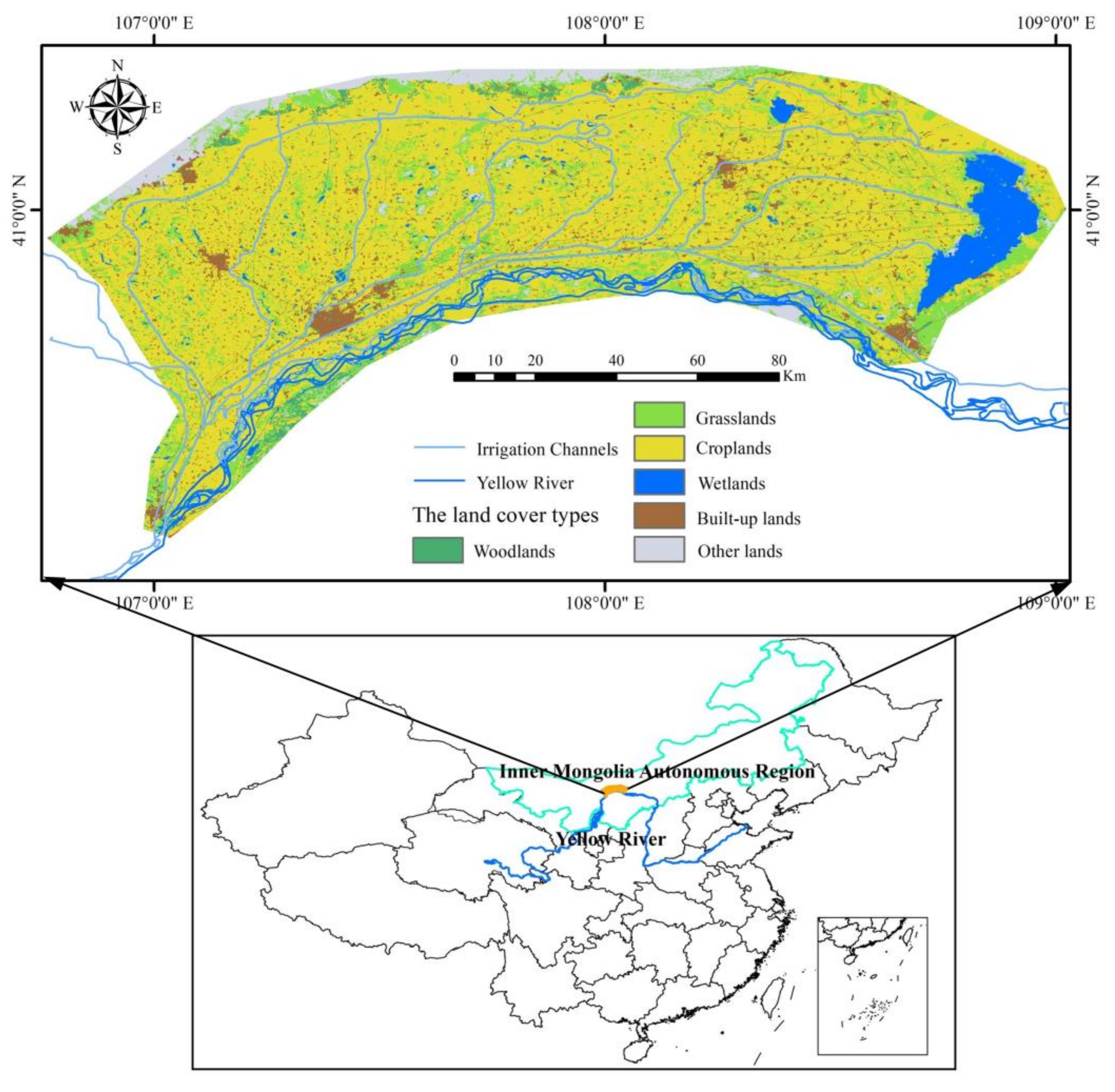
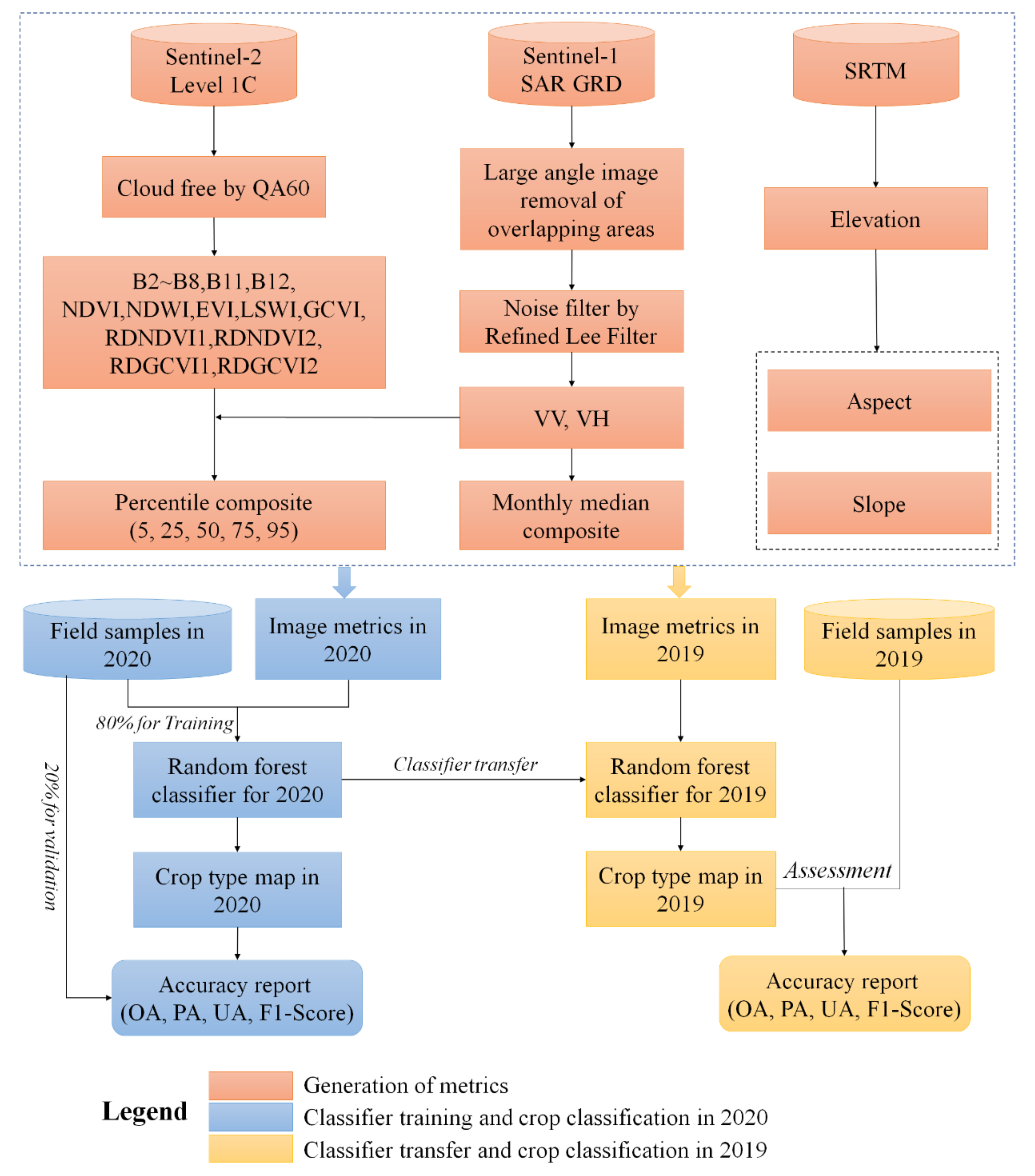
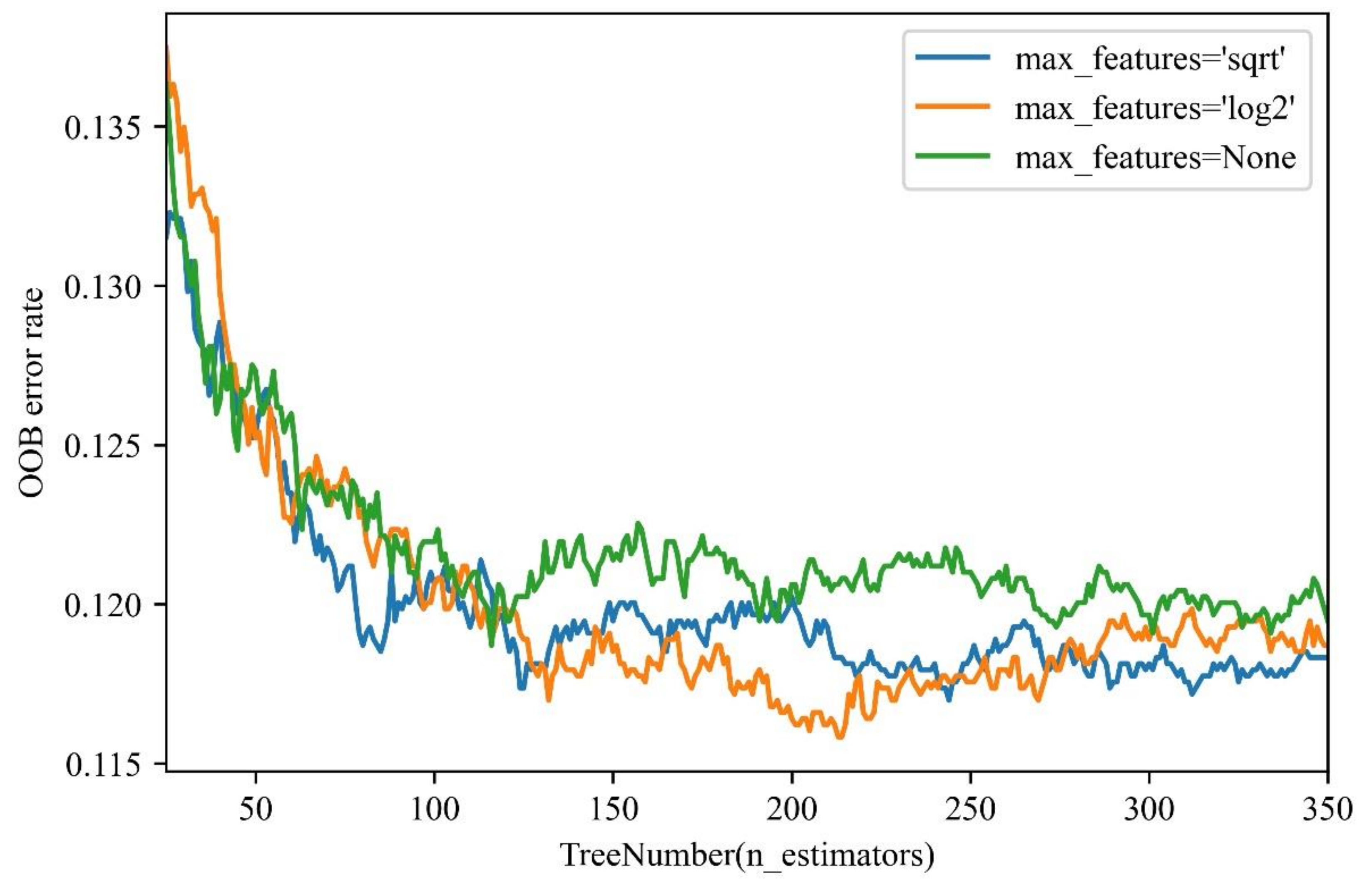
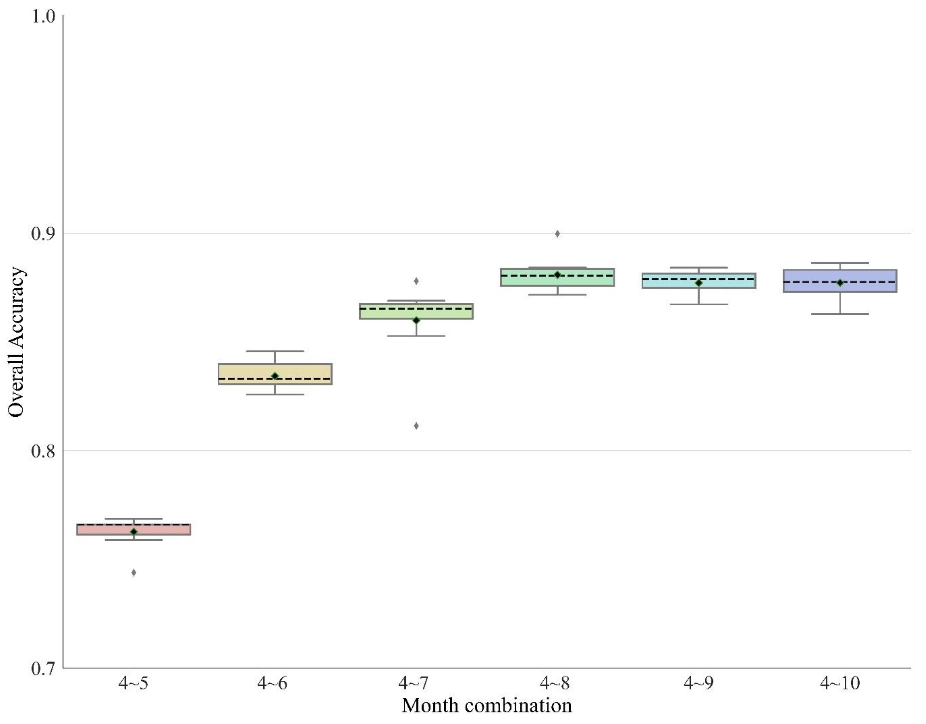
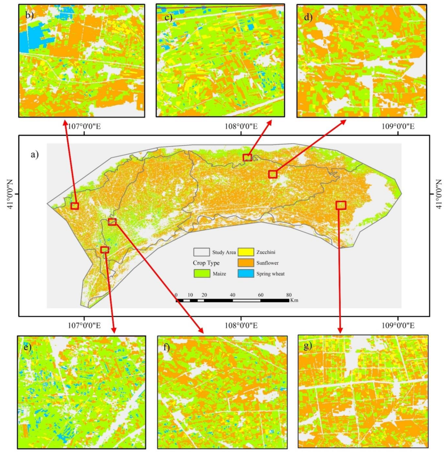
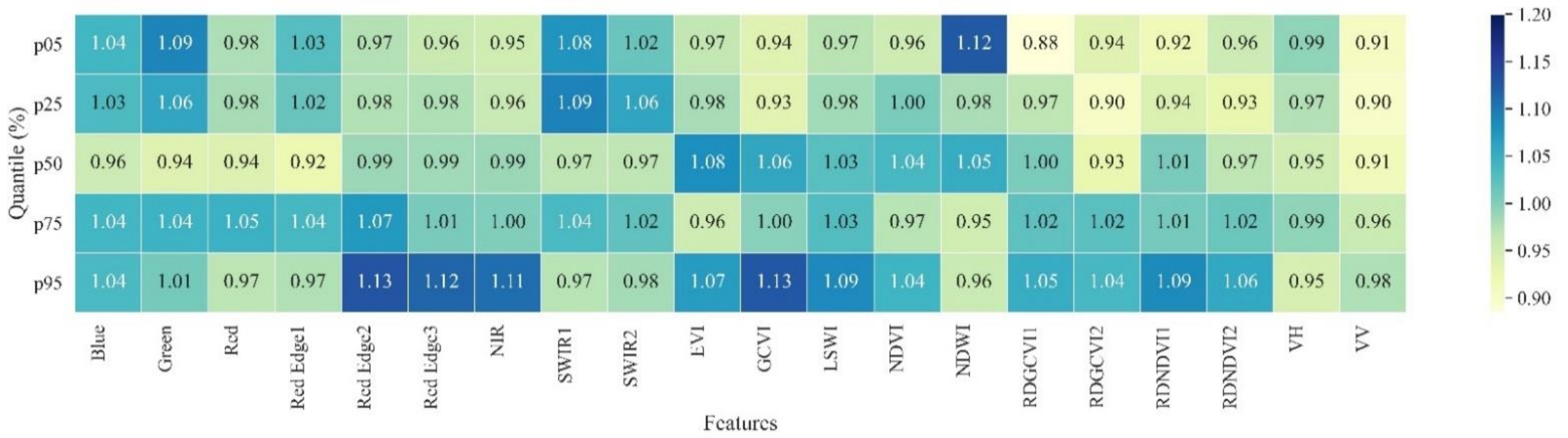
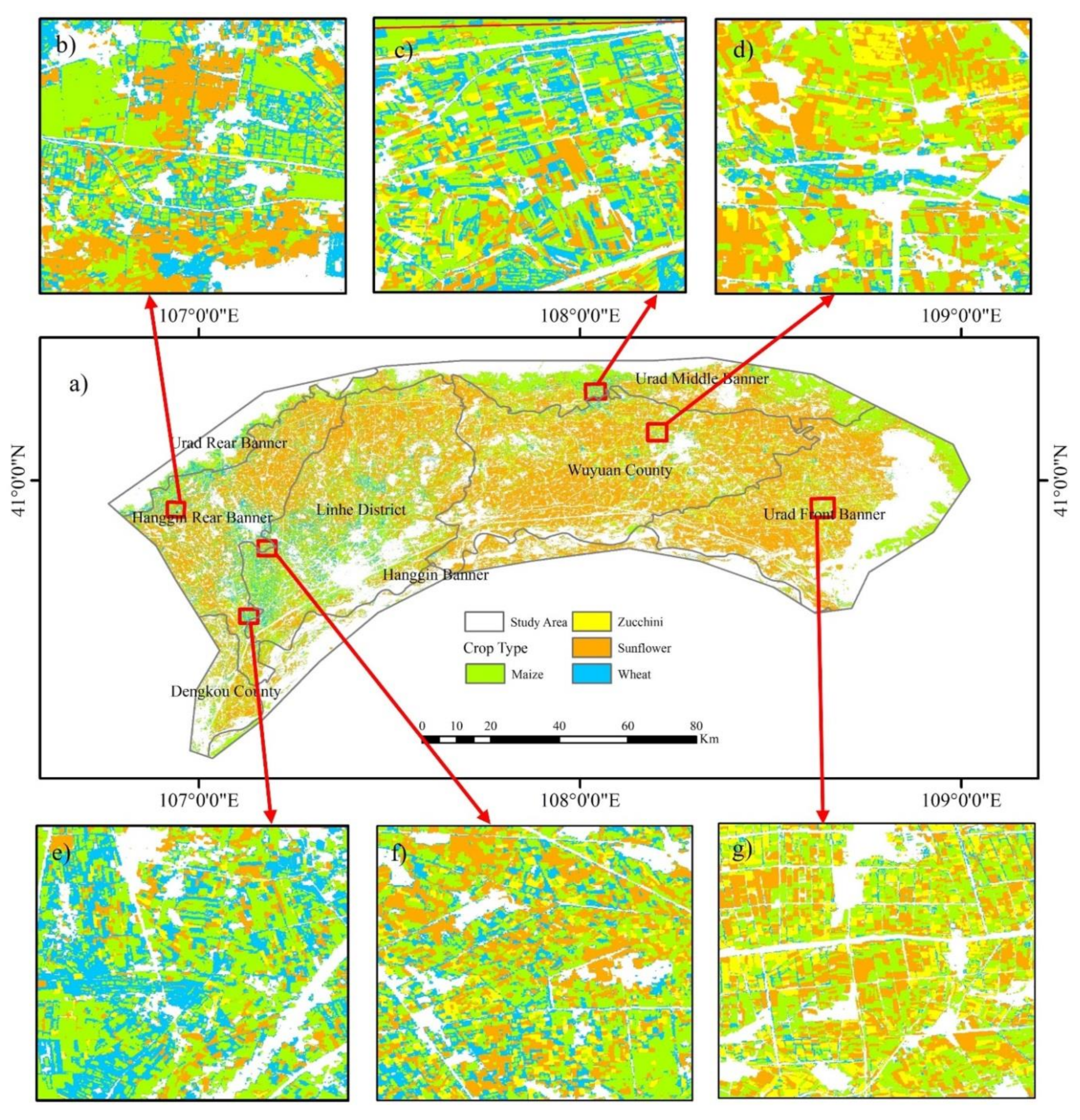
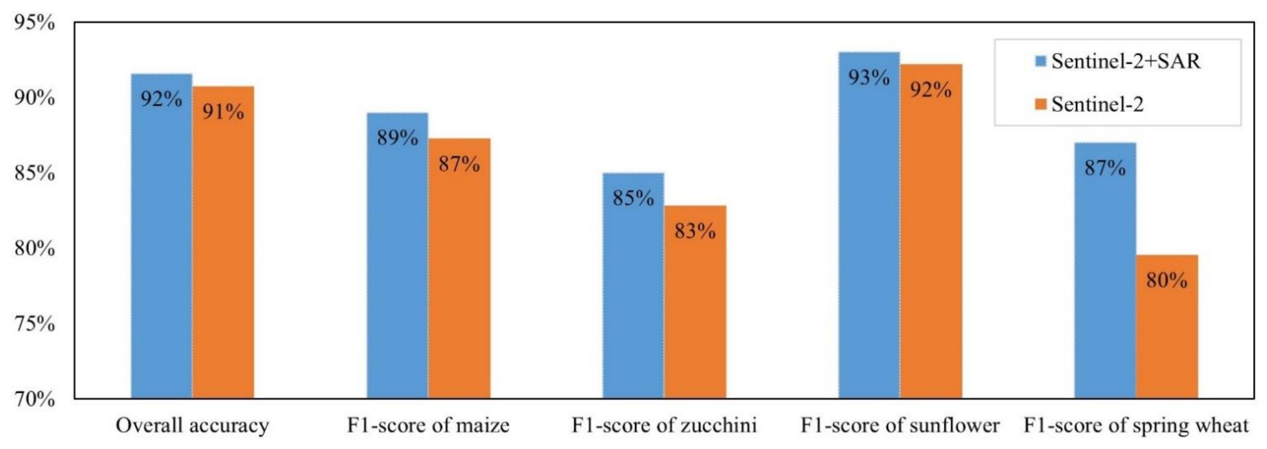
Crop type classification is critical for crop production estimation and optimal water allocation. Crop type data are challenging to generate if crop reference data are lacking, especially for target years with reference data missed in collection. Is it possible to transfer a trained crop type classification model to retrace the historical spatial distribution of crop types? Taking the Hetao Irrigation District (HID) in China as the study area, this study first designed a 10 m crop type classification framework based on the Google Earth Engine (GEE) for crop type mapping in the current season. Then, its interannual transferability to accurately retrace historical crop distributions was tested. The framework used Sentinel-1/2 data as the satellite data source, combined percentile, and monthly composite approaches to generate classification metrics and employed a random forest classifier with 300 trees for crop classification. Based on the proposed framework, this study first developed a 10 m crop type map of the HID for 2020 with an overall accuracy (OA) of 0.89 and then obtained a 10 m crop type map of the HID for 2019 with an OA of 0.92 by transferring the trained model for 2020 without crop reference samples. The results indicated that the designed framework could effectively identify HID crop types and have good transferability to obtain historical crop type data with acceptable accuracy. Our results found that SWIR1, Green, and Red Edge2 were the top three reflectance bands for crop classification. The land surface water index (LSWI), normalized difference water index (NDWI), and enhanced vegetation index (EVI) were the top three vegetation indices for crop classification. April to August was the most suitable time window for crop type classification in the HID. Sentinel-1 information played a positive role in the interannual transfer of the trained model, increasing the OA from 90.73% with Sentinel 2 alone to 91.58% with Sentinel-1 and Sentinel-2 together.
Keywords: crop type classification; random forest classifier; interannual transfer; GPS; video and GIS (GVG); Google Earth Engine; Hetao irrigation district crop type classification; random forest classifier; interannual transfer; GPS; video and GIS (GVG); Google Earth Engine; Hetao irrigation district