Dynamic Changes and Driving Forces of Alpine Wetlands on the Qinghai–Tibetan Plateau Based on Long-Term Time Series Satellite Data: A Case Study in the Gansu Maqu Wetlands
Abstract
:1. Introduction
2. Materials and Methods
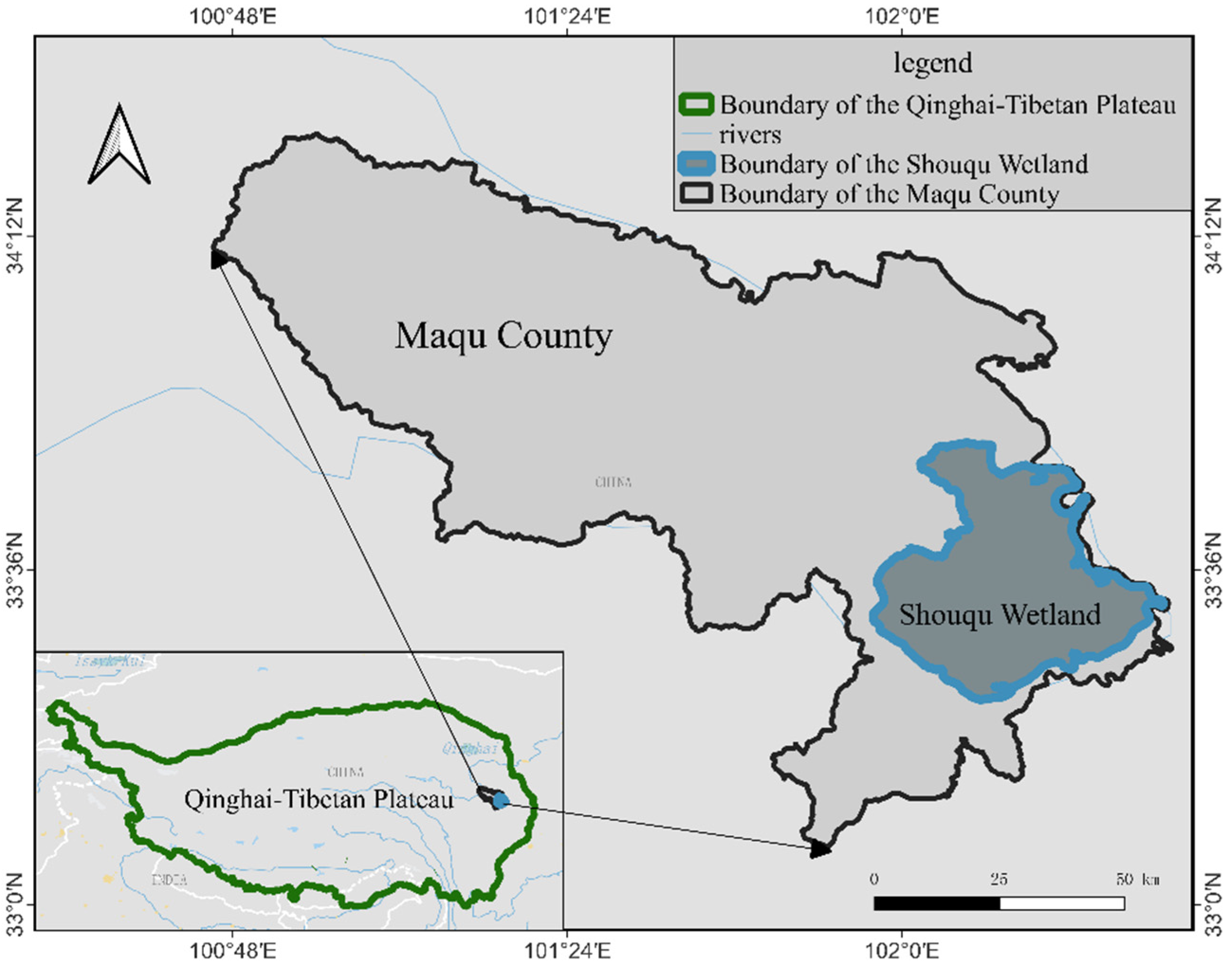
2.1. Study Area
2.2. Data
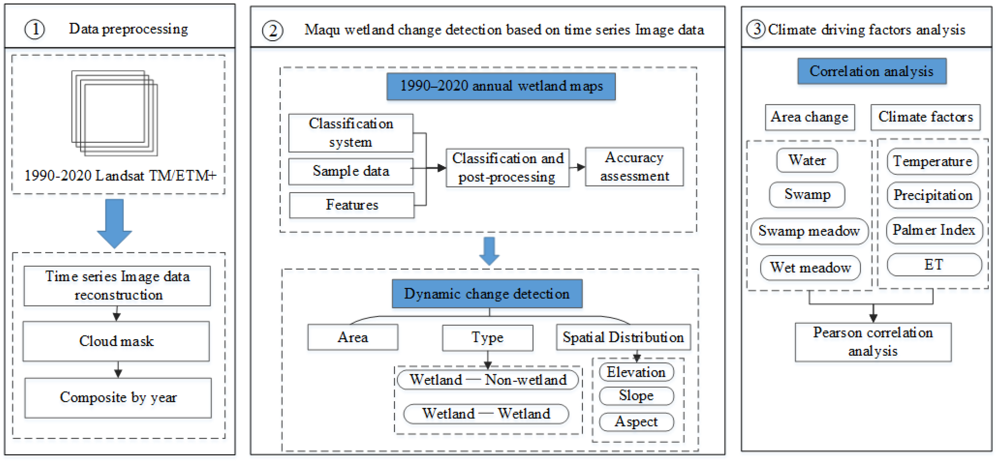
2.3. Methods
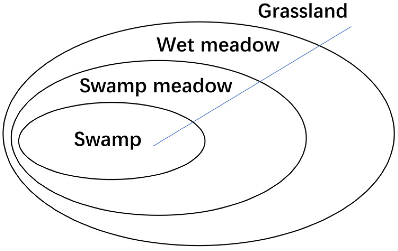
2.3.1. Classification System and Training Samples
2.3.2. Classification Based on Random Forest and Accuracy Assessment
| Features | Abbrev. | Formula | Reference |
|---|---|---|---|
| Water Body Index | NDWI | [41] | |
| MNDWI | [42] | ||
| LSWI | [43] | ||
| EWI | [44] | ||
| AWEI | ) | [45] | |
| Vegetation Index | NDVI | [46] | |
| RVI | |||
| RDVI | [47] | ||
| CIre | [48] | ||
| Terrain Features | TWI | [40] | |
| Slope | |||
| Aspect | |||
| Relief |
2.3.3. Post Classification Change Detection Analysis
3. Results
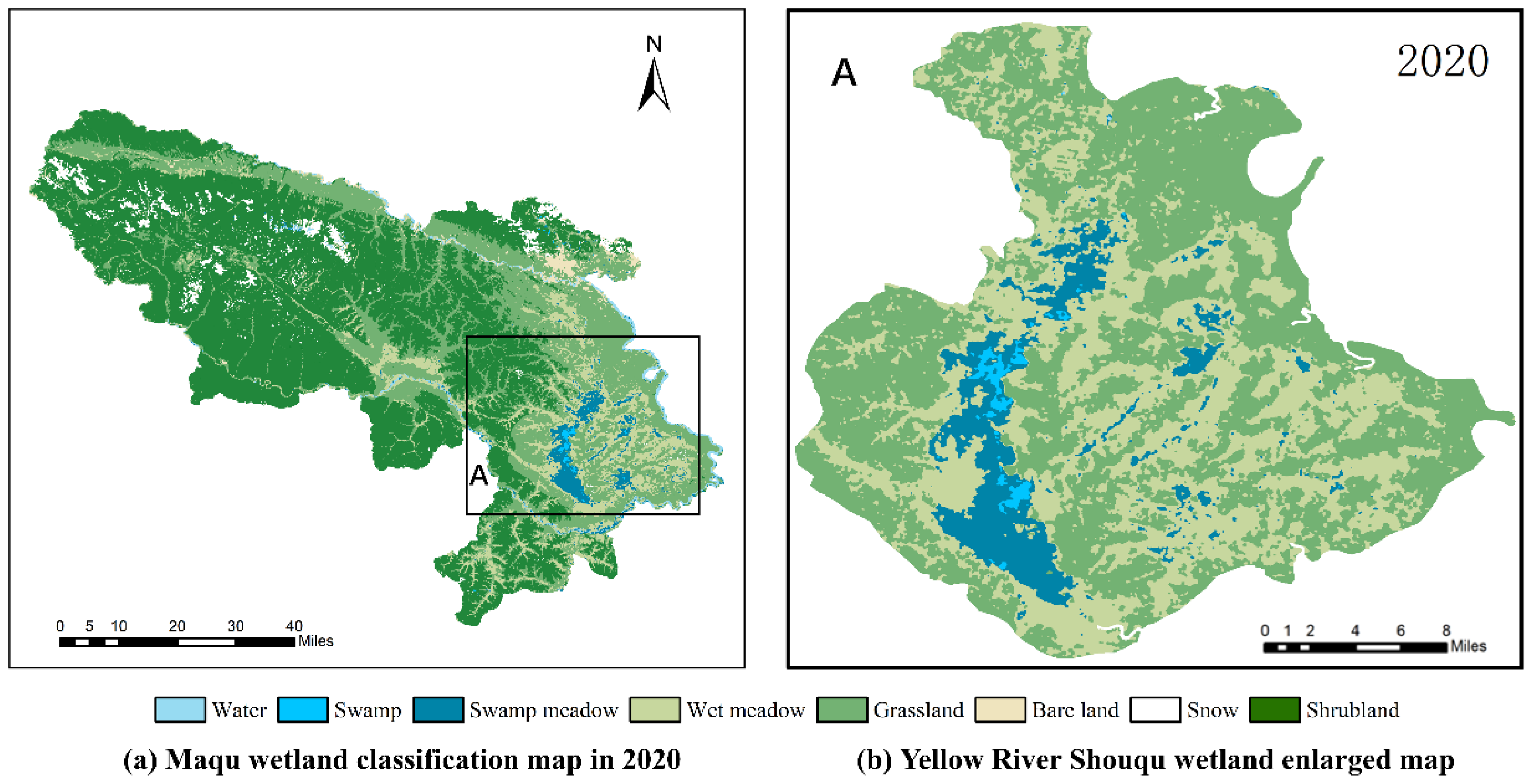
3.1. Annual Classification Results and Accuracy
3.2. Wetland Change Characteristics
3.2.1. Changes in Wetland Area
3.2.2. Changes in Wetland Type
3.2.3. Changes in Wetland Spatial Distribution
3.3. Driving Forces of Wetland Change
4. Discussion
4.1. Long-Term Annual Wetland Mapping and Change Detection
4.2. Analysis of within Wetland Changes
4.3. Limitations of the Current Study and Future Improvements
5. Conclusions
Author Contributions
Funding
Conflicts of Interest
References
- Brinson, M.M.; Malvárez, A.I.J.E.c. Temperate Freshwater Wetlands: Types, Status, and Threats; Cambridge University Press: Cambridge, UK, 2002; Volume 29, pp. 115–133. [Google Scholar]
- Gao, Q.Z.; Guo, Y.Q.; Xu, H.M.; Ganjurjav, H.; Li, Y.; Wan, Y.F.; Qin, X.B.; Ma, X.; Liu, S. Climate change and its impacts on vegetation distribution and net primary productivity of the alpine ecosystem in the Qinghai-Tibetan Plateau. Sci. Total Environ. 2016, 554, 34–41. [Google Scholar] [CrossRef]
- Cui, M.M.; Ma, A.Z.; Qi, H.Y.; Zhuang, X.L.; Zhuang, G.Q.; Zhao, G.H. Warmer temperature accelerates methane emissions from the Zoige wetland on the Tibetan Plateau without changing methanogenic community composition. Sci. Rep. 2015, 5, srep11616. [Google Scholar] [CrossRef] [Green Version]
- Toney, J.L.; García-Alix, A.; Jiménez-Moreno, G.; Anderson, R.S.; Seki, O. New insights into Holocene hydrology and temperature from lipid biomarkers in western Mediterranean alpine wetlands. Quat. Sci. Rev. 2020, 240, 106395. [Google Scholar]
- Shen, M.; Zhang, G.; Cong, N.; Wang, S.; Kong, W.; Piao, S. Increasing altitudinal gradient of spring vegetation phenology during the last decade on the Qinghai–Tibetan Plateau. Agric. For. Meteorol. 2014, 189–190, 71–80. [Google Scholar]
- Yao, T.; Bolch, T.; Chen, D.; Gao, J.; Immerzeel, W.; Piao, S.; Su, F.; Thompson, L.; Wada, Y.; Wang, L.; et al. The imbalance of the Asian water tower. Nat. Rev. Earth Environ. 2022, 1–15. [Google Scholar] [CrossRef]
- Winter, T.C. The vulnerability of wetlands to climate change: A hydrologic landscape perspective. JAWRA J. Am. Water Resour. Assoc. 2000, 36, 305–311. [Google Scholar]
- Niu, Z.G.; Zhang, H.Y.; Wang, X.W.; Yao, W.B.; Zhou, D.M.; Zhao, K.Y.; Zhao, H.; Li, N.N.; Huang, H.B.; Li, C.C.; et al. Mapping wetland changes in China between 1978 and 2008. Chin. Sci. Bull. 2012, 57, 2813–2823. [Google Scholar] [CrossRef] [Green Version]
- Wang, R.; He, M.; Niu, Z.G. Responses of Alpine Wetlands to Climate Changes on the Qinghai-Tibetan Plateau Based on Remote Sensing. Chin. Geogr. Sci. 2020, 30, 189–201. [Google Scholar] [CrossRef]
- Ding, M.; Zhang, Y.; Sun, X.; Liu, L.; Wang, Z.; Bai, W. Spatiotemporal variation in alpine grassland phenology in the Qinghai-Tibetan Plateau from 1999 to 2009. Chin. Sci. Bull. 2012, 58, 396–405. [Google Scholar]
- Xue, Z.S.; Zhang, Z.S.; Lu, X.G.; Zou, Y.C.; Lu, Y.L.; Jiang, M.; Tong, S.Z.; Zhang, K. Predicted areas of potential distributions of alpine wetlands under different scenarios in the Qinghai-Tibetan Plateau, China. Glob. Planet. Change 2014, 123, 77–85. [Google Scholar] [CrossRef]
- Wu, G.L.; Ren, G.H.; Wang, D.; Shi, Z.H.; Warrington, D. Above- and below-ground response to soil water change in an alpine wetland ecosystem on the Qinghai-Tibetan Plateau, China. J. Hydrol. 2013, 476, 120–127. [Google Scholar] [CrossRef]
- Chu, L.; Huang, C.; Liu, G.H.; Liu, Q.S.; Zhao, J. Analysis on Vegetation Changes of Maqu Alpine Wetlands in the Yellow River Source Region. In Proceedings of the Conference on Land Surface Remote Sensing II, Beijing, China, 13–16 October 2014. [Google Scholar]
- Chen, H.; Zhu, Q.; Peng, C.; Wu, N.; Wang, Y.; Fang, X.; Gao, Y.; Zhu, D.; Yang, G.; Tian, J.; et al. The impacts of climate change and human activities on biogeochemical cycles on the Q inghai-Tibetan Plateau. Glob. Change Biol. 2013, 19, 2940–2955. [Google Scholar]
- Syphard, A.D.; Garcia, M.W. Human- and beaver-induced wetland changes in the Chickahominy River watershed from 1953 to 1994. Wetlands 2001, 21, 342–353. [Google Scholar] [CrossRef]
- Mabwoga, S.; Thukral, A.J.S. Characterization of change in the Harike wetland, a Ramsar site in India, using landsat satellite data. SpringerPlus 2014, 3, 576. [Google Scholar]
- Marie, T.; Lai, X.; Huber, C.; Chen, X.; Uribe, C.; Huang, S.; LaCaux, J.-P.; LaFaye, M.; Yesou, H. Monitoring Temporal Evolution of the Presence Intermediate Host of the Schistosomiasis and its Risk Transmission Based on Dragon Times Series in Poyang Lake Area Jiangxi Province, PR China. In Proceedings of the ESA Living Planet Symposium, Bergen, Norway, 28 June–2 July 2010; p. 190. [Google Scholar]
- Coppin, P.; Jonckheere, I.; Nackaerts, K.; Muys, B.; Lambin, E. Digital change detection methods in ecosystem monitoring: A review. Int. J. Remote Sens. 2004, 25, 1565–1596. [Google Scholar] [CrossRef]
- Yang, T.; Guan, X.; Qian, Y.; Xing, W.; Wu, H. Efficiency Evaluation of Urban Road Transport and Land Use in Hunan Province of China Based on Hybrid Data Envelopment Analysis (DEA) Models. Sustainability 2019, 11, 3826. [Google Scholar]
- Barnieh, B.A.; Jia, L.; Menenti, M.; Zhou, J.; Zeng, Y.L. Mapping Land Use Land Cover Transitions at Different Spatiotemporal Scales in West Africa. Sustainability 2020, 12, 8565. [Google Scholar] [CrossRef]
- Soliman, G.; Soussa, H. Wetland change detection in Nile swamps of southern Sudan using multitemporal satellite imagery. J. Appl. Remote Sens. 2011, 5, 053517. [Google Scholar] [CrossRef]
- Zhou, H.P.; Jiang, H.; Huang, Q.H. Landscape and Water Quality Change Detection in Urban Wetland: A Post-classification Comparison Method with IKONOS Data. In Proceedings of the 3rd International Conference on Environmental Science and Information Application Technology (ESIAT), Xi’an, China, 20–21 August 2011; pp. 1726–1731. [Google Scholar]
- Pouliot, D.; Latifovic, R.; Fernandes, R.; Olthof, I. Evaluation of annual forest disturbance monitoring using a static decision tree approach and 250 m MODIS data. Remote Sens. Environ. 2009, 113, 1749–1759. [Google Scholar]
- Wu, L.; Li, Z.; Liu, X.; Zhu, L.; Tang, Y.; Zhang, B.; Xu, B.; Liu, M.; Meng, Y.; Liu, B. Multi-Type Forest Change Detection Using BFAST and Monthly Landsat Time Series for Monitoring Spatiotemporal Dynamics of Forests in Subtropical Wetland. Remote Sens. 2020, 12, 341. [Google Scholar]
- Huang, H.; Chen, Y.; Clinton, N.; Wang, J.; Wang, X.; Liu, C.; Gong, P.; Yang, J.; Bai, Y.; Zheng, Y.; et al. Mapping major land cover dynamics in Beijing using all Landsat images in Google Earth Engine. Remote Sens. Environ. 2017, 202, 166–176. [Google Scholar]
- Gorelick, N.; Hancher, M.; Dixon, M.; Ilyushchenko, S.; Thau, D.; Moore, R. Google Earth Engine: Planetary-scale geospatial analysis for everyone. Remote Sens. Environ. 2017, 202, 18–27. [Google Scholar]
- Mutanga, O.; Kumar, L. Google Earth Engine Applications. Remote Sens. 2019, 11, 591. [Google Scholar]
- Liu, D.; Chen, N.; Zhang, X.; Wang, C.; Du, W. Annual large-scale urban land mapping based on Landsat time series in Google Earth Engine and OpenStreetMap data: A case study in the middle Yangtze River basin. ISPRS J. Photogramm. Remote Sens. 2019, 159, 337–351. [Google Scholar]
- Zhang, Y.; Wang, G.; Wang, Y. Changes in alpine wetland ecosystems of the Qinghai–Tibetan plateau from 1967 to 2004. Environ. Monit. Assess. 2010, 180, 189–199. [Google Scholar]
- Abatzoglou, J.T.; Dobrowski, S.Z.; Parks, S.A.; Hegewisch, K.C. TerraClimate, a high-resolution global dataset of monthly climate and climatic water balance from 1958–2015. Sci. Data 2018, 5, 170191. [Google Scholar]
- Klingaman, T.E.; Oliver, L.R. Palmer Amaranth (Amaranthus palmeri) Interference in Soybeans (Glycine max). Weed Sci. 1994, 42, 523–527. [Google Scholar] [CrossRef]
- Pressey, R.L.; Adam, P. A review of wetland inventory and classification in Australia. In Classification and Inventory of the World’s Wetlands; Springer: Dordrecht, The Netherlands, 1995; pp. 81–101. [Google Scholar]
- Zhang, Y.L.; Wang, C.L.; Bai, W.Q.; Wang, Z.F.; Tu, Y.L.; Yangjaen, D.G. Alpine wetlands in the Lhasa River Basin, China. J. Geogr. Sci. 2010, 20, 375–388. [Google Scholar] [CrossRef]
- Zheng, Y.M.; Niu, Z.G.; Gong, P.; Li, M.N.; Hu, L.L.; Wang, L.; Yang, Y.X.; Gu, H.J.; Mu, J.R.; Dou, G.J.; et al. A method for alpine wetland delineation and features of border: Zoig Plateau, China. Chin. Geogr. Sci. 2017, 27, 784–799. [Google Scholar] [CrossRef] [Green Version]
- Huo, L.L.; Chen, Z.K.; Zou, Y.C.; Lu, X.G.; Guo, J.W.; Tang, X.G. Effect of Zoige alpine wetland degradation on the density and fractions of soil organic carbon. Ecol. Eng. 2013, 51, 287–295. [Google Scholar] [CrossRef]
- Ren, G.H.; Deng, B.; Shang, Z.H.; Hou, Y.; Long, R.J. Plant communities and soil variations along a successional gradient in an alpine wetland on the Qinghai-Tibetan Plateau. Ecol. Eng. 2013, 61, 110–116. [Google Scholar]
- Yan, X.; Niu, Z.G. Reliability Evaluation and Migration of Wetland Samples. IEEE J. Sel. Top. Appl. Earth Obs. Remote Sens. 2021, 14, 8089–8099. [Google Scholar] [CrossRef]
- Breiman, L.J.M.L. Random forests. Comput. Sci. Mach. Learn. 2001, 45, 5–32. [Google Scholar]
- Ghorbanian, A.; Zaghian, S.; Asiyabi, R.; Amani, M.; Mohammadzadeh, A.; Jamali, S. Mangrove Ecosystem Mapping Using Sentinel-1 and Sentinel-2 Satellite Images and Random Forest Algorithm in Google Earth Engine. Remote Sens. 2021, 13, 2565. [Google Scholar]
- Beven, K.J.; Kirkby, M.J. A physically based, variable contributing area model of Basin hydrology/Un modèle à base physique de zone d’appel variable de l’hydrologie du bassin versant. Hydrol. Sci. Bull. 1979, 24, 43–69. [Google Scholar] [CrossRef] [Green Version]
- McFeeters, S.K. The use of the Normalized Difference Water Index (NDWI) in the delineation of open water features. Int. J. Remote Sens. 1996, 17, 1425–1432. [Google Scholar]
- Xu, H.Q. Modification of normalised difference water index (NDWI) to enhance open water features in remotely sensed imagery. Int. J. Remote Sens. 2006, 27, 3025–3033. [Google Scholar] [CrossRef]
- Chandrasekar, K.; Sesha Sai, M.V.R.; Roy, P.S.; Dwevedi, R.S. Land Surface Water Index (LSWI) response to rainfall and NDVI using the MODIS Vegetation Index product. Int. J. Remote Sens. 2010, 31, 3987–4005. [Google Scholar]
- Pci, Y.A.N.; Youjing, Z.; Yuan, Z. A Study on Information Extraction of Water Enhanced Water Index (EWI) and GIS System in Semi-arid Regions with the Based Noise Remove Techniques. Remote Sens. Inf. 2007, 6, 62–67. [Google Scholar]
- Feyisa, G.L.; Meilby, H.; Fensholt, R.; Proud, S.R. Automated Water Extraction Index: A new technique for surface water mapping using Landsat imagery. Remote Sens. Environ. 2014, 140, 23–35. [Google Scholar] [CrossRef]
- Tucker, C.J. Red and photographic infrared linear combinations for monitoring vegetation. Remote Sens. Environ. 1979, 8, 127–150. [Google Scholar]
- Roujean, J.-L.; Breon, F.-M. Estimating PAR absorbed by vegetation from bidirectional reflectance measurements. Remote Sens. Environ. 1995, 51, 375–384. [Google Scholar] [CrossRef]
- Gitelson, A.A.; Gritz, Y.; Merzlyak, M.N. Relationships between leaf chlorophyll content and spectral reflectance and algorithms for non-destructive chlorophyll assessment in higher plant leaves. J. Plant Physiol. 2003, 160, 271–282. [Google Scholar] [CrossRef]
- Gao, J.; Li, X.L.; Brierley, G. Topographic influence on wetland distribution and change in Maduo County, Qinghai-Tibet Plateau, China. J. Mt. Sci. 2012, 9, 362–371. [Google Scholar] [CrossRef]
- Metz, M.; Mitasova, H.; Harmon, R.S. Accurate stream extraction from large, radar-based elevation models. Hydrol. Earth Syst. Sci. Discuss. 2010, 7, 3213–3235. [Google Scholar]
- Lippitt, C.D.; Rogan, J.; Li, Z.; Eastman, J.R.; Jones, T.G. Mapping selective logging in mixed deciduous forest: A comparison of Machine Learning Algorithms. Photogramm. Eng. Remote Sens. 2008, 74, 1201–1211. [Google Scholar] [CrossRef] [Green Version]
- Boriah, S. Time Series Change Detection: Algorithms for Land Cover Change; University of Minnesota: Minneapolis, MN, USA, 2010. [Google Scholar]
- Todorova, M.; Grozeva, N.; Dermendgieva, D. Technology. Soil properties and salt content of soil from Inland salt meadow near Radnevo town. Agric. Sci. Technol. 2014, 6, 68–71. [Google Scholar]
- Douda, J.; Čejková, A.; Douda, K.; Kochánková, J. Development of alder carr after the abandonment of wet grasslands during the last 70 years. Ann. For. Sci. 2009, 66, 712. [Google Scholar]
- Simard, M.; Lecomte, N.; Bergeron, Y.; Bernier, P.Y.; Paré, D. FForest productivity decline caused by successional paludification of boreal soils. Ecol. Appl. 2007, 17, 1619–1637. [Google Scholar]





| Period | Landsat Satellite | Number of Images |
|---|---|---|
| 1990–2011 | Landsat 5 TM | 570 |
| 2012 | Landsat 7 ETM+ | 21 |
| 2013–2020 | Landsat 8 OLI | 285 |
| Type | Class | Description | Image Example |
|---|---|---|---|
| Wetland | Water body | Freshwater surfaces, including water course of a plain river in the basin and some lakes | 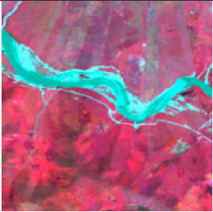 |
| Swamp | In a wet state for a long time, with special vegetation and soil-forming processes, peat accumulation in some areas |  | |
| Swamp meadow | Distributed in wide valleys with medium-lower altitudes, low-lying terrain, poor drainage, and excessively wet soil, in the transition zone between swamp and wet meadow |  | |
| Wet meadow | Distributed on the flood plain and island areas with poorly drained soils, composed of Kobresia, Carex, and Gramineae. |  | |
| Non- wetland | Grassland | Distributed on plains and gently sloping areas, mainly herbaceous plants grow | 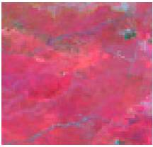 |
| Shrubland | Distributed in alpine areas, alpine dwarf forests, and other shrub lands that cannot be easily converted to trees |  | |
| Bare land | Non-vegetated land, including built-up areas and exposed rock. |  | |
| Snow | Distributed in steep alpine areas, partly in the shadow of mountains | 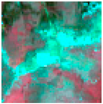 |
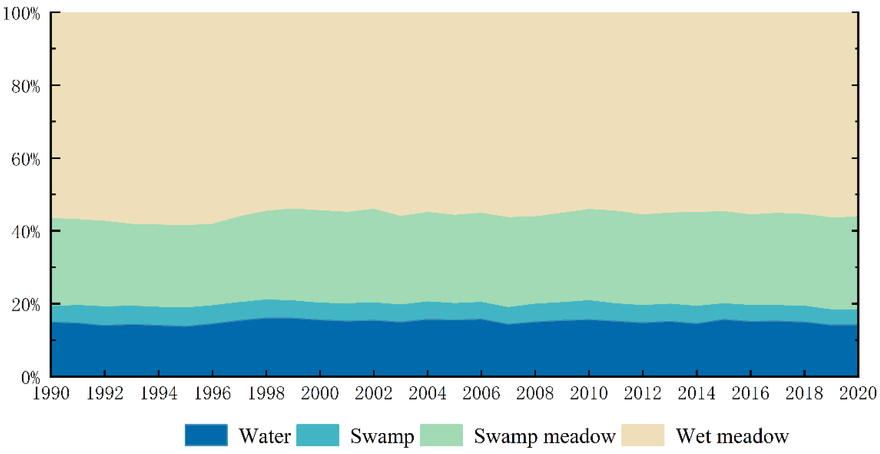
| Wetland Type | 1990 | 2003 | 2012 | 2020 | 1990–2003 | 2003–2012 | 2012–2020 | 1990–2020 |
|---|---|---|---|---|---|---|---|---|
| Water | 184.86 | 143.39 | 145.06 | 143.94 | −41.47 | +1.67 | −1.12 | −40.92 |
| Swamp | 65.89 | 44.61 | 43.25 | 40.81 | −21.28 | −1.36 | −2.44 | −25.08 |
| Swamp meadow | 298.81 | 232.89 | 258.52 | 257.69 | −65.92 | +25.63 | −0.83 | −41.12 |
| Wet meadow | 698.11 | 536.67 | 584.53 | 569.04 | −161.44 | +47.86 | −15.49 | −129.07 |
| Total | 1247.67 | 957.56 | 1031.36 | 10,111.484 | −290.11 | +73.80 | −19.88 | −236.19 |
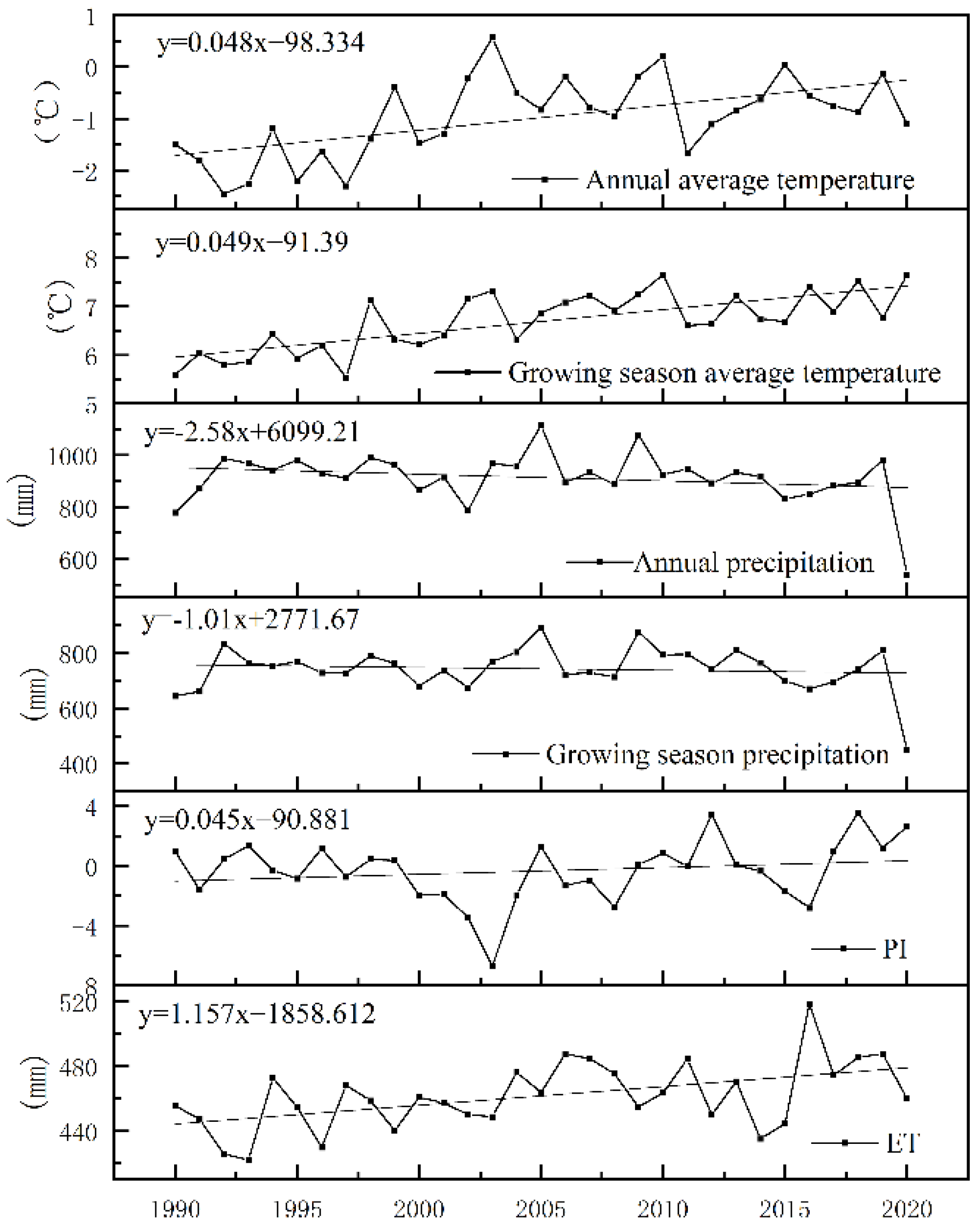
| Driving Forces | Water | Swamp | Swamp Meadow | Wet Meadow | Total |
|---|---|---|---|---|---|
| Annual average temperature | −0.629 * | −0.695 * | −0.656 * | −0.748 * | −0.754 * |
| Average growing season temperature | −0.73 * | −0.661 * | −0.662 * | −0.717 * | −0.744 * |
| Annual precipitation | 0.471 * | 0.4 * | 0.298 | 0.319 | 0.357 |
| Growing season precipitation | 0.469 * | 0.405 * | 0.288 | 0.299 | 0.342 |
| PI | 0.163 | 0.084 | 0.319 * | 0.226 | 0.236 |
| ET | −0.482 * | −0.561 * | −0.466 * | −0.467 * | −0.501 * |
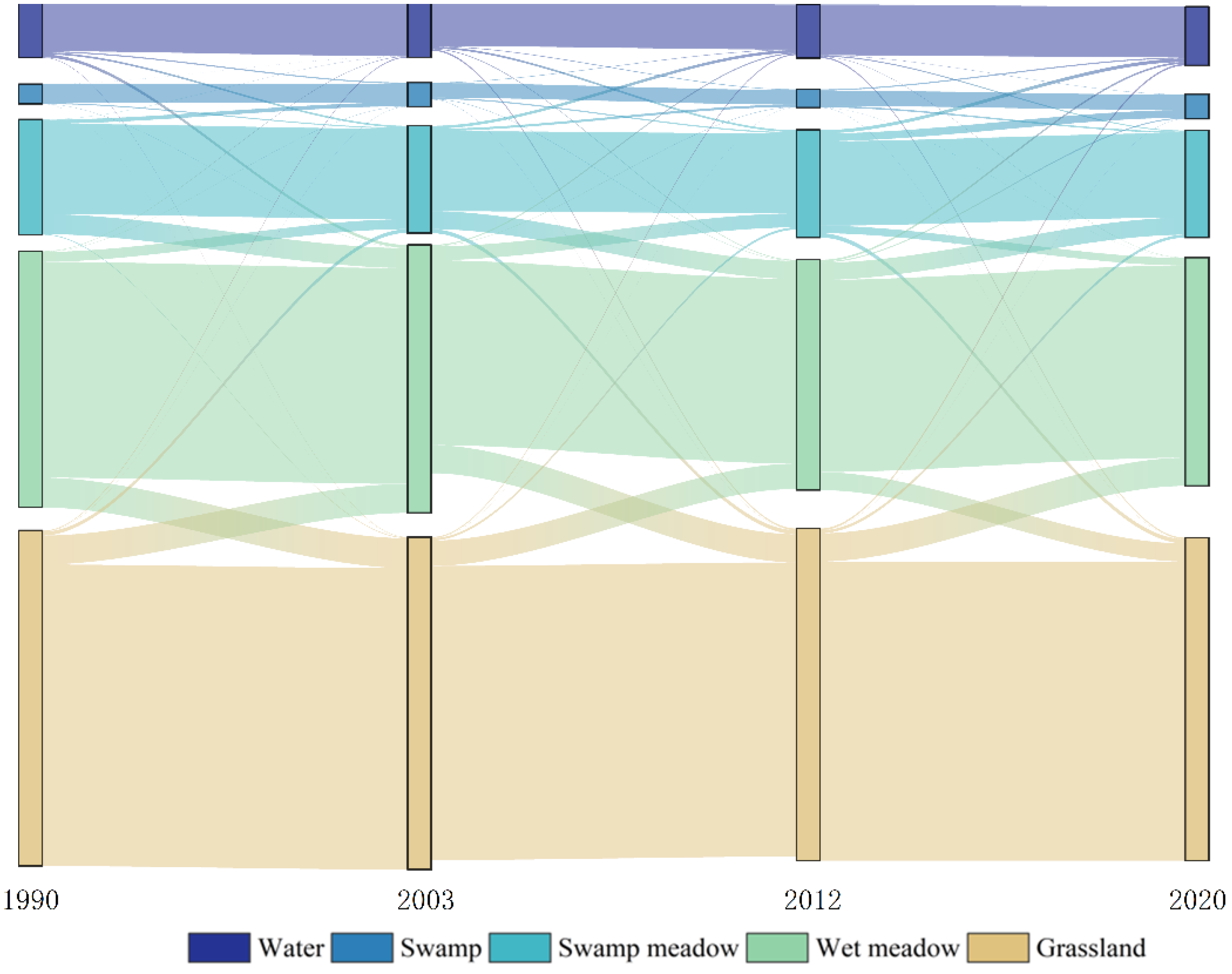
| Area Change (km2) | 1990–2003 | 2003–2012 | 2012–2020 |
|---|---|---|---|
| Water body–Swamp | 7.59 | 4.62 | 5.18 |
| Swamp–Swamp meadow | 5.63 | 2.21 | 4.30 |
| Swamp meadow–Wet meadow | 38.73 | 18.40 | 7.86 |
| Wet meadow–Grassland | 101.35 | 63.15 | 85.53 |
Publisher’s Note: MDPI stays neutral with regard to jurisdictional claims in published maps and institutional affiliations. |
© 2022 by the authors. Licensee MDPI, Basel, Switzerland. This article is an open access article distributed under the terms and conditions of the Creative Commons Attribution (CC BY) license (https://creativecommons.org/licenses/by/4.0/).
Share and Cite
Zhang, B.; Niu, Z.; Zhang, D.; Huo, X. Dynamic Changes and Driving Forces of Alpine Wetlands on the Qinghai–Tibetan Plateau Based on Long-Term Time Series Satellite Data: A Case Study in the Gansu Maqu Wetlands. Remote Sens. 2022, 14, 4147. https://doi.org/10.3390/rs14174147
Zhang B, Niu Z, Zhang D, Huo X. Dynamic Changes and Driving Forces of Alpine Wetlands on the Qinghai–Tibetan Plateau Based on Long-Term Time Series Satellite Data: A Case Study in the Gansu Maqu Wetlands. Remote Sensing. 2022; 14(17):4147. https://doi.org/10.3390/rs14174147
Chicago/Turabian StyleZhang, Bo, Zhenguo Niu, Dongqi Zhang, and Xuanlin Huo. 2022. "Dynamic Changes and Driving Forces of Alpine Wetlands on the Qinghai–Tibetan Plateau Based on Long-Term Time Series Satellite Data: A Case Study in the Gansu Maqu Wetlands" Remote Sensing 14, no. 17: 4147. https://doi.org/10.3390/rs14174147
APA StyleZhang, B., Niu, Z., Zhang, D., & Huo, X. (2022). Dynamic Changes and Driving Forces of Alpine Wetlands on the Qinghai–Tibetan Plateau Based on Long-Term Time Series Satellite Data: A Case Study in the Gansu Maqu Wetlands. Remote Sensing, 14(17), 4147. https://doi.org/10.3390/rs14174147


