Article

Meticulous Land Cover Classification of High-Resolution Images Based on Interval Type-2 Fuzzy Neural Network with Gaussian Regression Model

1
School of Software, Liaoning Technical University, Huludao 125105, China
2
Beijing Key Laboratory of Information Service Engineering, Beijing Union University, Beijing 100101, China
3
School of Robotics, Beijing Union University, Beijing 100027, China
4
School of Precision Instruments, Tsinghua University, Beijing 100062, China
*
Author to whom correspondence should be addressed.
Remote Sens. 2022, 14(15), 3704; https://doi.org/10.3390/rs14153704
Submission received: 23 June 2022 / Revised: 30 July 2022 / Accepted: 31 July 2022 / Published: 2 August 2022
(This article belongs to the Section Remote Sensing Image Processing)

Abstract

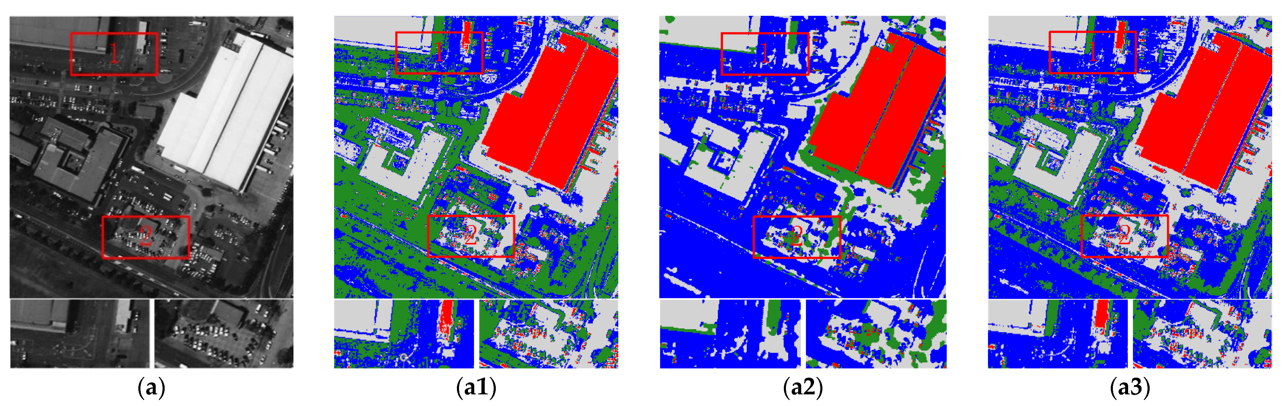
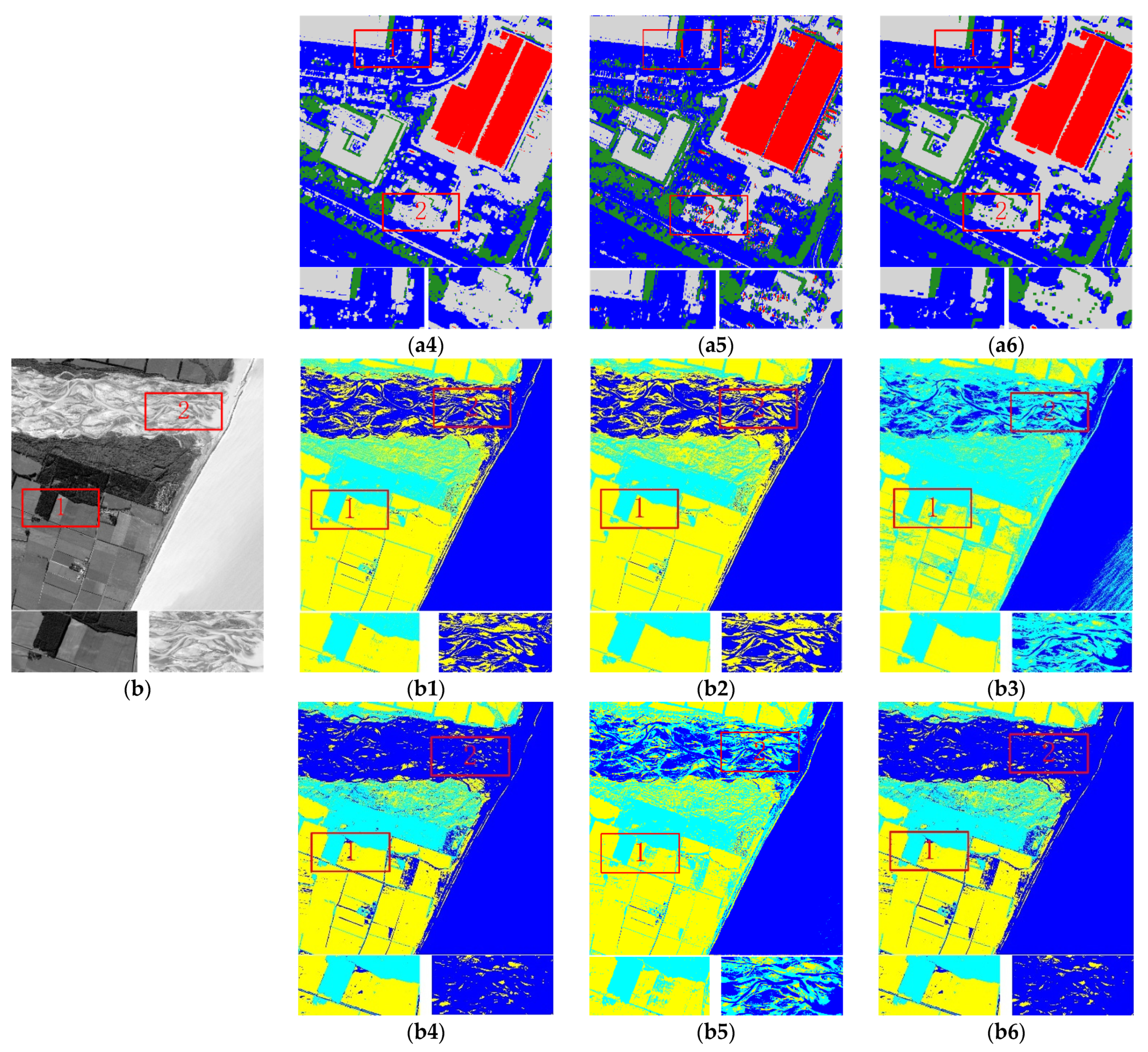
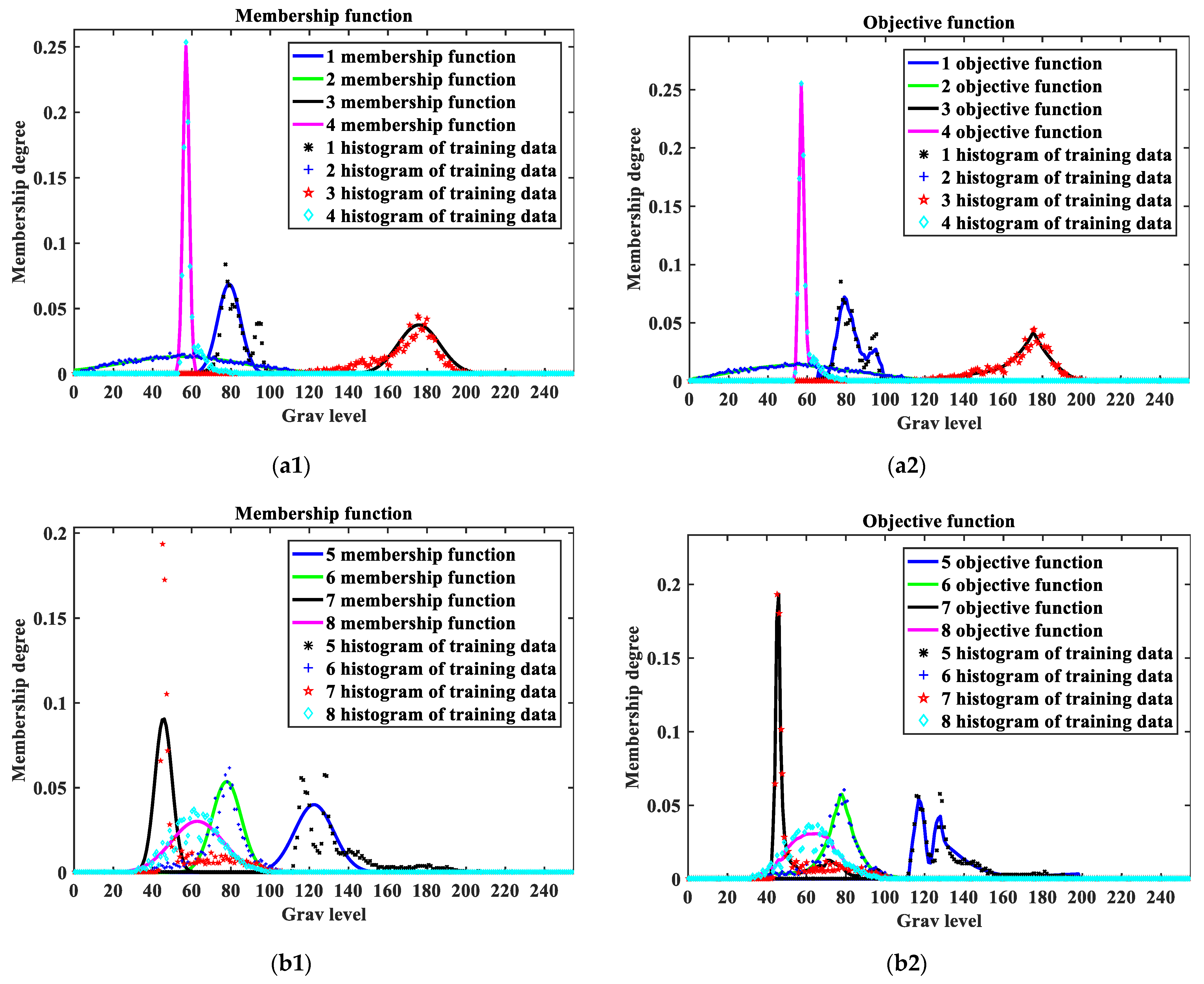
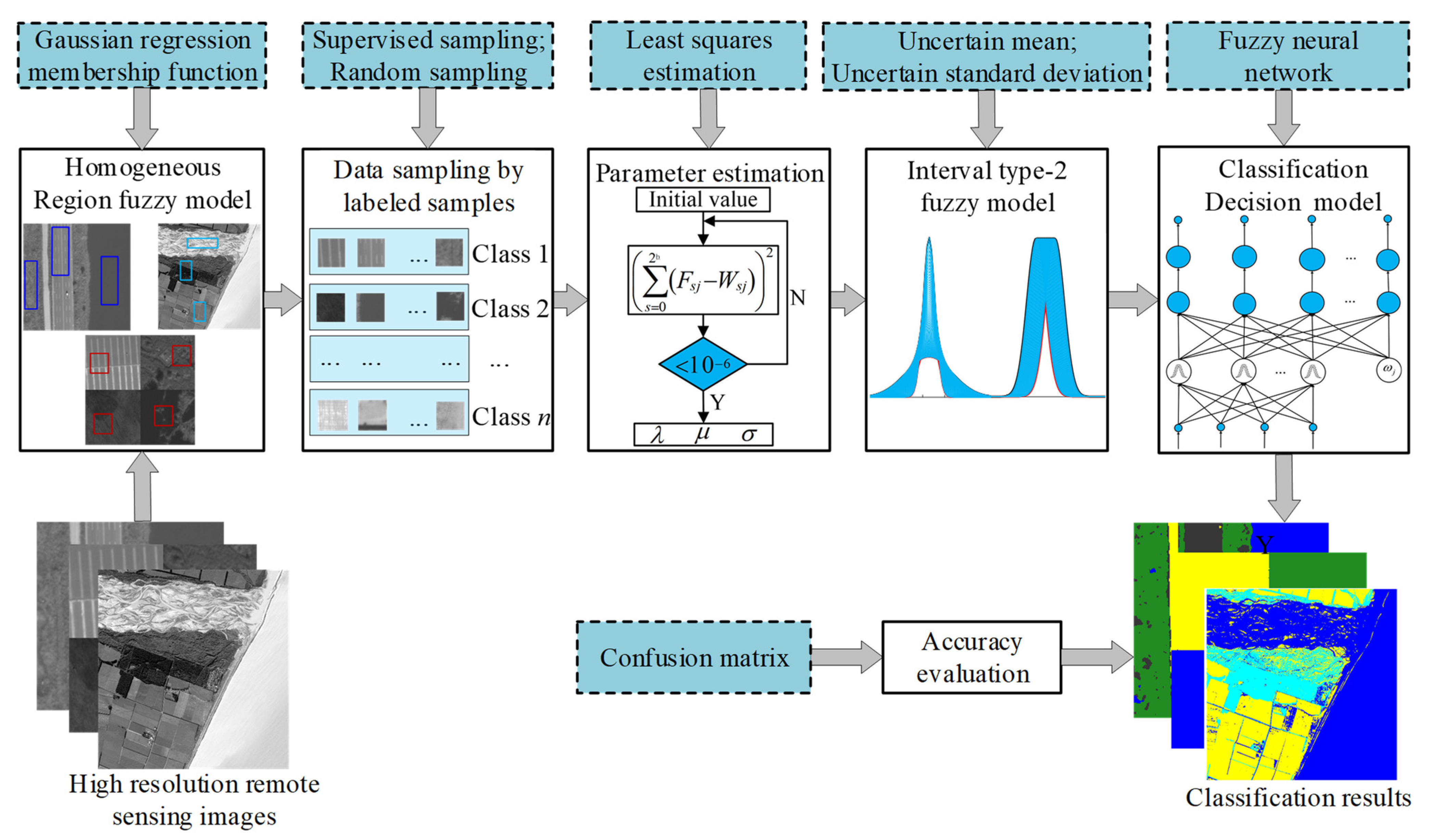
This paper proposes a land cover classification method that combines a Gaussian regression model (GRM) with an interval type-2 fuzzy neural network (IT2FNN) model as a classification decision model. Problems such as the increase in the complexity of ground cover, the increase in the heterogeneity of homogeneous regions, and the increase in the difficulty of classification due to the increase in similarity in different regions are overcome. Firstly, the local spatial information between adjacent pixels was introduced into the Gaussian model in image gray space to construct the GRM. Then, the GRM was used as the base model to construct the interval binary fuzzy membership function model and characterize the uncertainty of the classification caused by meticulous land cover data. Thirdly, the upper and lower boundaries of the membership degree of the training samples in all categories and the principle membership degree as input were used to build the IT2FNN model. Finally, in the membership space, the neighborhood relationship was processed again to further overcome the classification difficulties caused by the increased complexity of spatial information to achieve a classification decision. The classical method and proposed method were used to conduct qualitative and quantitative experiments on synthetic and real images of coastal areas, suburban areas, urban areas, and agricultural areas. Compared with the method considering only one spatial neighborhood relationship and the classical classification method without a classification decision model, for images with relatively simple spatial information, the accuracy of the interval type-2 fuzzy neural network Gaussian regression model (IT2FNN_GRM) was improved by 1.3% and 8%, respectively. For images with complex spatial information, the accuracy of the proposed method increased by 5.0% and 16%, respectively. The experimental results prove that the IT2FNN_GRM method effectively suppressed the influence of regional noise in land cover classification, with a fast running speed, high generalization ability, and high classification accuracy.
Keywords: land cover classification; high resolution; IT2FNN model; spatial neighborhood relationship; Gaussian regression model; classification decision model land cover classification; high resolution; IT2FNN model; spatial neighborhood relationship; Gaussian regression model; classification decision model