Correction: Li et al. Automatic Point Cloud Registration for Large Outdoor Scenes Using a Priori Semantic Information. Remote Sens. 2021, 13, 3474

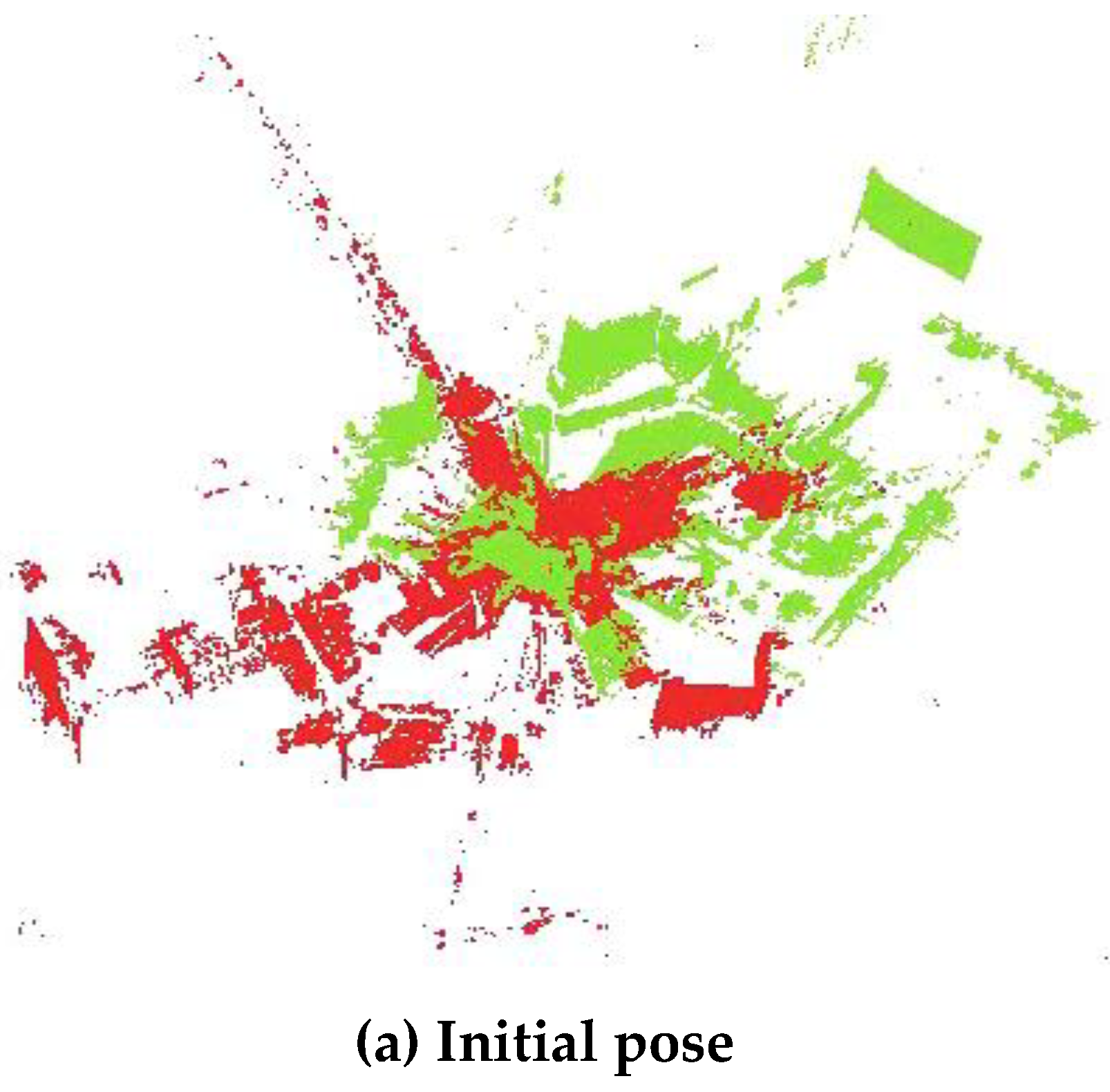
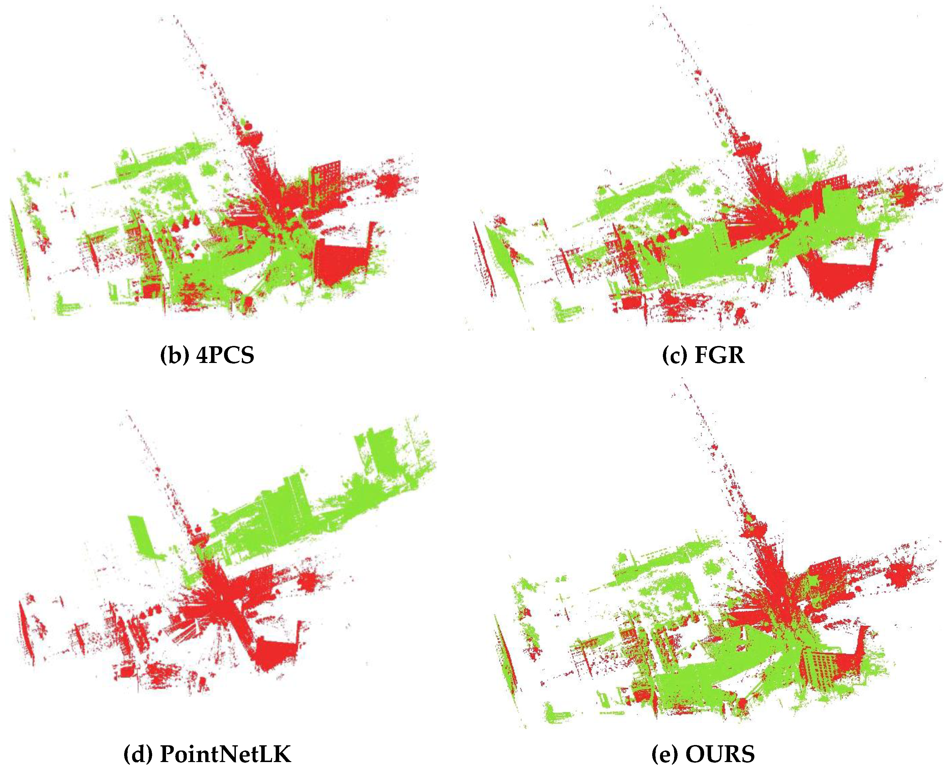
Error in Figure


Reference
- Li, J.; Huang, S.; Cui, H.; Ma, Y.; Chen, X. Automatic Point Cloud Registration for Large Outdoor Scenes Using a Priori Semantic Information. Remote Sens. 2021, 13, 3474. [Google Scholar] [CrossRef]
Publisher’s Note: MDPI stays neutral with regard to jurisdictional claims in published maps and institutional affiliations. |
© 2022 by the author. Licensee MDPI, Basel, Switzerland. This article is an open access article distributed under the terms and conditions of the Creative Commons Attribution (CC BY) license (https://creativecommons.org/licenses/by/4.0/).
Share and Cite
Remote Sensing Editorial Office. Correction: Li et al. Automatic Point Cloud Registration for Large Outdoor Scenes Using a Priori Semantic Information. Remote Sens. 2021, 13, 3474. Remote Sens. 2022, 14, 2413. https://doi.org/10.3390/rs14102413
Remote Sensing Editorial Office. Correction: Li et al. Automatic Point Cloud Registration for Large Outdoor Scenes Using a Priori Semantic Information. Remote Sens. 2021, 13, 3474. Remote Sensing. 2022; 14(10):2413. https://doi.org/10.3390/rs14102413
Chicago/Turabian StyleRemote Sensing Editorial Office. 2022. "Correction: Li et al. Automatic Point Cloud Registration for Large Outdoor Scenes Using a Priori Semantic Information. Remote Sens. 2021, 13, 3474" Remote Sensing 14, no. 10: 2413. https://doi.org/10.3390/rs14102413
APA StyleRemote Sensing Editorial Office. (2022). Correction: Li et al. Automatic Point Cloud Registration for Large Outdoor Scenes Using a Priori Semantic Information. Remote Sens. 2021, 13, 3474. Remote Sensing, 14(10), 2413. https://doi.org/10.3390/rs14102413