Article

Evaluation of Satellite Precipitation Estimates over the South West Pacific Region
1
School of Earth, Atmosphere, and Environment, Monash University, Melbourne 3800, Australia
2
Climate Risk and Early Warning Systems (CREWS), Bureau of Meteorology, Melbourne 3008, Australia
3
SPACE Research Centre, School of Science, Royal Melbourne Institute of Technology (RMIT) University, Melbourne 3000, Australia
*
Author to whom correspondence should be addressed.
Remote Sens. 2021, 13(19), 3929; https://doi.org/10.3390/rs13193929
Submission received: 15 July 2021 / Revised: 24 September 2021 / Accepted: 27 September 2021 / Published: 30 September 2021

Abstract

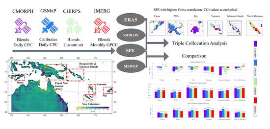
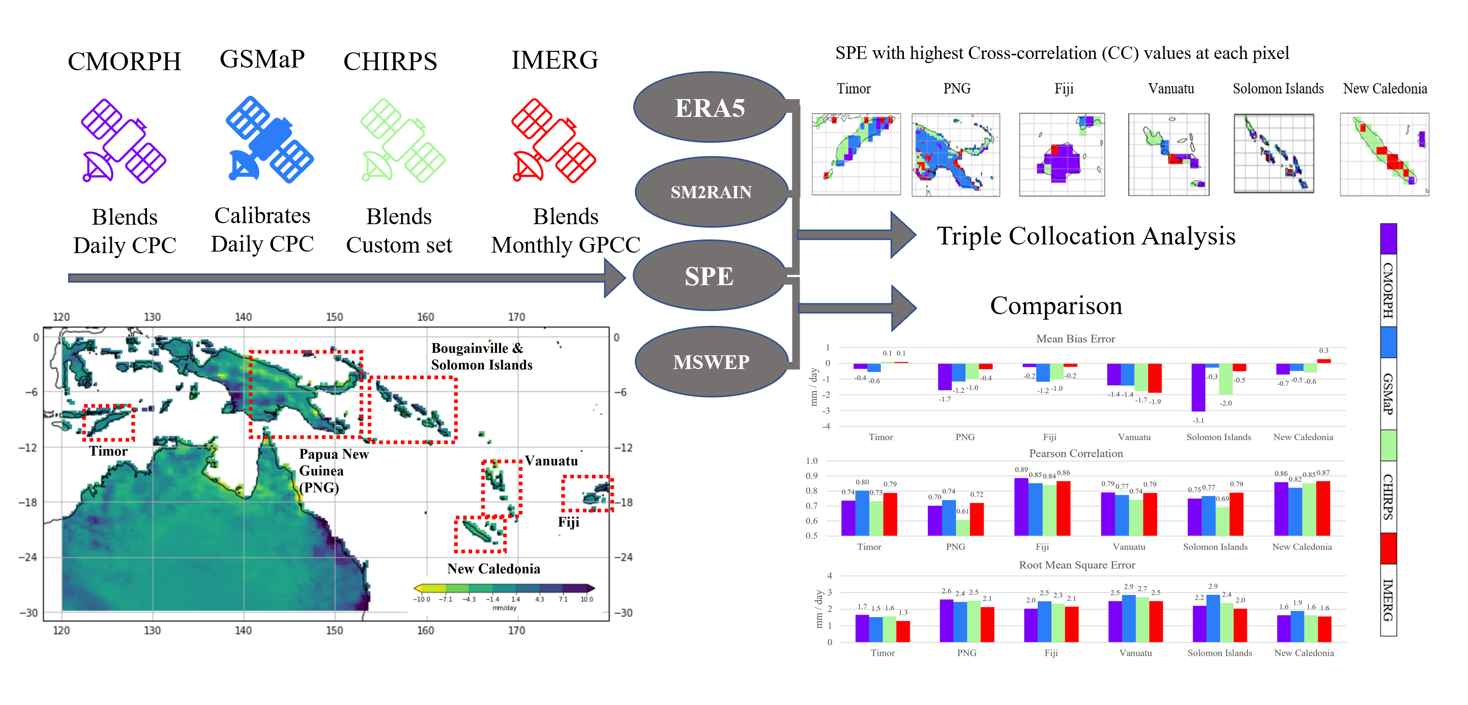
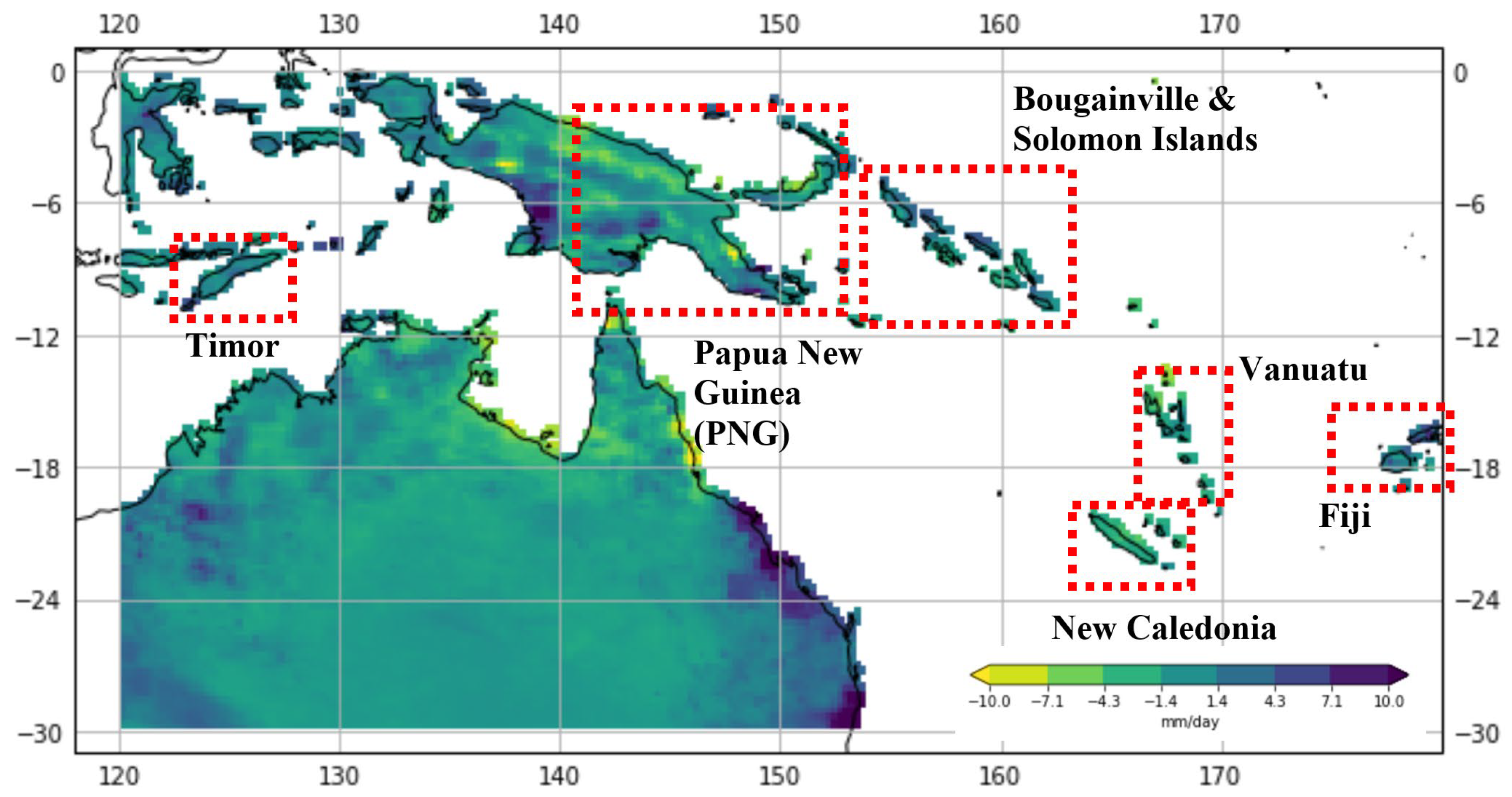
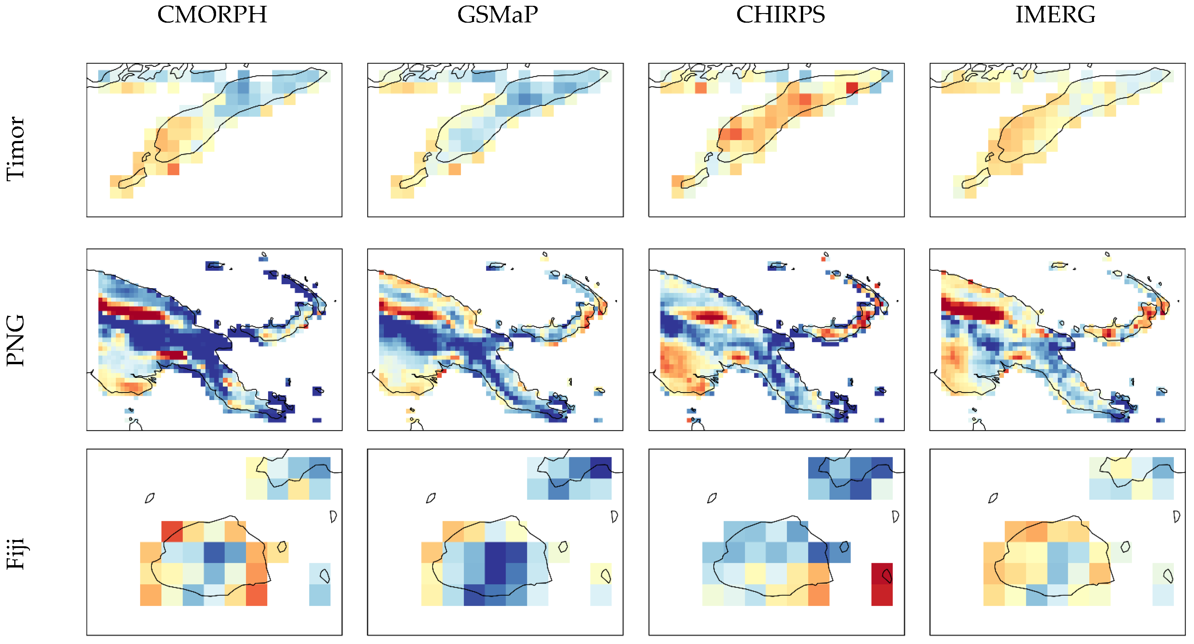
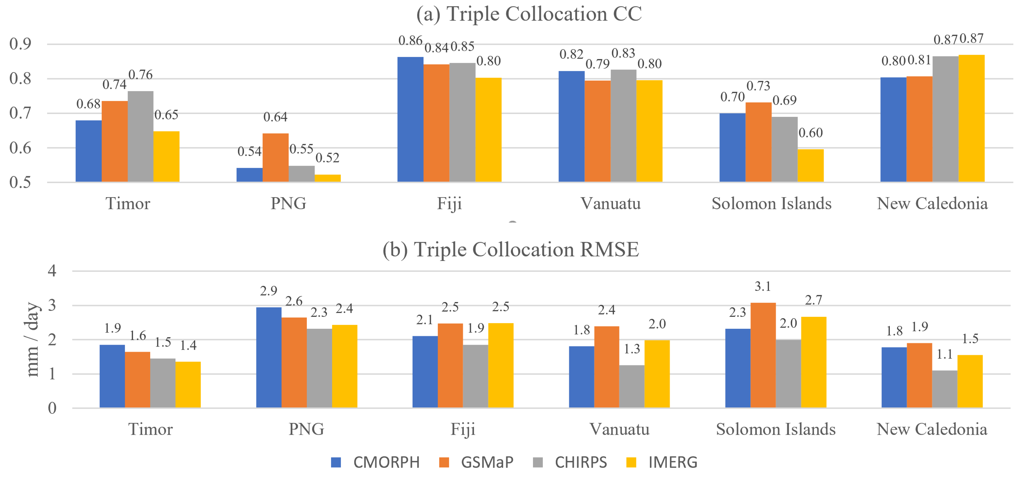
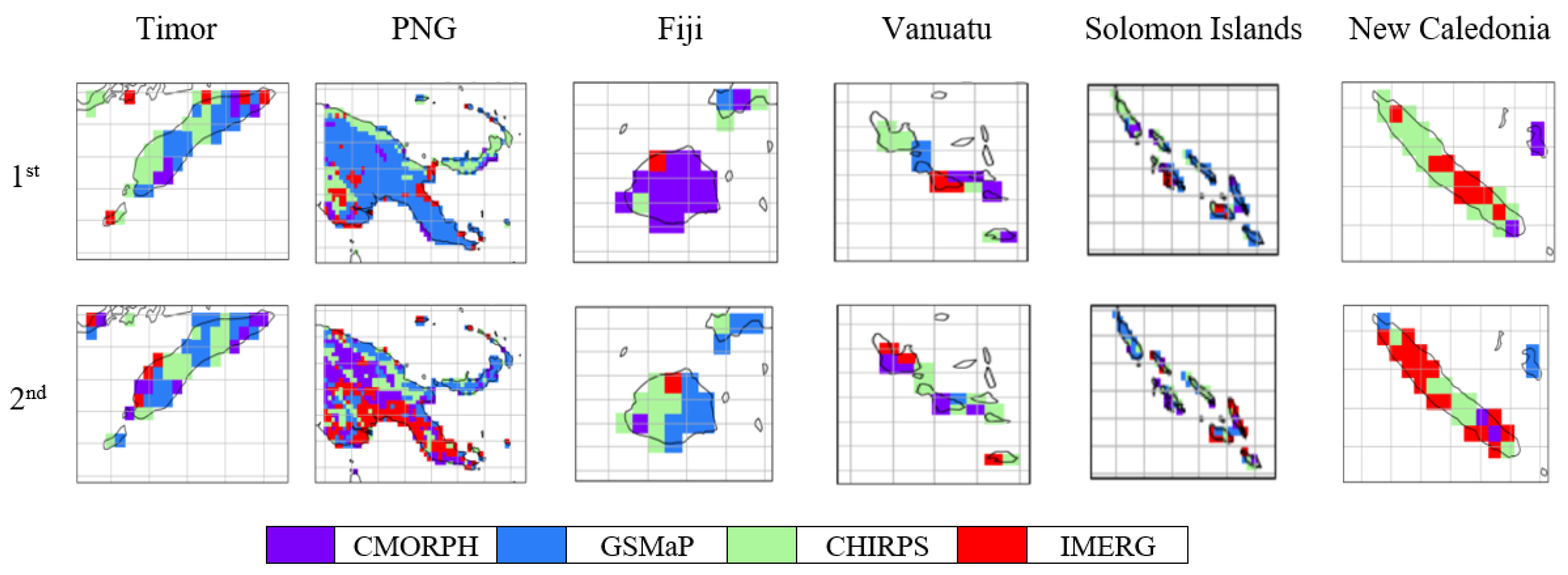
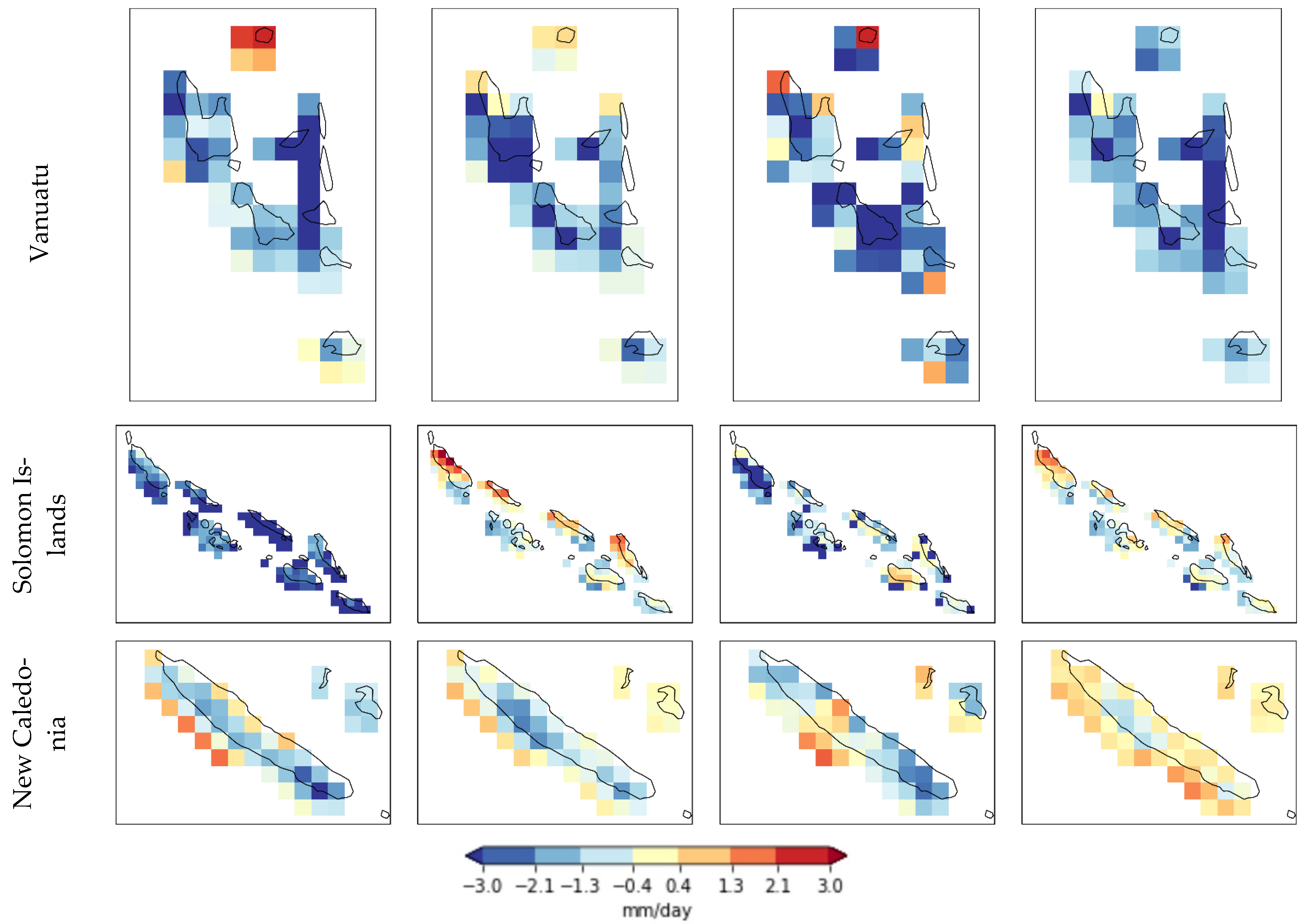
Rainfall estimation over the Pacific region is difficult due to the large distances between rain gauges and the high convection nature of many rainfall events. This study evaluates space-based rainfall observations over the South West Pacific Region from the Japan Aerospace Exploration Agency’s (JAXA) Global Satellite Mapping of Precipitation (GSMaP), the USA National Oceanographic and Atmospheric Administration’s (NOAA) Climate Prediction Center morphing technique (CMORPH), the Climate Hazards group Infrared Precipitation with Stations (CHIRPS), and the National Aeronautics and Space Administration’s (NASA) Integrated Multi-Satellite Retrievals for GPM (IMERG). The technique of collocation analysis (CA) is used to compare the performance of monthly satellite precipitation estimates (SPEs). Multi-Source Weighted-Ensemble Precipitation (MSWEP) was used as a reference dataset to compare with each SPE. European Centre for Medium-range Weather Forecasts’ (ECMWF) ERA5 reanalysis was also combined with Soil Moisture-2-Rain–ASCAT (SM2RAIN–ASCAT) to perform triple CA for the six sub-regions of Fiji, New Caledonia, Papua New Guinea (PNG), the Solomon Islands, Timor, and Vanuatu. It was found that GSMaP performed best over low rain gauge density areas, including mountainous areas of PNG (the cross-correlation, CC = 0.64), and the Solomon Islands (CC = 0.74). CHIRPS had the most consistent performance (high correlations and low errors) across all six sub-regions in the study area. Based on the results, recommendations are made for the use of SPEs over the South West Pacific Region.
Keywords: satellite precipitation estimates; South West Pacific Region; satellite precipitation validation satellite precipitation estimates; South West Pacific Region; satellite precipitation validation
Graphical Abstract