Georeferencing of Multi-Channel GPR—Accuracy and Efficiency of Mapping of Underground Utility Networks

Abstract
1. Introduction
2. Materials and Methods
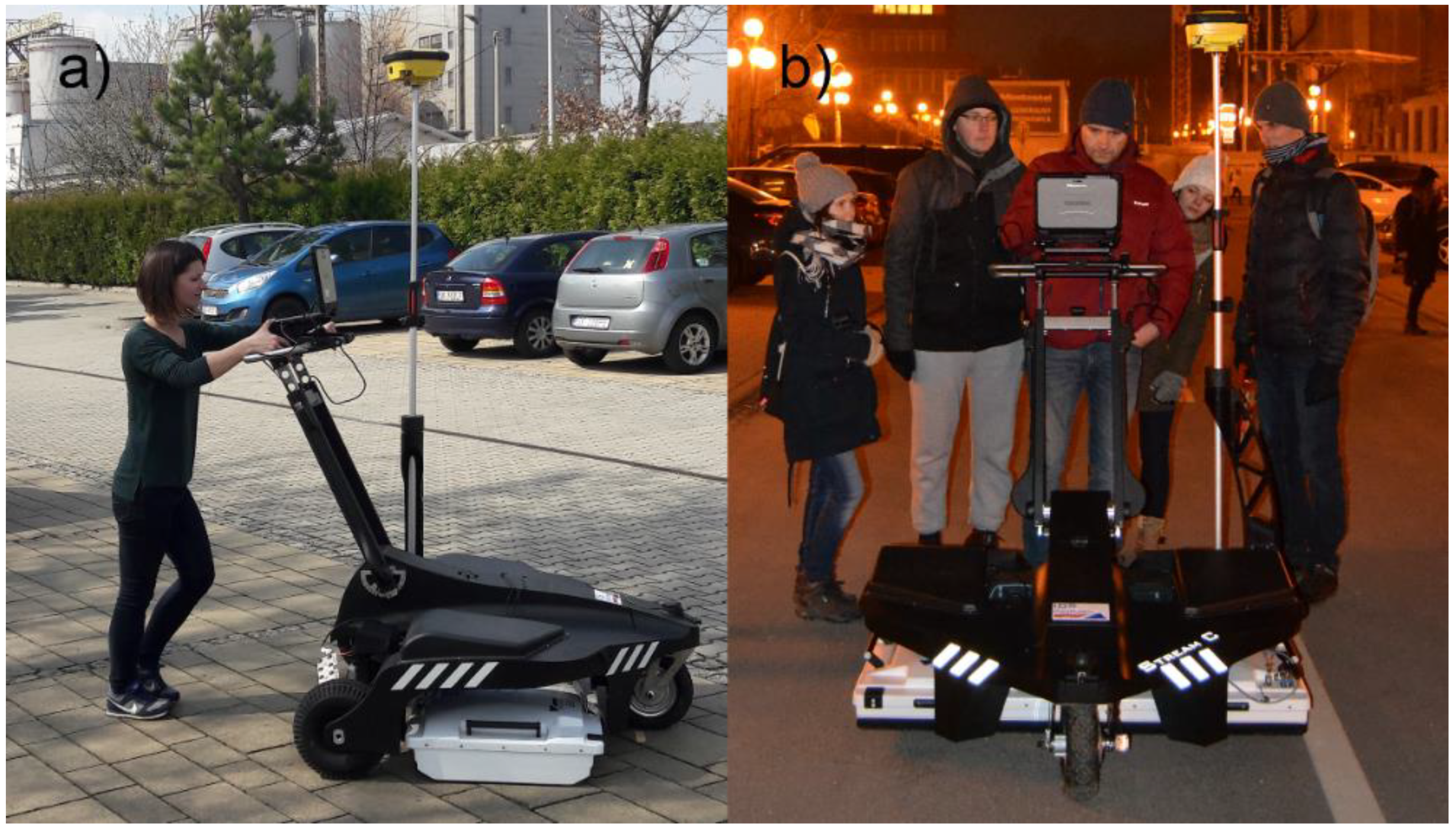
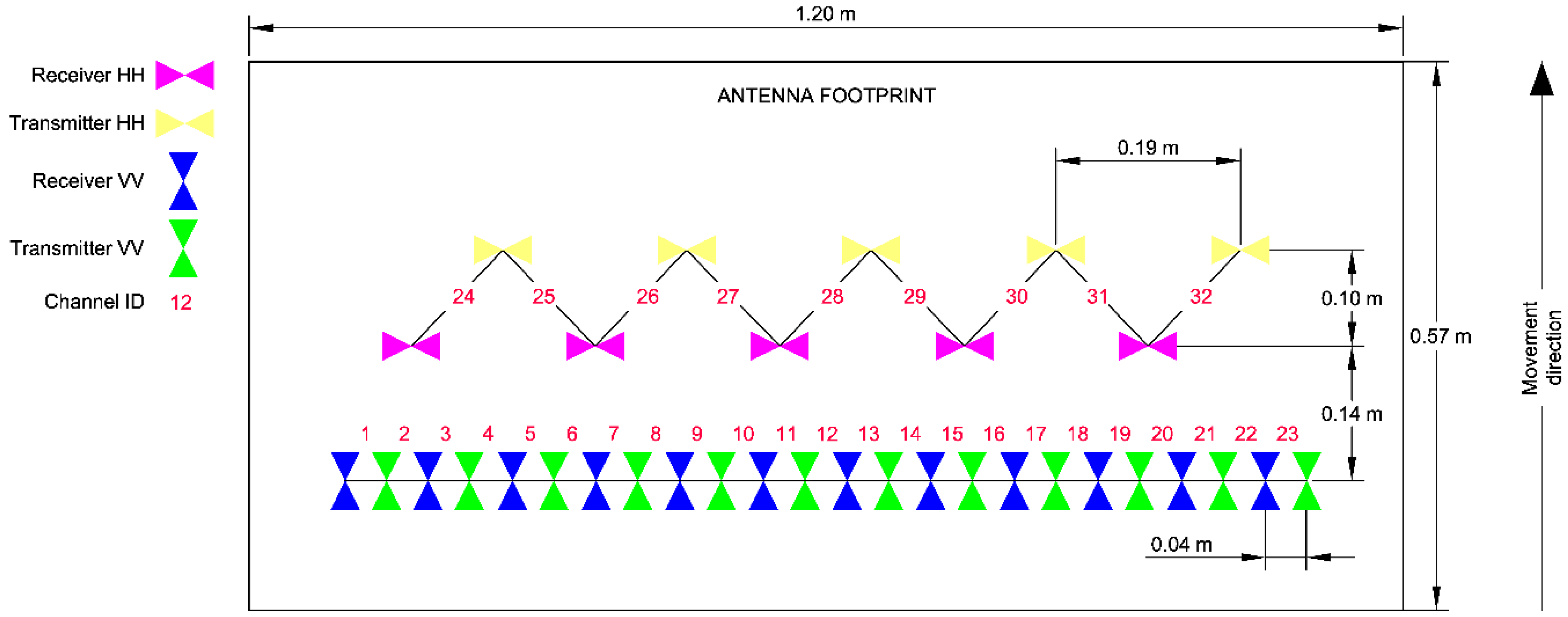
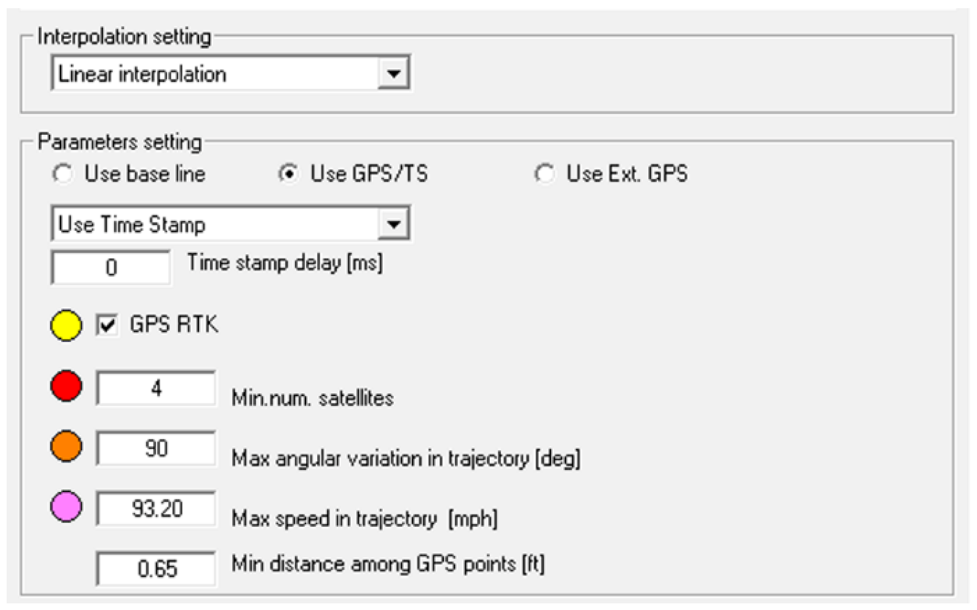
2.1. Description of the Equipment and Software
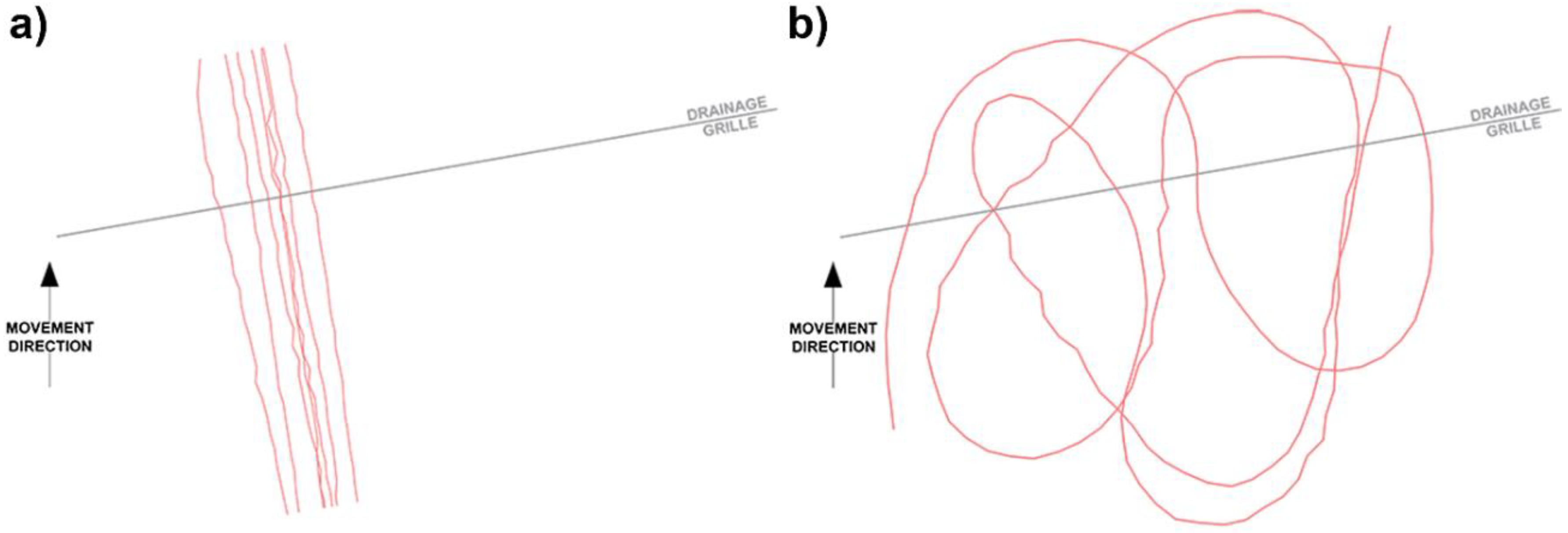
2.2. Methodology of the Experimental Measurement on a Test Field
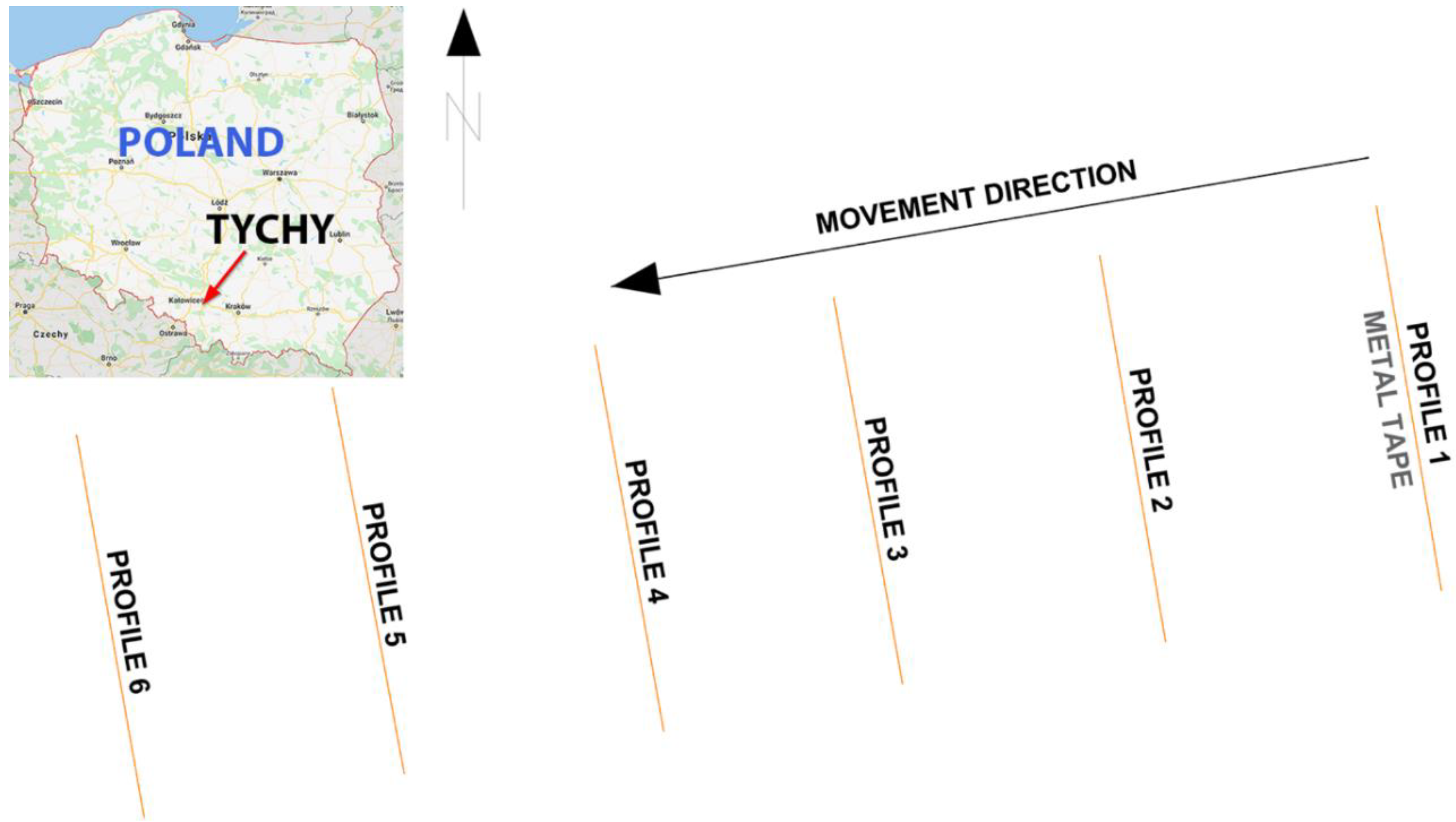
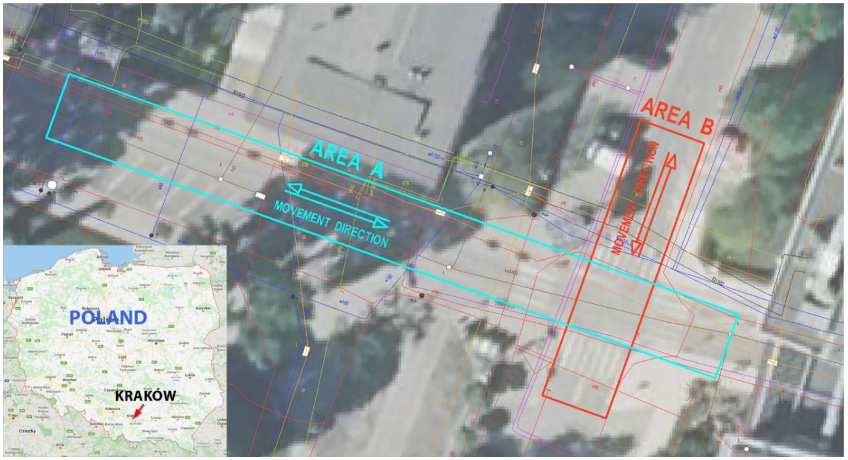
2.3. Methodology of GPR Measurement in Urban Conditions to the Need of Confrontation with Cartographic Material
3. Results
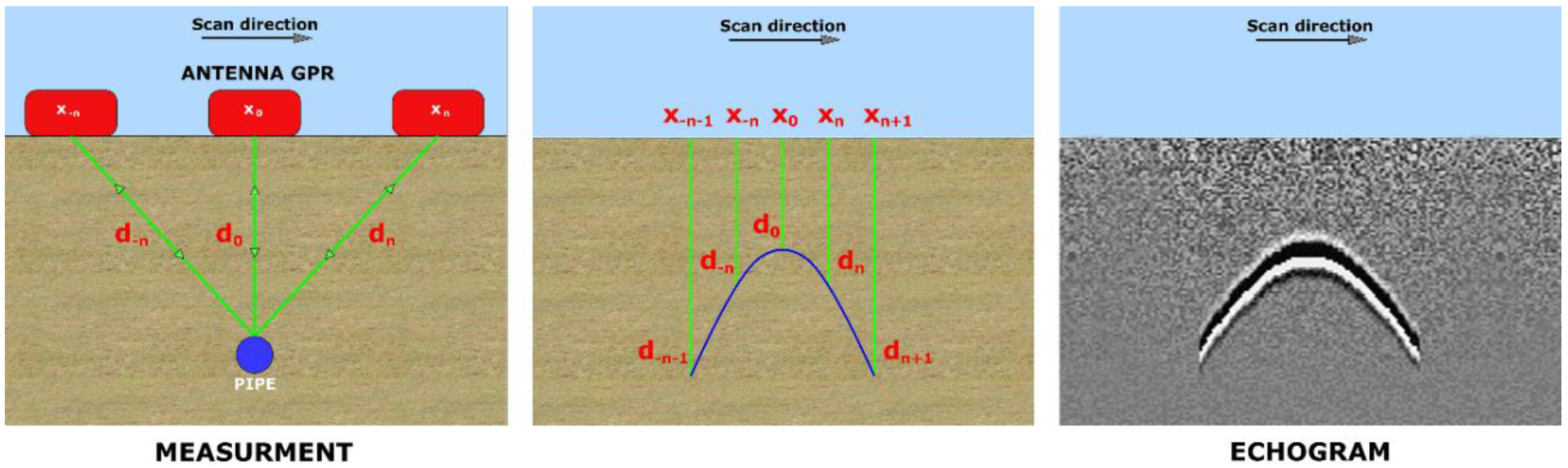
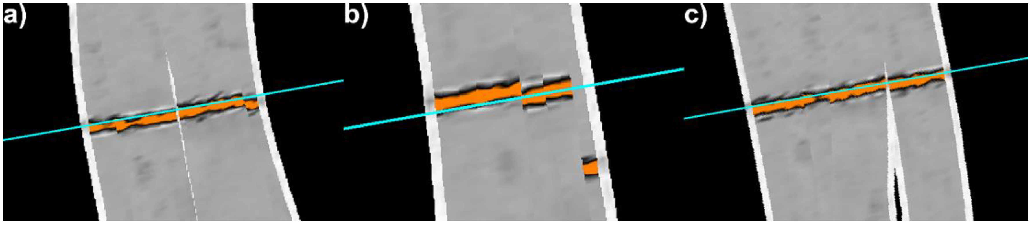
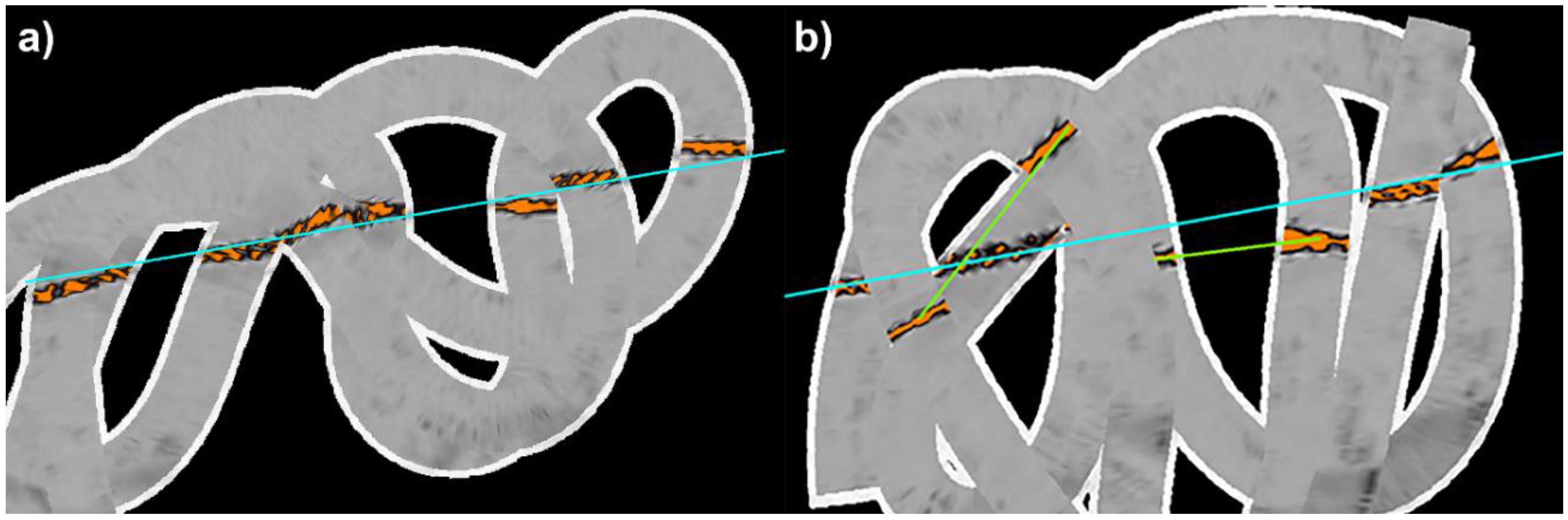
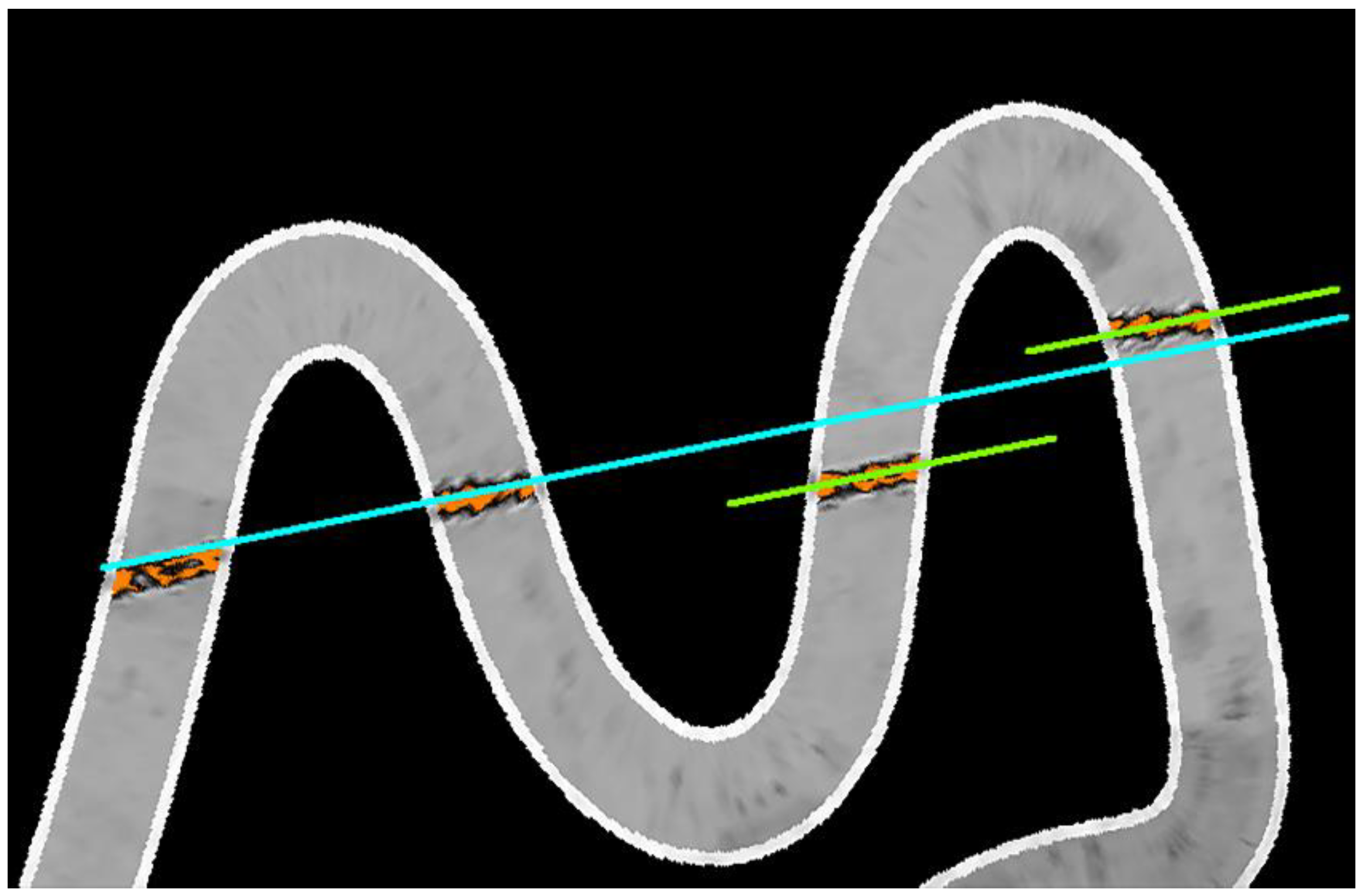
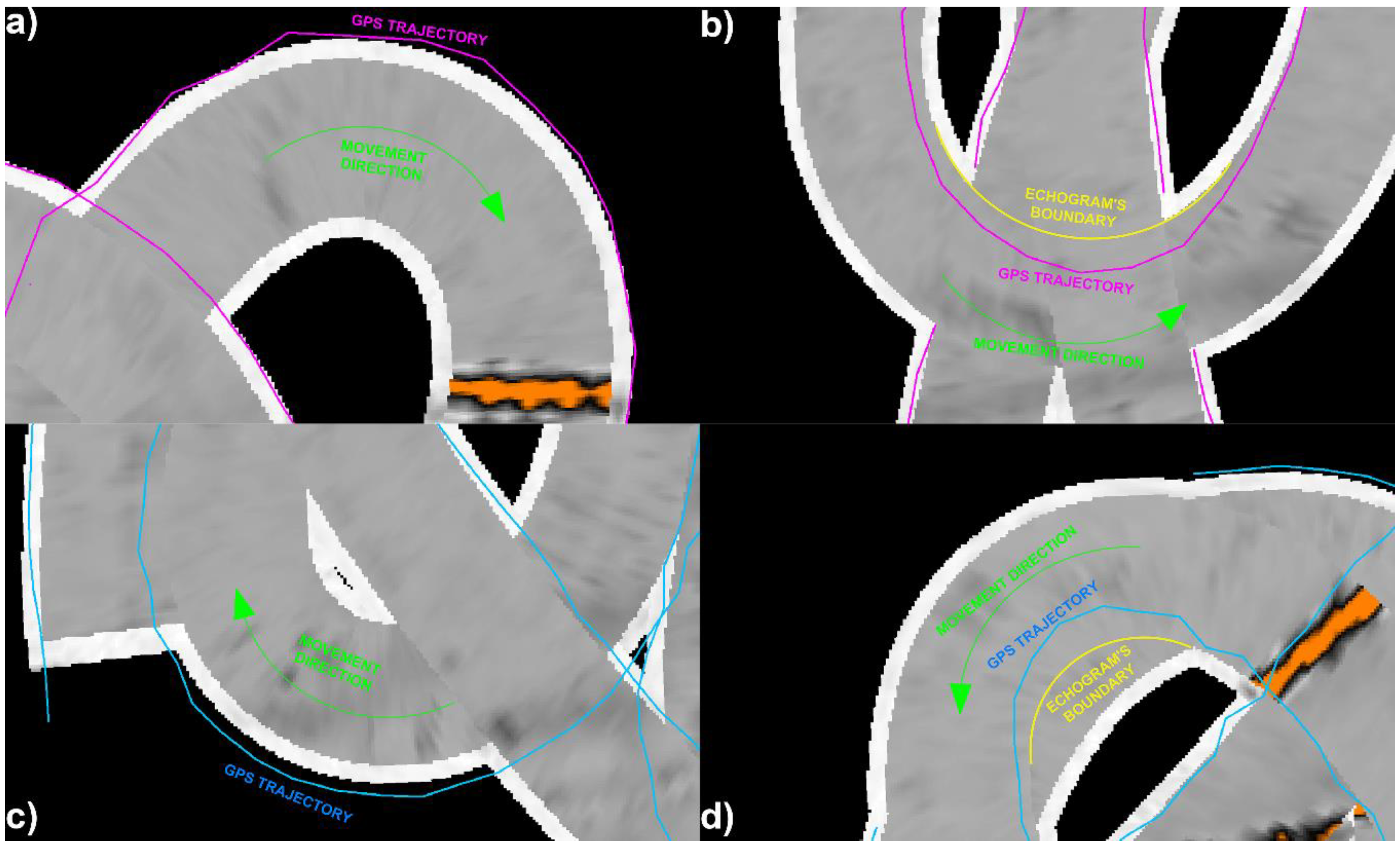
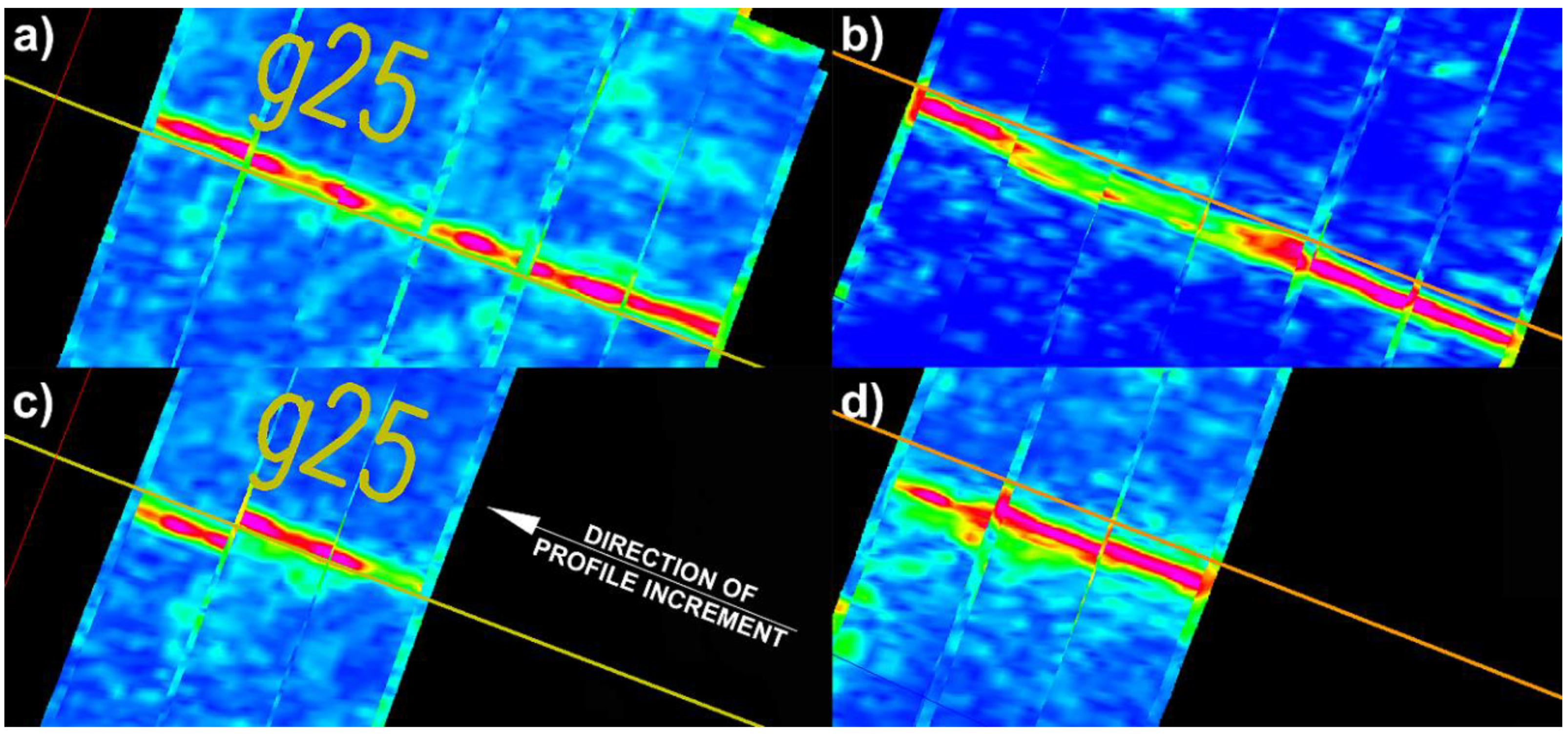
3.1. Results of the Test Measurement for Accuracy Assessment
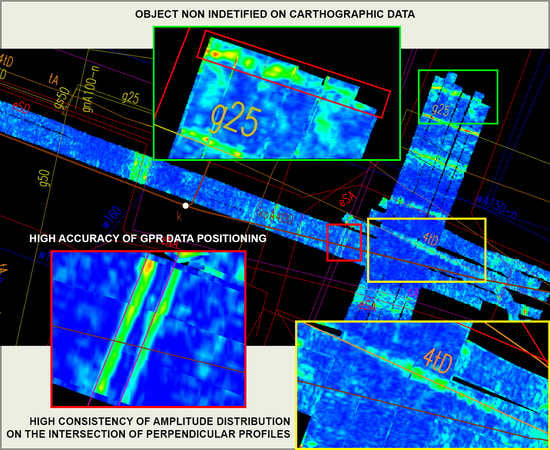
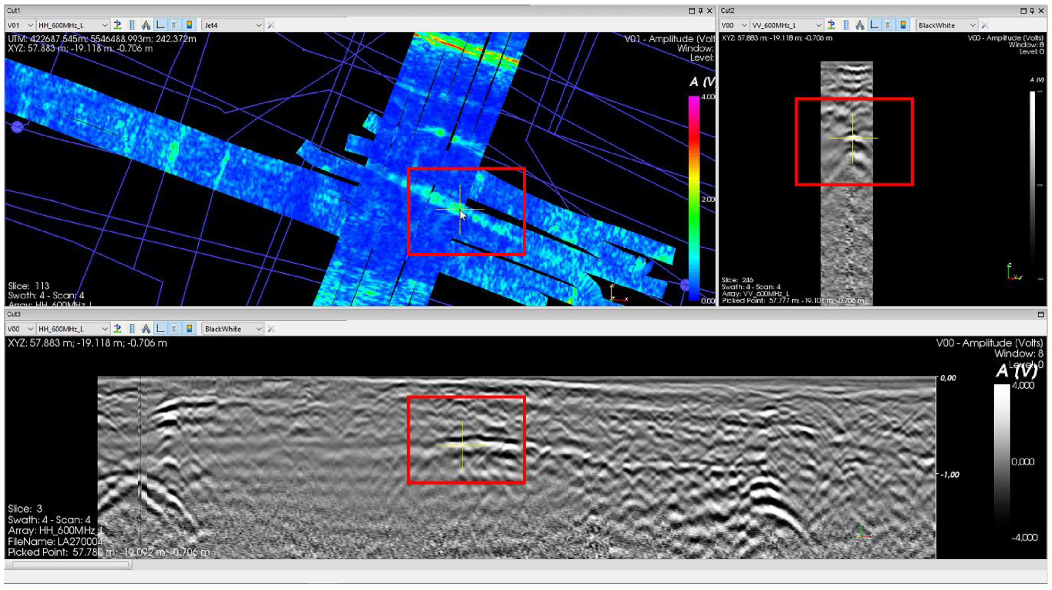
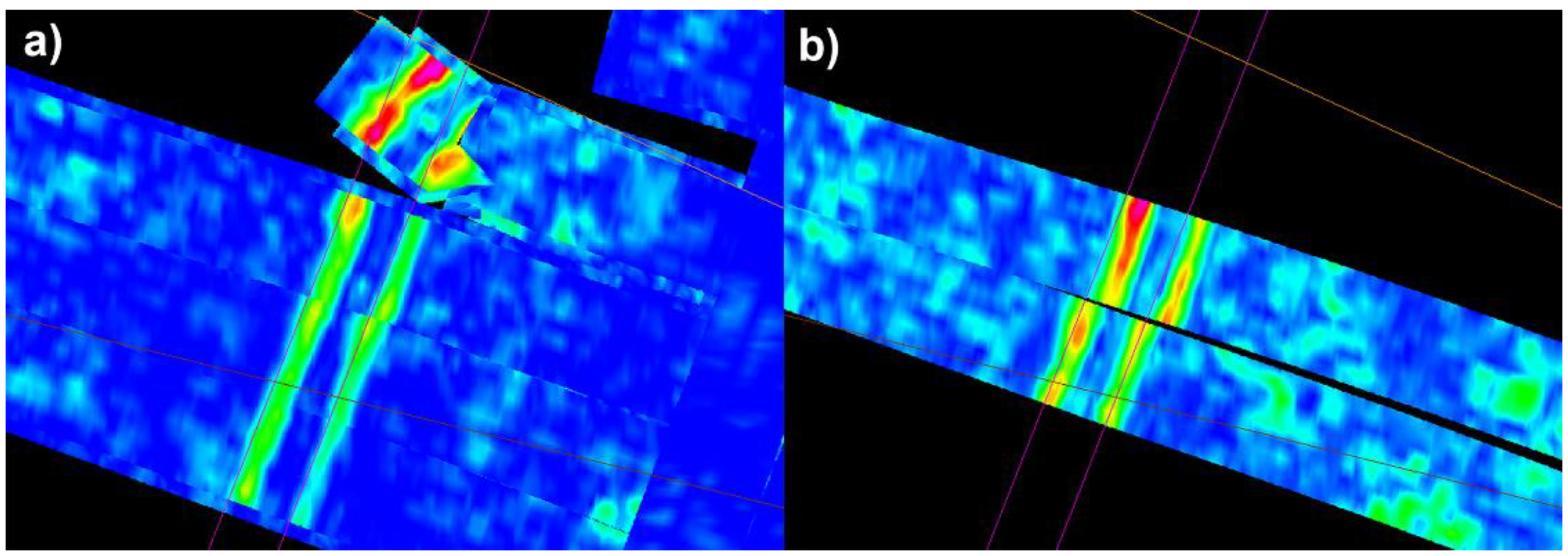
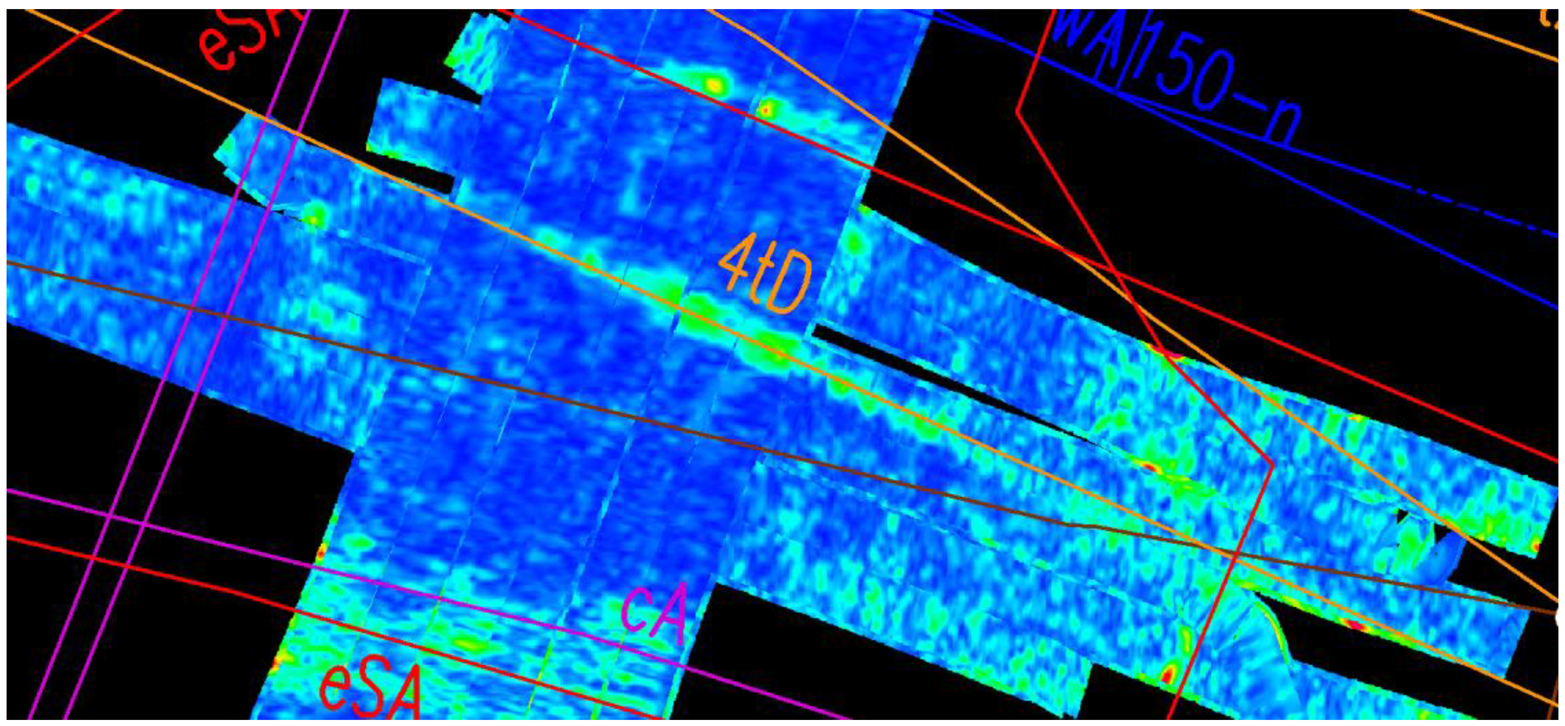
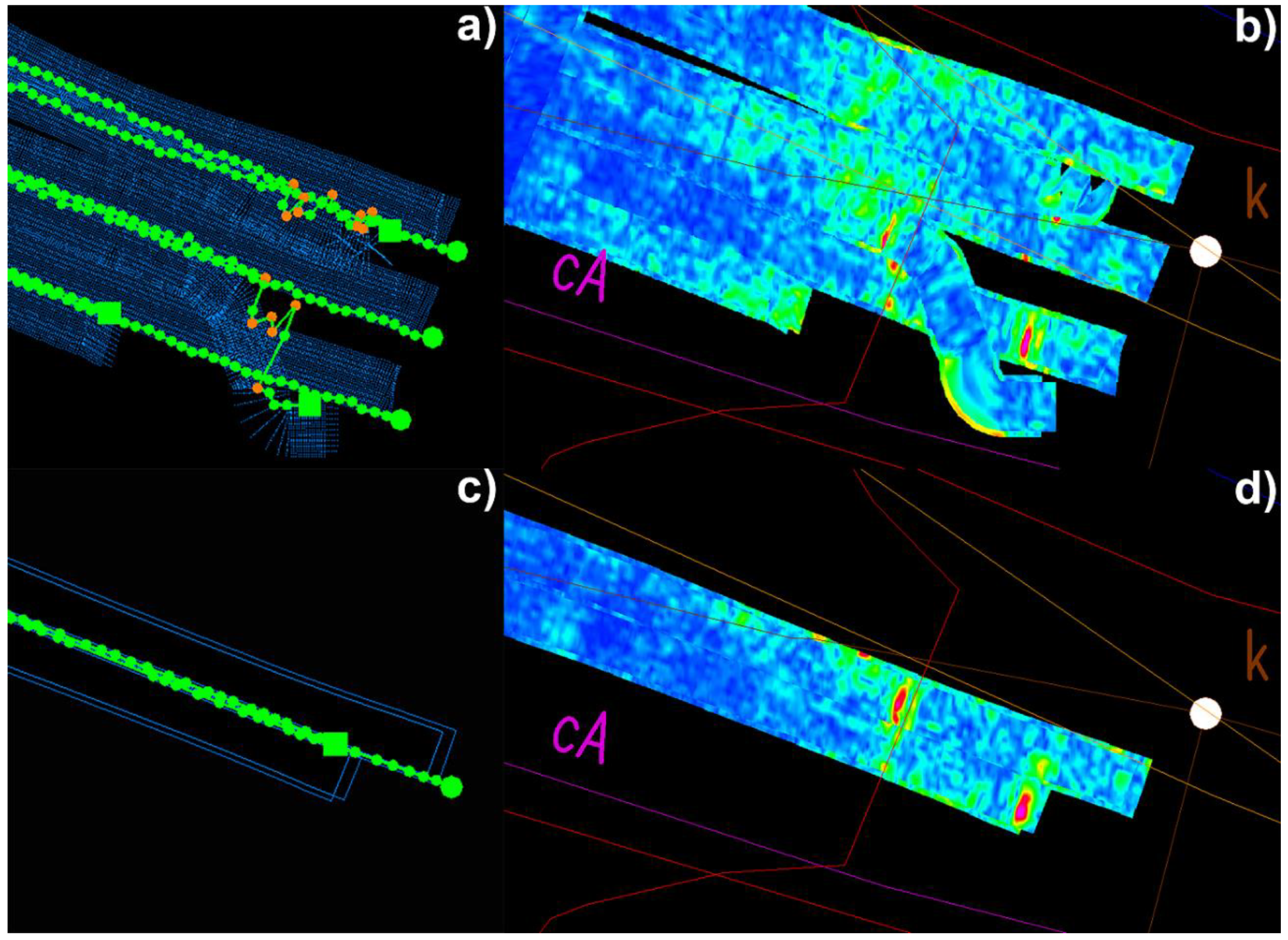
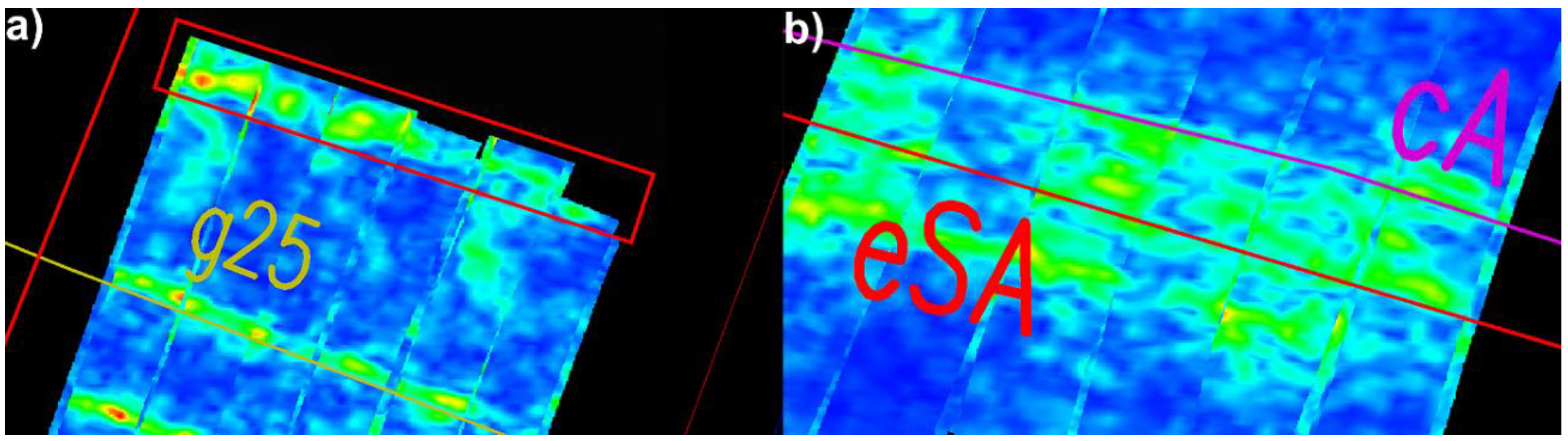
3.2. GPR Measurement Results in Urban Conditions to the Need of Confrontation with Cartographic Material
4. Discussion
5. Conclusions
Author Contributions
Funding
Conflicts of Interest
References
- Owerko, P.; Ortyl, Ł.; Salamak, M. Identification of concrete voids in an untypical railway bridge pillar by Ground Penetrating Radar Method. Meas. Autom. Monit. 2015, 61, 76–80. [Google Scholar]
- Lai, W.W.; Chang, R.K.; Sham, J.F. A blind test of nondestructive underground void detection by ground penetrating radar (GPR). J. Appl. Geophys. 2018, 149, 10–17. [Google Scholar] [CrossRef]
- Benedetto, A.; Tosti, F.; Ciampoli, L.B.; D’Amico, F. An overview of ground-penetrating radar signal processing techniques for road inspections. Signal Process. 2017, 132, 201–209. [Google Scholar] [CrossRef]
- Pajewski, L.; Fontul, S.; Solla, M. Ground-penetrating radar for the evaluation and monitoring of transport infrastructures. In Innovation in Near-Surface Geophysics; Elsevier Science Publishing Co Inc.: Amsterdam, The Netherlands, 2019; pp. 341–398. ISBN 978-0-12-812429-1. [Google Scholar]
- Marecos, V.; Fontul, S.; Antunes, M.L.; Solla, M. Assessment of a concrete pre-stressed runway pavement with ground penetrating radar. In Proceedings of the 8th International Workshop on Advanced Ground Penetrating Radar (IWAGPR 2015), Florence, Italy, 7–10 July 2015; pp. 1–4. [Google Scholar]
- Owerko, P.; Ortyl, Ł.; Salamak, M. Identification of prestressing tendons using ground penetrating radar in particular the anchorage zone. In Proceedings of the 9th Central European Congress on Concrete Engineering (CCC2013), Wrocław, Poland, 4–6 September 2013; pp. 250–253. [Google Scholar]
- Gabryś, M.; Kryszyn, K.; Ortyl, Ł. GPR surveying method as a tool for geodetic verification of GESUT database of utilities in the light of BSI PAS128. Rep. Geod. Geoinform. 2019, 107, 49–59. [Google Scholar] [CrossRef]
- Karczewski, J.; Ortyl, Ł.; Pasternak, M. Zarys Metody Georadarowej; Wydawnictwa AGH: Kraków, Poland, 2011; ISBN 978-83-66016-35-4. [Google Scholar]
- Pasternak, M. Radarowa Penetracja Gruntu GPR; Wydawnictwo Komunikacji i Łączności: Warszawa, Poland, 2015; ISBN 978-83-206-1951-5. [Google Scholar]
- Skartados, E.; Kostavelis, I.; Giakoumis, D.; Simi, A.; Manacorda, G.; Ioannidis, D.; Tzovaras, D. Ground Penetrating Radar Image Processing Towards Underground Utilities Detection for Robotic Applications. In Proceedings of the 2018 International Conference on Control, Artificial Intelligence, Robotics & Optimization (ICCAIRO), Prague, Czech Republic, 19–21 May 2018; pp. 27–31. [Google Scholar]
- Al-Nuaimy, W.; Huang, Y.; Nakhkash, M.; Fang, M.; Nguyen, V.; Eriksen, A. Automatic detection of buried utilities and solid objects with GPR using neural networks and pattern recognition. J. Appl. Geophys. 2000, 43, 157–165. [Google Scholar] [CrossRef]
- Jiang, G.; Zhou, X.; Li, J.; Chen, H. A Cable-Mapping Algorithm Based on Ground-Penetrating Radar. IEEE Geosci. Remote Sens. Lett. 2019, 16, 1630–1634. [Google Scholar] [CrossRef]
- Šarlah, N.; Podobnikar, T.; Mongus, D.; Ambrožič, T.; Mušič, B. Kinematic GPR-TPS Model for Infrastructure Asset Identification with High 3D Georeference Accuracy Developed in a Real Urban Test Field. Remote Sens. 2019, 11, 1457. [Google Scholar] [CrossRef]
- Šarlah, N.; Podobnikar, T.; Ambrožič, T.; Mušič, B. Application of Kinematic GPR-TPS Model with High 3D Georeference Accuracy for Underground Utility Infrastructure Mapping: A Case Study from Urban Sites in Celje, Slovenia. Remote Sens. 2020, 12, 1228. [Google Scholar] [CrossRef]
- Kim, N.; Kim, S.; An, Y.-K.; Lee, J.-J. A novel 3D GPR image arrangement for deep learning-based underground object classification. Int. J. Pavement Eng. 2019, 1–12. [Google Scholar] [CrossRef]
- Kaufmann, M.S.; Klotzsche, A.; Vereecken, H.; Van Der Kruk, J. Simultaneous multi-channel GPR measurements for soil characterization. In Proceedings of the 2018 17th International Conference on Ground Penetrating Radar (GPR), Rapperswil, Switzerland, 18–21 June 2018; pp. 1–4. [Google Scholar]
- Muller, W. Self-correcting pavement layer depth estimates using 3D multi-offset ground penetrating radar (GPR). In Proceedings of the 15th International Conference on Ground Penetrating Radar, Brussels, Belgium, 30 June–4 July 2014; pp. 887–892. [Google Scholar]
- Wollschläger, U.; Gerhards, H.; Yu, Q.; Roth, K. Multi-channel ground-penetrating radar to explore spatial variations in thaw depth and moisture content in the active layer of a permafrost site. Cryosphere 2010, 4, 269–283. [Google Scholar] [CrossRef]
- Simonin, J.-M.; Baltazart, V.; Hoornych, P.; Dérobert, X.; Thibaut, E.; Sala, J.; Utsi, V. Case study of detection of artificial defects in an experimental pavement structure using 3D OPR systems. In Proceedings of the 15th International Conference on Ground Penetrating Radar, Brussels, Belgium, 30 June–4 July 2014; pp. 847–851. [Google Scholar]
- Boyes, W. Instrumentation Reference Book, 4th ed.; Butterworth-Heinemann: Burlington, NJ, USA, 2009; ISBN 978-0-7506-8308-1. [Google Scholar]
- Jaw, S.W.; Hashim, M. Locational accuracy of underground utility mapping using ground penetrating radar. Tunn. Undergr. Space Technol. 2013, 35, 20–29. [Google Scholar] [CrossRef]
- Kuras, P.; Ortyl, Ł.; Kędzierski, M.; Podstolak, P. Vibration measurements of steel chimneys equipped with mass dampers, using interferometric radar, robotic total station and accelerometer. Pomiary Autom. Kontrola. 2014, 60, 1090–1095. [Google Scholar]
- Ortyl, Ł. Assessing of the effect of selected parameters of GPR surveying in diagnosis of the condition of road pavement structure. Meas. Autom. Monit. 2015, 61, 140–147. [Google Scholar]
- Ortyl, Ł. Artykuły Naukowe Geometryzacja form zjawisk krasowych na podstawie badań metodą georadarową. Przegląd Geol. 2019, 67, 252–269. [Google Scholar] [CrossRef]
- Boniger, U.; Tronicke, J. On the Potential of Kinematic GPR Surveying Using a Self-Tracking Total Station: Evaluating System Crosstalk and Latency. IEEE Trans. Geosci. Remote Sens. 2010, 48, 3792–3798. [Google Scholar] [CrossRef]
- Scott, A.W. Understanding Microwaves; John Wiley & Sons Inc.: New York, NY, USA, 1993; ISBN 0-471-57567-4. [Google Scholar]
- Annan, P.A. Ground Penetrating Radar: Principles, Procedures & Applications; Sensors & Software Inc.: Mississauga, ON, Canada, 2003. [Google Scholar]


| Positioning Variant | Difference ∆d [cm] | Type of Base |
|---|---|---|
| GPS PPS | 8 | metal tape |
| 7 | ||
| 7 | ||
| 7 | ||
| 5 | ||
| 5 | ||
| 5 | ||
| 5 | ||
| 3 | ||
| 3 | ||
| 6 | ||
| 5 | ||
| GPS PPS | 4 | drainage grille |
| 3 | ||
| 3 | ||
| 3 | ||
| GPS | −5 | |
| 1 | ||
| Total station | 1 | |
| 5 |
© 2020 by the authors. Licensee MDPI, Basel, Switzerland. This article is an open access article distributed under the terms and conditions of the Creative Commons Attribution (CC BY) license (http://creativecommons.org/licenses/by/4.0/).
Share and Cite
Gabryś, M.; Ortyl, Ł. Georeferencing of Multi-Channel GPR—Accuracy and Efficiency of Mapping of Underground Utility Networks. Remote Sens. 2020, 12, 2945. https://doi.org/10.3390/rs12182945
Gabryś M, Ortyl Ł. Georeferencing of Multi-Channel GPR—Accuracy and Efficiency of Mapping of Underground Utility Networks. Remote Sensing. 2020; 12(18):2945. https://doi.org/10.3390/rs12182945
Chicago/Turabian StyleGabryś, Marta, and Łukasz Ortyl. 2020. "Georeferencing of Multi-Channel GPR—Accuracy and Efficiency of Mapping of Underground Utility Networks" Remote Sensing 12, no. 18: 2945. https://doi.org/10.3390/rs12182945
APA StyleGabryś, M., & Ortyl, Ł. (2020). Georeferencing of Multi-Channel GPR—Accuracy and Efficiency of Mapping of Underground Utility Networks. Remote Sensing, 12(18), 2945. https://doi.org/10.3390/rs12182945