Article

Comparative Analysis of Landsat-8, Sentinel-2, and GF-1 Data for Retrieving Soil Moisture over Wheat Farmlands


1
School of Geodesy and Geomatics, Wuhan University, Wuhan 430079, China
2
Key Laboratory of Geospace Environment and Geodesy, Ministry of Education, Wuhan 430079, China
3
Meteorological Observation Center, China Meteorological Administration, Beijing 100081, China
4
City College, Southwest University of Science and Technology, Mianyang 621000, China
*
Author to whom correspondence should be addressed.
Remote Sens. 2020, 12(17), 2708; https://doi.org/10.3390/rs12172708
Submission received: 14 July 2020 / Revised: 7 August 2020 / Accepted: 18 August 2020 / Published: 21 August 2020
(This article belongs to the Special Issue Remote Sensing of Regional Soil Moisture)

Abstract

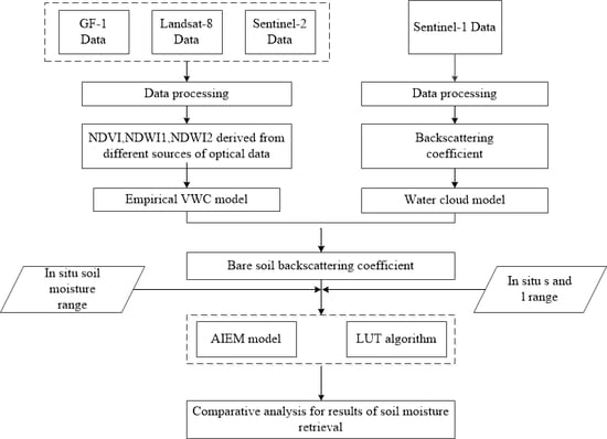
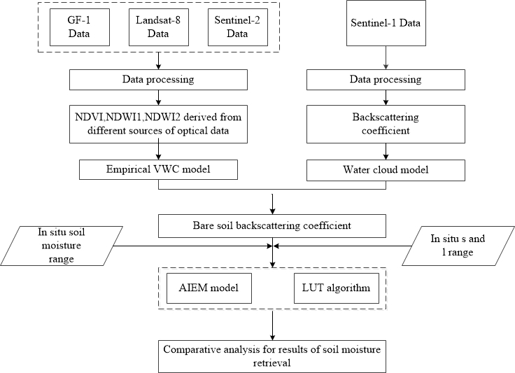
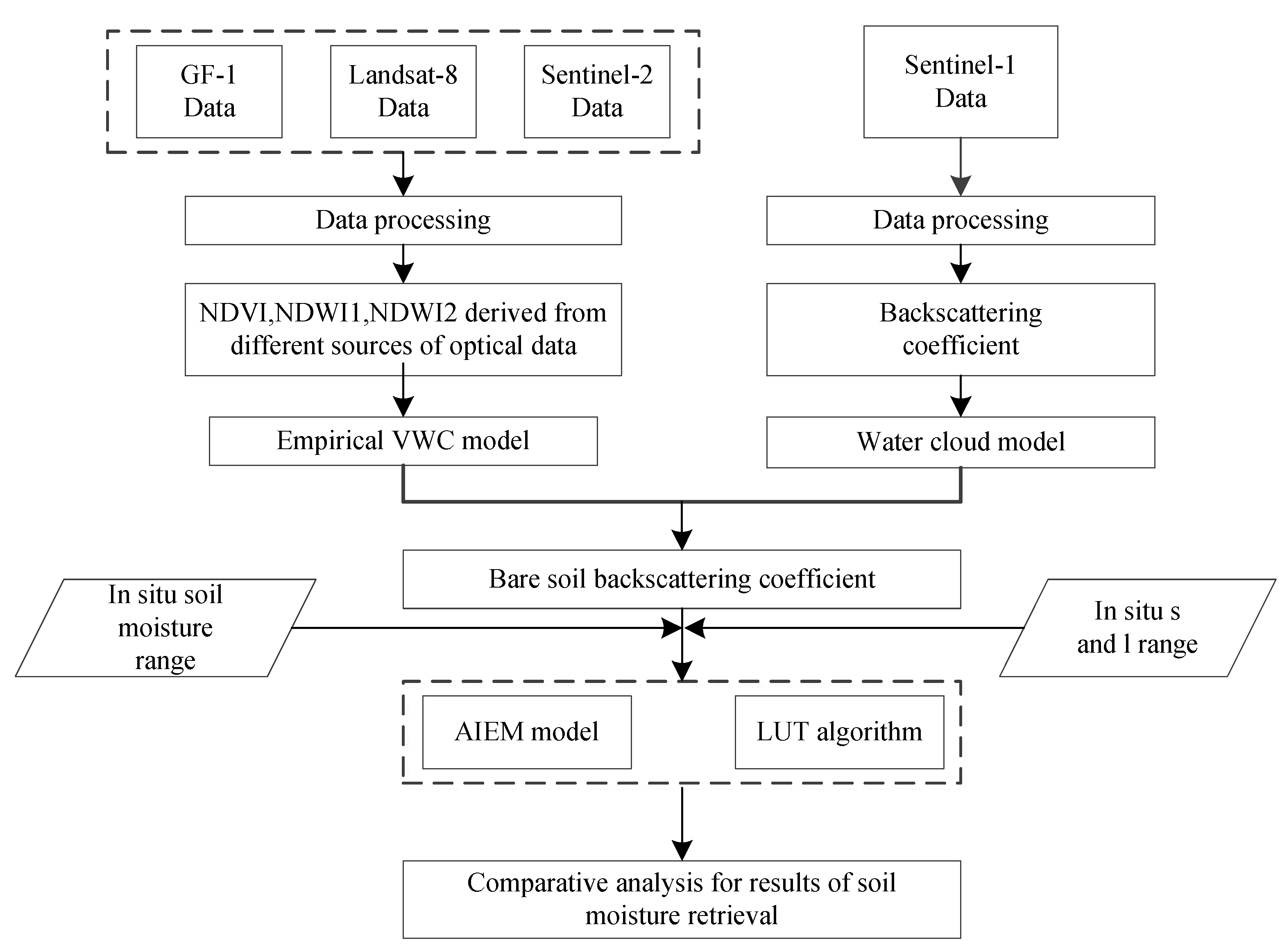
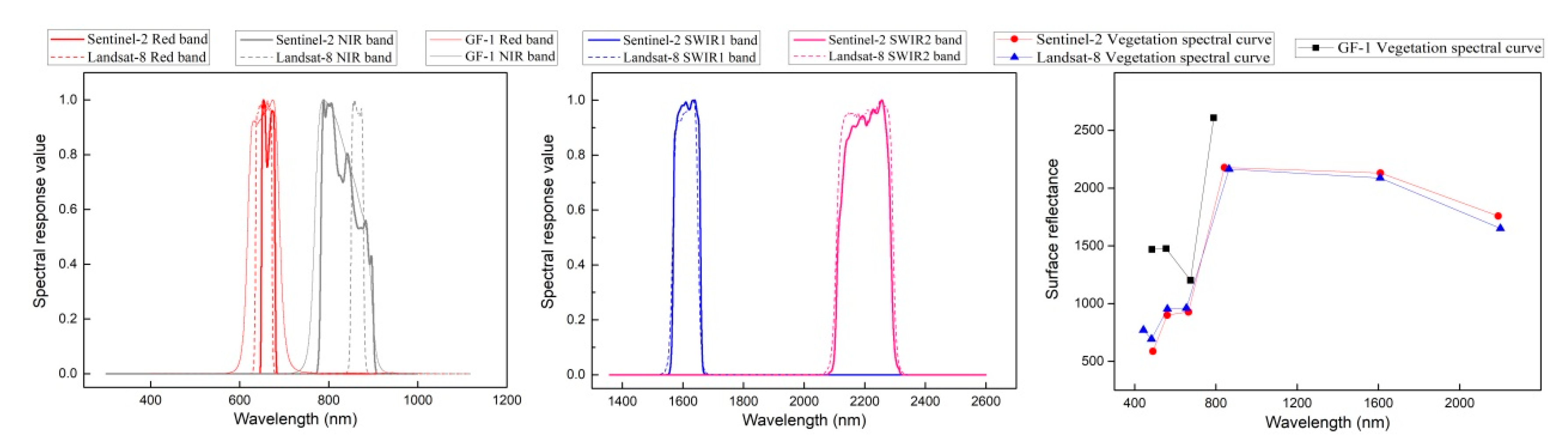
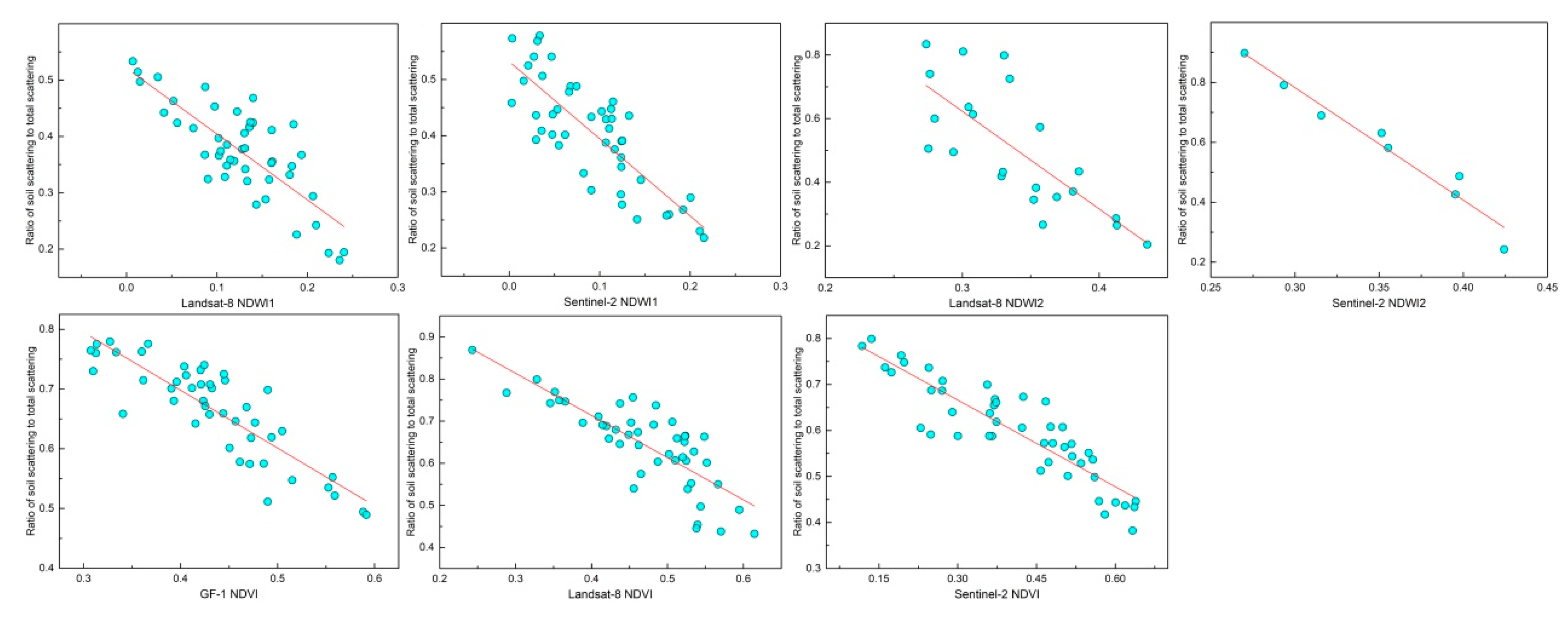
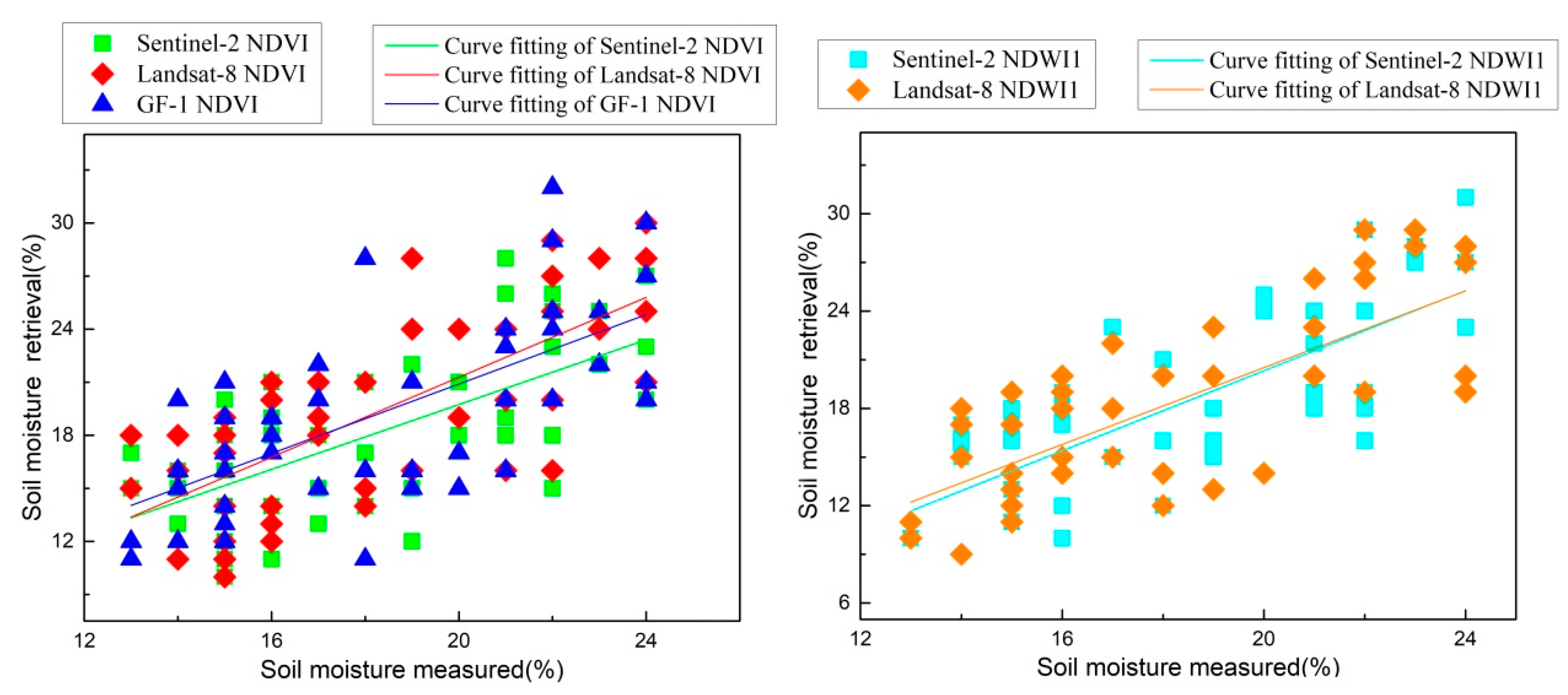
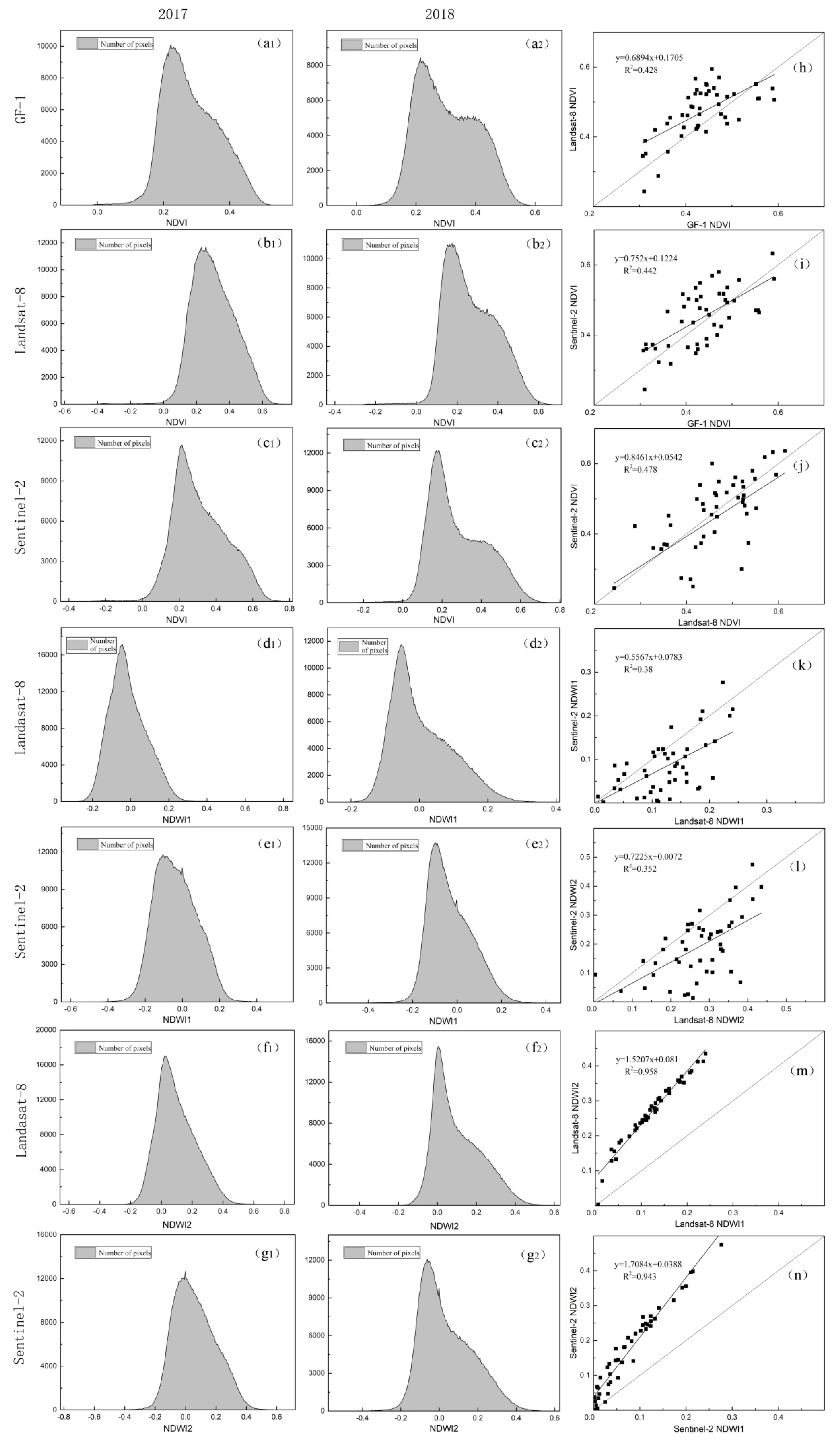
Soil moisture is an important variable in ecological, hydrological, and meteorological studies. An effective method for improving the accuracy of soil moisture retrieval is the mutual supplementation of multi-source data. The sensor configuration and band settings of different optical sensors lead to differences in band reflectivity in the inter-data, further resulting in the differences between vegetation indices. The combination of synthetic aperture radar (SAR) data with multi-source optical data has been widely used for soil moisture retrieval. However, the influence of vegetation indices derived from different sources of optical data on retrieval accuracy has not been comparatively analyzed thus far. Therefore, the suitability of vegetation parameters derived from different sources of optical data for accurate soil moisture retrieval requires further investigation. In this study, vegetation indices derived from GF-1, Landsat-8, and Sentinel-2 were compared. Based on Sentinel-1 SAR and three optical data, combined with the water cloud model (WCM) and the advanced integral equation model (AIEM), the accuracy of soil moisture retrieval was investigated. The results indicate that, Sentinel-2 data were more sensitive to vegetation characteristics and had a stronger capability for vegetation signal detection. The ranking of normalized difference vegetation index (NDVI) values from the three sensors was as follows: the largest was in Sentinel-2, followed by Landsat-8, and the value of GF-1 was the smallest. The normalized difference water index (NDWI) value of Landsat-8 was larger than that of Sentinel-2. With reference to the relative components in the WCM model, the contribution of vegetation scattering exceeded that of soil scattering within a vegetation index range of approximately 0.55–0.6 in NDVI-based models and all ranges in NDWI1-based models. The threshold value of NDWI2 for calculating vegetation water content (VWC) was approximately an NDVI value of 0.4–0.55. In the soil moisture retrieval, Sentinel-2 data achieved higher accuracy than data from the other sources and thus was more suitable for the study for combination with SAR in soil moisture retrieval. Furthermore, compared with NDVI, higher accuracy of soil moisture could be retrieved by using NDWI1 (R2 = 0.623, RMSE = 4.73%). This study provides a reference for the selection of optical data for combination with SAR in soil moisture retrieval.
Keywords: soil moisture; Sentinel-1/2; Landsat-8; GF-1; vegetation water content soil moisture; Sentinel-1/2; Landsat-8; GF-1; vegetation water content
Graphical Abstract