Benchmarking Machine Learning Algorithms for Instantaneous Net Surface Shortwave Radiation Retrieval Using Remote Sensing Data


Abstract
1. Introduction
2. Materials and Methods
2.1. Data
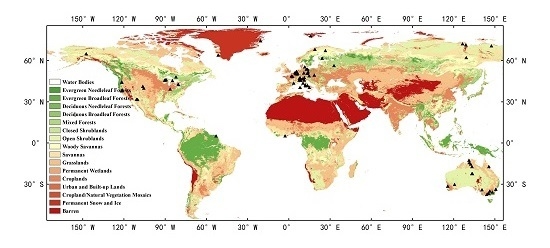
2.1.1. In Situ Data
2.1.2. Remote Sensing Data
2.2. Methodology
2.2.1. Net Surface Shortwave Radiation Retrieval Methodology
2.2.2. Brief Introduction of Machine Learning Algorithms
2.2.3. Dataset Processing
2.2.4. Statistical Analysis
3. Results and Discussion
3.1. Comparions of Normalized Independent Variables for the Train Dataset and Test Dataset
3.2. Evaluation of Machine Learning Algorithms Applied in NSSR Retrieval
3.2.1. Development and Validation of Random Forest
3.2.2. Development and Validation of Artificial Neural Network
3.2.3. Development and Validation of Support Vector Regression
3.3. Accuracy Intercomparison of Different Machine Learning Algorithms
3.4. Importance Analysis of the Independent Variables
4. Conclusions
Author Contributions
Funding
Acknowledgments
Conflicts of Interest
References
- Jia, A.L.; Liang, S.L.; Jiang, B.; Zhang, X.T.; Wang, G.X. Comprehensive Assessment of Global Surface Net Radiation Products and Uncertainty Analysis. J. Geophys. Res. Atmos. 2018, 123, 1970–1989. [Google Scholar] [CrossRef]
- Stephens, G.L.; Li, J.L.; Wild, M.; Clayson, C.A.; Loeb, N.; Kato, S.; L’Ecuyer, T.; Stackhouse, P.W.; Lebsock, M.; Andrews, T. An update on Earth’s energy balance in light of the latest global observations. Nat. Geosci. 2012, 5, 691–696. [Google Scholar] [CrossRef]
- Liang, S.L.; Wang, K.C.; Zhang, X.T.; Wild, M. Review on Estimation of Land Surface Radiation and Energy Budgets from Ground Measurement, Remote Sensing and Model Simulations. IEEE J. Stars 2010, 3, 225–240. [Google Scholar] [CrossRef]
- Inamdar, A.K.; Guillevic, P.C. Net Surface Shortwave Radiation from GOES Imagery-Product Evaluation Using Ground-Based Measurements from SURFRAD. Remote Sens. 2015, 7, 10788–10814. [Google Scholar] [CrossRef]
- Zhang, X.Y.; Li, L.L. Estimating net surface shortwave radiation from Chinese geostationary meteorological satellite FengYun-2D (FY-2D) data under clear sky. Opt. Express 2016, 24, A476–A487. [Google Scholar] [CrossRef]
- Kustas, W.P.; Norman, J.M. Use of remote sensing for evapotranspiration monitoring over land surfaces. Hydrol. Sci. J. 1996, 41, 495–516. [Google Scholar] [CrossRef]
- Duan, S.B.; Li, Z.L.; Leng, P. A framework for the retrieval of all-weather land surface temperature at a high spatial resolution from polar-orbiting thermal infrared and passive microwave data. Remote Sens. Environ. 2017, 195, 107–117. [Google Scholar] [CrossRef]
- Tarpley, J.D. Estimating Incident Solar-Radiation at the Surface from Geostationary Satellite Data. J. Appl. Meteorol. 1979, 18, 1172–1181. [Google Scholar] [CrossRef]
- Pinker, R.T.; Corio, L.A. Surface Radiation Budget from Satellites. Mon. Weather Rev. 1984, 112, 209–215. [Google Scholar] [CrossRef]
- Klink, J.C.; Dollhopf, K.J. An Evaluation of Satellite-Based Insolation Estimates for Ohio. J. Clim. Appl. Meteorol. 1986, 25, 1741–1751. [Google Scholar] [CrossRef]
- Masuda, K.; Leighton, H.G.; Li, Z.Q. A New Parameterization for the Determination of Solar Flux Absorbed at the Surface from Satellite Measurements. J. Clim. 1995, 8, 1615–1629. [Google Scholar] [CrossRef]
- Pinker, R.T.; Ewing, J.A. Modeling Surface Solar-Radiation—Model Formulation and Validation. J. Clim. Appl. Meteorol. 1985, 24, 389–401. [Google Scholar] [CrossRef]
- Atwater, M.A.; Ball, J.T. A Surface Solar-Radiation Model for Cloudy Atmospheres. Mon. Weather Rev. 1981, 109, 878–888. [Google Scholar] [CrossRef]
- Wang, D.D.; Liang, S.L.; He, T. Mapping High-Resolution Surface Shortwave Net Radiation from Landsat Data. IEEE Geosci. Remote Sens. Lett. 2014, 11, 459–463. [Google Scholar] [CrossRef]
- Tang, B.H.; Li, Z.L.; Zhang, R.H. A direct method for estimating net surface shortwave radiation from MODIS data. Remote Sens. Environ. 2006, 103, 115–126. [Google Scholar] [CrossRef]
- Cheng, J.; Liang, S.L.; Wang, W.H.; Guo, Y.M. An efficient hybrid method for estimating clear-sky surface downward longwave radiation from MODIS data. J. Geophys. Res. Atmos. 2017, 122, 2616–2630. [Google Scholar] [CrossRef]
- Wang, D.D.; Liang, S.L.; He, T.; Cao, Y.F.; Jiang, B. Surface Shortwave Net Radiation Estimation from FengYun-3 MERSI Data. Remote Sens. 2015, 7, 6224–6239. [Google Scholar] [CrossRef]
- Zhang, X.T.; Liang, S.L.; Wang, G.X.; Yao, Y.J.; Jiang, B.; Cheng, J. Evaluation of the Reanalysis Surface Incident Shortwave Radiation Products from NCEP, ECMWF, GSFC, and JMA Using Satellite and Surface Observations. Remote Sens. 2016, 8, 225. [Google Scholar] [CrossRef]
- Camps-Valls, G. Machine Learning in Remote Sensing Data Processing. IEEE Int. Works Mach. 2009. [Google Scholar] [CrossRef]
- Charlebois, D.; Goodenough, D.G.; Matwin, S. Machine Learning from Remote-Sensing Analysis. IEEE Igarss 1993, 165–172. [Google Scholar] [CrossRef]
- Yang, L.; Zhang, X.T.; Liang, S.L.; Yao, Y.J.; Jia, K.; Jia, A.L. Estimating Surface Downward Shortwave Radiation over China Based on the Gradient Boosting Decision Tree Method. Remote Sens. 2018, 10, 185. [Google Scholar] [CrossRef]
- Wang, T.X.; Yan, G.J.; Chen, L. Consistent retrieval methods to estimate land surface shortwave and longwave radiative flux components under clear-sky conditions. Remote Sens. Environ. 2012, 124, 61–71. [Google Scholar] [CrossRef]
- Jiang, B.; Zhang, Y.; Liang, S.L.; Zhang, X.T.; Xiao, Z.Q. Surface Daytime Net Radiation Estimation Using Artificial Neural Networks. Remote Sens. 2014, 6, 11031–11050. [Google Scholar] [CrossRef]
- Chen, Z.Q.; Hu, C.M.; Muller-Karger, F. Monitoring turbidity in Tampa Bay using MODIS/Aqua 250-m imagery. Remote Sens. Environ. 2007, 109, 207–220. [Google Scholar] [CrossRef]
- Balzarolo, M.; Vicca, S.; Nguy-Robertson, A.L.; Bonal, D.; Elbers, J.A.; Fu, Y.H.; Grunwald, T.; Horemans, J.A.; Papale, D.; Penuelas, J.; et al. Matching the phenology of Net Ecosystem Exchange and vegetation indices estimated with MODIS and FLUXNET in-situ observations. Remote Sens. Environ. 2016, 174, 290–300. [Google Scholar] [CrossRef]
- Chaney, N.W.; Herman, J.D.; Ek, M.B.; Wood, E.F. Deriving global parameter estimates for the Noah land surface model using FLUXNET and machine learning. J. Geophys. Res. Atmos. 2016, 121, 13218–13235. [Google Scholar] [CrossRef]
- FLUXNET2015 Dataset. Available online: https://fluxnet.fluxdata.org/data/fluxnet2015-dataset/ (accessed on 28 October 2019).
- Maes, W.H.; Gentine, P.; Verhoest, N.E.C.; Miralles, D.G. Potential evaporation at eddy-covariance sites across the globe. Hydrol. Earth Syst. Sci. 2019, 23, 925–948. [Google Scholar] [CrossRef]
- Belward, A.S.; Estes, J.E.; Kline, K.D. The IGBP-DIS global 1-km land-cover data set DISCover: A project overview. Photogramm. Eng. Remote Sens. 1999, 65, 1013–1020. [Google Scholar] [CrossRef]
- United States Geological Survey. Available online: https://lpdaac.usgs.gov/products/mcd12c1v006/ (accessed on 28 October 2019).
- Zhao, L.; Lee, X.H.; Liu, S.D. Correcting surface solar radiation of two data assimilation systems against FLUXNET observations in North America. J. Geophys. Res. Atmos. 2013, 118, 9552–9564. [Google Scholar] [CrossRef]
- Wang, D.D.; Liang, S.L.; He, T.; Shi, Q.Q. Estimation of Daily Surface Shortwave Net Radiation from the Combined MODIS Data. IEEE Trans. Geosci. Remote 2015, 53, 5519–5529. [Google Scholar] [CrossRef]
- Duan, S.B.; Li, Z.L.; Tang, B.H.; Wu, H.; Tang, R.L. Generation of a time-consistent land surface temperature product from MODIS data. Remote Sens. Environ. 2014, 140, 339–349. [Google Scholar] [CrossRef]
- Gentine, P.; Alemohammad, S.H. Reconstructed Solar-Induced Fluorescence: A Machine Learning Vegetation Product Based on MODIS Surface Reflectance to Reproduce GOME-2 Solar-Induced Fluorescence. Geophys. Res. Lett. 2018, 45, 3136–3146. [Google Scholar] [CrossRef] [PubMed]
- Duan, S.B.; Li, Z.L.; Li, H.; Gottsche, F.M.; Wu, H.; Zhao, W.; Leng, P.; Zhang, X.; Coll, C. Validation of Collection 6 MODIS land surface temperature product using in situ measurements. Remote Sens. Environ. 2019, 225, 16–29. [Google Scholar] [CrossRef]
- Kim, H.Y.; Liang, S.L. Development of a hybrid method for estimating land surface shortwave net radiation from MODIS data. Remote Sens. Environ. 2010, 114, 2393–2402. [Google Scholar] [CrossRef]
- National Aeronautics and Space Administration. Available online: https://search.earthdata.nasa.gov/ (accessed on 28 October 2019).
- Bannari, A.; Morin, D.; Bonn, F.; Huete, A.R. A review of vegetation indices. Remote Sens. Rev. 1995, 13, 95–120. [Google Scholar] [CrossRef]
- Chen, X.L.; Zhao, H.M.; Li, P.X.; Yin, Z.Y. Remote sensing image-based analysis of the relationship between urban heat island and land use/cover changes. Remote Sens. Environ. 2006, 104, 133–146. [Google Scholar] [CrossRef]
- Huete, A.R. A soil-adjusted vegetation index (SAVI). Remote Sens. Environ. 1988, 25, 295–309. [Google Scholar] [CrossRef]
- Renard, F.; Alonso, L.; Fitts, Y.; Hadjiosif, A.; Comby, J.J.R.S. Evaluation of the effect of urban redevelopment on surface urban heat islands. Remote Sens. 2019, 11, 299. [Google Scholar] [CrossRef]
- Zha, Y.; Gao, J.; Ni, S. Use of normalized difference built-up index in automatically mapping urban areas from TM imagery. Int. J. Remote Sens. 2003, 24, 583–594. [Google Scholar] [CrossRef]
- Gislason, P.O.; Benediktsson, J.A.; Sveinsson, J.R. Random Forests for land cover classification. Pattern Recognit. Lett. 2006, 27, 294–300. [Google Scholar] [CrossRef]
- Yuchi, W.R.; Gombojav, E.; Boldbaatar, B.; Galsuren, J.; Enkhmaa, S.; Beejin, B.; Naidan, G.; Ochir, C.; Legtseg, B.; Byambaa, T.; et al. Evaluation of random forest regression and multiple linear regression for predicting indoor fine particulate matter concentrations in a highly polluted city. Environ. Pollut. 2019, 245, 746–753. [Google Scholar] [CrossRef] [PubMed]
- Wu, H.; Li, W. Downscaling Land Surface Temperatures Using a Random Forest Regression Model with Multitype Predictor Variables. IEEE Access 2019, 7, 21904–21916. [Google Scholar] [CrossRef]
- Ferreira, A.G.; Soria-Olivas, E.; Lopez, A.J.S.; Lopez-Baeza, E. Estimating net radiation at surface using artificial neural networks: A new approach. Theor. Appl. Climatol. 2011, 106, 263–279. [Google Scholar] [CrossRef]
- Mahalakshmi, D.V.; Paul, A.; Dutta, D.; Ali, M.M.; Reddy, R.S.; Jha, C.; Sharma, J.R.; Dadhwal, V.K.J.S.E.R. Estimation of net surface radiation from eddy flux tower measurements using artificial neural network for cloudy skies. Sustain. Environ. Res. 2016, 26, 44–50. [Google Scholar] [CrossRef][Green Version]
- Aires, F.; Rossow, W.B.; Scott, N.A.; Chedin, A. Remote sensing from the infrared atmospheric sounding interferometer instrument—2. Simultaneous retrieval of temperature, water vapor, and ozone atmospheric profiles. J. Geophys. Res. Atmos. 2002, 107. [Google Scholar] [CrossRef]
- Mas, J.F.; Flores, J.J. The application of artificial neural networks to the analysis of remotely sensed data. Int. J. Remote Sens. 2008, 29, 617–663. [Google Scholar] [CrossRef]
- Geraldo-Ferreira, A.; Soria-Olivas, E.; Gomez-Sanchis, J.; Serrano-Lopez, A.J.; Velazquez-Blazquez, A.; Lopez-Baeza, E. Modelling net radiation at surface using “in situ” netpyrradiometer measurements with artificial neural networks. Expert Syst. Appl. 2011, 38, 14190–14195. [Google Scholar] [CrossRef]
- Jiang, H.; Rusuli, Y.; Amuti, T.; He, Q. Quantitative assessment of soil salinity using multi-source remote sensing data based on the support vector machine and artificial neural network. Int. J. Remote Sens. 2019, 40, 284–306. [Google Scholar] [CrossRef]
- Ichii, K.; Ueyama, M.; Kondo, M.; Saigusa, N.; Kim, J.; Alberto, M.C.; Ardo, J.; Euskirchen, E.S.; Kang, M.; Hirano, T.; et al. New data-driven estimation of terrestrial CO2 fluxes in Asia using a standardized database of eddy covariance measurements, remote sensing data, and support vector regression. J. Geophys. Res. Biogeosciences 2017, 122, 767–795. [Google Scholar] [CrossRef]
- Ying, W.M.; Wu, H.; Li, Z.L. Net Surface Shortwave Radiation Retrieval Using Random Forest Method with MODIS/AQUA Data. IEEE J. Stars 2019, 12, 2252–2259. [Google Scholar] [CrossRef]


| Surface Type | Description |
|---|---|
| Water Bodies | At least 60% of area is covered by permanent water bodies. |
| Evergreen Needleleaf Forests | Dominated by evergreen conifer trees (canopy >2 m). Tree cover >60%. |
| Evergreen Broadleaf Forests | Dominated by evergreen broadleaf and palmate trees (canopy >2 m). Tree cover >60%. |
| Deciduous Needleleaf Forests | Dominated by deciduous needleleaf (larch) trees (canopy >2 m). Tree cover >60%. |
| Deciduous Broadleaf Forests | Dominated by deciduous broadleaf trees (canopy >2 m). Tree cover >60%. |
| Mixed Forests | Dominated by neither deciduous nor evergreen (40%–60% of each) tree type (canopy >2 m). Tree cover >60%. |
| Closed Shrublands | Dominated by woody perennials (1–2 m height) >60% cover. |
| Open Shrublands | Dominated by woody perennials (1–2 m height) 10%–60% cover. |
| Woody Savannas | Tree cover 30%–60% (canopy >2 m). |
| Savannas | Tree cover 10%–30% (canopy >2 m). |
| Grasslands | Dominated by herbaceous annuals (<2 m). |
| Permanent Wetlands | Permanently inundated lands with 30%–60% water cover and >10% vegetated cover. |
| Croplands | At least 60% of area is cultivated cropland. |
| Urban and Built-up Lands | At least 30% impervious surface area, including building materials, asphalt, and vehicles. |
| Cropland/Natural Vegetation Mosaics | Mosaics of small-scale cultivation 40%–60% with natural tree, shrub, or herbaceous vegetation. |
| Permanent Snow and Ice | At least 60% of area is covered by snow and ice for at least 10 months of the year. |
| Barren | At least 60% of area is nonvegetated barren (sand, rock, soil) areas with less than 10% vegetation. |
| Independent Variable | Acronym |
|---|---|
| TOA MODIS red band reflectance | R1 |
| TOA MODIS near infrared band reflectance | R2 |
| TOA MODIS blue band reflectance | R3 |
| TOA MODIS green band reflectance | R4 |
| TOA MODIS shortwave infrared band reflectance -1 | R5 |
| TOA MODIS shortwave infrared band reflectance -2 | R6 |
| TOA MODIS shortwave infrared band reflectance -3 | R7 |
| Latitude | LAT |
| Viewing Zenith Angle | VZA |
| Solar Zenith Angle | SZA |
| Atmosphere precipitate water | w |
| Surface MODIS red band reflectance | SR1 |
| Surface MODIS near infrared band reflectance | SR2 |
| Surface MODIS blue band reflectance | SR3 |
| Surface MODIS green band reflectance | SR4 |
| Surface MODIS shortwave infrared band reflectance -1 | SR5 |
| Surface MODIS shortwave infrared band reflectance -2 | SR6 |
| Surface MODIS shortwave infrared band reflectance -3 | SR7 |
| Cloud mask–confident clear | CM1 |
| Cloud mask–probably clear | CM2 |
| Cloud mask–uncertain clear | CM3 |
| Cloud mask–cloudy | CM4 |
| Type | Size | RF | ANN | SVR | ||||||
|---|---|---|---|---|---|---|---|---|---|---|
| Bias | RMSE | R2 | Bias | RMSE | R2 | Bias | RMSE | R2 | ||
| ENF | 1276 | −10.28 | 60.25 | 0.95 | −5.52 | 58.22 | 0.96 | −5.51 | 55.57 | 0.96 |
| EBF | 401 | 6.69 | 62.59 | 0.95 | 2.74 | 60.81 | 0.95 | 3.56 | 58.93 | 0.95 |
| DNF | 117 | −9.94 | 61.35 | 0.90 | −15.76 | 80.18 | 0.84 | −20.8 | 80.51 | 0.84 |
| DBF | 639 | −10.60 | 59.65 | 0.95 | −11.62 | 62.73 | 0.94 | −14.81 | 60.73 | 0.95 |
| MF | 290 | −9.77 | 52.31 | 0.95 | −4.08 | 47.21 | 0.96 | −5.86 | 46.09 | 0.96 |
| CSH | 104 | 15.55 | 53.84 | 0.96 | 6.69 | 52.46 | 0.96 | 7.30 | 50.43 | 0.96 |
| OSH | 520 | 8.32 | 39.77 | 0.98 | 7.49 | 42.70 | 0.98 | 4.76 | 38.25 | 0.98 |
| WSA | 218 | −6.55 | 45.48 | 0.94 | −7.07 | 53.05 | 0.92 | −1.38 | 48.50 | 0.94 |
| SAV | 268 | 10.51 | 46.45 | 0.95 | −3.03 | 44.02 | 0.96 | 1.67 | 41.63 | 0.96 |
| GRA | 1759 | 6.42 | 46.09 | 0.97 | 7.24 | 47.76 | 0.97 | 4.89 | 46.08 | 0.97 |
| WET | 1474 | −2.85 | 53.38 | 0.96 | −3.01 | 56.62 | 0.95 | −4.15 | 53.38 | 0.96 |
| CRO | 730 | 7.26 | 46.77 | 0.97 | 10.31 | 51.61 | 0.96 | 10.44 | 50.44 | 0.96 |
| All | 7796 | −0.19 | 52.39 | 0.96 | 0.21 | 54.04 | 0.96 | −0.73 | 51.73 | 0.96 |
| Month | Size | RF | ANN | SVR | ||||||
|---|---|---|---|---|---|---|---|---|---|---|
| Bias | NRMSE | R2 | Bias | NRMSE | R2 | Bias | NRMSE | R2 | ||
| January | 612 | −5.60 | 20.0% | 0.95 | 4.36 | 20.3% | 0.95 | 0.62 | 18.4% | 0.96 |
| April | 669 | −5.01 | 14.2% | 0.96 | −2.11 | 15.9% | 0.96 | −4.66 | 15.5% | 0.96 |
| July | 777 | 9.80 | 12.5% | 0.97 | 5.06 | 13.2% | 0.96 | 5.94 | 12.2% | 0.97 |
| October | 626 | −1.09 | 13.7% | 0.96 | −3.39 | 13.4% | 0.96 | −3.33 | 13.1% | 0.97 |
| Case | Description | Bias | RMSE | R2 |
|---|---|---|---|---|
| CASE 1 | LAT, SZA, VZA, R1, R2, R3, R4, R5, R6, R7, w, SR1, SR2, SR3, SR4, SR5, SR6, SR7, CM1, CM2, CM3, CM4 | −0.19 | 52.39 | 0.96 |
| CASE 2 | R1, R2, R3, R4, R5, R6, R7 | 5.70 | 88.82 | 0.89 |
| CASE 3 | LAT, SZA, VZA, R1, R2, R3, R4, R5, R6, R7 | −0.52 | 55.50 | 0.96 |
| CASE 4 | R1, R2, R3, R4, R5, R6, R7, w | 5.82 | 89.82 | 0.89 |
| CASE 5 | R1, R2, R3, R4, R5, R6, R7, SR1, SR2, SR3, SR4, SR5, SR6, SR7 | 4.78 | 78.05 | 0.92 |
| CASE 6 | LAT, SZA, VZA, R1, R2, R3, R4, R5, R6, R7, w | −0.22 | 54.67 | 0.96 |
| CASE 7 | LAT, SZA, VZA, R1, R2, R3, R4, R5, R6, R7, SR1, SR2, SR3, SR4, SR5, SR6, SR7 | −0.38 | 54.22 | 0.96 |
| CASE 8 | R1, R2, R3, R4, R5, R6, R7, w, SR1, SR2, SR3, SR4, SR5, SR6, SR7 | 4.70 | 78.07 | 0.92 |
| CASE 9 | LAT, SZA, VZA, R1, R2, R3, R4, R5, R6, R7, w, SR1, SR2, SR3, SR4, SR5, SR6, SR7 | −0.17 | 53.30 | 0.96 |
| CASE 10 | LAT, SZA, VZA, R3 | −0.04 | 58.15 | 0.96 |
| CASE 11 | LAT, SZA, VZA, R3, R4 | −0.14 | 58.13 | 0.96 |
| CASE 12 | LAT, SZA, VZA, R3, R4, R1 | −0.12 | 58.06 | 0.96 |
| CASE 13 | LAT, SZA, VZA, R3, R4, R1, R5 | −0.39 | 56.59 | 0.96 |
| CASE 14 | LAT, SZA, VZA, R3, R4, R1, R5, R2 | −0.61 | 56.12 | 0.96 |
| CASE 15 | LAT, SZA, VZA, R3, R4, R1, R5, R2, R6 | −0.60 | 55.71 | 0.96 |
© 2019 by the authors. Licensee MDPI, Basel, Switzerland. This article is an open access article distributed under the terms and conditions of the Creative Commons Attribution (CC BY) license (http://creativecommons.org/licenses/by/4.0/).
Share and Cite
Wu, H.; Ying, W. Benchmarking Machine Learning Algorithms for Instantaneous Net Surface Shortwave Radiation Retrieval Using Remote Sensing Data. Remote Sens. 2019, 11, 2520. https://doi.org/10.3390/rs11212520
Wu H, Ying W. Benchmarking Machine Learning Algorithms for Instantaneous Net Surface Shortwave Radiation Retrieval Using Remote Sensing Data. Remote Sensing. 2019; 11(21):2520. https://doi.org/10.3390/rs11212520
Chicago/Turabian StyleWu, Hua, and Wangmin Ying. 2019. "Benchmarking Machine Learning Algorithms for Instantaneous Net Surface Shortwave Radiation Retrieval Using Remote Sensing Data" Remote Sensing 11, no. 21: 2520. https://doi.org/10.3390/rs11212520
APA StyleWu, H., & Ying, W. (2019). Benchmarking Machine Learning Algorithms for Instantaneous Net Surface Shortwave Radiation Retrieval Using Remote Sensing Data. Remote Sensing, 11(21), 2520. https://doi.org/10.3390/rs11212520