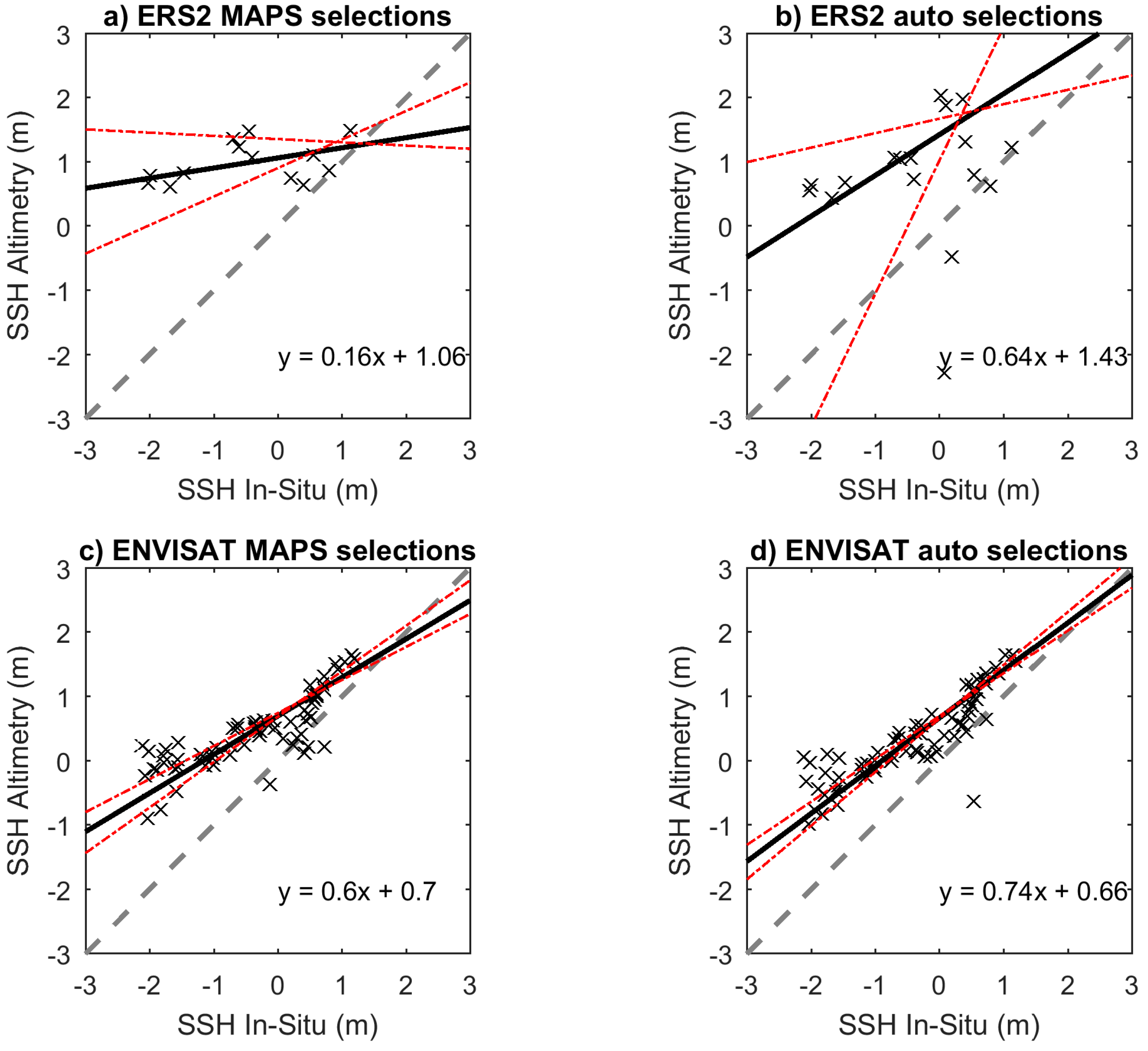
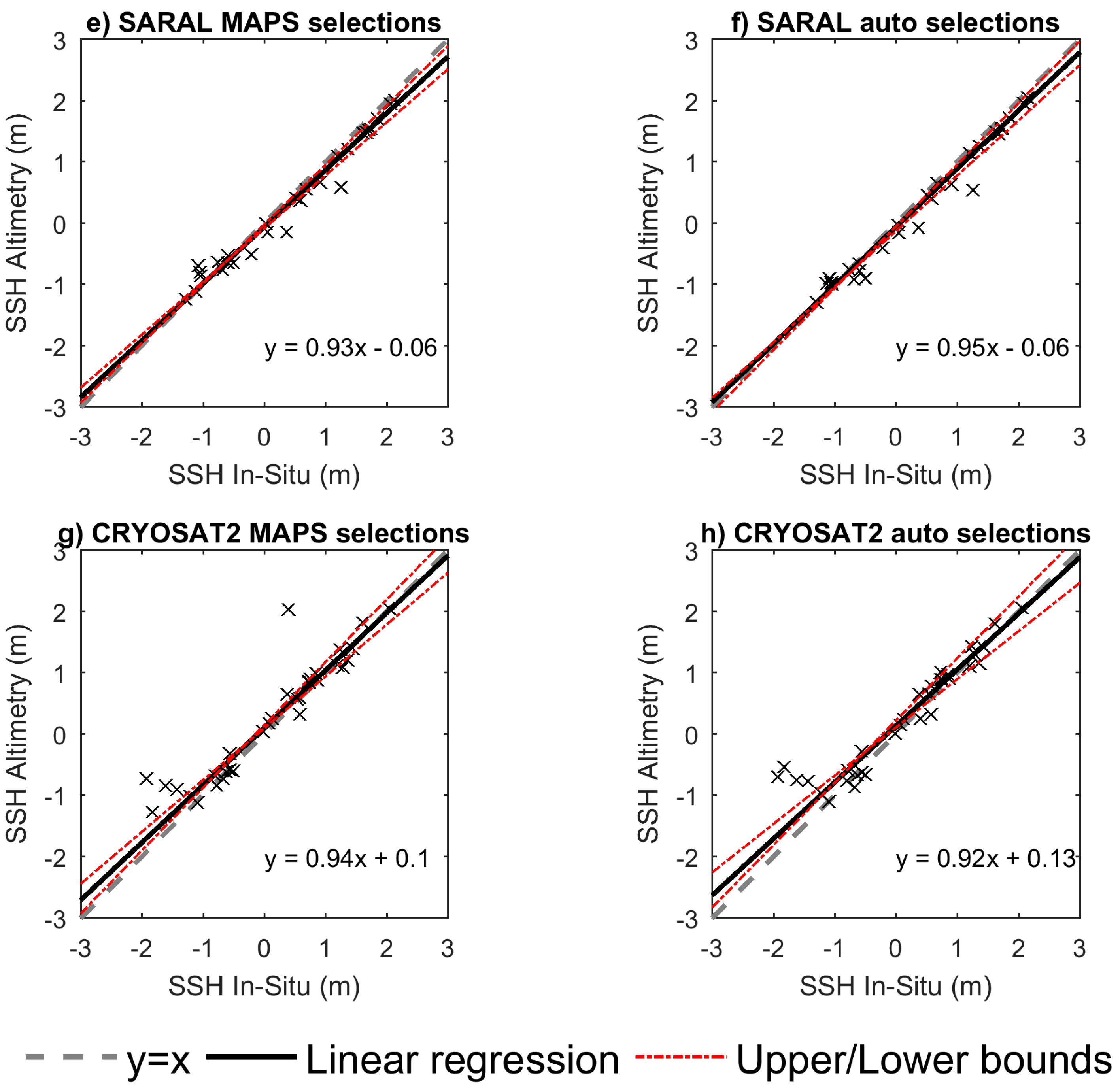
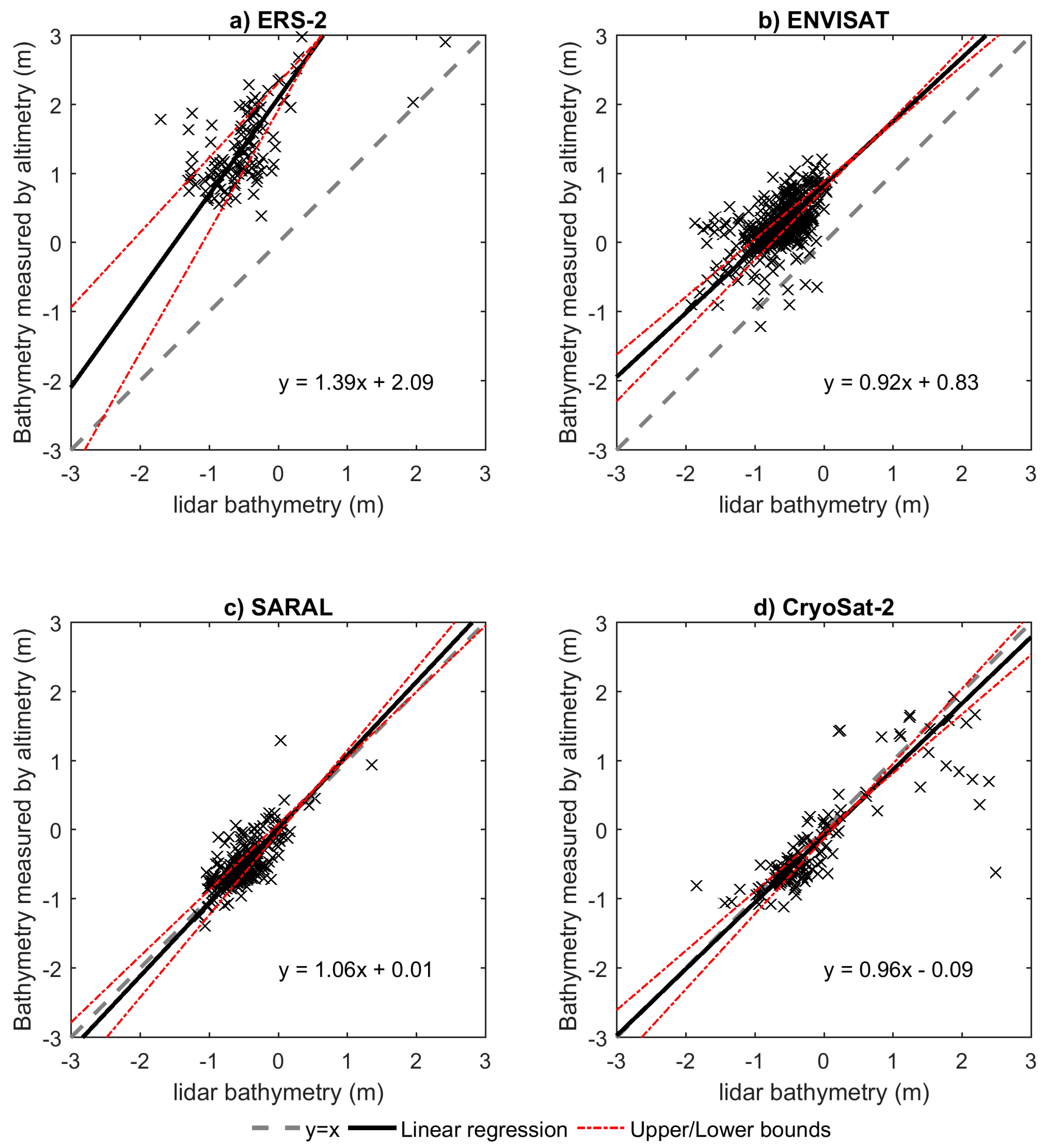
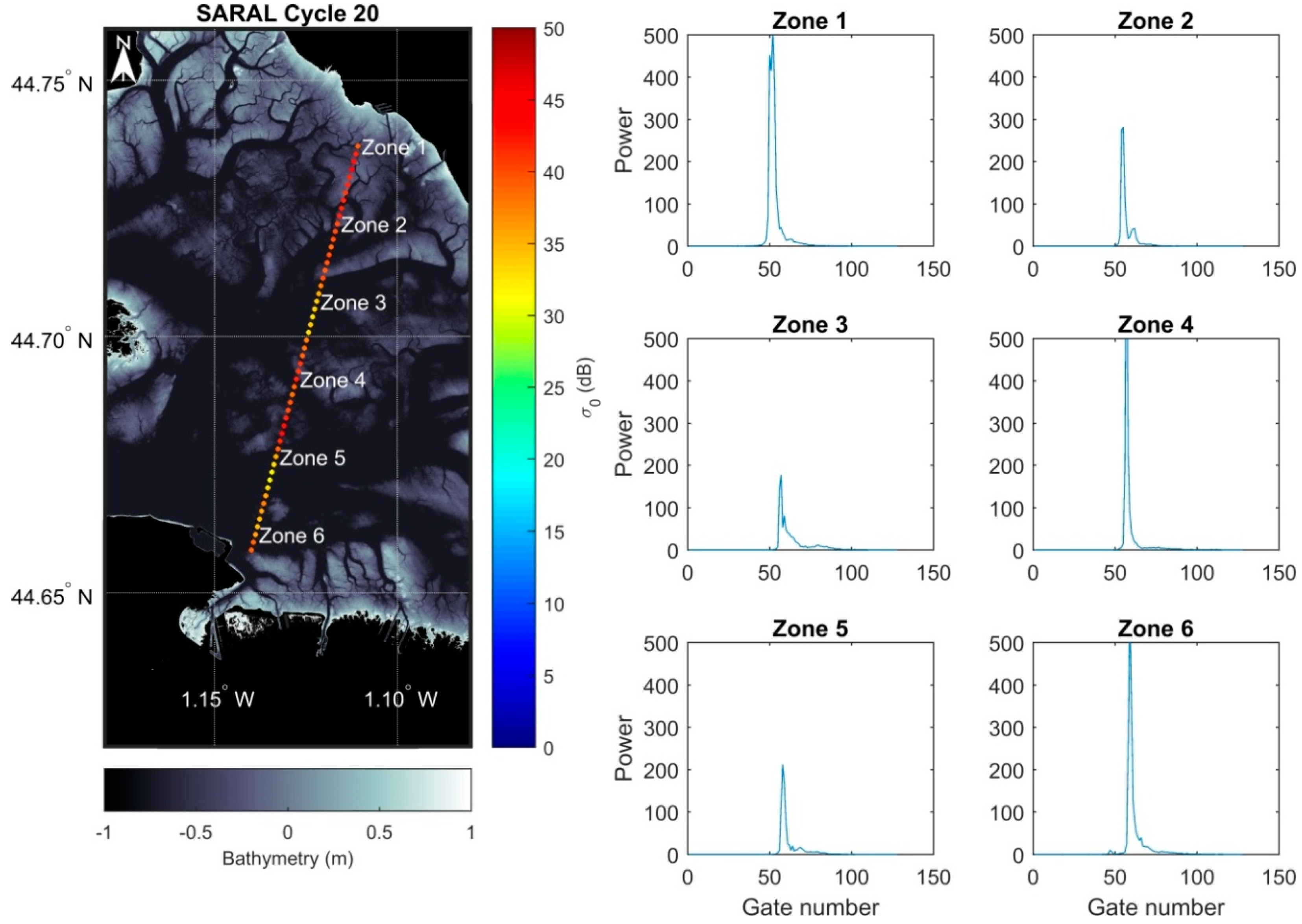
Monitoring Sea Level and Topography of Coastal Lagoons Using Satellite Radar Altimetry: The Example of the Arcachon Bay in the Bay of Biscay

 , , ,
, , , Abstract
Share and Cite
Salameh, E.; Frappart, F.; Marieu, V.; Spodar, A.; Parisot, J.-P.; Hanquiez, V.; Turki, I.; Laignel, B. Monitoring Sea Level and Topography of Coastal Lagoons Using Satellite Radar Altimetry: The Example of the Arcachon Bay in the Bay of Biscay. Remote Sens. 2018, 10, 297. https://doi.org/10.3390/rs10020297
Salameh E, Frappart F, Marieu V, Spodar A, Parisot J-P, Hanquiez V, Turki I, Laignel B. Monitoring Sea Level and Topography of Coastal Lagoons Using Satellite Radar Altimetry: The Example of the Arcachon Bay in the Bay of Biscay. Remote Sensing. 2018; 10(2):297. https://doi.org/10.3390/rs10020297
Chicago/Turabian StyleSalameh, Edward, Frédéric Frappart, Vincent Marieu, Alexandra Spodar, Jean-Paul Parisot, Vincent Hanquiez, Imen Turki, and Benoit Laignel. 2018. "Monitoring Sea Level and Topography of Coastal Lagoons Using Satellite Radar Altimetry: The Example of the Arcachon Bay in the Bay of Biscay" Remote Sensing 10, no. 2: 297. https://doi.org/10.3390/rs10020297
APA StyleSalameh, E., Frappart, F., Marieu, V., Spodar, A., Parisot, J.-P., Hanquiez, V., Turki, I., & Laignel, B. (2018). Monitoring Sea Level and Topography of Coastal Lagoons Using Satellite Radar Altimetry: The Example of the Arcachon Bay in the Bay of Biscay. Remote Sensing, 10(2), 297. https://doi.org/10.3390/rs10020297