1. Introduction
Urban expansion and environmental protection represent competing priorities in spatial planning processes, particularly in rapidly developing metropolitan regions [
1]. As cities grow, land use and land cover change intensify, placing increasing pressure on natural ecosystems and the critical services they provide to human communities [
2]. In this context, reconciling the demand for urban development with the need to preserve ecological integrity stands a pressing challenge for planners and policymakers worldwide [
3].
To address this balance between ecological preservation and urban expansion, planners have increasingly integrated Green Infrastructure as a multifunctional tool for sustainable spatial development. Green Infrastructure (GI) is defined as a planned network of a wide range of ecosystem services to provide help with climate mitigation and adaptation [
4]. Green Infrastructure is designed to reduce the environmental effects of land take, alongside tools like Urban Growth Boundaries, Net Environmental Benefit Analysis, and development cost assessments, and provides an advanced framework for managing urban growth, mitigating land consumption, and enhancing urban resilience [
5,
6].
Within the European Union (EU), implementing GI has become a cornerstone of urban adaptation strategies; in fact, the EU has prioritized GI as a key element in its efforts to achieve climate neutrality and protect natural habitats [
7,
8]. On 6 May 2013, the European Commission adopted an EU-wide strategy promoting investments in ecosystem services (Ess) and GI to address the increasing risks posed by climate change and integrate these approaches into urban spatial planning [
9].
Ecosystem services are defined as the benefits provided by nature’s functioning, ranging from provisioning services (e.g., food, water, and materials) to regulating services (e.g., climate and water regulation, pollination), and cultural services (e.g., recreation, esthetic value, and inspiration) [
10,
11]. Ecosystem services modeling has become a powerful approach for understanding the complex interactions between socio-ecological and technological systems, enabling planners to incorporate biophysical assessments into land use decisions [
12,
13,
14]. Integrating multifunctional ES assessments into land use planning marks a significant step toward sustainability. These assessments, typically represented as composite index scores, inform land use suitability analyses, ensuring environmentally sound transformations [
15]. By linking urban development with ecological functionality, GI and Nature Based Solutions (NBS) contribute to long-term urban resilience and sustainable growth [
16,
17,
18].
In planning processes, the trade-off analysis of ES helps to define optimal decisions by evaluating the costs and benefits of different ecosystem services [
19]. Therefore, incorporating ES into planning processes is essential for ensuring environmental sustainability and equitable development. Although environmental planning offers practical methods to integrate ecosystem services, spatial planning science has yet to fully engage with the ecosystem services discourse due to its practice challenges in planning [
20,
21]. ES provides benefits to human communities in categories; regulating, provisioning, habitat, and cultural services [
19,
20,
21,
22]. Ecosystem assessment to integrate in planning plays a vital role in sustainability and climate goals. Sustainable ecosystem services have interaction with land use and land cover [
19]. Also, integrating ecosystem services into planning processes helps to reveal potential trade-offs and contributes to more transparent and informed prioritization [
23].
Recently developed ecosystem services tools have been designed to inform multiple policy sectors and support their integration into spatial planning, but the concept of ES remains poorly operationalized in many developing countries and at the global level [
24]. In addition, there is still limited practical guidance on how ecosystem services should be systematically incorporated into land use and environmental planning processes [
25]. The absence of well-defined frameworks underscores a significant research gap and reinforces the need for new studies that explore practical methods for applying ecosystem services in real-world planning contexts.
In Turkiye, considerable uncertainty surrounds both the location and nature of future urban expansion [
3]. Also, urban and environmental planning operates within a complex, multi-level framework encompassing national, regional, and local authorities. However, constant institutional changes and overlapping responsibilities have led to difficulties in ensuring policy cohesion. For example, shifts in governance structures such as expanding metropolitan boundaries and redefining rural areas have increasingly blurred the line between urban and rural zones, contributing to rapid urban sprawl. The lack of an integrated, large-scale planning strategy and the tendency to adopt fragmented approaches have made it challenging to reconcile market-driven urban expansion with environmental sustainability.
The Izmir Peninsula, characterized by Its unique Mediterranean landscape and centuries of human–environment interaction, is undergoing rapid urbanization [
26]. This transformation poses significant challenges to the region’s natural environment, driven by poorly coordinated planning and limited regulatory control over urban expansion. The Izmir Peninsula stands as a representative case of the broader tensions between environmental protection and urban expansion observed in rapidly urbanizing Mediterranean landscapes. While Turkiye’s planning system includes environmental regulation plans at broad scales (1:100,000 and 1:25,000), the preparation of such plans for Izmir has faced persistent challenges since the 1980s. Frequent amendments and inconsistencies in upper-scale plans have hindered their integration with local development efforts, resulting in fragmented and uncoordinated urban growth [
27].
This rapid transformation is further compounded by limited awareness of ecosystem vulnerability and habitat quality within planning processes. Although some pioneering projects have integrated ecosystem services approaches, their application remains limited in Turkiye [
28]. A stronger emphasis on environmentally sound decision-making and the incorporation of ecosystem services into spatial planning is urgently needed to guide sustainable development.
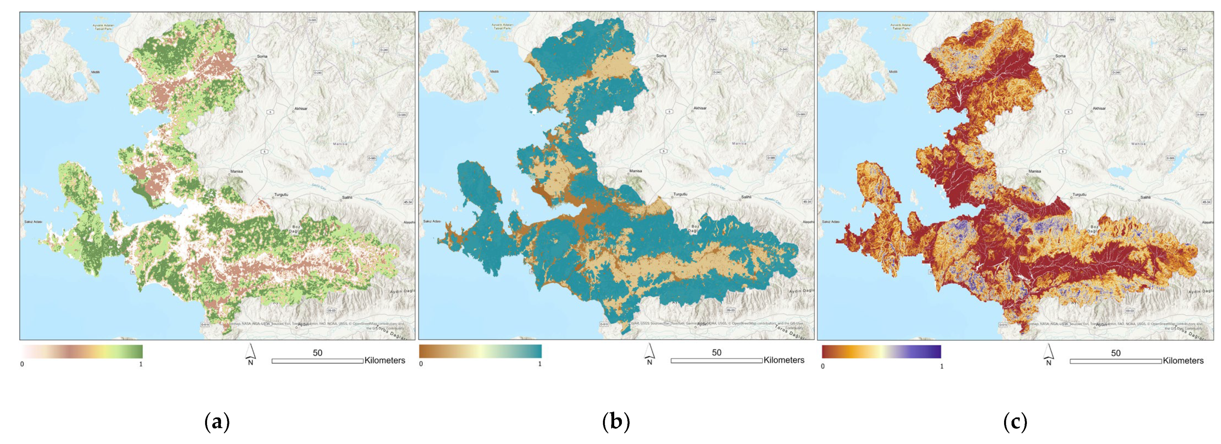
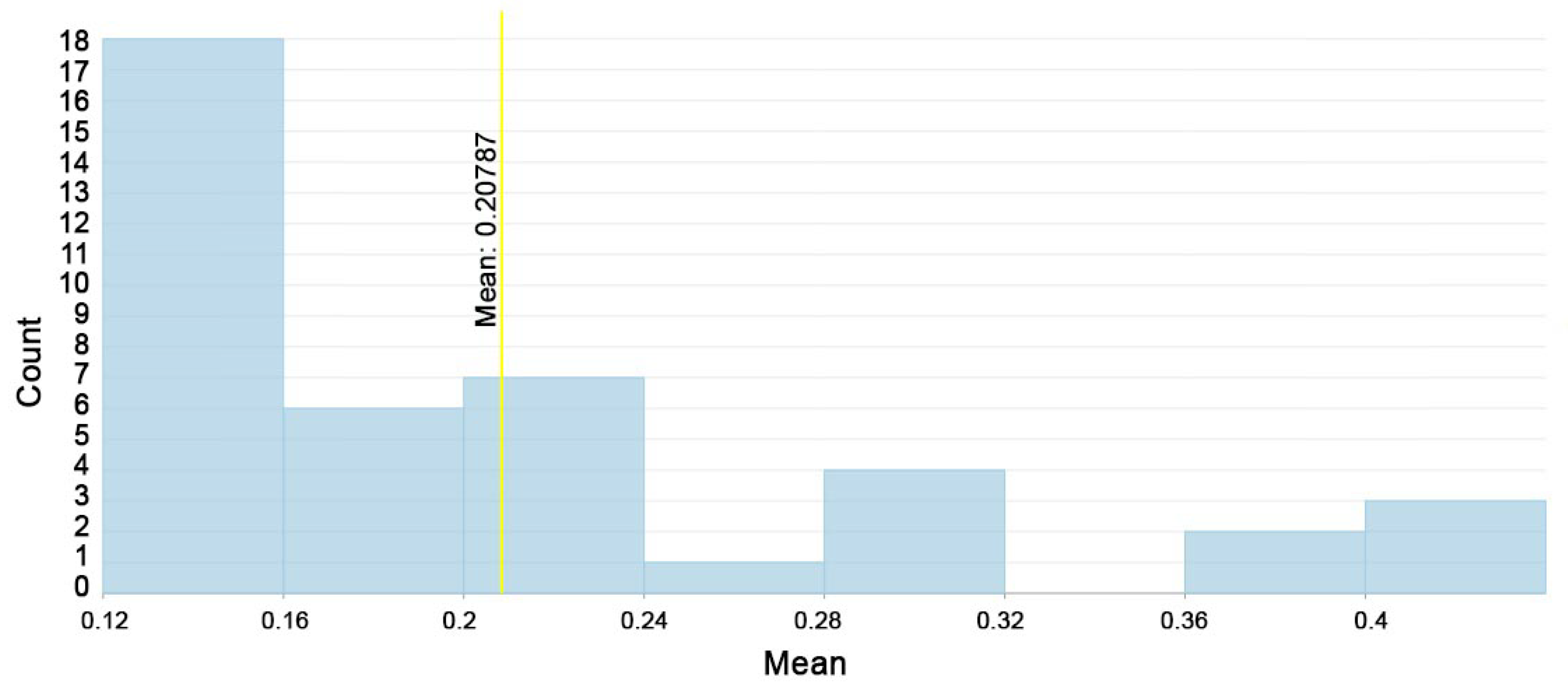
This study aims to address these gaps by integrating composite ecosystem assessments into planning processes, offering data-driven tools to support informed decisions on both conservation priorities and urban growth management. By utilizing advanced ES models and spatial analyses, the research proposes a methodology to support sustainable development in the metropolitan area of Izmir. The study explores the following questions: (i) How distributed are values of habitat quality, carbon storage, and sequestration or sediment delivery ratio?; (ii) Where are conflicts or synergy areas for environmental value and settlement expansion in the Environmental Regulation Plan in Izmir?; (iii) What are the spatial characteristics of large conflict areas with high environmental value?
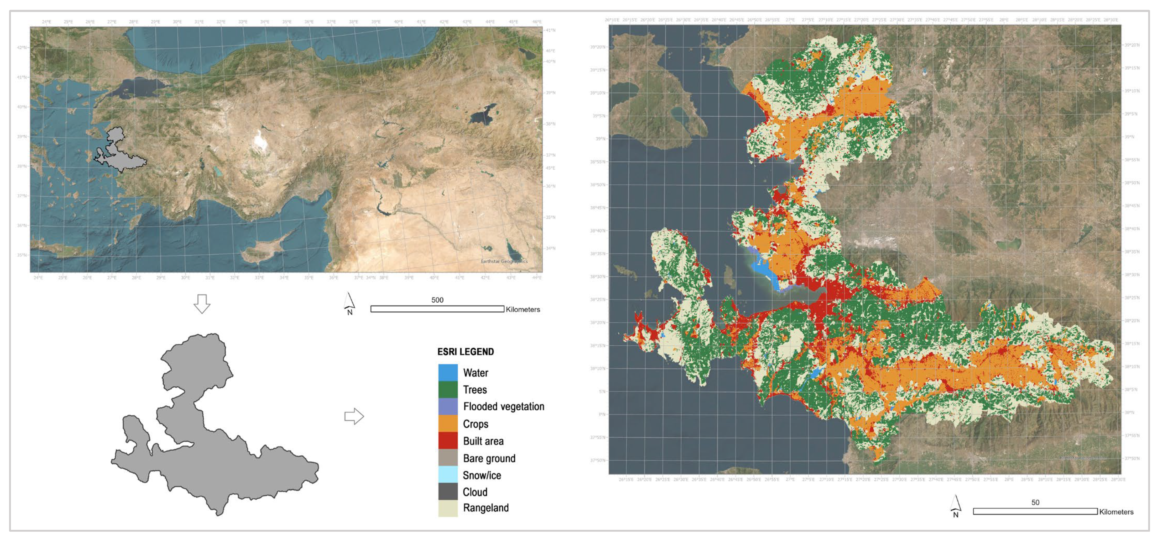
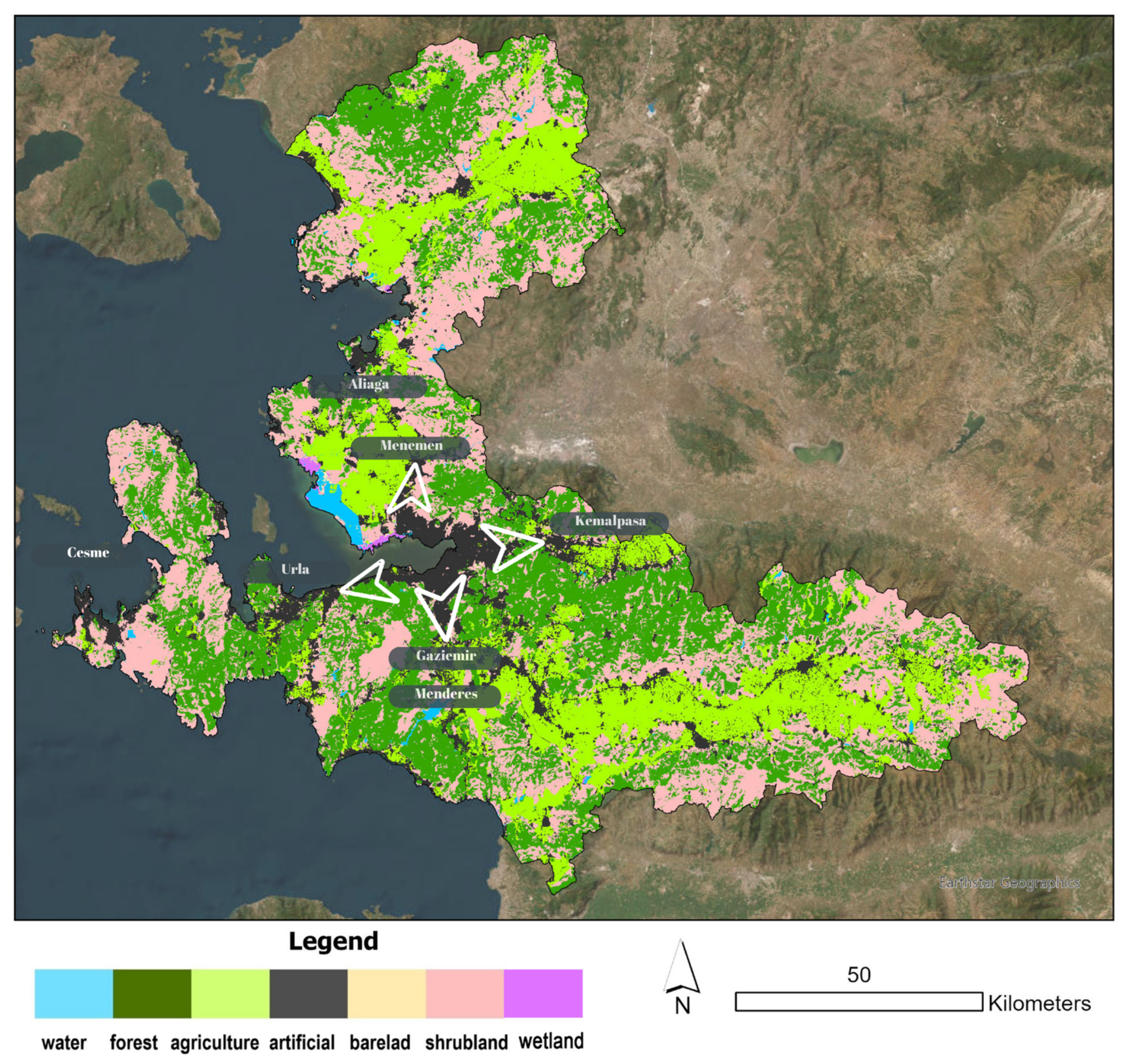
In this study, we conducted a spatial assessment of ecosystem services (Ess) in the İzmir Province by utilizing land use and land cover (LULC) data as the primary input. The LULC map served as the basis for modeling three key ecosystem services: habitat quality, carbon storage and sequestration, and sediment retention. These services were selected due to their relevance to environmental regulation, their sensitivity to urban land conversion, and the availability of reliable data.
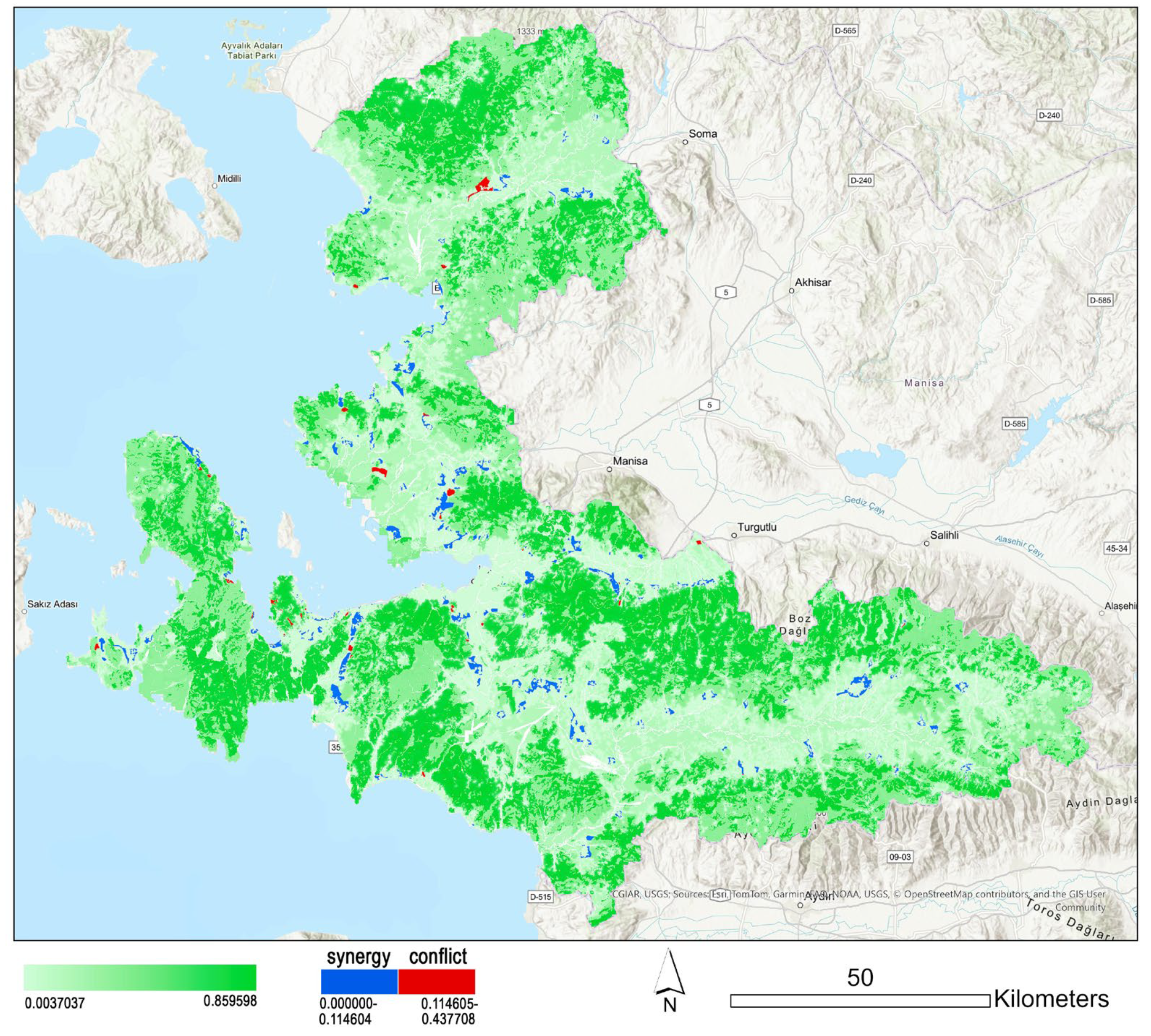
Using a spatial modeling tool (InVEST), we produced individual ES maps representing the spatial distribution and intensity of each service across the study area. Following this, we developed a composite ecosystem services map by aggregating the normalized outputs of the three individual ES models. This composite map reflects an integrated measure of overall environmental value, capturing both ecological function and potential vulnerability. To evaluate the interaction between urban development and ecological value, we overlaid the settlement expansion areas as identified in Izmir’s Environmental Regulation Plan (1:100,000 scale) onto the composite ES map. For each expansion zone, we calculated the mean environmental value, which allowed us to assess the ecological significance of areas targeted for urban growth.
This approach enabled the identification of synergy zones with low environmental value and suitable for development and conflict zones with high environmental value that may be at risk due to planned urban expansion. In the final part of the analysis, we discussed the spatial characteristics of these conflict zones, reflecting on the potential ecological trade-offs and planning implications. The study concludes by proposing how such data-driven ES assessments can support more sustainable and environmentally sensitive spatial planning strategies.
4. Discussion
Ecosystem services are shaped based on land use and land cover. Therefore, land use plans drive urban development which affects ecosystem services [
39]. In this study, it was observed that habitat quality, carbon storage and sequestration areas, and sediment delivery rate vary spatially according to different land use types. It is supported by studies examining the impact of land use on ecosystem services [
40,
41]. However, the study differentiates itself from existing research that examines the impact of temporal changes in land use intensity and type on ecosystem services [
40,
42].
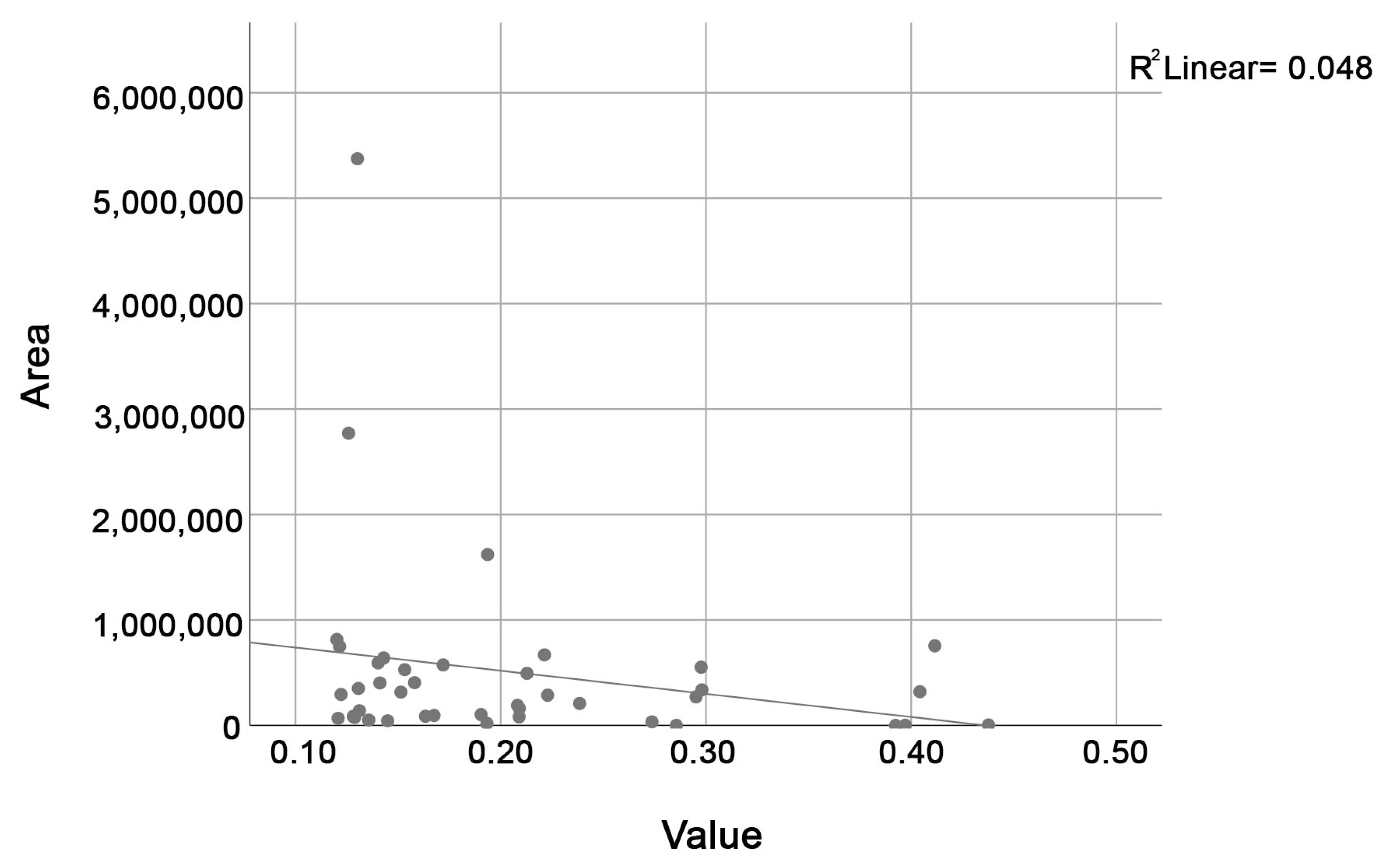
The conflict zones obtained by examining the average environmental value of 453 urban development zones in two categories with natural breaks represent high environmental values. These zones have high environmental values that contradict the urban development decision in planning. According to the correlation analysis conducted between the environmental value and land use categories in 41 conflict regions, there is a significant positive relationship between forest area and environmental value (
Table 8). As shown in
Table 9, since the wetland class is not present in any of the conflict zones, it could not be included in the Pearson Correlation analysis (
Table 8) between land use area and environmental value of the conflict regions.
Forest areas make the most significant contribution to ecosystem services. The limitation of this analysis can be explained by examining only the relationship between environmental value and land use in the conflict areas. However, when the positive contribution of forest areas in the ecosystem services analysis is taken into consideration, it is seen that this result is supported.
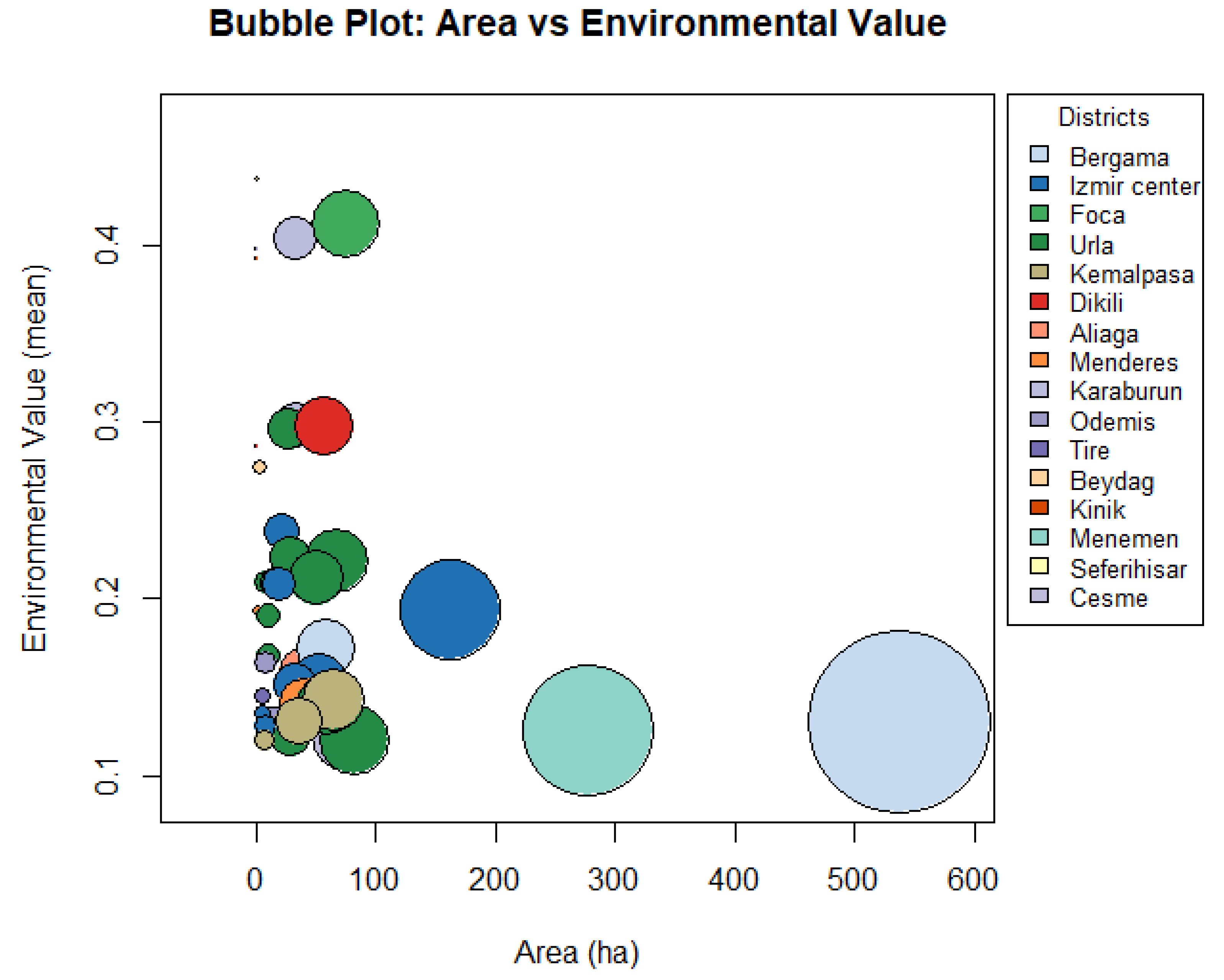
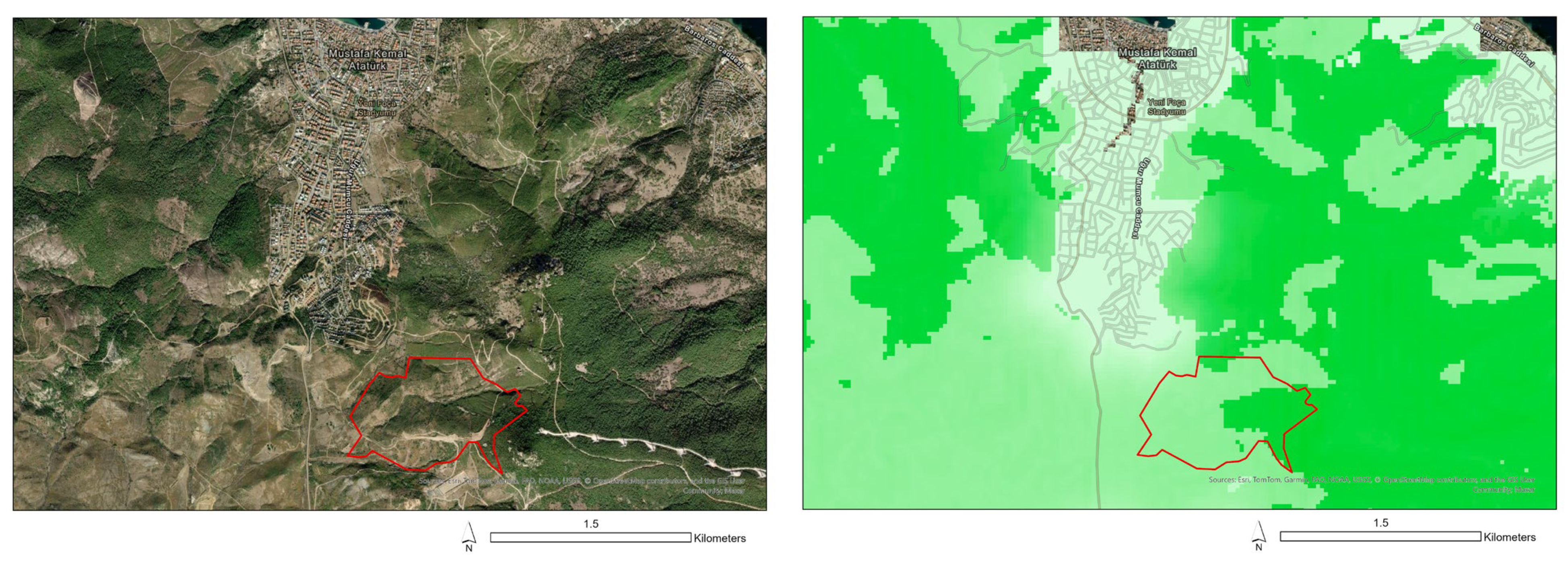
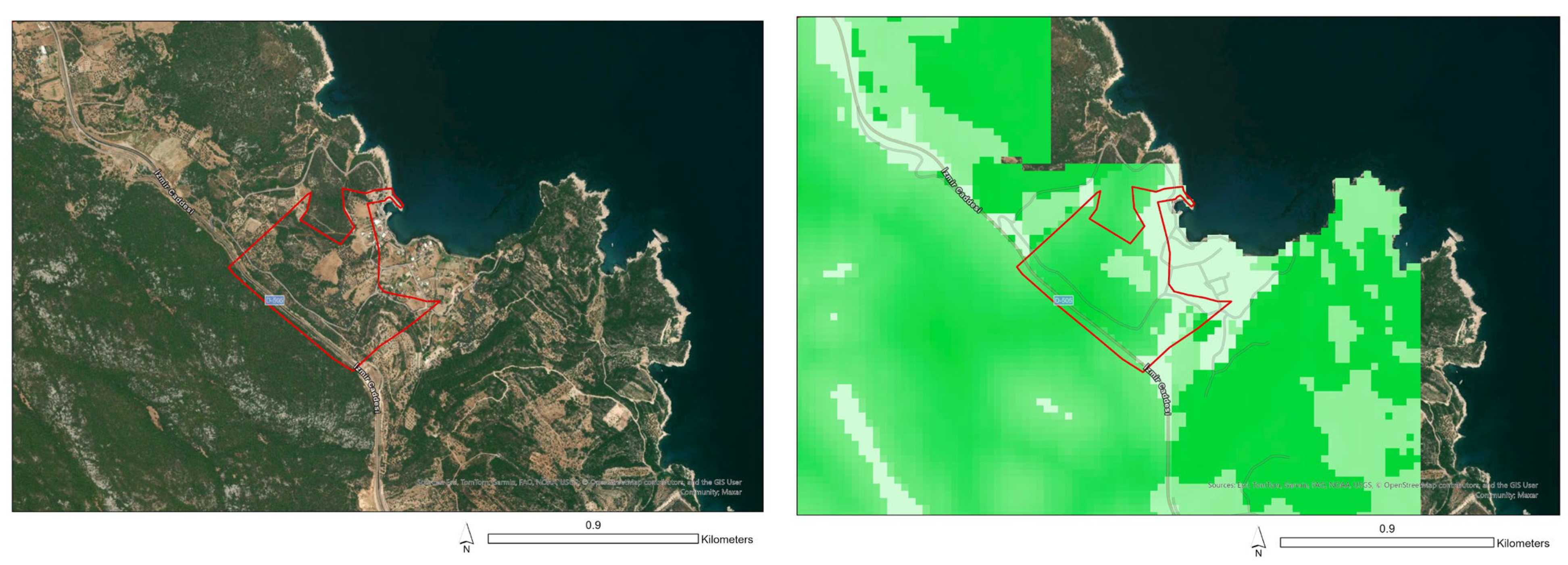
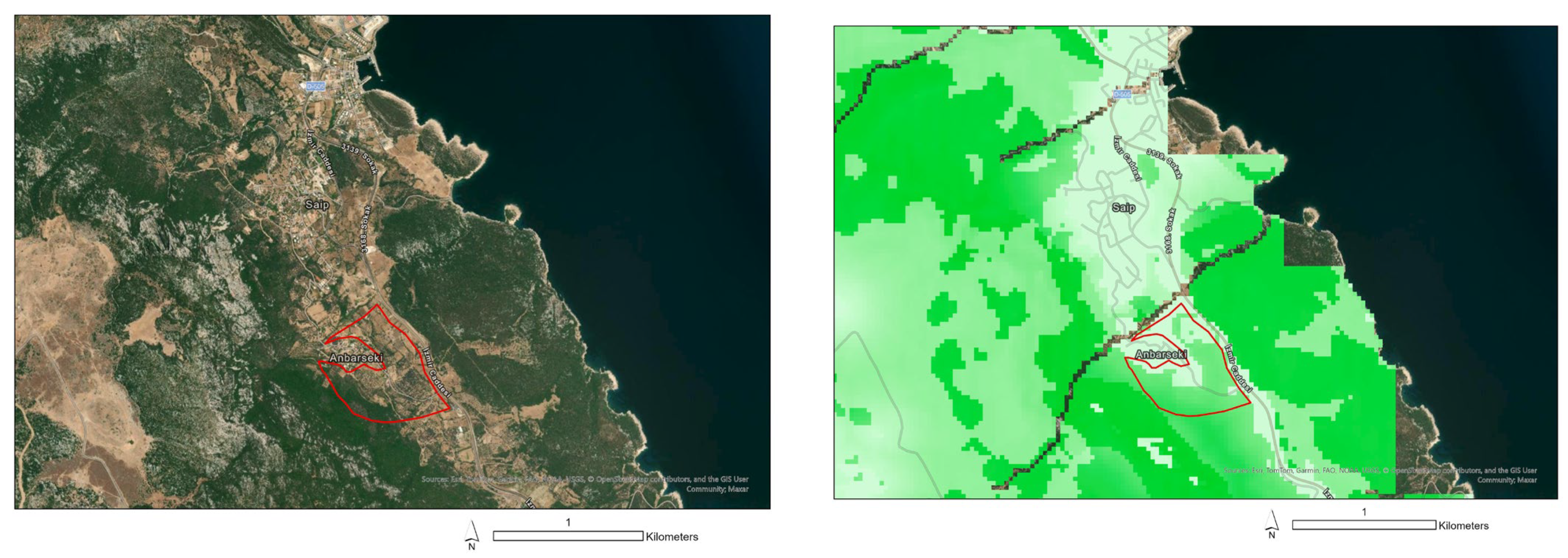
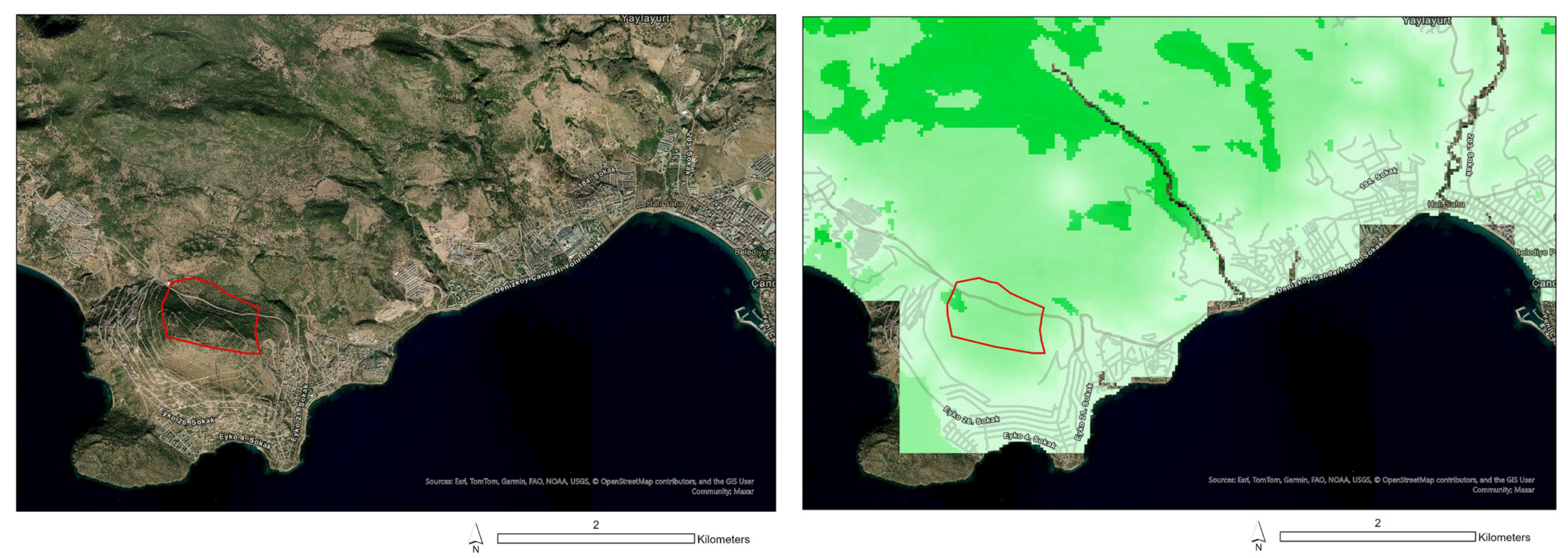
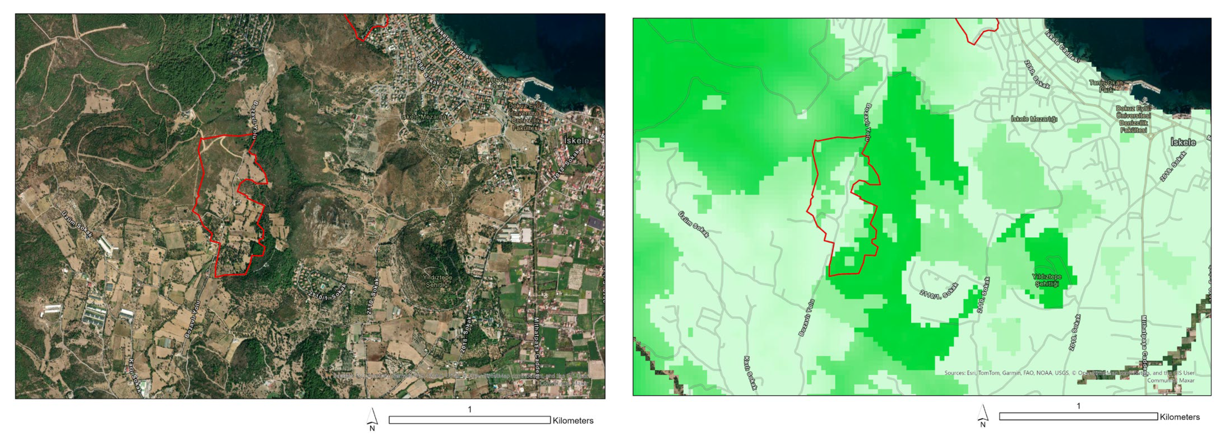
When the five areas with the highest environmental value (larger than 10 hectares) in the Izmir metropolitan area are examined in detail, the highest share in land use rates is shrubland (53%) and forest area (37%). Therefore, shrubland and forest are the most common in conflict areas with environmental value in urban development areas. Shrubland areas are prominent in the Dikili and Foca regions, while forested areas are more extensive in Urla and Karaburun, as shown in
Table 9 and
Figure 13.
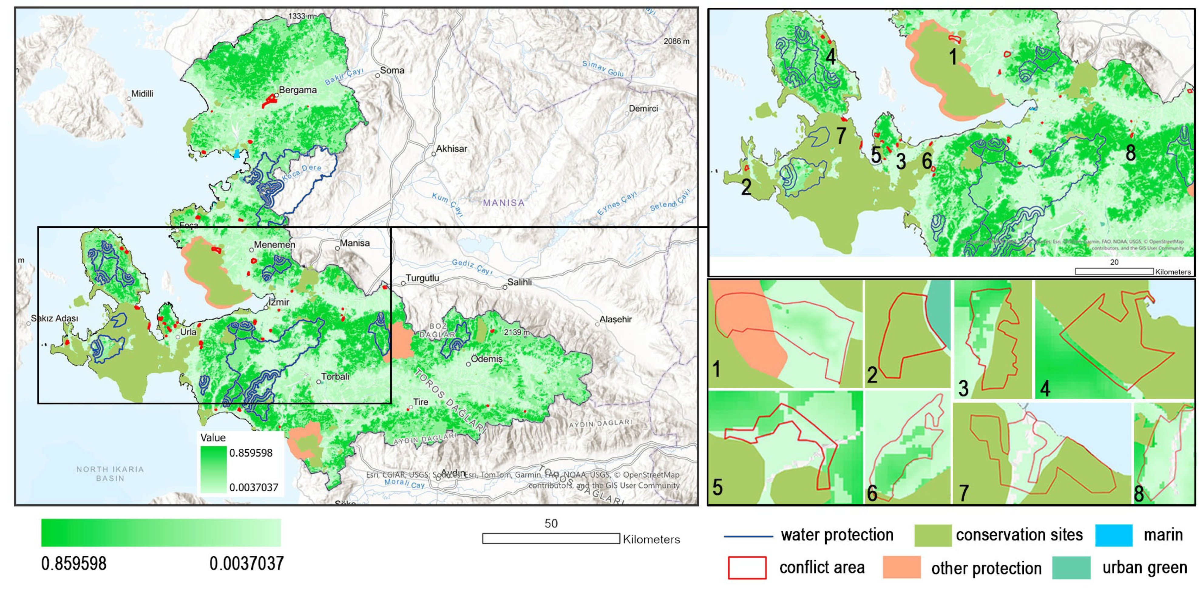
As previously mentioned, the conflict areas (41 areas) are between settlement expansion and composite ecosystem service. When examining the areas designated for environmental protection in the Izmir Environmental Plan (such as water protection areas, conservation sites, marine areas, urban green areas, and other protection areas), 80% of areas (33 areas) fall outside the scope of protection decisions, while 20% of areas (8 areas) overlap with conflict areas. In this case, these areas are not only zones where urban expansion conflicts with the natural environment, but also areas that overlap with existing environmental protection decisions.
Among the 41 conflict areas, 8 overlap with existing environmental protection zones (
Figure 14). The first of these areas is located in the Menemen district, with an average environmental value of 0.126. The second area has the lowest average environmental value among the eight, at 0.122 in the Cesme district. Four overlapping areas are located in the Urla district, numbered 3, 5, 6, and 7, with average environmental values of 0.295, 0.190, 0.223, and 0.14, respectively. The area numbered 4, located in the Karaburun district, has the highest average environmental value among the eight, at 0.404. Finally, the eighth area is situated in the Kemalpasa district, with an average environmental value of 0.131.
The discussion indicates that the conservation sites in the plan conflict with settlement expansion with the highest environmental value. Eight out of the forty-one conflict areas overlap with zones that already have environmental protection status. This shows that even areas under official conservation decisions are under pressure from urban expansion. The majority of conflict areas with high environmental value are not currently within protected zones. This is especially important, as some of the most ecologically valuable areas such as Karaburun and Urla are among the top five areas with the highest environmental value (Areas 2 and 5 in
Figure 13), yet they face threats from urban growth without any formal protection. These discussions highlight the need to revise conservation strategies by identifying and protecting areas with high composite environmental value, even if they are not yet officially designated.
It is important to examine synergies and conflicts in ecosystem services for sustainable and climate-resilient development [
40]. Quantitative analysis of trade-offs and synergies between LULC changes and ES helps accurately identify their quality status and key driving factors in the region [
33]. In the study, environmental value was determined by evaluating ecosystem services (habitat quality, carbon storage and sequestration, and sediment delivery ratio) in synergy and conflict areas in Izmir. According to the 2023 land use data, areas that once had high environmental value have now been classified as ’synergy zones’ in the current analysis as they have already been transformed into artificial areas. Therefore, analyzing the changes over the years may reveal different outcomes. This study differs from studies examining temporal land use change [
33,
40]. The study provides knowledge by investigating the environmental value of ecosystem services and the associated conflicts and synergies in urban development areas by exploring their interactions.
5. Conclusions
The evaluation of ecosystem services has become an urgent necessity for the effective implementation of policies [
43]. The increasing pressure of urbanization on ecosystem services (ESs) has become a critical issue highlighting the need to consider these services when identifying urban development areas in the context of planning decisions. Land use and land cover dynamics profoundly affect ecosystem services [
34,
42,
44].
This study examines the relationship between urban development areas, as defined by planning decisions, and the environmental value derived from key analyses of habitat quality, carbon storage and sequestration, and sediment delivery ratio. Areas with the highest environmental value, greater than 10 hectares, are predominantly forested regions. In the İzmir metropolitan area, it has been observed that urban development often conflicts with the environmental value provided primarily by forests. Also, we highlight the need to revise conservation strategies by identifying and protecting areas with high composite environmental value, even if they are not yet officially designated.
In order to mitigate this conflict and support climate neutrality, it is crucial to assess ecosystem services and consider environmental values before making planning decisions. Protecting high-value areas such as forests, which contribute significantly to carbon storage and climate regulation, is essential to reconcile urban growth with environmental and climate goals.
The study acknowledges several limitations such as using local parameters in the InVEST model rather than relying on default values, as this can lead to more accurate and context-specific environmental assessments. In addition, optimizing the contributions of different ecosystem services can improve the reliability of environmental valuations.
Future research should focus on conducting more comprehensive analyses and comparing different case study areas to further refine planning strategies. Synergies and conflicts in other planning decisions (for example; mining area, protected area and, industrial area) can also be examined to drive land use management. The results underscore the importance of integrating ecosystem service analysis into planning processes, not only for sustainable urban development but also for the advancement of climate-neutral land management.
