Article

Reintegrating Marginalized Rural Heritage: The Adaptive Potential of Barn Districts in Central Europe’s Cultural Landscapes

by
Elżbieta Komarzyńska-Świeściak
* and
Anna Alicja Wancel
Faculty of Architecture, Wroclaw University of Science & Technology, 50-370 Wrocław, Poland
*
Author to whom correspondence should be addressed.
Sustainability 2025, 17(15), 7166; https://doi.org/10.3390/su17157166
Submission received: 29 May 2025 / Revised: 11 July 2025 / Accepted: 21 July 2025 / Published: 7 August 2025

Abstract

Barn districts—ensembles of agricultural buildings situated at the edges of rural settlements—once played a key role in the spatial and economic organization of agrarian communities in Central Europe. Today, many of these structures remain marginalized and underexplored in contemporary landscape and heritage planning. This paper presents a comparative study of six barn districts in Poland’s Kraków-Częstochowa Upland, where vernacular construction, ecological adaptation, and local tradition shaped distinctive rural–urban interfaces. We applied a mixed-methods approach combining cartographic and archival analysis, field surveys, and interviews with residents and experts. The research reveals consistent patterns of landscape transformation, functional decline, and latent adaptive potential across varied morphological and material typologies. Despite differing levels of preservation, barn districts retain symbolic, spatial, and socio-cultural value for communities and local landscapes. The study emphasizes the importance of reintegrating these marginal heritage structures through adaptive reuse strategies rooted in the values of the New European Bauhaus—sustainability, aesthetics, and inclusion. The findings contribute to broader discussions on rural socio-ecological resilience and landscape-based development, highlighting how place-based strategies can bridge past identities with future-oriented spatial planning.

1. Introduction

The vernacular architecture of the Kraków-Częstochowa Upland, situated at the junction of the historical regions of Greater Poland, Lesser Poland, Mazovia, and Silesia, reflects the complex spatial and cultural history of the area [1]. The diversity of settlement layouts in this region stems from dynamic socio-economic transformations, including land enfranchisement, the expansion of transportation networks, and industrialization.
Within this context, barn districts—clusters of agricultural buildings typically located on the peripheries of rural settlements—represent a neglected but architecturally and culturally distinctive typology. Despite their spatial prominence, they have been largely overlooked in heritage studies and regional planning frameworks.
Once integral to the spatial and functional organization of agrarian towns, these structures have become marginalized and largely neglected in contemporary planning and heritage discourse.
Historically, barn districts played a significant role in the local agricultural economy, serving as storage facilities for harvests and machinery, as well as informal communal gathering spaces. Their development was shaped by spatial constraints such as dense town cores and fire-safety concerns, which necessitated their peripheral siting [2]. Over time, however, with the onset of urbanization and technological change, their original functions diminished, leading to both physical and symbolic degradation.
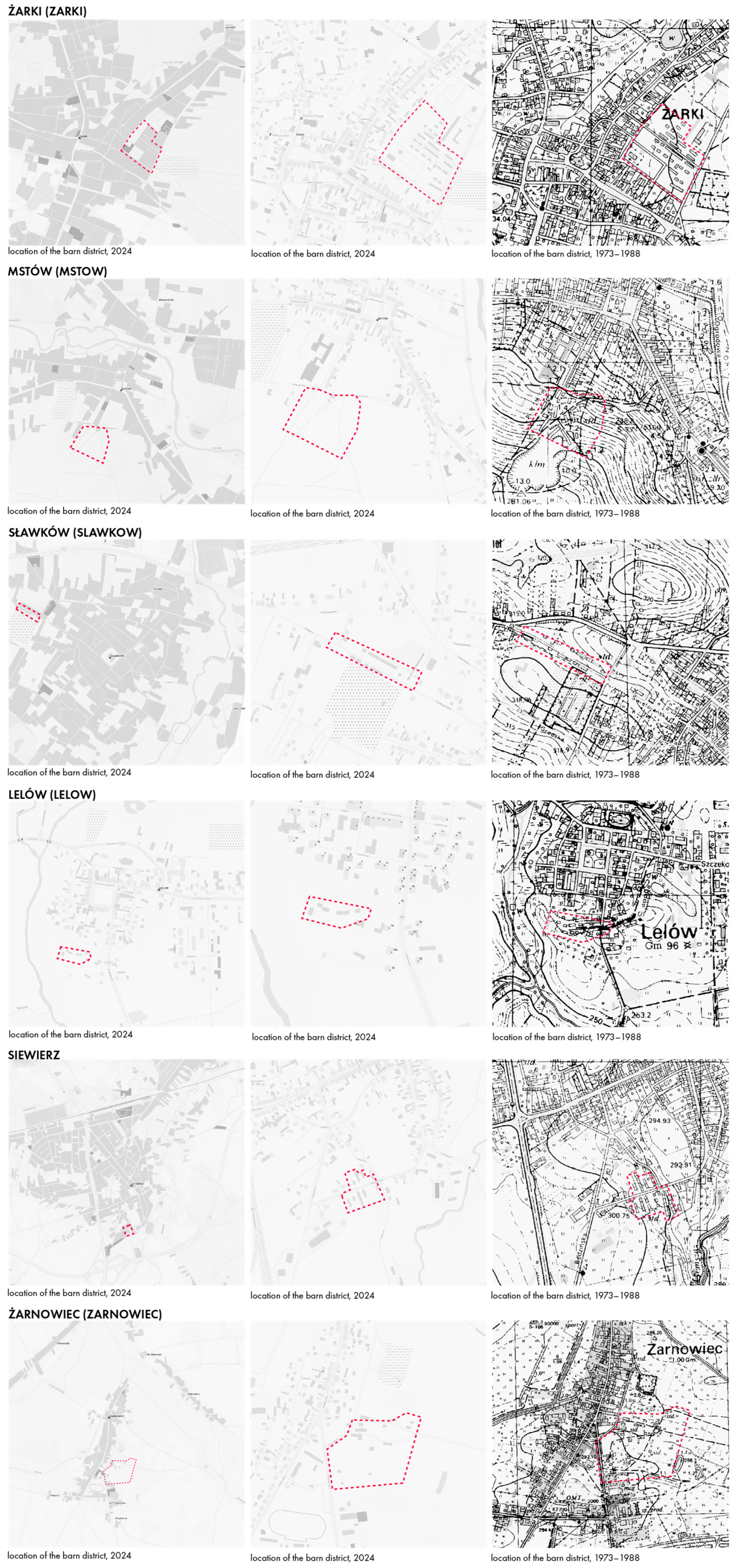
This article focuses on barn districts in six locations: Lelów, Mstów, Siewierz, Sławków, Żarki, and Żarnowiec, whose distribution is presented in Figure 1. Through a combination of fieldwork, literature review, and interviews with residents, the study identifies the defining characteristics of these spaces and assesses their role in the cultural landscape of the region. In the face of ongoing degradation, the findings underscore the need to recognize and adapt these sites as meaningful testimonies of local history and identity.
As the first comparative study of this kind in the region, it provides new insights into the architectural, social, and planning relevance of barn districts and argues for their inclusion in sustainable development strategies.

1.1. Research Aim and Scope

The primary aim of this article is to highlight the importance of barn districts as key components of the cultural landscape of the Kraków-Częstochowa Upland. This study addresses both the morphological and historical transformations of these structures, while also considering their current condition and possible adaptation scenarios. Special attention is paid to the processes that have contributed to the physical and symbolic decline of these areas and their potential role in future revitalization strategies. The objective is not only to document their historical and spatial context but also to propose new functional uses for barn districts in relation to contemporary urban and spatial planning.

1.2. Historical and Urban Context of Barn Districts

Barn districts are the product of long-standing settlement and economic processes that have shaped the landscape of the Kraków-Częstochowa Upland. The settlement structure in the region evolved under the influence of factors such as the expansion of agricultural hinterlands and broader economic and technological transformations. As a result, villages and small towns in the region display diverse spatial layouts that are closely related to the type of settlement and its connection to major transportation routes, such as roads and railway lines [1]. These transformations often disrupted traditional urban forms, leading to a gradual loss of legibility in historical layouts.
One of the critical factors influencing the spatial organization of settlements was the process of land enfranchisement, which triggered substantial spatial restructuring of many villages—often inconsistent with their original layouts. As infrastructural components of agricultural settlements, barn districts were similarly affected, progressively losing their original function. This pattern of peripheral functional displacement and morphological change reflects broader principles of town-plan analysis developed in urban morphology studies, particularly regarding the evolution of urban fringe zones [3]. At the turn of the nineteenth and twentieth centuries, changing social and economic conditions contributed to the abandonment of these spaces, which increasingly came to be perceived as relics of the past rather than active elements of the cultural landscape. These transformations can be better understood through the lens of urban morphological theory—especially the analytical framework introduced by Conzen [3] and further developed by the Italian school of Muratori and Caniggia, who emphasized the evolution of basic building types and settlement structures [4,5].
Although barn districts share some superficial similarities with peripheral agricultural structures found elsewhere in Europe—such as the Scheunenviertel in Kremmen and Friedland or monastic granges in France—no comparable, regionally integrated typology has been identified in the current European heritage literature.
In Germany, Scheunenviertel—barn clusters typically established beyond town walls for fire-safety reasons—have been partially documented in regions like Brandenburg and Lower Saxony [6,7]. However, existing studies primarily address conservation issues or typological classification, without adopting integrated, landscape-based or socio-spatial approaches. This highlights the originality of the present study in combining morphological, historical, and participatory methods within a coherent regional framework.

1.3. Research Hypotheses

This article is based on two central research hypotheses. First, it is assumed that barn districts, although currently overlooked, represent forgotten yet significant elements of the regional cultural landscape, whose importance has diminished due to urban and economic transformation. Comparable processes of marginalization affecting vernacular rural forms have been documented across Europe, highlighting the need for comparative, context-sensitive approaches to rural heritage [8,9]. Second, despite their present state of degradation, these districts are believed to hold considerable potential for revitalization and may serve as exemplary cases of adaptive reuse within broader frameworks of landscape-based heritage planning.

1.4. Research Context and Relevance for Urban Practice

Research on the cultural heritage of the Kraków-Częstochowa Upland is part of a broader academic discourse on the preservation and adaptation of historical urban structures in Poland and across Europe. The challenge of maintaining traditional clusters of agricultural buildings, such as barn districts, aligns with international discussions on the sustainable management of tangible heritage. Frameworks developed by ICOMOS and UNESCO emphasize the need to integrate historic spaces with modern functions, particularly in areas under strong urban development pressure. This aligns with recent studies emphasizing the transformative potential of cultural landscapes as resources for social innovation and community resilience [9]. Such a view aligns with Antrop’s [10] argument that historical landscapes serve as vital components of sustainable spatial development, especially when linked with participatory transformation frameworks.
From a planning perspective, the results of this study can inform strategies for the protection and activation of barn districts. These spaces offer a wide range of possible functions—from educational and recreational uses to exhibition venues, or even new forms of community infrastructure. Integrating this study’s findings into local territorial policies efforts could contribute to more effective cultural heritage protection while identifying new, sustainable forms of reuse. The article’s structure includes an in-depth analysis of the historical and spatial context of barn districts, a methodological overview, and a presentation of research findings, followed by detailed case studies and development recommendations. This study builds on methodological traditions combining spatial analysis, cultural landscape research, and vernacular heritage studies, as outlined in works by Fairclough et al. [11], Taylor and Lennon [12], and Pereira Roders and van Oers [13].

1.5. Literature Review and Research Gap

The literature on the cultural and spatial heritage of the Kraków-Częstochowa Upland remains fragmented, particularly regarding barn districts. While some historical research has been conducted—most notably in Żarki—there is a lack of comprehensive, interdisciplinary studies addressing the spatial transformation, adaptive reuse, and community value of these rural structures. This section presents five thematic strands of the existing literature: (1) local historical studies, (2) landscape transformation, (3) material conservation, (4) socio-cultural meaning, and (5) international references for adaptive reuse.
Local historical studies remain limited in scope. Żarki, considered one of the best-preserved barn districts in the region, has received the most attention due to its integration into the town’s everyday life and market activity [14]. While Antoniewicz [14] provides a foundational history of the town, and Laberschek [15] reconstructs its medieval structure, neither source includes a focused morphological or spatial analysis of the barn district. Local compilations such as Kubicki [16] document community memory, yet without engaging spatial or typological dimensions. The “Sites of Memory and Forgetting” project [17] acknowledged barn structures in Mstów, but without spatial analysis. More broadly, Dyduch-Falniowska et al. [18] called for integrated natural and cultural data in regional planning. Contributions by Krupa-Ławrynowicz [19] and Myga-Piątek and Żemła-Siesicka [20] emphasize rural landscape dynamics and functional tensions.
The second strand concerns landscape transformation. Figlus [21] analyzed the incorporation of rural settlements into urban structures and outlined the resulting spatial degradation. His earlier work [22] forms a useful basis for morphological research. Recent work by Dragan et al. similarly underscores how rural landscapes are increasingly recognized as cultural heritage assets that embody local identity and memory [8]. Nowicka [23,24] stressed the importance of local heritage in spatial policy using Mstów as a case study. This aligns with research by Wolski and Różycki [25], who examined how the commune’s landscape and cultural values are managed within a tourism-oriented development framework. This perspective resonates with established urban morphology research highlighting the persistence of spatial forms and the interplay between heritage value and evolving functional needs [26,27], reinforcing the notion that inherited spatial structures can support contemporary sustainability goals when reinterpreted through adaptive planning frameworks.
The third theme involves material and technical heritage. In regions like the Kraków-Częstochowa Upland—where Jurassic limestone construction predominates—preservation of traditional urban layouts and materials is essential. Wróblewski [28], Szymański [29], and Nita [30] all emphasized the role of vernacular construction in maintaining authenticity and adaptive potential.
The fourth thematic strand explores socio-cultural values and perceptions. The symbolic dimension of disappearing rural architecture is well-documented through qualitative methods, including studies from Poland [31], China [32], and through broader European perspectives such as those from France and Italy [33]. Plevoets and Sowińska-Heim [33] stress how community-led adaptations affect formal heritage practices and generate innovative reuse models. González and Fernández [34] show that local initiatives can be key to rural revitalization, as illustrated by the Ecomuseum in Asturias, Spain. Similar themes are explored by Ordóñez-Castañón and Ferreira [35] in the context of vernacular reuse practices promoted by the Porto School. Case studies from Portugal could be further explored to deepen this thematic thread, though specific examples are underrepresented in the current literature.
Finally, international scholarship and practice offer diverse models for the adaptive reuse of rural buildings, including examples from the Germany, Netherlands, the UK, France, and Spain [36,37,38,39,40,41,42]. These studies demonstrate how cultural, ecological, and landscape values can be integrated through flexible, place-based reuse strategies. However, such frameworks have rarely been applied to barn districts in Central Europe. The lack of integration of these rural typologies into international comparative studies or planning policies underscores a broader research and policy gap.
In the context of the Kraków-Częstochowa Upland, vernacular agricultural ensembles remain largely absent from regional development narratives. The cultural tourism potential of barn districts is often overlooked, as evidenced by their omission from regional promotional materials such as Jurassic Land [43] and Jurajskie Przygody [44]. Local historiography (e.g., [45]) tends to focus on political and religious narratives, while other types of rural heritage—such as medieval castle ruins—have been more successfully integrated into strategies for tourism and place branding [46].
Methodologically, this article operationalizes urban morphological theory to investigate barn district transformation. It draws on Conzen’s foundational concept of town-plan analysis [3] and the typological–processual approach developed by Muratori and Caniggia [4,5], not only as interpretive tools but also as a basis for comparative spatial typology. These frameworks enable the identification of persistent morphogenetic patterns despite socio-economic shifts.
Despite the existing body of literature, significant research gaps remain. These include the lack of comparative morphological studies, socio-economic analyses, documentation of ownership transformations, and examinations of bottom-up adaptive practices. Barwicka and Milecka [47] demonstrate how landscape metrics can be used to trace transformation trends—an approach particularly relevant for analyzing barn districts. Additionally, Koreleski [48] provides a broader context on the evolution of rural landscapes in Poland. While selected German-language studies have documented barn clusters (Scheunenviertel) in regions such as Brandenburg and Lower Saxony [6,7], they are generally limited to conservation inventories, heritage status reports, or localized typological analyses. These sources provide valuable historical context but lack integrated spatial, landscape, or participatory approaches.
Moreover, the historical and cultural context of the Kraków-Częstochowa Upland—although shaped by diverse political regimes, including periods of Prussian control and German occupation—was never part of a sustained German-speaking cultural landscape. This distinguishes it from regions such as Silesia or Pomerania and underscores its unique vernacular development. Consequently, the region remains largely absent from international heritage discourse, further highlighting the originality and relevance of this Central European perspective.
This article aims to address these gaps through a comprehensive, interdisciplinary analysis of barn districts in the Kraków-Częstochowa Upland, focusing on their transformation, reuse potential, and integration into sustainable spatial development strategies. This study is the first to offer a comprehensive, comparative framework for understanding and reactivating barn districts in Central European rural–urban landscapes. Spatial analysis methods and typological mapping techniques were adapted from heritage planning studies and applied to the context of barn districts [49,50]. Comparative insights from heritage landscape systems, such as the Italian Register of Historical Rural Landscapes and China’s NIAHS program, highlight diverse methodologies for identifying, protecting, and integrating agricultural heritage into planning frameworks [51].

2. Materials and Methods

This study employed a multi-method, interdisciplinary approach, combining qualitative methods (interviews, content analysis, historical review), quantitative tools (field inventory, spatial pattern classification), and spatially grounded techniques (on-site observations, cartographic comparison, photographic documentation). This integrative framework enabled a comprehensive understanding of the transformation and adaptive reuse potential of barn districts in the Kraków-Częstochowa Upland.
The criteria for selecting study sites included their historical significance, architectural typology, state of preservation, and spatial representativeness. These principles draw on foundational urban morphological theory [3,49], typological research on building form transformation [4,5], and integrative approaches to landscape interpretation [10,11,13]. The study also aligns with adaptive reuse theory [52], emphasizing the contextual and heritage-based transformation of vernacular structures.
Six settlements—Lelów, Mstów, Siewierz, Sławków, Żarki, and Żarnowiec—were selected as representative case studies based on criteria of historical significance, typological diversity, state of preservation, and spatial context. Together, they reflect a range of development trajectories, from severely degraded or fragmented remnants with limited reuse prospects (Mstów, Żarnowiec), through moderately preserved but underutilized ensembles (Lelów, Siewierz, Sławków), to a well-preserved and partially revitalized district with active use and formal heritage protection (Żarki). This comparative selection enabled the investigation of different spatial patterns, material techniques, and adaptive reuse potentials across a variety of rural–urban landscape conditions. It also allowed for the identification of broader morphological and conservation trends relevant to cultural landscape planning.

2.1. Literature and Historical Source Review

To capture the historical context of barn districts, the research involved an extensive review of the scientific literature and archival sources. The literature survey included both academic publications on urban morphology and vernacular and regional architecture, as well as historical studies and local monographs addressing the architectural heritage of the Kraków-Częstochowa Upland. Particular attention was given to earlier studies [1,14,15,17,21,24] that provide historical and spatial context for the selected locations.
In addition, historical cadastral and topographic maps were analyzed and compared with current urban planning maps to identify spatial changes over the course of the 19th and 20th centuries. These cartographic sources were obtained from local, military, and digital archives. Temporal comparative analysis enabled the identification of lost architectural elements, alterations in urban layouts, and the gradual functional decline of barn districts. Georeferencing tools and GIS-based overlays were used to align historical and contemporary datasets, enabling the spatial comparison of barn district footprints, layouts, and relations to urban infrastructure. These methods played a key role in tracing morphological change over time and in identifying patterns of continuity, fragmentation, and reuse. Spatial analyses focused not only on intra-site typologies but also on the relationship between barn districts and broader topographic and urban conditions. This approach allowed for a diachronic understanding of spatial transformations within their landscape and functional contexts.
All cartographic overlays and spatial analyses were performed using QGIS (version 3.28, QGIS.org Foundation, Bern, Switzerland). Diagrams, visual materials, and spatial drawings were prepared using AutoCAD (version 2024, Autodesk Inc., San Rafael, CA, USA), Adobe Illustrator (version 27.9, Adobe Inc., San Jose, CA, USA), and Adobe Photoshop (version 25.9, Adobe Inc., San Jose, CA, USA).

2.2. Field Studies and Morphological Analysis

Field research constituted a key component of the analysis of barn districts, incorporating both qualitative and quantitative methods. An architectural inventory, photographic documentation, and condition assessments of the buildings were conducted.
The morphological analysis included the classification of buildings based on construction material, structural typology, and current technical condition. Particular attention was given to materials typical for the region, such as limestone and wood, as well as traditional spatial arrangements. The number and configuration of buildings were compared across historical periods, which allowed for an assessment of the scope and nature of transformations.
Field surveys were carried out in five selected localities: Lelów, Mstów, Siewierz, Sławków, and Żarki. As part of the fieldwork, a photographic record was created, as shown in Figure 2, and on-site observations were conducted, enabling detailed analysis of the condition of the buildings and their urban layouts. The analysis also considered the transportation accessibility of each location and the degree to which the barn districts have been integrated into the urban structure.
The architectural typology of barn districts demonstrates significant diversity in both urban layout and construction techniques. Two main spatial patterns were identified: regular arrangements aligned along major transportation routes (Siewierz, Sławków, Żarki, Żarnowiec), and irregular layouts (Lelów, Mstów) shaped by local spatial constraints. The photographic documentation made it possible to capture shared characteristics of these structures that had previously been difficult to identify using the available literature and archival sources alone.

2.3. Interviews with Residents and Experts

To gain deeper insight into the social significance of barn districts, qualitative interviews were conducted with residents, property owners, and representatives of local institutions [53,54,55]. The interviews were semi-structured, which allowed for flexible adaptation of questions to the interviewees’ context, while maintaining thematic consistency across the study. The use of an open-ended interview guide enabled the free exploration of topics related to the history, meaning, and future of barn districts in the context of revitalization efforts, and facilitated the collection of diverse participant perspectives.
Individual interviews were conducted in four localities: Żarki, Lelów, Siewierz, and Mstów. Particular emphasis was placed on the local community of Żarki—especially individuals involved with the historically significant market—as a group strongly rooted in the spatial fabric of the barn district. Respondents were selected based on socio-demographic diversity, considering factors such as age, length of residence, and involvement in the town’s social and economic life. This approach made it possible to obtain a multifaceted perspective on the role and significance of these spaces in residents’ everyday lives. The interviews, which were open and semi-structured, encouraged the sharing of personal narratives, memories, and reflections related to barn districts. Research questions focused on the perception of these structures as elements of the cultural landscape, their role in local identity, and expectations or concerns related to their transformation. This aligns with Waterton and Smith’s [56] emphasis on the recognition and misrecognition of community heritage, underlining the role of local narratives and values in the redefinition of heritage significance. Special attention was given to emotional connections with these spaces, modes of past and present use, and visions for their future—from postulated heritage protection to proposals for functional adaptation to contemporary needs. The collected material was subjected to thematic analysis, which enabled the identification of recurring themes, narratives, and interpretive patterns related to the role of barn districts in local space.
Additionally, six expert interviews were conducted [2,57,58,59,60,61] with stakeholders from various professional backgrounds: three representatives of municipal institutions, two urban planners, and two specialists in revitalization and the protection and adaptation of heritage buildings. Respondents were selected based on their professional experience and active involvement in projects related to the adaptation and preservation of historic areas, with a particular focus on the Kraków-Częstochowa Upland region. The main thematic areas included the significance of barn districts in the spatial identity of towns, current challenges and barriers to their preservation, and possibilities for integrating these structures within contemporary development and revitalization strategies. The collected material underwent thematic analysis aimed at identifying recurring motifs, narrative structures, and interpretive patterns within expert responses. Special emphasis was placed on the ways in which different groups of professionals perceive these structures, in order to capture the multidimensional nature of approaches to cultural heritage in the local context.
Regarding research ethics and data collection procedures, the initial manuscript submitted at the end of May 2025 included preliminary interview material gathered during a scoping phase conducted under local disciplinary norms. During revision, and following the issuance of formal ethics approval by the Research Ethics Committee at Wrocław University of Science and Technology (Approval Code: O-25-42; 9 July 2025), the manuscript was updated to include only interview data collected after approval and for which written informed consent was obtained. Other components of this study (archival, cartographic, spatial inventory, and morphological analyses) did not involve human participants and therefore did not require ethics review under institutional and national regulations.

3. Results

3.1. Characterization of Selected Barn Districts

Barn districts in the Kraków-Częstochowa Upland were typically situated on the outskirts of towns and villages, a spatial arrangement directly linked to their agricultural function. Their location ensured convenient access to transportation routes, which was essential for their role as storage facilities for produce, tools, and agricultural machinery. Most barn complexes were aligned along main roads or adjacent to historical market routes, enabling efficient daily operations and facilitating access. A notable exception is the barn district in Mstów, positioned on a hill with significantly constrained access today.
Archival cartographic materials and historical aerial imagery clearly demonstrate that barn districts once occupied significantly larger and more cohesive areas than they do today (see Figure 3). This figure supports the spatial-morphological analysis by visualizing the positioning of barn districts in relation to historical layouts, contemporary urban structure, and current land use patterns. The comparative spatial analysis—based on cadastral maps, satellite imagery, and current planning documentation—reveals a consistent pattern of spatial contraction and fragmentation. This reduction stems primarily from urban expansion, infrastructural redevelopment, changes in agricultural practices, and the physical degradation or demolition of outbuildings. In many towns, the remaining barns now constitute only a fraction of the original ensemble, with former plots either redeveloped, infilled with housing, or left derelict. Recognizing the extent of this loss—and the remaining spatial coherence where it persists—is essential for identifying zones with higher potential for protection or revitalization.
The spatial typologies of barn districts vary considerably across the studied settlements, reflecting both the physical landscape and historical models of spatial organization. In Żarki, Siewierz, and Sławków, barns exhibit regular, linear arrangements aligned parallel to the main thoroughfares—forming compact rows that suggest planned integration with adjacent infrastructure. This pattern facilitated optimized land use and efficient circulation. In contrast, the barn districts of Mstów, Lelów, and Żarnowiec are characterized by looser, irregular configurations, shaped by local topography, fragmented land ownership, and historical constraints. In Żarnowiec, for example, the barns follow a perpendicular orientation to the street, suggesting a deliberate adaptation to functional or spatial hierarchies within the village.
These spatial patterns—ranging from ordered alignments to scattered, organic layouts—reflect both the natural terrain and socio-spatial development processes. As illustrated in Figure 3, these layouts correspond closely with historical cadastral patterns and current landform features. Steep slopes, river corridors, or irregular parcel divisions often necessitated looser configurations, while flatter ground enabled more systematic planning.
Importantly, the peripheral positioning of barn districts should not be viewed as marginal. On the contrary, their proximity to key cultural landscape elements—such as market squares, churches, main access roads, and even cemeteries—indicates deliberate spatial integration into the economic and social life of the settlement. Their siting supported the seasonal rhythms of agrarian production, while embedding them in local infrastructural and symbolic geographies.
Today, amid ongoing processes of functional transformation and suburbanization, these sites face growing pressure from either reinvestment or neglect. Understanding the layered spatial logic of barn districts—both historically and in contemporary terms—is therefore essential for developing informed conservation and adaptive reuse strategies tailored to their specific morphological and territorial context.

3.1.1. Żarki

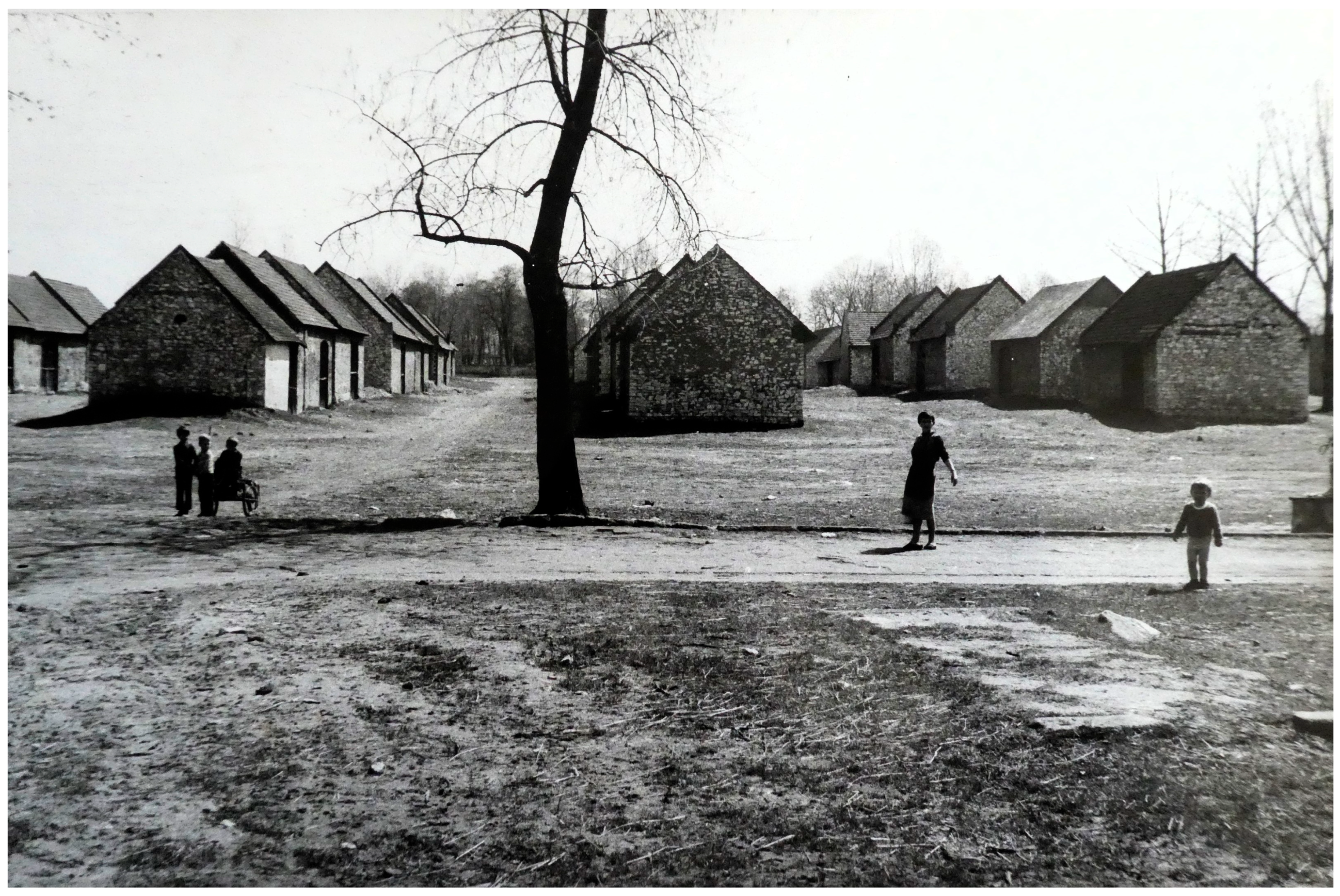
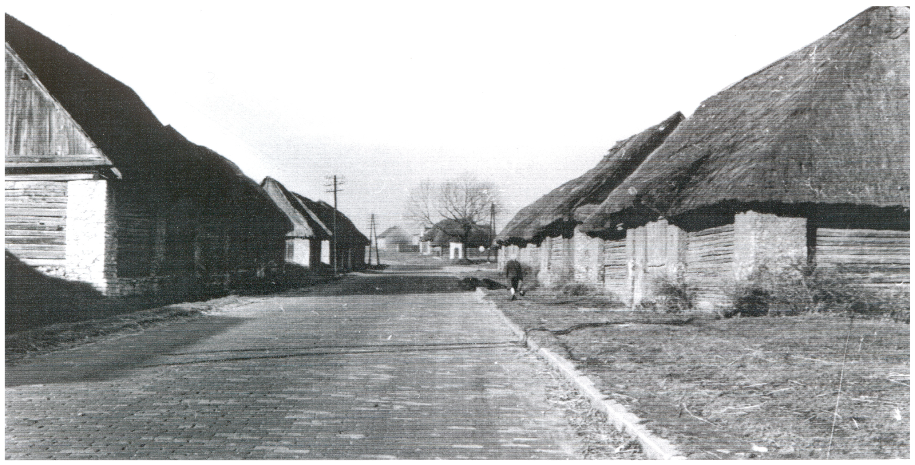
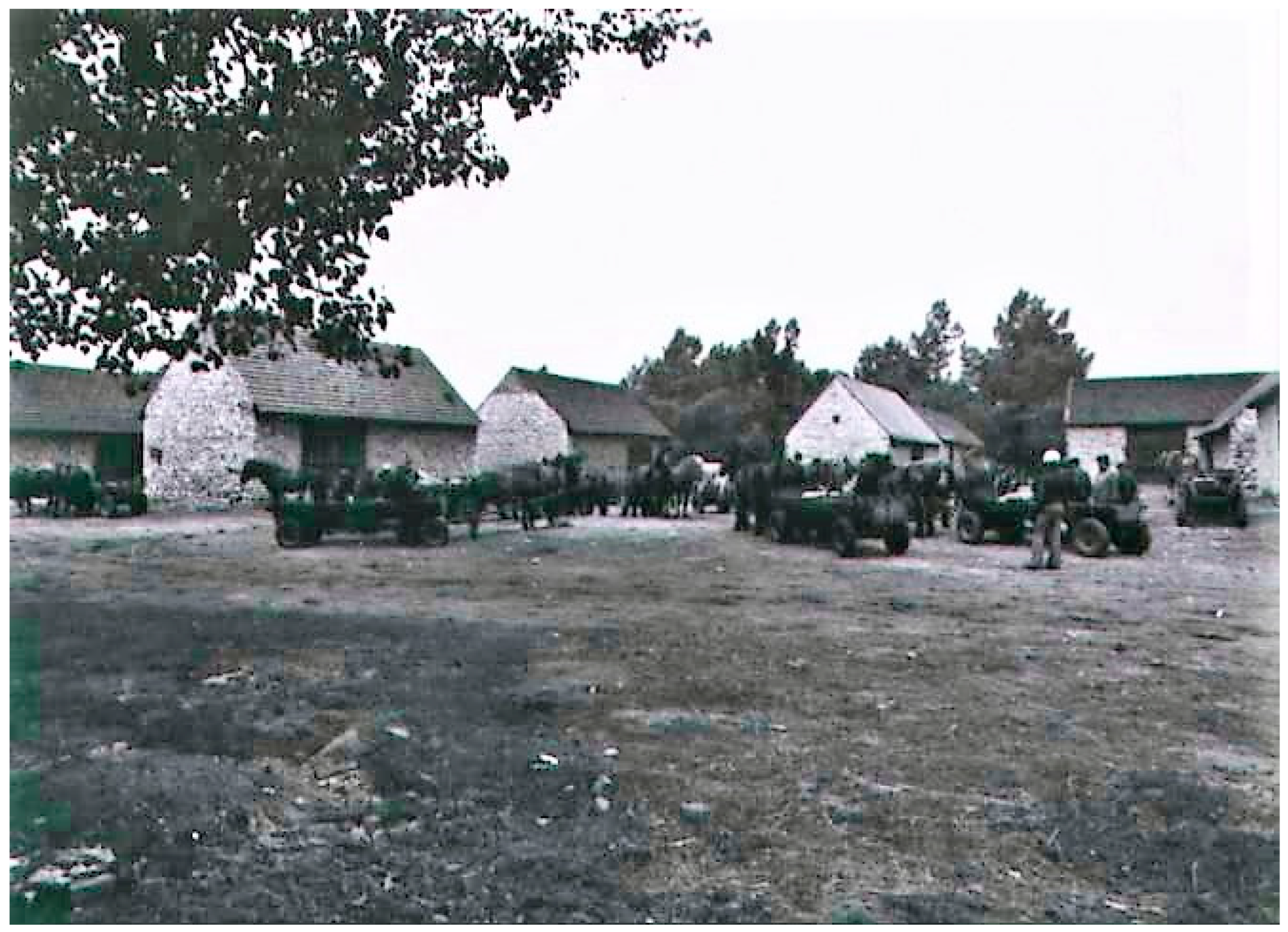
The barn district in Żarki was established after 1870, when the town lost its municipal rights as a result of repressive policies following the January Uprising. Located between Piaski and Ofiar Katynia Streets, it forms an integral part of the town’s urban structure, serving not only functional but also symbolic purposes. Adjacent to the district is a market square, referred to by residents as Targowica, which has been a trading site since the 16th century [57]. The barns were initially constructed in the second half of the 19th century as wooden structures with thatched roofs. Following a fire that destroyed a large portion of the complex, they were replaced with more durable limestone and brick buildings, as schematically illustrated in Figure 4. The post-development state is also shown in historical photographs (Figure 5 and Figure 6).
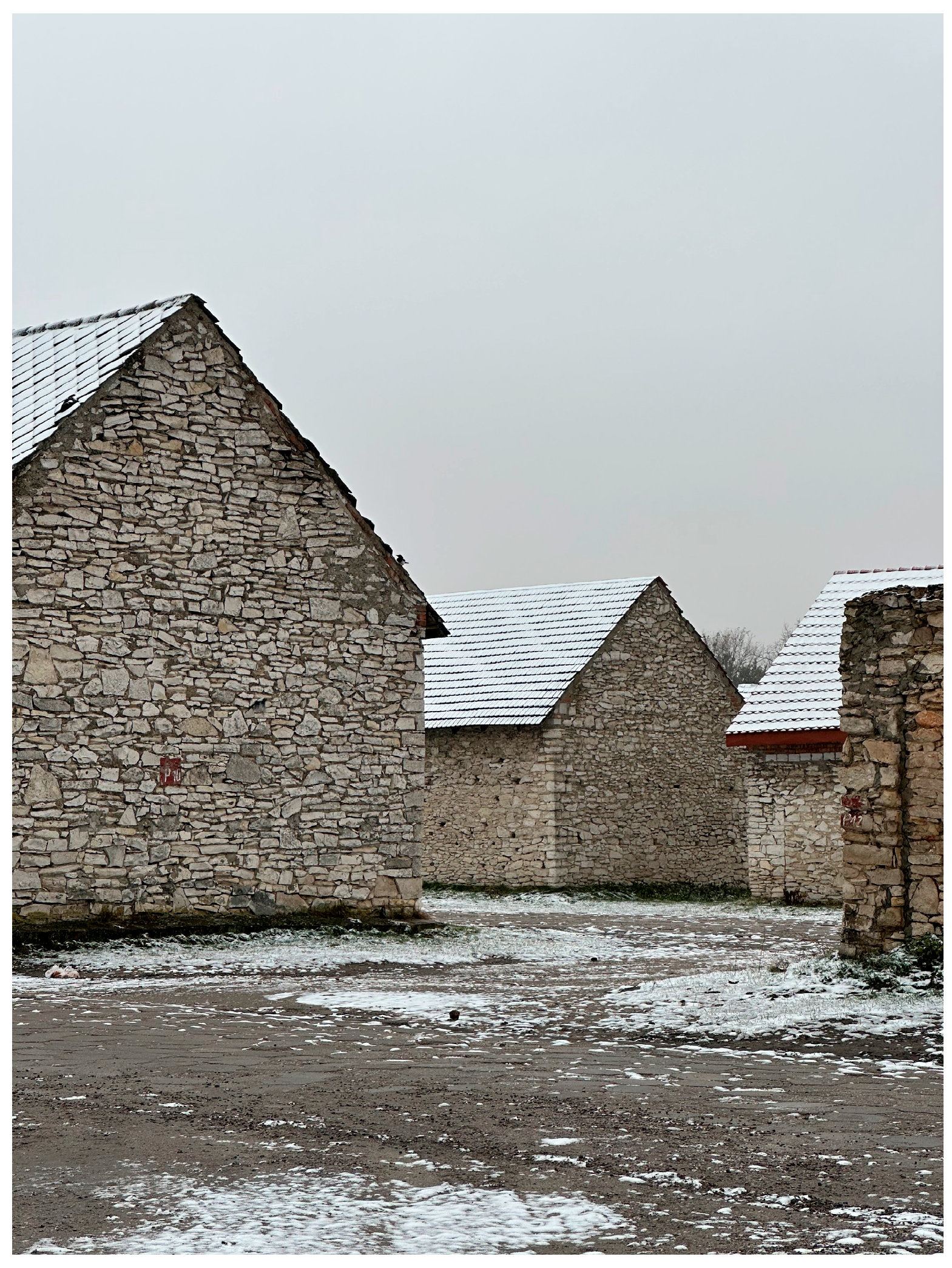
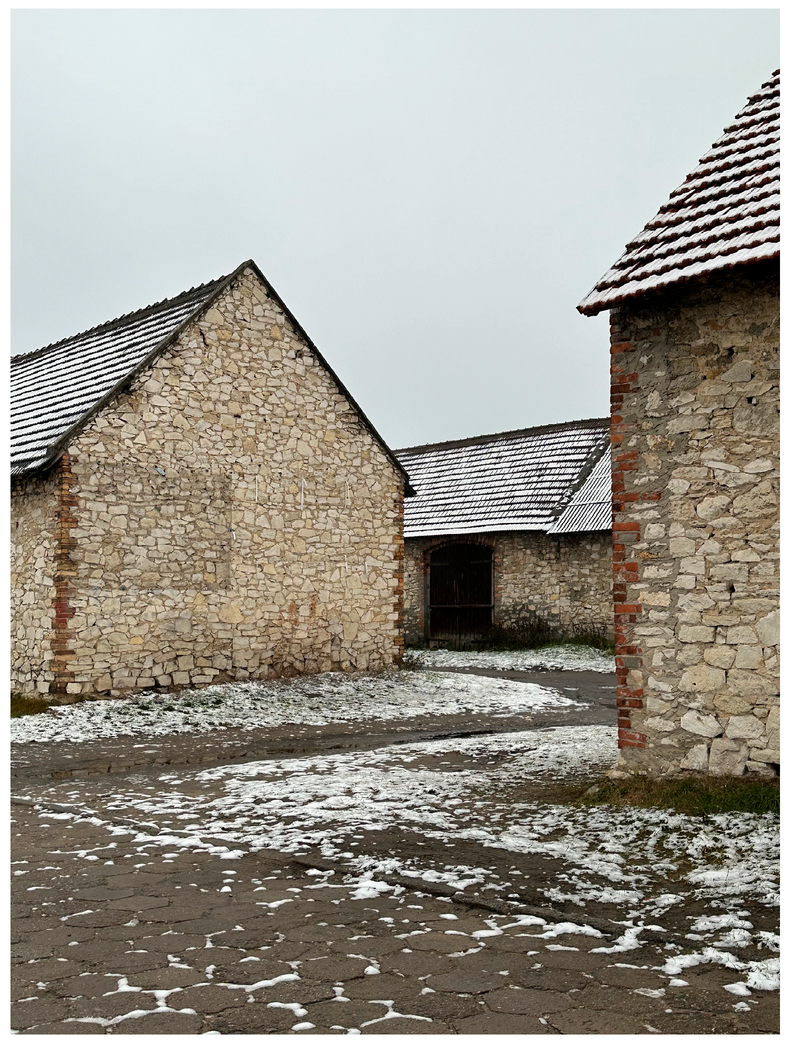
Currently, the barn district in Żarki includes 42 utility buildings arranged in a characteristic linear layout (Figure 7 and Figure 8). Some of the barns originally had basements, although most of them have since been filled in [57]. Despite the district’s inclusion in the municipal register of historical monuments, heritage protection measures remain insufficient, leading to its gradual physical degradation.

3.1.2. Mstów

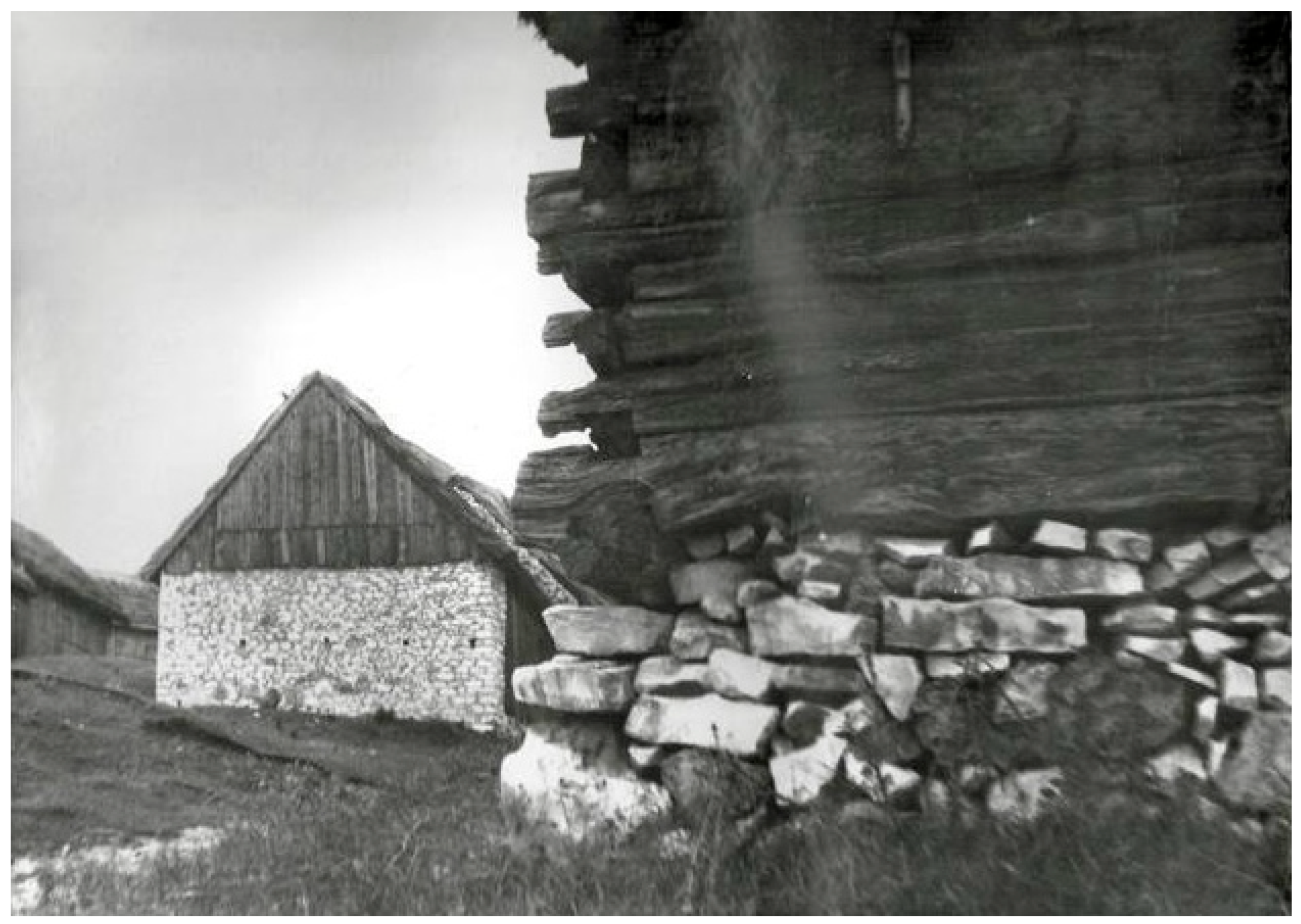
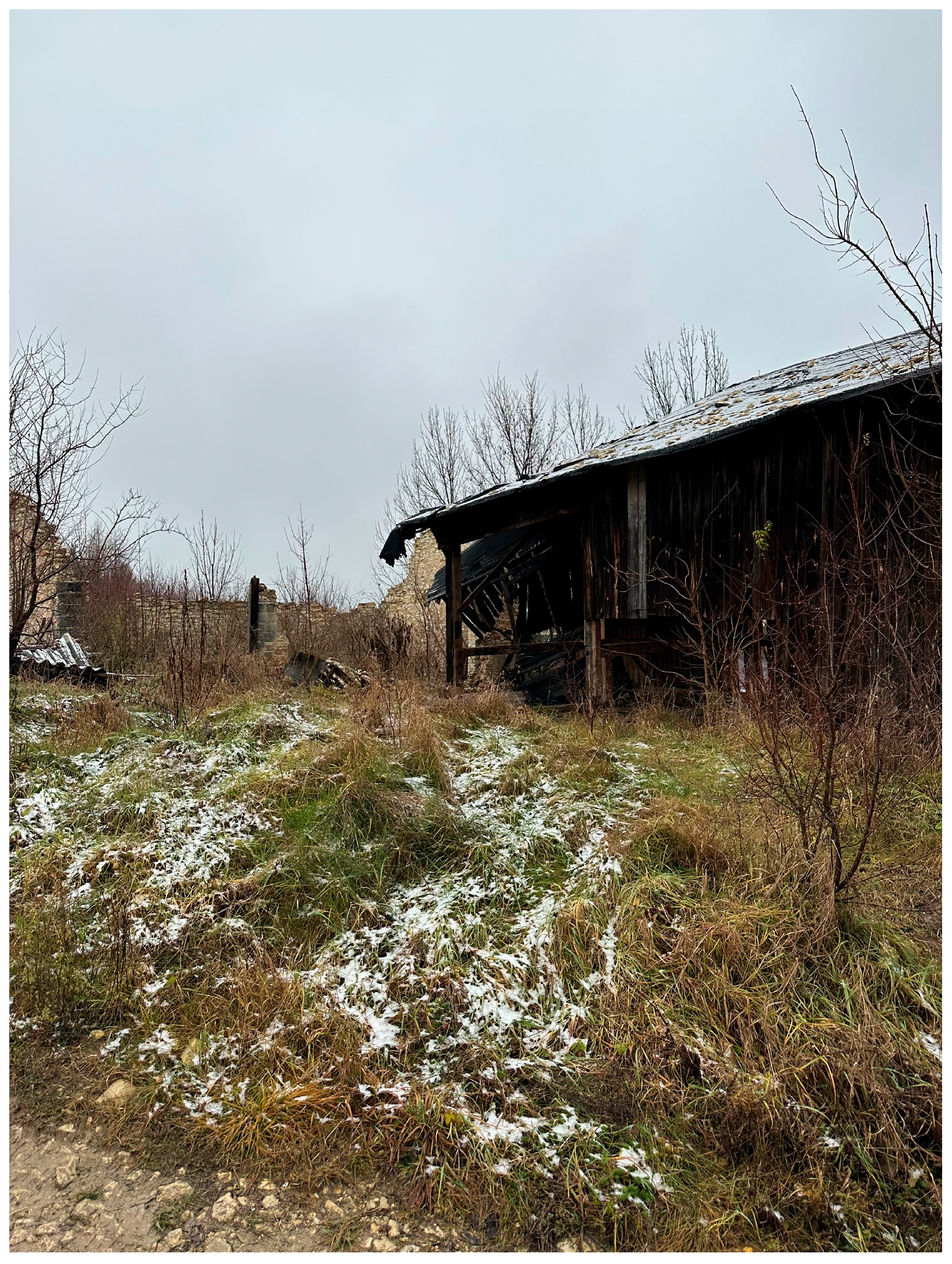
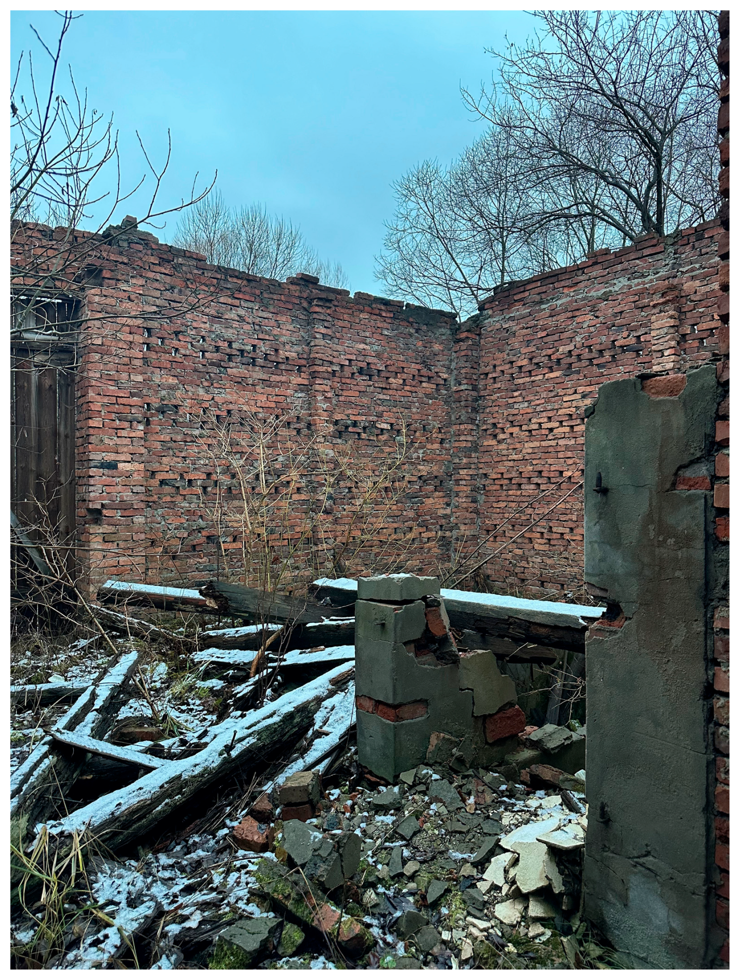
The barn district in Mstów, located southwest of the town square near Partyzantów Street, represents one of the most degraded and abandoned ensembles. Historically, the complex included about 30 buildings—some of them are shown in historical photograph (Figure 9), but only a few scattered structures remain on the hillside today as presented in Figure 10 and Figure 11. Built primarily from Jurassic limestone, some barns also contained timber elements. Due to gradual abandonment and a lack of maintenance, the buildings are falling into ruin. Mstów was an important trade center from the 11th century onward, and the barns served as storage facilities supporting the local market. Architecturally, three construction types can be distinguished: wooden structures on stone foundations, mixed limestone and timber barns, and entirely stone-built barns. The absence of conservation efforts has resulted in the complex’s progressive decay, leaving its future uncertain. Despite its degraded state, the elevated location of the Mstów barn district provides a unique vantage point over the surrounding landscape, suggesting potential for reintegration through cultural trails, scenic viewpoints, or seasonal interpretive installations. Such topographical distinctiveness may be reframed as a heritage asset within future revitalization frameworks, especially those emphasizing symbolic reuse and landscape narratives. This aligns with broader tendencies in rural heritage planning that prioritize visual exposure, cultural accessibility, and minimal intervention in cases of limited structural integrity.

3.1.3. Sławków

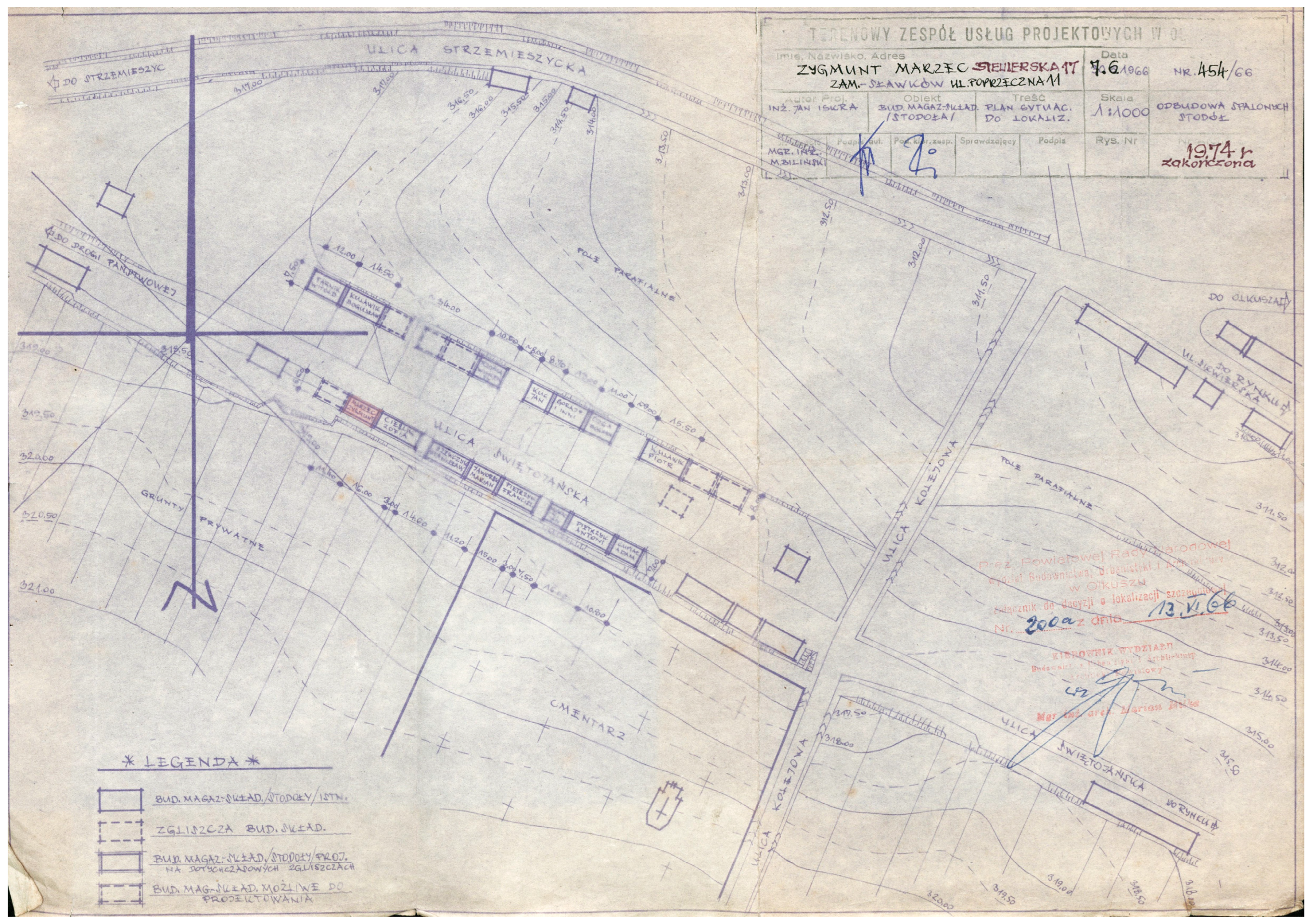
In Sławków, the barn district was located along Generała Józefa Hallera Street and was once a key component of the town’s historical built environment. The complex originally included a larger number of buildings, although only a dozen or so remain today. Initially built from timber, the barns were frequently destroyed by fires. After the fires, the barn complex in Sławków was planned to rebuilt, as shown in Figure 12.
From the 19th century onward, more durable materials such as brick and limestone were used.
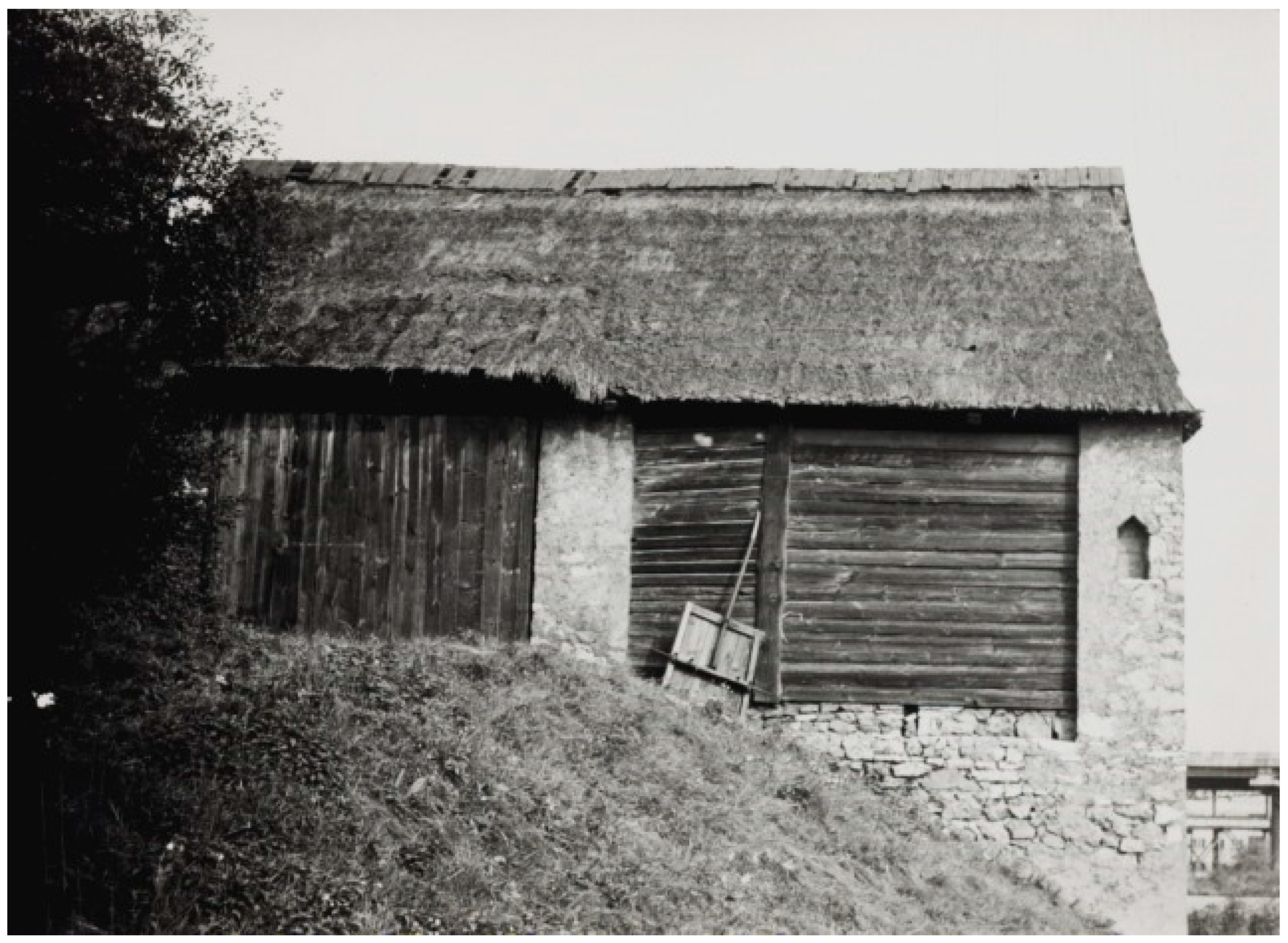
Cartographic sources indicate the presence of three separate barn districts in Sławków: a small complex, a large complex, and the main district, which are shown in historical photographs (Figure 13 and Figure 14) and in recent photos (Figure 15 and Figure 16).
A major fire in 1842, which destroyed 26 barns, was a particularly significant event in the district’s history. These structures served not only economic but also cultural roles—statues of the Virgin Mary placed on barn façades underscored their religious importance. Today, the district is heavily degraded, and its original function has disappeared.

3.1.4. Lelów

The barn district in Lelów was located along Krakowska Street, outside the former town walls. Historically, the town played a significant role in trade, and its urban structure evolved after losing its municipal rights in 1869. In the mid-19th century, a significant portion of Lelów’s population was Jewish, which may indicate the barns’ relevance to local economic activities. Today, only a few barns made of mixed materials remain, in mediocre technical condition. Due to the lack of conservation efforts, the complex is gradually vanishing, remaining only as a fragmentary testament to the town’s historical urban fabric.

3.1.5. Siewierz

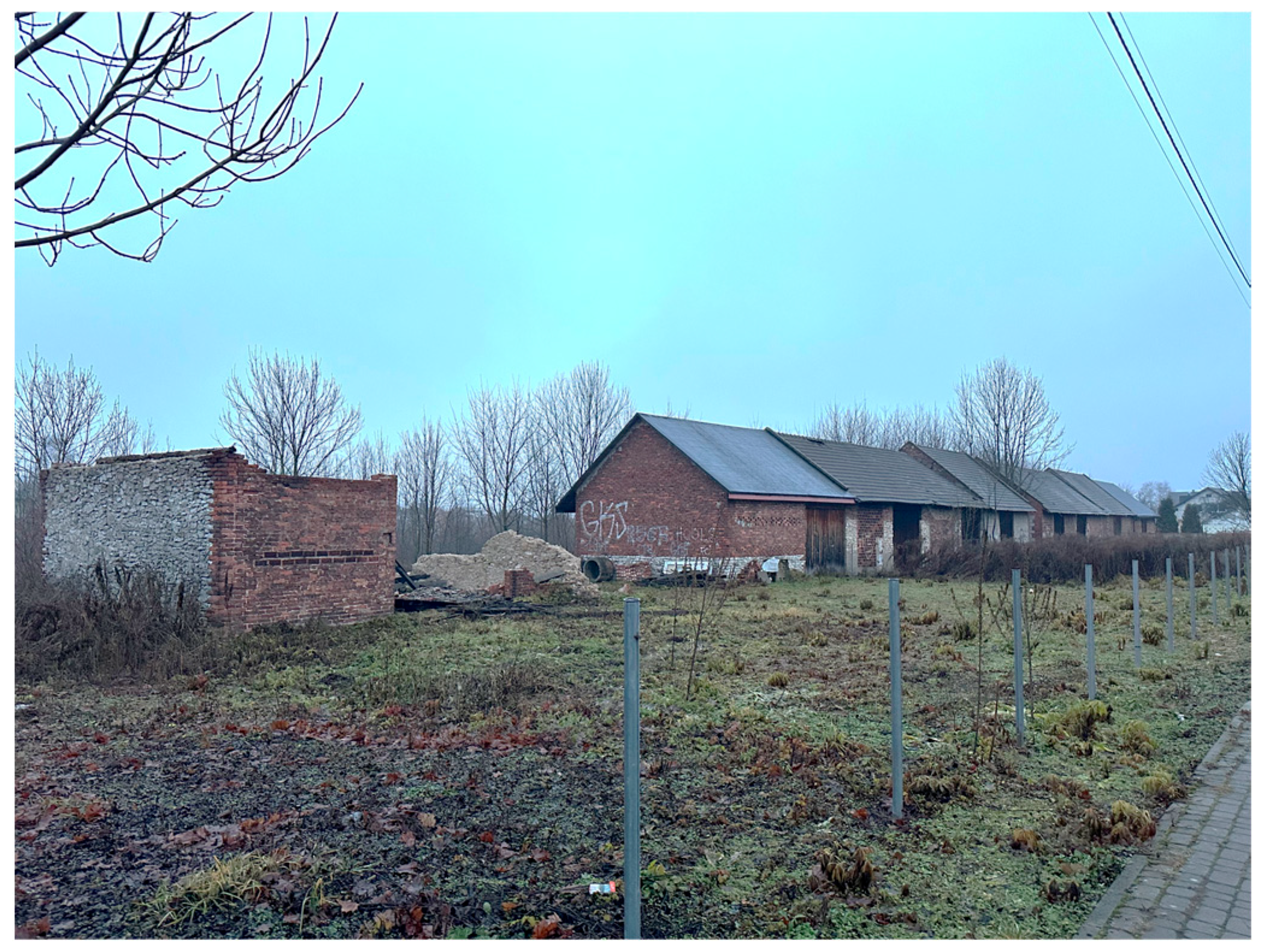
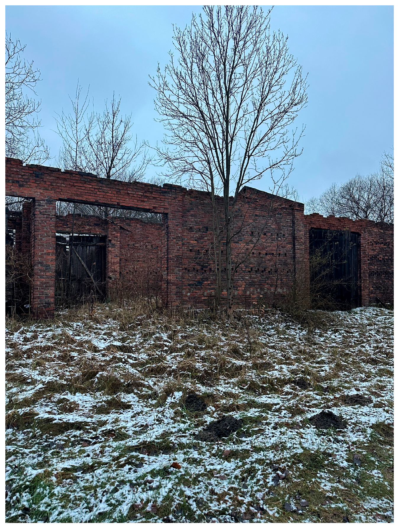
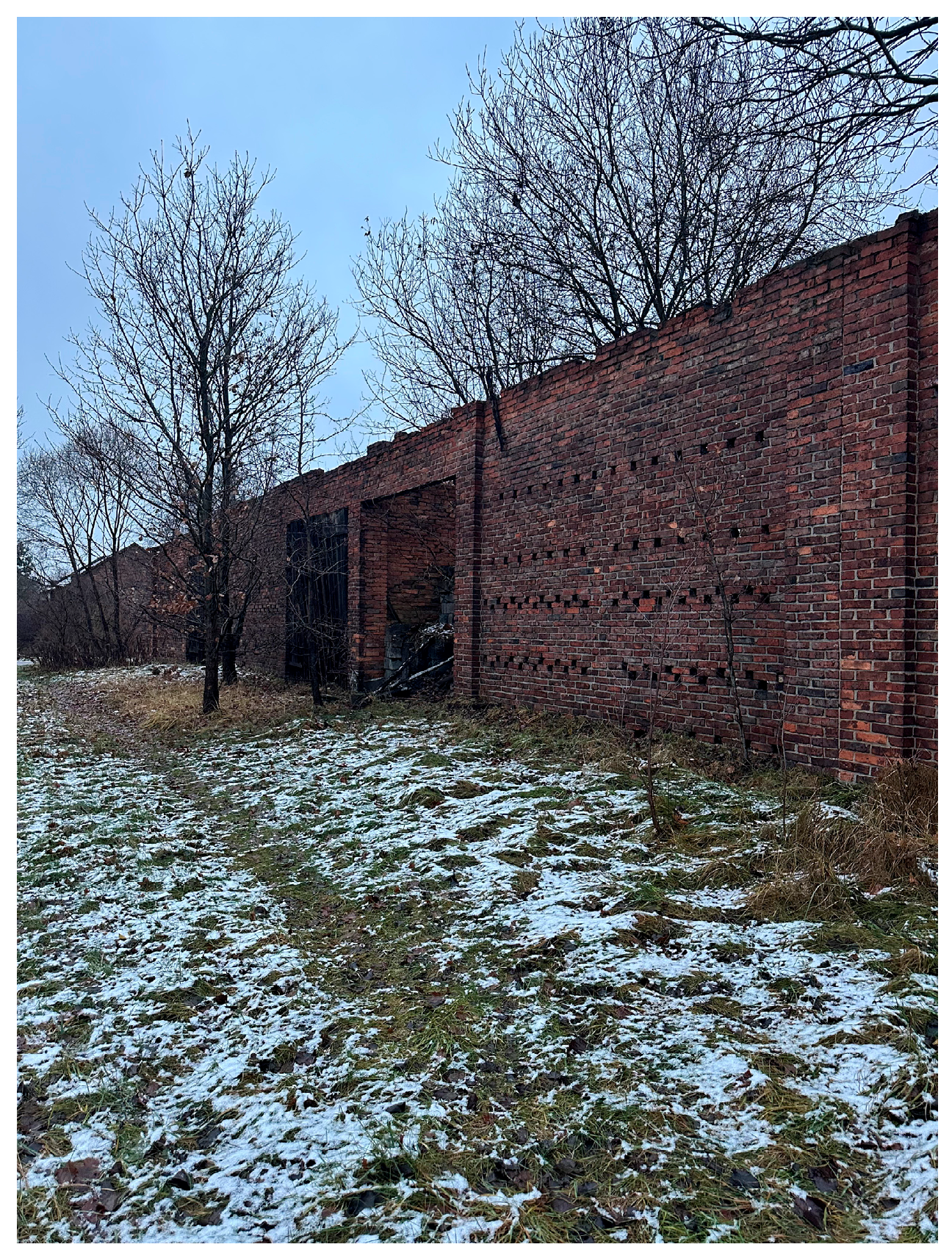
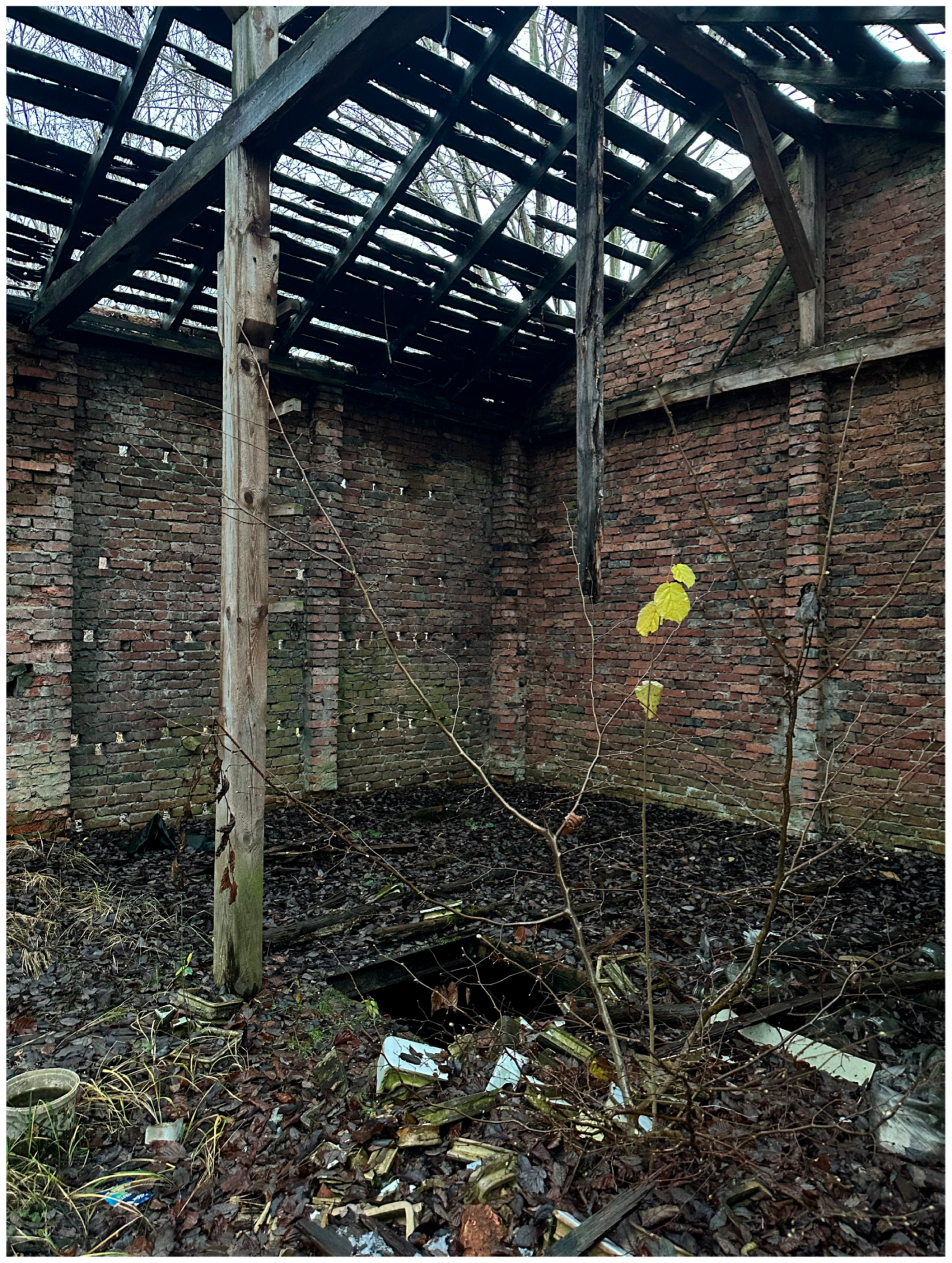
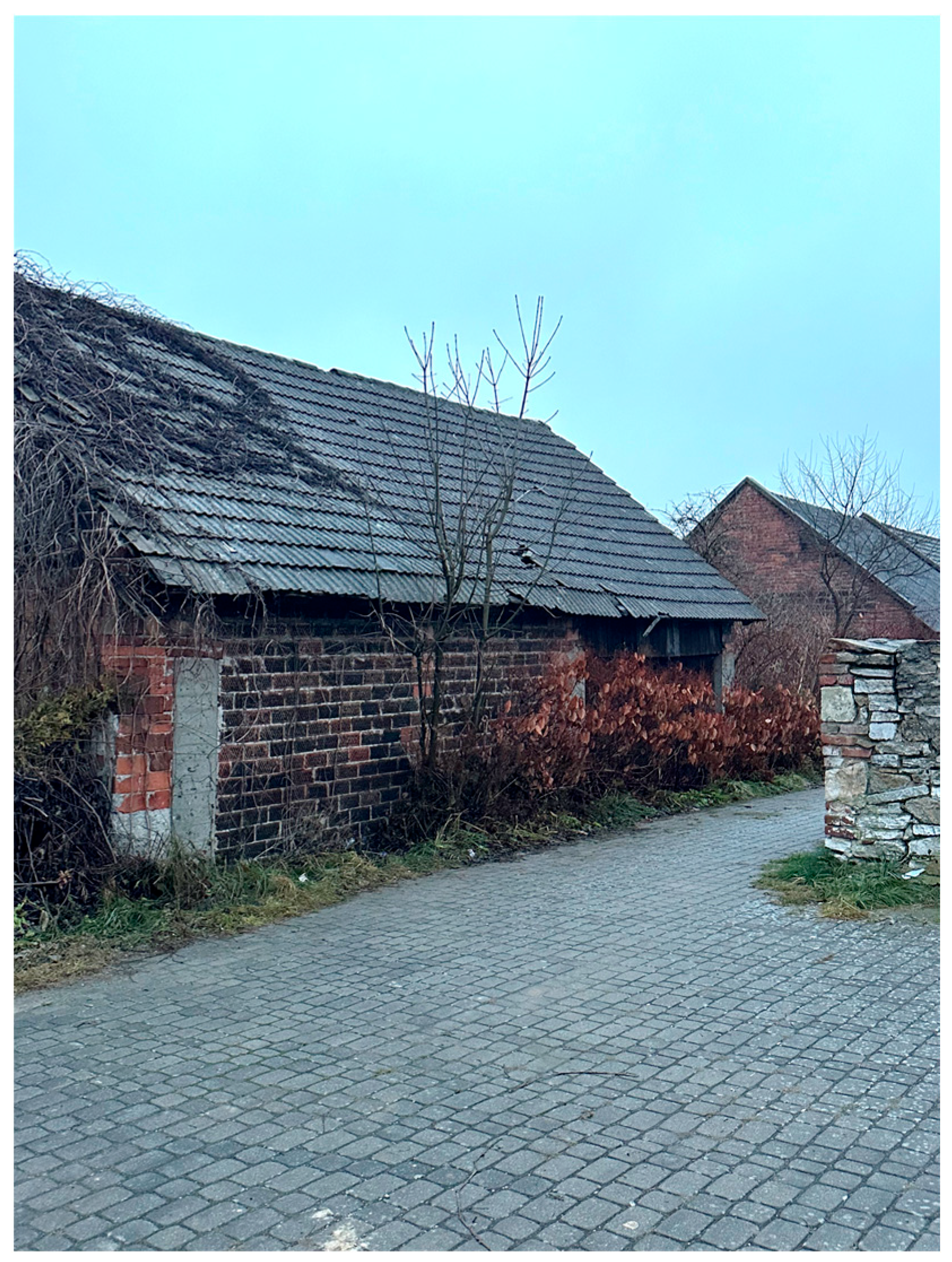
In Siewierz, the barn district was located near the intersection of Cmentarna and Stoczkowa Streets. Due to the dense urban core, the barns were situated outside the historic center. They were primarily constructed from bricks produced in local brickyards and featured wooden roof structures. A distinctive feature was the presence of doors on both sides of the buildings, facilitating use. Some barns also had basements, which are now either in poor condition or have been filled in. The barn district in Siewierz is gradually disappearing from the townscape, and its number continues to decline. The condition of the buildings is shown in Figure 17, Figure 18 and Figure 19.

3.1.6. Żarnowiec

The barn district in Żarnowiec was among the most poorly preserved examples of this typology in the region. Originally consisting of a dozen or so barns—both wooden and masonry—the complex had an irregular spatial layout, suggesting that buildings were added incrementally as needed by residents. Today, only two wooden barns remain, serving as the last remnants of the town’s historical agricultural infrastructure. In the absence of conservation initiatives and amid ongoing degradation, the complex has virtually ceased to exist as a visible element of the urban landscape.

3.2. Morphological Transformations and Urban Layout of Barn Districts

Barn districts were once an integral part of the historical fabric of many towns in the Kraków-Częstochowa Upland region. Their original location outside of the compact urban core resulted from functional needs and fire-safety considerations. These buildings served agricultural purposes—primarily the storage of crops and equipment, as shown in Figure 20—which required their spatial separation from residential areas [57].
Over time, due to urbanization and changes in the region’s economic structure, many of these complexes were either absorbed into expanding urban areas or marginalized on the periphery of towns and villages.
The urban layout of barn districts varied significantly between locations. Two main types can be identified: regular, planned complexes aligned along main communication routes (e.g., Żarki, Siewierz, Sławków, Żarnowiec), and irregular, organically developed layouts adapted to local topographic conditions (e.g., Lelów, Mstów), which is schematically illustrated in Figure 21.
The first type demonstrates intentional design, often enabling better integration with urban structures. The second reflects spontaneous development, with barn placement shaped by individual decisions and terrain.
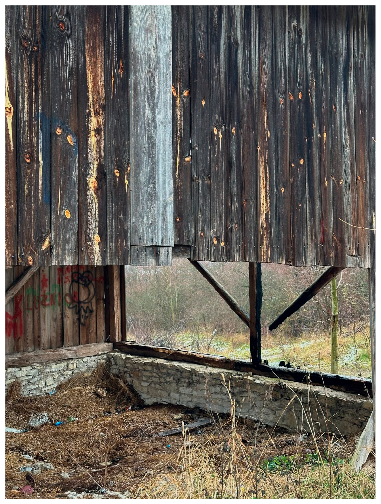
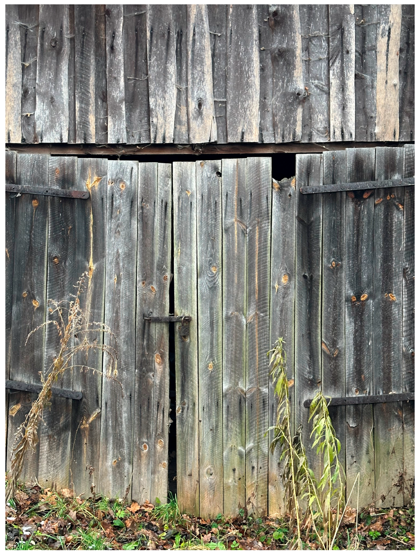
Morphological transformations of the barn districts were driven by both natural and human factors. Recurrent fires in agricultural areas led to shifts in construction materials. Wood (as shown in Figure 22 and Figure 23), once predominant, was increasingly replaced by more durable materials such as limestone and brick—especially visible in Żarki, Siewierz, and Sławków (Figure 24 and Figure 25). In some towns (e.g., Lelów, Żarnowiec), wooden barns have survived, though in greatly reduced numbers.
The preservation status of the original layouts and buildings varies by town. In Żarki, a cohesive complex of 42 barns is still intact, with a well-preserved spatial structure. In Siewierz, a row-based layout persists, though building conditions have deteriorated. In Mstów and Lelów, the layouts have largely vanished—leaving only scattered remnants. Sławków retains several agricultural buildings, though the overall district has become fragmented due to functional and urban transformations. A comparative summary of building preservation and layout transformations is presented in Table 1.
The degree of integration between barn districts and the urban grid also differs. The best transport accessibility is found in Żarki and Siewierz, where road infrastructure facilitates adaptive reuse. In contrast, Lelów and Mstów are much less accessible. In Mstów, the barns are located on an elevated site accessible only via unpaved roads, which hinders connectivity. In Lelów, the path is overgrown and similarly difficult to reach.
Comparative analysis of historical cadastral and topographic maps alongside contemporary urban plans reveals significant spatial transformations of the studied districts. Urban changes were closely tied to functional shifts. In many towns, barn numbers have declined, and many buildings have been repurposed. Historically, these districts functioned as storage zones for agricultural products and equipment. Today, most have lost their original function and have been extensively modified. In Żarki, some barns have been adapted into workshops and storage spaces; in Siewierz and Sławków, they are used for non-agricultural purposes. In Mstów and Lelów, the barns are largely abandoned or partially demolished. Table 1 presents a detailed comparison of these morphological and functional changes over time.
In summary, the morphological and urban transformations of barn districts result from both historical processes and contemporary urbanization dynamics. They are influenced by factors such as the development of transportation networks, shifts in economic structures, and the evolving social perception of these spaces. Today, the differences in the degree of preservation among these ensembles significantly determine their future potential for protection and adaptive reuse. In towns where the original structure has been preserved, there is a greater awareness of their functional potential. In contrast, where barn districts have been severely damaged or abandoned, coherent strategies for their preservation and adaptation are lacking. The findings underscore the need for continued documentation and conservation efforts to safeguard these unique elements of the cultural landscape of the Kraków-Częstochowa Upland. Furthermore, a key aspect of future research should be the analysis of their revitalization potential, taking into account both their historical significance and current urban planning conditions.

3.3. Architectural Characteristics and Technical Condition

Barn districts in the Kraków-Częstochowa Upland exhibit a notable diversity in architectural form, primarily due to local building traditions, material availability, and historical–economic developments. Originally built as simple wooden structures, barns were gradually transformed over time. The main drivers of change were the need for improved fire resistance and the use of locally available materials such as limestone and brick, which improved durability while also diversifying the appearance of individual complexes.
The basic architectural form is a rectangular block with a gable roof. Originally, roofs were covered with thatch or wooden shingles. Later, ceramic tiles and corrugated metal sheets were introduced to increase weather resistance. Wide double-door openings are characteristic, allowing carts to pass through and facilitating storage. In some towns (e.g., Żarki, Mstów), additional openings for wagon shafts were introduced to accommodate local agricultural needs [57].
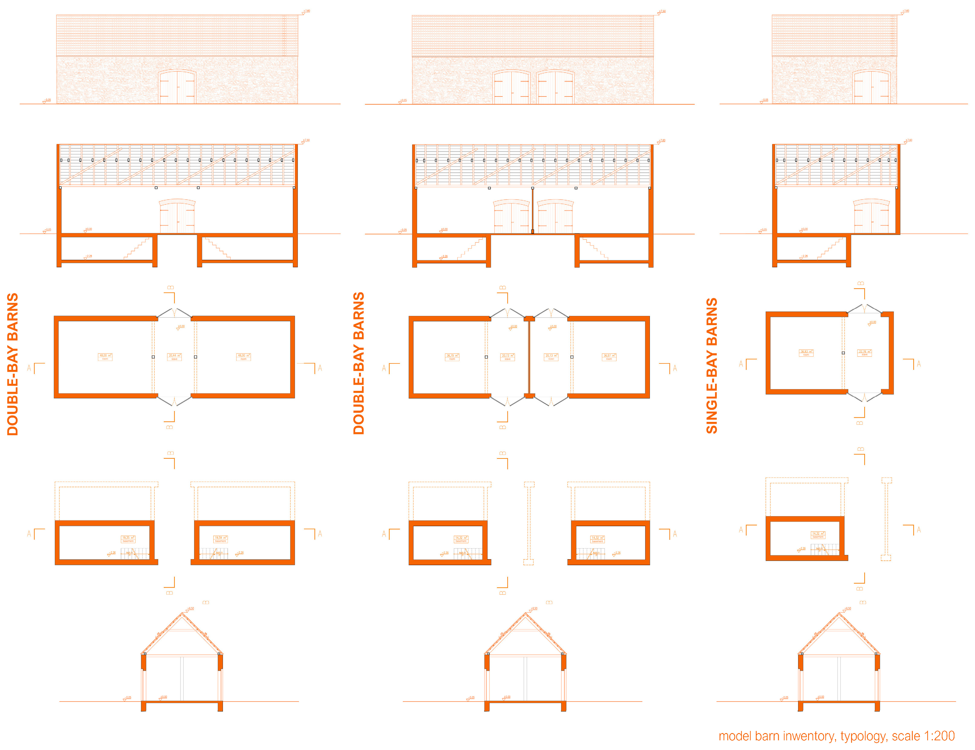
Interior spatial layouts can be categorized into two main types: single-bay and double-bay barns, as shown in Figure 26. The former consists of one storage area, a threshing floor, and a gate, while the latter offers larger storage capacity due to the presence of a second bay. In Żarki and Siewierz, barns with two gate openings are common, improving functional circulation.
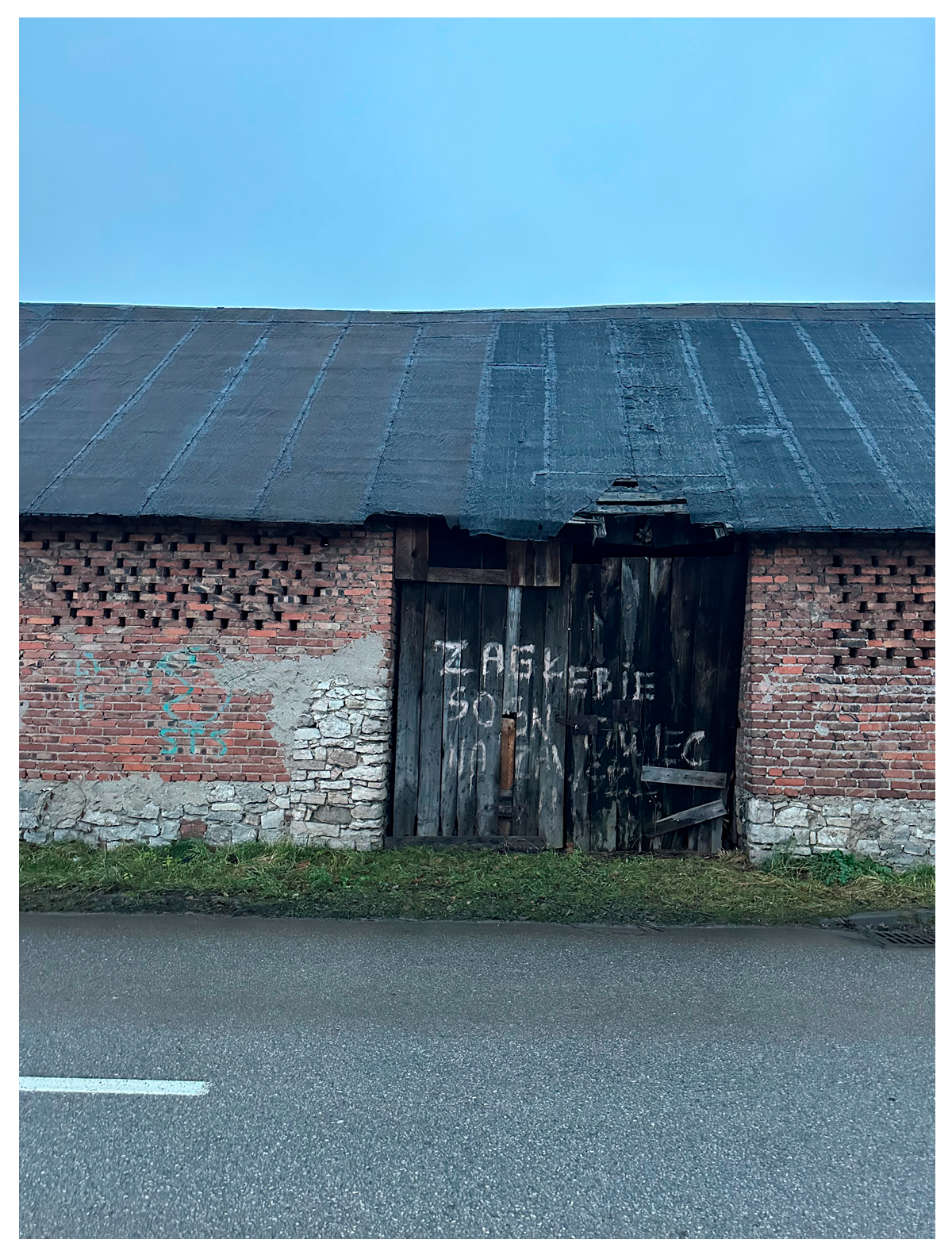
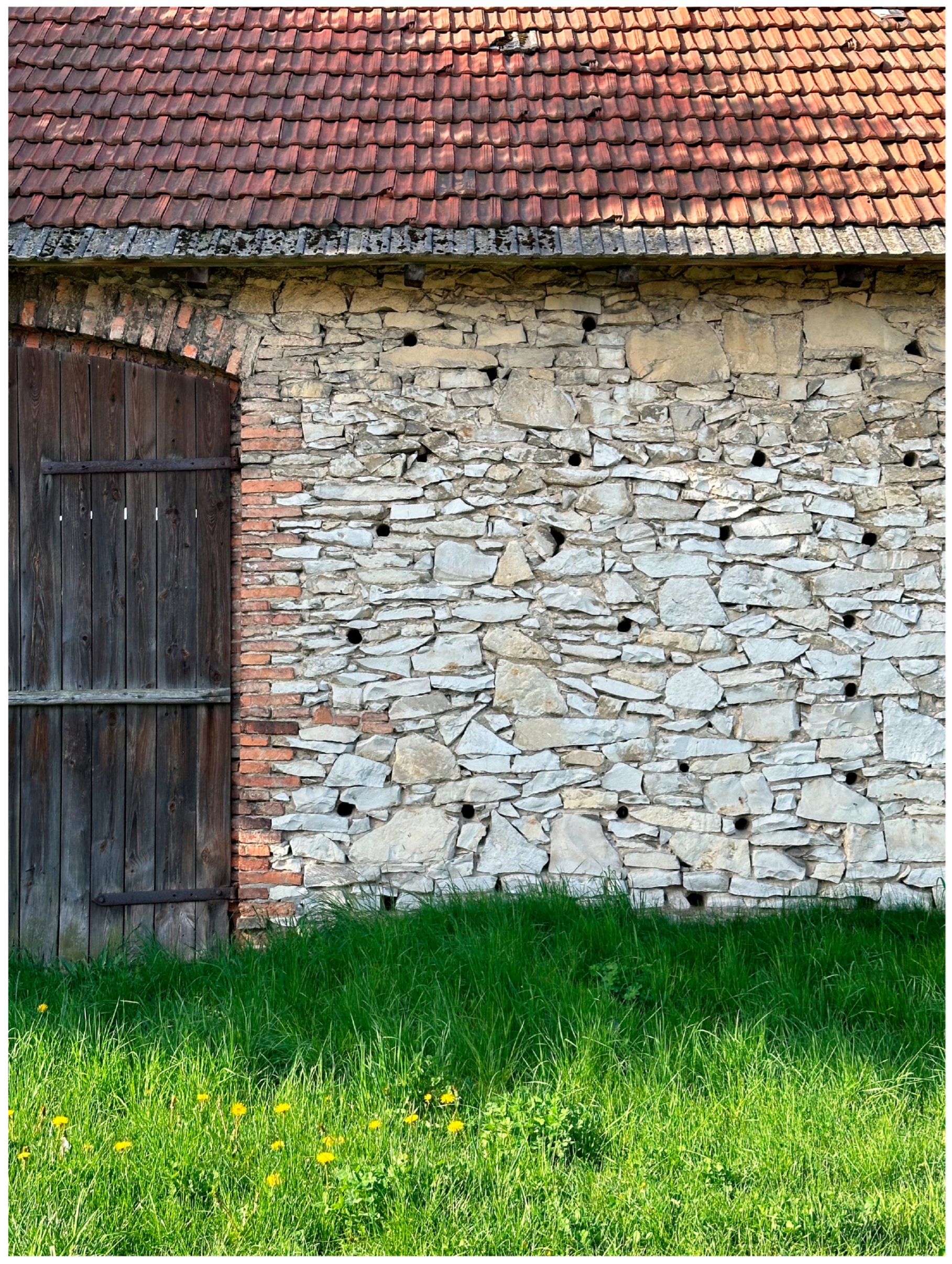
Brick-reinforced limestone walls were common in masonry barns. Brick was used in vulnerable parts of the building such as lintels, corners, and door surrounds. This construction technique is evident in Żarki and Sławków. As illustrated in Table 2, the distribution of construction materials—timber, limestone, and mixed masonry—correlates closely with both preservation status and historic material availability. The figure provides a comparative overview of building typologies across all barn districts, further underscoring how material choices and hybrid techniques shaped the resilience of these structures. A distinctive architectural feature is the inclusion of ventilation openings (Figure 27)—vertical slits or circular holes—to allow air circulation and protect stored crops from moisture and mold [57].
Technically, the condition of barn districts varies widely. Żarki is the best-preserved ensemble, with most barns in good condition and local residents actively involved in maintenance, including wall repairs, door replacements, and roof restoration. In Siewierz, despite degradation, the original layout and materials remain, presenting potential for revitalization. In Sławków, some barns are still standing but have lost their original function and are gradually losing historical integrity.
The complexes in Lelów and Mstów are in worse condition. Many barns have fallen into ruin or been demolished. In Mstów, only a few wooden structures remain, while in Lelów, access is difficult, and the remaining barns are overgrown with dense vegetation. The lack of conservation actions contributes to the gradual disappearance of these unique cultural landscape elements.
A detailed summary of construction types, materials, and technical conditions across the studied barn districts is provided in Table 2.
To summarize, the barn districts of the Kraków-Częstochowa Upland represent a distinct yet underrecognized layer of the region’s architectural and cultural landscape. Their architectural diversity and uneven states of preservation are not only indicative of local construction traditions and access to materials but also serve as material evidence of broader historical processes, including the restructuring of rural economies, shifts in land use, and the fragmentation of traditional agrarian systems. As such, these complexes should be understood not solely as physical structures, but as palimpsests of rural transformation, embedded within the evolving spatial logic of small towns and their surrounding landscapes.
The typological and material variation observed across the studied sites—ranging from masonry barns adapted to new uses to deteriorated or nearly vanished wooden structures—reveals the complex interplay between continuity and obsolescence in the post-agricultural era. In locations where durable materials such as limestone or locally produced brick were readily available—e.g., Siewierz, Żarki, or Sławków—these tended to replace earlier timber structures, especially following fire-related destruction. Conversely, in areas where economic constraints or limited access to masonry materials prevailed, such as Żarnowiec or Lelów, timber barns persisted longer, although few have survived in good condition. This interplay challenges conservation frameworks that privilege formal monumentality or architectural integrity alone. Instead, the barn districts invite a broader understanding of heritage as a relational and processual category—one that incorporates notions of spatial memory, community resilience, and adaptive potential within changing rural environments.
The comparative analysis shows that each barn district reflects a unique combination of local factors. In Żarki, the barn district is well-preserved and actively used, with most buildings maintained in good condition. This functional continuity has contributed to its survival, despite the lack of formal protection. The barns here are predominantly built of Jurassic limestone, often reinforced with brick, and the district has very high development potential, as it is already partially adapted for market functions and could easily accommodate further commercial, residential, or educational uses.
In Sławków and Siewierz, the barns also form regular, linear spatial arrangements, typically aligned parallel to the street. Both complexes are moderately preserved; Sławków’s barns are mainly brick with limestone elements, while Siewierz’s are built from Jurassic limestone with supplementary brick. In both cases, brick was typically used where local brickyards historically operated, highlighting the role of local material economies in shaping building techniques. These districts retain high potential for revitalization, particularly for tourism and cultural purposes, although they currently suffer from structural damage such as missing roofs.
In contrast, barn districts in Lelów, Mstów, and Żarnowiec exhibit more irregular and dispersed spatial arrangements, which were most likely shaped by the topography, parcel divisions, and local access routes. In Żarnowiec, despite the irregularity, many of the barns were oriented perpendicularly to the street, suggesting a semi-organized response to existing land divisions. Mstów, uniquely located on a hill with restricted access, is now in poor condition, with only fragments of walls and foundations remaining. Lelów’s barns, although still partly present, are increasingly overgrown and difficult to reach. Żarnowiec has suffered the most extensive degradation, with only timber fragments remaining, but still holds interpretive and educational potential.
Across all studied sites, the barns are generally similar in architectural form: simple, rectangular solid volumes with gable roofs. However, there was no standardized internal layout; the number of rooms or storage chambers varied and was typically adjusted to individual agricultural needs. In some locations, particularly in Żarki, Sławków, and Siewierz, archival traces and field observations confirm that certain barns included basements or partial substructures, most of which have since been filled in or are in poor condition. While the historical documentation is limited, these features appear to have been context-specific adaptations, likely influenced by terrain elevation, drainage needs, or the requirement for cool and secure storage. Their irregular distribution suggests they were not a common typological feature, but rather practical responses to local environmental and functional constraints. This functional flexibility, rather than strict typological uniformity, defined their historical use. Interestingly, many barn districts were located not only on the outskirts of towns and villages but also frequently in proximity to cemeteries, which may reflect a spatial logic that combined practical, religious, and land use considerations.
What emerges from this comparative analysis is not a linear narrative of decline or survival, but a constellation of local conditions—historical, social, topographical, and infrastructural—that have either supported or undermined the maintenance and reinterpretation of these ensembles. The example of Żarki demonstrates the importance of everyday engagement in sustaining vernacular heritage. Conversely, in locations such as Lelów and Mstów, where access is limited and community involvement is minimal, the absence of strategic intervention has accelerated material and spatial degradation.
From a heritage planning perspective, this underscores the need for context-sensitive approaches that move beyond conventional preservation toward integrative, multifunctional strategies. These should address not only technical conservation and adaptive reuse but also the socio-spatial dynamics that enable heritage to remain legible, accessible, and meaningful to local communities. Aligning with contemporary landscape and heritage theories, barn districts should be reimagined as infrastructural heritage—simultaneously ecological, architectural, and cultural—capable of contributing to sustainable territorial development.
Ultimately, the future of barn districts in the Kraków-Częstochowa Upland hinges on the articulation of locally grounded frameworks that combine conservation, education, and spatial reintegration. These frameworks must be adaptive in nature, informed by both the material realities of the structures and the intangible dimensions of place attachment, identity, and historical consciousness. In this light, barn districts should not be treated as marginal relics of the past but as strategic assets for rethinking rural resilience and landscape continuity in Central Europe.

3.4. Barn Districts in Social Perception and Their Role in Cultural Heritage

Barn districts play a significant role in shaping local cultural identity; however, their social perception varies depending on age, personal engagement, and familiarity with their historical functions. To gain a deeper understanding of their contemporary meaning, a series of qualitative interviews was conducted with residents, barn owners [53], and representatives of local institutions [54,55]. A semi-structured interview format allowed for flexible yet coherent exploration of themes related to the history, significance, and potential future of these sites, capturing a broad spectrum of stakeholder views.
The results are summarized in Table 3, which illustrates notable differences between residents’ and experts’ perspectives. Older residents tend to acknowledge the historical value of barn districts, associating them with past ways of life and personal or family histories. Younger generations, by contrast, often perceive barns as obsolete and functionally irrelevant structures. Experts, meanwhile, consistently emphasized the adaptive potential of these complexes—especially in cultural, educational, or mixed-use development scenarios.
Among younger residents, barns are often seen as aesthetically unremarkable and economically unviable, primarily due to a lack of personal experience with their original function. In contrast, older residents demonstrate a greater awareness of their historical and urban significance—particularly in towns such as Żarki (Figure 28, Figure 29, Figure 30 and Figure 31), where a significant number of barns have been preserved and partially repurposed, fostering their gradual reintegration into the town’s active fabric. In Mstów, Lelów, and Siewierz, however, most barns remain abandoned or poorly maintained, which contributes to their marginalization in both physical and social landscapes.
Interviews also revealed that people from outside the region often perceive barn districts as distinctive and architecturally intriguing, especially in contrast to more homogenized contemporary developments. These visitors frequently pointed out their cultural and tourism potential—highlighting how such structures could become assets for local branding or heritage-based storytelling.
The narratives collected through interviews further uncovered the emotional and symbolic dimensions of barn districts. For many respondents, especially older individuals, these buildings evoke nostalgia and a strong sense of place identity. At the same time, conflicting views emerged around the themes of preservation versus transformation. While some residents support conservation efforts, others advocate for demolition or radical redevelopment. These tensions reflect broader challenges in heritage management—particularly in communities undergoing socio-economic change.
Overall, the findings emphasize the need for community-sensitive approaches in revitalization efforts. The social potential of barn districts is closely tied to local engagement and the ability to reconnect residents—especially younger generations—with the value of these spaces. Educational programs, participatory planning processes, and heritage promotion initiatives may help bridge generational divides and foster a renewed sense of ownership and cultural continuity.
The expert analysis conducted as part of this study incorporated perspectives from specialists in revitalization, urban planning, and representatives of municipal institutions [2,57,58,59,60,61]. Experts unanimously emphasized that barn districts represent not only valuable heritage assets but also spaces with significant adaptive potential. Their unique morphological and historical characteristics were highlighted as offering creative opportunities for revitalization—particularly in relation to cultural, educational, artisanal, and local service functions.
The interviews also pointed to numerous challenges associated with the revitalization of these areas. Experts noted that such investments are complex and must comply with heritage protection regulations, which may limit flexible transformation. Economic barriers were also identified, including the absence of ready investment models and limited interest from private investors. Investment decisions, they argued, should be based on an objective assessment of the technical condition and location of the complexes, which directly determine their functional potential and the scope of feasible interventions. Public–private partnerships were indicated as a key mechanism for combining heritage protection with local development goals.
Crucially, additional expert input emphasized the need for structured action across several domains. First, systematic documentation and technical assessment of barn structures is needed, including inventories, heritage value evaluations, and comparative analyses of historical and current conditions (e.g., through heritage registers and conservation reports). This should involve local and regional heritage offices and could be supported by academic institutions and student research teams under expert supervision.
Second, legal reinforcement through municipal land use plans and clarification of ownership and formal status were identified as prerequisites for protection. Conservation strategies should emerge from evidence-based recognition of the problem and be developed at the municipal or county level.
Third, adaptive reuse strategies must be developed before implementation and tailored to each site’s specificity. Proposed uses include eco-product storage, small museums or open-air exhibits, and seasonal craft and agricultural spaces. Experts warned that due to structural constraints, barns may not be suitable for permanent occupancy without substantial intervention and recommended a phased, research-and-design-driven process involving multidisciplinary technical assessments.
Finally, experts underlined the importance of education and community engagement—through outreach events and off-site programs—as well as financial support mechanisms. Revitalization efforts should be integrated into broader ecological and rural development agendas (e.g., the New European Bauhaus, Green Deal) and not addressed solely on an individual object scale. Interventions may include stabilization, basic repair, full restoration, or, in exceptional cases, reconstruction or relocation with structural integrity maintained.
In summary, while community perception of barn districts remains diverse and shaped by generational and socio-spatial engagement, expert perspectives provide a cohesive vision that aligns adaptive reuse with sustainable cultural heritage development. The key challenge today is to embed these districts in formal protection and development strategies, ensuring their transformation into vibrant, locally rooted public assets responsive to the needs of the 21st century.
These findings highlight not only the architectural and spatial uniqueness of barn districts but also the need for differentiated, context-sensitive conservation strategies—an issue further explored in Section 4.5. The morphological, material, and social characteristics of barn districts in the Kraków-Częstochowa Upland position them as both endangered cultural artifacts and latent spatial resources. The following chapter synthesizes these insights into integrated models for their sustainable reuse.

4. Discussion

4.1. Heritage Values and Landscape Relevance

Barn districts represent a unique yet understudied component of the cultural landscape of the Kraków-Częstochowa Upland. Their regular or dispersed configurations reflect historical patterns of agricultural organization shaped by 19th- and early 20th-century models of land tenure, communal storage practices, and fire-safety considerations. Unlike most European rural areas—where barns and granaries were integrated into individual farmsteads or manorial complexes—these structures were organized into spatially distinct clusters located on the fringes of towns and villages. This systematic separation constitutes a distinctive vernacular typology, scarcely documented elsewhere in the European heritage literature.
Although barns are widely recognized as characteristic elements of vernacular architecture, the phenomenon of barn districts—clusters of storage buildings located on settlement peripheries—is extremely rare in Europe. The comparative literature identifies only a few partially similar configurations, shaped by different historical and institutional contexts:
  • Scheunenviertel in Germany (e.g., Kremmen, Friedland, Steinhude, Schlüsselburg) developed from the 17th century onward, often in response to urban fire-safety regulations that prohibited barns within dense town cores. These barn quarters were typically located just outside city walls and arranged linearly for functional and safety reasons. While some examples—most notably in Kremmen—have been preserved and repurposed as cultural tourism assets, others face degradation or ad hoc transformation.
    Relevant studies such as Busse [6] and Kleine-Limberg [7] provide valuable documentation of their morphology, typology, and conservation status, but focus primarily on architectural classification and heritage protection. Nevertheless, these works do not adopt landscape-scale or participatory methodologies, nor do they address socio-spatial dynamics in depth.
  • Cistercian granges, present in France and Central Europe (12th–15th centuries), were institutionalized monastic farm complexes typically located at a distance from settlements. Although spatially coherent and functionally integrated, these ensembles reflected centralized ecclesiastical land control rather than communal rural practice [62].
  • Medieval tithe barns in England served as grain storage facilities for feudal or ecclesiastical estates. Despite their monumental size and historical value, they were usually standalone structures not forming clustered districts [63,64].
These comparative examples reveal how distinct the barn districts of the Kraków-Częstochowa Upland truly are. Unlike institutionally managed or feudal agricultural units, Polish barn districts emerged from locally driven needs: fire safety, fragmented post-feudal land tenure, limited in-town storage space, and cooperative storage practices. Their integration into the rural–urban fringe and collective functionality represent a typology largely undocumented in the heritage literature.
Comprehensive fieldwork conducted for this study reveals both the extent of degradation and the latent adaptive reuse potential of these structures. While their original functions have largely disappeared, their forms remain legible and spatially coherent. These structures continue to shape the physical identity and symbolic continuity of villages in the region, often forming a threshold between compact settlement and open landscape. This places barn districts at the intersection of cultural memory, ecological infrastructure, and rural development.
Despite these values, barn districts face systemic challenges: a lack of legal protection (many are not listed monuments), no integrated conservation planning at the district scale, and rapid deterioration due to neglect and the vulnerabilities of traditional materials such as timber and Jurassic limestone [29]. Similar processes are observed in other rural regions in Central Europe, where vernacular architecture is especially at risk from abandonment, material decay, and conflicting land use priorities [6,7,24].
From the perspective of international conservation frameworks—such as the Venice Charter (ICOMOS, 1964) [65], the Nara Document (ICOMOS, 1994) [66], and the Washington Charter (ICOMOS, 1987) [67]—barn districts merit consideration not only for their material qualities but also for their role in shaping community identity and memory. Their preservation requires strategies that move beyond object-based conservation and embrace a landscape-based, socially inclusive perspective.
This position aligns with recent European discourses such as the New European Bauhaus and the European Landscape Convention, which emphasize place-sensitive, sustainable transformations of heritage sites. It also resonates with evolving theoretical frameworks in landscape sustainability science, which underscore the importance of multifunctionality, socio-ecological resilience, and place-based identity in rural transformation processes [68,69,70,71]. The adaptive reuse of barn districts could support biodiversity, microclimate regulation, and cultural continuity—especially in regions experiencing socio-economic transition and demographic decline. As Antrop [10] notes, “landscapes of the past are critical for shaping future visions of place”—and in this light, barn districts represent not only relics of agrarian infrastructure but also spatial assets for regeneration.
Addressing these challenges requires new frameworks that bridge spatial, ecological, and heritage discourses. The adaptive reuse of barn districts could support biodiversity, microclimate regulation, and cultural continuity—particularly in regions undergoing socio-economic transition and demographic decline. Their revitalization can thus serve broader sustainability goals and help build future-oriented, community-anchored development models for rural Europe.

4.2. Adaptive Reuse Potential: Typologies, Challenges, and Comparative Insights

The adaptive reuse potential of barn districts in the Kraków-Częstochowa Upland is deeply shaped by their spatial typology, architectural character, technical condition, and location within the urban fabric. Based on morphological and field analysis presented in Section 3, three distinct spatial configurations can be identified across the studied sites:
  • Linear configurations (e.g., Żarki, Siewierz): These ensembles are aligned parallel to roads or plot boundaries, forming cohesive, row-like patterns. Their regularity, accessibility, and proximity to central urban infrastructure offer high potential for adaptive reuse, including commercial or service functions.
  • Compact clusters (e.g., Sławków): Often located within or adjacent to historical town centers, these barn districts demonstrate spatial proximity to cultural landmarks and public infrastructure. However, their smaller scale, fragmentation, and limited separation from surrounding buildings can constrain functional transformation.
  • Dispersed layouts (e.g., Mstów, Lelów, Żarnowiec): Shaped by local topography, parcel fragmentation, and less formal spatial logic, these districts typically occupy peripheral, less accessible sites. Their current condition varies from partial preservation to near disappearance, which presents challenges for reintegration into contemporary townscapes but also opportunities for low-intervention, landscape-sensitive reuse.
Each of these types faces shared constraints that affect reuse feasibility:
  • Physical degradation, particularly in timber and limestone structures, limits immediate adaptation without stabilization.
  • Legal ambiguity, including unresolved ownership or zoning designations, complicates planning and investment.
  • Poor accessibility and infrastructure, especially in hilltop or outlying districts, restricts usage for daily or intensive functions.
  • Low investor interest, due to the sites’ perceived obsolescence and uncertain profitability, hinders large-scale revitalization efforts.
Nevertheless, barn districts offer a broad spectrum of potential new uses—seasonal or permanent, cultural or economic, public or private. Their structural simplicity and spatial flexibility allow for interventions such as the following:
  • Open-air markets;
  • Artisanal workshops;
  • Cultural or educational venues;
  • Storage for eco-products or tools supporting local circular economies.
Effective adaptive reuse strategies must be tailored to each site’s typology and condition. For example, the well-preserved barns of Żarki—with high spatial cohesion, public accessibility, and partial reuse for market activities—present strong development potential for mixed-use programs. In contrast, the hillside district in Mstów, now in ruins, may lend itself to interpretive or landscape-oriented reuse scenarios with limited built intervention.
Internationally, similar transformations of post-agrarian rural structures demonstrate the viability of creative reuse approaches. In the Netherlands, former farm buildings have been successfully converted for commercial and community purposes, guided by adaptive planning strategies and stakeholder collaboration [39]. In England, several barn conversion projects demonstrate the potential of conservation-led design, preserving historical integrity while integrating new functions in line with planning policies and local identity [40]. In Scotland, the Egg Shed in Argyll—a former agricultural warehouse—was adapted into a heritage center integrated with waterfront revitalization [36]. In Norway, the Hedmark Museum showcases vernacular barns preserved through low-intervention design strategies [36]. In France, barn conversions have increasingly been implemented with attention to sustainable systems, rural aesthetics, and local planning requirements. Research in Southern France confirms that farm buildings are being adapted in ways that support agri-food transitions, regional identity, and multifunctional land use [38]. More broadly, agricultural structures are recognized as active drivers of rural sustainability and cultural landscape coherence [42]. In Spain, traditional underground wine cellars in Atauta (Soria) have been documented and revitalized as cultural landscapes, combining heritage conservation with digital interpretation tools [41]. These cases underscore the importance of flexibility, local engagement, and context-sensitive design in successful reuse practices across rural Europe.
What distinguishes the barn districts of the Kraków-Częstochowa Upland is their urban–rural interface: historically positioned on the edges of towns, between compact centers and open farmland, they served as functional and symbolic transition zones. Their peripheral yet connected location renders them both vulnerable to marginalization and strategically valuable for resilient landscape development. Recognizing their hybrid character—as elements of both rural heritage and urban morphology—is key to unlocking their reuse potential.
This typology- and challenge-based perspective sets the stage for a closer look at two contrasting cases: Żarki, a largely preserved and partially reused ensemble with high strategic potential, and Mstów, a severely degraded site facing abandonment. These cases, examined in the next section, illustrate the spectrum of risks and opportunities for barn district transformation in Central European contexts.

4.3. Two Contrasting Cases: Żarki and Mstów

To complement the typological and comparative analyses, two contrasting cases—Żarki and Mstów—have been selected for closer discussion. These sites differ significantly in terms of spatial layout, material preservation, accessibility, legal status, and cultural landscape context, offering distinct yet complementary insights into place-based strategies for rural heritage revitalization.
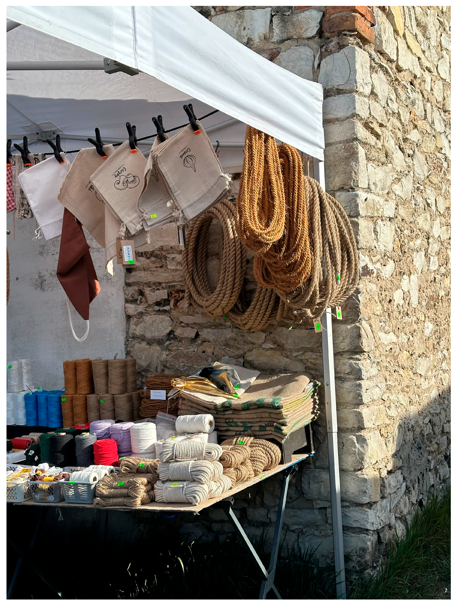
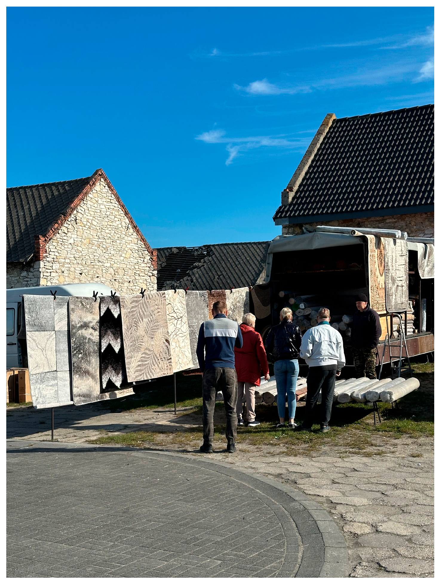
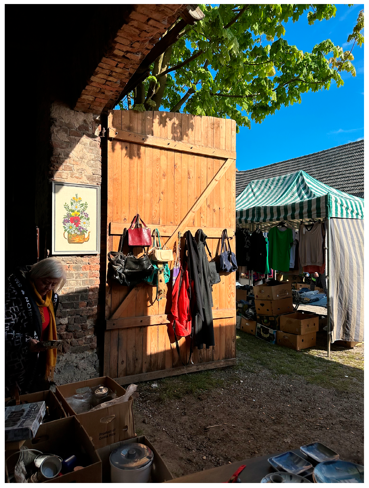
Żarki constitutes a relatively well-preserved example of a regular barn district with high technical viability and strong integration into the urban fabric. Located on the southeastern edge of the town, the district comprises approximately 42 barns, predominantly constructed from Jurassic limestone and arranged in a linear row along a paved access route. This regular, parallel configuration contributes to spatial legibility and facilitates circulation and reuse. Situated adjacent to the historical market square, the barns remain partially in use—primarily as seasonal storage and trading spaces—which has supported informal maintenance and sustained public visibility. Although the ensemble is not under statutory protection, it is listed in the national Heritage Inventory (Ewidencja Zabytków) [72], underscoring its cultural significance and development potential.
The site has also served as a basis for conceptual explorations within academic teaching and research environments, where its spatial coherence and functional continuity have inspired speculative design proposals [73]. These proposals envision multifunctional strategies that integrate cultural, ecological, and social uses while maintaining the district’s material authenticity and architectural logic. Such approaches, although preliminary in nature, echo the principles of the New European Bauhaus—sustainability, inclusiveness, and aesthetic quality—and illustrate the feasibility of low-threshold revitalization pathways for small-town vernacular heritage.
Mstów, in contrast, presents a more fragile yet symbolically rich landscape. Historically consisting of around 30 barns built from limestone and timber, the ensemble followed an irregular, organically developed layout shaped by the sloping topography on the southwestern edge of the historical core. Today, only scattered remnants—such as wall fragments and stone foundations—survive, and the spatial structure is largely illegible. The site lacks vehicular infrastructure, is difficult to access, and suffers from unclear ownership and fragmented land parcels. Despite this, it is included in the national Heritage Inventory [74], and its proximity to the former monastery complex and panoramic views over the Warta River valley endow it with notable symbolic and scenic value.
While technical feasibility remains low, the site’s cultural and landscape significance has been recognized in local planning documents [74,75] and the scholarly literature [19,23]. Mstów has been described as a landscape of tensions and layered meanings, where physical decline coexists with memory, identity, and potential for narrative reactivation [19]. Preliminary revitalization concepts developed in academic [23,24] contexts suggest non-invasive, landscape-oriented reuse strategies—such as open-air interpretation trails, seasonal workshops, or temporary installations engaging local narratives. These ideas, though conceptual, reflect a growing interest in adaptive heritage approaches rooted in symbolic value rather than built form alone.
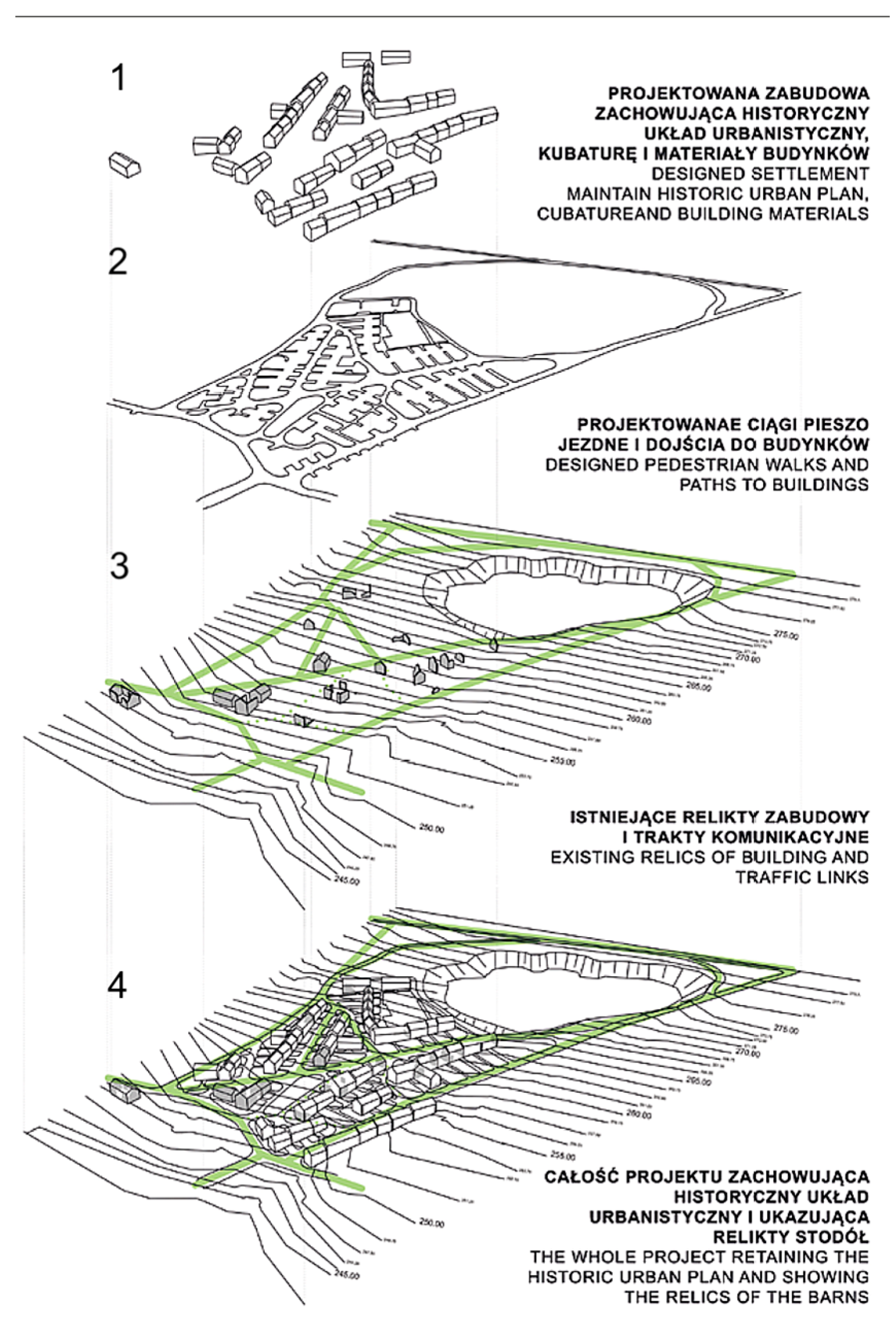
Together, Żarki and Mstów exemplify two divergent yet complementary models of rural heritage revitalization, as illustrated by the two revitalization concepts shown in the Figure 32, Figure 33, Figure 34 and Figure 35. Żarki offers a technically feasible case with preserved material fabric and functional continuity, whereas Mstów represents a culturally charged, visually dramatic setting more suitable for interpretive and educational reuse. These cases reinforce the central argument that adaptive reuse must be tailored to spatial, material, and socio-cultural specificities rather than guided by uniform prescriptions.
Moreover, they illustrate how multifunctionality, ecological sensitivity, and participatory engagement—principles emphasized in European heritage frameworks such as the New European Bauhaus [77], the European Landscape Convention [78], and the Valletta Principles [79]—can inform locally embedded revitalization approaches. Their continued exploration in future research phases—including participatory workshops, co-design sessions, and feasibility assessments—will aim to deepen the understanding of social and economic conditions specific to each site (as elaborated in Section 4.4) and support the development of diversified, transferable models for adaptive reuse.
Both cases demonstrate that successful revitalization frameworks must move beyond generic planning tools. Instead, they must balance physical possibilities with symbolic significance and local agency, drawing on both community narratives and site-specific capacities. As such, Żarki and Mstów serve as valuable testbeds for integrative, place-based approaches that may be adapted to similar barn districts across the Kraków-Częstochowa Upland and comparable rural cultural landscapes in Central Europe.

4.4. Socio-Economic and Demographic Conditions

Drawing upon the spatial and typological analyses presented in Section 3 and the focused case discussion in Section 4.3, this subsection interprets the socio-economic and demographic backdrop that shapes the adaptive reuse potential of barn districts in the Kraków-Częstochowa Upland. While architectural form and heritage value provide the foundation for reuse strategies, their actual implementation depends critically on population trends, economic resilience, local agency, and civic infrastructure.
Żarki represents a relatively stable case within the sample, both demographically and economically. With a population of approximately 4500, it retains a strong sense of local identity and commercial continuity. The barn district is situated adjacent to the still-functioning town market, known as Targowica, where local agricultural vendors gather on designated days [57]. This residual activity has prevented total abandonment of the barns, many of which remain in seasonal or partial use. Local authorities emphasize cultural identity and low-scale tourism in their strategic documents [57], and the town’s proximity to the Eagle’s Nests Trail and other landscape attractions enhances its visibility [53]. Importantly, the district benefits from paved infrastructure, clear parcel boundaries, and moderate building integrity—conditions that reduce investment barriers and allow for incremental, low-threshold reuse scenarios. These may include community-managed market shelters, seasonal exhibitions, or small-scale social enterprise hubs.
In contrast, Mstów faces significant socio-demographic constraints. With a smaller population of around 1900, the municipality shows signs of aging and youth outmigration. The barn district, located on a sloped site behind the former monastery complex, is physically disconnected from daily urban life. No structures are in use, and property ownership is fragmented or unclear. While the site is symbolically rich—offering dramatic landscape views and emotional resonance for local residents—its revival faces economic and logistical hurdles. Local planning documents acknowledge the site’s heritage value, including in the official municipal heritage protection program [78,79], and a dedicated conservation and development strategy has been proposed at the conceptual level [24]. However, no binding or implemented revitalization plan currently exists, and institutional capacity remains limited [23,24]. Interviews and prior research confirm a sense of local attachment to the site, especially among older generations [55], while also underscoring the limited institutional capacity to realize revitalization goals. In this context, large-scale structural revitalization is unlikely. Instead, educational or symbolic interventions such as interpretive signage, school-based landscape projects, or seasonal events could align with local resources and the community’s social carrying capacity.
These divergent conditions echo patterns observed in the remaining sites of Lelów, Siewierz, Sławków, and Żarnowiec. Lelów and Żarnowiec are characterized by deep demographic decline and marginal economic roles within the regional settlement structure. While their barn districts retain fragments of architectural form and landscape visibility, they lack clear access routes, functional continuity, and economic anchors. Siewierz and Sławków, although also affected by building degradation and ownership issues, benefit from better integration with their urban cores and higher tourist traffic. In each case, revitalization potential is filtered through the lens of local governance, planning culture, and community engagement.
The analysis thus reinforces the need for differentiated reuse strategies grounded in local socio-economic realities. Żarki illustrates a context in which a coherent architectural ensemble meets active public space and moderate institutional capacity. In Mstów, the emphasis must shift toward heritage education and non-invasive, symbolic programming. Across the study area, demographic aging, outmigration, and the erosion of agricultural functions have decoupled barn districts from their original roles—raising the question of how to re-anchor them in contemporary community life. As the following section argues, reuse frameworks must be tailored to the social carrying capacity of each site and developed through participatory, incremental, and context-sensitive models.

4.5. Toward Integrated Models of Rural Heritage Revitalization

Developing effective revitalization strategies for barn districts in the Kraków-Częstochowa Upland requires an integrated and site-sensitive approach. As demonstrated in the previous sections, these complexes vary not only in terms of architectural coherence and spatial morphology but also in socio-economic and demographic capacity. This diversity precludes a universal model of reuse. Instead, future strategies must be tailored to local conditions, balancing technical feasibility, cultural significance, and community readiness.
The comparative analysis of Żarki and Mstów exemplifies two ends of the revitalization spectrum—one based on preserved structures and market continuity, the other grounded in symbolic and landscape values. These cases illustrate the need for diversified frameworks that reflect the social carrying capacity and material conditions of each site. In Żarki, community-oriented programming can expand on existing market functions, supported by architectural integrity and local identity. In Mstów, where access and investment capacity are limited, symbolic reuse—via seasonal, artistic, or educational interventions—may offer a more viable path forward.
Building on this differentiation, a typology of strategic models can be proposed:
  • Functional Continuity Models (e.g., Żarki, Sławków): Prioritize adaptive reuse based on existing or historic uses (e.g., markets, craft production), with interventions focusing on repair, modernization, and improved accessibility.
  • Interpretive Landscape Models (e.g., Mstów): Emphasize educational, symbolic, and visual reuse, including trails, temporary installations, or heritage storytelling linked to cultural tourism and school programs.
  • Hybrid Strategies: Applicable in sites such as Siewierz or Żarnowiec, where spatial integrity exists but economic capacity is limited. Here, phasing and mixed-use scenarios may support gradual transformation through modest investment and community involvement.
To implement such models, revitalization efforts should follow a phased and research-based process, including the following:
  • Inventory and documentation—development of detailed “white cards” for each structure, comparing archival records with current conditions, coordinated by heritage services and supported by academic institutions (e.g., [73,74]).
  • Technical assessment—evaluation of structural safety, material degradation, and fire protection needs to determine feasible levels of reuse.
  • Legal and planning integration—securing zoning provisions and resolving ownership issues through local spatial development plans.
  • Scenario-based design—preparation of alternative design concepts (e.g., seasonal use, modular adaptation), tailored to site-specific conditions.
  • Community engagement and co-design—participatory planning sessions, workshops, and educational initiatives aimed at fostering local ownership and youth involvement.
Award-winning diploma projects focused on the adaptive reuse and revitalization of barn districts [73,76] illustrate the potential of transforming these vernacular ensembles into multifunctional public spaces that foster local identity, cultural continuity, and community involvement. Along with successful international examples like the revitalized Scheunenviertel districts in Germany (e.g., Kremmen, Friedland, Steinhude, and Schlüsselburg) [6,7,80], they demonstrate that even utilitarian rural structures can be transformed into meaningful, multifunctional public spaces—provided that interventions are grounded in the spatial logic and cultural narratives of the place.
In all cases, restoration and preservation must adhere to principles of material authenticity and proportional intervention. Where possible, original materials—such as timber framing or Jurassic limestone—should be preserved through consolidation and repair. However, in contexts of severe degradation or structural risk, the replacement of materials may be justified, provided that new elements are clearly distinguishable and compatible with the historic fabric. Given the heterogeneity of preservation status across sites, potential interventions may include basic stabilization (e.g., structural consolidation), restoration with original or locally sourced materials (such as stone and timber in Żarki or Siewierz), or adaptive reuse combined with partial reconstruction—particularly in degraded ensembles such as Mstów or Lelów. Conservation approaches must remain sensitive to the architectural logic, material authenticity, and socio-spatial context of each district.
This approach reflects international conservation standards, including the Nara Document (1994) and the Venice Charter (1964), which emphasize the need for reversibility, legibility, and respect for original construction logic. Importantly, conservation strategies should be adapted to the specific typology and condition of each barn district, with low-threshold, low-intervention techniques favored where resources or heritage status are limited.
Heritage planning frameworks such as the New European Bauhaus (NEB), the European Green Deal, and national conservation programs provide valuable policy anchors for such efforts. These models emphasize aesthetic quality, sustainability, and social inclusion, all of which align with the multifunctional potential of barn districts as ecological, cultural, and social infrastructure.
Equally important is the preservation of morphological coherence. Whether regular (Żarki), dispersed (Mstów), or compact (Sławków), the spatial arrangement of barn districts must be treated as a defining element of their value. Any revitalization strategy should therefore safeguard their relationship with the terrain, settlement structure, and surrounding open space.
Finally, the integration of conservation with economic and educational dimensions is essential. Barn districts should not be preserved as static relics, but rather activated as living heritage sites. This includes aligning reuse strategies with local development goals, landscape connectivity, and sustainable land use transitions [68].
The diversity of cases presented in this study suggests that barn districts can be reintegrated into contemporary rural life through plural and adaptive strategies—linking spatial, social, and symbolic values. Their transformation into multifunctional public assets not only contributes to local resilience but also creates transferable models for similar vernacular ensembles across Central Europe.
This study contributes to current research on vernacular heritage and rural spatial transformation by shedding light on the underexplored phenomenon of barn districts—communal storage ensembles situated at the urban–rural edge. While the existing literature has addressed the cultural value of individual rural structures [41,42], clustered barn districts remain largely absent from European heritage discourse. By combining morphological, socio-economic, and historical analysis with stakeholder perspectives, the study highlights both shared patterns and site-specific challenges. Rather than proposing a universal framework, it offers empirically grounded insights and context-sensitive directions for adaptive reuse—aligned with values such as sustainability, inclusiveness, and cultural continuity [33,35,72]. These findings may inform future planning strategies aimed at reintegrating marginalized heritage into resilient rural landscapes across Central Europe.

5. Conclusions

Barn districts in the Kraków-Częstochowa Upland represent a marginalized yet culturally significant component of Central Europe’s rural heritage. These ensembles of agricultural buildings reflect historical patterns of spatial and functional organization in small towns and agrarian settlements. Despite their inclusion in local heritage inventories, they remain underrepresented in contemporary urban and landscape planning frameworks.
This study demonstrates that, despite varying levels of degradation, barn districts retain a high degree of spatial coherence and material authenticity. Their potential for adaptive reuse—when grounded in context-specific strategies—offers a compelling model for revitalizing vernacular structures. Beyond their utilitarian origins, these sites hold symbolic and identity-forming significance, shaping the collective memory and contributing to the historic character of settlement landscapes.
Importantly, barn districts also exhibit typological and morphological uniqueness, rarely observed in other European rural contexts. Unlike dispersed farm buildings typical of Western European countryside, these ensembles were concentrated along strategic axes—often on the outskirts of towns—reflecting communal storage practices shaped by market-oriented agricultural systems. This spatial logic distinguishes them as a specific and largely undocumented heritage typology. Their analysis contributes to broader comparative debates on rural heritage valorization and spatial transformation across Europe.
While some similarities can be drawn with collective grain stores or granges in other parts of Europe (e.g., Cistercian granges in France or barn rows in Kremmen, Germany), the barn districts in this region offer a distinct landscape pattern, shaped by topography, ownership structures, and cultural practices. As such, the findings provide a relevant case for understanding how local agrarian systems generated lasting spatial forms that continue to hold social and symbolic meaning.
Community interviews reveal a generational divide in perception: older residents express strong emotional ties to the barn districts, while younger generations often view them as obsolete. This underlines the urgent need for educational and participatory strategies that foster heritage awareness and inclusivity, particularly as rural areas face population ageing and youth outmigration. Integrating barn districts into everyday life through adaptive functions and cultural programming may contribute to social cohesion and intergenerational dialogue.
From a planning perspective, the main challenges include the absence of systemic conservation measures, lack of legal and zoning clarity, and advanced technical deterioration of many buildings. Addressing these issues requires integrated conservation policies, interdisciplinary collaboration, and investment in tailored adaptive reuse strategies that align with sustainable development goals.
Beyond heritage protection, barn districts can also support contemporary spatial and environmental goals. Their reuse may contribute to land use efficiency, circular building practices, and climate adaptation—especially when low-carbon materials and nature-based solutions are integrated into revitalization processes. Their edge-of-town locations provide opportunities to reconnect settlement cores with peri-urban and agricultural landscapes through green corridors and multifunctional land uses. These strategies align with broader policy frameworks such as the European Green Deal and local climate resilience agendas, reinforcing the role of rural heritage in sustainable territorial transitions.
The findings support the argument that reintegrating barn districts through adaptive reuse can strengthen local identity and contribute to landscape resilience. Their transformation aligns with broader European ambitions for sustainable, aesthetic, and inclusive environments, as promoted by initiatives such as the New European Bauhaus. Rather than being treated as peripheral remnants, barn districts should be recognized as active components of place-based development.
Methodologically, this study introduces an integrated approach combining spatial analysis, typological comparison, socio-economic profiling, and qualitative interviews. The proposed framework can inform both heritage research and applied territorial planning, providing a transferable tool for identifying and evaluating underutilized vernacular assets.
As the first comparative study focused on the barn districts of the Kraków-Częstochowa Upland, this article contributes not only empirical insight but also conceptual grounding for future research and practice. Further work should explore legal frameworks, scenario-based design methods, and co-creation processes with local communities—ensuring that these sites are not just preserved, but reimagined as living components of resilient, inclusive rural landscapes across Central and Eastern Europe.

Author Contributions

Conceptualization, E.K.-Ś. and A.A.W.; methodology, E.K.-Ś. and A.A.W.; validation, E.K.-Ś. and A.A.W.; formal analysis, E.K.-Ś. and A.A.W.; investigation, E.K.-Ś. and A.A.W.; resources, E.K.-Ś. and A.A.W.; data curation, A.A.W.; writing—original draft preparation, E.K.-Ś.; writing—review and editing, E.K.-Ś. and A.A.W.; supervision, E.K.-Ś.; project administration, E.K.-Ś. All authors have read and agreed to the published version of the manuscript.

Funding

This research received no external funding.

Institutional Review Board Statement

This study received approval from the Ethics Committee at Wrocław University of Science and Technology (protocol code O-25-42 and date of approval 9 July 2025). It involved non-invasive, low-risk interviews. All participants were informed about the purpose of this study and its voluntary nature. Verbal informed consent was obtained prior to participation. No sensitive or personal data were collected. Responses from residents were fully anonymized, and the identities of academic experts were disclosed only with their explicit permission.

Informed Consent Statement

Informed consent was obtained from all subjects involved in this study.

Data Availability Statement

The interview transcripts collected for this study are not publicly available due to privacy and ethical considerations. Summarized findings from these interviews have been integrated into the analysis. Other supporting materials (field documentation, archival maps, site descriptions) are available from the corresponding author upon reasonable request.

Acknowledgments

The authors would like to express their sincere gratitude to Wojciech Mszyca, editor and resident of Żarki, for his valuable insights and participation in interviews that significantly enriched the historical and urban analysis of barn districts. Special thanks are also extended to Daniel Kaznodzieja from the Municipal Cultural Center in Sławków—Center for Environmental and Cultural Education—for his support during fieldwork in this location. The authors gratefully acknowledge the contributions of hab. Eng. Arch. Sebastian Wróblewski, hab. Eng. Arch. Magdalena Belof, hab. Eng. Arch. Paweł Kirschke, and hab. Eng. Arch. Agnieszka Szumilas for their expert input during discussions that informed the research and interpretation of results.

Conflicts of Interest

The authors declare no conflicts of interest.

References

  1. Trawińska, M. Z Badań Nad Budownictwem Wiejskim w Rejonie Częstochowskim [Research on Rural Architecture in the Częstochowa Region]. Rocz. Muz. W Częstochowie 1966, 2, 79–110. (In Polish) [Google Scholar]
  2. Wancel, A. (Faculty of Architecture, Wrocław University of Science and Technology, Wrocław, Poland); Wróblewski, S. (Faculty of Architecture, Wrocław University of Science and Technology, Wrocław, Poland). Personal communication, 2025.
  3. Conzen, M.R.G. Alnwick, Northumberland: A Study in Town-Plan Analysis; Institute of British Geographers Publication: London, UK, 1960. [Google Scholar]
  4. Muratori, S. Studi per una Operante Storia Urbana di Venezia; Istituto Poligrafico dello Stato: Rome, Italy, 1959. [Google Scholar]
  5. Caniggia, G.; Maffei, G.L. Interpreting Basic Buildings: Architectural Composition and Building Typology; Alinea Editrice: Florence, Italy, 2001. [Google Scholar]
  6. Busse, A. Das historische Scheunenviertel Kremmen. Aktion Denkmal des Monats; Arbeitsgemeinschaft Historische Stadtkerne Brandenburg: Potsdam, Germany, 2014; Available online: https://ag-historische-stadtkerne.de/wp-content/uploads/2019/12/15-06-DdM_Kremmen.pdf (accessed on 15 May 2025). (In German)
  7. Kleine-Limberg, W. Scheunenviertel und mehr: Sonderquartiere in historischen Siedlungen in Niedersachsen; Institut Mensch und Region/Niedersächsisches Ministerium: Hannover, Germany, 2012; Available online: https://mensch-und-region.de/wp-content/uploads/2021/02/nsgb-1_2012-scheunenviertel-und-mehr.pdf (accessed on 15 May 2025). (In German)
  8. Dragan, A.; Creţan, R.; Jucu, I.S.; Oancea, O.A. Rural Landscapes as Cultural Heritage and Identity along a Romanian River. Heritage 2024, 7, 4354–4373. [Google Scholar] [CrossRef]
  9. Panagiotopoulos, D.; Wallenwein, F.; Mildenberger, G.; Schimpf, G.-C. A Dialogue between the Humanities and Social Sciences: Cultural Landscapes and Their Transformative Potential for Social Innovation. Heritage 2023, 6, 7674–7705. [Google Scholar] [CrossRef]
  10. Antrop, M. Why landscapes of the past are important for the future. Landsc. Urban Plan. 2005, 70, 21–34. [Google Scholar] [CrossRef]
  11. Fairclough, G.; Sarlöv Herlin, I.; Swanwick, C. (Eds.) The Routledge Handbook of Landscape Character Assessment; Routledge: London, UK, 2018. [Google Scholar]
  12. Taylor, K.; Lennon, J. Cultural landscapes: A bridge between culture and nature? Int. J. Herit. Stud. 2011, 17, 537–554. [Google Scholar] [CrossRef]
  13. Pereira Roders, A.; van Oers, R. Bridging cultural heritage and sustainable development. J. Cult. Herit. Manag. Sustain. Dev. 2011, 1, 5–14. [Google Scholar] [CrossRef]
  14. Antoniewicz, M. Dzieje Żarek: Zarys Powstania i Rozwoju Miasta na Przestrzeni Sześciu Wieków; [The Past of Żarki: Outline of the Origin and Development of the Town Over Six Centuries]; Towarzystwo Miłośników Żarek: Żarki, Poland, 1982; 64p. (In Polish) [Google Scholar]
  15. Laberschek, J. Średniowieczne Dzieje Nadwarciańskiego Mstowa; Wydawnictwo Towarzystwa Naukowego „Societas Vistulana”: Kraków, Poland, 2014. [Google Scholar]
  16. Kubicki, A. Z Przeszłości Mstowa: Notatki Kronikarskie od Średniowiecza do 1939 Roku; [The Past of Mstów: Chronicle Notes from the Middle Ages to 1939]; Drukarnia Usługowa “Gryf”: Częstochowa, Poland, 2011. (In Polish) [Google Scholar]
  17. Ławrynowicz, O.; Krupa-Ławrynowicz, A.; Gadowska, I.; Nita, M.; Majorek, M.; Cieśliczka, A.; Majewska, A. Miejsca Pamięci i Zapomnienia. Studium Interdyscyplinarne na Jurze Krakowsko-Częstochowskiej. Tom 5. Gmina Lelów; [Sites of memory and forgetting. An interdisciplinary study in the Kraków-Częstochowa Jura. Vol. 5. Lelów Commune]; University of Łódź. 2019. Available online: http://hdl.handle.net/11089/43070 (accessed on 15 May 2025). (In Polish).
  18. Dyduch-Falniowska, A.; Makomaska-Juchiewicz, M.; Kaźmierczakowa, R.; Perzanowska, J.; Zając, K. Integration of Information on the Kraków-Czestochowa Jura for Conservation Purposes: Application of CORINE Methodology. In National Parks and Protected Areas; Springer: Berlin/Heidelberg, Germany, 1996; pp. 175–185. [Google Scholar] [CrossRef]
  19. Krupa-Ławrynowicz, A. Zmiany i napięcia w krajobrazie wsi jurajskiej. Na marginesie badań w Mstowie [Changes and tensions in the landscape of a Jura village. On the margins of research in Mstów]. Zesz. Wiej. 2016, 22, 153–167. (In Polish) [Google Scholar] [CrossRef]
  20. Myga-Piątek, U.; Żemła-Siesicka, A. How Has the Landscape Changed? Landscape Transformation Analysis of Ogrodzieniec-Podzamcze (Poland) Using Landgraphy and Landscape Stratigraphy Methods. Landsc. Online 2023, 98, 1110. [Google Scholar] [CrossRef]
  21. Figlus, T. Process of Incorporation and Morphological Transformations of Rural Settlement Patterns in the Context of Urban Development: The Case Study of Łódź. Quaest. Geogr. 2020, 39, 43–58. [Google Scholar] [CrossRef]
  22. Figlus, T. The past and present of historical morphology of rural and urban forms in Poland. Stud. Geohistorica 2018, 6, 149–168. [Google Scholar] [CrossRef]
  23. Nowicka, A. Wskazanie potrzeb rewitalizacyjnych oraz analiza przeprowadzonych dotychczas działań mających na celu rewitalizację wsi Mstów [Identification of revitalization needs and analysis of conducted revitalization activities in Mstów village]. Stud. Obsz. Wiej. 2018, 49, 7–24. (In Polish) [Google Scholar] [CrossRef]
  24. Nowicka, A. Zabytkowa dzielnica stodół w Mstowie. Strategia ochrony i projekt zagospodarowania [The historic barn quarter in Mstów. A protection strategy and a development plan]. In Miejsca Pamięci i Miejsca Zapomnienia w Krajobrazach Kulturowych Jury Krakowsko Częstochowskiej; Ławrynowicz, O., Krupa Ławrynowicz, A., Eds.; Instytut Archeologii, Uniwersytet Łódzki: Łódź, Poland, 2019; pp. 147–162. (In Polish) [Google Scholar]
  25. Wolski, O.; Różycki, P. Management of tourist values on the example of the Mstów commune. Geotourism/Geoturystyka 2012, 3–4, 55–70. [Google Scholar] [CrossRef]
  26. Larkham, P.J.; Ashworth, G.J. A Heritage for Europe: The Need, the Task, the Contribution. In Building a New Heritage: Tourism, Culture and Identity in the New Europe; Ashworth, G.J., Larkham, P.J., Eds.; Routledge: London, UK, 1994; pp. 1–9. [Google Scholar]
  27. Larkham, P.J.; Adams, D. The Character of Urban Form in Historic Urban Cores: Reconstructing the Morphology of Pre-Modern Towns. Urban Morphol. 2019, 23, 125–139. [Google Scholar]
  28. Wróblewski, S. Kolor i faktura w budownictwie wsi regionu Jury Krakowsko-Częstochowskiej [Color and texture in the architecture of villages in the Kraków-Częstochowa Jura region]. Architectus 2000, 1, 137–141. Available online: https://dbc.wroc.pl/publication/59048 (accessed on 15 May 2025). (In Polish).
  29. Szymański, S. Budownictwo z wapienia jurajskiego w Częstochowie [Architecture in Jurassic limestone in Częstochowa]. In Rocznik Muzeum w Częstochowie; Błaszczyk, W., Ed.; Muzeum w Częstochowie: Częstochowa, Poland, 1966; pp. 111–142. (In Polish) [Google Scholar]
  30. Nita, J.; Plit, J.; Nita, M. Surowce skalne jako materiał budowlany—Analiza zachowanych wyróżników regionalnych [Rock raw materials as building material—Analysis of preserved regional features]. Pr. Kom. Kraj. Kult. 2018, 32, 65–78. (In Polish) [Google Scholar] [CrossRef]
  31. Orzeł, T. Z badań nad budownictwem ludowym Kotliny Rabczańskiej [Research on folk architecture in the Rabka Valley]. Pr. Etnogr. 2017, 45, 71–87. (In Polish) [Google Scholar]
  32. Zhao, X.; Greenop, K. From ‘neo-vernacular’ to ‘semi-vernacular’: Reinterpreting vernacular architecture in China’s urban redevelopment. Int. J. Herit. Stud. 2019, 25, 1128–1147. [Google Scholar] [CrossRef]
  33. Plevoets, B.; Sowińska-Heim, J. Community initiatives as a catalyst for regeneration of heritage sites: Vernacular transformation and its influence on the formal adaptive reuse practice. Cities 2018, 78, 128–139. [Google Scholar] [CrossRef]
  34. González, P.; Fernández, M. Rural development and heritage commons management in Asturias, Spain: The Ecomuseum of Santo Adriano. Int. J. Herit. Stud. 2013, 19, 660–679. Available online: http://hdl.handle.net/10261/126379 (accessed on 15 May 2025).
  35. Ordóñez-Castañón, D.; Cunha Ferreira, T. Toward the Adaptive Reuse of Vernacular Architecture: Practices from the School of Porto. Heritage 2024, 7, 1826–1849. [Google Scholar] [CrossRef]
  36. Wong, L. Adaptive Reuse in Architecture: A Typological Index; Birkhäuser: Basel, Switzerland, 2023. [Google Scholar]
  37. Prieto, V. Vernacular architecture and their setting vulnerability. In Proceedings of the 15th ICOMOS General Assembly and International Symposium (ICOMOS 2005), Xi’an, China, 17–21 October 2005; pp. 2–6. Available online: http://openarchive.icomos.org/342/ (accessed on 15 May 2025).
  38. Loisel, P.; Maurel, P.-Y.; Conversy, B. Farm Buildings and Agri-Food Transitions in Southern France: Mapping Dynamics Using a Stakeholder-Based Diagnosis. Geogr. Sustain. 2023, 5, 108–120. [Google Scholar] [CrossRef]
  39. Bergevoet, T.; Korthals Altes, W.K. Re-Using Vacant Farm Buildings for Commercial Purposes: Two Cases in the Netherlands. Land Use Policy 2023, 132, 106713. [Google Scholar] [CrossRef]
  40. Bilmez, Z.D.; Hersek, N. Conservation and Restoration Works in England: Conversion of Barns. Gazi Univ. J. Sci. Part B Art. Humanit. Des. Plan. 2024, 12, 97–112. [Google Scholar] [CrossRef]
  41. Maté González, M.Á.; Herrero-Tejedor, T.R.; Pérez-Martín, E.; Villanueva, P. Documentation and Virtualisation of Vernacular Cultural Heritage: The Case of Underground Wine Cellars in Atauta (Soria). Heritage 2023, 6, 5130–5150. [Google Scholar] [CrossRef]
  42. Picuno, P. Farm Buildings as Drivers of the Rural Environment. Front. Built Environ. 2022, 8, 693876. [Google Scholar] [CrossRef]
  43. Pleszyński, J. Jurajska Kraina. Przewodnik Turystyczny; [Jurassic Land. Tourist Guide]; Związek Gmin Jurajskich: Katowice–Ogrodzieniec, Poland, 2023; 96p. (In Polish) [Google Scholar]
  44. Ptaszek, M. (Ed.) Jurajskie Przygody. Turystyka Aktywna: Ludzie, Pasje, Historie [Jurassic Adventures. Active Tourism: People, Passions, Stories]; Związek Gmin Jurajskich: Zawiercie, Poland; 52p, 2021. Available online: https://www.polskiemarkiturystyczne.gov.pl/uploaded_files/eve_1649838505_jurajskie-przygody-2021-kompresja.pdf (accessed on 15 May 2025). (In Polish)
  45. Jakubczak, A. Mstów w czasach najnowszych [Mstów in Recent Times]. In Mstów. Miasto—Klasztor—Parafia. Na Przestrzeni Wieków; Łatak, K., Ed.; Wydawnictwo LTW: Łomianki, Poland, 2013; pp. 9–15. (In Polish) [Google Scholar]
  46. Sroczyńska, J. Enhancing the Attractiveness of Architectural Monuments as Tourist Attractions: Medieval Castle Ruins in the Kraków-Częstochowa Jura. IOP Conf. Ser. Mater. Sci. Eng. 2019, 471, 082062. [Google Scholar] [CrossRef]
  47. Barwicka, S.; Milecka, M. The Use of Selected Landscape Metrics to Evaluate the Transformation of the Rural Landscape—A Case Study of the Puchaczów Commune. Sustainability 2021, 13, 12279. [Google Scholar] [CrossRef]
  48. Koreleski, K. An Outline of the Evolution of Rural Cultural Landscapes in Poland. Rev. Română De Geogr. și Geol. 2007, 2, 23–28. Available online: https://rrrs.reviste.ubbcluj.ro/site/arhive/Artpdf/v3n22007/RRRS032200703.pdf (accessed on 15 May 2025).
  49. Whitehand, J.W.R.; Gu, K. Urban Morphology and Conservation Planning: The Case of Tainan. J. Urban Des. 2006, 11, 217–236. [Google Scholar]
  50. Oliveira, V. Urban Morphology: An Introduction to the Study of the Physical Form of Cities; Springer: Cham, Switzerland, 2016. [Google Scholar] [CrossRef]
  51. Piras, F.; Pan, Y.; Santoro, A.; Fiore, B.; Min, Q.; Guo, X.; Agnoletti, M. Agro-Silvo-Pastoral Heritage Conservation and Valorization—A Comparative Analysis of the Chinese Nationally Important Agricultural Heritage Systems and of the Italian Register of Historical Rural Landscapes. Land 2024, 13, 988. [Google Scholar] [CrossRef]
  52. Plevoets, B.; Van Cleempoel, K. Adaptive Reuse as a Strategy Towards Conservation of Cultural Heritage: A Literature Review. In Structural Studies, Repairs and Maintenance of Heritage Architecture XII; WIT Press: Southampton, UK, 2011; pp. 155–164. [Google Scholar]
  53. Wancel, A. (Faculty of Architecture, Wrocław University of Science and Technology, Wrocław, Poland). Personal communications with local residents of Żarki (various ages and occupations), conducted during fieldwork interviews, 2025.
  54. Wancel, A.; (Faculty of Architecture, Wrocław University of Science and Technology, Wrocław, Poland). Personal communication with municipal representatives in Siewierz, 2025.
  55. Wancel, A. (Faculty of Architecture, Wrocław University of Science and Technology, Wrocław, Poland). Personal communication with representatives of institutions in Mstów, 2025.
  56. Waterton, E.; Smith, L. The Recognition and Misrecognition of Community Heritage. Int. J. Herit. Stud. 2010, 16, 4–15. [Google Scholar] [CrossRef]
  57. Wancel, A. (Faculty of Architecture, Wrocław University of Science and Technology, Wrocław, Poland); Mszyca, W. (Independent heritage researcher and local cultural activist, Żarki, Poland). Personal communication, 2025.
  58. Wancel, A. (Faculty of Architecture, Wrocław University of Science and Technology, Wrocław, Poland); Kaznodziej, D. (Cultural and Ecological Education Center, Municipal Cultural Center, Sławków, Poland). Personal communication, 2025.
  59. Komarzyńska-Świeściak, E. (Faculty of Architecture, Wrocław University of Science and Technology, Wrocław, Poland); Kirschke, P. (Faculty of Architecture, Wrocław University of Science and Technology, Wrocław, Poland). Personal communication, 2025.
  60. Komarzyńska-Świeściak, E. (Faculty of Architecture, Wrocław University of Science and Technology, Wrocław, Poland); Belof, M. (Faculty of Architecture, Wrocław University of Science and Technology, Wrocław, Poland). Personal communication, 2025.
  61. Komarzyńska-Świeściak, E. (Faculty of Architecture, Wrocław University of Science and Technology, Wrocław, Poland); Szumilas, A. (Faculty of Architecture, Wrocław University of Science and Technology, Wrocław, Poland). Personal communication, 2025.
  62. Guilaine, J. Granges cisterciennes et aménagement rural au Moyen Âge. In Paysages Monastiques; CNRS Éditions: Paris, France, 2013; Available online: https://books.openedition.org/editionscnrs/14838 (accessed on 15 May 2025).
  63. Rogers, J. Tithe Barns of Britain. Peregrinations 2021, 7, 312–327. Available online: https://digital.kenyon.edu/perejournal/vol7/iss3/16 (accessed on 15 May 2025).
  64. Thoen, E. Tithe Barns in England: Symbols of Power and Agricultural Control. In Medieval Rural Settlement in Britain and Ireland; Le Patourel, H.E.J., Smith, J.T., Eds.; Oxbow Books: Oxford, UK, 2004. [Google Scholar]
  65. ICOMOS. International Charter for the Conservation and Restoration of Monuments and Sites (The Venice Charter). 1964. Available online: https://civvih.icomos.org/wp-content/uploads/2022/03/Charter-of-Venice_1964.pdf (accessed on 8 July 2025).
  66. ICOMOS. The Nara Document on Authenticity. 1994. Available online: https://landscapes.icomos.org/wp-content/uploads/1994-NARA-document-on-authenticity-International-Council-on-Monuments-and-Sites-1.pdf (accessed on 8 July 2025).
  67. ICOMOS. Charter for the Conservation of Historic Towns and Urban Areas (Washington Charter). 1987. Available online: https://civvih.icomos.org/wp-content/uploads/2022/03/Charter-of-Washington_10_1987.pdf (accessed on 8 July 2025).
  68. Termorshuizen, J.W.; Opdam, P. Landscape services as a bridge between landscape ecology and sustainable development. Landsc. Ecol. 2009, 24, 1037–1052. [Google Scholar] [CrossRef]
  69. Pedroli, B.; Pinto-Correia, T.; Cornish, P. Landscape—what’s in it? Trends in European landscape research and priority themes for future research. Landsc. Ecol. 2007, 22, 1447–1459. [Google Scholar] [CrossRef]
  70. Wu, J. Landscape Sustainability Science: Ecosystem Services and Human Well-Being in Changing Landscapes. Landsc. Ecol. 2013, 28, 999–1023. [Google Scholar] [CrossRef]
  71. Opdam, P.; Steingröver, E.; van Rooij, S. Ecological Networks: A Spatial Concept for Multi-Actor Planning of Sustainable Landscapes. Landsc. Urban Plan. 2006, 75, 322–332. [Google Scholar] [CrossRef]
  72. Narodowy Instytut Dziedzictwa. Żarki—Zespół Stodół, ul. Piaski [Barn District Heritage Card]. 2024. Available online: https://zabytek.pl/pl/obiekty/zespol-48-stodol-869263 (accessed on 15 May 2025).
  73. Wancel, A. Stodoły 2.0—Reinterpretacja Zabytkowych Założeń Urbanistycznych Jury Krakowsko-Częstochowskiej na Przykładzie Dzielnicy Stodół w Żarkach [Barn 2.0—Reinterpretation of Historical Urban Layouts in the Kraków-Częstochowa Jura Based on the Barn District in Żarki]. Master’s Thesis, Wrocław University of Science and Technology, Wrocław, Poland, 2024. (In Polish). [Google Scholar]
  74. Borowska-Antoniewicz, J. Program Opieki Nad Zabytkami Gminy Mstów; Załącznik nr 1 do uchwały Rady Gminy Mstów nr XXXVII/249/2013 z Dnia 14 Września 2013 r, Mstów, Częstochowa; Municipal Council of Mstów: Częstochowa, Poland, 2013. [Google Scholar]
  75. Narodowy Instytut Dziedzictwa. Mstów—Zespół Stodół [Barn District Heritage Card]. 2024. Available online: https://zabytek.pl/pl/obiekty/zespol-stodol-864070 (accessed on 15 May 2025).
  76. Nowicka, A. Strategia Ochrony i Rozwoju Zabytkowej Dzielnicy Stodół we Mstowie [Strategy for the Protection and Development of the Historic Barn District in Mstów]. Master’s Thesis, Wrocław University of Science and Technology, Wrocław, Poland, 2015. (In Polish). [Google Scholar]
  77. European Commission. New European Bauhaus. Available online: https://new-european-bauhaus.europa.eu/ (accessed on 15 May 2025).
  78. Council of Europe. European Landscape Convention (Florence Convention). 2000. Available online: https://www.coe.int/en/web/landscape (accessed on 15 May 2025).
  79. ICOMOS. The Valletta Principles for the Safeguarding and Management of Historic Cities, Towns and Urban Areas. 2011. Available online: https://www.icomos.org/en/resources/charters-and-texts/404-icomos-charter-for-the-conservation-of-historic-towns-and-urban-areas-valletta-principles (accessed on 15 May 2025).
  80. Stadt Kremmen. Scheunenviertel Kremmen. Available online: http://www.scheunenviertel-kremmen.com/verzeichnis/objekt.php?mandat=46491 (accessed on 8 July 2025).
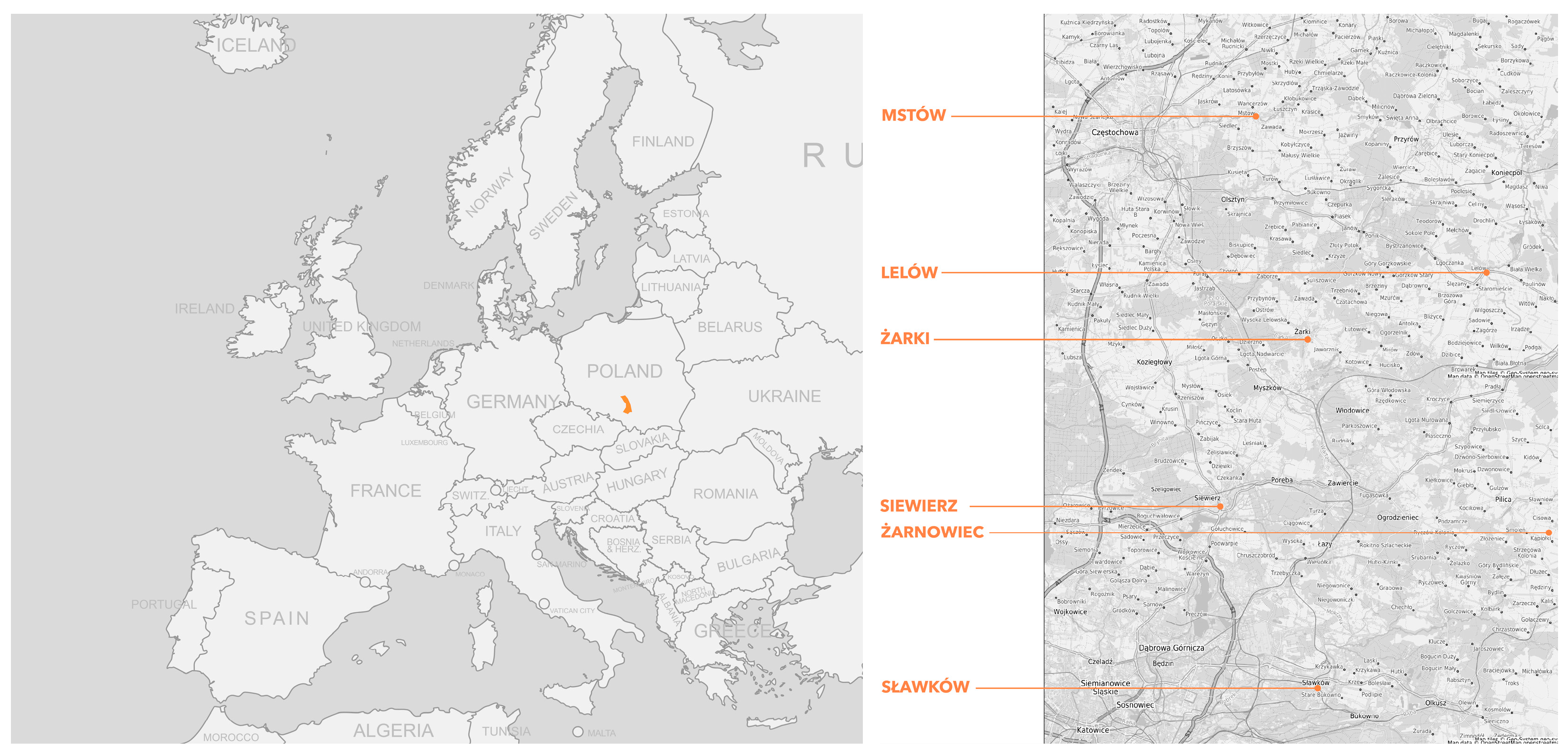
Figure 1. Location of barn districts analyzed in this study: Lelów (Lelow), Mstów (Mstow), Siewierz, Sławków (Slawkow), and Żarki (Zarki). (Left): Poland with the boundaries of the Kraków-Częstochowa Upland indicated. (Right): Distribution of representative barn districts in selected towns within the Upland, characterized by historical and cultural significance. Source: Authors’ study.
Sustainability 17 07166 g001
Figure 2. Summary of photographs from the barn districts included in this study (December 2024): Lelów (Lelow), Mstów (Mstow), Siewierz, Sławków (Slawkow), and Żarki (Zarki). Source: Authors’ study.
Sustainability 17 07166 g002
Figure 3. Comparative analysis of barn district locations across all case study towns: Żarki (Zarki), Mstów (Mstow), Siewierz, Lelów (Lelow), Sławków (Slawkow), Żarnowiec (Zarnowiec). Left: contemporary urban structure with the location of the barn district marked; middle: close-up of the barn district (2024); right: archival map (1973–1988) showing the historical extent of the barn district marked “std.” Source: Authors’ compilation based on Geoportal ORSIP and historical military topographic maps.
Sustainability 17 07166 g003
Figure 4. Transformation diagram illustrating the sequential evolution from a wooden barn to a stone barn. The process includes initial timber construction, destruction by fire, reuse of recovered materials, and reconstruction in stone. Arrows indicate chronological progression. Source: Authors.
Sustainability 17 07166 g004
Figure 5. Żarki, archival photograph (1970s–1980s). Author unknown. Source: Wojciech Mszyca, private archive.
Sustainability 17 07166 g005
Figure 6. Żarki, fragment of a former well (1970s). Author: Zbigniew Zalewski. Source: Wojciech Mszyca, private archive.
Sustainability 17 07166 g006
Figure 7. Barns in Żarki (December 2024). Source: Authors.
Sustainability 17 07166 g007
Figure 8. Barns in Żarki, view from the north side of the complex (December 2024). Source: Authors.
Sustainability 17 07166 g008
Figure 9. Barns in Mstów, archival photograph (1970s–1980s). Source: Municipal Cultural Center in Mstów.
Sustainability 17 07166 g009
Figure 10. Remnants of the stone barn district in Mstów (December 2024). Source: Authors.
Sustainability 17 07166 g010
Figure 11. Remnants of the only preserved wooden barn of the barn district in Mstów, (December 2024). Source: Authors.
Sustainability 17 07166 g011
Figure 12. Reconstruction plan of barn districts along Wąska Street (Waska Street) in Sławków (Slawkow). Archival drawing prepared by the Tarnów (Tarnow) Branch of the Voivodeship Design Services Team (Wojewódzki Zespół Usług Projektowych Oddział w Tarnowie), designed by Zygmunt Marzec-Spieszny. Map dated 9 August 1974 (drawing no. A5k/66), with handwritten annotations added in 1976. Source: Center for Environmental and Cultural Education, Municipal Cultural Center in Sławków.
Sustainability 17 07166 g012
Figure 13. Sławków, barn on the slope near the so-called “Stoky,” with a basement. Located outside the compact barn district, near the Biała Przemsza River (1960s–1970s). Source: Center for Environmental and Cultural Education, Municipal Cultural Center in Sławków.
Sustainability 17 07166 g013
Figure 14. Sławków, so-called small barns at the end of present-day Siewierska Street, toward the outskirts of town (1960s). Source: Center for Environmental and Cultural Education, Municipal Cultural Center in Sławków.
Sustainability 17 07166 g014
Figure 15. Barn district in Sławków, distant view (December 2024). Source: Authors.
Sustainability 17 07166 g015
Figure 16. Barn district in Sławków, close-up frontal view showing gate opening and ventilation features in brickwork (December 2024). Source: Authors.
Sustainability 17 07166 g016
Figure 17. Barns in Siewierz, view showing gate openings and ventilation features in brickwork (December 2024). Source: Authors.
Sustainability 17 07166 g017
Figure 18. Barns in Siewierz, alternative perspective showing similar architectural features in brickwork (December 2024). Source: Authors.
Sustainability 17 07166 g018
Figure 19. Barns in Siewierz, wooden structural details (December 2024). Source: Authors.
Sustainability 17 07166 g019
Figure 20. Barns in Żarki with local residents (1970s–1980s). Source: Wojciech Mszyca, private archive, author unknown.
Sustainability 17 07166 g020
Figure 21. Urban layouts: Żarki, Mstów, Siewierz, Lelów, Sławków. Source: Authors’ study.
Sustainability 17 07166 g021
Figure 22. Remains of a wooden barn in Mstów (December 2024). Source: Authors.
Sustainability 17 07166 g022
Figure 23. Wooden gate opening in a barn in Lelów (December 2024). Source: Authors.
Sustainability 17 07166 g023
Figure 24. Remains of the interior of a barn in Siewierz. Source: Authors’ study (December 2024).
Sustainability 17 07166 g024
Figure 25. Sławków, barn wall showing later brick and mixed-material infills (December 2024). Source: Authors.
Sustainability 17 07166 g025
Figure 26. Inventory of typologies of spatial arrangements. Source: Authors’ study.
Sustainability 17 07166 g026
Figure 27. Barn wall in Żarki with features; irregular limestone masonry and fully brick-framed gateway (April 2024). Source: Authors’ study.
Sustainability 17 07166 g027
Figure 28. Trading activity in the barn district, Żarki (April 2024). Source: Authors’ study.
Sustainability 17 07166 g028
Figure 29. Local market in the barn district, Żarki (April 2024). Source: Authors’ study.
Sustainability 17 07166 g029
Figure 30. Active use of barn space for commerce, Żarki (April 2024). Source: Authors’ study.
Sustainability 17 07166 g030
Figure 31. Variety of goods sold at the barn district market, Żarki (April 2024). Source: Authors’ study.
Sustainability 17 07166 g031
Figure 32. Żarki—“Is, Will Be.” (Left): Current view from the southwestern corner of the former barn district, showing the preserved structures and their relation to the urban context. (Right): Visualization of the proposed public square, emphasizing the spatial integration of historic barn buildings into the contemporary urban fabric. Source: [73].
Sustainability 17 07166 g032
Figure 33. Mstów—“From Memory to Vision.” (Left): Archival photograph of the barn district taken in 1960, showing its original spatial coherence (photo courtesy of T. Wilczyński). (Right): Design visualization illustrating the proposed revitalization of the site through cultural and landscape-oriented reuse. Source: [76].
Sustainability 17 07166 g033
Figure 34. Mstów—axonometric visualization of the barn district redevelopment strategy. Four-layer axonometric sequence showing (1) designed buildings reflecting historical form and materials; (2) proposed pedestrian and vehicular circulation; (3) preserved barn relics and historical routes; and (4) the integrated project retaining the historic urban layout. Prepared by A. Nowicka. Source: [76].
Sustainability 17 07166 g034
Figure 35. Żarki—axonometric conceptual design with integration of historical barns. Axonometric visualization of the proposed redevelopment strategy, highlighting preserved historic barns (in orange) and newly designed complementary structures (in white). The project respects the historic street layout and spatial rhythm of the original ensemble, integrating new functions while maintaining the continuity of historical circulation routes. Prepared by A. Wancel. Source: [73].
Sustainability 17 07166 g035
Table 1. Comparison of morphological and functional transformations. Source: Authors’ elaboration.
LocationUrban LayoutGraphic SchemeNumber of Preserved BuildingsCurrent UseProximity to Central AreaTransport Accessibility
LelówIrregular layoutSustainability 17 07166 i001A few wooden barns; severely degraded; layout largely illegiblePresumed to be abandonedOutskirts
of village
Limited; barns accessed via overgrown, unpaved side road
MstówIrregular layoutSustainability 17 07166 i002Remains of single walls and foundations; layout lostAbandoned structuresOutskirts
of village
Limited; barns situated on a hill, accessed via unpaved rural path
SiewierzRegular layoutSustainability 17 07166 i003About a dozen buildings without roofs; preserved linear arrangementAbandoned structuresTown outskirtsAccessible by car; barns located along a paved road
SławkówRegular layoutSustainability 17 07166 i004About a dozen buildings; dispersed and modified ensembleAbandoned structuresTown outskirtsAccessible by car; barns located along a paved road
ŻarkiRegular layoutSustainability 17 07166 i005Approx. 42 structures; well-preserved ensemblePartially abandoned; some reused as warehouses or for market tradeClose to town centerEasily accessible by car; barns located along a main road
ŻarnowiecIrregular layoutNo confirmed dataOnly 2 wooden barns preserved; the complex has mostly disappearedAbandoned structuresOutskirts
of village
No reliable data
Table 2. Construction types, materials used, and preservation status across barn districts. Source: authors’ study.
LocationTechnical
Condition
Construction
Material
Building
Form
Heritage
Value
Development
Potential
LelówModerate; several wooden barns preserved; some overgrown and difficult to access.TimberRectangular solid volumes with gable roofsSignificant element of the historical landscape due to the presence of surviving wooden structures.Noticeable potential; possible adaptation for educational or tourism-related uses.
MstówPoor; mostly foundations and gable-end wall fragments remain.Timber, Jurassic limestoneRectangular solid volumes with gable roofsImportant component of the cultural landscape despite severe degradation.High potential; possible revitalization and partial historical reconstruction.
SiewierzModerate; preserved structures lack roofs; walls in fair to poor condition.Mainly brick with limestone elementsRectangular solid volumes with gable roofsHistorically valuable complex with a well-preserved spatial layout.High potential; feasible revitalization and functional adaptation.
SławkówModerate; brick buildings preserved with some limestone elements; visible damage.Mainly brick with limestone elementsRectangular solid volumes with gable roofs Valuable landscape feature; significant preserved architectural details.High potential; tourism and commercial functions could be introduced.
ŻarkiGood; most barns are in use or partially used, roofs preserved, ongoing maintenance.Jurassic limestone, brick used for reinforcementRectangular solid volumes with gable roofsVery important and well-preserved architectural complex with high historical and aesthetic values.Very high potential; currently partially used as a seasonal market. Further adaptation for commercial, residential, educational, and cultural use is viable.
ŻarnowiecPoor; only fragments of timber structures remain, heavily degraded.TimberRectangular solid volumes with gable roofsComponent of the cultural landscape; retains historical value despite major damage.Noticeable potential; suitable for educational and interpretive purposes.
Table 3. Comparison of expert and resident perspectives on the perception of barn districts. Source: Authors’ study.
AspectResidentsExperts
Perception
of historical value
Older generations recognize historical value and link barns with local traditions; younger people often see them as obsolete structures.High appreciation of historical value; barn districts seen as testimonies to past urban and economic structures.
Technical condition
and renovation needs
Opinions are divided: some support preservation, others favor demolition or radical redevelopment.Preserving historic fabric is essential; investment decisions should be based on technical condition and location.
Usability
potential
Lack of a coherent vision for future use; residents often cite limited adaptability and low functionality.Recognized adaptive reuse potential for cultural, educational, tourism, and mixed-use purposes; flexibility often limited by conservation regulations.
Significance
for local identity
Barns are seen as important for identity and memory by older residents; younger residents show less interest in preservation or reuse.Barns are considered key elements of cultural and urban heritage that can foster place-based identity.
Perception
by outsiders
Some residents note that outsiders find barns unique and architecturally distinct compared to modern buildings.Acknowledged for their unique architectural and landscape value; seen as underused cultural and tourism assets.
Investment
challenges
Limited awareness of formal protection needs and investment challenges.Revitalization requires compliance with heritage guidelines; economic barriers and lack of investment models; public–private partnerships and municipal strategies are needed.
Disclaimer/Publisher’s Note: The statements, opinions and data contained in all publications are solely those of the individual author(s) and contributor(s) and not of MDPI and/or the editor(s). MDPI and/or the editor(s) disclaim responsibility for any injury to people or property resulting from any ideas, methods, instructions or products referred to in the content.