Review

Thematic and Bibliometric Review of Remote Sensing and Geographic Information System-Based Flood Disaster Studies in South Asia During 2004–2024

by
Jathun Arachchige Thilini Madushani
1,2,
Neel Chaminda Withanage
1,3,
Prabuddh Kumar Mishra
4,
Gowhar Meraj
5,
Caxton Griffith Kibebe
6,7 and
Pankaj Kumar
8,*
1
Department of Geography, Faculty of Humanities and Social Sciences, University of Ruhuna, Matara 81000, Sri Lanka
2
School of Geomatics, Liaoning Technical University, No. 47, Zhonghua Rd, Xihe District, Fuxin 123000, China
3
School of Geographical Sciences, Southwest University, Bebei District, Chongqing 400715, China
4
Department of Geography, Shivaji College, University of Delhi, New Delhi 110027, India
5
Department of Ecosystem Studies, Graduate School of Agricultural and Life Sciences, The University of Tokyo, Tokyo 113-8654, Japan
6
School of Environmental Science and Engineering, Liaoning Technical University, No. 47, Zhonghua Rd, Xihe District, Fuxin 123000, China
7
School of Mechanical Engineering, Kenya Institute of Highways and Building Technology, P.O. Box 57511, Nairobi 0200, Kenya
8
Institute for Global Environmental Strategies, Hayama 240-0115, Japan
*
Author to whom correspondence should be addressed.
Sustainability 2025, 17(1), 217; https://doi.org/10.3390/su17010217
Submission received: 18 November 2024 / Revised: 25 December 2024 / Accepted: 26 December 2024 / Published: 31 December 2024

Abstract

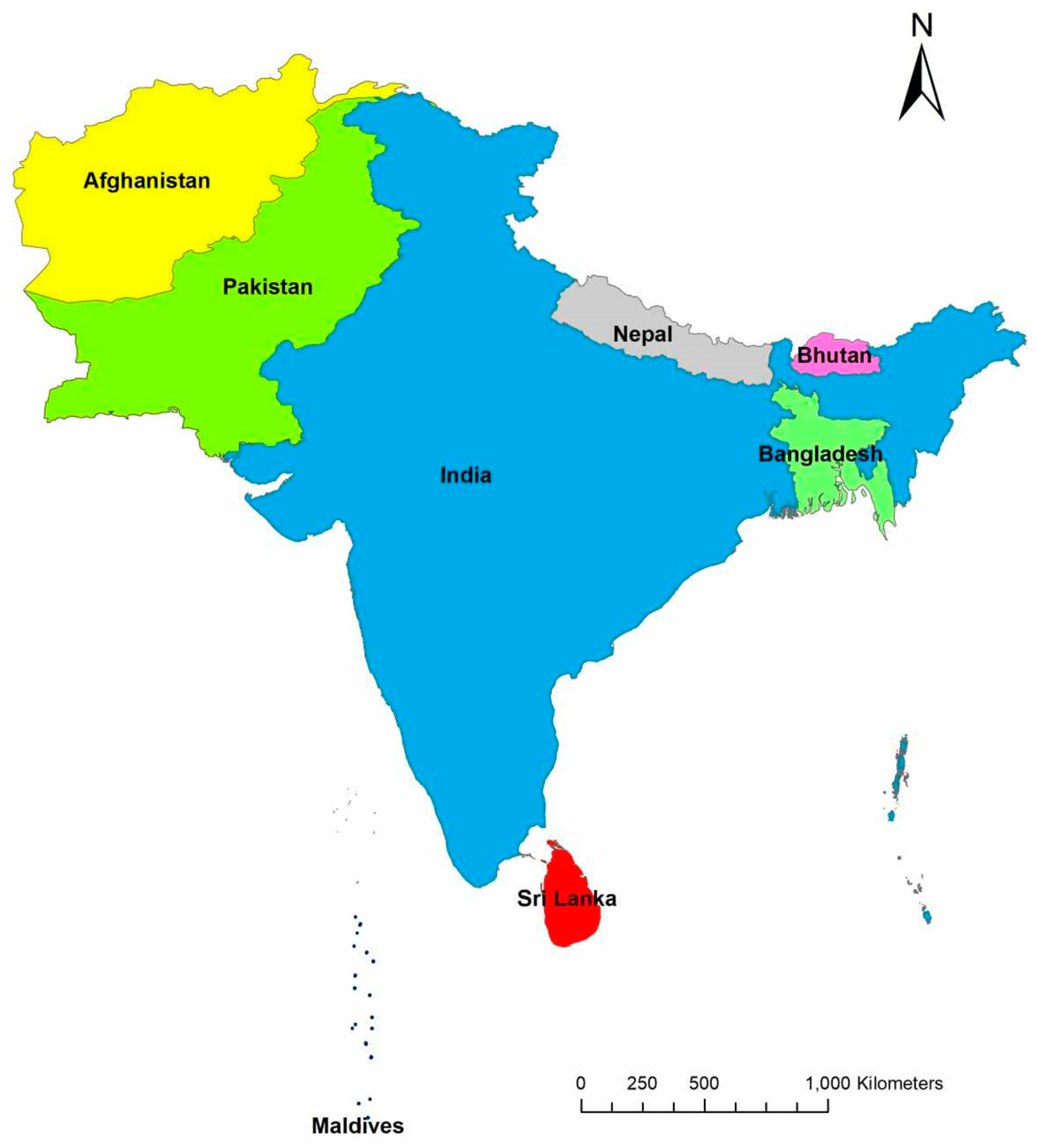
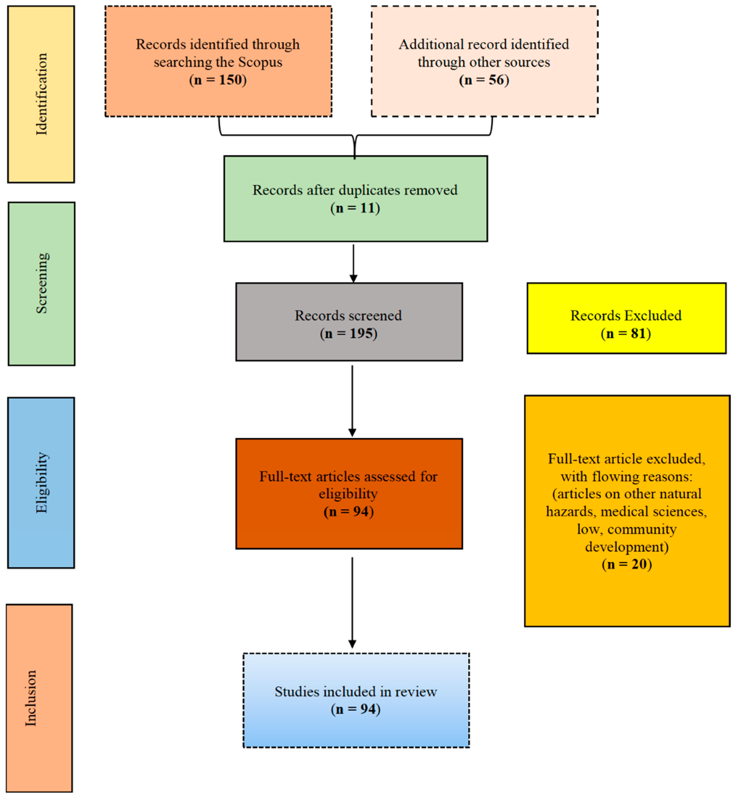
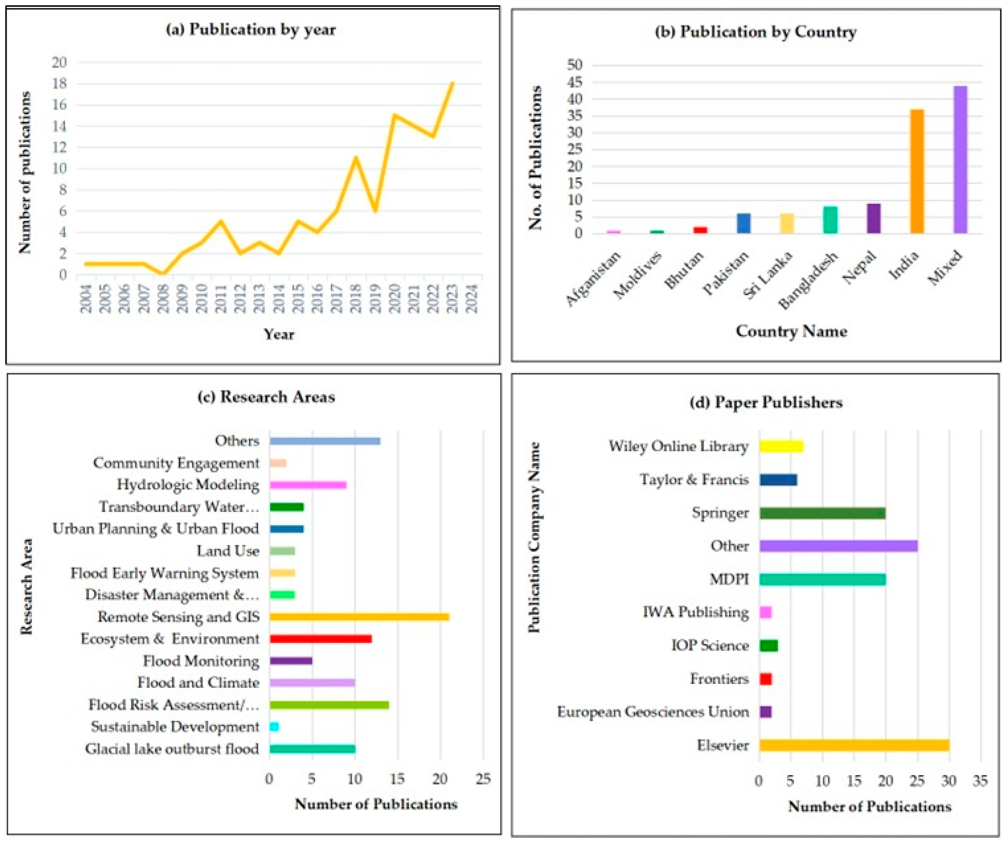
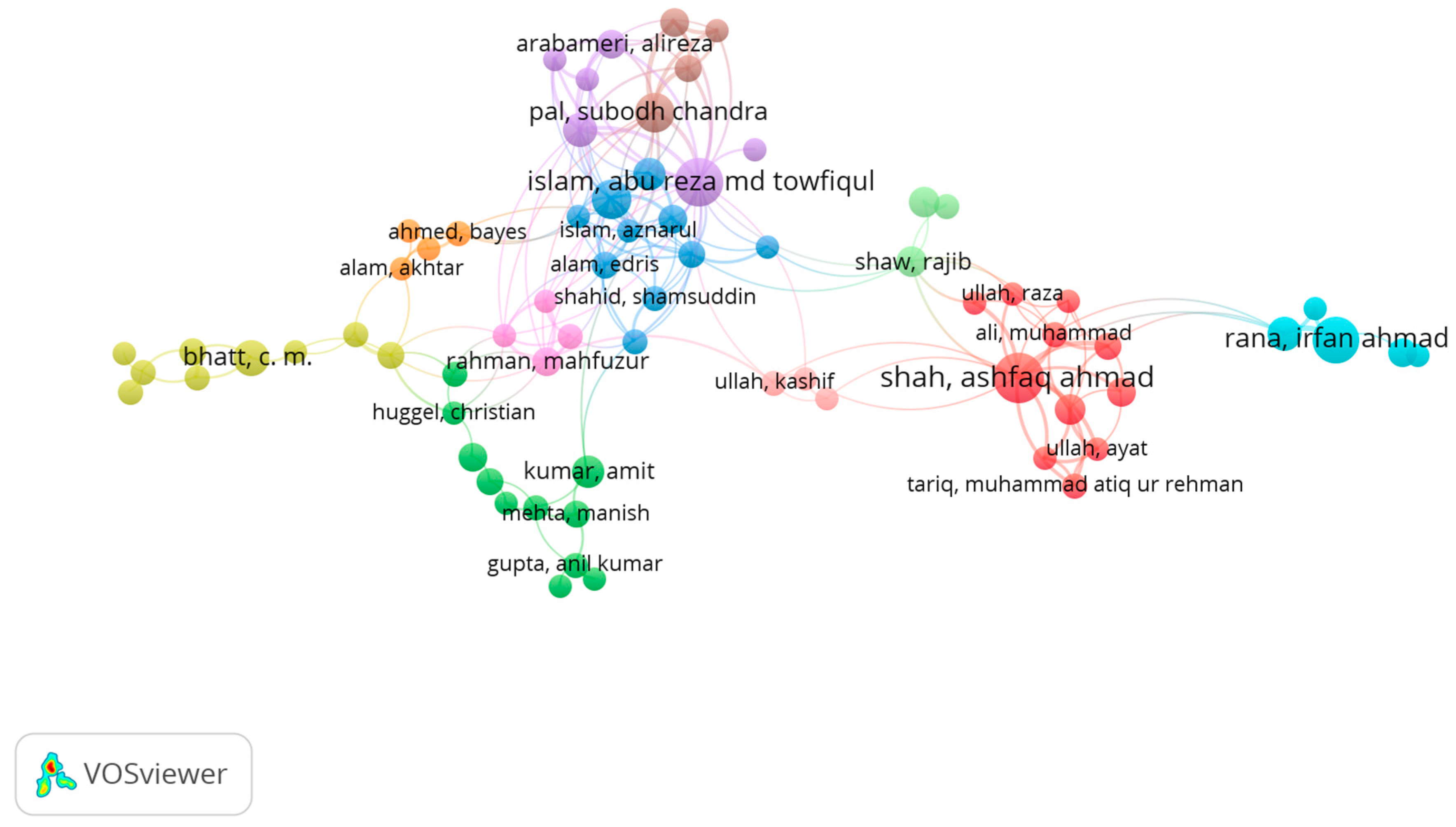
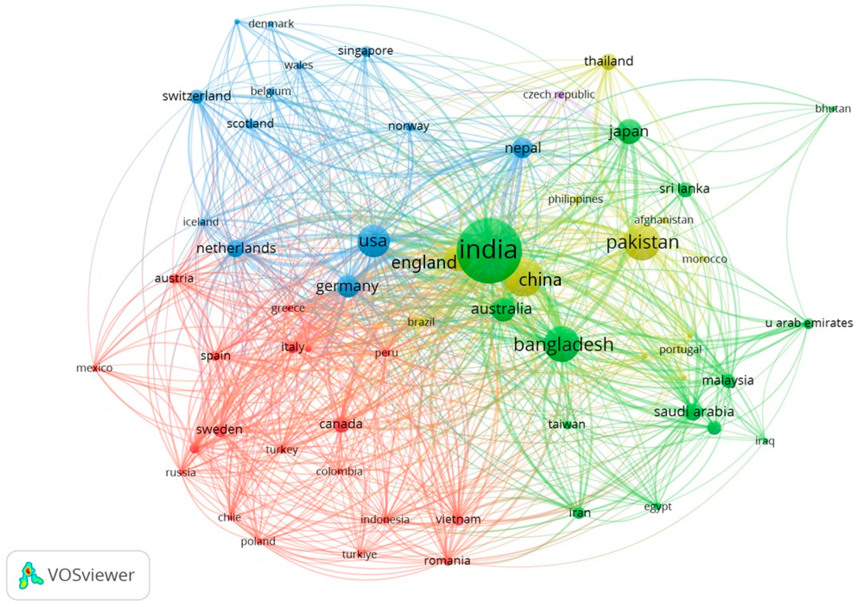
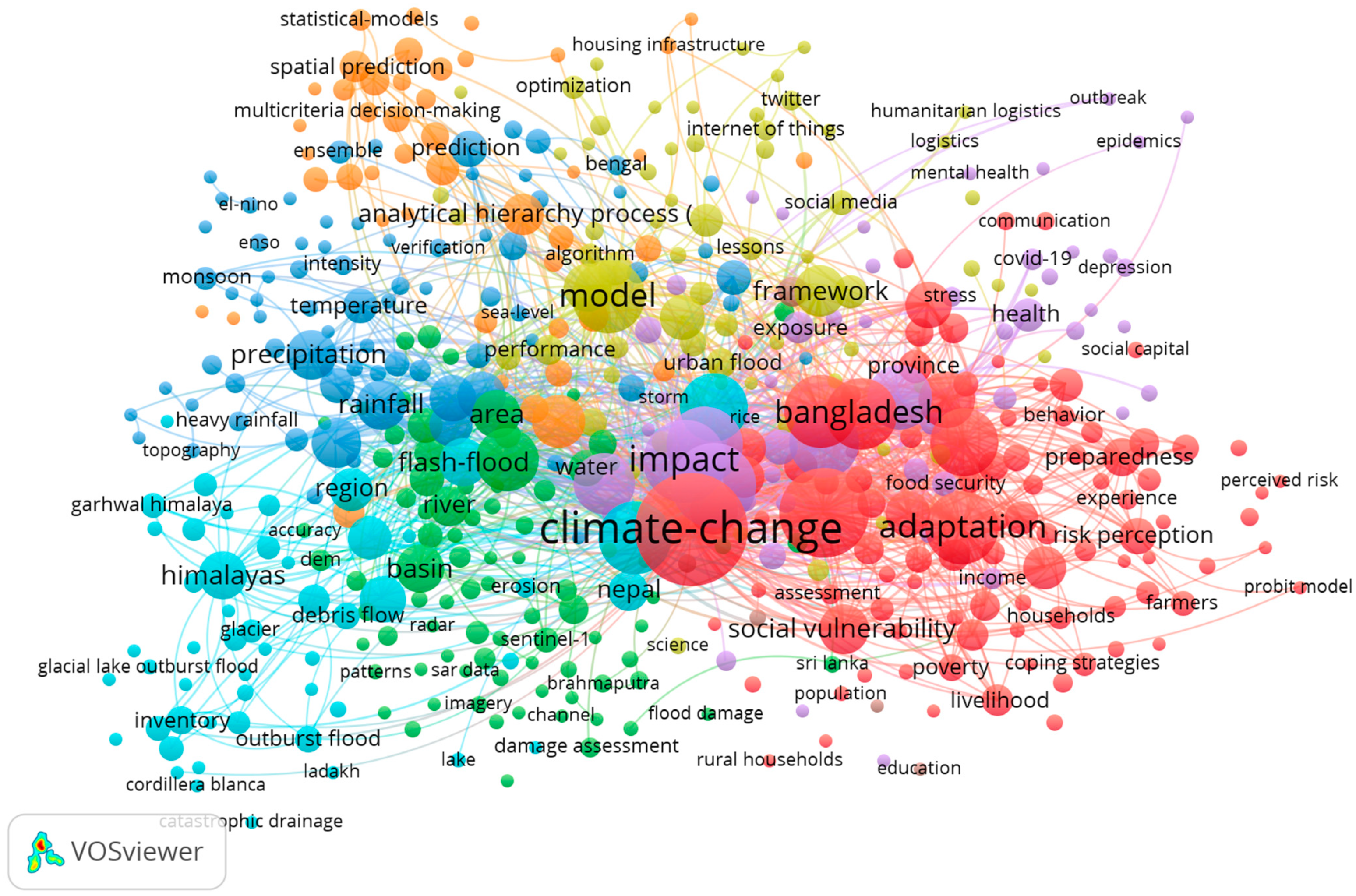
Floods have catastrophic effects worldwide, particularly in monsoonal Asia. This systematic review investigates the literature from the past two decades, focusing on the use of remote sensing (RS), Geographic Information Systems (GISs), and technologies for flood disaster management in South Asia, and addresses the urgent need for effective strategies in the face of escalating flood disasters. This study emphasizes the importance of tailored GIS- and RS-based flood disaster studies inspired by diverse research, particularly in India, Pakistan, Bangladesh, Sri Lanka, Nepal, Bhutan, Afghanistan, and the Maldives. Our dataset comprises 94 research articles from Google Scholar, Scopus, and ScienceDirect. The analysis revealed an upward trend after 2014, with a peak in 2023 for publications on flood-related topics, primarily within the scope of RS and GIS, flood-risk monitoring, and flood-risk assessment. Keyword analysis using VOSviewer revealed that out of 6402, the most used keyword was “climate change”, with 360 occurrences. Bibliometric analysis shows that 1104 authors from 52 countries meet the five minimum document requirements. Indian and Pakistani researchers published the most number of papers, whereas Elsevier, Springer, and MDPI were the three largest publishers. Thematic analysis has identified several major research areas, including flood risk assessment, flood monitoring, early flood warning, RS and GIS, hydrological modeling, and urban planning. RS and GIS technologies have been shown to have transformative effects on early detection, accurate mapping, vulnerability assessment, decision support, community engagement, and cross-border collaboration. Future research directions include integrating advanced technologies, fine-tuning spatial resolution, multisensor data fusion, social–environmental integration, climate change adaptation strategies, community-centric early warning systems, policy integration, ethics and privacy protocols, and capacity-building initiatives. This systematic review provides extensive knowledge and offers valuable insights to help researchers, policymakers, practitioners, and communities address the intricate problems of flood management in the dynamic landscapes of South Asia.
Keywords: GIS; remote sensing; flood disaster; South Asia; flood risk assessment; flood monitoring; hydrological modeling GIS; remote sensing; flood disaster; South Asia; flood risk assessment; flood monitoring; hydrological modeling