1. Introduction
The global population continues to grow, and is expected to reach 9.8 billion people by 2050 and 11.2 billion people by 2100 [
1]. According to the United Nations, more than half of the global population lives in urban areas, and this is expected to reach 75% in the next fifty years [
1]. This inbound migration from rural areas is creating enormous pressure at the edges of cities, making urban–rural fringes and peri-urban areas amongst the fastest-changing landscapes in Europe. The problem is that most planning policies seem to be inadequate to deal with this rapid transformation [
2].
Management and governance processes are fragmented, and it is rare to find any vehicle to integrate them, as, over decades, cities have become more and more isolated from their hinterlands and dependent on global economies. However, as the future proofing of regions becomes a more and more significant political priority, it is clear that the challenges of supplying food and water as well as mitigating climate change through a number of strategies, including biomass production and carbon sequestration, require a more holistic approach. As indicated by Driessen et al. [
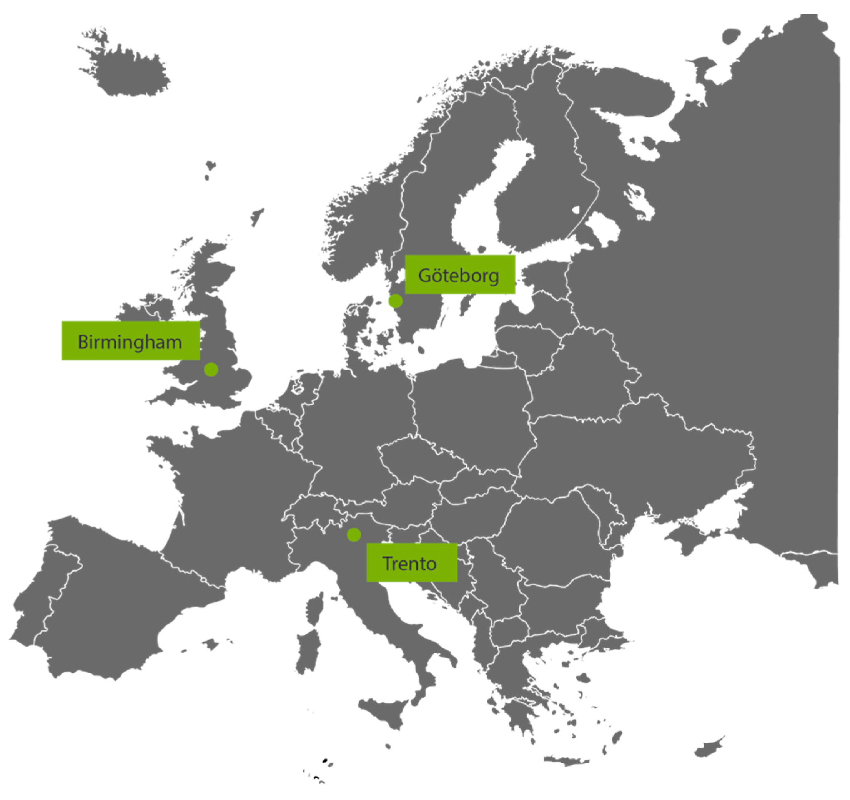
3], there is a lack of understanding as to how and when environmental governance differentiates from one mode to another and why this is happening. The System and sustainable Approach to virTuous interaction of Urban and Rural LaNdscapes (SATURN) project is exploring how this might be achieved based on a collaboration between three cities of very different scales and contexts, namely Gothenburg in western Sweden, Trento in northern Italy, and Birmingham in the middle of the United Kingdom (
Figure 1).
SATURN focuses on the relationship among cities, food growing, and the rural landscape. This paper outlines the progress made to generate holistic strategic frameworks for landscape management, development, and transformation, thus engaging urban populations in urban and peri-urban landscapes and local farming.
2. Methodology
This paper forms part of the broader SATURN project, looking at the governance of nature and landscapes. Based on the concept that the human approach to land management is determined by ownership and often focused on the interests of a single sector and that this approach results in fragmented landscape, isolated governance, and minimum public engagement, the project aims to develop a framework to help resolve such issues.
The consortium: The European Institute of Innovation and Technology (EIT)Climate-KIC SATURN project requires a minimum of three European countries to be co-funded by the European Institute of Innovation and Technology (EIT). The three countries involved (Italy (IT), the United Kingdom (UK), and Sweden (SW)) formed a consortium and were awarded funds in 2018. The successful team that forms the consortium represents southern, western and northern Europe. SATURN is co-funded by EIT and Climate-KIC, as well as the cities and institutions forming the consortium from November 2018 to December 2021. Its aim is to create new methodologies and to support exchange of knowledge between cities, public and private organizations in matters related to nature, climate emergency, and governance, as well as to recognize the capacity of the landscape to contribute to global challenges. Each of the three cities forming the consortium have already taken significant steps towards trying to create a more sustainable future and have expressed their interest in undertaking the SATURN project in order to find further innovative ways and collaboration techniques. The strong and continuous collaboration of the three core cities is attracting other cities to join the project, and plans are in place for additional ‘satellite cities’ to join the existing project to expand the network. There are also plans for an extension of the lifetime of the project following the successful completion of the initial phase.
The case studies: To undertake this work, SATURN focuses on the relationships among cities, food growing, and the rural landscape through the development of case studies at each hub. Aligning with the goals of the Sustainable Land Use theme of EIT Climate-KIC, its underlying assumption is that a comprehensive vision supported by a cross-sectoral approach is needed to support cities to create resilient urban–rural networks. It anticipates that through the project, each city–region will absorb this new knowledge into their local governance structures. The real-life case studies have distinctly different physical, social, economic, and cultural conditions within a varied range of existing spatial aspirations and contexts. A stakeholder mapping and engagement process is developed through workshops, field visits, and extensive communications, including regular meetings across the consortium. The stakeholder mapping and analysis workshops aim to produce a range of tools to improve participants’ skills and identify key actors for the participating cities. A hybrid method between existing Climate-KIC mapping tools and tools developed by the consortium was utilized, and suggestions were made as to how these can be improved. A series of visioning workshops were designed and tested across the three regions, aiming at supporting the creation of overarching spatial visions for each area. The stakeholder engagement process will focus on both upscaling the consortium methods, but, most importantly, on providing efficient ways for key actors of each area, such as cities and institutions, to improve their knowledge on their own stakeholders.
This paper presents preliminary findings from the first and a half of the project. So far, around 25 external organizations and public institutions have been engaged across the three hubs. This number is expected to rise at least by one third by the completion of the project. Progress reports, papers, videos, newsletters, and proposed frameworks are being produced and disseminated.
SATURN is underpinned by a three-tiered, interrelated approach. The first tier aims to establish a methodology to generate a holistic spatial vision that can be applied at any scale and in any area to fundamentally challenge the current fragmented approach. The second tier, utilizing an ecosystem service methodology and the mapping of natural capital, aims to create a set of tools to evaluate existing and future potential of the interfaces between urban and rural landscapes to make evident the wider benefits of the entire landscape. This second tier then identifies all the connected and inter-dependent stakeholders, some of which will be already known, but many will be new, as they have been hidden from view. It is only when one considers this hidden value of landscapes that this reveals those stakeholders who could or do benefit from those values. The third tier adopts a system modelling/assessment approach to convert the newly acquired knowledge on stakeholders into the potential that this presents to grow organisational capacity. This capacity-building methodology can then link these actors directly into the developing circular economy. In undertaking these three simple steps, they challenge the current fragmented view through visioning; they highlight its entire value and its underlying beneficiaries and players. The third step starts to lock these changes into revised local strategies and governance arrangements.
The success of SATURN will be demonstrated by an evaluation of any policy changes introduced by the participatory cities in terms of landscape, food production, biodiversity, governance, institutional behaviour, and progress towards carbon neutrality. These criteria may need to be judged in the long term beyond the length of the initial three-year period.
3. Landscape Fragmentation and Management Strategies in Connection to Climate Emergency
The landscape is becoming more significant. It is championed by the European Landscape Convention, signed by 38 nation states (ELC) [
4], and it is clear, as Nefs [
5] mentions, that “soft factors, like landscape, heritage, and quality of life, are gaining importance on the policy agenda.” However, there is growing evidence that rural and peri-urban landscapes are strongly affected by the climate emergency, but there is limited evidence of the development of new ideas and policies to deal with the crisis. Rural and urban surroundings are vulnerable because they fall outside the powerbase and economic sphere of the cities [
6]. The greater awareness of sustainable solutions, such as resource recovery and reuse of materials, is very welcome, but it is necessary as a matter of urgency to address the bigger picture and develop policies, regulatory frameworks, and strategies to deal with the value of the land, issues of spatial justice, and the interface and potential co-dependency between the cities and their territories for the future. The little implementation to date, especially in rural and peri-urban areas [
7], demonstrates a need for action. This has become even more pressing in a post-COVID19 world, as we are being forced to reevaluate how and where we live.
Venter et al. reveal that dilemmas regarding green justice are quite significant [
8], leaving questions on how a sustainable future might look. Even though issues such as climate adaptation and mitigation are gaining increasing recognition, the legislation in place is not as up to date as it should be [
9] considering the significance of the environmental challenges. The procurement processes, policies, and regulations in relation to the climate strategies and the landscape often follow ‘conventional frameworks’ instead of new methods that will allow for new approaches to arise and embed ideas and policy in relation to climate adaptation and mitigation in governmental strategies [
10]. Gordon et al. [
11] suggests that “long-term strategic planning” should be developed in order to support land-use decision-making on a regional level, and they explain that in the greater Melbourne region, the creation of ‘zones’ that allow and prohibit development, such as the conversion of rural and farming land to residential areas, is examined. The provision of new alternative frameworks that embed sustainability, environmental instability, quality of space, and economic and social benefits requires large-scale policies and multidisciplinary work [
12].
SATURN examines similar questions on the European scale, investigating the process of decision-making as well as the role of multidisciplinary teams in addressing the way in which rural and peri-urban landscapes are managed.
4. The Case of SATURN
SATURN’s objective is to create tools and approaches to facilitate new ways of decision-making and working within cities and regions. Each of the partner cities has established case studies to examine a number of related topics, including the value a landscape-led spatial vision has in challenging perceptions and reinvigorating the territories, the establishment of financially sustainable initiatives that bring together public and private sectors to create resilient and sustainable regions, the development of new policies, and an examination of a range of local and national food-growing initiatives to reintroduce and promote the production of organic agricultural products. An ongoing series of community engagement exercises and consortium events are being undertaken to build up comprehensive and flexible tools and frameworks to help cities implement spatial visioning and food growing, as well as to improve their decision-making strategies in relation to the climate crisis. These are interdisciplinary in nature and can operate at a range of scales. They are based on the conception that landscape is not just a physical object, but is integral to the culture and identity of communities. The case studies are being developed simultaneously on different scales across Europe and focus on both the development of spatial visions (Birmingham) and the governance management issue of small-scale model farms (Trento, Gothenburg).
The transformations that our metropolitan landscapes are going through have a significant impact in regional economics, resulting in “policies that are degrading the living world on a scale that threatens all of our futures” [
11]. Clearly establishing the need for cross-boundary working, the case studies in Birmingham are being undertaken in the context of the West Midlands National Park (WMNP) (the West Midlands National Park (WMNP) proposal developed by the (Crtitical Artistic Thinking in Design) (CATiD) research centre at Birmingham City University in 2018 offers a unique approach for the area, identifying resilient ways to re-discover a hidden landscape when supporting the social, historic, and economic characteristics of the region) in order to investigate how it is possible to “re-conceptualise and transform regions by realising new, holistic and integrated approaches to urban and rural development and change, to underpin strategic regional design decisions and increase awareness of the capacity of landscape to help towards resilience and climate emergency” [
13]. Addressing “an evident deep-seated need for new ideas and a new approach, particularly in the context of the deepening climate emergency and food security”, it is felt “that this will be instrumental in transforming the identity and ambitions of regions in a way that prioritises quality of life, environment, and landscape as economic investments, engendering civic pride and hope for future generations” [
13].
4.1. Landscape-Led Spatial Visions: The Urban Farming and Growing Network in the Birmingham Case Study
Many individual food-growing initiatives operate in the city of Birmingham and across the whole conurbation. The case study presented here (which is one of the three case studies selected by the Birmingham hub) aims to establish a spatial vision to help bring synergies and political clout amongst these different food growing networks. Working in collaboration with the Social Farms and Gardens network, Naturally Birmingham (a National Lottery Heritage funded project) and other small farming projects, the case study is developing a narrative to help broaden the appeal of urban agriculture, change local perceptions about the quality of food from the region, and help existing organisations to re-establish local food-growing traditions. The investigation is contributing to the development of the West Midlands National Park (WMNP) by focusing on food, soil, and water security in the UK. The case study considers the national and international position of urban agriculture as part of the response to the climate emergency and biodiversity loss as well as the significance of changing the way of local food production. The critical part of this program for Birmingham is to explore, identify, trial and test (if possible), and contribute to the making of proposals for a national standard methodology for health benefit assessment. This would build the economic case for change and political re-prioritisation.
Stakeholder Engagement
As part of the identification and trial phase, the Birmingham Hub has developed a stakeholder engagement and capacity-building methodology, consisting of a series of activities and visual tools, to be used by the different food-growing teams and organizations in order to allow them to create a broader vision for their projects and the city. During a series of workshops, the participants brainstorm and discuss their challenges and map their stakeholders. The work evolves with in-depth analysis of the stakeholders while building up their profile and needs in relation to the participants’ project. Putting the specific methodology into practice, the SATURN consortium aims to evaluate the significance of the tools developed and identify how successful such a method is in providing support to stakeholders. The first phase of the activity, completed by the Birmingham stakeholders in the food-growing case study, demonstrated the value of the tool to create better communication between the teams and to reveal hidden aspects or needs of a stakeholder that the participants had not been aware of, allowing them to improve or adjust their proposal/project. Acknowledging that these are only the preliminary findings and that the stakeholder engagement tool is still being developed, the initial indications demonstrate a positive outcome with regards to visioning and future planning.
Initial findings across the SATURN consortium based on the partners’ stakeholder engagement workshops also demonstrate clear benefits; for example, even though some of the teams have been working together for a long time, it became clear that their aspirations were not always aligned. In addition, the initial spatial visioning exercises have helped to clarify the potential spatial opportunities to inform future work.
4.2. Integrating Sustainability in the Policy Agenda—Trento
The Trentino SATURN hub focuses on three complementary study areas that form an integrated system. It has a number of ambitions: to analyse and support initiatives in order to relocate the production and distribution of agricultural goods locally, to enable the reuse of vacated farmland in order to create new employment opportunities through innovative social enterprises, new production models, and the development of agriculture processes, and to increase the multi-functionality of the peri-urban landscape. The process includes an exhaustive mapping of urban, rural, and forest ecosystems, focusing on the relations among biodiversity conservation, land recovery, food production, and resources. This is set within a broader context considering the connections between different ecosystems. Engagement strategies include focusing on social inclusion, creating community gardens, organising educational visits to farms, and programmes for schools.
It is envisaged that business opportunities will arise at micro and individual scales for women, youth, or disadvantaged categories in food production, transformation, and trade. In addition, the rising interest of citizens and consumers in sustainable landscape practices and food supply is fostering the conversion of many producers to organic methods, supported by nongovernmental organizations (NGOs), private/public partnerships, and a strong network of cooperative businesses. The level of public engagement is illustrated in a number of examples and supported by existing forms of shared landscape governance such as described in Gretter et al. (2018) [
14]. It has led to the recent establishment of a ’Biodistretto’ (organic district) (The ’Biodistretto’ is an association of public administrations, producers, NGOs, and enterprises of a specific territory committed to promote local products, organic farming methods and short supply chains. It is officially recognized by the Italian law 205 of 27 December 2017) in the city of Trento and to the development of processes and policies to ban the use of non-organic methods in the provincial territory. In another case, Rotaliana, another Trento case study, has recently formalised strategic documents relating to planning, infrastructure, and ecological connectivity, but these have not yet been implemented. The delay has resulted in a series of disconnected initiatives being taken by local inhabitants and a challenge from residents and local farmers to the decision-making process of the territorial policies.
To understand the ecological, social, and economic history and dynamics that have influenced the current landscape in the Municipality of Pergine Valsugana, the abandoned or poorly governed agroforest territories in the municipality have been mapped. The open areas invaded by forest were mapped using ICT (Information and Communication Technologies) tools, such as GIS (Geographic Information System) or aerial images, and, in some cases, through field work and surveys as explored in Tattoni et al. (2017) [
15]. The importance of previous agricultural areas relates to their traditional cultural, social, and landscape value (e.g., dry-stone walls), as well as to their contribution to local biodiversity through ecological connectivity across urban and agricultural areas and forest environments. The municipality is supporting a short-distance value chain of production and has recently launched two initiatives relating to processes to embed carbon neutrality in future development. There are an existing number of national and local initiatives to support this work, including the desire to connect and expand the Natura 2000 sites ( a network of core breeding and resting sites for rare and threatened species, as well as some rare natural habitat types that are protected in their own right; it stretches across all 27 EU countries, both on land and at sea; the aim of the network is to ensure the long-term survival of Europe’s most valuable and threatened species and habitats, listed under both the Birds Directive and the Habitats Directive) and the need to comply with strategic planning laws, such as the ‘Climate and Energy Adaptation Plan’, (PAES in Italian law), a tool to be adopted by every Italian municipality to require development to focus on climate adaptation, reduce energy consumption, and improve water management. PAES contains planning guidelines and governance initiatives to increase landscape resilience and future-proof the territory to climate change. The ’Nutrire Trento’ (Feeding Trento) project aims to identify ideas and create solutions to improve the quality of the food in the city by supporting farmers to adopt more sustainable practices and raise consumer awareness. Farmers have created a match-making platform between producers, suppliers, restaurants, and other businesses to help them directly sell produce at a higher premium to a committed network of stakeholders, and consumers have established campaigns to help change local behaviours. SATURN has established a digital platform to allow people to simultaneously visualize the people and places engaged in the Trento local supply chain, including producers, markets, shops, cooperative purchasing groups, and urban or community vegetable gardens as already investigated by Cantiani and others (2016) [
16]. This mapping activity is being developed together with the adaptation of existing metrics, such as the ‘economy-wide Material Flow Analysis’, and other methods to measure landscape biocapacity, material flows, and territorial metabolism. These metrics and methods have been widely tested on large-scale territorial units, but their application to smaller-scale areas requires more precise and refined data. The Trentino Hub of SATURN is adapting these metrics to fit the specific localities to make these tools available to local administrations and planning officers. This involves reviewing and simplifying data needed on one side and finding ways to geo-reference the numerical data on the other. The combination of the two processes is allowing a more usable tool to be built, which is also strongly connected to the planning processes. The Trentino case studies are developing more effective connectivity between the city and the rural areas by demonstrating the co-dependency of their processes and the reputational, health, and economic value of resilient and local agricultural activities. Further work is to be undertaken to analyse the ecological fluxes related to local food cycles in a more specific way. The mapping of flows and the model structure will be developed together with key stakeholders to collect more precise data and raise awareness on their impact on landscape. The results of the analysis will be used to develop guidelines to support sustainable practices and planning tools. As with the other hubs, Trentino is aiming to establish innovative approaches to connect different disciplines and stakeholders and to find ways to overcome existing barriers to the implementation of sustainable land use models. The SATURN project is facilitating this work by enhancing the existing connections between different disciplinary groups and by offering collaborative environments with local administrations to test the methods and tools.
4.3. Farming Initiatives—Gothenburg
The city of Gothenburg in Sweden aims to develop an ‘ecosystem’ of small-scale opportunities for commercial farmers and citizens that can be replicated, allowing them to develop their own sustainable agriculture businesses and help to recover abandoned plots. This line of work has been chosen as one of Gothenburg’s case studies with regards to the SATURN EIT Climate-KIC project. The experience and knowledge gained by the case study will be presented through a series of handbooks and guides, and it will form part of the SATURN toolbox. The goal behind the creation of a toolbox is to share experiences, engage public and private actors to work with sustainable land use, and further connect to urban and rural landscapes. In order to explore different ways to support urban agriculture, the Gothenburg hub is working on a Model Farm, using leasing and finance methods for small-scale farmers as well as the establishment of a ‘didactic’ hub dedicated to urban agriculture (UA) and education. This top-down and bottom-up approach is a collaboration of four municipalities and the city of Gothenburg in seeking to develop a model for mapping and matchmaking underutilized and abandoned land and buildings to new entrepreneurs who want to scale up their agricultural businesses in the peri-urban and rural landscape. The Model Farm, coordinated by Gothenburg’s first public city farmer, is being developed as a collaboration between the City of Gothenburg and the Region Västra Götaland as a pioneer of urban farming, and is set to play a key role in the integration of sustainable farming practices across the wider region. The model seeks to become a ‘blueprint’ that new farmers can follow, allowing for certain adjustments depending on their location and topography. Daily activities are currently supported by local interns and students, giving them the opportunity to familiarize themselves with agricultural methods and develop a sustainable mindset. The farm applies the most innovative manual and low-tech techniques for sustainable agriculture, including the consideration of plant–soil interplay, the enhancement of carbon sequestration, and circular urban metabolism (bio-char/aquaponic residual sludge materials). A holistic sustainable management of water and biomass resources is applied together with a selection of crops to increase biodiversity. The food produced by the farm is directly consumed in local schools’ canteens and in elderly care homes in the local area, further enhancing the sustainability of the project. The importance of such small-scale experiences lies in the possibility to directly involve different stakeholders around a project enhancing the impact of their actions [
17]. When the need for initial capital and technology remains low or is subsidized, the chance for larger groups to be part of the initiative is greater. However, we must acknowledge that, in small-scale experiences, the dynamic and instability of the structure could lead to the abruption of the process; therefore, a strong vision and strategy must be developed. Land lease contracts connected with financing schemes for young entrepreneurs are structured in order to improve ecosystem services and to offer test beds for farming business models. Small-scale production has a positive contribution to resilience and sustainability of agriculture in urban fringes and, therefore, is highly supported by the scheme. The experiences are collected and valorised in the framework of an incubator dedicated to farmers (called Stadsbruk), which aims to bring together local farmers in a learning hub to spread knowledge and best practices regarding urban agriculture. The farmers are involved in a training process in order to be eligible for leased land from the municipality. This allows for the municipality-owned land to be allocated to already trained farmers, strengthening the potential for positive outcomes of the process. Urban agriculture could bring many benefits to the urban–rural environment, ranging from ecological to social elements [
18,
19]; therefore, this initiative aims to identify and test the model in order to help a new generation of farmers to scale their businesses in rural landscapes.
5. Discussion: The Benefits to Date
The three hubs aim to support and improve the local knowledge at larger and smaller scales to develop a strong basis for further sustainable landscape activities. With its extended network of stakeholders, the Birmingham hub is leading in stakeholder mapping and analysis and the follow-on capacity building, and is using its current experience in visioning and spatial strategies to support the development of broader visions in the case studies. This allows the greater socialisation of ideas, sharing of knowledge, and the engagement of a wider range of stakeholders in order to more effectively reach out those who make decisions in rural, peri-urban, and metropolitan areas. Both the Trentino and Gothenburg hubs are working on both large and local scales, aiming to map and identify the most promising areas for urban agriculture businesses or activities and to set priorities for future interventions. The enhancement of small-scale agricultural activities, supported by the three hubs aims to enhance socio-economic inclusion, engages with younger generations and embeds the ideas of ecological connectivity and landscape multi-functionality within the current planning framework. While urban expansion puts pressure on the landscape and forces the farmers to abandon their land in search of better or different jobs, this project focuses on creating new opportunities for our agricultural landscapes. The initial stakeholder mapping activities (conducted by the three hubs) have been developed in order to quantify the dimensions of the abandoned land. Further initiatives will include development of guidelines for land lease models and sustainable farming by the Gothenburg hub with the support of Trento and Birmingham. A cross-municipality action plan to connect green entrepreneurs with suitable land will be created. Educational activities will include courses for nature-based solutions and risk mitigation to ensure that these become the norm in any development. To date, responses to the stakeholder engagement tool have been very positive, thus improving the training skills of the consortium, internal communication across SATURN, and collaboration of the selected stakeholders. Employing the expertise of its core members, the SATURN consortium has managed to design, facilitate, and run several stakeholder workshops aimed at testing and creating an effective stakeholder mapping and analysis method. Preliminary findings demonstrate that the activities used have had a positive response from the participants, allowing for further discussion and building on the exchange of knowledge.
6. Conclusions
The initial stages of this project have demonstrated the need for interdisciplinary working and the exchange of knowledge between cities and regions if we are to deal effectively with the climate emergency and food and water security. The experience has been beneficial for each of the hubs and their respective cities, from sharing knowledge to enable the SATURN partners to begin developing frameworks for climate resilience in urban and rural areas. Preliminary findings demonstrate the significance of landscape-led visioning tools to shape or reshape regions. The significance of the stakeholder mapping and analysis using a visual tool has been proved to be immensely important in the way that it has revealed hidden stakeholders and even misconceptions between team members and across hubs. The process is challenging as a result of the different ways of thinking, attitudes, and policy frameworks in each country. In order to develop a comprehensive and effective framework that cities and regions can use, it is apparent that a holistic visioning as well as a clear stakeholder engagement process needs to be in place, followed by environmental and spatial policy. This will allow for more impactful farming activities across Europe.
Future steps for SATURN partners, including the work undertaken so far, are to build the tools and flexible frameworks to help cities implement broader strategies to encompass food-growing and water-cleansing policies, as well as projects at a range of scales with the wider territory, taking into account land use assets, ownership, intensely competing uses, and cultural identity. Responding to the increasing interest from consumers, citizens, and private/public institutions, SATURN will also aim to raise awareness of the capacity of the land and local production to mitigate climate change. The scale of the climate and ecological challenges is such that it is imperative that landscape is valued as an integrated whole in all regions for social, environmental, and economic reasons. Understanding how to develop a holistic vision and how to deal with the governance and financial challenges required to take this knowledge forward and embed it in new policy is critical if we are to address pressing global challenges. SATURN offers some fundamental first steps towards municipal transformation in re-understanding land and landscape; it is essential that this work is broadly acknowledged and disseminated. We hope that in reading this paper, you will feel compelled to want to follow this SATURN project and keenly await its final findings. Among the challenges of this project is the different culture and communication/work ethos of each country, which needs to be put aside in order to reach the project’s goal. However, this is also the most significant lesson learned to date, since a successful transition to carbon neutral cities will require close collaboration of cities and institutions across the globe.
Author Contributions
Author Contributions: Methodology: A.N. (Anastasia Nikologianni), A.B., A.G., K.M., N.G., E.M., S.F., M.B. and A.T.; Validation: A.N. (Anastasia Nikologianni), A.B., A.G., K.M., N.G. and M.C.; Formal analysis: A.N. (Anastasia Nikologianni), A.B., A.P., S.F. and M.B.; Investigation: A.N. (Anastasia Nikologianni), A.B., A.P., M.A., K.M., S.F., M.C., A.T., A.N. (Anders Nilsson) and M.B.; Resources: A.G., N.G. and M.B.; Data curation: A.N. (Anastasia Nikologianni), A.B. and Visualization, A.B., A.N. (Anastasia Nikologianni) and A.P.; Supervision: A.G. and K.M.; Project administration: A.G. and E.M.; Funding acquisition: A.G., M.C., N.G. and M.B. All authors have read and agreed to the published version of the manuscript.
Funding
This research has received co-funding support by EIT CLIMATE-KIC. The funders had no role in the collection, analyses, or interpretation of data; in the writing of the manuscript; or in the decision to publish the results.
Acknowledgments
The authors want to thank EIT Climate-KIC, which has supported this research throughout, as well as all the stakeholders and case study participants in the UK, Italy, and Sweden. SATURN consortium partners and logos:
Conflicts of Interest
The authors declare no conflict of interest.
Abbreviations
The following abbreviations are used in this manuscript:
| MDPI | Multidisciplinary Digital Publishing Institute |
| EEA | European Environmental Agency |
| UNSDGs | United Nations Sustainable Development Goals |
References
- Department of Economic and Social AffairsPopulation Division. World Urbanization Prospects: The 2018 Revision (ST/ESA/SER. A/420); United Nations: New York, NY, USA, 2019. [Google Scholar]
- Piorr, A.; Ravetz, J.; Tosics, I. Peri-urbanisation in Europe: Towards a European Policy to Sustain Urban-Rural Futures. A Synthesis Report; Forest & Landscape University of Copenhagen: Nødebo, Denmark, 2011. [Google Scholar]
- Driessen, P.P.; Dieperink, C.; van Laerhoven, F.; Runhaar, H.A.; Vermeulen, W.J. Towards a conceptual framework for the study of shifts in modes of environmental governance–experiences from the Netherlands. Environ. Policy Gov. 2012, 22, 143–160. [Google Scholar] [CrossRef]
- Council of Europe. European landscape convention. Florence Eur. Treaty Ser. 2000, 176, 20. [Google Scholar]
- Nefs, M. Blind Spot; Metropolitan Landscape in the Global Battle for Talent; Vereniging Deltametropool: Rotterdam, The Netherlands, 2016; p. 128. [Google Scholar]
- Wandl, A.; Magoni, M. Sustainable Planning of Peri-Urban Areas: Introduction to the Special Issue. Plan. Pr. Res. 2017, 32, 1–3. [Google Scholar] [CrossRef]
- Capodaglio, A.G. Integrated, Decentralized Wastewater Management for Resource Recovery in Rural and Peri-Urban Areas. Resources 2017, 6, 22. [Google Scholar] [CrossRef]
- Venter, Z.S.; Barton, D.; Gundersen, V.; Figari, H.; Nowell, M. Urban nature in a time of crisis: Recreational use of green space increases during the COVID-19 outbreak in Oslo, Norway. Environ. Res. Lett. 2020. [Google Scholar] [CrossRef]
- Clapp, J. Distant agricultural landscapes. Sustain. Sci. 2015, 10, 305–316. [Google Scholar] [CrossRef]
- Nikologianni, A.; Moore, K.; Larkham, P. Making Sustainable Regional Design Strategies Successful. Sustainability 2019, 11, 1024. [Google Scholar] [CrossRef]
- Gordon, A.; Simondson, D.; White, M.; Moilanen, A.; Bekessy, S.A. Integrating conservation planning and land use planning in urban landscapes. Landsc. Urban Plan. 2009, 91, 183–194. [Google Scholar] [CrossRef]
- Nikologianni, A. The role of low carbon, spatial quality and drawings in landscape-based regional strategies. In Arts, Design and Media; Birmingham City University: Birmingham, UK, 2017. [Google Scholar]
- Consortium, S. SATURN Conference, Workshop, Exhibition; Moore, K., Nikologianni, A., Eds.; Birmingham City University: Birmingham, UK, 2019. [Google Scholar]
- Gretter, A.; Rizzi, C.; Favargiotti, S.; Betta, A. Ulrici G.Trento Social Commons. Community Engagement as Tools for New Physical and Cultural Relationships Between Rural and Peripheral Spaces. J. Alpine Res.|Revue de Géographie Alpine 2018. [Google Scholar] [CrossRef]
- Tattoni, C.; Ianni, E.; Geneletti, D.; Zatelli, P.; Ciolli, M. Landscape changes, traditional ecological knowledge and future scenarios in the Alps: A holistic ecological approach. Sci. Total Environ. 2017, 579, 27–36. [Google Scholar] [CrossRef]
- Cantiani, M.G.; Geitner, C.; Haida, C.; Maino, F.; Tattoni, C.; Vettorato, D.; Ciolli, M. Balancing economic development and environmental conservation for a new governance of Alpine areas. Sustainability 2016, 8, 802–820. [Google Scholar] [CrossRef]
- Rolf, W.; Pauleit, S.; Wiggering, H. A stakeholder approach, door opener for farmland and multifunctionality in urban green infrastructure. Urban For. Urban Green. 2019, 40, 73–83. [Google Scholar] [CrossRef]
- Mougeot, L.J. Urban Agriculture: Definition, Presence, Potentials and Risks, and Policy Challenges; IDRC (International Development Research Centre): Ottawa, ON, Canada, 2000. [Google Scholar]
- Van Veenhuizen, R. Cities Farming for the Future: Urban Agriculture for Green and Productive Cities; IDRC: Ottawa, ON, Canada, 2014. [Google Scholar]
© 2020 by the authors. Licensee MDPI, Basel, Switzerland. This article is an open access article distributed under the terms and conditions of the Creative Commons Attribution (CC BY) license (http://creativecommons.org/licenses/by/4.0/).

 ,
, 


