1. Introduction
The cornerstone of any positioning system design activity is the understanding of the user and the specific application requirements. As Global Navigation Satellite Systems (GNSS) are constantly improving, providing advanced signals and services, and GNSS receivers utilized in road sectors adopt multi-frequency, multi-constellation schemes, GNSS positioning will remain the dominant positioning service [
1]. A variety of transport applications based on GNSS have been studied in practical scenarios, e.g., railways, air, and maritime transport, and geodetic networks [
2,
3,
4,
5,
6]. Under the Intelligent Transportation Systems (ITS) umbrella lies a broad range of vehicular applications with different sets of requirements that can be categorized foremost as non-safety critical and safety-critical [
7,
8,
9]. Following up, these are classified as non-connected and connected ITS (C-ITS) applications [
7,
8,
9]. The adaptation of C-ITS applications implies future internet connectivity, a future road environment with minimum safety risks, maximum recourses benefits, and greener eco-driving due to lower emissions and fuel consumption [
9].
Interruptions of satellite positioning regarding signal receptions in obstructed skies and complex propagation environments will require coupling with communication technologies and other sensors for more demanding applications [
10,
11]. Fusion with other onboard sensors, such as inertial sensors, lidars, ultra-wideband, and cameras, will be inevitable for both categories in order to fulfill the requirements of the applications [
10,
11]. However, Inertial Navigation System (INS)/GNSS integration can come at a prohibitive cost for mass deployment, has limited sensory coverage, and is unsuitable for small handheld devices. Similarly, Real-time Kinematic Positioning (RTK) constitutes a Differential GNSS (D-GNSS) technique to improve the positioning accuracy of the receiver but does not provide a stable solution in deep urban centers [
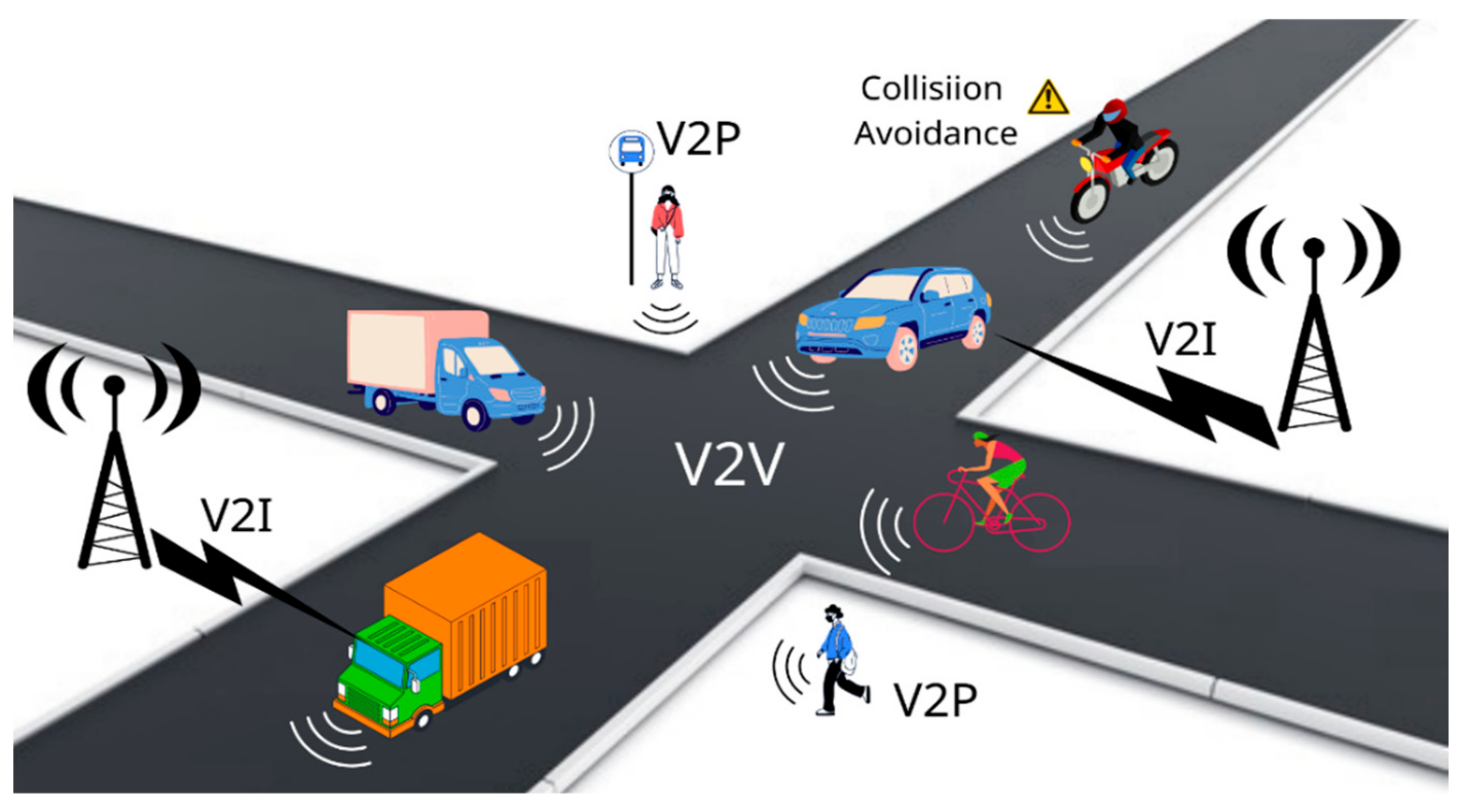
12]. Communication technologies empower vehicle-to-everything (V2X) information share, and as they are established in the vehicle industry, a wide range of ITS applications emerge [
13]. Hence, V2X and C-ITS are paving the way for Cooperative Positioning (CP) among mobile terminals but demand the highest performance levels for several metrics such as availability, accuracy, robustness, and integrity [
13].
In this work, the challenge of efficient, accurate, and reliable CP that incorporates low-cost GNSS receivers in various critical ITS scenarios was addressed. The Cooperative Differential GNSS (C-DGNSS) framework was employed, which is the classical D-GNSS coupled with CP between a target vehicle and a number of surrounding candidate neighbors. All of the cars are considered connected. That means that data can be exchanged through all the vehicles and belong to a wireless network. By retaining the properties of D-GNSS, the cooperating vehicles disseminate their Position-Velocity-Time (PVT) data through radio links and GNSS corrections from the available satellites in view. The main hypothesis is that the target vehicle’s low-cost receiver could improve both its relative and absolute positioning accuracy. The GNSS PVT information is comprised of National Marine Electronics Association (NMEA) messages, and the target vehicle parses the incoming NMEA sentences in a serial manner [
14]. With the aid of a multi-attribute decision-making (MADM) module, the target vehicle optimally decides in real-time which neighbors to select for retrieving the GNSS corrections for improving/updating its own PVT state.
The contributions of this work are summarized as follows:
A CP solution stemming from the C-DGNSS concept is proposed to enhance the performance of low-cost GNSS receivers in safety-critical ITS scenarios. The target’s vehicle receiver can obtain GNSS corrections from a neighboring vehicle and update its own position in real-time;
The proposed C-DGNSS methodology is aided by a MADM module that, given a variety of position-related criteria and alternative neighboring vehicles, ranks them and optimally decides which neighbor to select to retrieve PVT corrections.
Real experimental measurements from several low-cost GNSS receivers and trajectories (experimental sessions) are provided to simulate various operating environments (i.e., deep urban, suburban, and rural areas);
The experimental data are easily processed NMEA sentences which are manufactured universally regardless of GNSS receiver producer. The globally available NMEA data formats are fed as input (i.e., criteria values) to the considered MADM algorithms;
Thirteen MADM algorithms are simulated with various weightings, normalization techniques, and criteria associated with positioning accuracy and reliability, such as horizontal accuracy, dilution of precision (DOP), integer ambiguity status, etc.;
A comparative analysis is provided through an evaluation of the MADM algorithms in terms of ranking performance and robustness. An investigation of the importance and criticality of the criteria is also presented (sensitivity analysis) together with the necessary simulations’ ranking results and MADM algorithms’ performance tables;
The proposed C-DGNSS algorithm will be beneficial for critical applications such as anti-collision, lane-keeping, and intersection crossing, which require high relative positioning accuracy. Moreover, it aims to improve the positioning accuracy of low-cost receivers in complex propagation environments by minimizing the operational overheads but does not guarantee the effective minimization and elimination of user-related errors;
The multi-purpose, generic applicability of the proposed scheme is not only for land vehicles but extends to drone positioning, swarm-of-entities guidance, drone-to-car communication, etc.
The remainder of the paper is structured as follows: in
Section 2, a brief review of the ITS definitions and usages is reported, and a summary of the C-DGNSS framework on the enhancement of low-cost GNSS receivers is presented, along with the specifications for ITS positioning quality. In
Section 3, the MADM theory is developed, and the employed MADM algorithms, normalization techniques, and weightings are elaborated. In
Section 4, the simulation environment (trajectory, alternative vehicles, and input parameters) is described, and the MADM simulations using the experimental data take place. The ranking and numerical results are exhibited, and comments are made. Finally,
Section 5 concludes the paper.
3. MADM Methodologies
In the C-DGNSS framework, the target vehicle’s low-cost GNSS receiver strives to acquire GNSS corrections from the neighbor vehicles in the vicinity. Each neighbor vehicle transmits both PVT data (NMEA sentences) and corrections (Radio Technical Commission for Maritime (RTCM) Services messages). For latency-sensitive applications and critical ITS in general, it is best to rank the moving vehicles in the neighborhood and select the optimal one with which to cooperate. The ranking of moving neighbor vehicles will be estimated using only PVT data that is transmitted, while the PVT solution status of each vehicle will vary; it may be RTK-fixed or a standalone solution. After selecting the best neighbor vehicle, the target car selects to receive the corrections only from this particular neighbor vehicle and tries to estimate the integer phase ambiguities in order to improve the standard deviation of its solution. A MADM module is proposed to aid the neighbor selection using a variety of criteria, weights, and alternatives and finally rank higher a neighbor vehicle with RTK fixed solution than another standalone. MADM algorithms are computational decision-making methods that decide upon the optimal alternative or rank a specified set of alternatives [
22,
23].
The performance of each alternative to a specific criterion/attribute is called criterion value, and it is stored in the decision matrix of size (
P × Q), where
P is the number of alternatives and
Q is the number of criteria [
22]. The derivation of the criteria weights vector is a complicated task; hence a variety of objective (e.g., entropy method) and subjective (e.g., direct rating) weighting techniques are available [
22]. Additionally, the MADM algorithms are founded on linear aggregation and causality, which implies that strong inter-dependencies between criteria may disrupt the ranking outcomes. Finally, the normalization of the criteria values is a pre-processing conversion to derive a common scale and comparable input data. It is necessary to apply the right normalization techniques to facilitate the decision-making process. Given certain weighted criteria, normalized criteria values are fed as input to the MADM module, and the sorting of the alternatives is outputted. The arrangement of the decision matrix (
D.M.) is illustrated in (1):
where
A1,
A2,
A3, …,
AP are the alternatives to be employed for decision making,
C1,
C2,
C3, …,
CQ are the decision criteria, and
αi,j is the performance value of the
ith alternative with respect to the
jth criterion.
Currently, a wide variety of MADM methodologies and normalization techniques are available [
22,
23]. They can be divided according to the decision process and their common characteristics. The MADM algorithms typically employ score functions, outranking relations, hierarchy structures, and others for optimal selection.
Table 3 exhibits some well-accepted and employed MADM methodologies [
22,
23].
The Simple Additive Weighting (SAW), Complex Proportional Assessment (COPRAS), Multi-Objective Optimization on the Basis of Ratio Analysis (MOORA), and Grey Relational Analysis (GRA) belong to the scoring-based MADM family. The scoring class is regarded to have the minimum complexity, cost, and latency and is quite readable and interpretable by the decision-makers. Moreover, the intake criteria values from the formulated decision matrix are generated, and then a scoring function is employed to output a single value for each alternative. They are most suited for the evaluation of a specific alternative than for a complete ranking. Their disadvantages are many, i.e., the idealistic assumption of linear attribute aggregation, the decision matrix normalization, the acceptance of only positive criteria values, and ranking instability in cases where the input attribute values vary greatly [
22,
23].
The Technique for Order of Preference by Similarity to Ideal Solution (TOPSIS), Visekriterijumsko Kompromisno Rangiranje (VIKOR), Combinative Distance-based Assessment (CODAS), Multi-Attributive Border Approximation Area Comparison (MABAC), Displaced Ideal Method (D’IDEAL), and Organization, Rangement Et. Syn-these De Donnes Relationnelles (ORESTE) belong to the distance-based MADM family. The distance-based class is regarded to have a moderate complexity, cost, and latency but high stability even at large fluctuations of the input data. This group of MADM methods calculates a pair of ideal geometric points and considers that the optimal alternative is the one that has the smallest distance from the best point and the greatest distance from the worst point; their disadvantages are few, i.e., the decision matrix normalization and Euclidean distance are inefficient for high correlations between the criteria [
22,
23].
The Analytic Hierarchy Process (AHP) and Analytic Network Process (ANP) belong to the pairwise comparisons MADM family and are regarded as having significant latency, exponential complexity, computational cost, and flexibility. They demand the formulation of a three-level hierarchic structure, and the solution requires good knowledge of eigenvalues and eigenvectors. These methods mix both qualitative and quantitative data types without normalizations. However, they assume largely independent criteria, they are very biased from the subjective opinions of the decision-makers, and modifications are necessary to overcome inconsistency problems [
22,
23].
The Preference Ranking Organization Method for Enrichment Evaluations (PROMETHEE) and Elimination and Choice Expressing Reality (ELECTRE) belong to the outranking MADM family and are regarded as having high flexibility, rationality, and no need for any data transformations or normalizations, but they express a quadratic time complexity and are unfit for more than five criteria. They employ a preference function, e.g., Gaussian, and a number of veto thresholds to perform pairwise comparisons between a set of alternatives and derive preference flows. They can produce partial and complete rankings or select the best action based on outranking relationships [
22,
23].
Finally, the Multi Attribution Utility Theory (MAUT) and Multi Attribution Value Theory (MAVT) belong to the utility/valuate MADM family. They are also biased by decision-maker judgment, but they can deal with uncertainties in the data. On the other hand, they demand an immense amount of input data, and the derived results exhibit strong subjectivity [
22,
23].
In general, the sensitivity analysis investigates the impact of weighting, the number of alternatives, and the measurement scale on the ranking stability and hence the method’s robustness [
24,
25]. The importance of a criterion reflects its weight’s magnitude on that criterion, while the criticality is the degree of ranking variation for a small shift in the criterion’s weight. Those methods that statistically retain the priorities and ranking of alternatives when altering the input data deem them to be the more robust, and consequently, they suit real-time applications. Another problem is the rank-reversal phenomenon that occurs in all classes and methods. It occurs when a duplicate alternative or a worse-scoring alternative is added, removed, or replaced, then the top ranks might reverse, which is inconsistent [
22,
23].
In [
26], the challenge of energy-efficient network selection in wired, wireless, and public transport networks is formulated as a decision-making problem. The authors propose a MADM strategy based on users’ requirements and different services (e.g., QoS, bandwidth, delay, data volume, and cost, etc.). Specifically, the AHP is applied for a heterogeneous vehicular-assisted network in the context of smart cities. Unarguably, the method’s consistency constitutes a key parameter in vehicular network selections so as to achieve efficient handovers.
Due to their complex architecture, a vast quantity of input data, and strong subjectivity, the pairwise comparison techniques and utility algorithms are rejected for cooperative positioning systems operating in dynamic environments with demanding latency, reliability, and continuity requirements [
23].
4. Simulation Results
4.1. Simulation Criteria and Environment Description
By means of the C-DGNSS positioning framework, the participating vehicles in the neighborhood share PVT-related data with the target vehicles employing low-cost receivers. The NMEA 0183 messaging protocol is an international data format intended for communication between electronic devices similar to the ASCII character standard for computer programming [
1,
14]. The NMEA messages are plain sentences with specific serial data fields that can be read by a common digital notepad and are composed of ASCII strings that convey useful location-based information. A summary of the basic positioning metrics along with the corresponding NMEA messages is reported below [
1,
14]:
Geographic latitude, longitude, and altitude ($GNGNS);
Number of GNSS satellites in view ($GNGNS);
Horizontal and vertical dilution of precision ($GNGNS);
Horizontal and vertical accuracy standard deviations ($GNGST);
Quality of the location (integrity, validity, and integer ambiguity status) ($GNGFA).
Especially, the
$GNGST message is considered a significant requirement for high-precision GNSS positioning because of the role of GNSS metadata in evaluating the quality of GNSS coordinates. The low-cost GNSS receivers may transmit these NMEA messages through various short-range radio-communication interfaces such as the ITS technologies described in
Table 1 as well as Wi-Fi, 3G, LTE-4G, 5G, and Bluetooth. The benefits of the NMEA protocol are numerous since it enables the communication between heterogeneous hardware and software while the users are not submitted to develop custom implementations for each GNSS receiver. In
Figure 2, the operation of the proposed C-DGNSS framework is depicted.
The aiding MADM module assists the target vehicle in selecting the best neighboring vehicle with which to cooperate and hence improves/updates its position in a realistic manner. It parses the incoming NMEA messages that constitute the criteria values of the decision matrix, and then the appropriate MADM algorithm takes over, providing rankings of the neighboring moving vehicles. The MADM module assumes a set of criteria or attributes that collectively define the GNSS position quality of the engaged cars. For the purpose of efficient C-DGNSS and achieving improved position accuracy with the lowest latency and cost, it is advisable that these attributes should be highly uncorrelated and up to 5 or 6.
From the reported NMEA messages described earlier, in our contribution, only certain fields are employed as input criteria for the proposed MADM module.
Table 4 exhibits the list of criteria investigated per NMEA sentence: (1) The number of GNSS satellites in view (
NS), (2) the root mean square of the double-difference phase residuals in the L1 band (
Range RMS), (3) the standard deviation of the horizontal coordinates point fix (
Hz std), (4) the standard deviation of the vertical coordinates point fix (
V std), (5) the ambiguity status of the position solution (
Amb Stat), and (6) the horizontal dilution of precision (
HDOP). In greater detail, the
Range RMS is measured in meters, the
Hz std and
V std are measured in meters and express the horizontal and vertical accuracy error in the position, and the
Amb Stat denotes the GNSS receiver’s integer ambiguity status. Thus,
Amb Stat may yield an autonomous solution, a differential GNSS, a float solution, and a high-resolution fixed solution. Finally, the
HDOP reveals the effect of the DOP on the horizontal position value. The more satellites that are visible and low in the sky, the better the
HDOP and the horizontal position (latitude and longitude). Finally, the criteria are of type “Expenses” or “Benefits”. The first type implies that the lower the criterion value, the better (minimum), while the second type implies that the higher the criterion value, the better (maximum).
The experimental NMEA PVT data used for the simulation and evaluation of our contribution were recorded from six land vehicles that drove concurrently over nonidentical trajectories that endured approximately 2000 epochs at a 1 Hz sampling rate (33.3 min in total) [
27]. The collected trajectories’ data are GNSS observations from various outdoor areas, including: (i) unobstructed, open space conditions, (ii) urban settings with narrow lanes and tall buildings, and (iii) semi-urban sections with grown trees and thick vegetation, causing a large-scale signal degradation and restricted view of the GNSS satellites [
27]. Evidently, all vehicles carry a single low-cost GNSS receiver aboard able to compute the position solution and produce NMEA GNS and GST sentences. The first vehicle (veh. #1) is notated as the target vehicle, and the other five (veh. #2, veh. #3, veh. #4, veh. #5, and veh. #6) are considered the aiding vehicles. The MATLAB
® toolbox was employed to import the data and establish a simulation environment for the MADM algorithms.
4.2. Comparative Analysis
In this section, thirteen MADM algorithms are simulated with various weightings, normalization techniques, and criteria associated with positioning accuracy employing experimental NMEA data time series. A comparative analysis is provided through an evaluation of the MADM algorithms in terms of ranking performance and robustness. An investigation of the importance and criticality of the criteria is also presented (sensitivity analysis), accompanied by the necessary ranking diagrams and simulation results.
The investigated methods are the SAW, CODAS, COPRAS, GRA, MABAC, D’IDEAL, TOPL1, TOPL2, TOPL3, VIKOR, ORESTE, PROMETHEE, and ELECTRE, where TOPL1 is the TOPSIS using the L1 norm or taxicab/Manhattan distance metric, TOPL2 employs the L2 norm, which is the Euclidean distance of each alternative from the best and worst ideal points, TOPL3 employs the infinite norm distance metric, while four distinct preference functions were employed for PROMETHEE.
The five alternative vehicles move in simultaneous but separate trajectories that span 2000 epochs. For each trajectory epoch, a decision matrix is formed with criteria values extracted from the NMEA sentences of the five aiding vehicles. Hence, a decision matrix associated with a specific timestamp (epoch) yields as many ranking results as the number of MADM algorithms and normalization techniques. In summary, in our MADM simulations, a trajectory of
T = 2000 timestamps subject to
Q = 6 criteria is examined employing
P = 5 alternative vehicles (veh. #02–veh. #06) while the ranking results of 13 different MADM algorithms and five normalization techniques are reported.
Table 5 exhibits the decision matrix with a of size (5 × 6) of a random timestamp filled with the required criteria values. The Amb Stat takes values of 1.0 for a fixed solution and 0.5 for a float solution.
Table 6,
Table 7,
Table 8 and
Table 9 present the simulations’ ranking results after applying the MADM methods SAW, TOPL1, CODAS, and PROMETHEE, indicatively, with the criteria input data of
Table 5. The index P
i represents the performance score of the
ith alternative, and A
i expresses the ID of the
ith alternative with
i = 2, 3, 4, 5, and 6. It is observed that SAW, TOPL1, and CODAS produce identical rankings while PROMETHEE yields a slightly different top-three ranking. Moreover, the five normalization techniques are in good agreement with each other and with their corresponding ranking results.
Table 10 depicts the rank distribution (I-II-III-IV-V) among the alternative vehicles from all of the simulations incorporating all of the MADM methods and normalization techniques. Each column and each row add up to 100%. It is observed that veh. #03 is placed 85.7% in rank I; therefore, it is considered the optimal neighboring vehicle to receive the GNSS corrections for the specific epoch.
The results derived from the total trajectory data using all of the MADM methods and normalization techniques are presented in
Figure 3. The upper plot of
Figure 3 assumes equal weights, whilst the bottom plot adopts a weight matrix
. Obviously, the rankings of vehicles #02 and #04 remain almost the same, while the rankings of vehicles #03, #05, and #06 change slightly. Furthermore, vehicle #02 remains in rank I compared to other vehicles, and vehicle #04 remains in rank III along the trajectory.
4.3. Sensitivity Analysis
In this sub-section, a sensitivity analysis is carried out to determine the most critical position-related criteria and to evaluate the robustness of the investigated MADM algorithms [
24,
25]. A sensitivity analysis can be performed for all the available methods, but in our case, only
n = 3 MADM methods are compared: SAW, CODAS, and TOPL1, while
m = 6 alternative vehicles are examined for a trajectory of
k = 2000 epochs. Each epoch consists of data from
i = 6 criteria, respectively: Number of satellites, L1 RMS double-difference phase residual, Hz std, V std, Amb Status, and HDOP indicator. Seven weight matrices are constructed: at first, a matrix with 1/6 equal weight for every criterion is formulated, and then six different weight matrices where each criterion weight is set to have a weight of 2/6 and the remaining criteria have equal weights. Thus, the weight matrices are presented analytically in
Table 11.
Every timestamp corresponds to a column that includes the ranking of alternative vehicles for each MADM method (), and thus the dimensions of the ranking matrix for every timestamp are . The subsequent step is the correlation coefficient matrix calculation using Spearman’s correlation method between the ranking matrix obtained from the equal weight matrix with the results of the rest weight matrices (, , , , , and ), where the result is a matrix at every timestamp. In order to calculate the total correlation coefficient matrix from the complete trajectory, a sum along the third dimension is performed, and then it is divided by the total number of timestamps; this is the total correlation index (TCI). Conclusively, the criterion with the smaller TCI is the most sensitive one per each MADM method.
The Spearman’s correlation coefficient
rho between the two ranking vectors
is given by:
where,
is the difference in the
ith rank between two ranking vectors (i.e., two MADM methods) and
n is the length of each vector (number of alternatives). If the input is a ranking matrix
X with multiple columns,
returns a matrix with the correlations between each pair of its columns.
The Pearson’s correlation coefficient
ρ is a metric of the linear correlation between two random variables,
X and
Y, and it can be alternatively employed using the real-valued performance scores of the MADM methods instead of the integer-valued ranking vectors. It is defined as follows:
where
,
are the mean values and
n is the length of each vector.
Table 12 summarizes Spearman’s correlation results along the complete trajectory, where clearly, the smaller TCI values are observed in criteria L1 RMS double-difference phase residuals, HDOP, and Hz std, while the other criteria are less sensitive.
Table 13 includes the Pearson’s correlation results where the smaller TCI values are also spotted in criteria L1 RMS, HDOP, and V std, whereas the other criteria are slightly less sensitive. Concretely, Spearman’s correlation coefficient is a more suitable tool to use for sensitivity analysis because the obtained TCIs differ a lot more, giving a definite ranking as compared to Pearson’s TCIs, which mainly differ on the second and third decimal.
In
Table 14 and
Table 15, the criteria from the most to least sensitive are sorted where the numbers 1–6 are the criteria IDs. L1 RMS (no. 2) is the most sensitive, followed by HDOP (no. 6).
5. Challenges and Future Research Trends
In this Section, the extension of the C-DGNSS concept beyond land-based vehicles is discussed, along with emerging challenges and future trends. Moreover, the “moving base station” technique can be fairly applied to drone positioning, drone-to-drone, drone-to-car communications, internet of drones (IoD), multi-UAV systems, UAV swarms, coordinated drones, and to improve their relative position accuracy further [
28,
29,
30].
Considering a swarm of UAVs or a multi-UAV system, in order to maintain a coordinated and planned formation, a very accurate and efficient relative positioning method must be employed. Similar to land vehicles, open-sky conditions are favorable for GNSS-only positioning and navigation. On the other hand, in urban centers, the likelihood of an inner-system collision is high.
Future work will include low-cost C-DGNSS aided with a MADM module for drone vehicles in deep urban, suburban, and rural regions, simulations with experimental drone-to-car positioning measurements, and GNSS/INS integration in coordinated drone formations.
6. Conclusions
In this work, the challenge of efficient, accurate, and reliable CP, incorporating low-cost GNSS receivers in various critical ITS scenarios, was addressed. The C-DGNSS framework was employed, which is the classical D-GNSS coupled with CP between a target vehicle and a number of surrounding candidate neighbors. By retaining the properties of D-GNSS, the cooperating vehicles disseminate their PVT data and GNSS corrections from the available satellites in view through radio links. The main hypothesis is that the target vehicle’s low-cost receiver could improve both its relative and absolute positioning accuracy. The GNSS PVT information is comprised of NMEA messages, and the target vehicle parses the incoming NMEA sentences in a serial manner. With the aid of a MADM module, the target vehicle ranks and optimally decides in real-time which neighbors to select for retrieving GNSS corrections (RTCM data) to update its own PVT state. A set of thirteen MADM algorithms and several different normalization techniques were adopted for the simulation of scenarios involving various weightings and the criteria associated with positioning accuracy and ambiguities residual status. Real experimental criteria values derived from several low-cost GNSS receivers in complex driving environments were employed. A comparative analysis was then provided through an evaluation of the MADM algorithms in terms of ranking performance. A sensitivity analysis to determine the methods’ robustness and the criticality of the criteria is also presented. It is concluded that L1 RMS, HDOP, and Hz std are the most critical, while the other criteria are less sensitive. Multi-purpose, generic applicability of the proposed scheme is suggested, not only for land vehicles, as it can be extended to drone positioning, swarm-of-entities guidance, drone-to-car communication, etc.


