
Comprehensive Generation of Historical Construction CAD Models from Data Provided by a Wearable Mobile Mapping System: A Case Study of the Church of Adanero (Ávila, Spain)

 ,
,  ,
,  ,
,  and
and 
Abstract
:1. Introduction
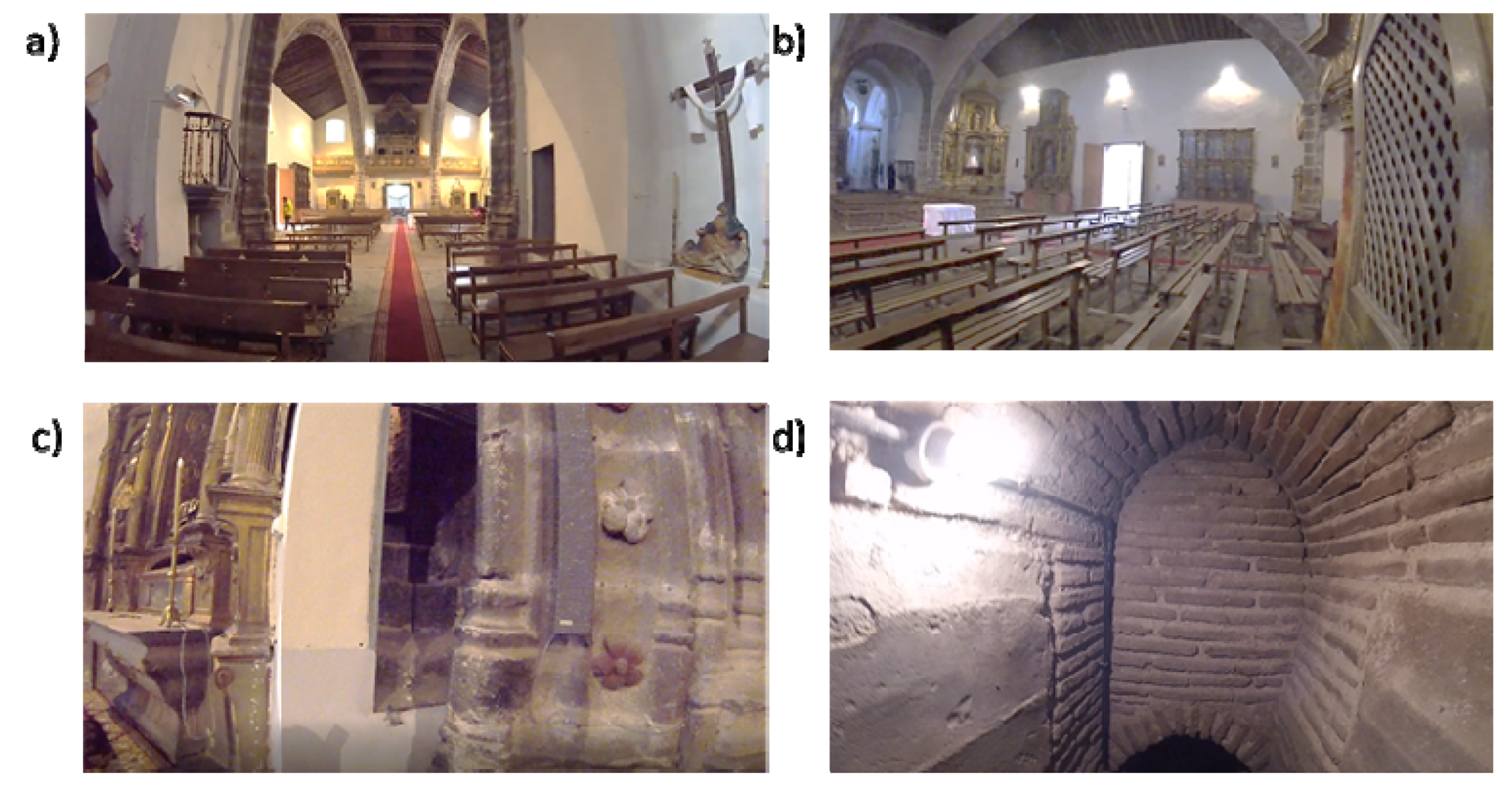
2. Case Study
3. Three-Dimensional Point Cloud Generation
3.1. Description of the WMMS Used
3.2. Acquisition Protocol
4. CAD Model Generation
- Vertical walls (Figure 8a): These elements were modelled using the methodology proposed by Sánchez-Aparicio et al. [12]. The results classified the walls into two different groups: (i) the vertical/tilted walls [12] and (ii) the walls with complex out-of-plane deformations. The vertical/leaning walls were adjusted using the random sample consensus (RANSAC) shape detector algorithm [28], while the walls with complex deformations whose points deviated too much from the ideal fitted plane were modelled using the surface deformation approach suggested by Barrazzetti et al. [29]. This method enables complex surfaces to be modelled by a progressive adaptation of a seed surface, turning it into a NURBS surface that closely fits the point cloud. The modification of this surface was performed by changing the weights, the control points and the knot vectors of the NURBS surface until the adjustment was accomplished.
- Segmental arches (Figure 8b,c): The two segmental arches were modelled separately but using a similar procedure. Firstly, we extracted and vectorized the longitudinal trace of the arch by using a B-Spline modelling strategy. Then, we extracted and vectorized the section of the keystone with several B-Spline curves. Finally, the solid model was created by extruding the keystone section along the longitudinal trace. The brick masonry placed at the extrados of the arch was modelled by using the planes extracted after the application of the RANSAC shape detector approach. The supports of the arch were modelled by extruding the reference section (generated with B-Spline curves) in the vertical direction.
- Vaults and domes (Figure 9): The barrel vault placed at the crossing was modelled by using the deformation strategy previously shown. The arches of this vault were generated by using the strategy of the segmental arches. The vaults of the towers were modelled by defining the cross-section (B-Spline curves) and extruding it along the longitudinal direction of the vaults. The hemispherical dome was modelled by revolving the cross-section which was modelled with a B-Spline. The lunette vaults were modelled by extracting several sections in both directions and then creating loft surfaces among them. It is worth mentioning that the 3D point cloud captured by the WMMS device only covers the intrados of the elements. Thus, the application of an extra step with the aim of obtaining a solid model of these elements was necessary. In this case, the approach proposed by Sánchez-Aparicio et al. [30] was used in order to pass from the surface model to a solid model of the vaults. The thickness, infill and other stabilization elements were modelled according to with the construction rules of the epoch, as explained by Huerta Fernández [31].
- Timber elements (Figure 10): These elements, especially in the naves of the church, were modelled with high detail, including not only the deformations with high-order curves but also the joints between elements. On the one hand, the rafters of the secondary naves were modelled by extruding the vectorized section along the longitudinal trace. This trace was modelled by using a B-Spline curve. The union between these elements and the masonry walls was performed with a birdsmouth joint and a plate timber. The elements of the timber frame placed at the central nave were modelled by using the same procedure, considering the joints in [32]. The extrados of the roof was modelled by using an offset of the plane defined by the rafters, considering that the roof was built with a simple table system and ceramic tiles.
5. Discussion and Conclusions
Author Contributions
Funding
Conflicts of Interest
References
- Cabo, C.; Del Pozo, S.; Rodríguez-Gonzálvez, P.; Ordóñez, C.; González-Aguilera, D. Comparing Terrestrial Laser Scan-ning (TLS) and Wearable Laser Scanning (WLS) for Individual Tree Modeling at Plot Level. Remote Sens. 2018, 10, 540. [Google Scholar] [CrossRef] [Green Version]
- Rodríguez-Gonzálvez, P.; Nocerino, E. Portable Mobile Mapping Systems applied to the Management of Natural Spaces. In New Developments in Agricultural Research; Nova Science Publishers: New York, NY, USA, 2019. [Google Scholar]
- Herrero-Huerta, M.; Lindenbergh, R.; Rodríguez-Gonzálvez, P. Automatic tree parameter extraction by a Mobile LiDAR System in an urban context. PLoS ONE 2018, 13, e0196004. [Google Scholar] [CrossRef] [PubMed] [Green Version]
- Eyre, M.; Wetherelt, A.; Coggan, J. Evaluation of automated underground mapping solutions for mining and civil engineering applications. J. Appl. Remote Sens. 2016, 10, 20–39. [Google Scholar] [CrossRef]
- Dewez, T.J.; Yart, S.; Thuon, Y.; Pannet, P.; Plat, E. Towards cavity-collapse hazard maps with Zeb-Revo handheld laser scanner point clouds. Photogramm. Rec. 2017, 32, 354–376. [Google Scholar] [CrossRef] [Green Version]
- Rodríguez-Martín, M.; Rodríguez-Gonzálvez, P.; Gonzalez-Aguilera, D.; Nocerino, E. Novel Approach for Three-Dimensional Integral Documentation of Machine Rooms in Hospitals Using Portable Mobile Mapping System. IEEE Access. 2018, 6, 79200–79210. [Google Scholar] [CrossRef]
- Rodríguez-Martín, M.; Rodríguez-Gonzálvez, P.; Ruiz de Oña Crespo, E.; González-Aguilera, D. Validation of Portable Mobile Mapping System for Inspection Tasks in Thermal and Fluid–Mechanical Facilities. Remote Sens. 2019, 11, 2205. [Google Scholar] [CrossRef] [Green Version]
- Tucci, G.; Visintini, D.; Bonora, V.; Parisi, E. Examination of Indoor Mobile Mapping Systems in a Diversified Inter-nal/External Test Field. Appl. Sci. 2018, 8, 401. [Google Scholar] [CrossRef] [Green Version]
- Maté-González, M.Á.; Sánchez-Aparicio, L.J.; Sáez Blázquez, C.; Carrasco García, P.; Álvarez-Alonso, D.; de An-drés-Herrero, M.; García-Davalillo, J.C.; González-Aguilera, D.; Hernández Ruiz, M.; Jordá Bordehore, L.; et al. On the Combination of Remote Sensing and Geophysical Methods for the Digitalization of the San Lázaro Middle Paleolithic Rock Shelter (Segovia, Central Iberia, Spain). Remote Sens. 2019, 11, 2035. [Google Scholar] [CrossRef] [Green Version]
- Chiabrando, F.; Sammartano, G.; Spanò, A. A comparison among different optimization levels in 3D multi-sensor models. A test case in emergency context: 2016 Italian earthquake. Int. Arch. Photogramm. Remote Sens. Spat. Inf. Sci. 2017, XLII-2/W3, 155–162. [Google Scholar] [CrossRef] [Green Version]
- Mora, R.; Sánchez-Aparicio, L.J.; Maté-González, M.A.; García-Álvarez, J.; Sánchez-Aparicio, M.; González-Aguilera, D. An historical building information modelling approach for the preventive conservation of historical constructions: Ap-plication to the Historical Library of Salamanca. Autom. Constr. 2021, 121, 103449. [Google Scholar] [CrossRef]
- Sánchez-Aparicio, L.J.; Mora, R.; Conde, B.; Maté-González, M.Á.; Sánchez-Aparicio, M.; González-Aguilera, D. Integration of a Wearable Mobile Mapping Solution and Advance Numerical Simulations for the Structural Analysis of Historical Constructions: A Case of Study in San Pedro Church (Palencia, Spain). Remote Sens. 2021, 13, 1252. [Google Scholar] [CrossRef]
- Di Filippo, A.; Sánchez-Aparicio, L.J.; Barba, S.; Martín-Jiménez, J.A.; Mora, R.; González Aguilera, D. Use of a Wearable Mobile Laser System in Seamless Indoor 3D Mapping of a Complex Historical Site. Remote Sens. 2018, 10, 1897. [Google Scholar] [CrossRef] [Green Version]
- Nocerino, E.; Menna, F.; Remondino, F.; Toschi, I.; Rodríguez-Gonzálvez, P. Investigation of indoor and outdoor per-formance of two portable mobile mapping systems. Proc. SPIE. 2017, 10332, 103320I. [Google Scholar] [CrossRef]
- Nocerino, E.; Rodríguez-Gonzálvez, P.; Menna, F. Introduction to mobile mapping with portable systems. In Laser Scanning: An Emerging Technology in Structural Engineering; CRC Press: Boca Raton, FL, USA, 2019; pp. 37–52. [Google Scholar] [CrossRef] [Green Version]
- GeoSlam Zeb-Revo. Available online: https://geoslam.com/solutions/zeb-revo/ (accessed on 13 September 2020).
- Chiabrando, F.; Coletta, C.D.; Sammartano, G.; Spanò, A.; Spreafico, A. “Torino 1911” project: A contribution of a slam-based survey to extensive 3D heritage modeling. Int. Arch. Photogramm. Remote Sens. Spat. Inf. Sci. 2018, XLII-2, 225–234. [Google Scholar] [CrossRef] [Green Version]
- Castellazzi, G.; D’Altri, A.M.; Bitelli, G.; Selvaggi, I.; Lambertini, A. From Laser Scanning to Finite Element Analysis of Complex Buildings by Using a Semi-Automatic Procedure. Sensors 2015, 15, 18360–18380. [Google Scholar] [CrossRef] [Green Version]
- Barsanti, S.G.; Guidi, G. A geometric processing workflow for transforming reality-based 3D models in volumetric meshes suitable for FEA. Int. Arch. Photogramm. Remote Sens. Spat. Inf. Sci. 2017, 42, 331. [Google Scholar] [CrossRef] [Green Version]
- Wen, Q.J.; Ren, Z.J.; Lu, H.; Wu, J.F. The progress and trend of BIM research: A bibliometrics-based visualization analysis. Autom. Constr. 2021, 124, 103558. [Google Scholar] [CrossRef]
- Azhar, S. Building information modeling (BIM): Trends, benefits, risks, and challenges for the AEC industry. Leadersh. Manag. Eng. 2011, 11, 241–252. [Google Scholar] [CrossRef]
- Azenha, M.; Masciotta, M.G.; Sousa, G.; Alarcon, C.; Morais, M J C.; Sena-Cruz, J.; Oliveira, D.V. Building Information Modelling (BIM) no contexto dos edificios antigos. In Proceedings of the Conferência Internacional sobre Reabilitação de Estruturas Antigas de Alvenaria, Lisboa, Portugal, 5 July 2018. [Google Scholar]
- Aguilera, D G; Lahoz, J.G. Laser scanning or image-based modeling? A comparative through the modelization of San Nicolas Church. Int. Arch. Photogramm. Remote Sens. 2012, 36, B5.
- Rodríguez-Gonzálvez, P.; Garcia-Gago, J.; Gomez-Lahoz, J.; González-Aguilera, D. Confronting Passive and Active Sensors with Non-Gaussian Statistics. Sensors 2014, 14, 13759–13777. [Google Scholar] [CrossRef] [PubMed] [Green Version]
- Bosse, M.; Zlot, R.; Flick, P. Zebedee: Design of a Spring-Mounted 3-D Range Sensor with Application to Mobile Mapping. IEEE Trans. Robot. 2012, 28, 1104–1119. [Google Scholar] [CrossRef]
- Durrant-Whyte, H.; Bailey, T. Simultaneous localization and mapping: Part I. IEEE Robot. Autom. Mag. 2006, 13, 99–110. [Google Scholar] [CrossRef] [Green Version]
- Goberment of Spain. Real Decreto 314/2006, de 17 de marzo, por el que se aprueba el Código Técnico de la Edificación. Código Técnico de la Edificación. Available online: https://www.boe.es/buscar/doc.php?id=BOE-A-2006-5515 (accessed on 5 April 2022).
- Schnabel, R.; Wahl, R.; Klein, R. Efficient RANSAC for point-cloud shape detection. Comput. Graph. Forum. 2007, 26, 214–226. [Google Scholar] [CrossRef]
- Barazzetti, L.; Banfi, F.; Brumana, R.; Oreni, D.; Previtali, M.; Roncoroni, F. HBIM and augmented information: Towards a wider user community of image and rangebased reconstructions. In Proceedings of the 25th International CIPA Symposium, Taipei, Taiwan, China, 31 August–5 September 2015; pp. 35–42. Available online: https://re.public.polimi.it/handle/11311/973037 (accessed on 26 August 2020).
- Sánchez-Aparicio, L.J.; Villarino, A.; García-Gago, J.; González-Aguilera, D. Photogrammetric, Geometrical, and Numerical Strategies to Evaluate Initial and Current Conditions in Historical Constructions: A Test Case in the Church of San Lorenzo (Zamora, Spain). Remote Sens. 2016, 8, 60. [Google Scholar] [CrossRef] [Green Version]
- Huerta Fernández, S. Arcos, Bóvedas y Cúpulas. Geometría y Equilibrio en El Cálculo Tradicional de Estructuras de FábricaArcos, Bóvedas y Cúpulas. Geometría y Equilibrio en el Cálculo Tradicional de Estructuras de Fábrica, 1st ed; Juan de Herrera Institute: Madrid, Spain, 2004. [Google Scholar]
- Nuere, E. La Carpinteria de Armar Española; Casa del Libro: Madrid, Spain, 1989; Volume 10, pp. 73–74. [Google Scholar]


| Parameter | Value |
|---|---|
| Measurement range (indoor) (m) | 30 |
| Measurement range (outdoor) (m) | 15 |
| Data capture speed (points/s) | 43,200 |
| Accuracy | ±0.1% |
| Relative accuracy | 1–3 cm |
| Field of view | 270° × 360° |
| Operating time (h) | 4 |
| Scanner dimensions (mm) | 86 × 113 × 470 |
| Weight (kg) | 0.85 |
| Rotation frequency (Hz) | 0.5 |
Publisher’s Note: MDPI stays neutral with regard to jurisdictional claims in published maps and institutional affiliations. |
© 2022 by the authors. Licensee MDPI, Basel, Switzerland. This article is an open access article distributed under the terms and conditions of the Creative Commons Attribution (CC BY) license (https://creativecommons.org/licenses/by/4.0/).
Share and Cite
Rodríguez-Martín, M.; Sánchez-Aparicio, L.J.; Maté-González, M.Á.; Muñoz-Nieto, Á.L.; Gonzalez-Aguilera, D. Comprehensive Generation of Historical Construction CAD Models from Data Provided by a Wearable Mobile Mapping System: A Case Study of the Church of Adanero (Ávila, Spain). Sensors 2022, 22, 2922. https://doi.org/10.3390/s22082922
Rodríguez-Martín M, Sánchez-Aparicio LJ, Maté-González MÁ, Muñoz-Nieto ÁL, Gonzalez-Aguilera D. Comprehensive Generation of Historical Construction CAD Models from Data Provided by a Wearable Mobile Mapping System: A Case Study of the Church of Adanero (Ávila, Spain). Sensors. 2022; 22(8):2922. https://doi.org/10.3390/s22082922
Chicago/Turabian StyleRodríguez-Martín, Manuel, Luis Javier Sánchez-Aparicio, Miguel Ángel Maté-González, Ángel Luis Muñoz-Nieto, and Diego Gonzalez-Aguilera. 2022. "Comprehensive Generation of Historical Construction CAD Models from Data Provided by a Wearable Mobile Mapping System: A Case Study of the Church of Adanero (Ávila, Spain)" Sensors 22, no. 8: 2922. https://doi.org/10.3390/s22082922
APA StyleRodríguez-Martín, M., Sánchez-Aparicio, L. J., Maté-González, M. Á., Muñoz-Nieto, Á. L., & Gonzalez-Aguilera, D. (2022). Comprehensive Generation of Historical Construction CAD Models from Data Provided by a Wearable Mobile Mapping System: A Case Study of the Church of Adanero (Ávila, Spain). Sensors, 22(8), 2922. https://doi.org/10.3390/s22082922