Article

Application of UAV-LiDAR Data for Assessing Forest Canopy Height Variations Across Forest Types and Topography


1
The University of Tokyo Hokkaido Forest, Graduate School of Agricultural and Life Sciences, The University of Tokyo, 9-61 Yamabe-Higashi-Machi, Furano 079-1563, Hokkaido, Japan
2
Forestry and Forest Products Research Institute, 1 Matsunosato, Tsukuba 305-8687, Ibaraki, Japan
3
Department of Global Agricultural Sciences, Graduate School of Agricultural and Life Sciences, The University of Tokyo, Yayoi 1-1-1, Bunkyo-ku, Tokyo 113-8657, Japan
*
Author to whom correspondence should be addressed.
Geomatics 2026, 6(5), 103; https://doi.org/10.3390/geomatics6050103

Submission received: 17 July 2026 / Revised: 26 August 2026 / Accepted: 14 September 2026 / Published: 16 September 2026

Abstract

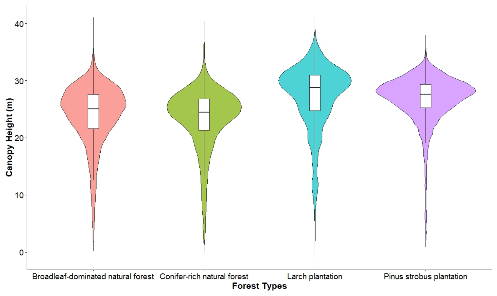
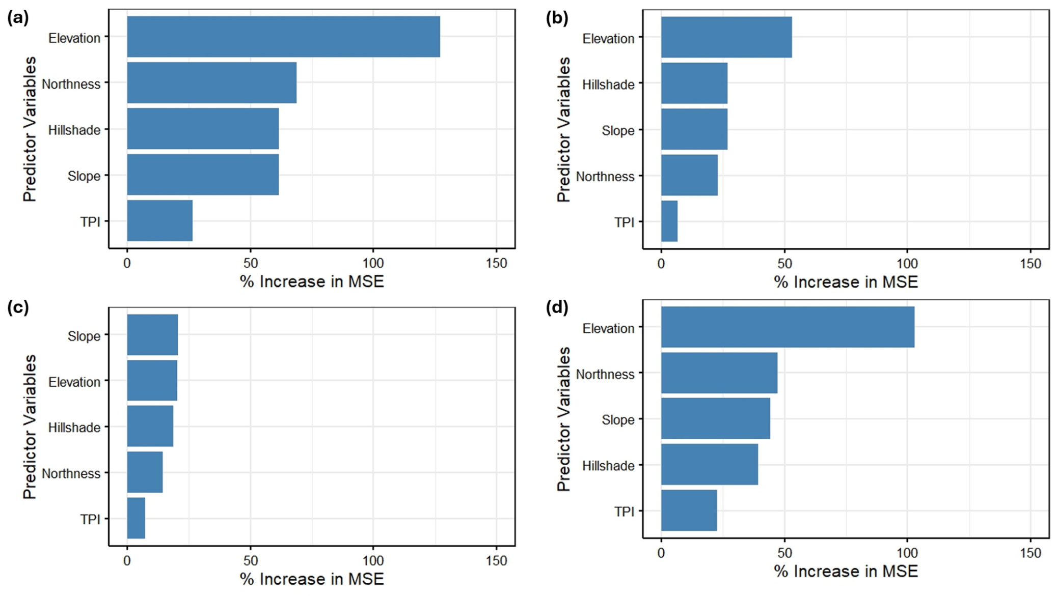
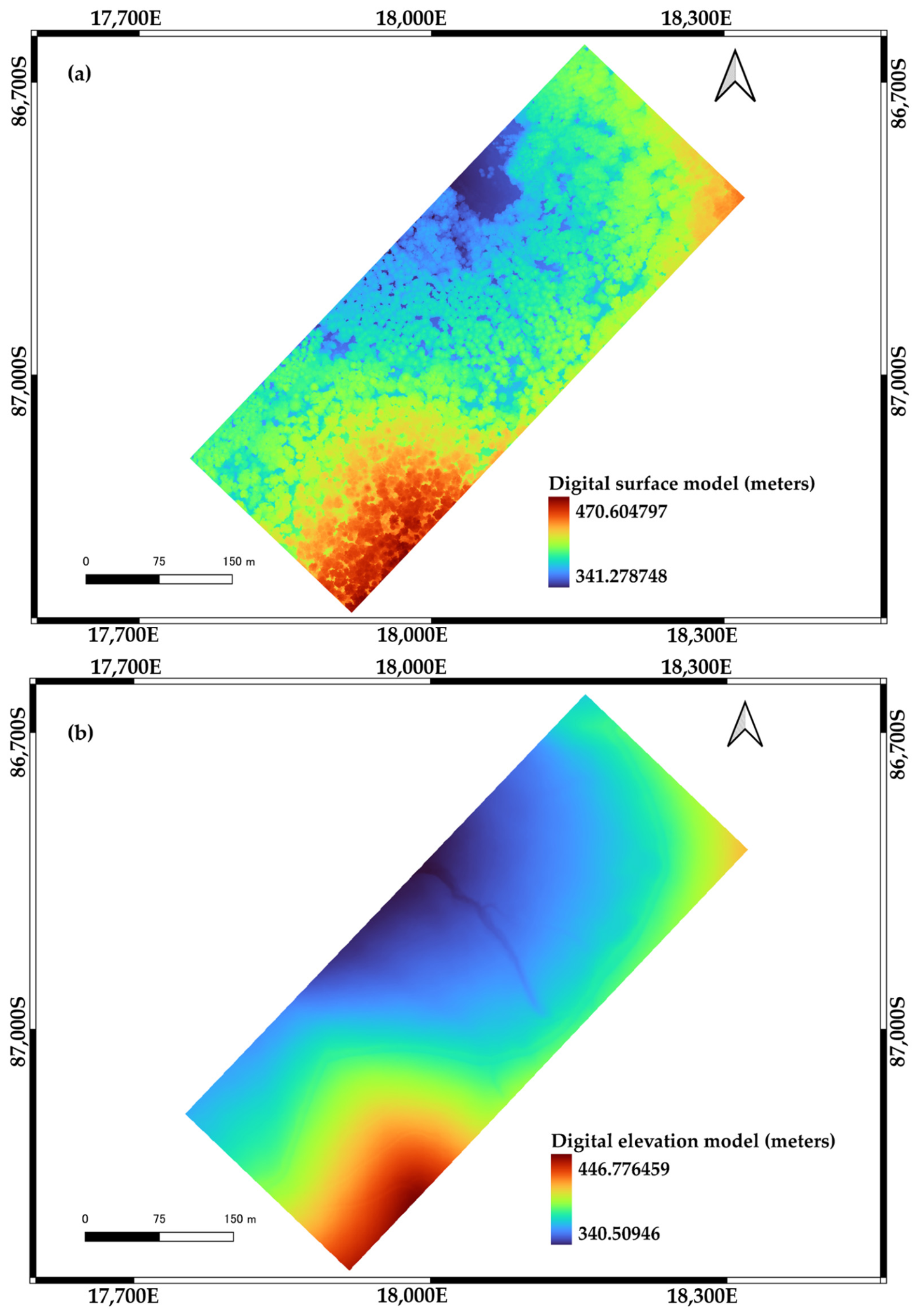
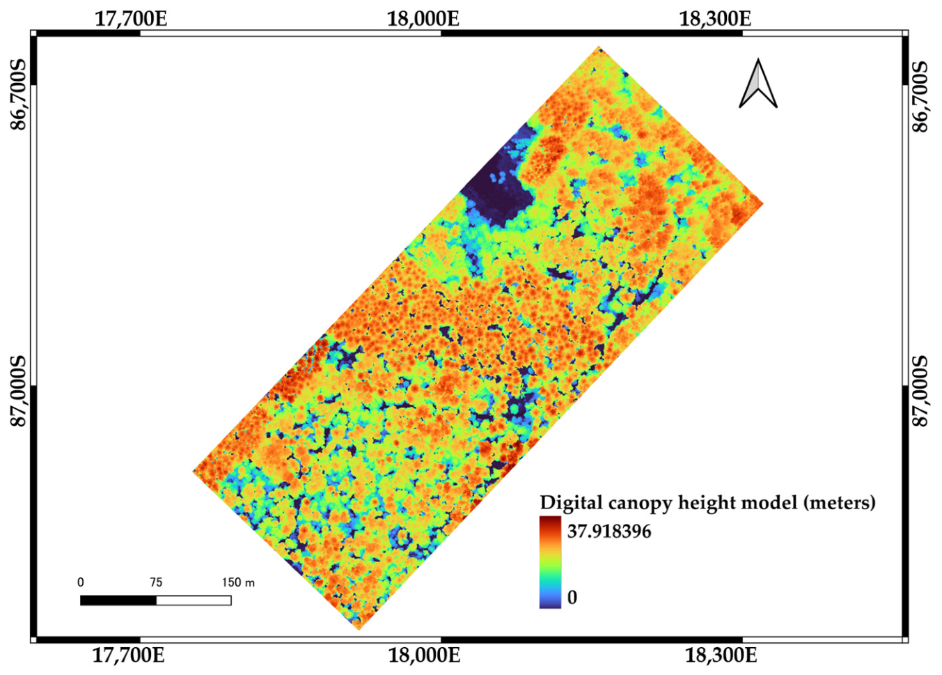
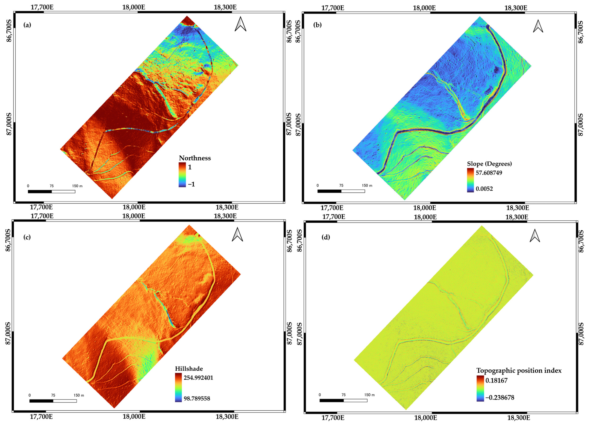
Understanding forest canopy height (H) variations across different forest types and topographic conditions is essential for sustainable forest management; however, quantitative information on how H varies among forest types and responds to topographic factors remains limited. This study investigated H variations among forest types and their relationships with topographic factors using UAV-LiDAR data. Digital surface and elevation models (DSM and DEM) were generated from UAV-LiDAR data, and a digital canopy height model (DCHM) was calculated by subtracting DEM from DSM. Individual treetops were detected using the local maxima algorithm, and H was extracted from the corresponding DCHM values. Differences in H among forest types were evaluated using Kruskal–Wallis test followed by Dunn’s post hoc test. Generalized additive model and random forest model were applied to examine the influence of topographic factors on H. A total of 26,886 individual trees were detected, with broadleaf-dominated natural forest accounting for the largest proportion (42.9%). H differed significantly among forest types, although no significant difference was observed between the larch and Pinus strobus plantation. The influence of topographic variables on H varied among forest types. Elevation was the most influential predictor in three of four forest types, whereas slope was the dominant predictor in the larch plantation. In contrast, topographic position index exhibited the lowest importance across all forest types. The findings demonstrate an effective application of UAV-LiDAR data for assessing H variations and understanding forest-type-specific responses to topographic conditions, thereby providing scientific references for sustainable forest management.
Keywords: forest canopy height; elevation; local maxima algorithm; treetop detection; UAV-LiDAR forest canopy height; elevation; local maxima algorithm; treetop detection; UAV-LiDAR