1. Introduction
Geographers have long been interested in understanding the resource potential and “hazardousness of a place,” the latter having been succinctly detailed more than half a century ago by Kenneth Hewitt and Ian Burton [
1] in their seminal work in Ontario, Canada. The subsequent interest in the vulnerability of “place-based” communities to natural hazards sparked a discourse focusing on how people and local communities deal with multi-hazards, particularly their coping and adaptation processes [
2,
3]. This notion has also been applied to larger scale risk research and management [
4,
5,
6,
7]. Such efforts in flood risk assessment of both urban and rural communities encompassed improving our understanding of the hazards, exposure, and vulnerability of places in the cities and countryside [
8,
9,
10]. A local community can be defined as a group of people who live in a common or shared geographic location, have interactions with one another, are organized around common values, and have social cohesion generating social units larger than a household [
11]. Among the various types of natural hazards, flooding is a leading cause of disaster loss at multiple levels, from the local community level to the sub-national level, across the globe. In particular, settlements along river valleys are vulnerable to significant interruption in their daily lives due to abnormal flooding [
12,
13].
Early institutional efforts to reduce disaster losses failed due to their over-emphasis on structural-engineering measures and a lack of critical analysis of disaster risk. This failure led the United Nations to declare the period between 1990–1999 as the International Decade for Natural Disaster Reduction (IDNDR). Notably, this action led to the creation of the UN International Strategy for Disaster Risk Reduction (UN-ISDR), which facilitated the coordination of disaster-risk-reduction efforts at the national level. Although the UN-ISDR promoted risk awareness and institutional development, it did not yield any legally binding treaties with targets or consequences for noncompliance. In 2005, a total of 168 countries signed the Hyogo Framework for Action (HFA), which aimed to reduce disaster losses significantly by 2015; unfortunately, the HFA was not very effective as evidenced by increased vulnerability, exposure to, and losses from disasters occurring since 2005.
This failure made it apparent that our understanding of the local community situation is generally poor, and that efforts to engage with disaster management decision-making at this level have not been very effective. These realizations resulted in the creation of the 2015 Sendai Framework, which called for the empowerment of local communities and authorities by directly involving them in the formulation of disaster management policy [
14].
Figure 1 illustrates how the approaches taken in the various UN initiatives have shifted since 1990, primarily through learning and taking measures to effectively empower and engage local communities and institutions [
15,
16].
The Sendai Framework for Disaster Risk Reduction (2015–2030) represented an important paradigm shift: instead of an approach that emphasizes a location’s physical vulnerability to disaster, the Sendai Framework endorsed an integrated, participatory approach based on providing stakeholders with meaningful roles in the decision-making process [
17]. Participatory approaches attempt to create a bridge between stakeholders and policy makers by enabling community members to share their concerns and interests in the decision-making process through platforms designed to facilitate engagement and dialogue [
18,
19]. Such efforts to integrate local or municipal level entities to flood risk decision making were made in several countries [
20,
21,
22]. The need to transition to a more participatory and bottom-up approach to flood management has generally been recognized in the scholarly literature as optimal and effective [
23,
24,
25], and the Sendai Framework one of the first practical implementations to embody this consensus.
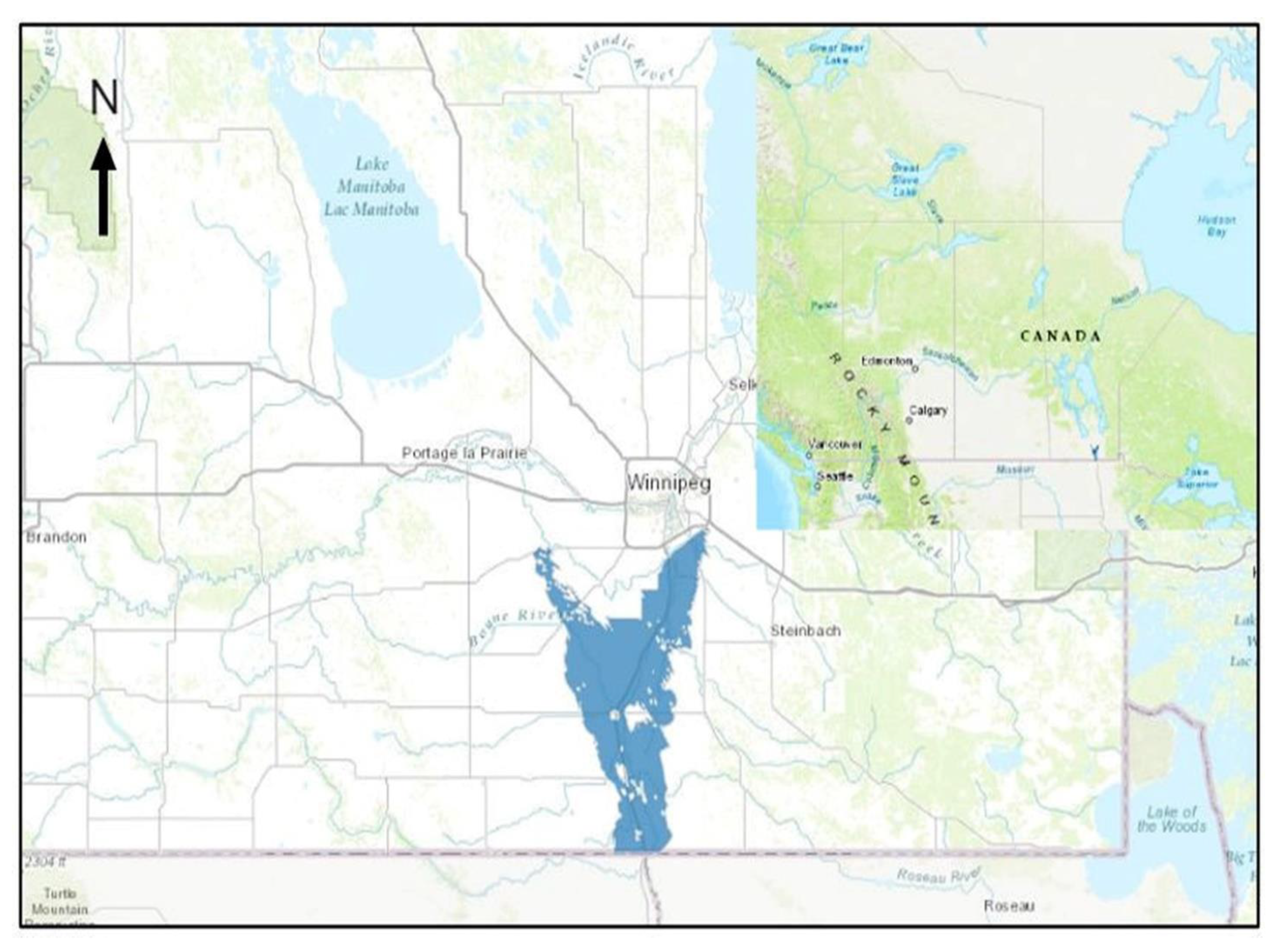
In Canada, the rural communities in the Red River Valley in the Province of Manitoba have historically been vulnerable to catastrophic flooding. The flood history of the Red River Valley can be traced back to 1793 AD. For instance, fur traders located near the present Canada-USA border wrote that the Red River had risen to a “prodigious height” [
26,
27]. Subsequent noteworthy floods include: the flood of 1826, which was estimated to have a return period of 500 years; a high-magnitude flood in 1852 and 1861; the flood of 1950 which inundated the City of Winnipeg and was seminal in the creation of top-down government management of future floods; the floods of 1974, 1979, 1996, and 1997 during late 20th century; and floods in 2006, 2009, and 2011 that suggest a decrease in the return frequency of devastating floods. The comparative peak discharges in the years of major floods in the Red River Valley are shown in
Figure 2.
In the 21st Century, the floods of 2009 and 2011 have been notable in terms the water discharge volume and magnitude of loss. However, the most significant recent flood occurred in 1997. This flood, known as “The Flood of Century”, was the most severe to occur in the Red River Valley since 1852. The water level of the Red River was approximately 7.5 m at the James Avenue, and would have been upwards of 10.5 m without flood control works [
28,
29]. The 1997 flood caused high running water levels in the Red River and numerous other rivers throughout Manitoba, which adversely impacted many communities (
Figure 3).
The 2009 spring flood, which was largely due to a heavy rainstorm in the first week of November 2008, had the fourth highest water levels recorded in the Red River Valley since 1826. Unfavorable ice conditions further exacerbated the flooding in the Red River watershed, causing the Red River to crest at 6.9 m in Winnipeg. In 2011, a steady rise in water levels was observed in several lakes and in rivers, including the Red, Assiniboine, Souris, Pembina, and Qu’Appelle, causing the Government of Manitoba to declare high flood risk for communities along the affected bodies of water. When the Red River peaked in Winnipeg on April 7, the 2011 flood had become the third largest in the last 150 years, and had necessitated the declaration of a province-wide state-of-emergency [
30,
31].
In addition to their physical vulnerabilities, social stressors also amplify the vulnerabilities of local communities in Manitoba. Although community residents and municipal managers are knowledgeable and experienced in local risk and hazard assessment and response, external factors such as provincial/regional floodplain policy and development have often discouraged local-level risk-management initiatives [
32]. Overall, there is a lack of literature on the mechanisms and dynamics of local-level disaster management, and engagement of the locale in decision-making particularly concerning flood management, in Manitoba [
33]. While community-level activities are intertwined with municipal and provincial governmental authorities, the state of local-level institutions and their role in flood disaster management are not well-documented. As such, it is necessary to investigate the institutional arrangements and local-level patterns relating to flood preparedness, response, and recovery in the Province of Manitoba.
The purpose of this study is to identify attributes of the local-level flood-management structure in Manitoba, Canada, with respect to flood preparedness, response, and recovery. Specifically, this study has two key objectives: (1) to examine the salient features of local-level flood preparedness, response, and recovery in selected rural communities; and (2) to map and analyze stakeholders’ views on the effectiveness of the existing structure and approaches to community-level flood management.
This paper is organized into six sections. In
Section 2, we present the conceptual considerations and framework of this research, followed by a detailed description of the materials and methods in
Section 3. In
Section 4, we analyze the results and major findings of the study, and in
Section 5, we discuss the implications of our results and compare how they align or diverge from those of previously published works. Finally, the conclusions of our study are presented in
Section 6.
2. Conceptual Considerations: Disaster Management Cycle and Community Engagement
The term, “disaster management,” refers to the aggregate of all activities, programs, and measures undertaken by various responders before, during, and after a disaster. Such actions can help to avoid disasters, and/or reduce their impacts, and/or help to recover from associated losses [
34]. The Disaster Management Cycle (
Figure 4) consists of three sequential components: (i) pre-disaster preparedness; (ii) response after a natural hazard strikes a community (such responses are carried out by individuals and local institutions); and (iii) post-disaster recovery and rehabilitation.
People in communities prepare themselves for floods in various ways. In the Red River Valley of Manitoba, Canada, community members tend to employ few interventions or actions to prepare for future floods. The principal flood-preparation measure taken in communities in the Red River Valley is floodproofing, which entails raising the elevation of houses and properties out of the reach of floodwaters; however, such action is typically only carried out in locations where it is recommended or made mandatory by the local/municipal government. During the pre-flood phase, community members also use their social network to collect sandbags to protect their lands and properties. However, a false sense of security, inspired chiefly by structural measures such as community dikes, is cited as the primary driver of the overall resistance to, or lack of, interest in preparedness [
35].
Raising awareness among community members about risk-reduction potential and motivating them to take precautionary measures are integral elements of effective flood preparedness. In New South Wales, Australia, flood-management education and information sharing have been emphasized to help local communities reduce flood risks and respond effectively when disasters do occur [
36]. Such education plans are developed, evaluated, and implemented by local committees consisting of community residents, business representatives, local council members, and government agency staff.
Flood memory is another source of knowledge that is often co-produced and shared at the community level for effective flood management and preparation measures. McEwen et al. [
37] found that, in the United Kingdom, flood memory is utilized as a major instrument for flood preparedness. To develop flood memories in the preparedness phase, schools include “flood week” as part of their curricular activities, and flood action groups are mobilized for the rehearsal and reinforcement of flood memory. Community people then build on these flood memories to develop and implement further proactive measures.
In Germany, communities tend to place their low-value assets in flood-prone areas. In addition, after the floods of 2002, households in the Elbe basin joined neighbourhood flood networks to prepare for the next flood. However, many households and businesses had not taken any precautionary measures, and instead relied completely on insurance and government bail outs [
38]. Terpstra and Gutteling [
39] observed that, in the Netherlands, people in local communities took steps such as installing flood-proof flooring and situating electrical outlets higher up on the walls. In addition, community members also kept a tentative evacuation plan and an emergency kit in their households. Overall, however, communities in developed countries tend to rely heavily on upper-level government interventions.
2.1. Response (Onset of Disaster) and Its Components
Disaster response refers to the measures that are taken to protect people, the environment, and other resources from natural or anthropogenic hazards, including the provision of relief during disaster events [
40]. In the United States, the National Response Framework (NRF) defines disaster response as the capability to save lives, and to protect property and the environment. Furthermore, it is critical to note that disaster response should also meet basic human needs after an incident has occurred [
41].
People in communities within the Red River Valley of Manitoba, Canada, tend to rely on their own capacity to respond to floods, as well as communication with those in their neighbourhoods via social media and/or phone calls. In addition, community members also communicate with emergency managers in the local government and seek advice on when to start pumping out floodwaters from breached areas of community dikes. Evacuation is not usually a preferred option among residents in communities. During the 1997 flood, more than 27,000 residents in the Red River Valley were evacuated from their communities [
42]. However, such large-scale emergency responses can only take place when provincial and federal institutions help to implement them.
In recent years, social media has emerged as a major platform where community members can share information and organize initiatives. These united efforts both complement and complicate professional emergency efforts, especially when response measures are undertaken without coordination. During the 2014 urban flash floods in Germany, the government utilized social media platforms such as Facebook and Twitter to engage communities in response and relief actions. This approach proved effective, as community actions initiated through these platforms helped to substantially limit flood damages [
43]. Similarly, several Facebook groups acted as the primary medium for citizens to gather and share information during the 2013 floods in Dresden, Germany. These networks functioned as “switch boards” that connected citizens in need of help with those who were able to offer it. This initiative was well-received by both the residents of Dresden and the local government [
23,
44].
2.2. Flood Recovery (Post-Disaster) and Its Indicators
Recovery is a complex process that begins immediately after a disaster and focuses on returning to a “normal state” or to a “new normal state” after the period of difficulty passes. However, the concept of “normal” is a matter of debate. Based on the context, “normal” can be interpreted as either the pre-disaster state, or the subsequent state that follows a new trajectory post-disaster. In fact, with loss and damage of infrastructure, local ecosystems and sometimes total elimination of existing landscape (e.g., large-scale landslides), recovering to the pre-disaster condition may become impossible. The pre-disaster state may even become undesirable after a disaster [
45].
Recovering from a disaster follows variable courses depending on the magnitude, type and nature of the hazard and the scale of the disaster. Both pre- and post-disaster planning and a successful implementation such resources and strategies help quick recovery from disasters. Following Smith and Wenger’s early work [
46], we identify the components of successful local recovery plans (
Table 1). During the recovery phase, emergency supplies, logistical and financial assistance, and psychological help play pivotal roles. For instance, Medd et al. [
47] found that community members in Hull, England relied on both social and institutional supports for their mental, physical, and financial recovery following major flooding. For their physical recovery, many of these people relied on health service systems. Although some people who had lost their homes in the flood reported being uncomfortable with living in rented housing, many said that spending time with family members had been effective in facilitating their mental recovery.
Local communities often take initiatives to manage and recover from flood losses. For instance, Rowlands [
48] observed that some communities in Australia had installed large roadside blackboards where community members could write messages to one another and where important information could be shared each morning during the early recovery stage. At the time of Rowlands’ [
48] study, these blackboards had been in place for more than a year. The blackboards served as a community source of information regarding where to find help, who could help, and who needed support. Moreover, the local hotel and pub became community rallying points where food, drink, and shelter were offered, and where people could gather, find one another, and self organize.
2.3. Local Community Engagement with Disaster Management
Many local governments engage stakeholders in determining criteria to follow during developing flood-emergency and disaster management strategies [
34] In other cases, traditional authority-led interactions and creative approaches to citizen engagement and citizen-initiated collaboration with authorities have all shaped the role of citizens in flood management [
35,
36]. For example, spontaneous local involvement and volunteerism in Australia have been cited as playing a key role in driving effective disaster management and recovery planning [
49].
To investigate a given local-level flood-management governance structure, it is necessary to gain an understanding of flood preparedness, response, and recovery patterns by identifying their respective elements and indicators. Community members can undertake flood management initiatives, but, unlike formal institutions, they face resource constraints and lack the necessary technical expertise. Therefore, cooperation and coordination between local and provincial governments is required to intervene and mobilize their resources. Although disaster management governance structures can take a variety of different forms, they can generally be categorized as either “top-down” or “bottom-up.”
Top-down structures are approaches wherein a central government agency acts as the sole authority by setting goals and guiding implementation. For over a century, emergency and disaster management approaches followed a “top-down” approach, relying heavily on structural-engineering interventions. The Province of Manitoba was no exception to this norm [
50].
Top-down approaches generally fail to engage community members, and are often ineffective at addressing the root causes of vulnerability and systemic issues. This results in the emergence of numerous local disputes, along with demands for transparency, engagement with civil society, and the inclusion of the community in the decision-making process. For example, during the 2010–2011 floods in Queensland and New South Wales, Australia, the number of assistance requests from community members received by local council and State Emergency Service representatives was so great that it outstripped their capacity to respond effectively [
51]. In southern Alberta, Canada, government initiatives aimed at transformative change toward social capacity building were unsuccessful due to insufficient engagement from community members [
52]. Conversely, experiential learning from the 2013 floods in Germany engendered numerous local disputes wherein community members became highly vocal about their desire to be included in the decision-making process [
53]. These deliberations led to the formulation of a participatory, “bottom-up” structure wherein multiple governmental and non-governmental entities agree to collaboratively participate in the decision-making process and work to achieve a consensus on a common set of goals and implementation strategies [
54].
4. Results
The results of the present study revealed that the flood-management remains a policy issue in Manitoba, and that efforts to this end are ongoing and have produced a number of multi-level institutional initiatives. In 2019, the Government of Manitoba unveiled the Manitoba Flood Coordination Plan [
67], which was developed in an effort to coordinate the various provincial and federal departments and agencies involved in flood management. Provincial and federal stakeholders formed the Flood Steering Committee, which was co-chaired by representatives from the Manitoba Emergency Measures Organization (EMO), Manitoba Infrastructure’s Water Management and Structures Division (WMSD), and Communication Services Manitoba (CSM). A Flood Annex Planning Committee was also established; this committee is responsible for developing, reviewing, and updating the Plan, and convenes at the request of the EMO. A list of agencies that have contributed to the planning process is presented in
Table 3.
Presently, Emergency Measures Organization (EMO) under Manitoba Infrastructure is the Department that is primarily responsible for flood-management activities in the province. While the Water Management and Structures Division also plays a pivotal role, other divisions within MI, such as Engineering and Operations, provide engineering and construction expertise, infrastructure protection, operational and logistical support, survey information, and provincial traffic and transportation systems management.
During the emergency response phase, the EMO engages relevant organizations and acts as the Provincial coordinating department. In addition, the EMO also coordinates federal response and assistance for the province through the Public Safety Canada Regional Office. Several organizations fulfill their pre-established roles and responsibilities during an emergency and/or the flood-recovery phase. These organizations include but are not limited to: Manitoba Infrastructure (MI), Communications Services Manitoba (CSM?), Sustainable Development, Manitoba Families, Manitoba Agriculture, Manitoba Education and Training, Manitoba Indigenous and Northern Relations, the Office of Disaster Management (on behalf of Manitoba Health, Seniors and Active Living), the Office of the Fire Commissioner, Manitoba Justice, and the Royal Canadian Mounted Police (RCMP).
4.1. Pattern of Local-Level Flood Preparedness in Manitoba
4.1.1. Provincial Flood Preparedness Influencing Local Preparedness
Each year, MI’s Hydrologic Forecast Center issues a spring flood outlook, which is typically forecast during the third week of February and updated during the third week of March. However, summer flood events resulting from severe rainfall may develop rapidly. Therefore, Manitoba Infrastructure’s communication regarding summer flooding is not included in the formal flood outlook report. The flood outlook (or alert) or forecast information is used in a meeting co-chaired by representatives from MI, the EMO, and CSM. The steering committee then establishes a flood planning benchmark for potential flood events. Given the area’s high flood potential, the Inter-Agency Emergency Preparedness Committee and senior government officials are briefed about the situation [
67].
Our study identifies several major critical structural and non-structural measures of flood preparedness in Manitoba. The structural measures include: (i) the construction of the Red River Floodway; (ii) maintenance and modification of the Red River Floodway according to needs; (iii) the provision of operating guidelines for flood-protection structures; (iv) engagement in land-use planning based on flood experiences; (v) the development of community dikes and pump stations; and (vi) dike pump and drainage maintenance.
The non-structural measures include: (i) a review of the operating guidelines for flood-protection structures; (ii) the establishment of the Manitoba Floodway Expansion Authority and the development of the EMO; (iii) coordination between provincial and municipal governments regarding flood forecasts and subsequent measures; (iv) the publication of reports detailing the provincial government’s research, findings, and recommendations; (v) communications by the Manitoba Floodway Authority to raise public awareness; (vi) the implementation of lessons learned from the 1997 Red River Flood under the “Canada-Manitoba Partnership Agreement on Red River Valley Flood Protection”; (vii) clarification of definitions for transparency purposes; (viii) the establishment of the Red River Floodway Operation Advisory Board to facilitate information dissemination and exchange among stakeholders in a timely manner; and (ix) hiring retired experienced civil servants to engage and communicate with First Nations communities.
4.1.2. Local-Level Flood-Preparedness Measures
Although local-level flood preparedness in Manitoba mainly depends on provincial initiatives, the participants in the KIIs and OHIs noted that local institutions have also undertaken some critical local activities in the preparedness phase. These activities include: (i) municipal authorities becoming more vocal about their interests when negotiating with the provincial government; (ii) municipal governments advising the community with respect to flood preparedness (e.g., the local RM government asked residents to floodproof their houses by raising the foundation); (iii) residents working collectively to build their local economies and add economic value to their communities; (iv) local municipal representatives and sub-watershed-committees working together on water-retention projects to mitigate flood losses; (v) the establishment of community-managed pump stations to remove floodwaters; and (vi) the use of social media by community members to facilitate dialogue and the exchange of information regarding flood preparedness.
Empirical evidence suggests that local-level flood preparedness in Manitoba is dependent on senior-level institutional initiatives. The former Department of Manitoba Transportation and Infrastructure (MTI) built and managed structural and non-structural infrastructure relevant to flood management. For risk communication, the Government of Manitoba keeps local communities updated on their research through published reports, which are available on the provincial government’s website. In addition, the MTI regularly held press conferences, and the EMO maintains contact with municipal governments and local representatives to communicate vulnerabilities and update them on context-specific measures. As one government representative shared:
“This will be debatable, but in my experience, we’ve gotten more comfortable with sharing information transparently with partners. We realized that there‘s a risk there. Information can be misinterpreted, maybe even abused, and exploited. But, by and large, sharing things accurately and in good faith leads to better outcomes. So, I think we‘ve gotten better.”
With experiential learning, the local communities took proactive initiatives as well. For example, the people of St. Adolphe realized that flood-management strategies developed by the government prioritize the capital city of Winnipeg due to its vital economic role in the province. To build their economic strength, local businesses have attempted to diversify their offerings in order to capitalize on their close proximity to the US-Canada border.
The development of networks and the utilization of new technologies in flood preparedness are also evident. For example, the Watershed Districts work as non-profit organizations that use government funding to identify flood-preparedness problems and seek solutions. The use of LiDAR to generate a three-dimensional visualization of an area has created newer opportunities for flood preparedness. An official from one of the watershed districts stated that:
“With LiDAR, we can take our modeling of the watershed. Previously, we could do maybe two or three projects a year. Now we have the potential to look at up to 20 projects and implement half of them in a year. It’s quite phenomenal.”
As part of one community initiative, a group of community people, with the help of the local government, constructed the Red River Valley Floods Interpretive Center, which now houses detailed information on floods in Manitoba and along the Red River Valley. The management committee of the Interpretive Center also provides educational tours for students of various ages to help them to learn about floods, how to adapt to floods, and the history of floods in Manitoba and the lessons learned from them. One elderly participant from Ste. Agathe shared that:
“The community people put the Red River Valley Foods Interpretive Center in the Cartier Park. The interpretive center was used by Manitoba Conservation and Water Resources for meetings. It was used as a school program facility. The then-premier used it on four occasions for press conferences during flood events.”
However, from the data collected, it is evident that aside from flood-proofing houses, which is mandated by the local government, there have been few flood-preparedness efforts at the household level in the studied communities.
4.2. Pattern of Local-Level Response to Floods in Manitoba
In this section, we focus on the pattern of response during the 1997 flood and, more recently, the floods of 2009 and 2014. According to the Manitoba Flood Coordination Plan [
53], during a flood emergency, the Government of Manitoba operates under an incident command system that links all contributing departments and agencies. The Flood Steering Committee provides the operational leadership to respond to flood emergencies throughout the province, as it is co-chaired by the Assistant Deputy Minister of Emergency Measures and Public Safety (EMPS), the Assistant Deputy Minister of MI-Water Management and Structures Division, and the Assistant Deputy Minister of Communication Services Manitoba. Based on the scale and scope of the measures taken, senior representatives of other primary, coordinating, and supporting departments and agencies may also serve on this steering committee.
During a flood response, the steering committee is responsible for communication across provincial and federal agencies and for making operational decision. During the emergency response phase of flood management, activities conducted by MI include flood forecasting; predicting and monitoring elevations; operating the Red River Floodway, Portage Diversion, Fairford River Water Control Structure, and Shellmouth Reservoir; modeling/mapping of the flood plain; undertaking mitigation initiatives.
The Manitoba EMO coordinates the response phase and plays a key role in facilitating collaboration between provincial departments, local authorities, non-government organizations, private-sector entities, and other relevant stakeholders. To support governmental departments, NGOs and private companies capable of contributing to the emergency response are contacted and mobilized according to their capacities. Each department is also advised to activate their own Emergency Operations Center (EOC) in accordance with their emergency response plans, and municipalities affected by a flood emergency are advised to activate and follow their emergency plans as well. After the activation of the Manitoba Emergency Coordination Centre (MECC), municipalities may be asked to participate in daily community conference calls, submit situation reports, and upload all relevant information and updates relevant to the response in WebEOC.
In a flood emergency, a local authority has the power to declare a state of local emergency (SoLE) within their region, while the provincial government has the power to declare a provincial state of emergency (PSoE), which provides it with access to specific powers under the Emergency Measures Act. Our field investigation identified six major elements of response in St. Adolphe and Ste. Agathe (
Table 4 and
Table 5). These elements include: (i) evacuation of the residents; (ii) psychosocial support in emergency conditions; (iii) coordination among levels of government; (iv) relief management; (v) communication among community people and authoritative institutions; and (vi) protective measures by governments.
In terms of emergency response, an official from the local government shared that they hope there will not be another flood similar in magnitude to the 1997 flood. During the emergency response phase of the 1997 flood, the Canadian Red Cross, the Salvation Army, and the Hutterite Colonies played an active role in supporting the people in the community. The Canadian Red Cross used vans to deliver food and water to those impacted by the flood, and they also raised money from all over Canada to assist them financially. For their part, the Salvation Army provided financial assistance to the community members based on their needs, while the Hutterite colonies contributed human resources in the management of sandbagging machines. Our results further revealed that the response phase of flood management in the two studied communities has partly been influenced by flood preparedness. The more the communities are prepared, the less they are vulnerable to flooding and the better they can respond to such events. Activities to this end have been spontaneous, improvised, and needs-based. During the flood of 1997, both communities had to be evacuated, which is significant as records indicated that Ste. Agathe had never experienced flooding previously. Looking back, one elderly member of the Ste. Agathe community offered the following insights:
“I’d say complacency played a big role in us flooding in 1997, because we‘d never flooded before. So, I‘d say it was ignoring what the government was saying. If the government tells you the water level is going to be 776.5 feet, and you don‘t dike it, there‘s going to be a problem. So, it was that refusal to believe that there was going to be a problem.”
The community was overwhelmed by the impact of the 1997 flood, and people were evacuated immediately thanks to the rapid action taken by the local and the provincial governments. Although, numerous personal and public properties were destroyed, such losses created a sense of unity and cohesion within the community as people came forward to help each another and share their emotions. One community member burst into tears while sharing his experience during an oral history interview, explaining that he felt guilty when he was living in a hotel because he had been less impacted by the 1997 flood than others in his community. He shared that:
“I would get back to the International Inn about between 10 and 11 o‘clock at night with my brother and I would walk into the door and that‘s where you would see the support group. Because people were coming back from their property, if they had been allowed to go, and they had lost their house, their property, and other people were there to support them. It was strong enough. And the disaster was so awful that, after a number of days, I would not go amongst that group. I would sneak in and go to my room because my place had not been overwhelmed. I felt terrible. Imagine! I felt terrible that I had saved my house! That‘s how bad that disaster was. And some people were seniors. So yes, there was massive support amongst […] people who knew each other. And if they didn‘t, they got to know each other. Personnel and the leadership at the hotel were also very, very supportive.”
To synthesize the patterns in emergency and flood disaster response, here, it is useful to apply a model developed by Wong-Parodi and Feygina (2018) that combines the elements of disaster emergency response and mass casualty incidents (MCIs) (also see O’Neill, 2005). We compared these elements with the aspects of emergency response that surfaced during the KIIs and OHIs in relation to the contexts of St. Adolphe and Ste. Agathe. It is apparent that during the 1997 flood and more recent floods, the Government of Manitoba has made efforts to respond to the situation based on the learning and experiences it has gained from previous floods. The efforts taken by the provincial government are detailed in
Table 4.
The key informant interviews and oral history interviews revealed that harmony and solidarity among community members are the principal elements that bolster flood response, especially under emergency conditions.
Table 5 presents the patterns in local flood response in the communities of St. Adolphe and Ste. Agathe.
4.3. Pattern of Local-Level Flood Recovery in Manitoba
Following the Manitoba Flood Coordination Plan, the Flood Annex Planning Committee allows residents to return to their respective municipalities after the recession of floodwaters, as outlined in the re-entry guidelines. The municipalities receive extensive provincial assistance in their post-emergency operations, including re-entry operations, clean-up, restoration of utilities, flood damage estimation, claims for financial assistance, and the resolution of flood operations costs.
The respondents identified five dimensions relating to flood-recovery patterns and activities at the local level in Manitoba: (i) functioning partnerships among stakeholders; (ii) recovery governance; (iii) preparing for the next flood; (iv) physical and economic recovery; and (v) the social and physical fabric of homes and communities. Some of these activities are carried out as part of provincial initiatives aimed at all vulnerable municipalities, while others are specific to the communities of St. Adolphe and Ste. Agathe.
4.3.1. Provincial Flood-Recovery Activities in Manitoba
Recovery Governance
In Manitoba, all decision-making approaches at the provincial government level, including those relating to flood-recovery activities, must move through a public-policy process. Since bureaucrats and politicians serve a democratically elected government, decisions related to flood-recovery activities must be approved by the elected leadership. For their part, bureaucrats can draw upon lessons learned from experience and research on similar cases to develop recommendations and a plan for the government to implement. Once a plan has been developed, the elected leadership evaluates its feasibility, but this can be influenced by the government’s political mandate. A member of the bureaucracy involved in flood management in Manitoba stated that:
“We‘re not like a non-profit or a research think tank, or even a private organization that can just decide, oh, we‘ve learned these lessons, we‘re going to do it. What we do, government has to see value in it. And it‘s got to be a part of their platform.”
However, the area of flood management has an advantage because, unless there has been a recent flood with devastating impacts on peoples’ lives, political campaigns typically do not give much attention to flood-management mandates. This lack of attention enables the decision-making process to be more flexible and allows elected leaders to explore different options and alternatives to find those that work best. Thus, power dynamics, accountability, and hierarchy are the major factors in flood-recovery measures in Manitoba.
Physical and Economic Recovery
After the flood of 1997, the Government of Manitoba and the Canadian Red Cross evaluated damages to individual properties and compensated people independently based on these evaluations. The provincial government and the municipal government collaborate to manage compensation programs through a needs-based approach. After the 1997 flood, the provincial government sent adjusters to estimate the damages to each flood-affected house once the floodwaters had receded, and to assess whether a house was salvageable or a write-off. The adjusters also examined personal items, differentiating those that were deemed to be essential products from those that were considered luxury items. For example, beds were considered essential items, while televisions and lawn mowers were considered luxury products. Once this assessment had been completed, the government compensated individuals for the essential items that had been lost, but not for their luxury items. Each household was eligible to receive up to $100,000 based on their needs.
The municipal government and the provincial government also collaborate with the federal government when flood-related damages and losses exceed the capacity of the Province. The federal government assists the Manitoba government financially through the Disaster Financial Assistance program. One member of the Government of Manitoba bureaucracy explained that,
“Once a flood is over, the municipal government works closely with Public Works and the EMO. They also work with the Disaster Financial Assistance unit of the federal government to coordinate the disaster sites and document pictures. Then, they finalize the repairments throughout the municipality together. They put all claims [and] evidence together, and submit those for reimbursements according to DFA guidelines. The federal government sends money to the municipalities through the provincial government.”
In Southern Manitoba, farmers are especially impacted by major floods, as such events destroy their crops and harvests. Currently, farmers have access to private insurance to protect their crops and property. Examples of such insurance include, Farm and Agricultural Insurance in Ontario and Manitoba, Farm and Agricultural Insurance, and Farm Insurance—the Co-operators, Western Financial Group’s Farm, and Ranch and Crop Hail Insurance.
After experiencing floods, some designated regions are considered unsuitable for living. To help homeowners in these areas, the provincial government developed a buyout program through which it purchases condemned houses from their owners to assist with the financial burdens of resettlement. This program is generally active in areas that are deemed risky for both the occupants and the rescuers due to prevailing flood conditions.
4.3.2. Flood-Recovery Initiatives in St. Adolphe and Ste. Agathe
Functioning Partnership among Stakeholders
After the 1997 flood, the people of St. Adolphe and Ste. Agathe worked together to recover from the economic losses they had suffered. As part of this recovery, the people of these communities took advantage of their proximity to the US-Canada border when redeveloping their businesses. The community people also requested that the provincial government increase the radius of the community dikes to allow more space for their businesses to flourish. This request was granted and carried out utilizing local knowledge. The people in the community developed community-based groups to present their demands to the local and provincial government; following the flood of 1997, the people of these communities became very vocal about their interests, including their strong desire to rebuild and protect their communities. Collective efficacy and social cohesion played a major role in such activities. The people of Ste. Agathe also established an Economic Development Committee, which was chaired by a member from within the community. The purpose of this Committee was to work towards rebuilding the community.
Social and Physical Fabric of Homes and Communities
After losing a house, or parts of it, due to floods, along with everyday commodities, it becomes very difficult for individuals to cope with the sense of loss of the social connections and lives built within the community. With regard to his experience following the 1997 flood, one elderly member of the community remarked, “I just lost fifteen years of my life!”
The difficulty of psychosocial recovery was evident, as the community members still shed tears of sadness while sharing their experiences of the 1997 flood, even after 25 years. The intangible losses caused by a flood can hardly be compensated through monetary assistance. With sadness, suffering, and agony, comes attribution of blame. Consequently, the communities have become very concerned about their rights after the 1997 flood. In a conversation with the then-premier, the community reprimanded the provincial government’s past endeavours to protect the communities from floods. A member of the St. Adolphe community shared that, “We shamed the government into providing us with dikes, funding, and to put plans in place.” Such community actions ensured a quick recovery, with considerable assistance coming from the provincial government.
5. Discussion
In this study, we investigated the salient features and characteristics of local-level flood management in the communities of St. Adolphe and Ste. Agathe, which are situated in the RM of Ritchot in Manitoba, Canada. To this end, we analyzed the patterns of flood preparedness, response, and recovery in these communities. In terms of preparedness for coping with flood hazards through structural mitigation measures, the communities were indifferent to the uncertainty and unpredictable nature of floods in Manitoba and even expressed their frustration regarding the necessity of their involvement in flood-management activities. Such lack of engagement and even unwillingness to being part of the process is a major obstacle in knowledge co-production and stakeholder partnership.
As Scolobig et al. [
68] observed in their study of Tasmania, Australia, a lack of willingness among at-risk populations to share the responsibility for disaster management measures can encourage a top-down approach. According to the findings of this Australian study, although local participation may create conflict between public and private interests, it is necessary for government authorities to understand community perspectives and responsibility expectations. Kahl’s [
69] study of Giles County, Virginia, USA, reaffirmed that the people of the community actively participated in flood modelling to help the local government enhance its flood preparedness. For example, the community members identified inaccuracies in the model and enlightened the researchers who were preparing the model about any community-specific necessities that needed to be considered.
In Italy, Germany, England, and the Netherlands, the professionalization of community members as risk-management stakeholders was noticeable at the local level [
70,
71]. Such efforts to increase community capacity and efficiency have generally been absent in the Red River Valley communities of Manitoba. Flood-preparedness activities in these communities are more centralized in Departments of the Manitoba Government, and the process through which community members can participate in such activities is not well-defined. Moon et al. [
72] observed a similar state of public engagement in Belfast, Northern Ireland, which had a participatory process that was not transparent and did not encourage active participation from the key stakeholders. Consequently, proactive flood-preparedness measures did not take place in these communities.
In the Red River Valley, the community respondents alleged that there is a one-way flow of information, with little-to-no reciprocity. For example, the EMO informs schools, hospitals, and senior homes about imminent risks and potential evacuation. After evacuation warnings have been communicated by the provincial government, the emergency coordinator at the municipal level takes the initiative to evacuate the affected community members. In potentially high-risk situations, the EMO and forecast group from Manitoba Infrastructure goes out to the communities to conduct briefings. The EMO has direct contact with the emergency management coordinators of local municipalities. However, little-to-no community input is considered in such briefings.
In 2022, Manitoba Transportation and Infrastructure held a “flood outlook” press conference to provide information about flood risks at the regional level, the resources and capacity of the Manitoba government, and Federal Disaster Financial Assistance arrangements. Such centralized management systems cause community members to become reliant on the local and provincial government for flood response rather than empowering them to mobilize their own resources and local knowledge and skills. This is problematic, as such approaches eventually extinguish community members’ interest in taking measures at the community level.
Manitoba’s centralized system is comparable with that Southern Alberta, Canada, where social capacity could not be built due to lack of public engagement [
52]. The failure of institutions to mitigate flood losses engenders public rage, as was evident after the 1997 flood. Not unlike Manitoba, experiential learning from the 2013 flood in Germany gave rise to local disputes as well [
52,
53].
Nonetheless, the panel responsible for reviewing the operating guidelines of flood-protection structures has established a website where it can communicate background information about its management practices and where the public can submit comments and opinions. Such interactive initiatives make flood preparedness in the Red River Valley top-down in character with very little community-level participation.
It is evident that, in Manitoba, the majority of flood-management policies and decisions are meant to be implemented at the community level, but are designed by the provincial government with little-to-no input from the communities they affect. Such a top-down approach is unsustainable, as it is incapable of incorporating the community’s expectations, in addition to creating misunderstandings between the government and community members. For example, our empirical investigation revealed growing dissatisfaction among community people and non-profit organizations about numerous measures taken by the provincial government, including those related to the financial aid systems, prioritizing the City of Winnipeg in flood management, lack of fund allocation to the RMs, and the absence of timely communication. These results align with those of Haer et al.’ [
73] study of Rotterdam-Rijnmond, the Netherlands, which found that risk-based top-down communication strategies are less effective than collaborative ones.
There is ongoing coordination and collaboration between the provincial government and local governments in the Red River Valley, especially in response to floods. However, the decision-making process has been and largely remains centralized, with community engagement being limited to manning the pumping stations, sandbagging, communication of assistance, and volunteering services. In emergency situations, community members tried to collaborate with one another, and the advent of social media has made communication among community members more dynamic. For example, Facebook groups allow community members to exchange valuable information and share their experiential knowledge. A similar scenario was observed during the 2013 floods in Dresden, Germany, where people in the community primarily communicated with one another and shared information via Facebook [
44].
Local-level flood recovery in the Red River Valley is primarily managed by the local and provincial governments. The provincial government and the municipal governments collaborate to manage compensation programs, whereas non-profit organizations such as the Canadian Red Cross assist in flood recovery at the field level. The community dikes surrounding St. Adolphe and Ste. Agathe were constructed with a larger radius than specified in the government plan, but this only occurred because the people of these communities took the initiative to make their wishes clearly known to the provincial government. The benefits of local community input have been evident in many places. Unlike the flood-recovery process in the Red River Valley, the municipal government in Arnhem, Netherlands, took the initiative to engage citizens in knowledge co-production. Similarly, natural-hazard risk tolerance criteria for development activities were advocated by stakeholders in a government-driven engagement program aimed at shaping the recovery process following a flood in the District of North Vancouver, British Columbia [
74,
75].
In contrast to the informal community engagement observed in the flood-recovery measures implemented in the Red River Valley, community involvement has been formalized in Southern Alberta, Canada, where service providers have recognized the benefits of incorporating community members’ insight and input into flood-recovery processes. Notably, the people in these communities have also recognized their participation in the decision-making and implementation approaches as a way toward sustainable recovery. As a result, community engagement efforts engendered community-led services and initiatives [
76].
In terms of flood recovery, the prevailing opinion among the majority of people in St. Adolphe and Ste. Agathe is that the provincial government’s flood-management strategy prioritizes the City of Winnipeg due to its economic contributions to the Province. They expressed their frustration at this perceived unfair treatment, and noted that it had driven them to focus on developing their economic value and clout as a community and to begin diversifying their community business offerings.
After careful analysis of local-level flood-management in the Red River Valley, it can be inferred that, while the relevant decision-making processes remain institutionally centralized, the overall flood preparedness, response, and recovery measures have begun to move away from conventional top-down approaches. However, local community participation and engagement in flood-management decision making is still limited. A false sense of safety due to structural mitigation measures and a lack of effective vertical collaboration between the formal institutions and the communities can be identified as two of the major factors responsible for this pattern. Consequently, the knowledge co-production process is thwarted, and a command-and-control structure remains the dominant flood-management paradigm in the Red River Valley.
6. Conclusions
Despite the UN Sendai Framework’s strong call for local community engagement in disaster management and community resilience building, efforts to this end on the part of the Canadian federal and provincial governments have been nominal. Consequently, there is a lack of knowledge and information on the local-level management of floods and other types of disasters, particularly in terms of engagement of the locale. The Province of Manitoba is no exception to this condition. The present case study makes a contribution to the understanding of the mechanisms and factors of local level flood risk assessment and management, especially in the context of a developed country like Canada. Given these knowledge gaps, the primary purpose of this study was to identify the attributes of local-level flood-management structures in Manitoba in terms of flood preparedness, response, and recovery. The specific objectives of the study were to examine the salient features of local-level flood preparedness, response, and recovery, and to map and analyze stakeholders’ views on the effectiveness of the existing structure and approaches to community-level flood management.
One of most conspicuous findings of our study is that the reluctance or often avoidance of flood risk-reduction and management responsibilities by the local communities, which is partly attributed to the previous experience of “bailing out” of flood-victims by the public funds, instigated a continuation of the top-down approach in the Province of Manitoba, Canada.
In agreement with the results of Homsy et al. [
77] and McClymont et al. [
78], the findings of our empirical investigation indicate that a multi-level governance approach, or a “fluid frontier” between top-down and bottom-up flood management, is necessary in the Province of Manitoba. Such an approach is likely to effectively minimize the limitations of a top-down technocratic approach, while maintaining vertical and horizontal communication and knowledge co-production and preserving order and a uniform guideline. The results of our study enable four key policy recommendations:
- (1)
Further research should be carried out to investigate the means and ways to encourage and motivate floodplain residents to undertake appropriate flood preparedness, risk-reduction and management responsibilities.
- (2)
Community-level flood management should be rigorous instead of depending entirely on institutional initiatives. Community members should be integrated into the decision-making process to utilize local-level knowledge, skills, and experience.
- (3)
Communication gaps between community members, local and provincial governments, and non-government organizations should be addressed using interactive, two-ways means to improve trust, mutual respect, and knowledge co-production.
- (4)
To achieve sustainability, disaster- and flood-management approaches should adopt a pluralist governance structure that incorporates elements from both the top-down and bottom-up approaches.
- (5)
Further research is needed to investigate the dynamic combinations of top-down and bottom-up flood-management governance and to analyze the compatibility of multi-level governance in the context of the Red River Valley.
Finally, the present study has several limitations. First, the data used in the study are cross-sectional and therefore do not allow a time-series analysis for making longitudinal inferences. Second, only two selected towns on the Red River Valley of Manitoba were covered in the study and therefore, generalization about the entire Valley should be made with caution.


