
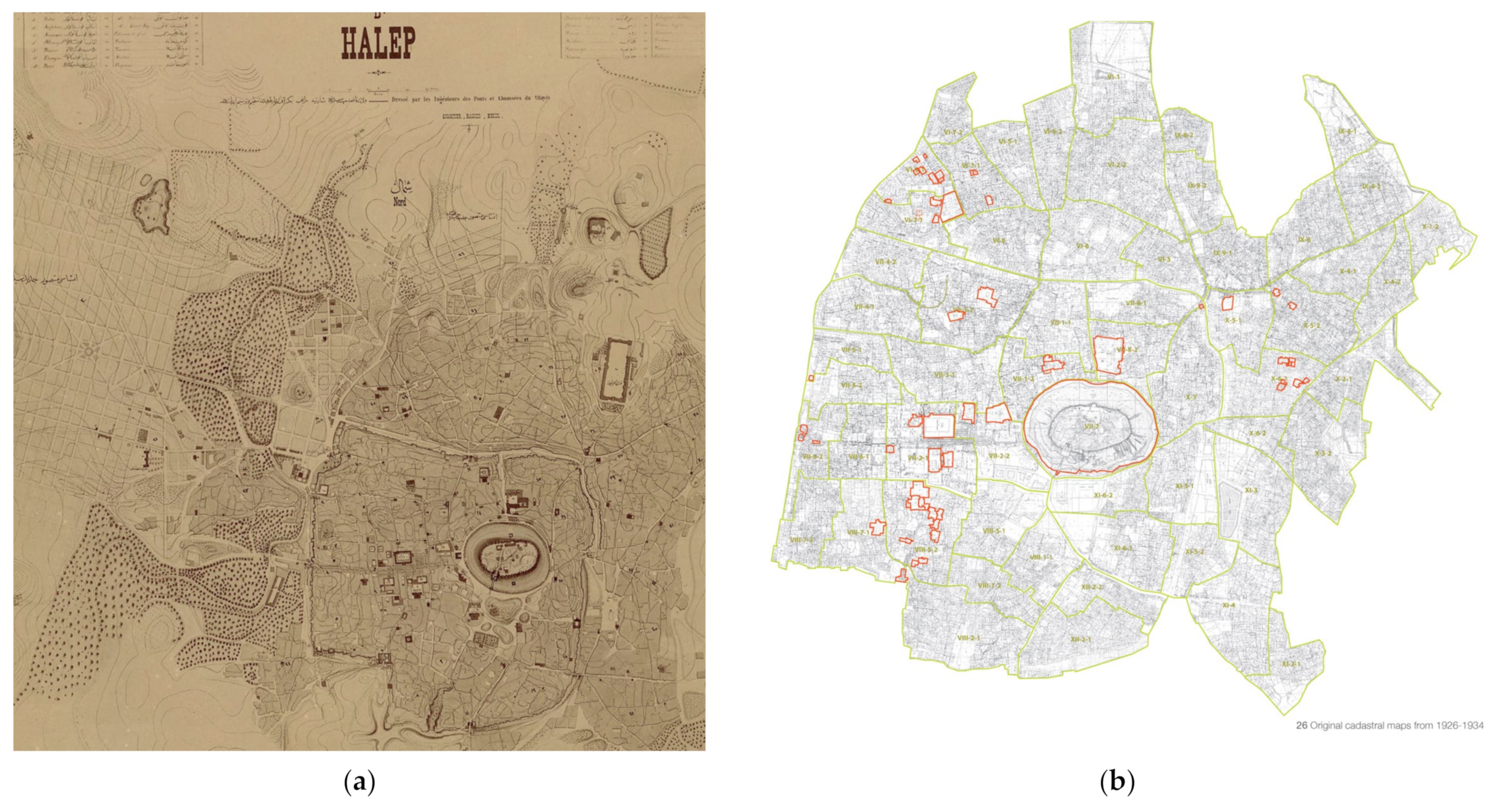
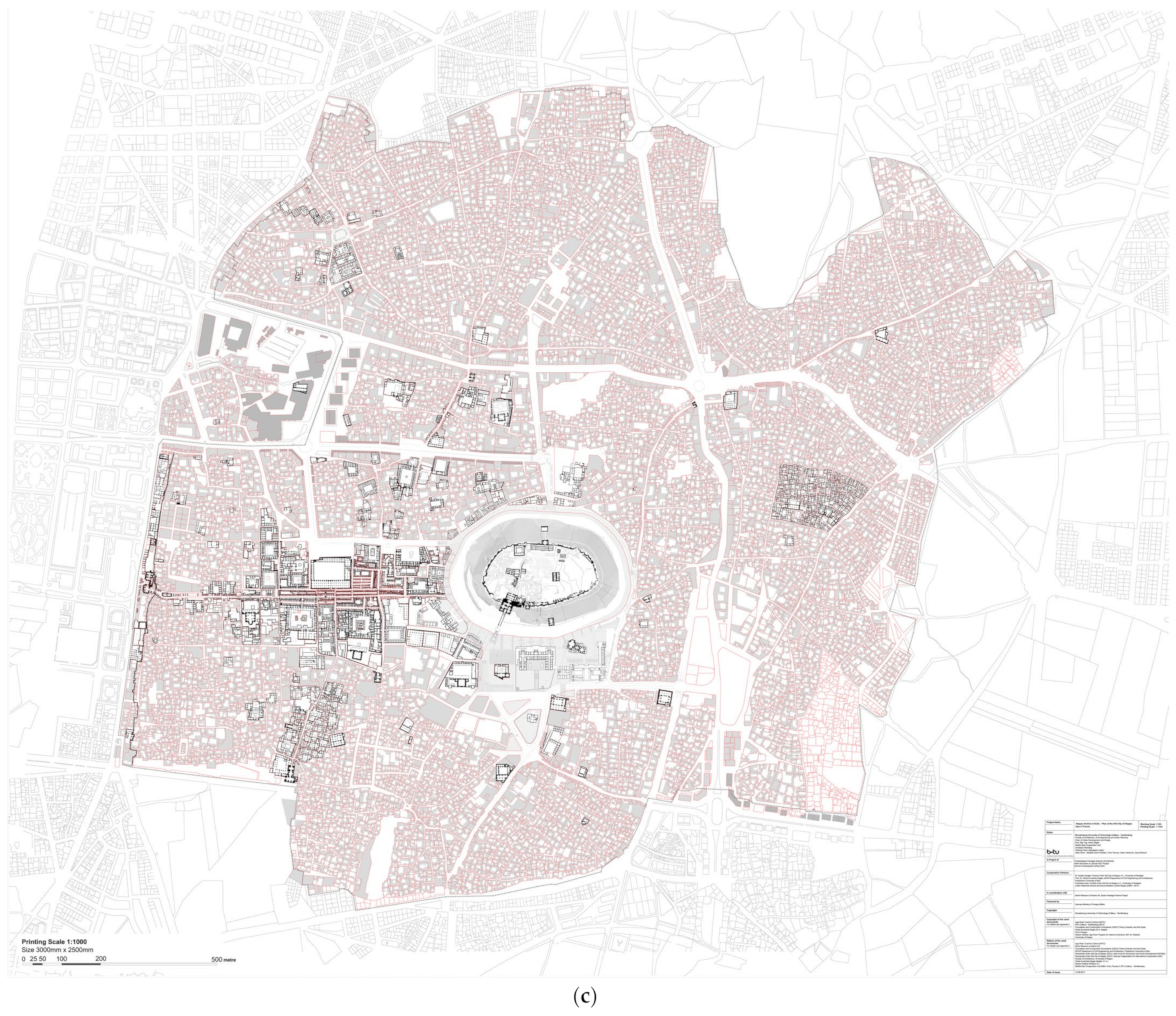
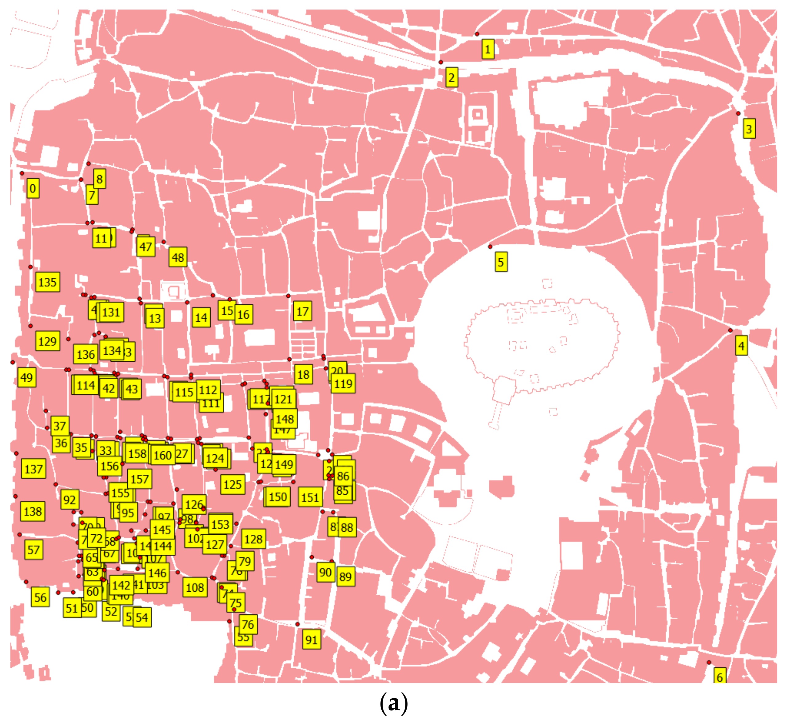
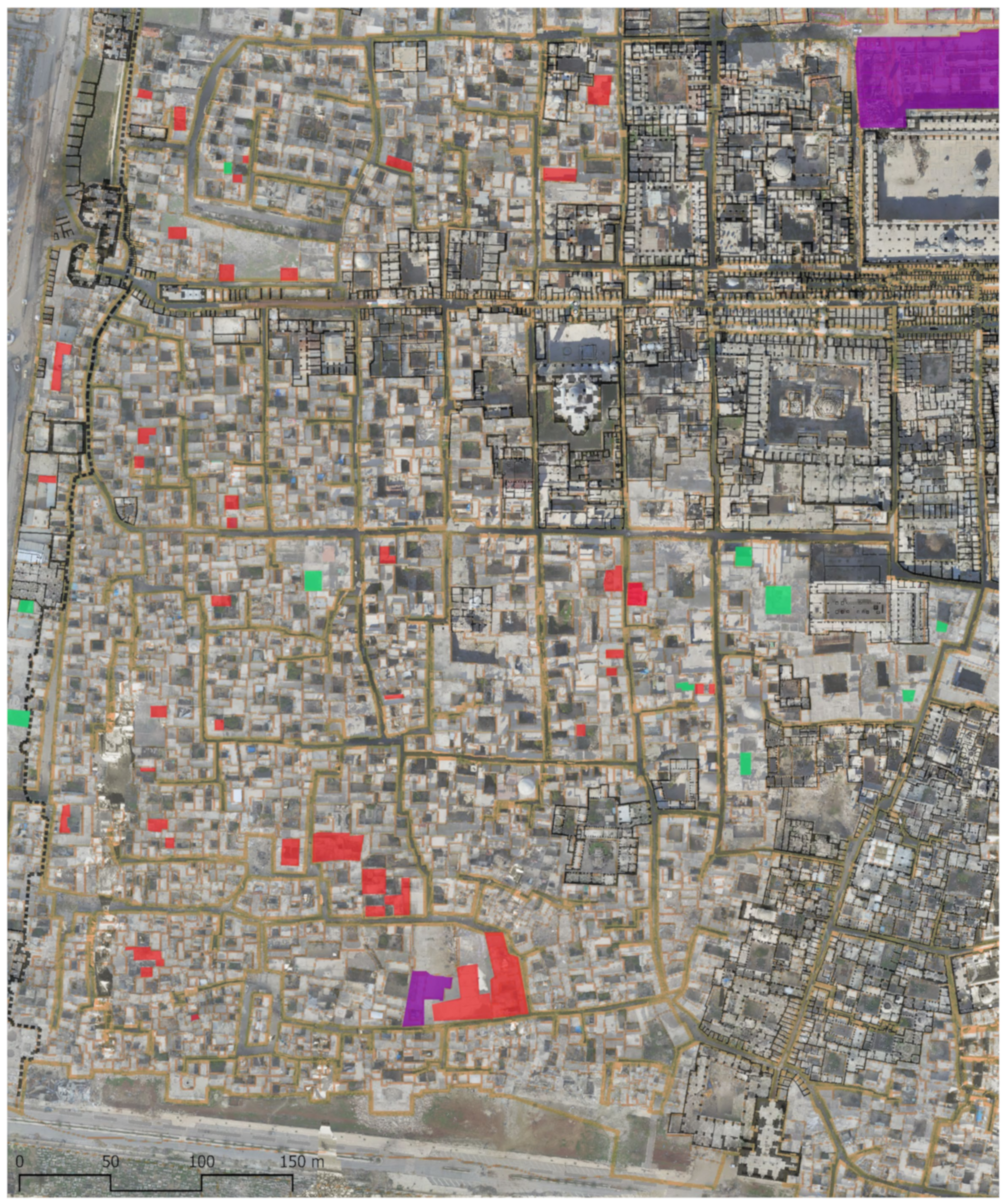
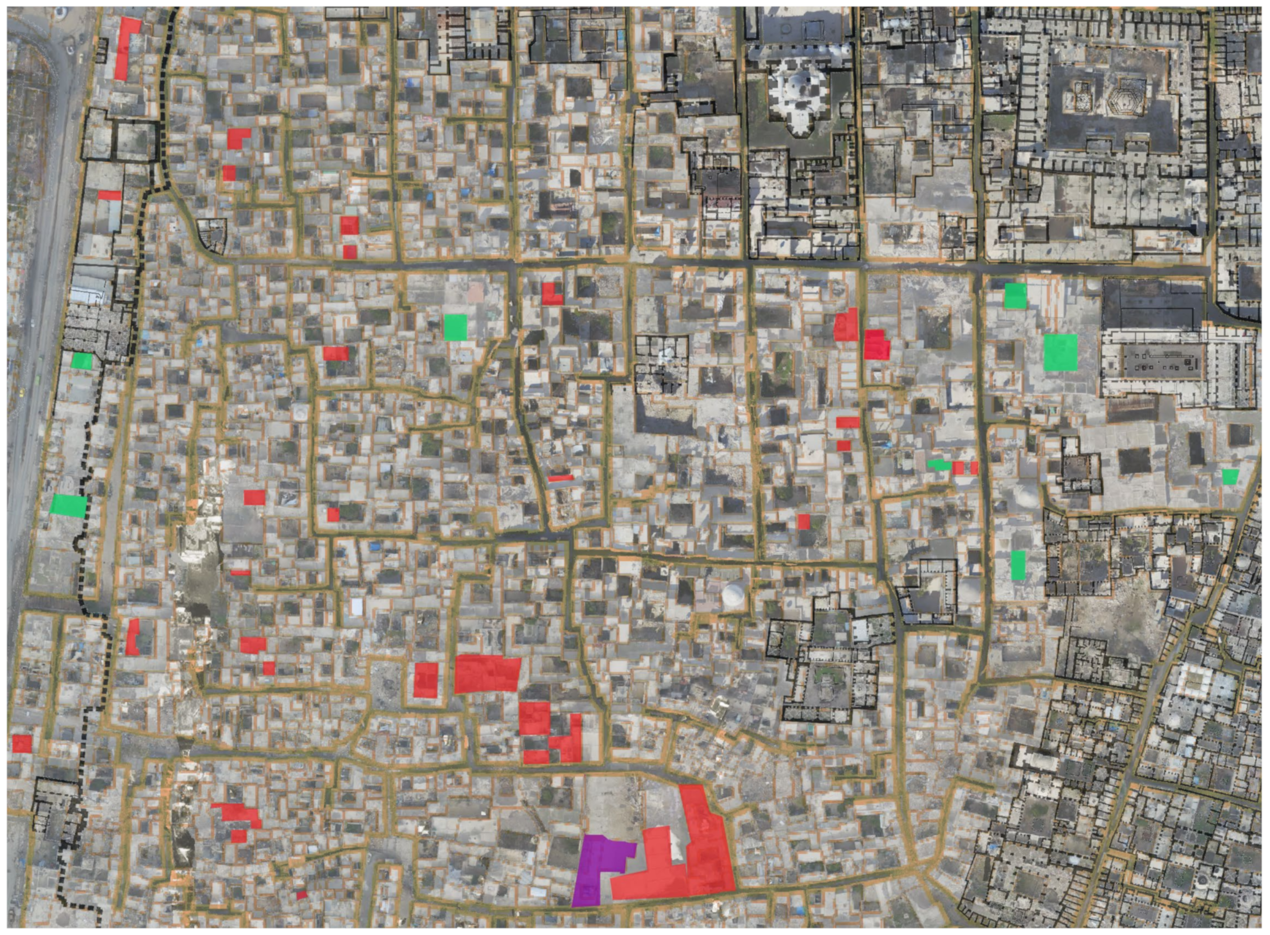
Aleppo Pixelated: An Urban Reading through Digitized Historical Maps and High-Resolution Orthomosaics Case Study of al-ʿAqaba and al-Jallūm Quarters


Abstract
Share and Cite
Orabi, R. Aleppo Pixelated: An Urban Reading through Digitized Historical Maps and High-Resolution Orthomosaics Case Study of al-ʿAqaba and al-Jallūm Quarters. Digital 2024, 4, 152-168. https://doi.org/10.3390/digital4010007
Orabi R. Aleppo Pixelated: An Urban Reading through Digitized Historical Maps and High-Resolution Orthomosaics Case Study of al-ʿAqaba and al-Jallūm Quarters. Digital. 2024; 4(1):152-168. https://doi.org/10.3390/digital4010007
Chicago/Turabian StyleOrabi, Rahaf. 2024. "Aleppo Pixelated: An Urban Reading through Digitized Historical Maps and High-Resolution Orthomosaics Case Study of al-ʿAqaba and al-Jallūm Quarters" Digital 4, no. 1: 152-168. https://doi.org/10.3390/digital4010007
APA StyleOrabi, R. (2024). Aleppo Pixelated: An Urban Reading through Digitized Historical Maps and High-Resolution Orthomosaics Case Study of al-ʿAqaba and al-Jallūm Quarters. Digital, 4(1), 152-168. https://doi.org/10.3390/digital4010007