
Treatment and Analysis of the GNSS Signal from Smartphones and Its Applicability to Urban Mobility †


Abstract
:1. Introduction
2. Background and Current Status
3. Material and Methods
3.1. Material
3.1.1. Hardware
3.1.2. Software
- Flutter: An open-source mobile app created by Google SDK. It is often used to develop user interfaces for Android, iOS, and Web applications, as well as being the primary method for creating applications for Google Fuchsia.
- NodeJS: A cross-platform, open-source, server-layer runtime environment based on the JavaScript programming language; it is asynchronous, with data I/O in an event-driven architecture and based on Google’s V8 engine.
- RTKLib: Open-source software package for standard and accurate positioning with GNSS (global navigation satellite system). RTKLIB consists of a portable program library and various APs (application programs) that use the library.
3.2. Methods
4. Results
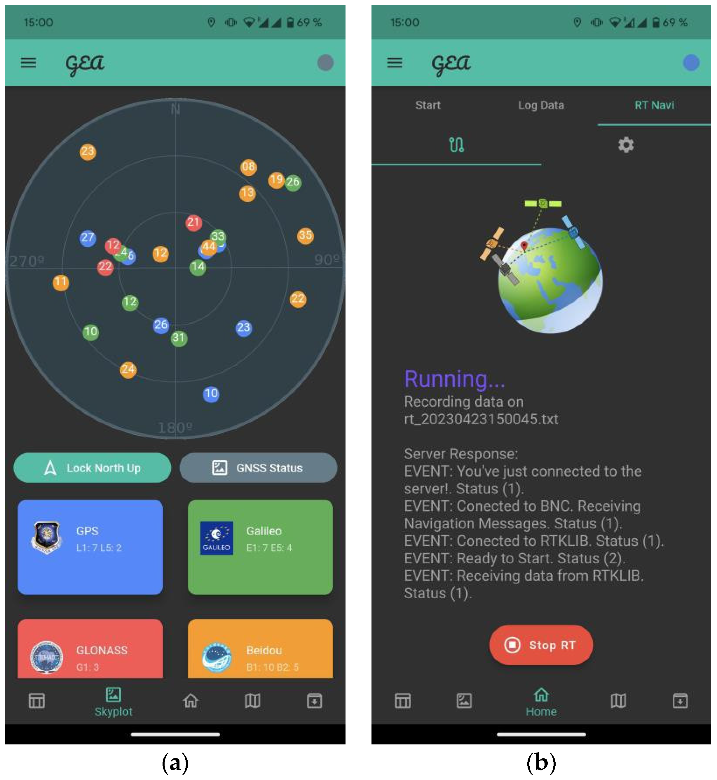
- Data capture and dumping data into plain text files: Currently, the application already has the possibility of capturing and storing GNSS data for their subsequent post-processing as shown in Figure 2. In addition, the user interface has been improved so that all the executions that are carried out are stored in the database; thus, in the case of phone data loss, said executions can be recovered, thus also generating an information store that can be used in the future to establish clear parameters on the applicability of the solution.
- Raw data processing in real-time: The development of this part of the application is being finished. Currently, on the client side, a first version of the interface for sending data to the computing server has already been defined and implemented. For this, a connection has been implemented through websockets, creating an information tunnel between the user and the server, which will remain open until the server and/or the client close the connection to request information in real time. The raw data from the sensor are converted to an internal NMEA-type format, thus generating a message for each of the observables (satellites) received by the sensor. On the server side, the implementation of the data reception part through websockets is being completed, as well as the connection between the web server and the GNSS data processing application (RTKLIB). For this, the transformation of raw GNSS data to the standard RTCM3 format has been defined as an interface.
Author Contributions
Funding
Informed Consent Statement
Data Availability Statement
Conflicts of Interest
References
- Banville, S.; Diggelen, F.V. Precision GNSS for everyone: Precise positioning using raw GPS measurements from Android smartphones. GPS World 2016, 27, 43–48. [Google Scholar]
- European Global Navigation Satellite System (GSA). Using GNSS Raw Measurements on Android Devices: Towards Better Location Performance in Mass Market Applications; Publications Office of the European Union: Luxembourg, 2017. [Google Scholar] [CrossRef]
- Robustelli, U.; Baiocchi, V.; Pugliano, G. Assessment of Dual Frequency GNSS Observations from a Xiaomi Mi 8 Android Smartphone and Positioning Performance Analysis. Electronics 2019, 8, 91. [Google Scholar] [CrossRef]
- Lucas-Sabola, V.; Seco-Granados, G.; Lopez-Salcedo, J.A.; Garcia-Molina, J.A.; Crisci, M. Cloud GNSS receivers: New advanced applications made possible. In Proceedings of the 2016 International Conference on Localization and GNSS (ICL-GNSS), Barcelona, Spain, 28–30 June 2016; IEEE: New York City, NY, USA, 2016. [Google Scholar] [CrossRef]
- García-Molina, J.A.; Parro, J.M. Cloud-based GNSS Processing of Distributed Receivers of Opportunity: Techniques, Applications and Data-collection Strategies. In Proceedings of the 6th International Colloquium on Scientific and Fundamental Aspects of GNSS/Galileo, Valencia, Spain, 25–27 October 2017. [Google Scholar]
- Favenza, A.; Rossi, C.; Pasin, M.; Dominici, F. A Cloud-Based Approach to GNSS Augmentation for Navigation Services. Proceedings of 2014 IEEE/ACM 7th International Conference on Utility and Cloud Computing (UCC), London, UK, 8–11 December 2014; IEEE: New York City, NY, USA, 2015; pp. 489–490. [Google Scholar] [CrossRef]
- Lucas-Sabola, V.; Seco-Granados, G.; López-Salcedo, J.A.; García-Molina, J.A.; Hein, G.W. GNSS IoT Positioning: From Conventional Sensors to a Cloud-Based Solution. Inside GNSS, 15 June 2018. Available online: http://spcomnav.uab.es/docs/journals/Lucas_InsideGNSS2018.pdf (accessed on 5 June 2023).

Disclaimer/Publisher’s Note: The statements, opinions and data contained in all publications are solely those of the individual author(s) and contributor(s) and not of MDPI and/or the editor(s). MDPI and/or the editor(s) disclaim responsibility for any injury to people or property resulting from any ideas, methods, instructions or products referred to in the content. |
© 2023 by the authors. Licensee MDPI, Basel, Switzerland. This article is an open access article distributed under the terms and conditions of the Creative Commons Attribution (CC BY) license (https://creativecommons.org/licenses/by/4.0/).
Share and Cite
Olcina, J.H.; Julián, A.B.A.; Furones, Á.E.M. Treatment and Analysis of the GNSS Signal from Smartphones and Its Applicability to Urban Mobility. Environ. Sci. Proc. 2023, 28, 1. https://doi.org/10.3390/environsciproc2023028001
Olcina JH, Julián ABA, Furones ÁEM. Treatment and Analysis of the GNSS Signal from Smartphones and Its Applicability to Urban Mobility. Environmental Sciences Proceedings. 2023; 28(1):1. https://doi.org/10.3390/environsciproc2023028001
Chicago/Turabian StyleOlcina, Jorge Hernández, Ana B. Anquela Julián, and Ángel E. Martín Furones. 2023. "Treatment and Analysis of the GNSS Signal from Smartphones and Its Applicability to Urban Mobility" Environmental Sciences Proceedings 28, no. 1: 1. https://doi.org/10.3390/environsciproc2023028001