Monitoring Water Turbidity Using Remote Sensing Techniques †
Abstract
1. Introduction
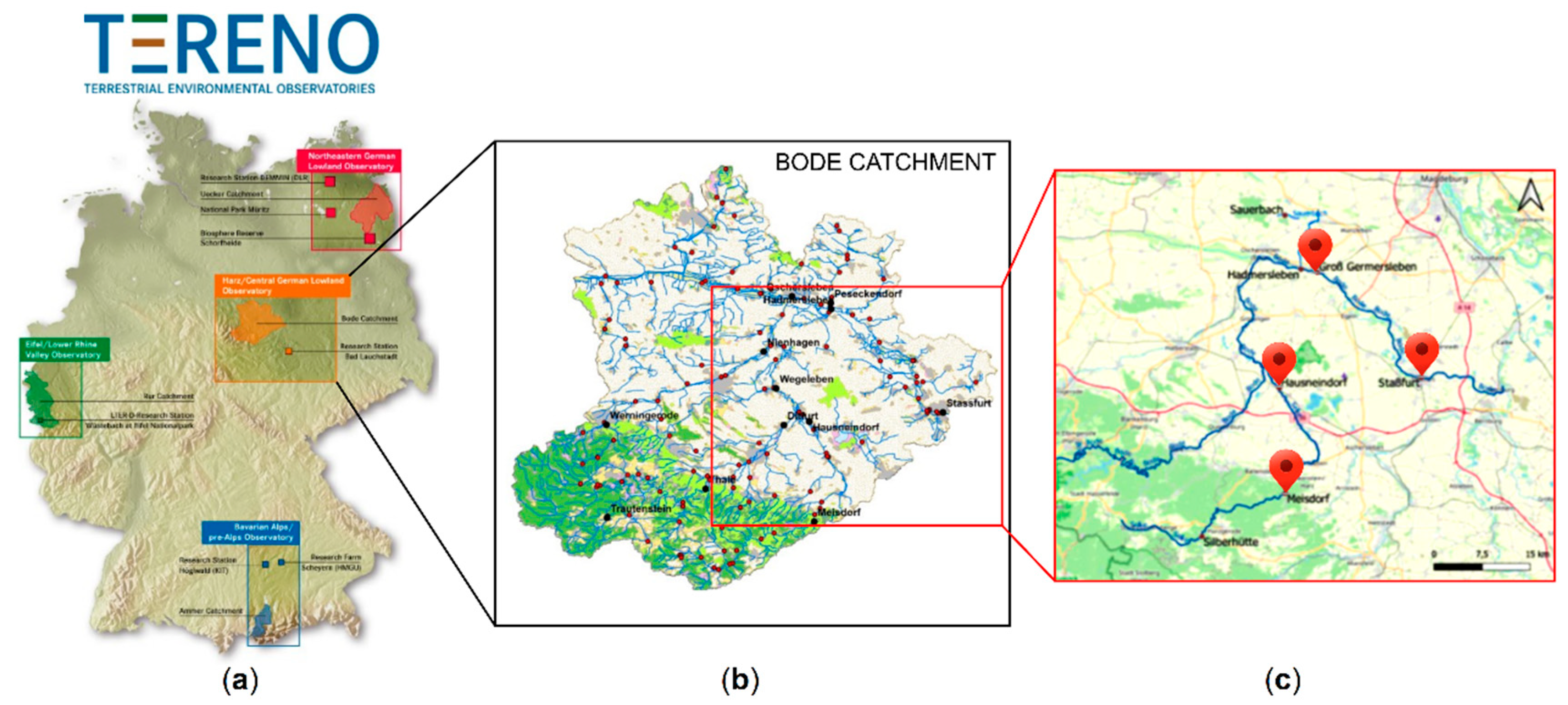
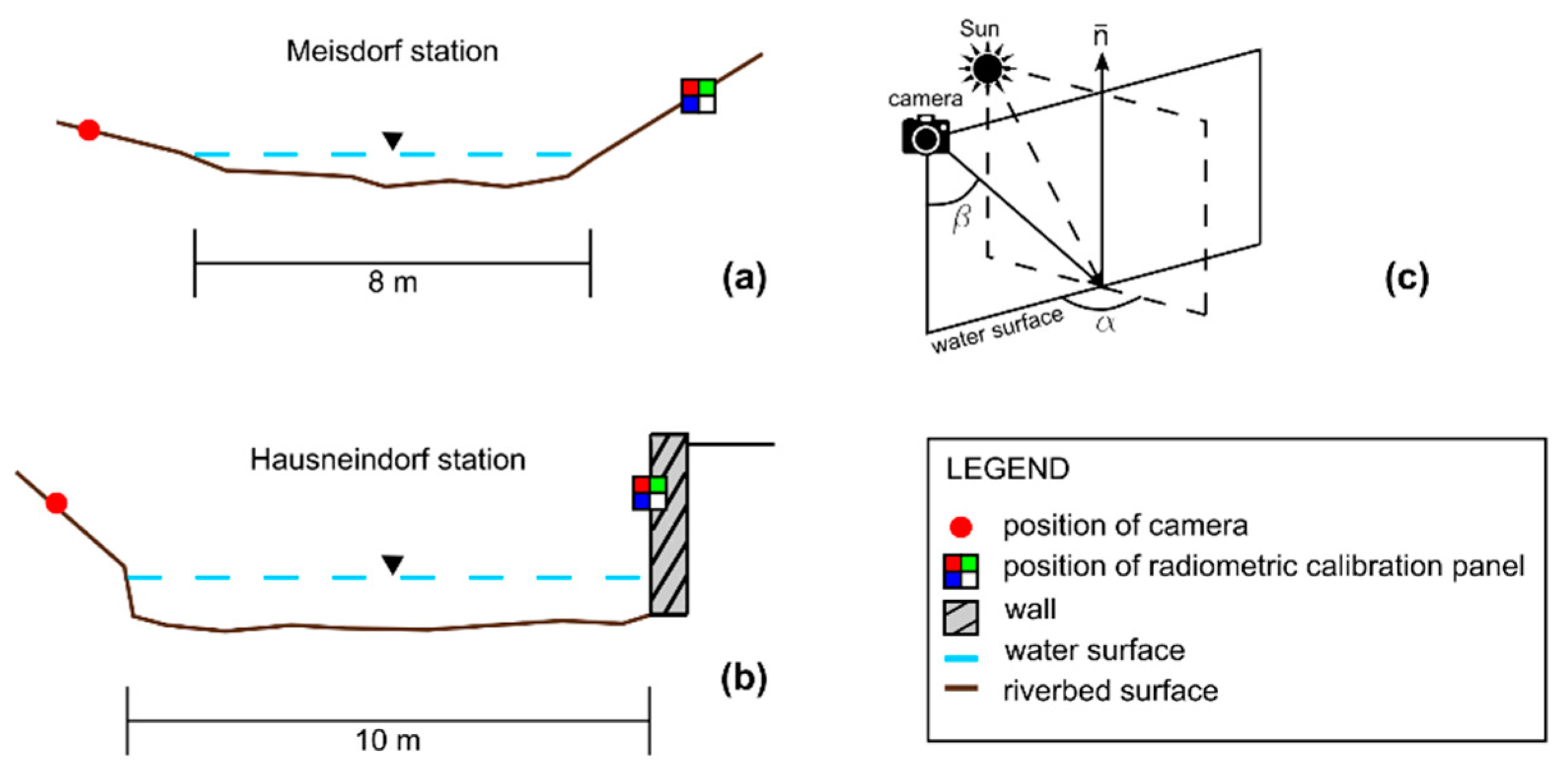
2. Bode River Field Campaign
3. Preliminary Results on Water Surface Turbidity Monitoring with Camera
4. Conclusions
Author Contributions
Funding
Institutional Review Board Statement
Informed Consent Statement
Data Availability Statement
Acknowledgments
Conflicts of Interest
References
- Brando, V.E.; Dekker, A.G. Satellite hyperspectral remote sensing for estimating estuarine and coastal water quality. IEEE Trans. Geosci. Remote Sens. 2003, 41, 1378–1387. [Google Scholar] [CrossRef]
- Giardino, C.; Bresciani, M.; Cazzaniga, I.; Schenk, K.; Rieger, P.; Braga, F.; Matta, E.; Brando, V.E. Evaluation of multi-resolution satellite sensors for assessing water quality and bottom depth of lake garda. Sensors 2014, 14, 24116–24131. [Google Scholar] [CrossRef] [PubMed]
- Gholizadeh, M.H.; Melesse, A.M.; Reddi, L. A comprehensive review on water quality parameters estimation using remote sensing techniques. Sensors 2016, 16, 1298. [Google Scholar] [CrossRef] [PubMed]
- Akbar, T.; Hassan, Q.; Achari, G. A remote sensing based framework for predicting water quality of different source waters. In Proceedings of the ISPRS Commission I Mid-Term Symposium, Image Data Acquisition—Sensors & Platforms, Calgary, AB, Canada, 15–18 June 2010. [Google Scholar]
- Toming, K.; Kutser, T.; Uiboupin, R.; Arikas, A.; Vahter, K.; Paavel, B. Mapping water quality parameters with sentinel-3 ocean and land colour instrument imagery in the Baltic Sea. Remote Sens. 2017, 9, 1070. [Google Scholar] [CrossRef]
- Wang, F.; Han, L.; Kung, H.T.; van Arsdale, R. Applications of Landsat-5 TM imagery in assessing and mapping water quality in Reelfoot Lake, Tennessee. Int. J. Remote Sens. 2006, 27, 5269–5283. [Google Scholar] [CrossRef]
- Garg, V.; Aggarwal, S.P.; Chauhan, P. Changes in turbidity along Ganga River using Sentinel-2 satellite data during lockdown associated with COVID-19. Geomat. Nat. Hazards Risk 2020, 11, 1175–1195. [Google Scholar] [CrossRef]
- Wollschläger, U.; Attinger, S.; Borchardt, D.; Brauns, M.; Cuntz, M.; Dietrich, P.; Fleckenstein, J.H.; Friese, K.; Friesen, J.; Harpke, A.; et al. The Bode hydrological observatory: A platform for integrated, interdisciplinary hydro-ecological research within the TERENO Harz/Central German Lowland Observatory. Environ. Earth Sci. 2017, 76, 29. [Google Scholar] [CrossRef]
- Zacharias, S.; Bogena, H.; Samaniego, L.; Mauder, M.; Fuß, R.; Pütz, T.; Frenzel, M.; Schwank, M.; Baessler, C.; Butterbach-Bahl, K.; et al. A network of terrestrial environmental observatories in Germany. Vadose Zone J. 2011, 10, 955–973. [Google Scholar] [CrossRef]
- Guo, Y.; Senthilnath, J.; Wu, W.; Zhang, X.; Zeng, Z.; Huang, H. Radiometric calibration for multispectral camera of different imaging conditions mounted on a UAV platform. Sustainability 2019, 11, 978. [Google Scholar] [CrossRef]
- Le, C.; Li, Y.; Zha, Y.; Sun, D.; Huang, C.; Lu, H. A four-band semi-analytical model for estimating chlorophyll a in highly turbid lakes: The case of Taihu Lake, China. Remote Sens. Environ. 2009, 113, 1175–1182. [Google Scholar] [CrossRef]


| Monitoring Stations | Mean Turbidity (NTU) | Min Turbidity (NTU) | Max Turbidity (NTU) | Mean Water Level (cm) | Min Water Level (cm) | Max Water Level (cm) |
|---|---|---|---|---|---|---|
| Meisdorf | 29.8 | 4.9 | 1063.1 | 48.0 | 29.0 | 101.0 |
| Hausneindorf | 18.7 | 0.9 | 1319.4 | 114.6 | 89.0 | 181.6 |
| Staßfurt | 47.7 | 4.4 | 1663.6 | 181.9 | 110.9 | 259.1 |
| Gross | 10.6 | 2.3 | 76.1 | 158.2 | 96.6 | 240.7 |
Publisher’s Note: MDPI stays neutral with regard to jurisdictional claims in published maps and institutional affiliations. |
© 2022 by the authors. Licensee MDPI, Basel, Switzerland. This article is an open access article distributed under the terms and conditions of the Creative Commons Attribution (CC BY) license (https://creativecommons.org/licenses/by/4.0/).
Share and Cite
Miglino, D.; Jomaa, S.; Rode, M.; Isgro, F.; Manfreda, S. Monitoring Water Turbidity Using Remote Sensing Techniques. Environ. Sci. Proc. 2022, 21, 63. https://doi.org/10.3390/environsciproc2022021063
Miglino D, Jomaa S, Rode M, Isgro F, Manfreda S. Monitoring Water Turbidity Using Remote Sensing Techniques. Environmental Sciences Proceedings. 2022; 21(1):63. https://doi.org/10.3390/environsciproc2022021063
Chicago/Turabian StyleMiglino, Domenico, Seifeddine Jomaa, Michael Rode, Francesco Isgro, and Salvatore Manfreda. 2022. "Monitoring Water Turbidity Using Remote Sensing Techniques" Environmental Sciences Proceedings 21, no. 1: 63. https://doi.org/10.3390/environsciproc2022021063
APA StyleMiglino, D., Jomaa, S., Rode, M., Isgro, F., & Manfreda, S. (2022). Monitoring Water Turbidity Using Remote Sensing Techniques. Environmental Sciences Proceedings, 21(1), 63. https://doi.org/10.3390/environsciproc2022021063


