
Capturing and Evaluating the Effects of the Expansive Species Ailanthus altissima on Agro-Ecosystems on the Ionian Islands †

 ,
, 

 ,
, 

Abstract
:1. Introduction
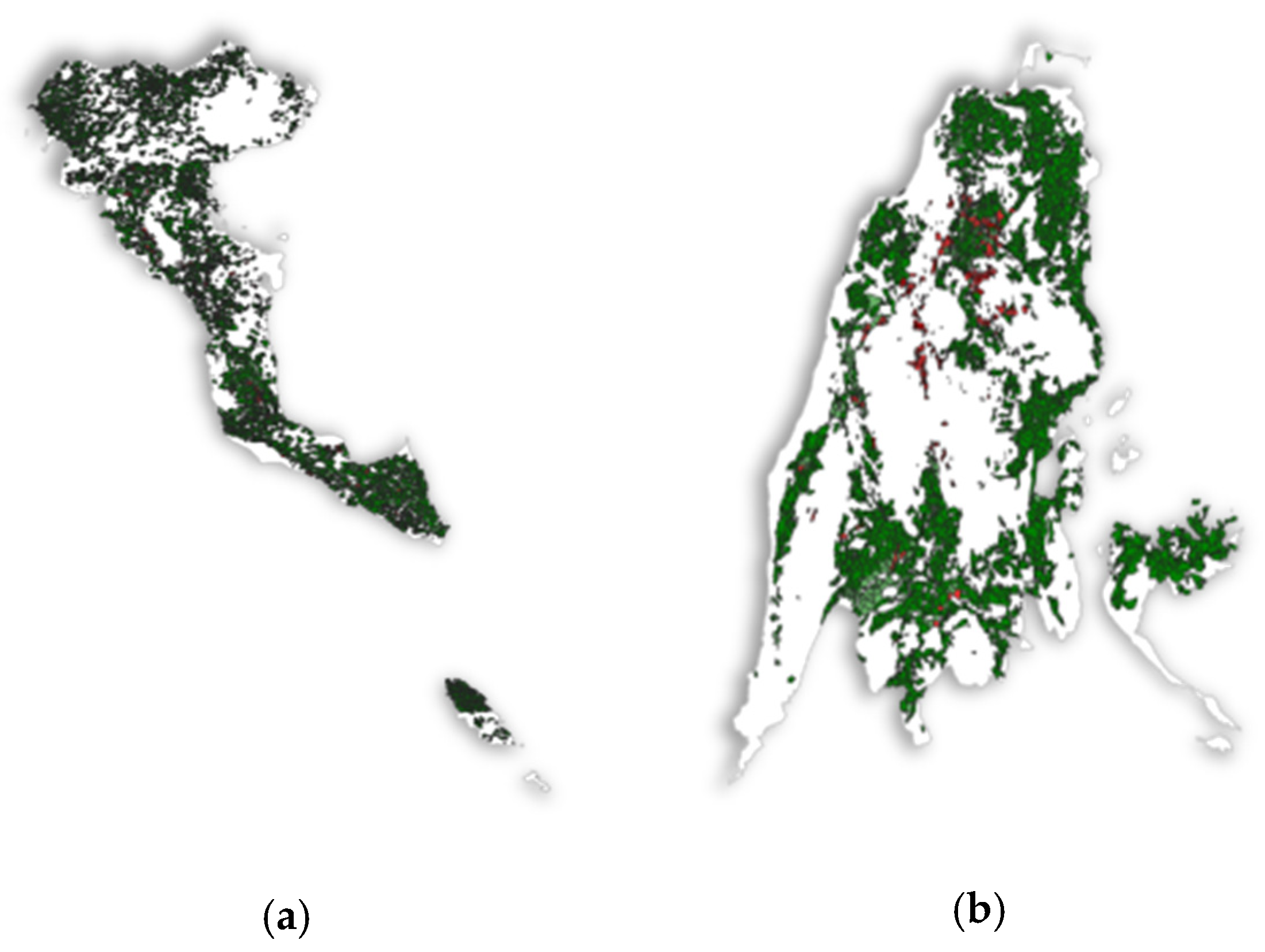
2. Study Area
3. Methodology
3.1. Mapping
3.2. Policy Recommendations
4. Results
5. Conclusions
Supplementary Materials
Author Contributions
Funding
Institutional Review Board Statement
Informed Consent Statement
Data Availability Statement
Conflicts of Interest
References
- Dimalexis, T.; Markopoulou, D.; Kourakli, P.; Manolopoulos, A.; Vitaliotou, M.; Chouvardas, D. Identification of High Nature Value Agricultural and Forestry Land; Hellenic Ornithological Society: Athens, Greece, 2008; p. 5. [Google Scholar]
- Keenleyside, C.; Beaufoy, G.; Tucker, G.; Jones, G. High Nature Value Farming throughout EU-27 and Its Financial Support under the CAP; Report Prepared for DG Environment, Contract ENV B.1/ETU/2012/0035; Institute for European Environmental Policy: London, UK, 2014. [Google Scholar]
- Miller, J.H. Ailanthus altissima (Mill.) Swingle Ailanthus. In Silvics of North America; US Department of Agriculture: Washington, DC, USA, 1990; pp. 101–104. [Google Scholar]
- Fisher, B.; Turner, R.K. Ecosystem services: Classification for valuation. Biol. Conserv. 2008, 141, 1167–1169. [Google Scholar] [CrossRef]
- Koschke, L.; Fürst, C.; Frank, S.; Makeschin, F. A multi-criteria approach for an integrated land-cover-based assessment of ecosystem services provision to support landscape planning. Ecol. Indic. 2012, 21, 54–66. [Google Scholar] [CrossRef]
- Kefalas, G.; Kalogirou, S.; Poirazidis, K.; Lorilla, R.S. Landscape transition in Mediterranean islands: The case of Ionian islands, Greece 1985–2015. Landsc. Urban Plan. 2019, 191, 103641. [Google Scholar] [CrossRef]
- Commission of the European Communities. Communication from the commission to the council, the European parliament, the European economic and social committee, and the committee of the regions: A mid-term assessment of implementing the EC biodiversity action plan. J. Int. Wildl. Law Policy 2009, 12, 108–120. [Google Scholar] [CrossRef]
- Sentinel Online-ESA-Sentinel Online. Available online: https://earth.esa.int/web/sentinel/home (accessed on 13 April 2021).
- CLC 2018—Copernicus Land Monitoring Service. Available online: https://land.copernicus.eu/pan-european/corine-land-cover/clc2018 (accessed on 30 July 2021).
- OPEKEPE.-Home Page. Available online: https://www.opekepe.gr/en/ (accessed on 30 July 2021).
- Lorilla, R.S.; Poirazidis, K.; Kalogirou, S.; Detsis, V.; Martinis, A. Assessment of the spatial dynamics and interactions among multiple ecosystem services to promote effective policy making across mediterranean island landscapes. Sustainability 2018, 10, 3285. [Google Scholar] [CrossRef] [Green Version]
- Fernández Martínez, P.; de Castro-Pardo, M.; Barroso, V.M.; Azevedo, J.C. Assessing Sustainable Rural Development Based on Ecosystem Services Vulnerability. Land 2020, 9, 222. [Google Scholar] [CrossRef]
- Benke, K.K.; Steel, J.L.; Weiss, J.E. Risk assessment models for invasive species: Uncertainty in rankings from multi-criteria analysis. Biol. Invasions 2011, 13, 239–253. [Google Scholar] [CrossRef]


| HNV Areas | Total Cover |
|---|---|
| Corfu | 46.2% |
| Zakynthos | 26.1% |
| Lefkada | 16.1% |
| Cephalonia | 11.6% |
Publisher’s Note: MDPI stays neutral with regard to jurisdictional claims in published maps and institutional affiliations. |
© 2021 by the authors. Licensee MDPI, Basel, Switzerland. This article is an open access article distributed under the terms and conditions of the Creative Commons Attribution (CC BY) license (https://creativecommons.org/licenses/by/4.0/).
Share and Cite
Voutos, Y.; Godsil, N.; Sotiropoulou, A.; Mylonas, P.; Bouchagier, P.; Exarchos, T.; Martinis, A.; Kabassi, K. Capturing and Evaluating the Effects of the Expansive Species Ailanthus altissima on Agro-Ecosystems on the Ionian Islands. Eng. Proc. 2021, 9, 19. https://doi.org/10.3390/engproc2021009019
Voutos Y, Godsil N, Sotiropoulou A, Mylonas P, Bouchagier P, Exarchos T, Martinis A, Kabassi K. Capturing and Evaluating the Effects of the Expansive Species Ailanthus altissima on Agro-Ecosystems on the Ionian Islands. Engineering Proceedings. 2021; 9(1):19. https://doi.org/10.3390/engproc2021009019
Chicago/Turabian StyleVoutos, Yorghos, Nicole Godsil, Anna Sotiropoulou, Phivos Mylonas, Pavlos Bouchagier, Themis Exarchos, Aristotelis Martinis, and Katerina Kabassi. 2021. "Capturing and Evaluating the Effects of the Expansive Species Ailanthus altissima on Agro-Ecosystems on the Ionian Islands" Engineering Proceedings 9, no. 1: 19. https://doi.org/10.3390/engproc2021009019
APA StyleVoutos, Y., Godsil, N., Sotiropoulou, A., Mylonas, P., Bouchagier, P., Exarchos, T., Martinis, A., & Kabassi, K. (2021). Capturing and Evaluating the Effects of the Expansive Species Ailanthus altissima on Agro-Ecosystems on the Ionian Islands. Engineering Proceedings, 9(1), 19. https://doi.org/10.3390/engproc2021009019