Article

At the Intersection of Flood Risk and Social Vulnerability: A Case Study of New Orleans, Louisiana, USA


1
Department of Geology & Geological Engineering, Colorado School of Mines, Golden, CO 80401, USA
2
Department of Civil and Environmental Engineering, College of Engineering and Computer Science, Syracuse University, Syracuse, NY 13244, USA
*
Author to whom correspondence should be addressed.
GeoHazards 2024, 5(3), 866-885; https://doi.org/10.3390/geohazards5030044

Submission received: 27 July 2024 / Revised: 29 August 2024 / Accepted: 30 August 2024 / Published: 2 September 2024

Abstract

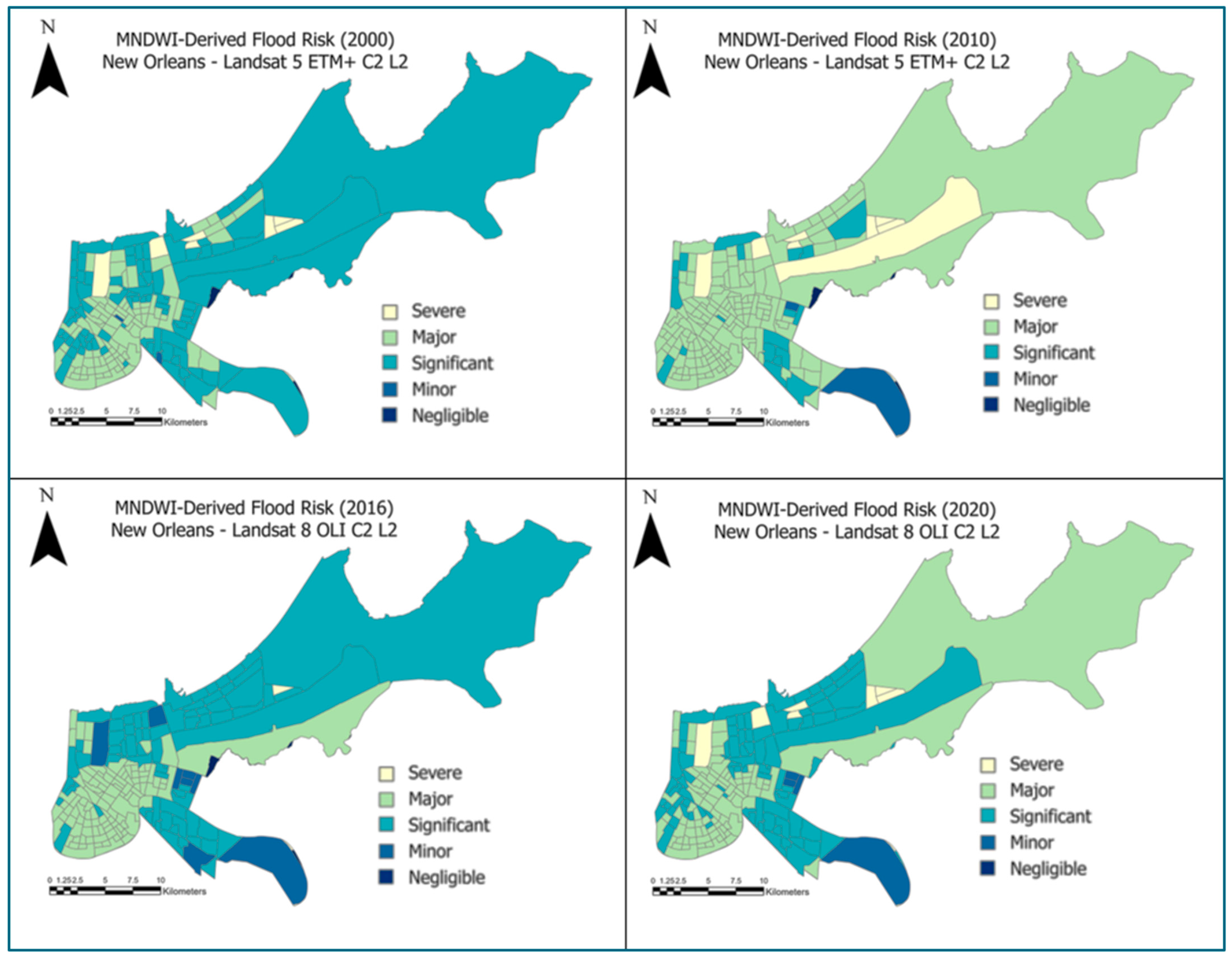
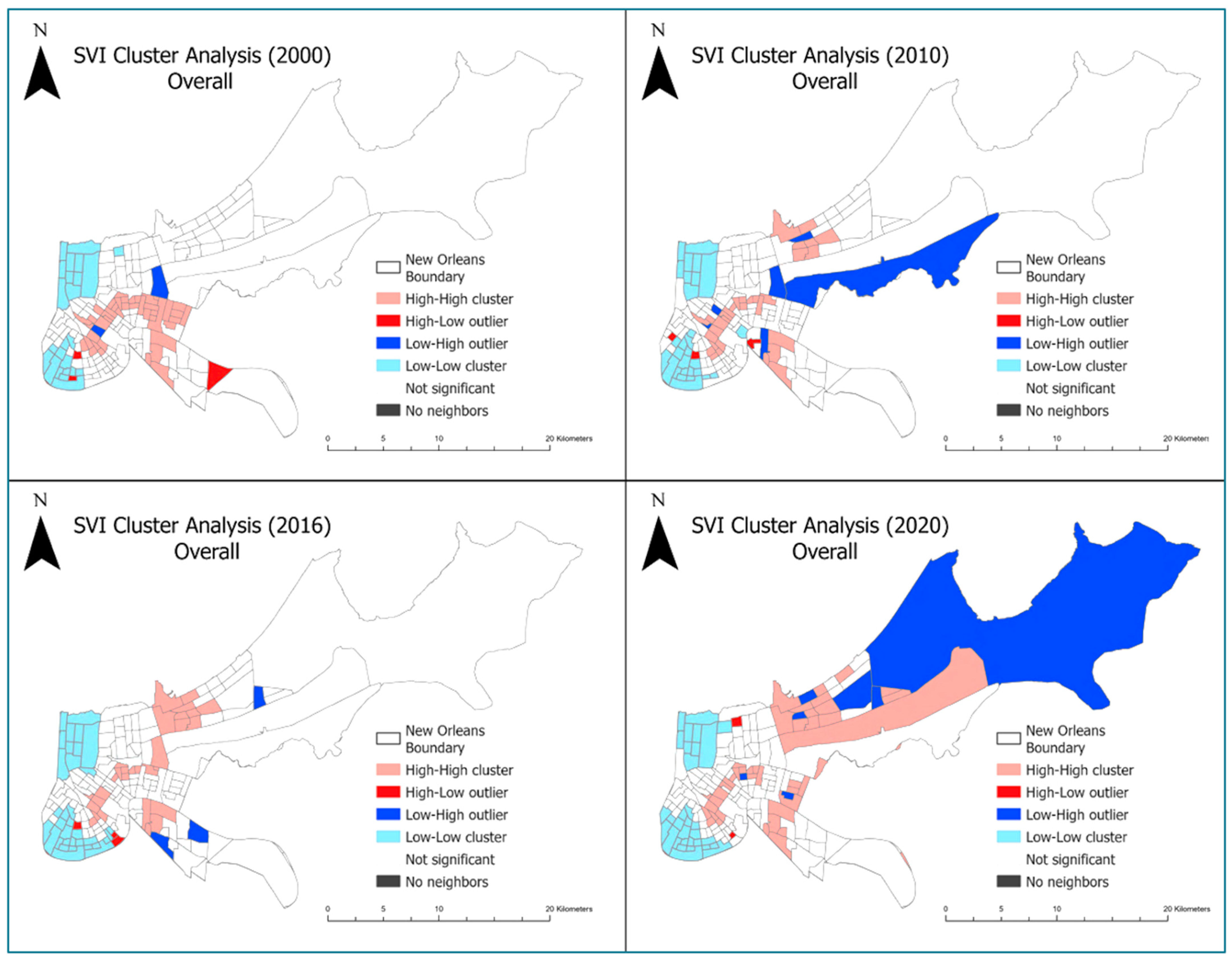
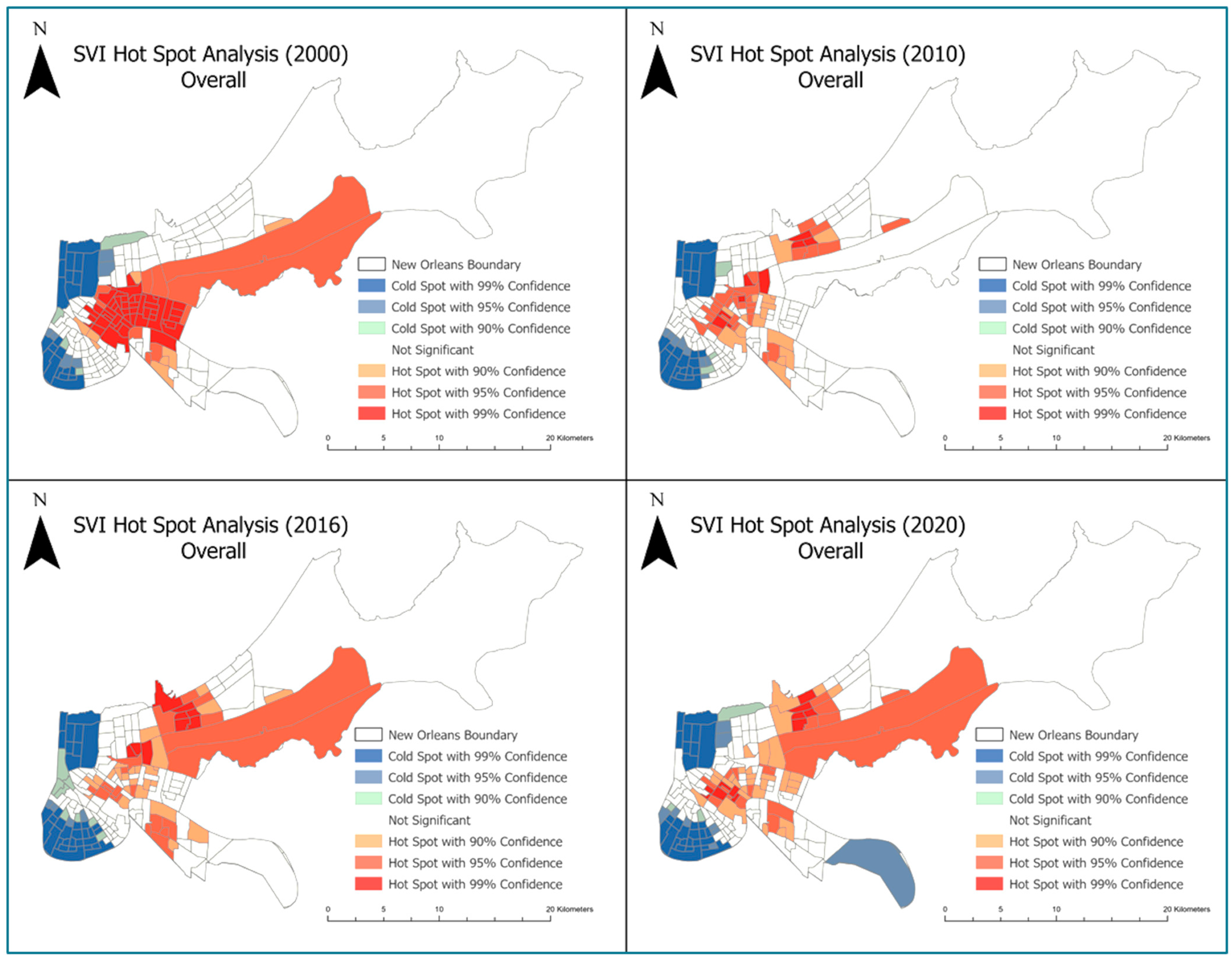
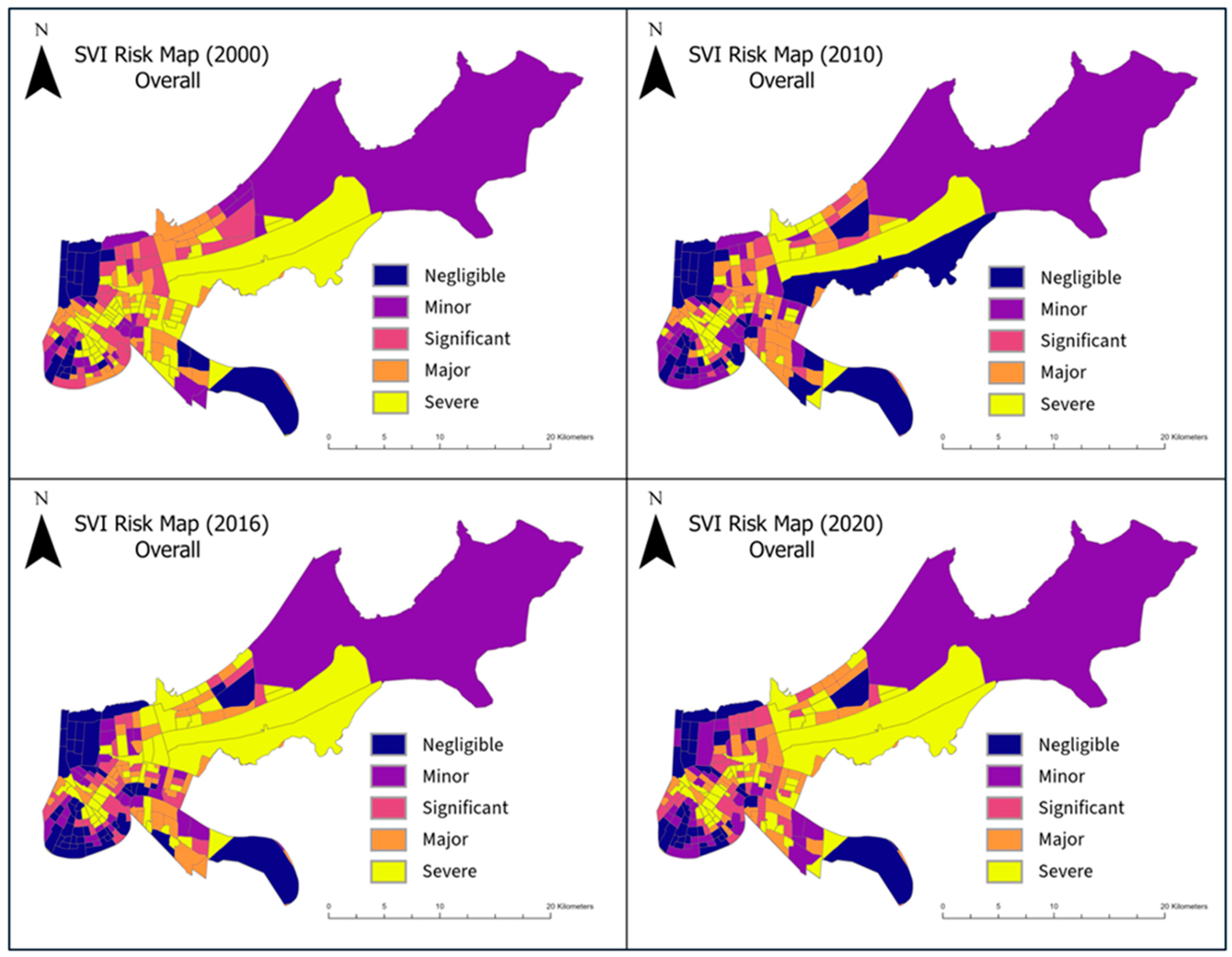
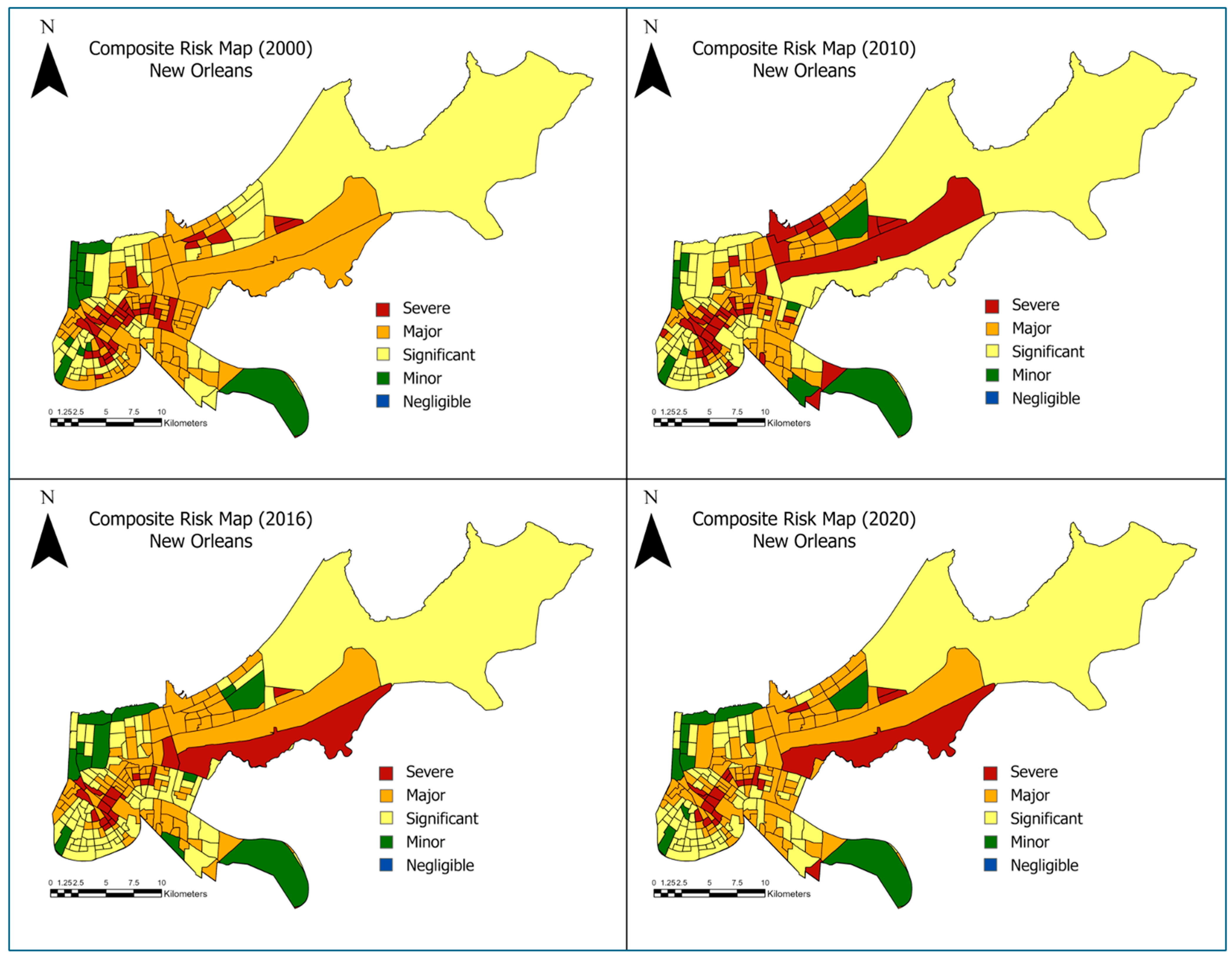
Urban flooding is becoming more frequent and severe due to the impact of climate change, underscoring the urgent need for effective flood risk management. This study investigates the dynamics of flood risk through two decades, from 2000 to 2020, in New Orleans, United States—a city historically marked by catastrophic flooding events. This research also explores the spatial patterns of socially vulnerable neighborhoods at the census tract level and patterns that have changed over the two decades. The Modified Normalized Difference Water Index (MNDWI) was used to indirectly evaluate flood risks over time utilizing Landsat 5 and Landsat 8 satellite imagery and geospatial analyses. Thematic mapping and geospatial analysis were used to generate maps revealing neighborhoods at the intersection of high flood risk and social vulnerability in New Orleans. Integrating flood maps derived from satellite observations with Social Vulnerability Index (SVI) calculations provides a comprehensive view of flood dynamics in the context of social vulnerability in an urban setting. The final composite products provide insight into zones where past resilience-building and risk-reduction efforts have reduced vulnerability in New Orleans and identify zones requiring intervention. The findings demonstrate how integrated data-driven analysis can inform urban infrastructure and policy development, thereby promoting discussions on urban resilience and the nuanced understanding of interactions between urban settings and flood risks, potentially aiding in implementing adaptive strategies to build resilience in New Orleans.
Keywords: flood risk; SVI; urban flooding; New Orleans; resilience; socioeconomic factors; flood susceptibility maps; MNDWI flood risk; SVI; urban flooding; New Orleans; resilience; socioeconomic factors; flood susceptibility maps; MNDWI