Article

Assessment of LiDAR-Based Sensing Technologies in Bird–Drone Collision Scenarios

by
Paula Seoane
,
Enrique Aldao
,
Fernando Veiga-López
and
Higinio González-Jorge
*
Aerolab, Insituto de Física e Ciencias Aeroespaciais (IFCAE), Universidade de Vigo, Campus de As Lagoas, E-32004 Ourense, Spain
*
Author to whom correspondence should be addressed.
Drones 2025, 9(1), 13; https://doi.org/10.3390/drones9010013
Submission received: 21 November 2024 / Revised: 22 December 2024 / Accepted: 25 December 2024 / Published: 27 December 2024

Abstract

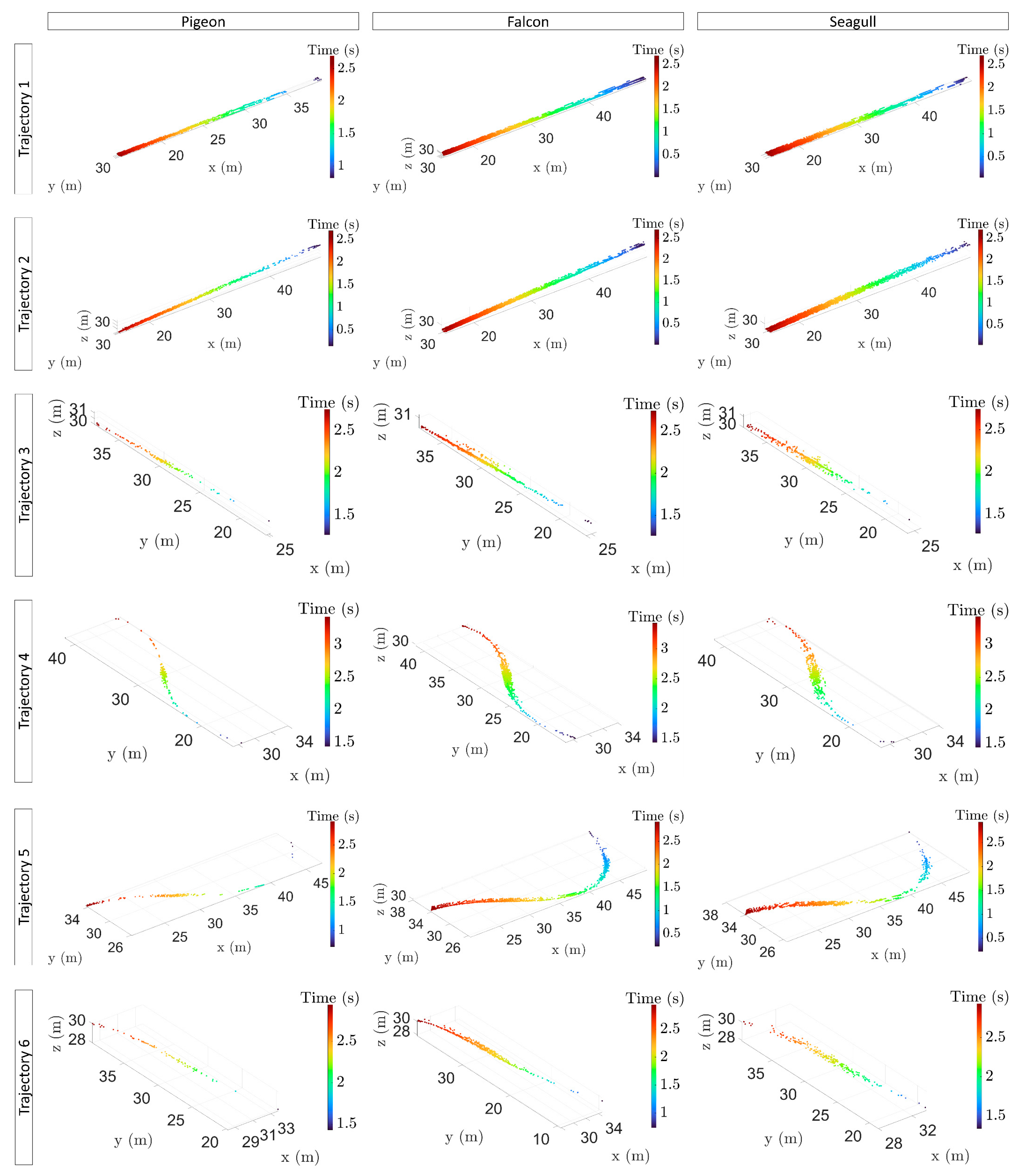
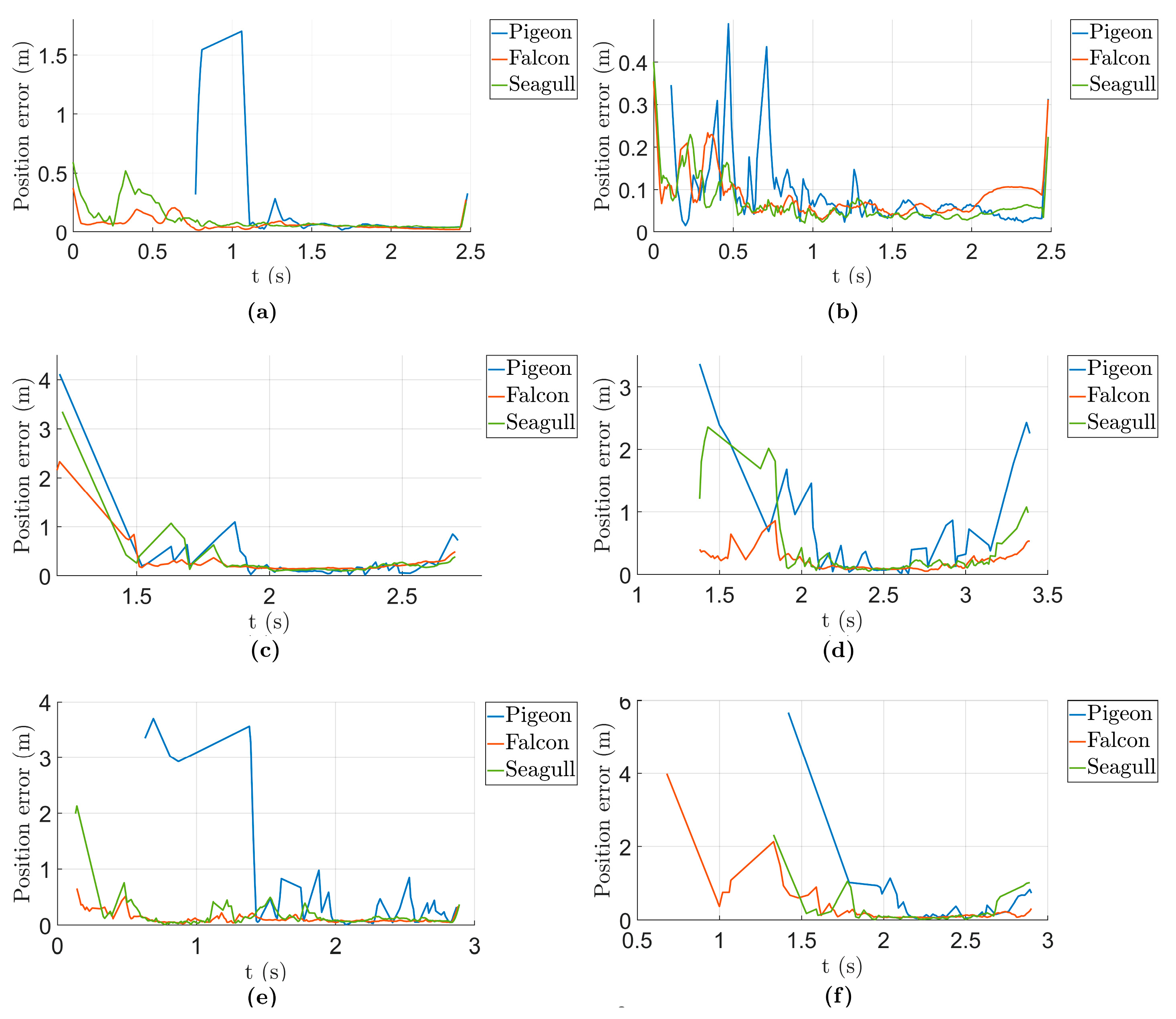
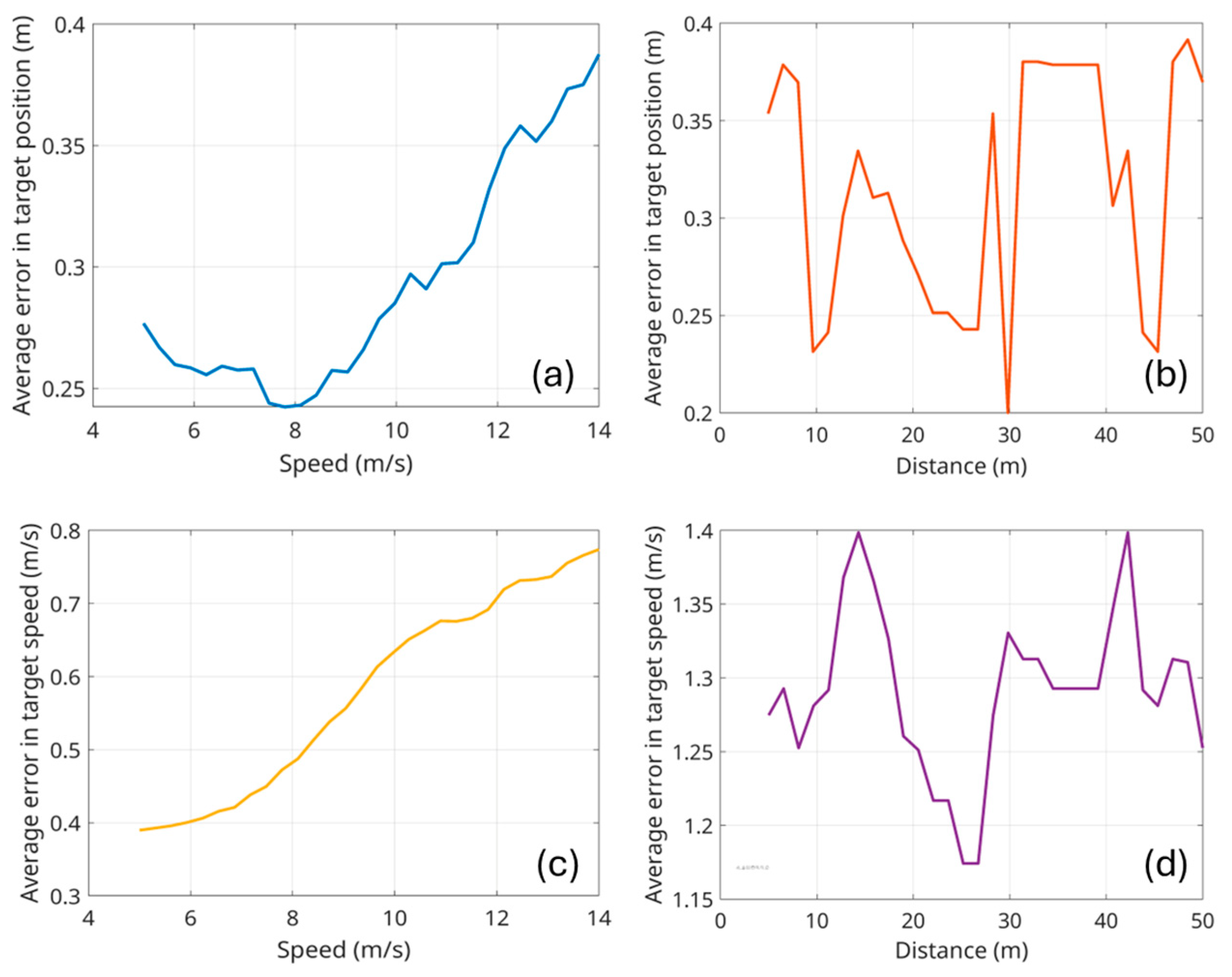
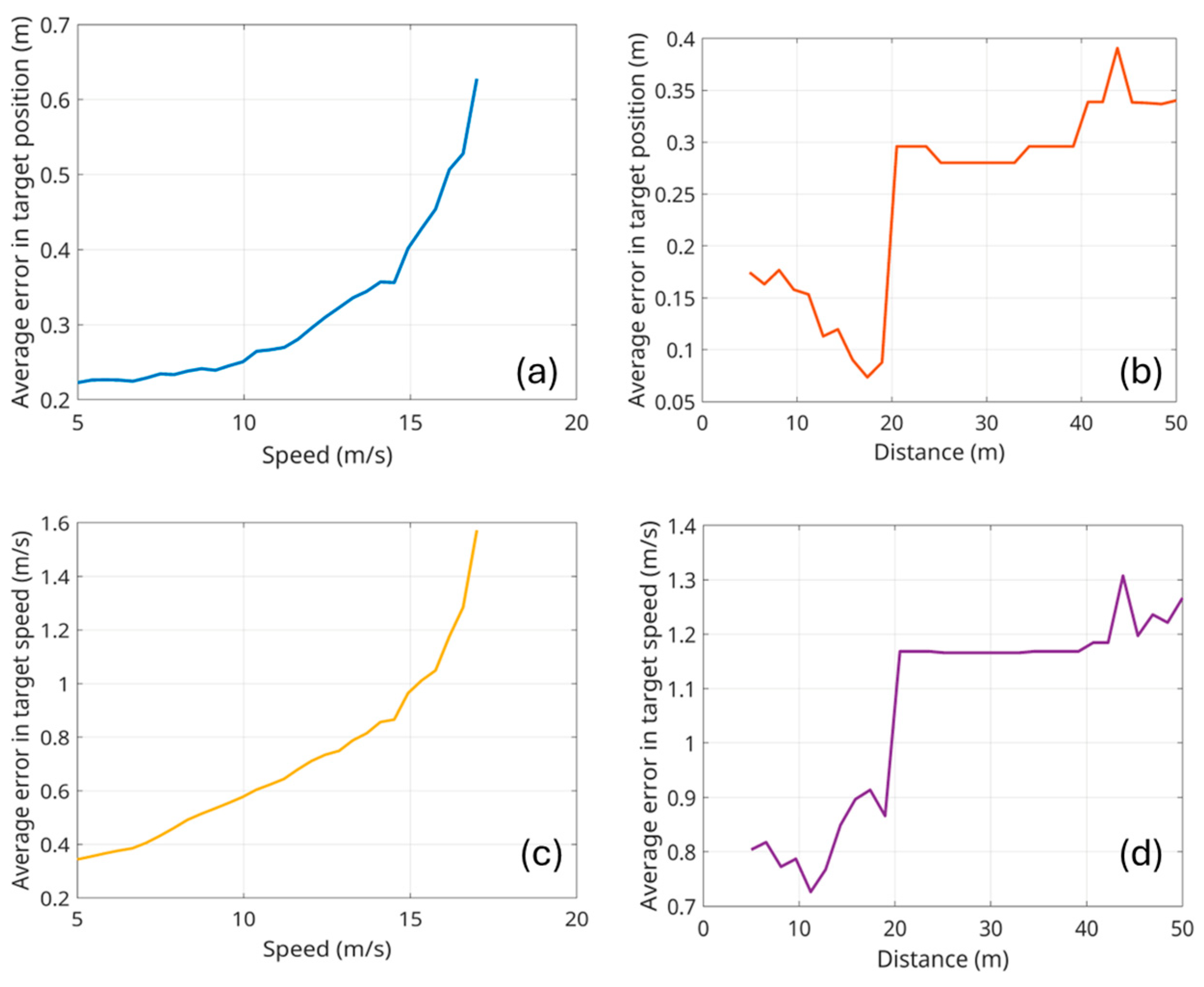
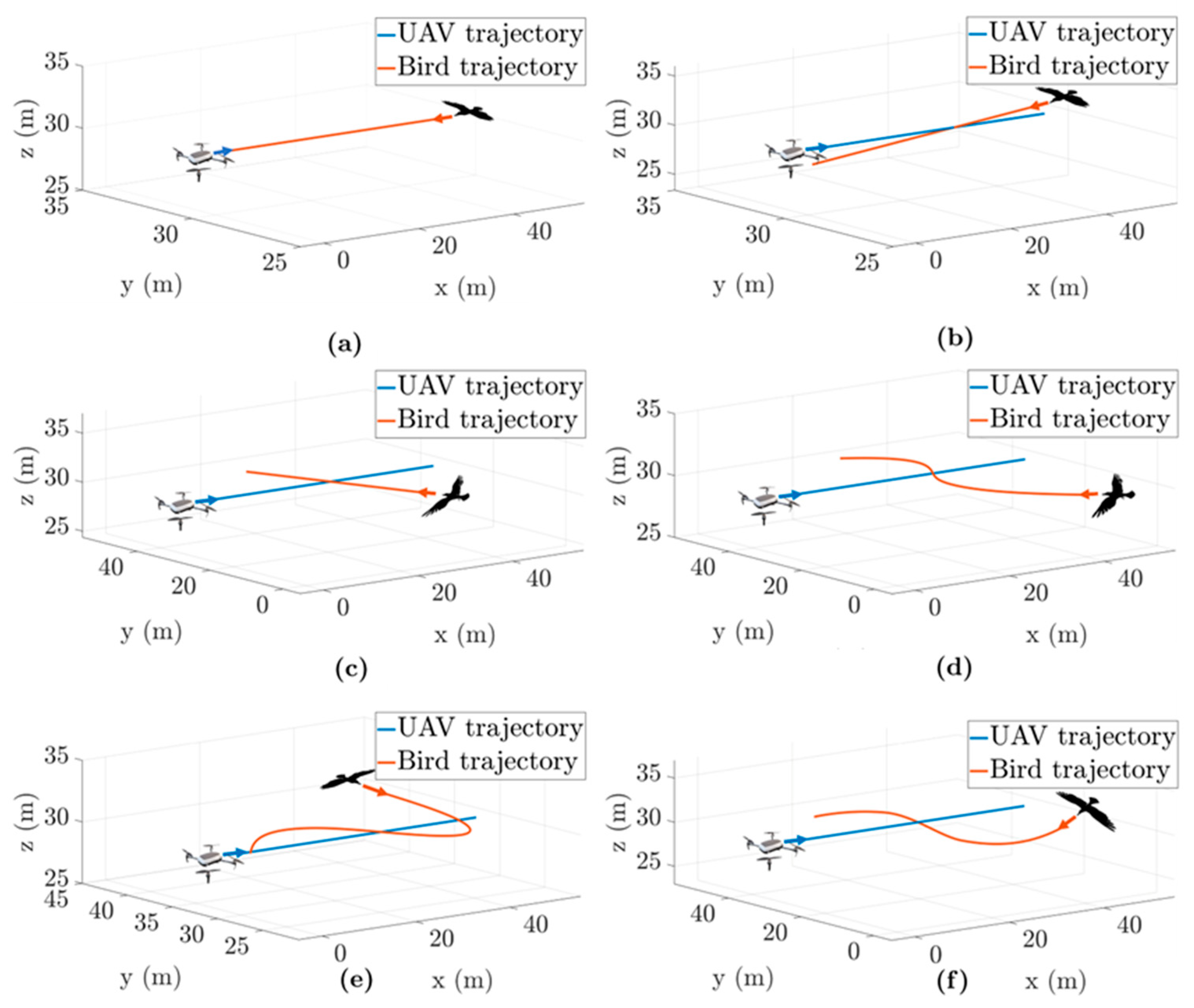
The deployment of Advanced Air Mobility requires the continued development of technologies to ensure operational safety. One of the key aspects to consider here is the availability of robust solutions to avoid tactical conflicts between drones and other flying elements, such as other drones or birds. Bird detection is a relatively underexplored area, but due to the large number of birds, their shared airspace with drones, and the fact that they are non-cooperative elements within an air traffic management system, it is of interest to study how their detection can be improved and how collisions with them can be avoided. This work demonstrates how a LiDAR sensor mounted on a drone can detect birds of various sizes. A LiDAR simulator, previously developed by the Aerolab research group, is employed in this study. Six different collision trajectories and three different bird sizes (pigeon, falcon, and seagull) are tested. The results show that the LiDAR can detect any of these birds at about 30 m; bird detection improves when the bird gets closer and has a larger size. The detection accuracy is higher than 1 m in most of the cases under study. The errors grow with increasing drone-bird relative speed.
Keywords: unmanned aerial vehicle; advanced air mobility; tactical deconfliction; LiDAR; detect and avoid unmanned aerial vehicle; advanced air mobility; tactical deconfliction; LiDAR; detect and avoid