Article

Coverage Path Planning with Adaptive Hyperbolic Grid for Step-Stare Imaging System

1
Changchun Institute of Optics, Fine Mechanics and Physics, Chinese Academy of Sciences, Changchun 130033, China
2
Changchun Changguang Insight Vision Optoelectronic Technology Co., Ltd., Changchun 130102, China
Drones 2024, 8(6), 242; https://doi.org/10.3390/drones8060242
Submission received: 3 April 2024 / Revised: 26 May 2024 / Accepted: 31 May 2024 / Published: 4 June 2024
(This article belongs to the Section Drone Design and Development)

Abstract

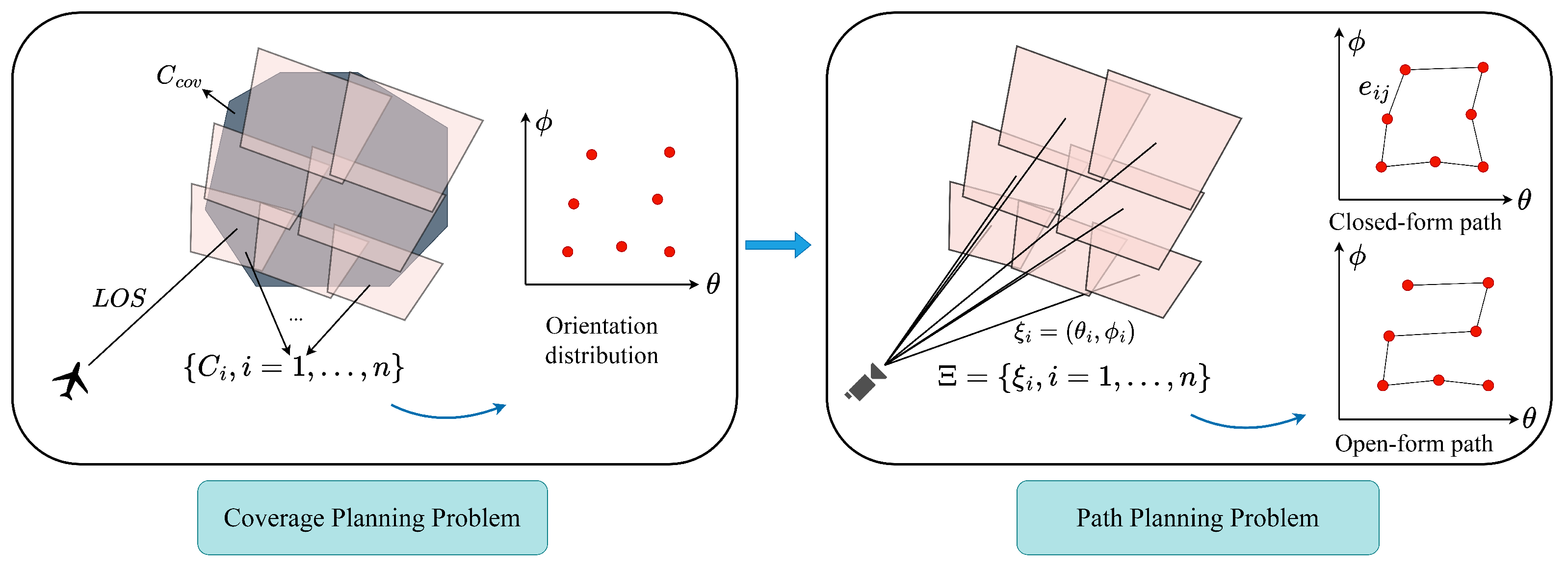
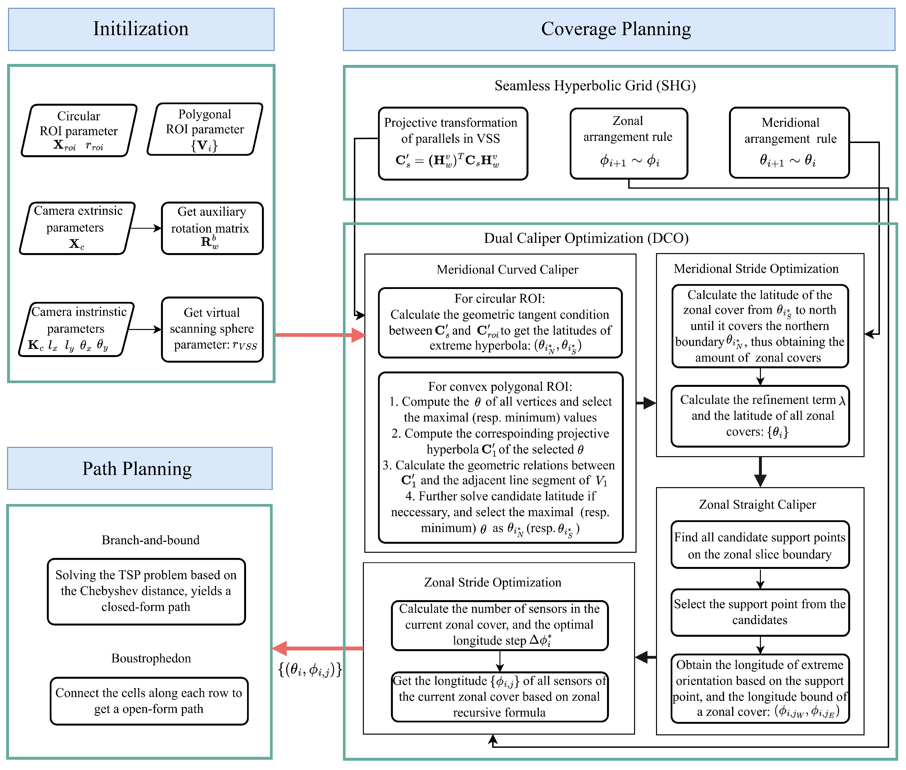
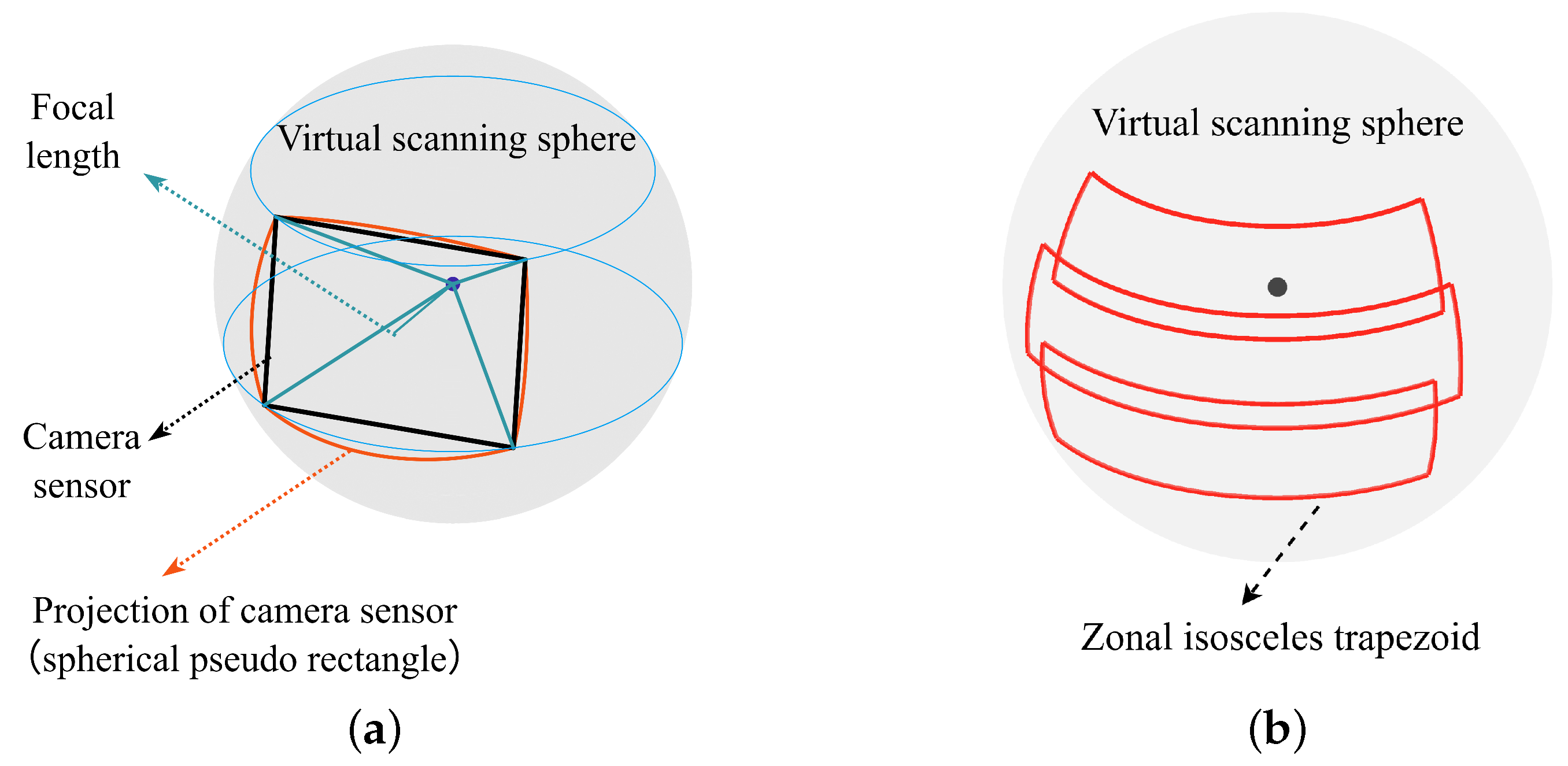
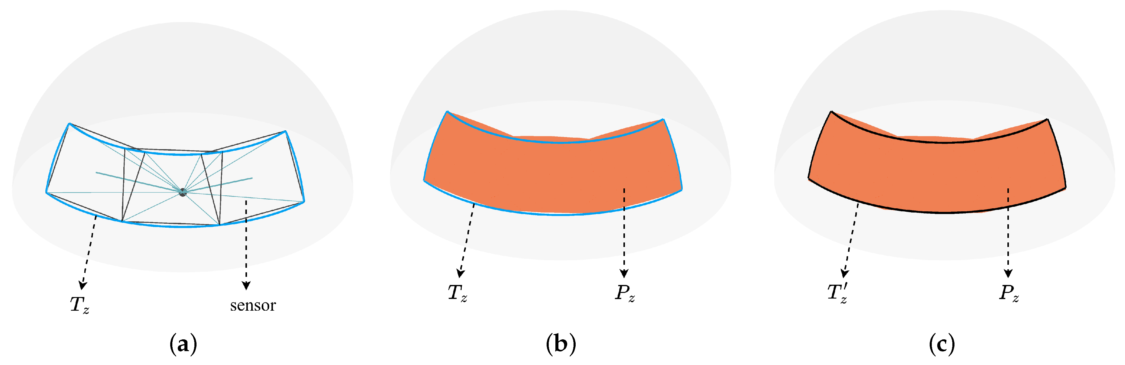
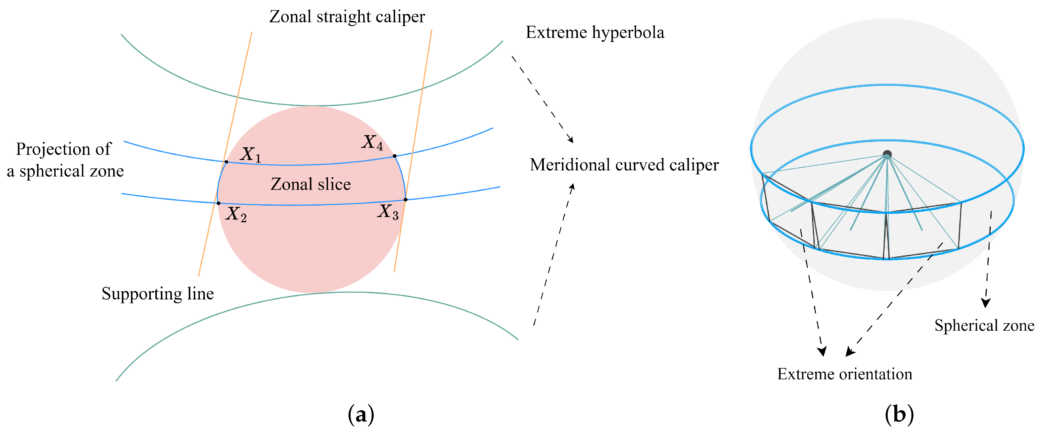
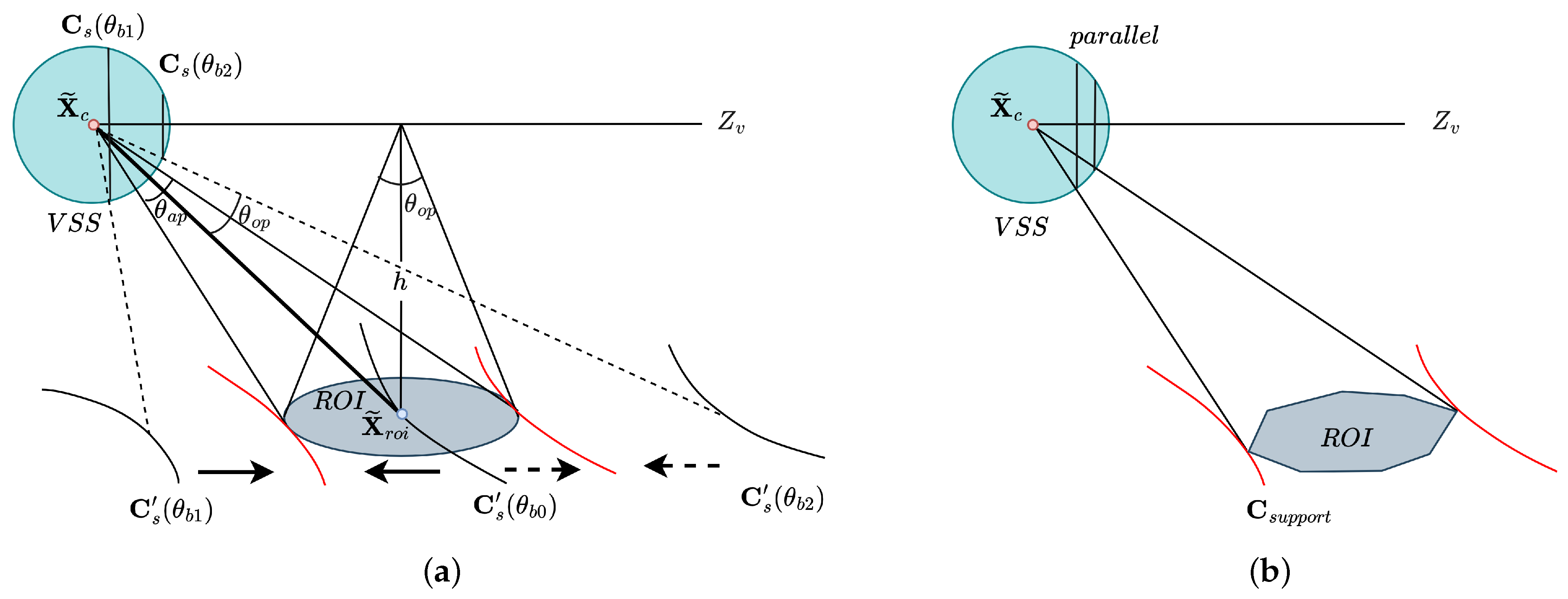
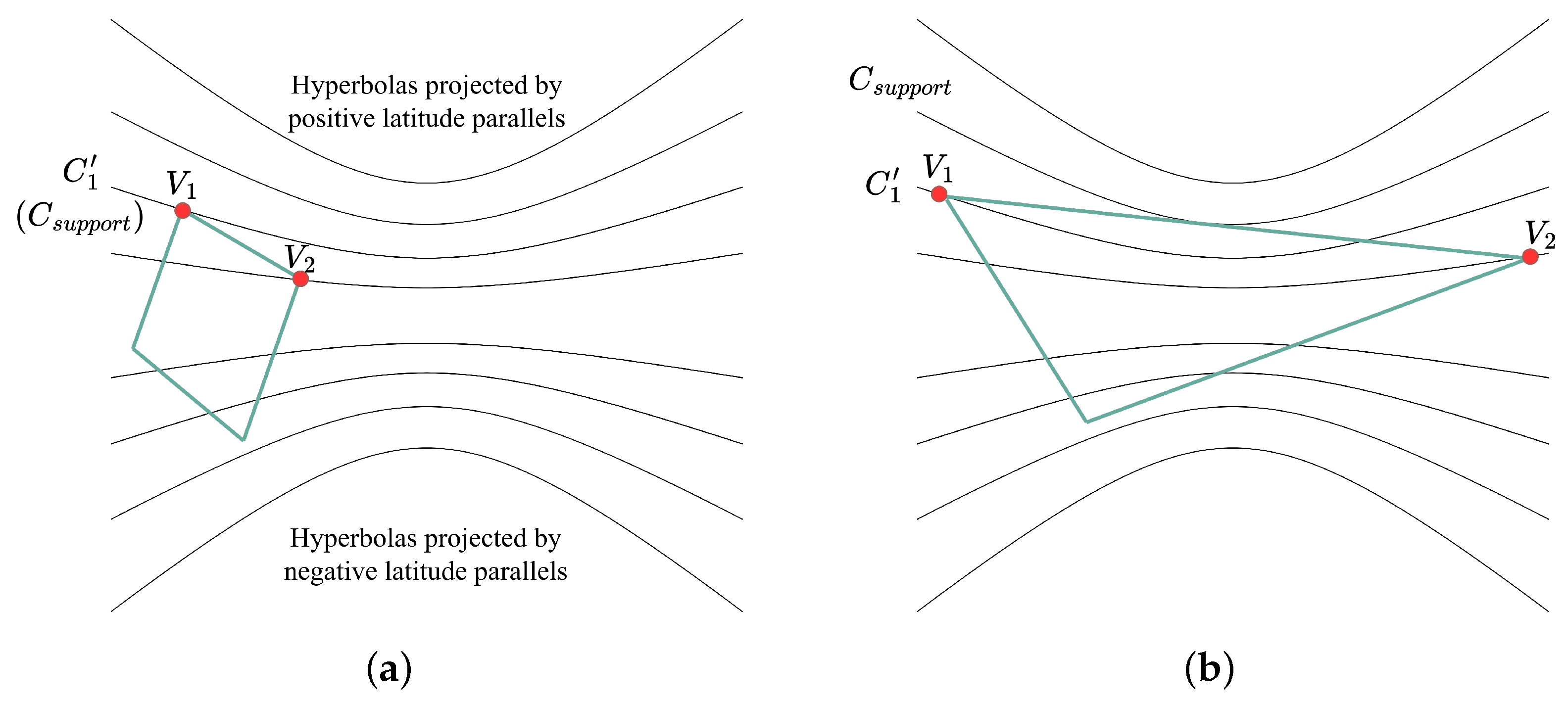
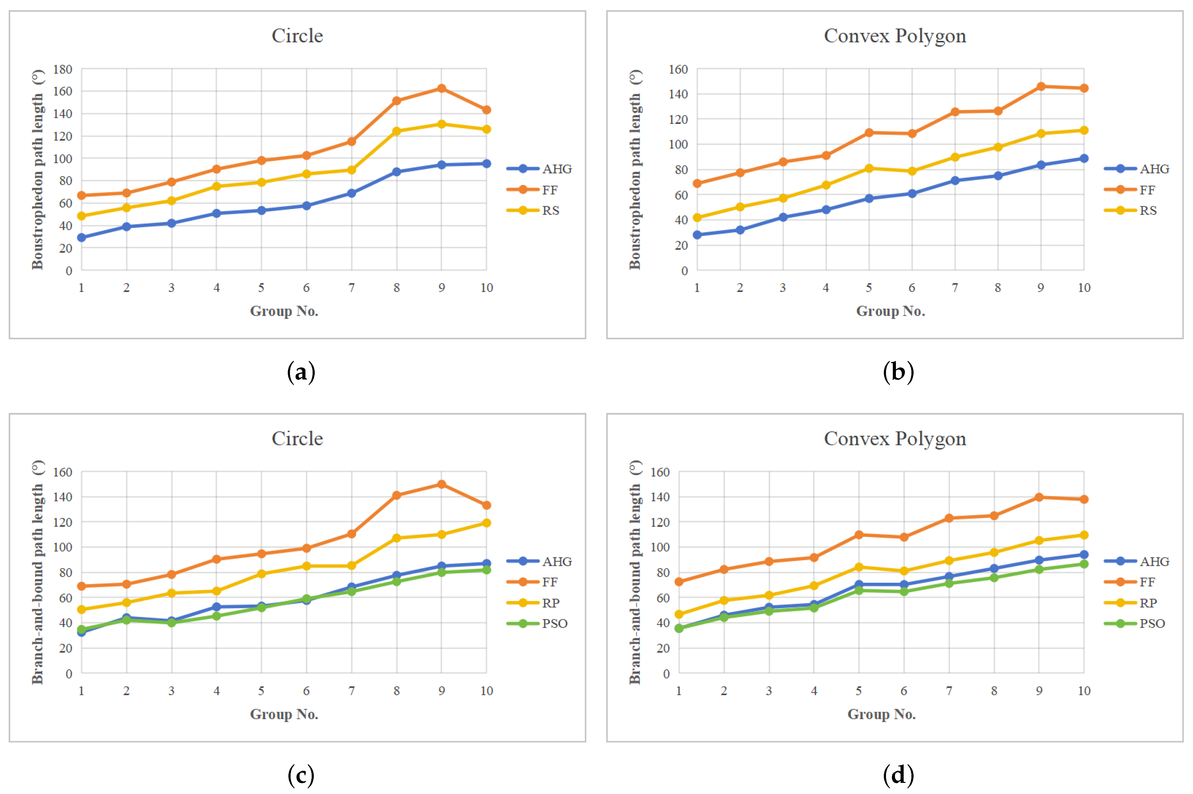
Step-stare imaging systems are widely used in aerospace optical remote sensing. In order to achieve fast scanning of the target region, efficient coverage path planning (CPP) is a key challenge. However, traditional CPP methods are mostly designed for fixed cameras and disregard the irregular shape of the sensor’s projection caused by the step-stare rotational motion. To address this problem, this paper proposes an efficient, seamless CPP method with an adaptive hyperbolic grid. First, we convert the coverage problem in Euclidean space to a tiling problem in spherical space. A spherical approximate tiling method based on a zonal isosceles trapezoid is developed to construct a seamless hyperbolic grid. Then, we present a dual-caliper optimization algorithm to further compress the grid and improve the coverage efficiency. Finally, both boustrophedon and branch-and-bound approaches are utilized to generate rotation paths for different scanning scenarios. Experiments were conducted on a custom dataset consisting of 800 diverse geometric regions (including 2 geometry types and 40 samples for 10 groups). The proposed method demonstrates comparable performance of closed-form path length relative to that of a heuristic optimization method while significantly improving real-time capabilities by a minimum factor of 2464. Furthermore, in comparison to traditional rule-based methods, our approach has been shown to reduce the rotational path length by at least 27.29% and 16.71% in circle and convex polygon groups, respectively, indicating a significant improvement in planning efficiency.
Keywords: coverage path planning; hyperbolic grid; step-stare imaging; spherical tiling; dual-caliper optimization coverage path planning; hyperbolic grid; step-stare imaging; spherical tiling; dual-caliper optimization