Articulated Trajectory Mapping for Reviewing Walking Tours

Abstract
1. Introduction
2. Problems and Approaches
2.1. Problems of Raw Trajectory Data Based on Observations
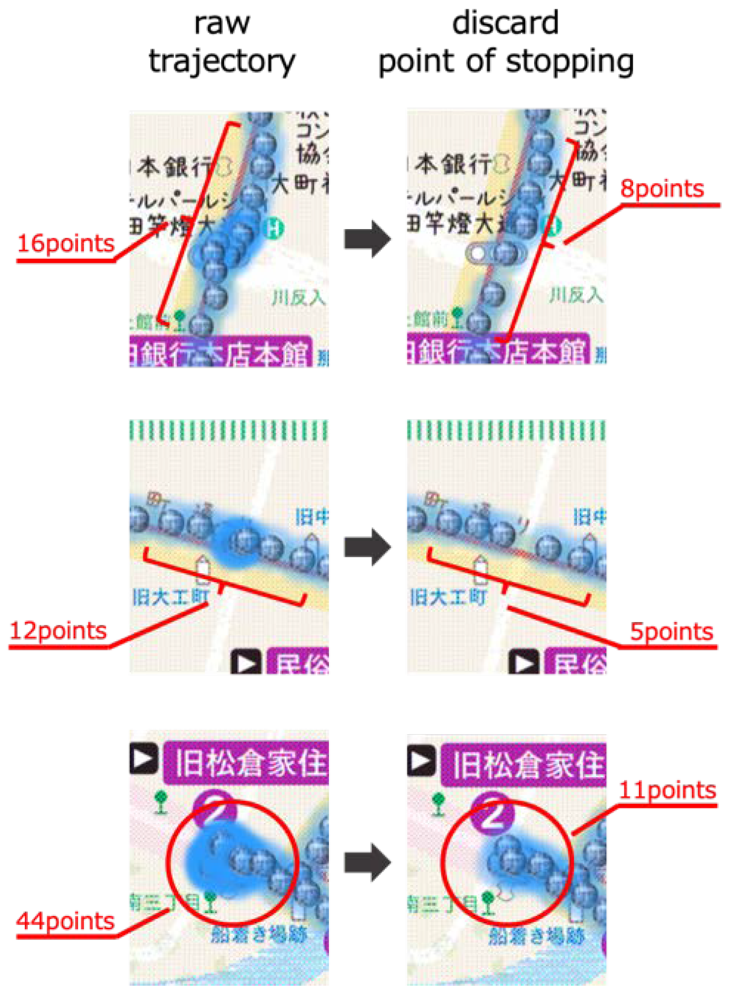
- Problem A: Tangled Trajectory Line
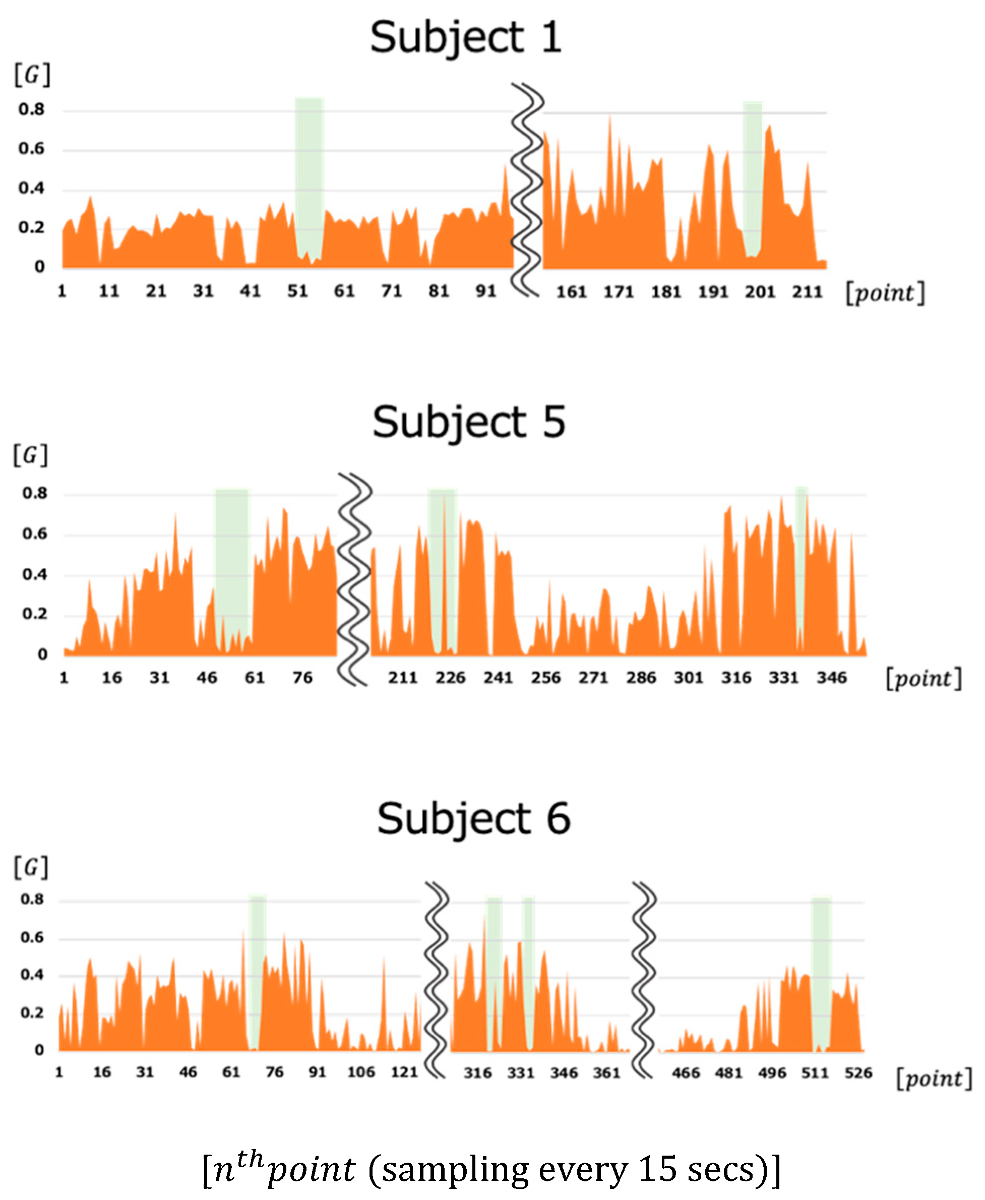
- Problem B: Inaccurate Indoor Positioning
- Problem C: Unstable Trajectory Line
2.2. Approaches of Articulated Trajectory Data in Related Work
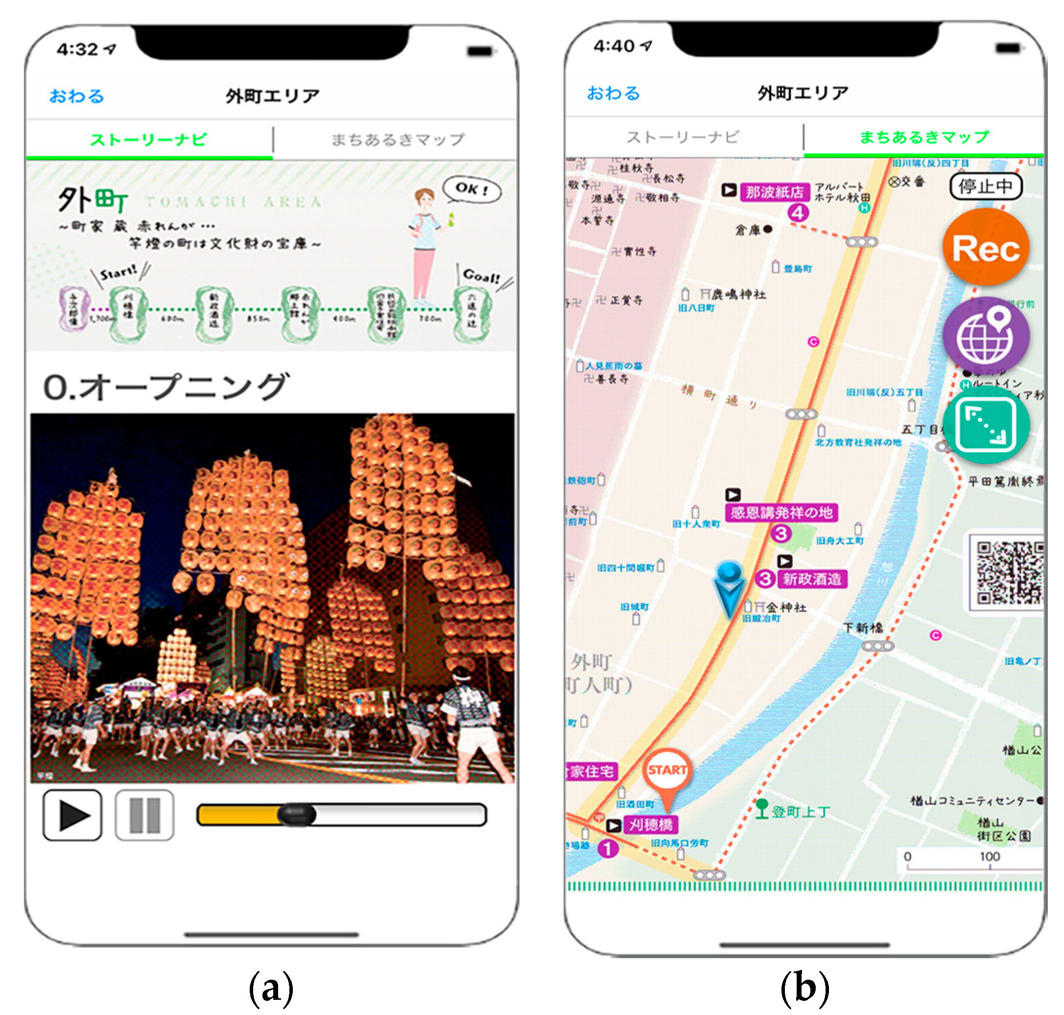
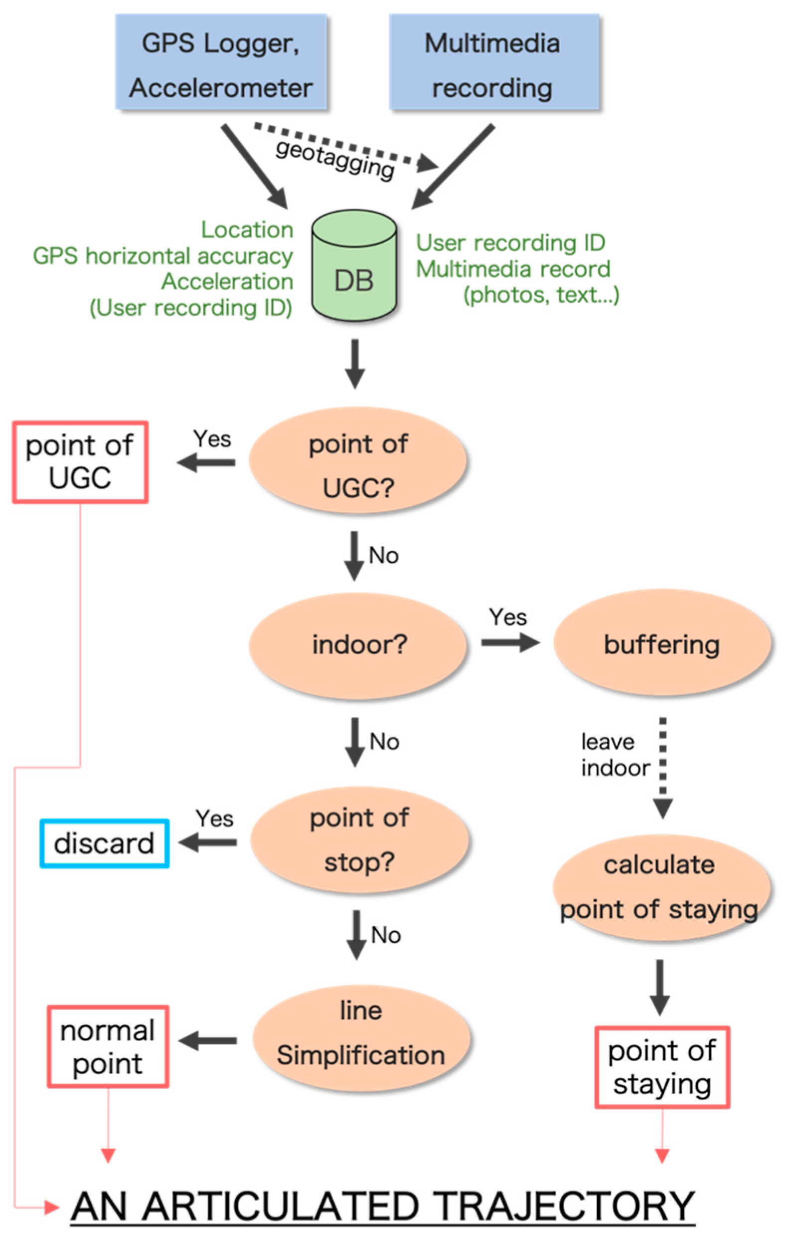
3. Methodology: Articulated Trajectory Mapping
3.1. Overview
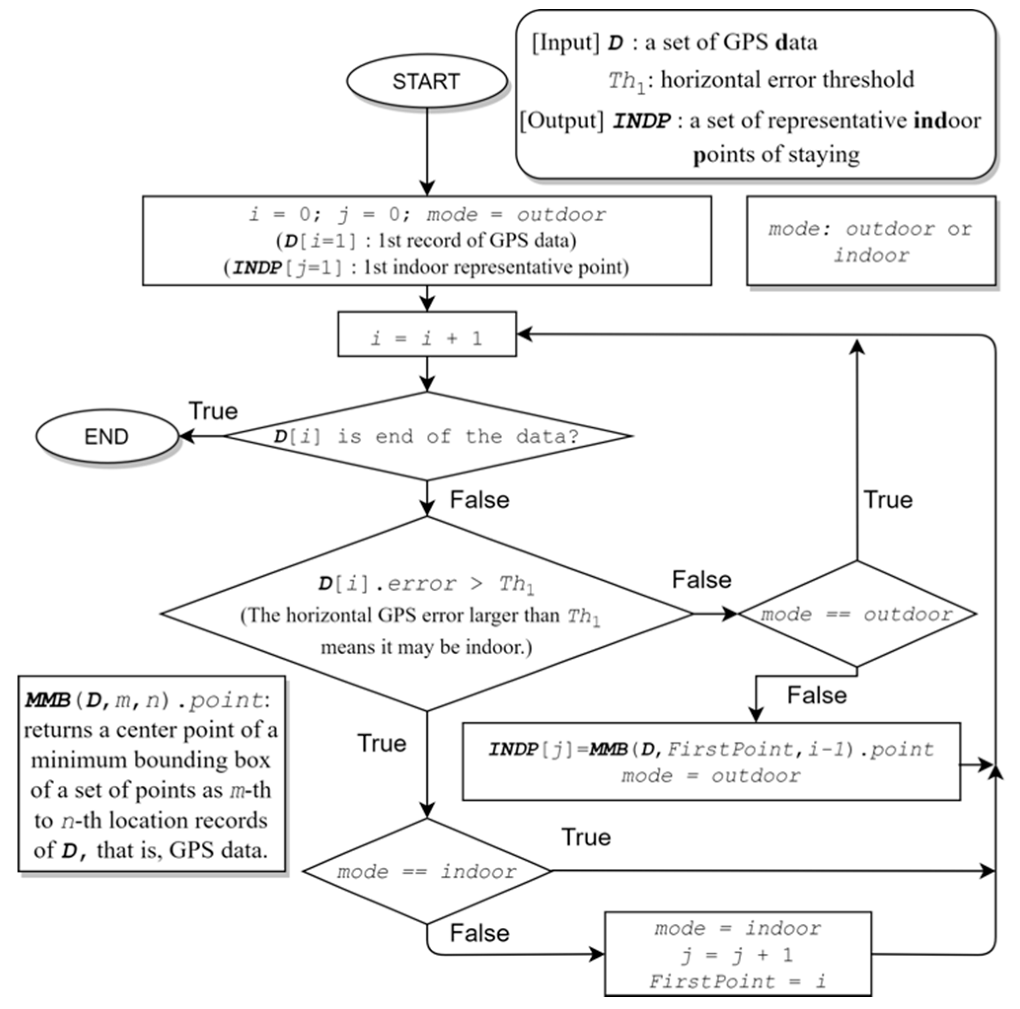
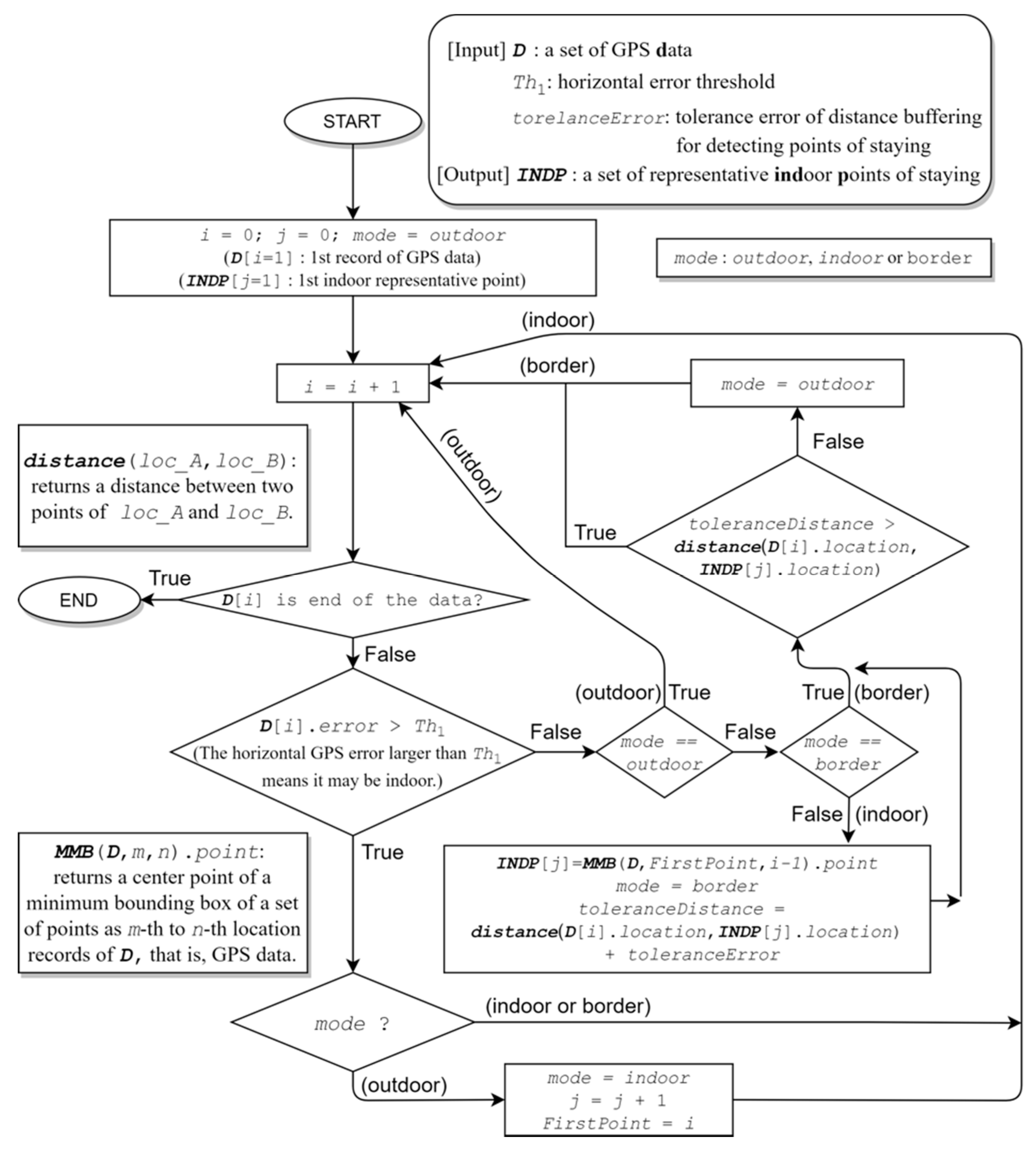
3.2. Indoor and Outdoor Recognitions
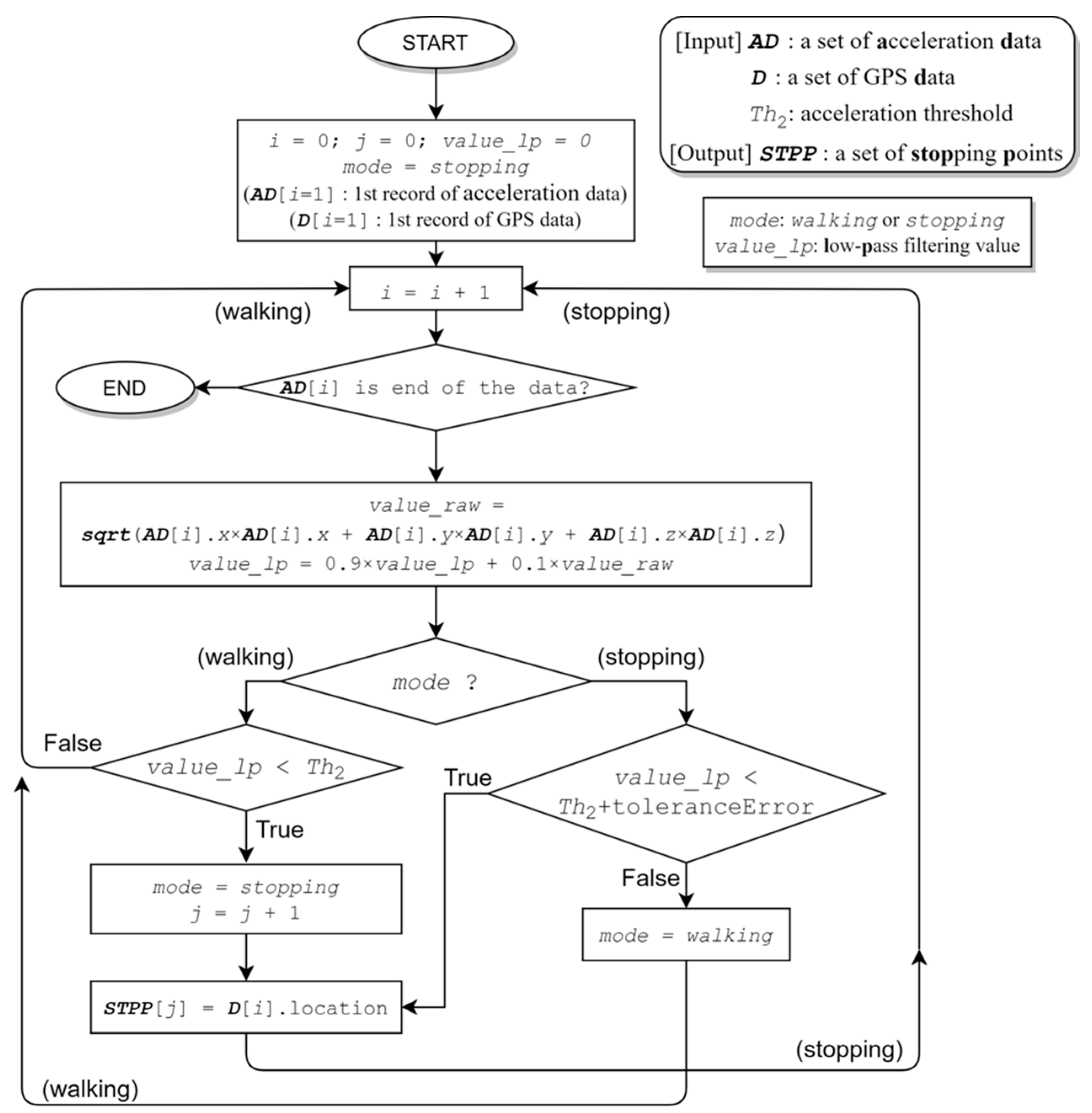
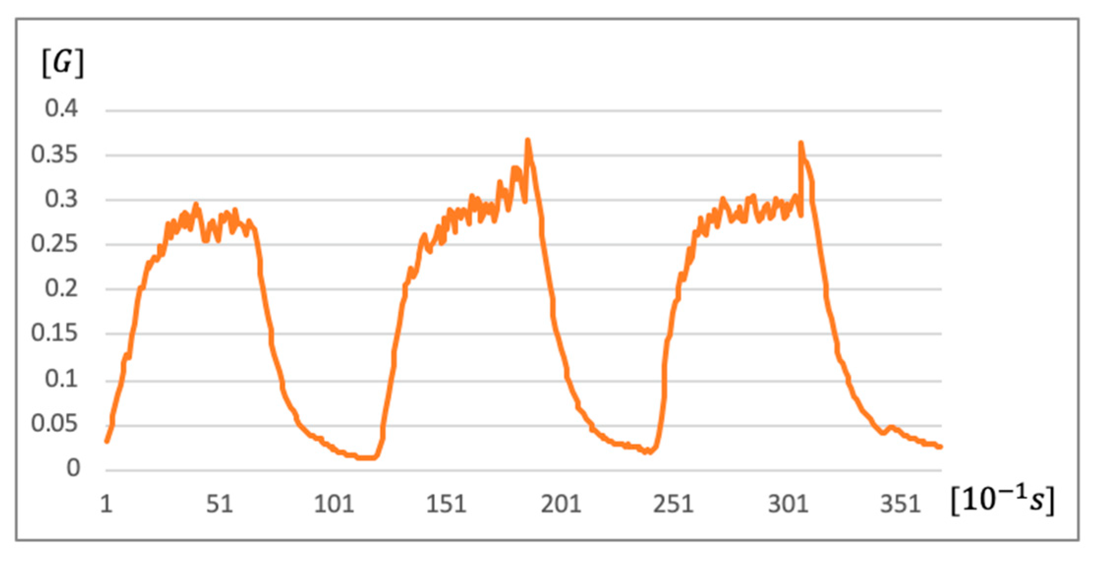
3.3. Walking and Stopping Recognitions
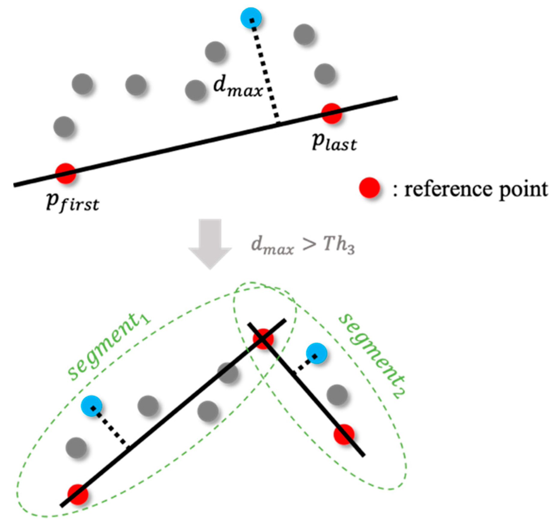
3.4. Line Simplification
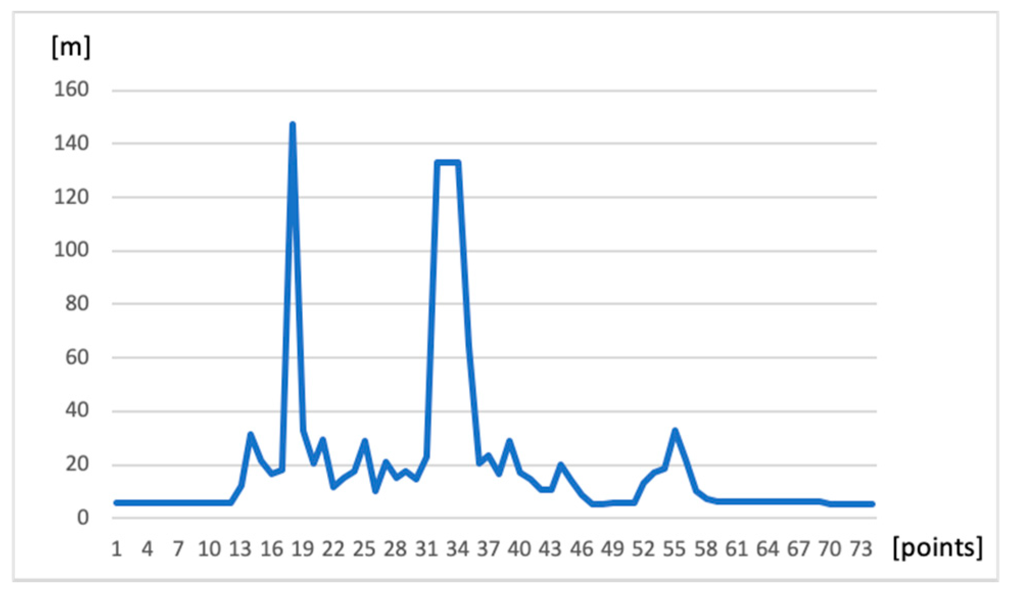
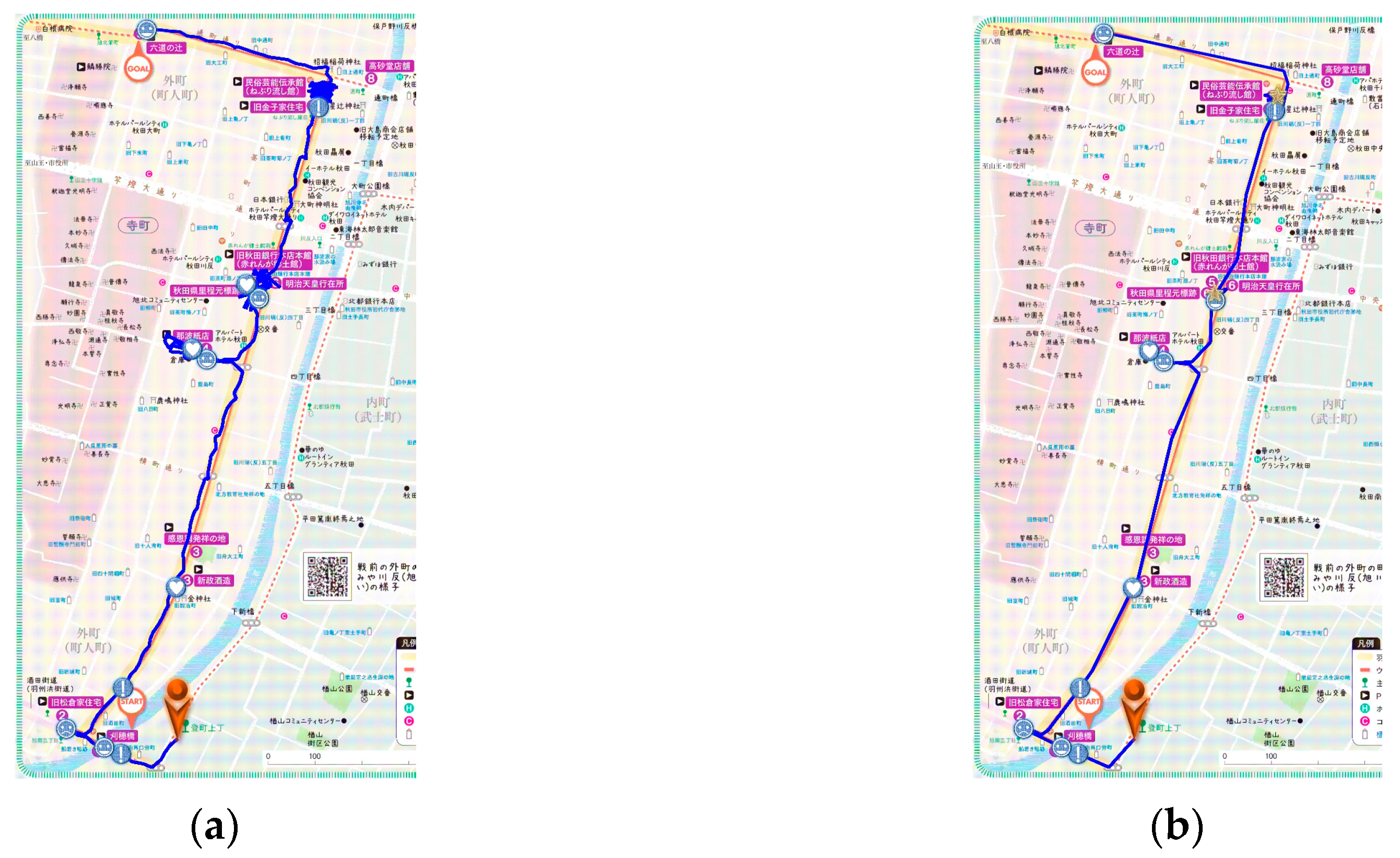
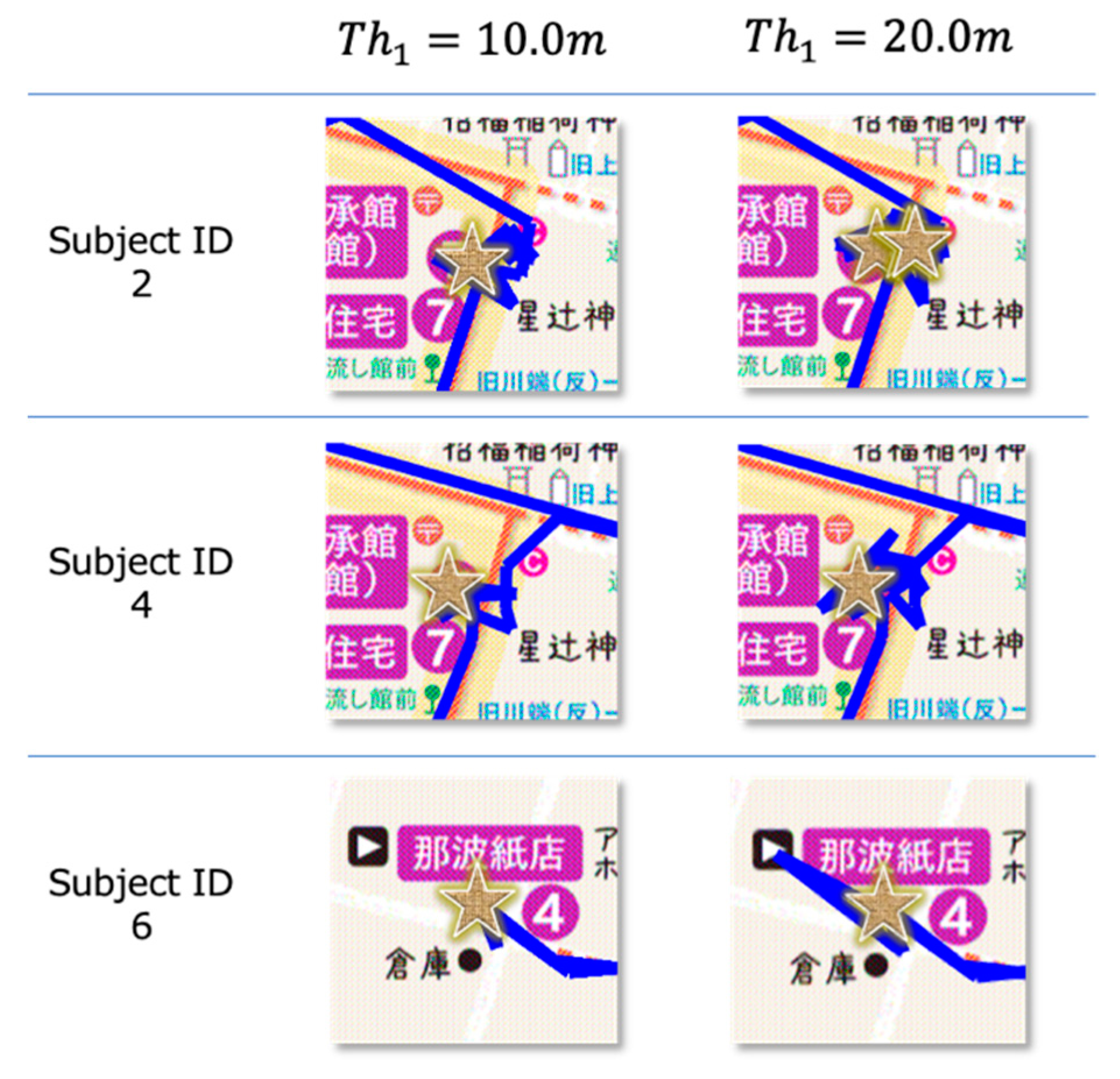
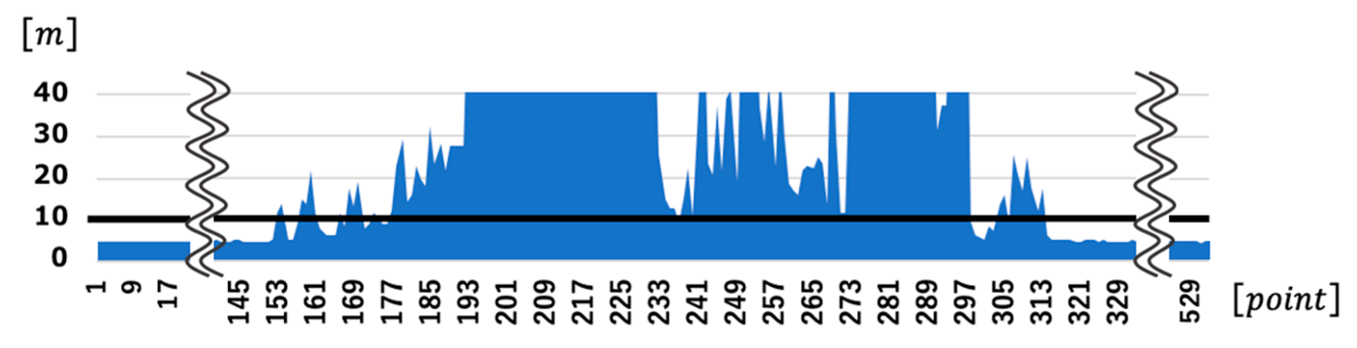
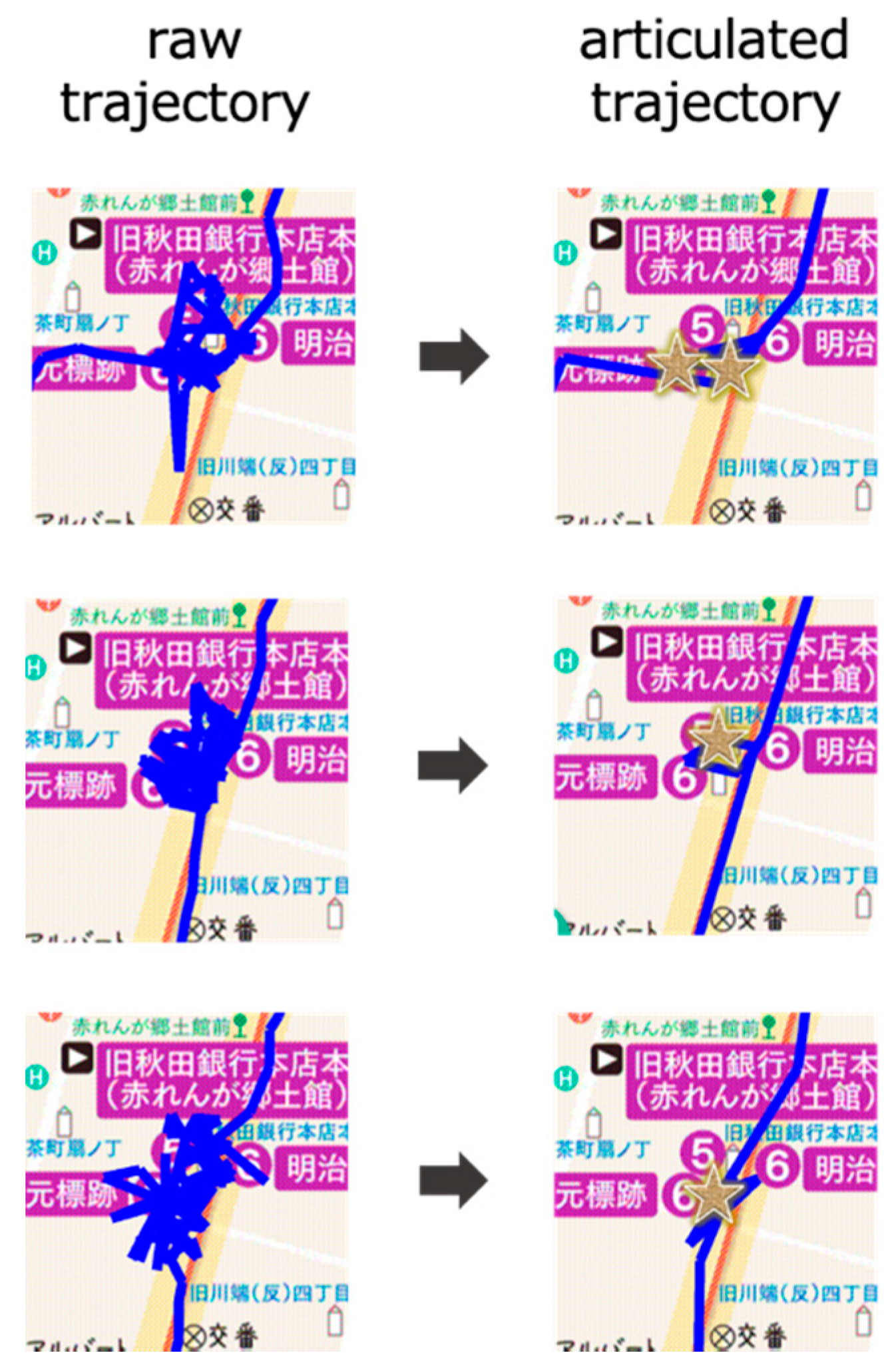
4. Experiments and Results
5. Discussion
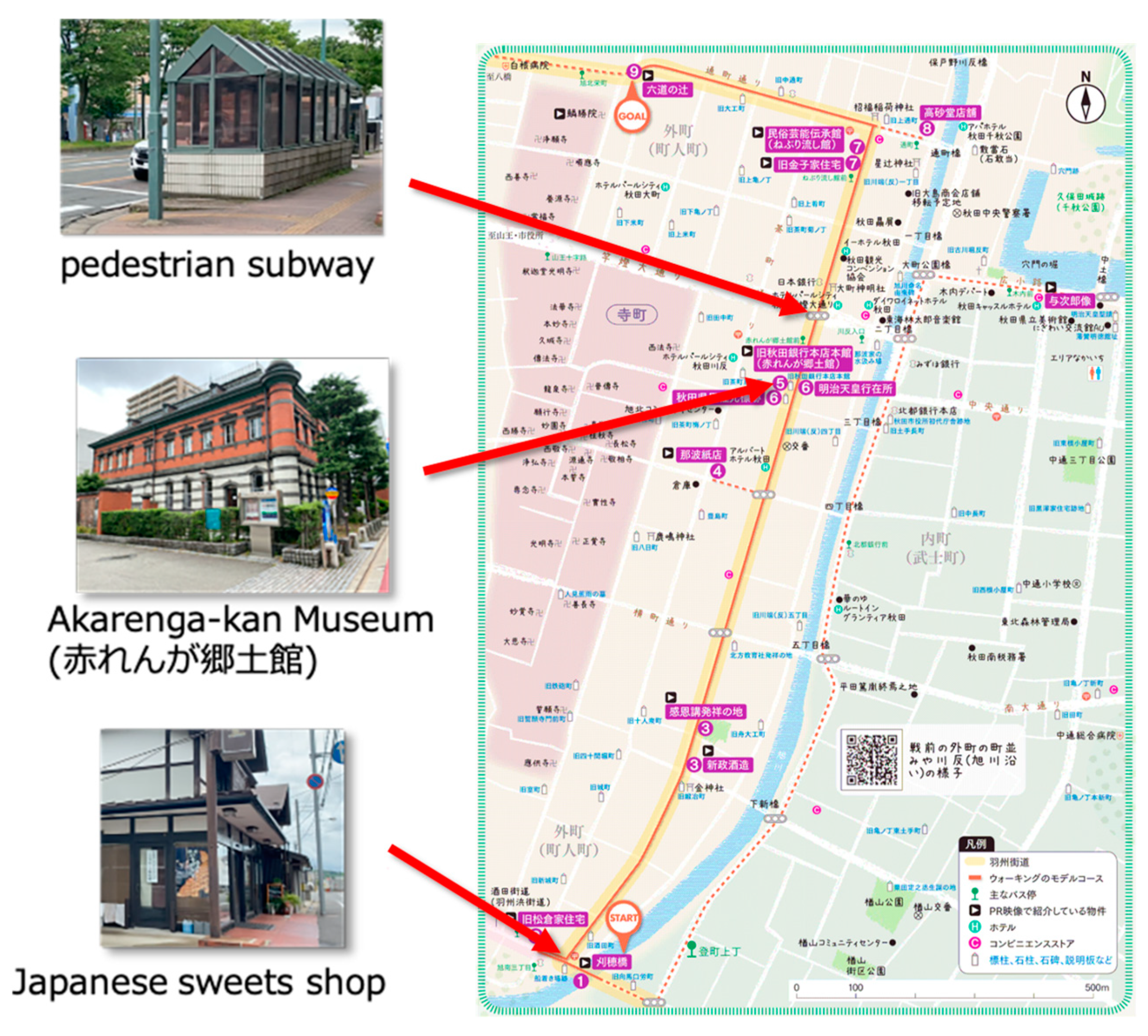
- Pedestrian subway (Figure 18)
- Japanese sweets shop (Figure 19)
6. Conclusions
Supplementary Materials
Author Contributions
Funding
Acknowledgments
Conflicts of Interest
References
- World Tourism Organization. Walking Tourism—Promoting Regional Development. 2019. Available online: https://www.e-unwto.org/doi/book/10.18111/9789284420346 (accessed on 8 August 2020).
- Benyon, D.; Quigley, A.; O’Keefe, B.; Riva, G. Presence and digital tourism. AI Soc. 2014, 29, 521–529. [Google Scholar] [CrossRef]
- Statler, S. Geofencing: Everything you need to know. In Beacon Technologies; Apress: Berkeley, CA, USA, 2016; pp. 307–316. [Google Scholar]
- Lu, M.; Arikawa, M. Map-based storytelling tool for real-world walking tour. J. Locat. Based Serv. 2013, 435–451. [Google Scholar]
- Spaccapietra, S.; Parent, C.; Damiani, M.L.; Macedo, J.A.; Porto, F.; Vangenot, C. A conceptual view on trajectories. Data Knowl. Eng. 2008, 65, 126–146. [Google Scholar] [CrossRef]
- myTracks The GPS solution for iOS and macOS. Available online: https://www.mytracks4mac.info/index.php/en/ (accessed on 15 September 2020).
- Douglas, H.D.; Peucker, T.K. Algorithms for the reduction of the number of points required to represent a digitized line or its caricature. Cartogr. Int. J. Geogr. Inf. Geovisualization 1973, 10, 112–122. [Google Scholar] [CrossRef]
- Reumann, K.; Witkam, A.P. Optimizing curve segmentation in computer graphics. In Proceedings of the International Computing Symposium, Davos, Switzerland, 4–7 September 1973; pp. 467–472. [Google Scholar]
- Quddus, M.A.; Ochieng, W.Y.; Noland, R.B. Current map-matching algorithms for transport applications: State-of-the art and future research directions. Transp. Res. C 2007, 15, 312–328. [Google Scholar] [CrossRef]
- Zheng, Y. Trajectory data mining: An overview. ACM Trans. Intell. Syst. Technol. 2015, 6, 29. [Google Scholar] [CrossRef]
- Katsikouli, P.; Sarkar, R.; Gao, J. Persistence based online signal and trajectory simplification for mobile devices. In Proceedings of the 22th ACM SIGSPATIAL International Conference on Advances in Geographic Information Systems, Dallas, TX, USA, 4–7 November 2014; pp. 371–380. [Google Scholar]
- Li, Z.; Ding, B.; Han, J.; Kays, R.; Nye, P. Mining periodic behaviors for moving objects. In Proceedings of the 16th ACM SIGKDD International Conference on Knowledge Discovery and Data Mining, Washington, DC, USA, 24–28 July 2010; pp. 1099–1108. [Google Scholar]
- Li, Q.; Zheng, Y.; Xie, X.; Chen, Y.; Liu, W.; Ma, W. Mining user similarity based on location history. In Proceedings of the 16th ACM SIGSPATIAL Conference on Advance in Geographical Information Systems, Irvine, CA, USA, 5–7 November 2008; pp. 1–10. [Google Scholar]
- Palma, A.T.; Bogorny, V.; Kuijpers, B.; Alvares, L.O. A clustering-based approach for discovering interesting places in trajectories. In Proceedings of the 2008 ACM Symposium on Applied Computing, Fortaleza Ceara, Brazil, 16–20 March 2008; pp. 863–868. [Google Scholar]
- Boukhechba, M.; Bouzouane, A.; Bouchard, B.; Vallerand, C.G.; Giroux, S. Online recognition of people’s activities from raw GPS data: Semantic trajectory data analysis. In Proceedings of the 8th ACM International Conference on PErvasive Technologies Related to Assistive Environments, Corfu, Greece, 1–3 July 2015; pp. 1–8. [Google Scholar]
- Alvares, L.O.; Bogorny, V.; Kuijpers, B.; Macedo, J.A.F.; Moelans, B.; Vaisman, A. A model for enriching trajectories with semantic geographical information. In Proceedings of the 15th Annual ACM International Symposium on Advances in Geographic Information Systems, Seattle, WA, USA, 7–9 November 2007; pp. 1–8. [Google Scholar]
- Bogorny, V.; Avancini, H.; Paula, B.C.; Kuplich, C.R.; Alvares, L.O. Weka-STPM: A software architecture and prototype for semantic trajectory data mining and visualization. Trans. GIS 2011, 15, 227–248. [Google Scholar] [CrossRef]
- Huang, H.; Gartner, G.; Krisp, J.M.; Raubal, M.; Weghe, N.V. Location based services: Ongoing evolution and research agenda. J. Locat. Based Serv. 2018, 12, 63–93. [Google Scholar] [CrossRef]
- Grifoni, P.; D’Ulizia, A.; Ferri, F. Context-awareness in location based services in the big data era. In Mobile Big Data; Skourletopoulos, G., Mastorakis, G., Mavromoustakis, C.X., Dobre, C., Eds.; Springer: Berlin/Heidelberg, Germany, 2017; Volume 10, pp. 85–127. [Google Scholar]
- horizontalAccuracy | Apple Developer Documentation. Available online: https://developer.apple.com/documentation/corelocation/cllocation/1423599-horizontalaccuracy/ (accessed on 19 September 2020).
- Xia, H.; Qiao, Y.; Jian, J.; Chang, Y. Using smart phone sensors to detect transportation modes. Sensors 2014, 14, 20843–20865. [Google Scholar] [CrossRef]


| Issue | Approaches |
|---|---|
| Problem A: Tangled Trajectory Line | [simplification] Discard from trajectory. |
| Problem B: Inaccurate Indoor Positioning | [characterization] Abstract a point of staying. |
| Problem C: Unstable Trajectory Line | [simplification] Conventional algorithms [7,8] are possible solutions. |
| Points of UGC (e.g., photos, text) | [characterization] Visualize on a map by a geotag. |
Users | 5.0 m | 7.5 m | 10.0 m | 12.5 m | 15.0 m |
|---|---|---|---|---|---|
Publisher’s Note: MDPI stays neutral with regard to jurisdictional claims in published maps and institutional affiliations. |
© 2020 by the authors. Licensee MDPI, Basel, Switzerland. This article is an open access article distributed under the terms and conditions of the Creative Commons Attribution (CC BY) license (http://creativecommons.org/licenses/by/4.0/).
Share and Cite
Sasaki, I.; Arikawa, M.; Takahashi, A. Articulated Trajectory Mapping for Reviewing Walking Tours. ISPRS Int. J. Geo-Inf. 2020, 9, 610. https://doi.org/10.3390/ijgi9100610
Sasaki I, Arikawa M, Takahashi A. Articulated Trajectory Mapping for Reviewing Walking Tours. ISPRS International Journal of Geo-Information. 2020; 9(10):610. https://doi.org/10.3390/ijgi9100610
Chicago/Turabian StyleSasaki, Iori, Masatoshi Arikawa, and Akinori Takahashi. 2020. "Articulated Trajectory Mapping for Reviewing Walking Tours" ISPRS International Journal of Geo-Information 9, no. 10: 610. https://doi.org/10.3390/ijgi9100610
APA StyleSasaki, I., Arikawa, M., & Takahashi, A. (2020). Articulated Trajectory Mapping for Reviewing Walking Tours. ISPRS International Journal of Geo-Information, 9(10), 610. https://doi.org/10.3390/ijgi9100610