Article

Normalized-Mutual-Information-Based Mining Method for Cascading Patterns

1
Key Laboratory of Digital Earth Science, Institute of Remote Sensing and Digital Earth, Chinese Academy of Sciences, Beijing 100094, China
2
Key Laboratory of the Earth Observation, Sanya 572029, Hainan, China
*
Authors to whom correspondence should be addressed.
ISPRS Int. J. Geo-Inf. 2016, 5(10), 174; https://doi.org/10.3390/ijgi5100174
Submission received: 24 May 2016 / Revised: 19 September 2016 / Accepted: 19 September 2016 / Published: 27 September 2016

Abstract

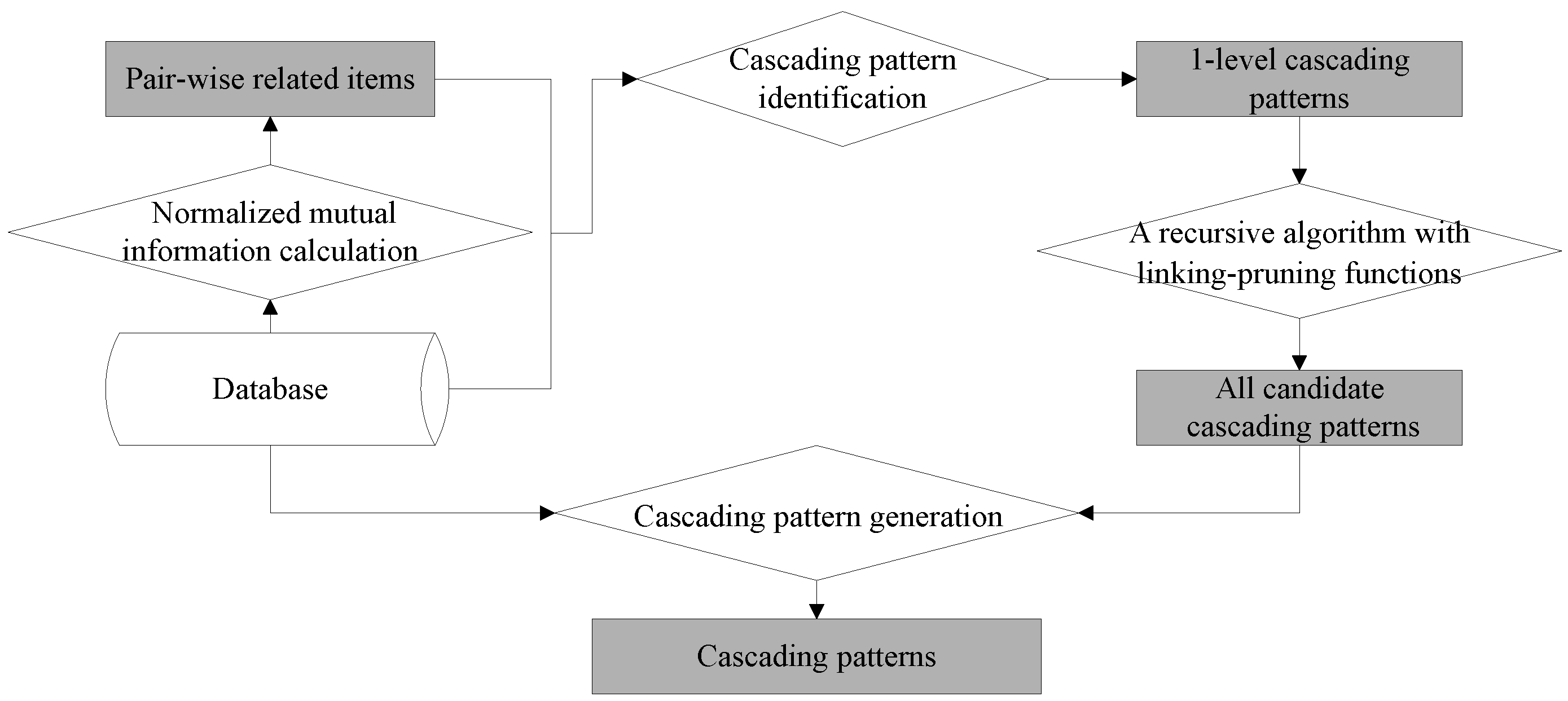
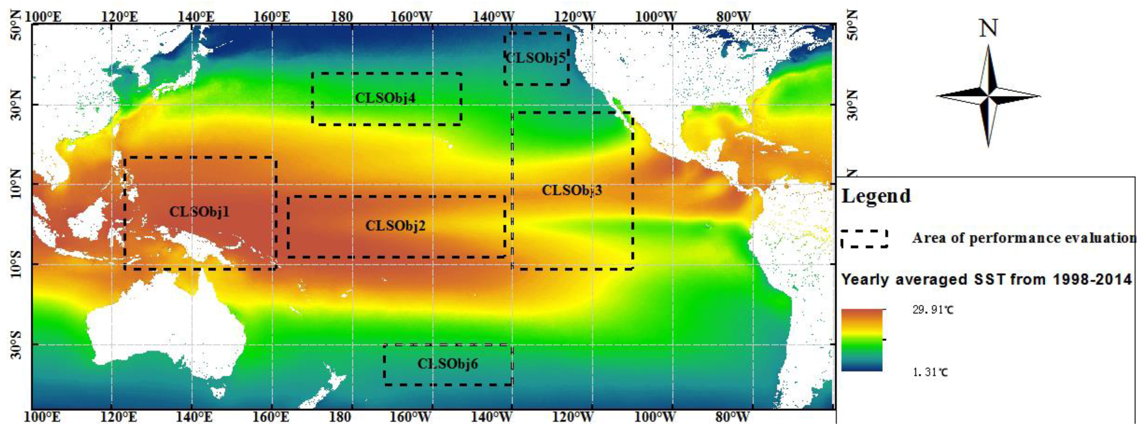
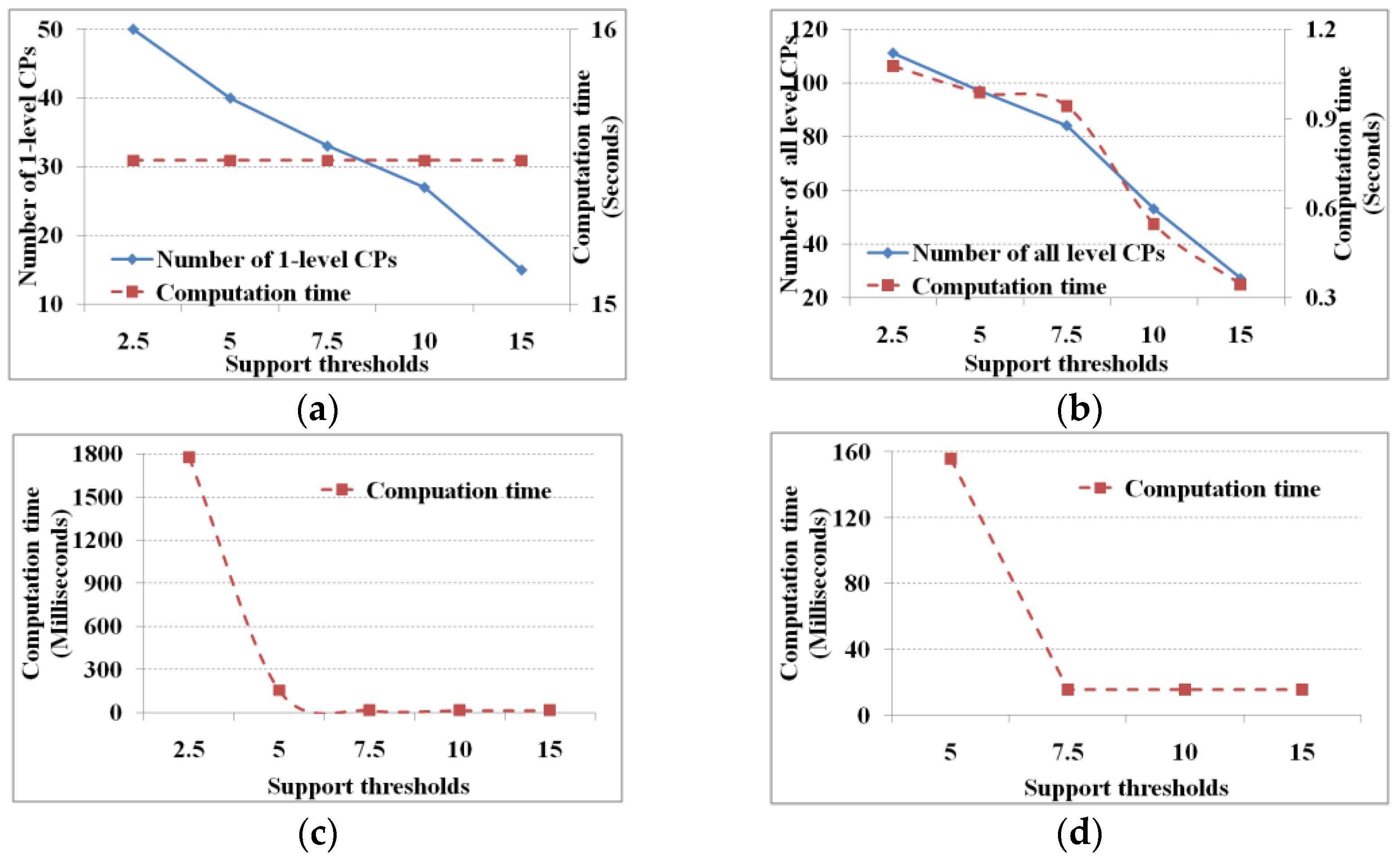
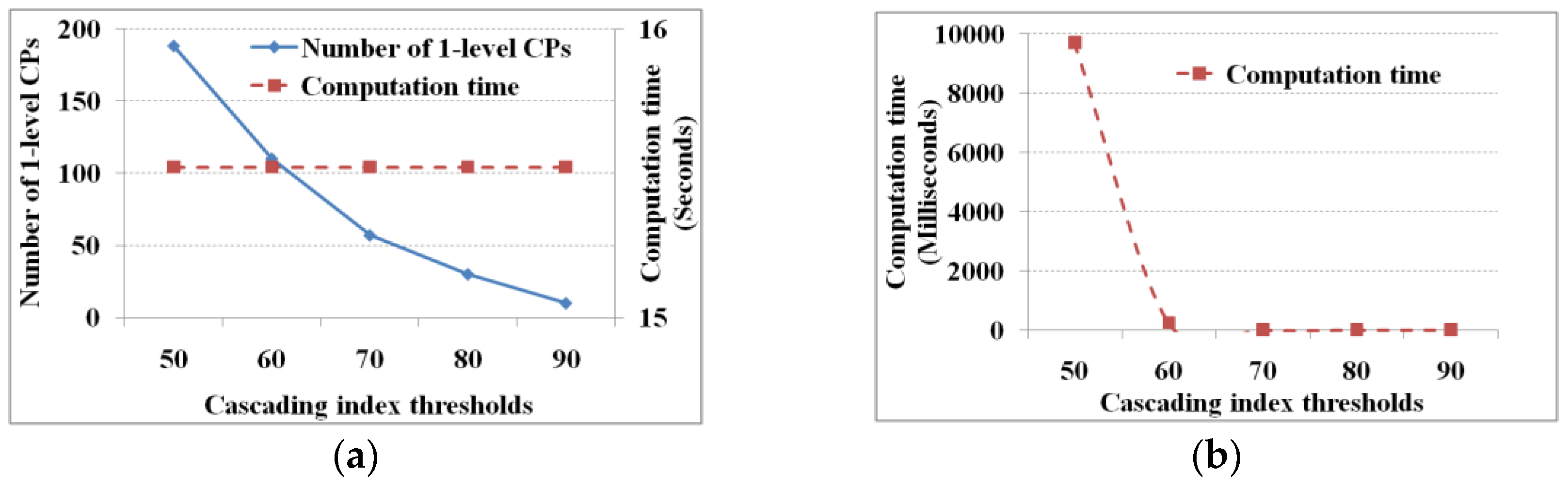
A cascading pattern is a sequential pattern characterized by an item following another item in order. Recent research has investigated a challenge of dealing with cascading patterns, namely, the exponential time dependence of database scanning with respect to the number of items involved. We propose a normalized-mutual-information-based mining method for cascading patterns (M3Cap) to address this challenge. M3Cap embeds mutual information to reduce database-scanning time. First, M3Cap calculates the asymmetrical mutual information between items with one database scan and extracts pair-wise related items according to a user-specified information threshold. Second, a one-level cascading pattern is generated by scanning the database once for each pair-wise related item at the quantitative level. Third, a recursive linking–pruning–generating loop generates an (m + 1)-level-candidate cascading pattern from m-dimensional patterns on the basis of antimonotonicity and non-additivity, repeating this step until no further candidate cascading patterns are generated. Fourth, meaningful cascading patterns are generated according to user-specified minimum evaluation indicators. Finally, experiments with remote sensing image datasets covering the Pacific Ocean demonstrate that the computation time of recursive linking and pruning is significantly less than that of database scanning; thus, M3Cap improves performance by reducing database scanning while increasing intensive computing.
Keywords: spatiotemporal data mining; cascading pattern; mutual information; marine remote sensing spatiotemporal data mining; cascading pattern; mutual information; marine remote sensing