
A Method of Optimizing Terrain Rendering Using Digital Terrain Analysis

Abstract
:1. Introduction
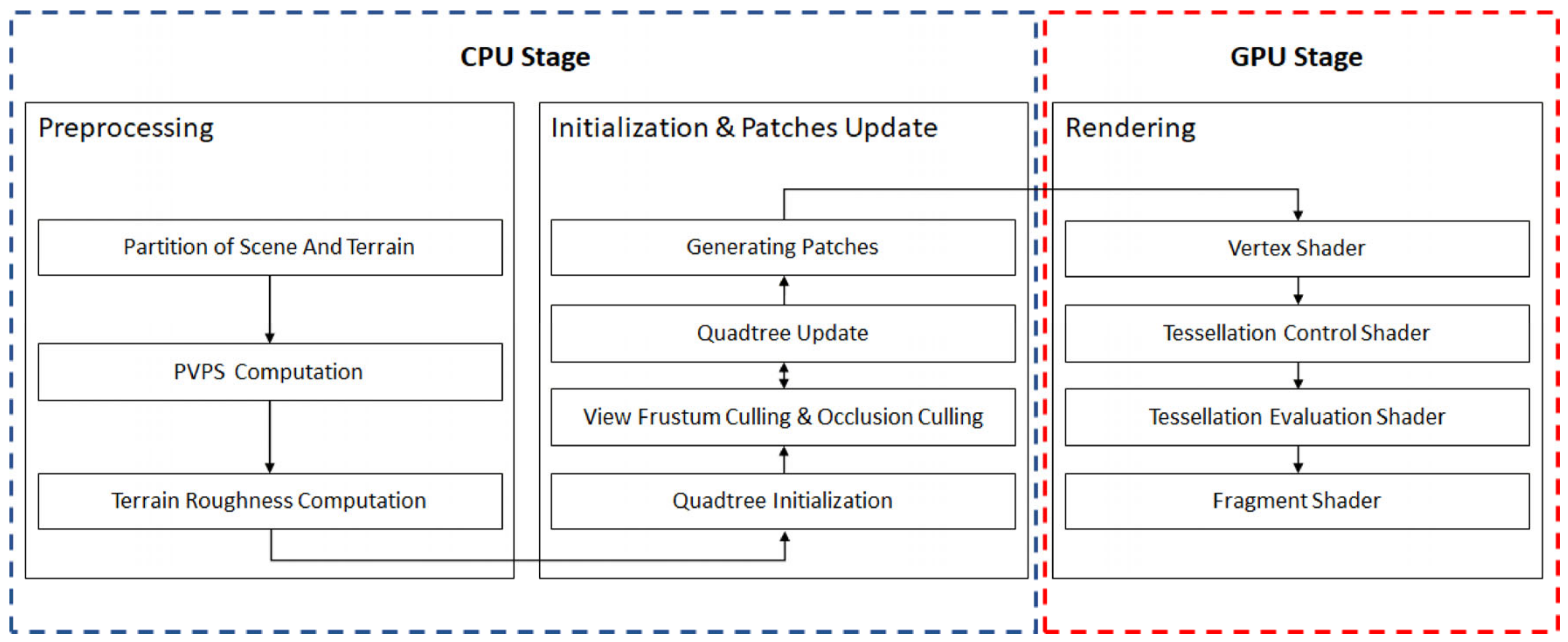
2. Methods
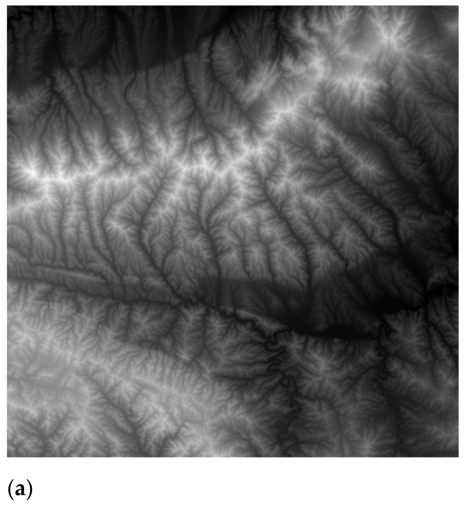
2.1. Experimental Data
2.2. Preprocessing
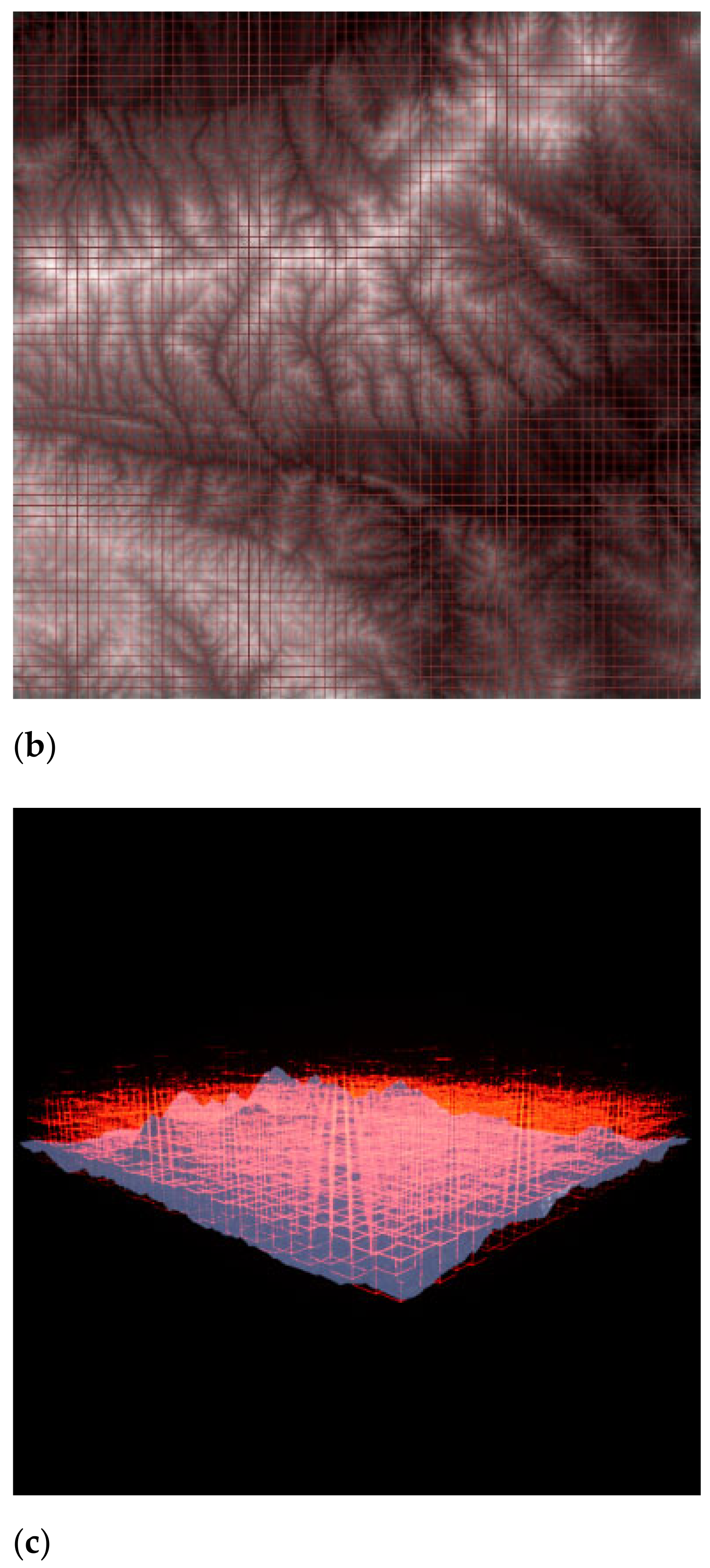
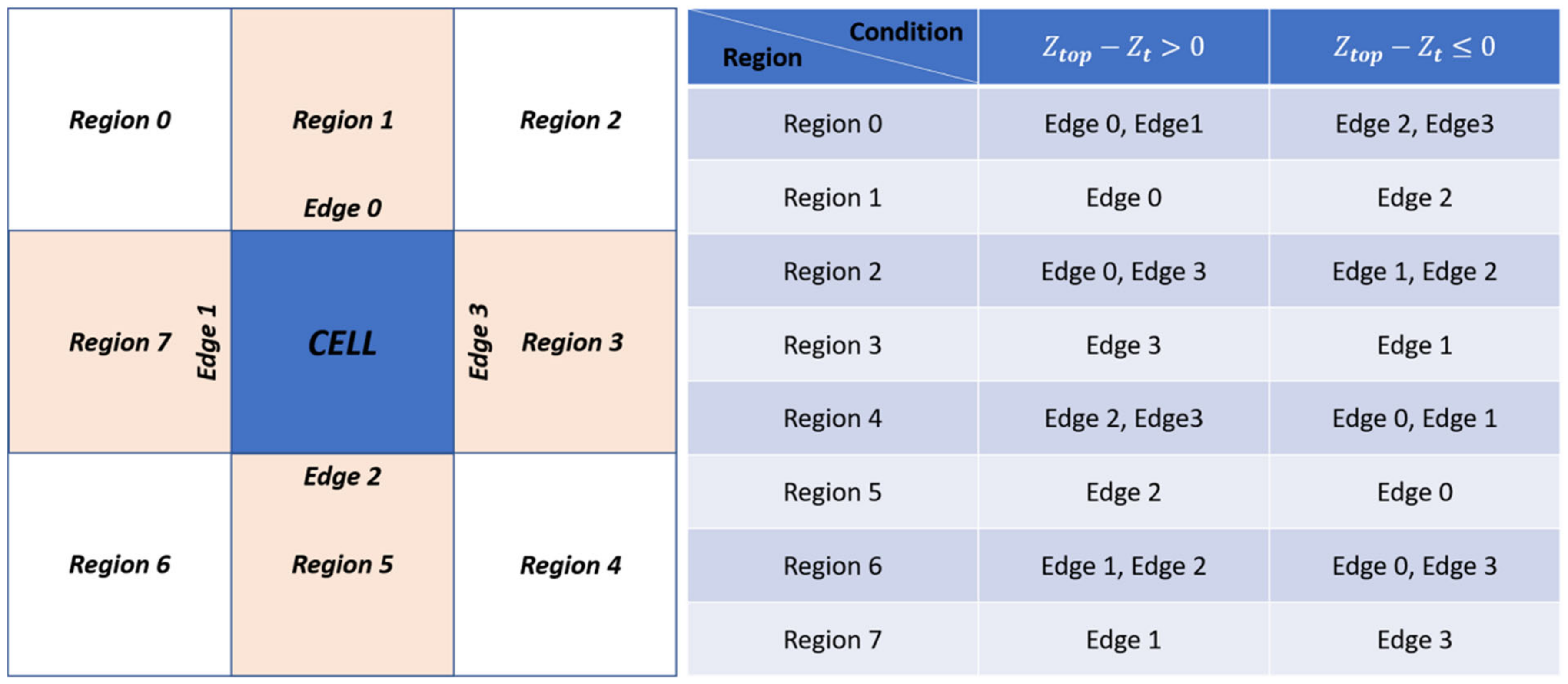
2.2.1. Partition of Scene and Terrain
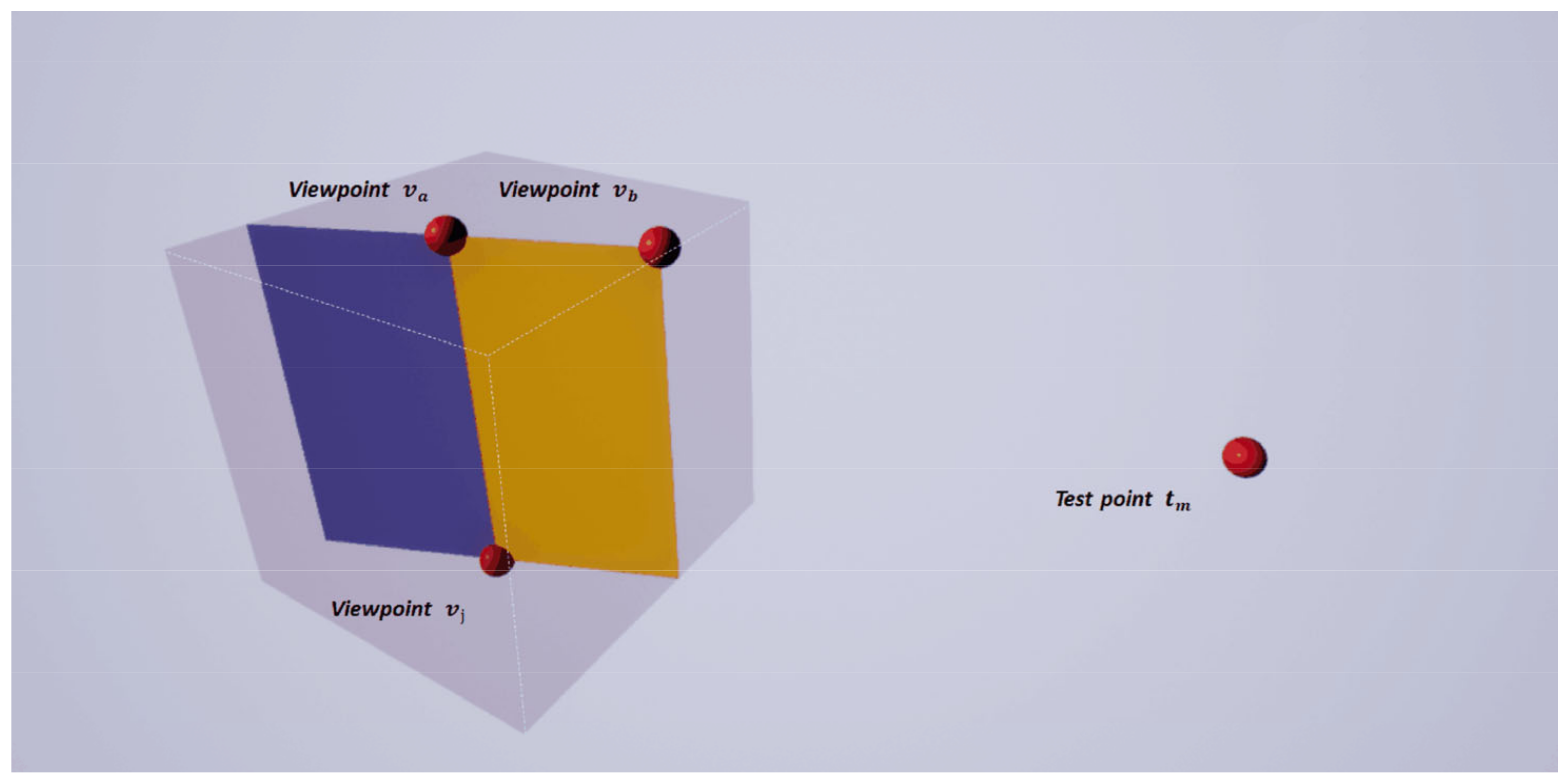
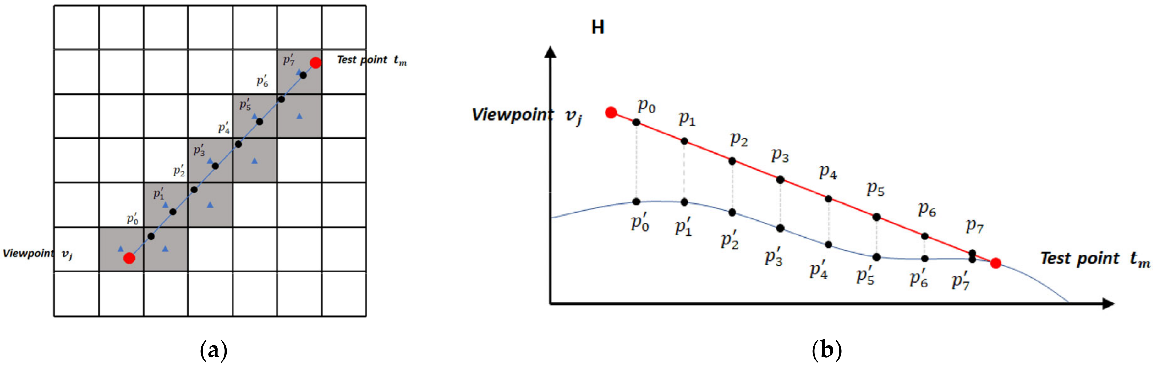
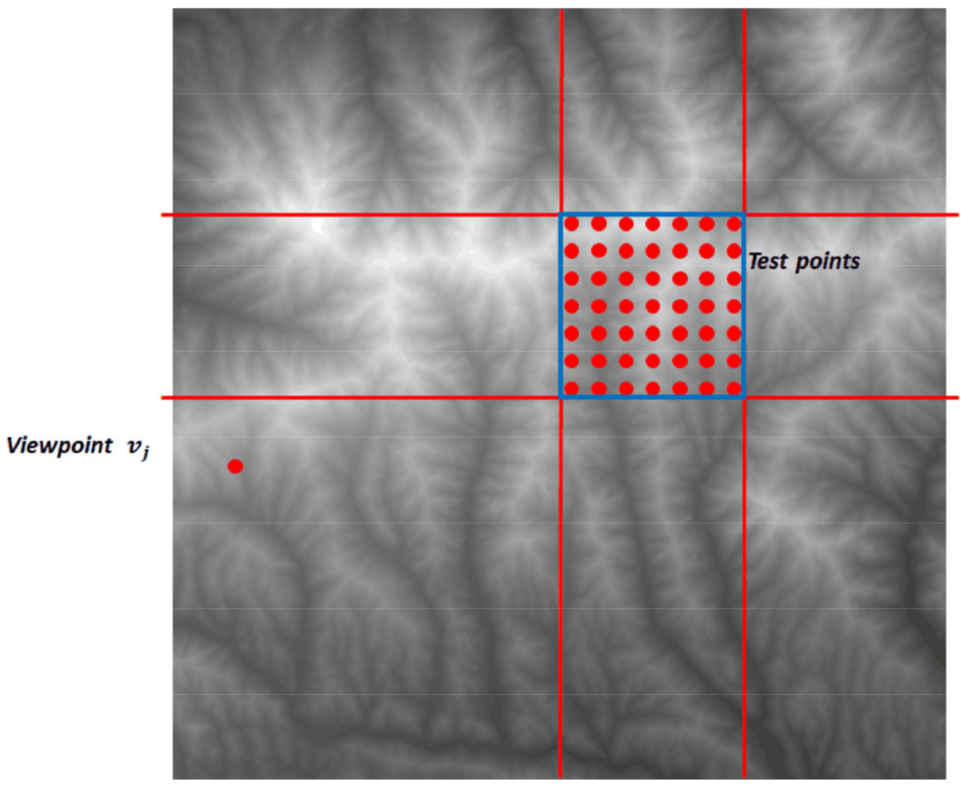
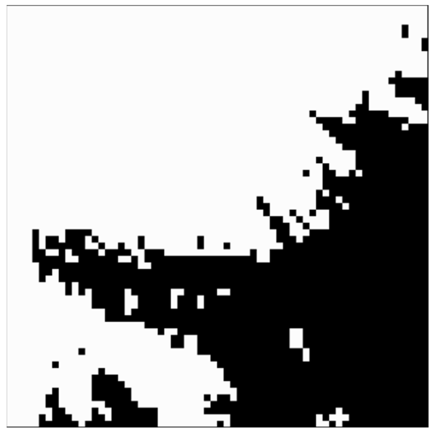
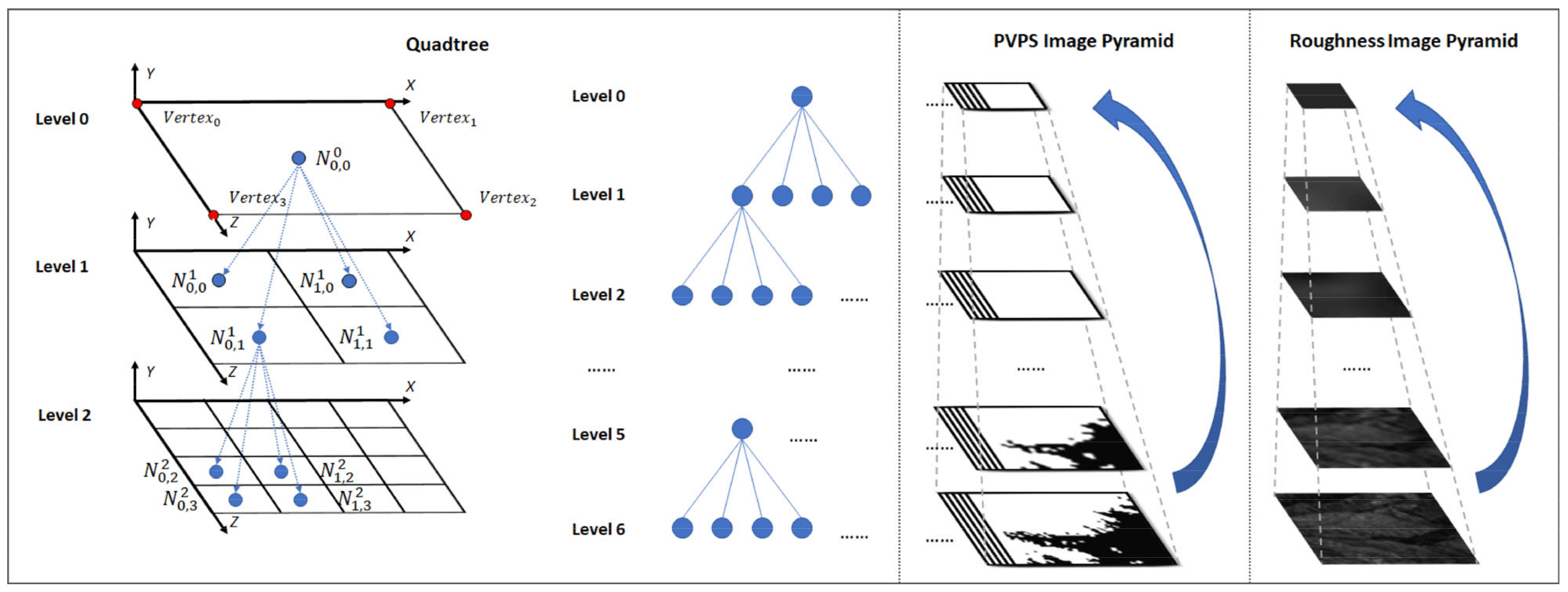
2.2.2. PVPS Computation
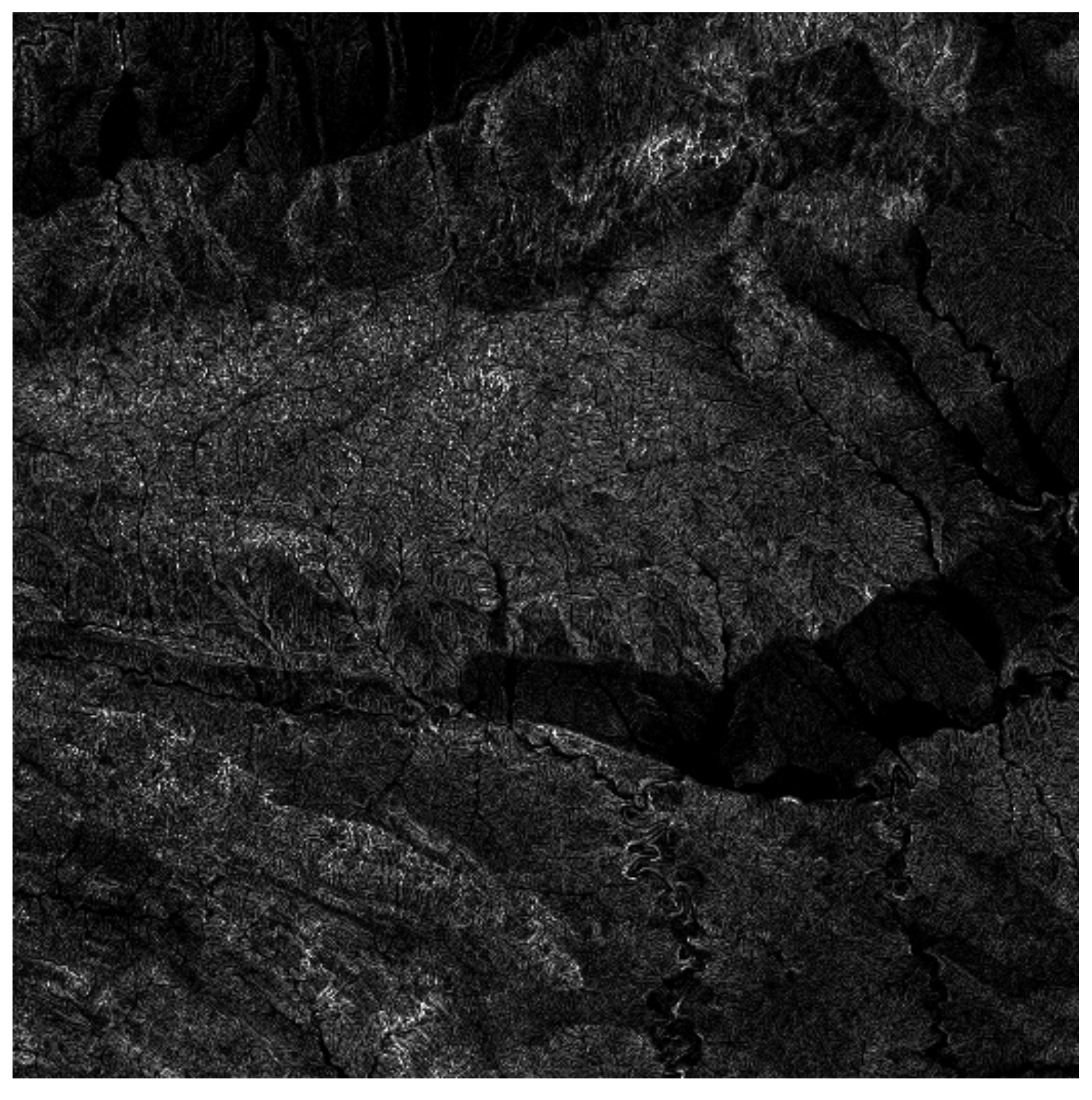
2.2.3. Roughness Map Computation
2.3. Initialization and Patches Update
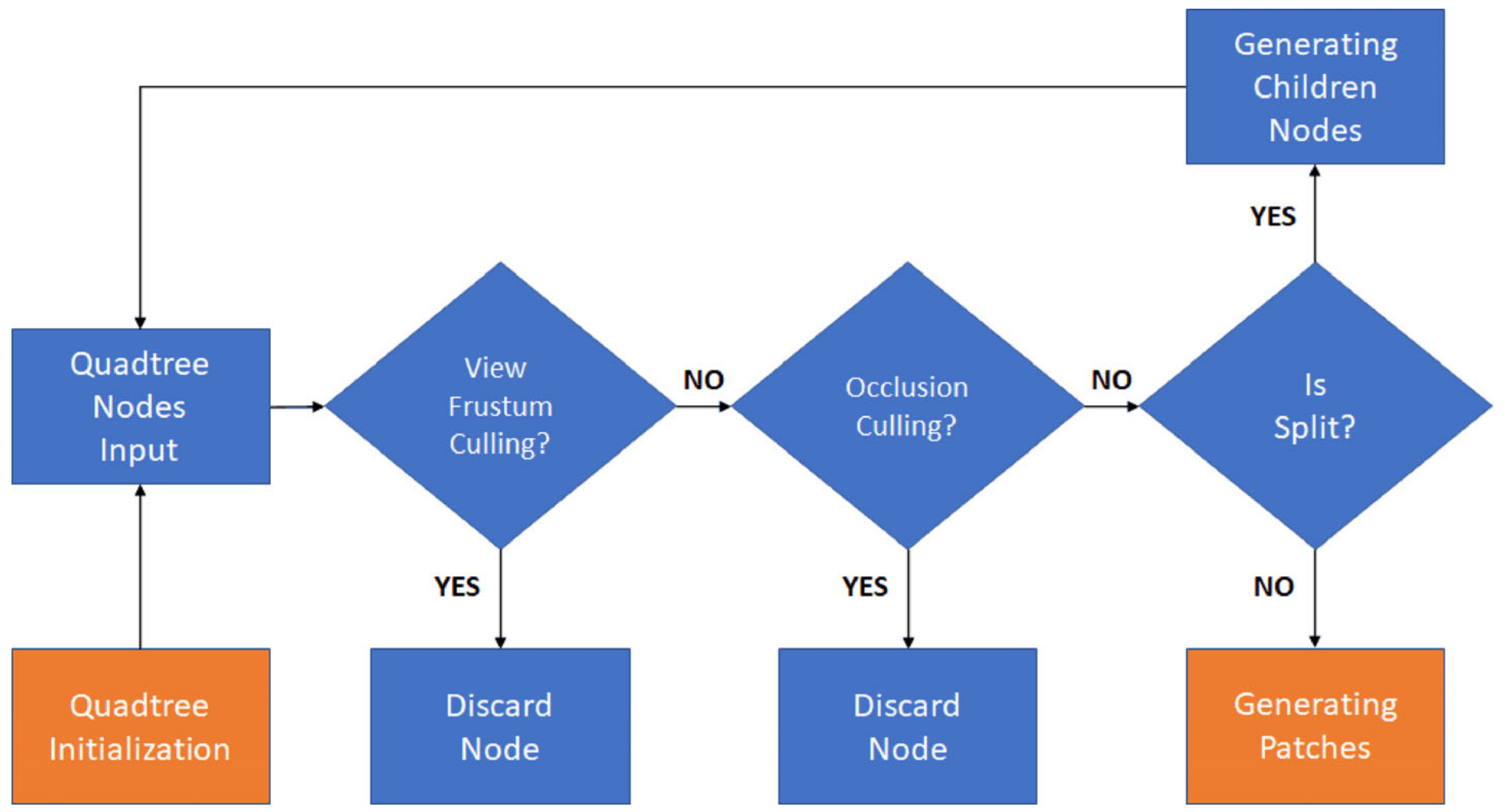
2.3.1. Quadtree Initialization and Quadtree Nodes Input
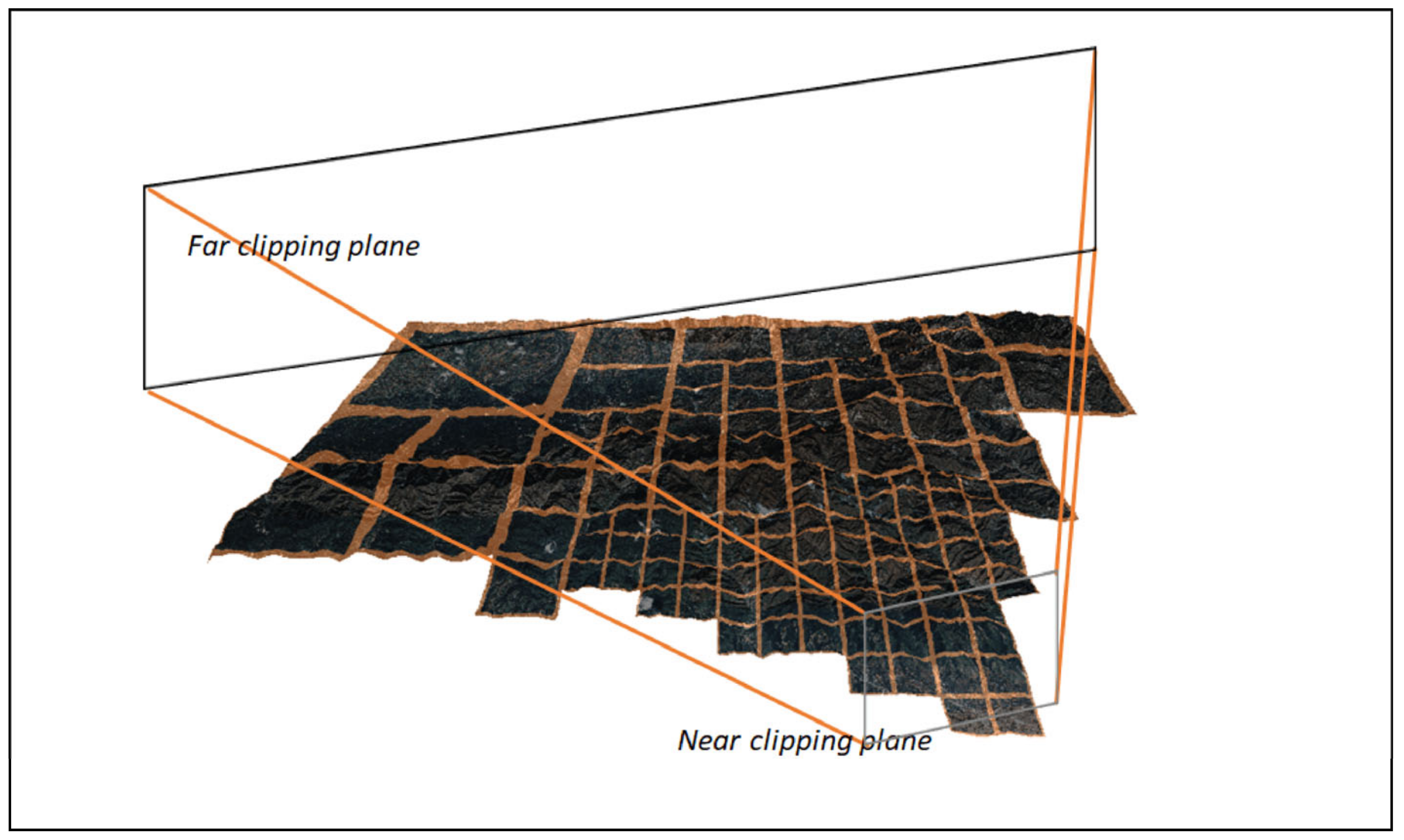
2.3.2. View Frustum Culling
2.3.3. Occlusion Culling
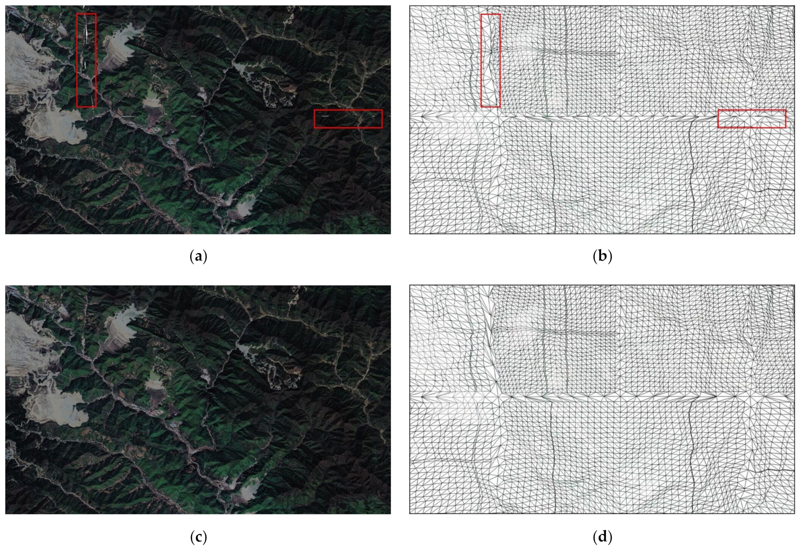
2.3.4. Quadtree Nodes Splitting
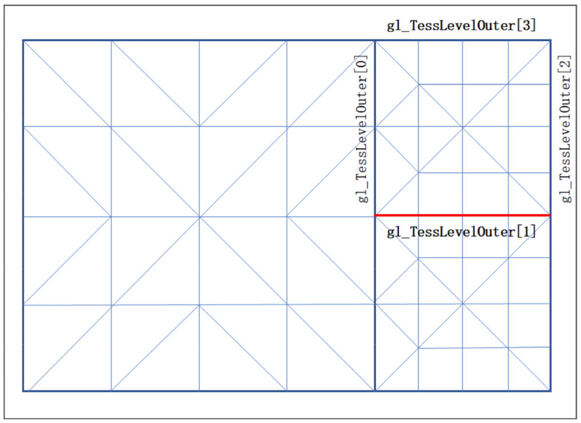
2.4. Rendering
| Algorithm 1 Crack-Free Process. |
|
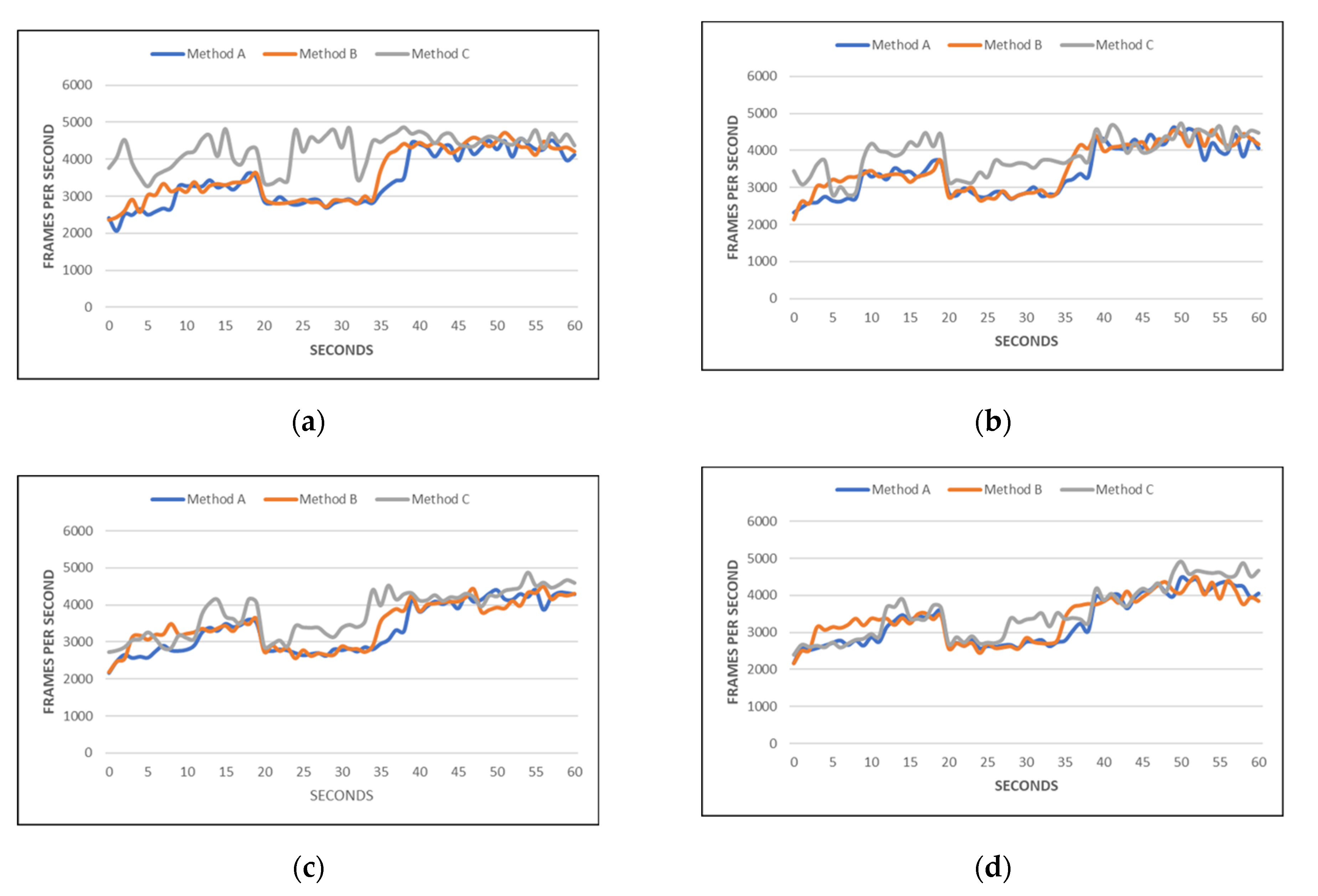
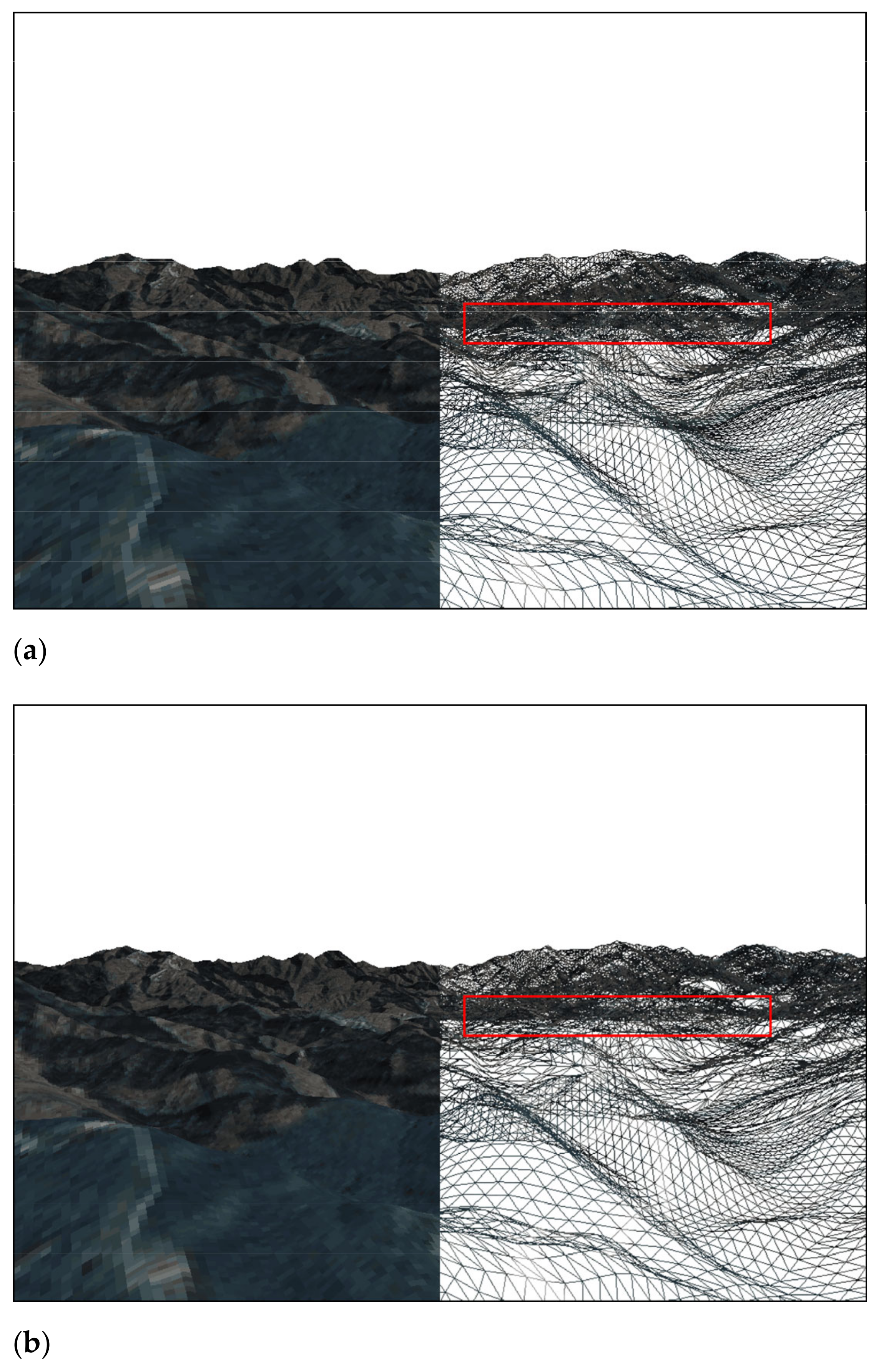
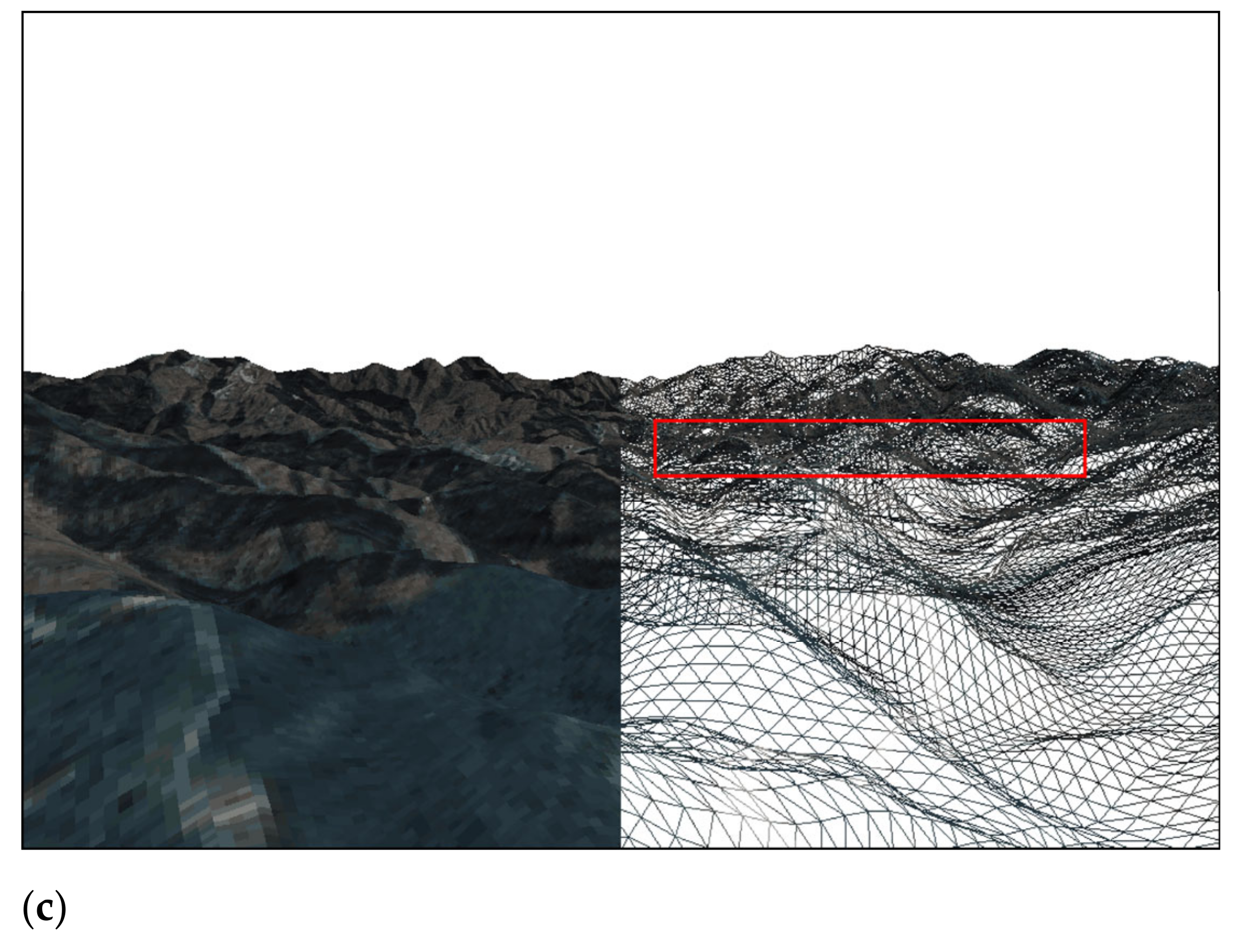
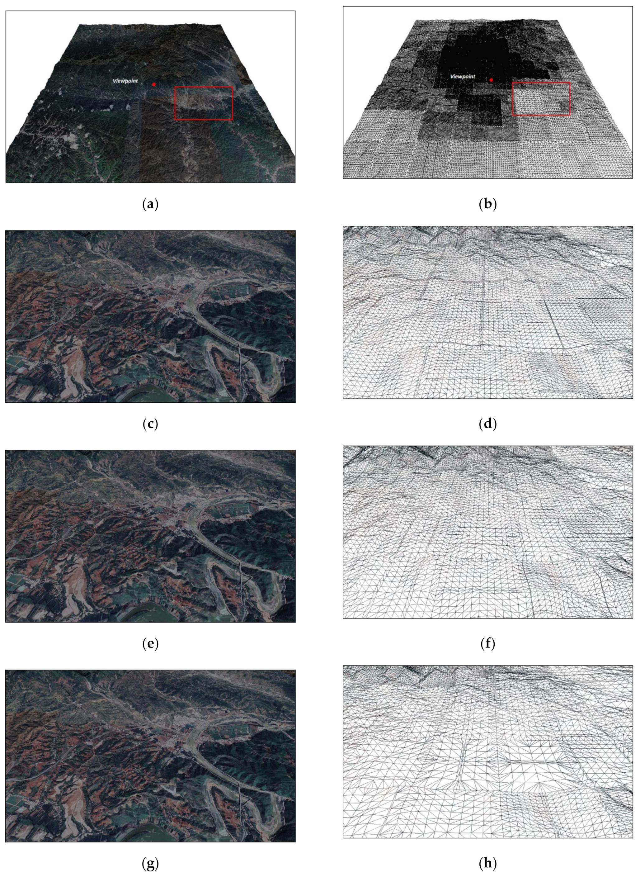
3. Results
4. Conclusions and Future Work
Author Contributions
Funding
Acknowledgments
Conflicts of Interest
References
- Petrie, G.; Kennie, T.J.M. Terrain modelling in surveying and civil engineering. Comput.-Aided Des. 1987, 19, 171–187. [Google Scholar] [CrossRef]
- Baumann, K.; Doellner, J.; Hinrichs, K.H.; Kersting, O. A Hybrid, Hierarchical Data Structure for Real-Time Terrain Visualization. In Proceedings of the Computer Graphics International, Canmore, Alta, Canada, 11 June 1999; IEEE: Picataway, NJ, USA, 1999; pp. 85–92. [Google Scholar]
- Boo, M.; Amor, M. Dynamic hybrid terrain representation based on convexity limits identification. Int. J. Geogr. Inf. Sci. 2009, 23, 417–439. [Google Scholar] [CrossRef]
- Paredes, E.G.; Bóo, M.; Amor, M.; Döllner, J.; Bruguera, J.D. GPU-based Visualization of Hybrid Terrain Models. In Proceedings of the GRAPP/IVAPP, Rome, Italy, 24–26 February 2012; pp. 254–259. [Google Scholar]
- Hoppe, H. Progressive meshes. In Proceedings of the 23rd Annual Conference on Computer Graphics and Interactive Techniques; ACM Press: Boston, MA, USA, 1996; pp. 99–108. [Google Scholar]
- Hoppe, H. View-dependent refinement of progressive meshes. In Proceedings of the 24th Annual Conference on Computer Graphics and Interactive Techniques, Los Angeles, CA, USA, 3–8 August 1997; ACM Press: Boston, MA, USA, 1997; pp. 189–198. [Google Scholar]
- Duchaineau, M.; Wolinsky, M.; Sigeti, D.E.; Miller, M.C.; Aldrich, C.; Mineev-Weinstein, M.B. ROAMing terrain: Real-time optimally adapting meshes. In Proceedings. Visualization’97 (Cat. No. 97CB36155); IEEE: Piscataway, NJ, USA, 1997; pp. 81–88. [Google Scholar]
- Ulrich, T. Rendering massive terrains using chunked level of detail control. In Proc. ACM SIGGRAPH 2002; Association for Computing Machinery: New York, NY, USA, 2002. [Google Scholar]
- Luna, F. Introduction to 3D Game Programming with DirectX 12; Stylus Publishing, LLC: Sterling, VA, USA, 2016. [Google Scholar]
- Lindstrom, P.; Pascucci, V. Terrain simplification simplified: A general framework for view-dependent out-of-core visualization. IEEE Trans. Vis. Comput. Graph. 2002, 8, 239–254. [Google Scholar] [CrossRef]
- Ripolles, O.; Ramos, F.; Puig-Centelles, A.; Chover, M. Real-time tessellation of terrain on graphics hardware. Comput. Geosci. 2012, 41, 147–155. [Google Scholar] [CrossRef] [Green Version]
- Livny, Y.; Kogan, Z.; El-Sana, J. Seamless patches for GPU-based terrain rendering. Vis. Comput. 2009, 25, 197–208. [Google Scholar] [CrossRef] [Green Version]
- Luna, F. Introduction to 3D Game Programming with DirectX 11; Stylus Publishing, LLC: Sterling, VA, USA, 2012. [Google Scholar]
- Schäfer, H.; Niessner, M.; Keinert, B.; Stamminger, M.; Loop, C.T. State of the Art Report on Real-time Rendering with Hardware Tessellation. In Eurographics (State of the Art Reports); EUROGRAPHICS Association: Goslar, Germany, 2014; pp. 93–117. [Google Scholar]
- Yusov, E.; Shevtsov, M. High-performance terrain rendering using hardware tessellation. WSCG 2011, 19, 85–92. [Google Scholar]
- Engel, W. (Ed.) GPU Pro 4: Advanced Rendering Techniques; CRC Press: Boca Raton, FL, USA, 2013. [Google Scholar]
- Cantlay, I. Directx 11 Terrain Tessellation. Nvidia Whitepaper 2011, 8, 3. [Google Scholar]
- Zhai, R.; Lu, K.; Pan, W.; Dai, S. GPU-based real-time terrain rendering: Design and implementation. Neurocomputing 2016, 171, 1–8. [Google Scholar] [CrossRef]
- Kang, H.; Jang, H.; Cho, C.S.; Han, J. Multi-resolution terrain rendering with GPU tessellation. Vis. Comput. 2015, 31, 455–469. [Google Scholar] [CrossRef]
- Fu, H.; Yang, H.; Chen, C. Large-scale terrain-adaptive LOD control based on GPU tessellation. Alex. Eng. J. 2021, 60, 2865–2874. [Google Scholar] [CrossRef]
- Dong, L.; Zhang, B.; Zhao, X. A Seamless Terrain Rendering Algorithm Based on GPU Tessellation; Geomatics and Information Science of Wuhan University; Wuhan University: Wuhan, China, 2017. [Google Scholar]
- Airey, J.M.; Rohlf, J.H.; Brooks Jr, F.P. Towards image realism with interactive update rates in complex virtual building environments. ACM SIGGRAPH Comput. Graph. 1990, 24, 41–50. [Google Scholar] [CrossRef] [Green Version]
- Laakso, M. Potentially Visible Set (PVS); Helsinki University of Technology: Espoo, Finland, 2003. [Google Scholar]
- Durand, F. A Multidisciplinary Survey of Visibility. In ACM Siggraph Course Notes Visibility, Problems, Techniques, and Applications; Association for Computing Machinery: New York, NY, USA, 2000. [Google Scholar]
- Zaugg, B.; Egbert, P.K. Voxel column culling: Occlusion culling for large terrain models. In Data Visualization; Springer: Vienna, Austria, 2001; pp. 85–93. [Google Scholar]
- Floriani, L.; Magillo, P. Algorithms for visibility computation on terrains: A survey. Environ. Plan. B Plan. Des. 2003, 30, 709–728. [Google Scholar] [CrossRef] [Green Version]
- Bresenham, J.E. Algorithm for computer control of a digital plotter. IBM Syst. J. 1965, 4, 25–30. [Google Scholar] [CrossRef]
- Chorley, R.J. Spatial Analysis in Geomorphology; Routledge: Oxfordshire, UK, 2019; pp. 3–16. [Google Scholar]
- Kessenich, J.; Sellers, G.; Shreiner, D. OpenGL Programming Guide: The Official Guide to Learning Opengl, Version 4.5 with SPIR-V; Addison-Wesley Professional: Boston, MA, USA, 2016. [Google Scholar]
- Zhang, L.; She, J.; Tan, J.; Wang, B.; Sun, Y. A multilevel terrain rendering method based on dynamic stitching strips. ISPRS Int. J. Geo-Inf. 2019, 8, 255. [Google Scholar] [CrossRef] [Green Version]


| Method | Grid-Based/Triangulation-Based/Hybrid | Levels Of Detail (LOD) | Quadtree/Binary Tree | GPU Tessellation | View Frustum Culling | Occlusion Culling |
|---|---|---|---|---|---|---|
| Baumann [2] | Hybrid | Yes | No | No | Yes | No |
| Paredes [4] | Hybrid | Yes | No | Yes | No | No |
| Hoppe [5] | Triangulation | Yes | No | No | No | No |
| Duchaineau [7] | Triangulation | Yes | Binary Tree | No | No | No |
| Ulrich [8] | Grid | Yes | Quadtree | No | No | No |
| Ripolles [11] | Grid | No | No | Yes | No | No |
| Yusov [15] | Grid | Yes | Quadtree | Yes | No | No |
| Engel [16] | Procedural Algorithm | Yes | Quadtree | Yes | Yes | No |
| Cantlay [17] | Grid | Yes | No | Yes | No | No |
| Zhai [18] | Grid | Yes | Quadtree | Yes | Yes | No |
| Kang [19] | Grid | Yes | Quadtree | Yes | No | No |
| Fu [20] | Grid | Yes | Quadtree | Yes | Yes | No |
| DONG [21] | Grid | Yes | Quadtree | Yes | Yes | No |
| Zaugg [25] | Grid | Yes | Quadtree | No | No | Yes |
| Ours | Grid | Yes | Quadtree | Yes | Yes | Yes |
| Average Camera Heights (m) | Methods | Average Frame Rate (Frame/s) | Average Number of Patches | Average Number of Triangles |
|---|---|---|---|---|
| 884 | Method A | 3445 | 92 | 115,269 |
| Method B | 3567 | 104 | 110,194 | |
| Method C | 4279 | 68 | 79,063 | |
| 1012 | Method A | 3433 | 91 | 116,540 |
| Method B | 3521 | 103 | 112,497 | |
| Method C | 3884 | 73 | 89,391 | |
| 1140 | Method A | 3357 | 90 | 117,139 |
| Method B | 3444 | 102 | 116,505 | |
| Method C | 3764 | 81 | 102,119 | |
| 1268 | Method A | 3304 | 88 | 118,157 |
| Method B | 3392 | 101 | 117,094 | |
| Method C | 3557 | 83 | 105,194 |
| Adjustment Parameters | Number of Triangles | Frame Rate (Frame/s) |
|---|---|---|
| = 10, = 1 | 112,868 | 1921 |
| = 12.5, = 0.5 | 72,314 | 2223 |
| = 15, = 0.25 | 83,470 | 2295 |
Publisher’s Note: MDPI stays neutral with regard to jurisdictional claims in published maps and institutional affiliations. |
© 2021 by the authors. Licensee MDPI, Basel, Switzerland. This article is an open access article distributed under the terms and conditions of the Creative Commons Attribution (CC BY) license (https://creativecommons.org/licenses/by/4.0/).
Share and Cite
Zhang, L.; Wang, P.; Huang, C.; Ai, B.; Feng, W. A Method of Optimizing Terrain Rendering Using Digital Terrain Analysis. ISPRS Int. J. Geo-Inf. 2021, 10, 666. https://doi.org/10.3390/ijgi10100666
Zhang L, Wang P, Huang C, Ai B, Feng W. A Method of Optimizing Terrain Rendering Using Digital Terrain Analysis. ISPRS International Journal of Geo-Information. 2021; 10(10):666. https://doi.org/10.3390/ijgi10100666
Chicago/Turabian StyleZhang, Lei, Ping Wang, Chengyi Huang, Bo Ai, and Wenjun Feng. 2021. "A Method of Optimizing Terrain Rendering Using Digital Terrain Analysis" ISPRS International Journal of Geo-Information 10, no. 10: 666. https://doi.org/10.3390/ijgi10100666
APA StyleZhang, L., Wang, P., Huang, C., Ai, B., & Feng, W. (2021). A Method of Optimizing Terrain Rendering Using Digital Terrain Analysis. ISPRS International Journal of Geo-Information, 10(10), 666. https://doi.org/10.3390/ijgi10100666