
Environmental Risk Assessment of Petroleum Activities in Surface Sediments, Suez Gulf, Egypt

 ,
,  ,
,  , ,
, ,  and
and 
Abstract
1. Introduction
2. Materials and Methods
2.1. The Study Area
2.2. Sample Collection
2.3. Environmental Pollution Indices
3. Results
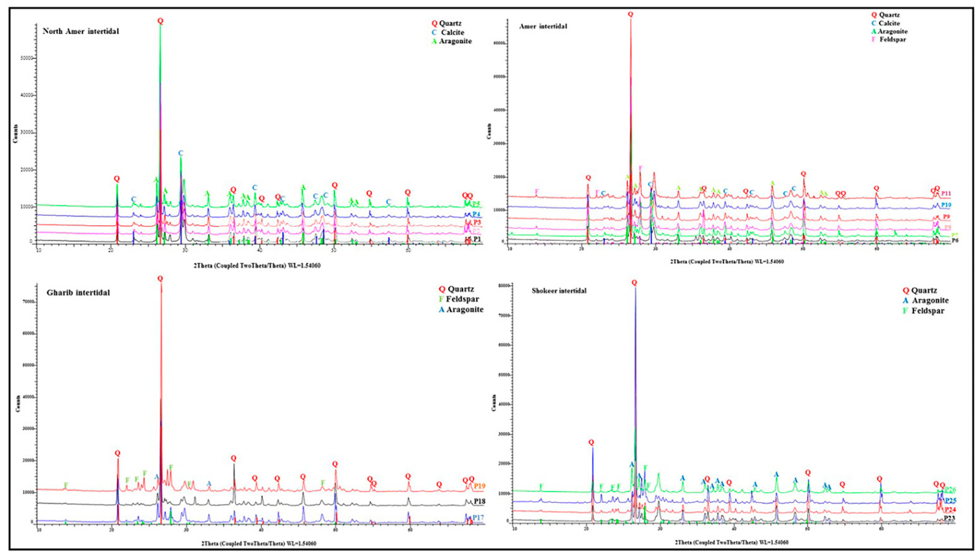
3.1. Sediment Properties
3.2. Hydrochemical Properties
3.3. Heavy Metals
3.4. Ecological Indices
4. Discussion
5. Conclusions
Author Contributions
Funding
Institutional Review Board Statement
Informed Consent Statement
Data Availability Statement
Acknowledgments
Conflicts of Interest
References
- Tang, W.; Shan, B.; Zhang, H.; Zhang, W.; Zhao, Y.; Ding, Y.; Rong, N.; Zhu, X. Heavy metal contamination in the surface sediments of representative limnetic ecosystems in eastern China. Sci. Rep. 2014, 4, 7152. [Google Scholar] [CrossRef]
- Qian, Y.; Zhang, W.; Yu, L.; Feng, H. Metal Pollution in Coastal Sediments. Curr. Pollut. Rep. 2015, 1, 203–219. [Google Scholar] [CrossRef]
- Bastami, K.D.; Neyestani, M.R.; Shemirani, F.; Soltani, F.; Haghparast, S.; Akbari, A. Heavy metal pollution assessment in relation to sediment properties in the coastal sediments of the southern Caspian Sea. Mar. Pollut. Bull. 2015, 92, 237–243. [Google Scholar] [CrossRef] [PubMed]
- Birch, G.F. Determination of sediment metal background concentrations and enrichment in marine environments—A critical review. Sci. Total Environ. 2017, 580, 813–831. [Google Scholar] [CrossRef] [PubMed]
- Masindi, V.; Muedi, K.L. Environmental contamination by heavy metals. Heavy Metals 2018, 7, 115–133. [Google Scholar] [CrossRef]
- Zhang, H.B.; Walker, T.R.; Davisa, E.; Ma, B. Ecological risk assessment of metals in small craft harbour sediments in Nova Scotia, Canada. Mar. Pollut. Bull. 2019, 146, 466–475. [Google Scholar] [CrossRef]
- Meng, K.; Xu, M.; Zhao, Y.; Li, F.; Xu, W.; Chen, Y. Accumulation, sources and pollution of heavy metals in the sediments of coastal tidal flats in the North Jiangsu Radial Sand Ridges, China. Environ. Earth Sci. 2019, 78, 1–13. [Google Scholar] [CrossRef]
- Hosono, T.; Su, C.C.; Delinom, R.; Umezawa, Y.; Toyota, T.; Kaneko, S.; Taniguchi, M. Decline in heavy metal contamination in marine sediments in Jakarta Bay, Indonesia due to increasing environmental regulations. Estuar. Coast. Shelf Sci. 2011, 92, 297–306. [Google Scholar] [CrossRef]
- El-Sorogy, A.S.; Mohamed, M.A.; Nour, H.E. Heavy metals contamination of the Quaternary coral reefs, the Red Sea coast, Egypt. Environ. Earth Sci. 2012, 67, 777–785. [Google Scholar] [CrossRef]
- Cardoso, P.G.; Pereira, E.; Duarte, A.C.; Azeiteiro, U.M. Temporal characterization of mercury accumulation at different trophic levels and implications for metal biomagnification along a coastal food web. Mar. Pollut. Bull. 2014, 87, 39–47. [Google Scholar] [CrossRef]
- Hu, J.; Zhou, S.; Wu, P.; Qu, K. Assessment of the distribution, bioavailability and ecological risks of heavy metals in the lake water and surface sediments of the Caohai plateau wetland, China. PLoS ONE 2017, 12, e0189295. [Google Scholar] [CrossRef] [PubMed]
- Wu, S.; Yang, H.; Guo, F.; Han, R. Science of the Total Environment Spatial patterns and origins of heavy metals in Sheyang River catchment in Jiangsu, China based on geographically weighted regression. Sci. Total Environ. 2017, 580, 1518–1529. [Google Scholar] [CrossRef] [PubMed]
- Kuang, Z.; Gu, Y.; Rao, Y.; Huang, H. Biological risk assessment of heavy metals in sediments and health risk assessment in marine organisms from Daya bay, China. J. Mar. Sci. Eng. 2021, 9, 17. [Google Scholar] [CrossRef]
- Li, Y.; Cai, Y. Mobility of toxic metals in sediments: Assessing methods and controlling factors. J. Environ. Sci. 2015, 31, 203–205. [Google Scholar] [CrossRef]
- Zakaly, H.M.; Uosif, M.A.; Madkour, H.; Tammam, M.; Issa, S.; Elsaman, R.; El-Taher, A. Assessment of natural radionuclides and heavy metal concentrations in marine sediments in view of tourism activities in Hurghada City, northern Red Sea, Egypt. J. Phys. Sci. 2019, 30, 21–47. [Google Scholar] [CrossRef]
- Mikhailenko, A.V.; Ruban, D.A.; Ermolaev, V.A.; van Loon, A.J. Cadmium pollution in the tourism environment: A literature review. Geosciences 2020, 10, 242. [Google Scholar] [CrossRef]
- Emara, M.M.; Farid, N.A.; El-Sabagh, E.A.; Ahamed, O.E.; Kamal, E.M. Physico- Chemical Study of Surface Seawater in the Northwestern the Suez Gulf. Egypt. J. Chem. 2013, 56, 345–365. [Google Scholar]
- Abo-El-Khair, E.M.; Abdel Fattah, L.M.; Abdel Halim, A.M.; Abd-Elnaby, M.A.; Fahmy, M.A.; Ahdy, H.H.; Hemeilly, A.; Abu El-Soud, A.; Shriadah, M.A. Assessment of the hydrochemical characteristics of the Suez Gulf Coastal Waters during 2011–2013. J. Environ. Prot. 2016, 7, 1497–1521. [Google Scholar] [CrossRef]
- Mahmoud, M.G.; Abu El-Khir, E.; Ebeid, M.H.; Mohamed, L.A.; Fahmy, M.A.; Shaban, K.S. An assessment on the coastal seawater quality of the Suez Gulf, Egypt. J. Environ. Prot. 2020, 11, 34–47. [Google Scholar] [CrossRef]
- Alsharhan, A.S. Petroleum geology and potential hydrocarbon plays in the Gulf of Suez rift basin, Egypt. AAPG Bull. 2003, 87, 143–180. [Google Scholar]
- Milab, A.; Conti, G.O.; Dadar, M.; Mahjoub, M.; Copat, C.; Ferrante, M. Heavy metal concentrations in edible muscle of whitecheek shark, Carcharhinus dussumieri (elasmobranchii, chondrichthyes) from the Persian Gulf: A food safety issue. Food Chem. Toxicol. 2016, 97, 135–140. [Google Scholar] [CrossRef]
- Xu, F.; Hu, B.; Yuan, S.; Zhao, Y.; Dou, Y.; Jiang, Z.; Yin, X. Heavy metals in surface sediments of the continental shelf of the South Yellow Sea and East China Sea: Sources, distribution and contamination. Catena 2018, 160, 194–200. [Google Scholar] [CrossRef]
- Diab, H.M.; Ramadan, A.; Monged, M.H.D.; Shahin, M. Environmental assessment of radionuclides levels and some heavy metals pollution along the Suez Gulf, Egypt. Environ. Sci. Pollut. Res. 2019, 26, 12346–12358. [Google Scholar] [CrossRef] [PubMed]
- Ibrahim, M.I.A.; Mohamed, L.A.; Mahmoud, M.G.; Shaban, K.S.; Fahmy, M.A.; Ebeid, M.H. Potential ecological hazards assessment and prediction of sediment heavy metals pollution along the Suez Gulf, Egypt. Egypt. J. Aquat. Res. 2019, 45, 329–335. [Google Scholar] [CrossRef]
- Azetsu-Scott, K.; Yeats, P.; Wohlgeschaffen, G.; Dalziel, J.; Niven, S.; Lee, K. Precipitation of heavy metals in produced water: Influence on contaminant transport and toxicity. Mar. Environ. Res. 2007, 63, 146–167. [Google Scholar] [CrossRef] [PubMed]
- Pichtel, J. Oil and Gas Production Wastewater: Soil Contamination and Pollution Prevention. Appl. Environ. Soil Sci. 2016, 2016, 2707989. [Google Scholar] [CrossRef]
- Al-Ghouti, M.A.; Al-Kaabi, M.A.; Ashfaq, M.Y.; Da’na, D.A. Produced water characteristics, treatment and reuse: A review. J. Water Process Eng. 2019, 28, 222–239. [Google Scholar] [CrossRef]
- US Environmental Protection Agency (EPA). Method 3052: Microwave Assisted Acid Digestion of Siliceous and Organically Based Matrices; Print. Office: Washington, DC, USA, 1996; p. 20. [Google Scholar]
- Loska, K.; Cebula, J.; Pelczar, J.; Wiechuła, D.; Kwapuliński, J. Use of enrichment, and contamination factors together with geoaccumulation indexes to evaluate the content of Cd, Cu, and Ni in the Rybnik water Reservoir in Poland. Water Air Soil Pollut. 1997, 93, 347–365. [Google Scholar] [CrossRef]
- Lim, W.Y.; Aris, A.Z.; Hanidza, T.; Ismail, T.; Lim, W.Y.; Aris, A.Z.; Ismail, T. Spatial Geochemical Distribution and Sources of Heavy Metals in the Sediment of Langat River, Western Peninsular Malaysia. Environ. Forensic 2013, 14, 133–145. [Google Scholar] [CrossRef]
- Wang, A.; Wei, C.; Xu, Y.; Hakif, M.; Hassan, A.; Ye, X.; Hoe, K. Assessment of heavy metal pollution in surficial sediments from a tropical river-estuary-shelf system: A case study of Kelantan River, Malaysia. Mar. Pollut. Bull. 2017, 125, 492–500. [Google Scholar] [CrossRef] [PubMed]
- Hu, Z.; Gao, S. Upper crustal abundances of trace elements: A revision and update. Chem. Geol. 2008, 253, 205–221. [Google Scholar] [CrossRef]
- Müller, G. Index of geoaccumulation in sediments of the Rhine River. Geol. J. 1969, 2, 108–118. [Google Scholar]
- Boszke, L.; Sobczyński, T.; Głosińska, G.; Kowalski, A.; Siepak, J. Distribution of mercury and other heavy metals in bottom sediments of the middle Odra River (Germany/Poland). Pol. J. Environ. Stud. 2004, 13, 495–502. [Google Scholar]
- Tomlinson, D.L.; Wilson, J.G.; Harris, C.R.; Jeffrey, D.W. Problems in the assessment of heavy-metal levels in estuaries and the formation of a pollution index. Helgoländer Meeresunters. 1980, 33, 566–575. [Google Scholar] [CrossRef]
- Harikumar, P.S.; Nasir, U.P.; Rahman, M.P.M. Distribution of heavy metals in the core sediments of a tropical wetland system. Int. J. Environ. Sci. Technol. 2009, 6, 225–232. [Google Scholar] [CrossRef]
- Hakanson, L. An ecological risk index for aquatic pollution control. Water Res. 1980, 14, 975–1001. [Google Scholar] [CrossRef]
- Maanan, M.; Saddik, M.; Maanan, M.; Chaibi, M. Environmental and ecological risk assessment of heavy metals in sediments of Nador lagoon, Morocco. Ecol. Indic. 2014, 48, 616–626. [Google Scholar] [CrossRef]
- Juen, L.; Ahmad, L.; Aris, Z. Application of enrichment factor, geoaccumulation index, and ecological risk index in assessing the elemental pollution status of surface sediments. Environ. Geochem. Health 2018. [Google Scholar] [CrossRef]
- Hanif, N.; Eqani, S.A.M.A.S.; Ali, S.M.; Cincinelli, A.; Ali, N.; Katsoyiannis, I.A.; Bokhari, H. Geo-accumulation and enrichment of trace metals in sediments and their associated risks in the Chenab River, Pakistan. J. Geochem. Explor. 2016, 165, 62–70. [Google Scholar] [CrossRef]
- Mansour, A.M.; Askalany, M.S.; Madkour, H.A.; Bakheit, B.; Assran, B.B. Assessment and comparison of heavy-metal concentrations in marine sediments in view of tourism activities in Hurghada area, northern Red Sea. Egypt. Egypt. J. Aquat. Res. 2013, 39, 91–103. [Google Scholar] [CrossRef]
- Salem, D.M.S.A.; Khaled, A.; El Nemr, A.; El-Sikaily, A. Comprehensive risk assessment of heavy metals in surface sediments along the Egyptian Red Sea coast. Egypt. J. Aquat. Res. 2014, 40, 349–362. [Google Scholar] [CrossRef]
- Wang, C.; Chen, M.; Qi, H.; Intasen, W.; Kanchanapant, A. Grain-size distribution of surface sediments in the Chanthaburi coast, Thailand and implications for the sedimentary dynamic environment. J. Mar. Sci. Eng. 2020, 8, 242. [Google Scholar] [CrossRef]
- Paul, B.K.; Rashid, H. Chapter Four—Coastal Landform Changes: Coastal Erosion. Land Accretion and Subsidence. In Climatic Hazards in Coastal Bangladesh, 1st ed.; Paul, B.K., Rashid, H., Eds.; Butterworth-Heinemann: Oxford, UK, 2017; pp. 121–152. [Google Scholar] [CrossRef]
- Barut, I.F.; Ergin, M.; Meriç, E.; Avsar, N.; Nazik, A.; Suner, F. Contribution of natural and anthropogenic effects in the Iznik Lake bottom sediment: Geochemical and microfauna assemblages evidence. Quat. Int. 2018, 486, 129–142. [Google Scholar] [CrossRef]
- Hanna, R.G.M. The level of heavy metals in the Red Sea after 50 years. Sci. Total Environ. 1992, 125, 417–448. [Google Scholar] [CrossRef]
- Masoud, M.S.; Said, T.O.; El Zokm, G.; Shreadah, M.A. Assessment of heavy metals contamination in surface sediments of the Egyptian Red Sea coasts. Aust. J. Basic Appl. Sci. 2012, 6, 44–58. [Google Scholar]
- El Nemr, A.; El-Said, G.F.; Khaled, A.; Ragab, S. Distribution and ecological risk assessment of some heavy metals in coastal surface sediments along the Red Sea, Egypt. Int. J. Sediment Res. 2016, 31, 164–172. [Google Scholar] [CrossRef]
- El-Metwally, M.E.A.; Abouhend, A.S.; Dar, M.A.; El-Moselhy, K.M. Effects of urbanization on the heavy metal concentrations in the Red Sea coastal sediments, Egypt. Int. J. Mar. Sci. 2017, 7, 114–124. [Google Scholar] [CrossRef]
- El-Metwally, M.E.A.; Othman, A.I.; El-Moselhy, K.M. Distribution and assessment of heavy metals in the coastal area of the Red Sea, Egypt. Egypt. J. Aquat. Biol. Fish. 2019, 23, 1–13. [Google Scholar] [CrossRef]
- Soliman, N.F.; Younis, A.M.; Elkady, E.M.; Mohamedein, L.I. Geochemical associations, risk assessment, and source identification of selected metals in sediments from the Suez Gulf, Egypt. Hum. Ecol. Risk Assess. Int. J. 2019, 25, 738–754. [Google Scholar] [CrossRef]
- Nour, H.E.; El-Sorogy, A.S.; Abd El-Wahab, M.; Nouh, E.S.; Mohamaden, M.; Al-Kahtany, K. Contamination and ecological risk assessment of heavy metals pollution from the Shalateen coastal sediments, Red Sea, Egypt. Mar. Pollut. Bull. 2019, 144, 167–172. [Google Scholar] [CrossRef]
- Alharbi, T.; Alfai, H.; El-sorogy, A. Metal pollution in Al-Khobar seawater, Arabian Gulf, Saudi Arabia. Mar. Pollut. Bull. 2017, 119, 407–415. [Google Scholar] [CrossRef] [PubMed]
- Ruiz-fernández, A.C.; Sanchez-cabeza, J.A.; Pérez-bernal, L.H.; Gracia, A. Spatial and temporal distribution of heavy metal concentrations and enrichment in the southern Gulf of Mexico. Sci. Total Environ. 2019, 651, 3174–3186. [Google Scholar] [CrossRef] [PubMed]
- Pereira-Dore, M.; Farias, C.; Hamacher, C. Offshore drilling effects in Brazilian SE marine sediments: A meta-analytical approach. Environ. Monit. Assess. 2017, 189, 44. [Google Scholar] [CrossRef] [PubMed]
- Breuer, E.; Stevenson, A.G.; Howe, J.A.; Carroll, J.; Shimmield, G.B. Drill cutting accumulations in the northern and central North Sea: A review of environmental interactions and chemical fate. Mar. Pollut. Bull. 2004, 48, 12–25. [Google Scholar] [CrossRef] [PubMed]
- Secrieru, D.; Secrieru, A. Heavy metal enrichment of man-made origin of superficial sediment on the continental shelf of the north-western Black Sea. Estuar. Coast. Shelf Sci. 2002, 54, 513–526. [Google Scholar] [CrossRef]
- De Mora, S.; Sheikholeslami, M.R.; Wyse, E.; Azemard, S.; Cassi, R. An assessment of metal contamination in coastal sediments of the Caspian Sea. Mar. Pollut. Bull. 2004, 48, 61–77. [Google Scholar] [CrossRef]
- Usman, A.R.A.; Alkredaa, R.S.; Al-wabel, M.I. Heavy metal contamination in sediments and mangroves from the coast of Red Sea: Avicennia marina as potential metal bioaccumulator. Ecotoxicol. Environ. Saf. 2013, 97, 263–270. [Google Scholar] [CrossRef]
- Arienzo, M.; Bolinesi, F.; Aiello, G.; Barra, D.; Donadio, C.; Stanislao, C.; Ferrara, L.; Mangoni, O.; Toscanesi, M.; Giarra, A.; et al. The environmental assessment of an estuarine transitional environment, southern Italy. J. Mar. Sci. Eng. 2020, 8, 628. [Google Scholar] [CrossRef]
- Pereira, J.S.F.; Moraes, D.P.; Antes, F.G.; Diehl, L.O.; Santos, M.F.P.; Guimarães, R.C.L.; Fonseca, T.C.O.; Dressler, V.L.; Flores, E.M.M. Determination of metals and metalloids in light and heavy crude oil by ICP-MS after digestion by microwave-induced combustion. Microchem. J. 2010, 96, 4–11. [Google Scholar] [CrossRef]
- Khuhawar, M.Y.; Aslam Mirza, M.; Jahangir, T.M. Determination of metal ions in crude oils. In Crude Oil Emulsions—Composition Stability and Characterization; Abdel-Raouf, M.E., Ed.; InTech: London, UK, 2012; pp. 121–144. [Google Scholar]
- El-Sikaily, A.; Khaled, A.; El-Nemr, A. Leachable and total nine heavy metals in muddy and sandy sediment collected from Gulf of Suez. Egypt. J. Aquat. Res. 2005, 31, 99–119. [Google Scholar]
- Ma, X.L.; Zou, H.; Tian, M.J.; Zhang, L.J.; Meng, J.; Zhou, X.N.; Min, N.; Chang, X.Y.; Liu, Y. Assessment of heavy metals contamination in sediments from three adjacent regions of the Yellow River using metal chemical fractions and multivariate analysis techniques. Chemosphere 2016, 144, 264–272. [Google Scholar] [CrossRef] [PubMed]
- Gholizadeh, M.; Patimar, R. Ecological risk assessment of heavy metals in surface sediments from the Gorgan Bay, Caspian Sea. Mar. Pollut. Bull. 2018, 137, 662–667. [Google Scholar] [CrossRef] [PubMed]
- Li, G.; Hu, B.; Bi, J.; Leng, Q.; Xiao, C.; Yang, Z. Heavy metals distribution and contamination in surface sediments of the coastal Shandong peninsula (Yellow Sea). Mar. Pollut. Bull. 2013, 76, 420–426. [Google Scholar] [CrossRef]


| Location | Sediment Samples | The Distance (m) | Water Samples | |||||||||
|---|---|---|---|---|---|---|---|---|---|---|---|---|
| Name | Profile NO. | Longitude E | Latitude N | Sample No. | H.T. –B.F. | B.F.- L.T. | Surf Zone | Surf Zone | pH | Salinity (S‰) | 200 m * | 500 m * |
| North Amer El Bahry | P1 | 32°49′18.408″ | 28°44′25.080″ | P1-1 to P1-6 | 6 | 2 | 28 | W1 | 8.22 | 42 | AMN 1 pH: 8.26 (S‰):42 | AMN 2 pH 8.27 (S‰)42 |
| P2 | 32°49′20.460″ | 28°44′22.668″ | P2-1 to P2-5 | 3 | 3 | 18 | W2 | 8.23 | 42 | |||
| P3 | 32°49′21.648″ | 28°44′19.680″ | P3-1 to P3-5 | 3 | 2 | 28 | W3 | 8.24 | 42 | |||
| P4 | 32°49′23.232″ | 28°44′16.152″ | P4-1 to P4-5 | 2 | 5 | 25.5 | W4 | 8.37 | 42 | |||
| P5 | 32°49′24.168″ | 28°44′12.588″ | P5-1 to P5-5 | 4 | 4 | 10 | W5 | 8.4 | 42 | |||
| Amer | P6 | 32°56′39.912″ | 28°31′57.252″ | P6-1 to P6-5 | 5 | 6 | 30 | W6 | 8.31 | 42 | AMS1 8.11 44 | AMS2 8.12 43 |
| P7 | 32°56′40.848″ | 28°31′54.948″ | P7-1 to P7-5 | 5 | 4 | 16 | W7 | 8.3 | 42 | |||
| P8 | 32°57′5.580″ | 28°31′30.468″ | P8-1 to P8-12 | 10 | 1.2 | 6 | W8 | 8.19 | 43 | |||
| P9 | 32°57′57.528″ | 28°30′59.508″ | P9-1 to P9-10 | 6 | 2 | 10 | W9 | 8.4 | 42 | |||
| P10 | 32°57′47.520″ | 28°30′44.280″ | P10-1 to P10-8 | 4 | 3 | 31 | W10 | 8.48 | 43 | |||
| P11 | 32°58′38.388″ | 28°29′38.868″ | P11-1 to P11-8 | 10 | 4 | 19 | W11 | 8.38 | 42 | |||
| Bakr | P12 | 32°59′55.608″ | 28°29′19.320″ | P12 | W12 | 8.23 | 44 | NB1 7.21 42.1 | NB2 7.4 43 | |||
| P13 | 32°59′55.140″ | 28°29′6.180″ | P13-1 to P13-5 | 4 | 3 | 10 | W13 | 8.12 | 43 | |||
| P14 | 33°0′31.788″ | 28°28′11.640″ | P14-1 to P14-7 | 3.5 | 3.5 | 11 | W14 | 8.13 | 43 | |||
| P15 | 33°1′34.500″ | 28°26′59.172″ | P15-1 to P15-3 | 5 | 3 | 3 | W15 | 7.49 | 44 | B 1 7.22 42.5 | B 2 7.47 42.3 | |
| P16 | 33°3′2.520″ | 28°24′6.048″ | P16-1 to P16-6 | 3 | 4 | 25 | W16 | 7.11 | 43 | |||
| Gharib | P17 | 33°3′56.088″ | 28°23′13.128″ | P17-1 to P17-5 | 6 | 4 | 10 | W17 | 7.31 | 43 | GH1 7.48 43 | GH2 7.49 43 |
| P18 | 33°4′8.868″ | 28°22′48.900″ | P18-1 to P18-6 | 4.5 | 3.5 | 7 | W18 | 7.41 | 42 | |||
| P19 | 33°6′4.572″ | 28°21′37.908″ | P19-1 to P19-3 | 2 | 1 | N.M. | W19 | 7.44 | 43 | |||
| July Water Floud | P20 | 33°13′25.140″ | 28°11′12.372″ | P20-1 to P20-6 | 6 | 2 | 45 | W20 | 7.89 | 43 | JWF 1 7.81 43 | JWF 2 7.71 43 |
| P21 | 33°14′26.412″ | 28°10′17.652″ | P21-1 to P21-6 | 3 | 2 | 10 | W21 | 7.83 | 43 | |||
| P22 | 33°14′30.048″ | 28°8′52.692″ | P22-1 to P22-6 | 5 | 2 | 14.5 | W22 | 7.97 | 43 | |||
| Ras Shokeir | P23 | 33°15′42.048″ | 28°8′22.668″ | P23-1 to P23-5 | 5 | 5 | 13 | W23 | 7.56 | 43 | SH1 7.82 43 | SH2 7.88 43 |
| P24 | 33°16′50.700″ | 28°7′47.460″ | P24-1 to P24-3 | 2.5 | 2.5 | N.M. | W24 | 7.64 | 43 | |||
| P25 | 33°16′58.368″ | 28°7′40.080″ | P25-1 to P25-2 | 4 | 5 | 9.5 | W25 | 7.57 | 43 | |||
| P26 | 33°18′32.040″ | 28°6′13.680″ | P26-1 to P26-4 | 3 | 3 | N.M. | W26 | 7.92 | 43 | |||
| El Marageen | P27 | 33°18′45.900″ | 28°6′1.080″ | P27-1 to P27-3 | 3 | 3 | N.M. | W27 | 7.79 | 43 | M1 7.89 42 | M2 7.78 42 |
| Index | Index Categories | Description | Reference |
|---|---|---|---|
| CF | ≤1 | Low CF | [35] |
| 1 < CF ≤ 3 | Moderate CF | ||
| 3 < CF ≤ 6 | Considerable CF | ||
| 6 < CF | Very high | ||
| EF | <1 | No enrichment | [40] |
| 1–3 | Minor enrichment | ||
| 3–5 | Moderate enrichment | ||
| 5–10 | Moderately severe enrichment | ||
| 10–25 | Severe enrichment | ||
| 25–50 | Very severe enrichment | ||
| >50 | Extremely severe enrichment | ||
| Igeo | Igeo ≤ 0 | Unpolluted | [33] |
| 0 < Igeo ≤ 1 | Unpolluted to moderately polluted | ||
| 1 < Igeo ≤ 2 | Moderately polluted | ||
| 2 < Igeo ≤ 3 | Moderately to strongly polluted | ||
| 3 ˂ Igeo ≤ 4 | Strongly polluted | ||
| 4 < Igeo ≤ 5 | Strongly to extremely polluted | ||
| 5 < Igeo | Extremely polluted | ||
| PLI | 1 > PLI | Unpolluted | [36] |
| 1 < PLI | Polluted | ||
| RI | RI < 40 | Low ecological risk | [37] |
| 40 < RI < 80 | Moderate ecological risk | ||
| 80 < RI < 160 | Appreciable ecological risk | ||
| 160 < RI < 320 | High ecological risk | ||
| 320 < RI | Serious ecological risk |
| Location | Profile No. | Intertidal Zone | |||||||||||||
|---|---|---|---|---|---|---|---|---|---|---|---|---|---|---|---|
| Sediment Type | Gravel % | Sand % | Silt % | Al | Fe | Mn | Cr | Co | Ni | Cu | Zn | Cd | Pb | ||
| North Amer El Bahry | P1 | Gravel | 53.16 | 46.84 | 0.00 | 2.8 | 0.7 | 323.9 | 93.4 | 3.7 | 26.2 | 46.5 | 27.8 | 2.6 | 463.3 |
| P2 | Sand | 9.94 | 90.03 | 0.03 | 9.6 | 2.8 | 768.4 | 247.2 | 9.9 | 41.2 | 16.6 | 45.3 | 4.0 | 246.9 | |
| P3 | Sand | 0.52 | 99.38 | 0.10 | 4.1 | 1.3 | 386.0 | 72.8 | 4.9 | 13.7 | 80.3 | 56.6 | 6.2 | 613.6 | |
| P4 | Sand | 9.79 | 90.05 | 0.16 | 3.5 | 0.5 | 210.2 | 50.0 | 1.8 | 4.9 | 49.2 | 25.6 | 1.0 | 376.4 | |
| P5 | Sand | 3.84 | 96.15 | 0.01 | 4.6 | 0.2 | 119.5 | 38.8 | 1.0 | 5.0 | 40.6 | 16.6 | 0.1 | 252.5 | |
| Amer | P6 | Gravelly sed. | 14.87 | 85.06 | 0.07 | 4.8 | 0.3 | 145.8 | 39.2 | 1.2 | 4.2 | 36.9 | 16.8 | 0.5 | 486.4 |
| P7 | Sand | 0.27 | 99.71 | 0.02 | 9.2 | 1.2 | 447.4 | 116.4 | 5.7 | 2.8 | 13.2 | 71.1 | 2.3 | 956.4 | |
| P8 | Gravel | 60.19 | 39.81 | 0.00 | 5.2 | 0.4 | 147.6 | 35.4 | 2.3 | 3.7 | 42.3 | 45.2 | 0.9 | 345.0 | |
| P9 | Sand | 0.47 | 99.46 | 0.07 | 1.4 | 0.2 | 118.8 | 43.0 | 1.1 | 84.0 | 0.1 | 2.9 | 3.0 | 232.3 | |
| P10 | Gravelly sed. | 34.82 | 64.99 | 0.19 | 1.7 | 0.1 | 46.5 | 10.1 | 0.8 | 7.1 | 26.6 | 20.1 | 0.4 | 669.7 | |
| P11 | Sand | 2.51 | 97.34 | 0.15 | 3.0 | 1.9 | 225.3 | 124.7 | 6.6 | 11.7 | 69.5 | 75.7 | 0.6 | 294.3 | |
| Bakr | P12 | Gravelly sed. | 34.22 | 65.78 | 0.00 | 6.3 | 0.5 | 38.8 | 20.0 | 0.6 | 5.2 | 19.5 | 25.2 | 0.4 | 293.7 |
| P13 | Sand | 5.33 | 94.64 | 0.03 | 0.5 | 0.1 | 30.0 | 4.3 | 0.9 | 80.0 | 4.2 | 10.8 | 4.5 | 312.6 | |
| P14 | Gravelly sed. | 25.55 | 74.45 | 0.00 | 1.3 | 0.1 | 7.5 | 3.1 | 0.2 | 7.9 | 6.8 | 5.3 | 0.1 | 27.2 | |
| P15 | Gravelly sed. | 14.96 | 85.01 | 0.03 | 0.9 | 0.4 | 94.5 | 41.5 | 1.4 | 83.4 | 19.5 | 11.7 | 2.9 | 7.3 | |
| P16 | Gravelly sed. | 25.81 | 74.19 | 0.00 | 2.2 | 0.2 | 26.5 | 8.1 | 0.3 | 0.1 | 8.5 | 6.3 | 0.1 | 320.9 | |
| Gharib | P17 | Gravelly sed. | 19.99 | 79.95 | 0.06 | 9.3 | 1.4 | 178.0 | 85.7 | 2.9 | 9.1 | 143.9 | 50.1 | 1.0 | 108.6 |
| P18 | Gravelly sed. | 19.99 | 79.95 | 0.06 | 10.9 | 0.5 | 66.3 | 58.3 | 1.6 | 4.1 | 28.5 | 12.9 | 2.7 | 224.6 | |
| P19 | Gravelly sed. | 21.55 | 78.45 | 0.00 | 8.4 | 0.9 | 115.3 | 112.5 | 2.1 | 5.1 | 34.3 | 25.5 | 1.6 | 205.5 | |
| July Water Floud | P20 | Gravelly sed. | 26.21 | 73.76 | 0.03 | 12.5 | 0.8 | 101.0 | 134.0 | 5.3 | 5.9 | 54.4 | 22.5 | 2.0 | 430.9 |
| P21 | Sand | 4.65 | 95.32 | 0.03 | 5.7 | 0.3 | 169.8 | 36.7 | 2.7 | 4.2 | 40.0 | 60.1 | 0.8 | 932.0 | |
| P22 | Sand | 0.28 | 99.72 | 0.00 | 7.7 | 0.8 | 392.2 | 146.9 | 7.8 | 6.4 | 170.1 | 143.8 | 2.2 | 541.2 | |
| Ras Shokeir | P23 | Gravelly sed. | 45.40 | 54.60 | 0.00 | 0.2 | 0.0 | 11.5 | 4.5 | 0.1 | 7.7 | 0.3 | 0.2 | 0.6 | 40.1 |
| P24 | Gravelly sed. | 10.63 | 89.37 | 0.00 | 6.6 | 0.6 | 110.1 | 916.8 | 2.8 | 3.8 | 80.5 | 34.5 | 2.6 | 591.4 | |
| P25 | Sand | 4.81 | 95.18 | 0.01 | 4.8 | 0.3 | 66.6 | 294.6 | 0.6 | 5.8 | 13.1 | 12.4 | 0.2 | 148.8 | |
| Gravelly sed. | 22.10 | 75.25 | 2.70 | 1.3 | 0.2 | 39.7 | 17.7 | 0.5 | 7.3 | 6.7 | 3.2 | 0.4 | 30.2 | ||
| P26 | Sand | 0.79 | 99.08 | 0.13 | 3.1 | 0.5 | 1441.5 | 55.9 | 1.4 | 1.7 | 49.9 | 63.2 | 0.1 | 132.2 | |
| El Marageen | P27 | Sand | 0.04 | 99.87 | 0.09 | 0.2 | 0.1 | 58.2 | 95.4 | 0.3 | 2.9 | 10.2 | 34.4 | 0.3 | 11.2 |
| Location | Profile No. | Surf Zone at 0.5 m depth | |||||||||||||
| Sediment type | Gravel % | Sand % | Silt % | Al | Fe | Mn | Cr | Co | Ni | Cu | Zn | Cd | Pb | ||
| North Amer El Bahry | P1 | Gravelly sed. | 36.73 | 63.15 | 0.12 | 1.2 | 0.5 | 131.2 | 27.6 | 1.5 | 5.2 | 22.8 | 18.8 | 0.4 | 118.0 |
| P2 | Gravelly sed. | 16.98 | 82.74 | 0.28 | 1.6 | 0.4 | 176.9 | 30.2 | 1.3 | 5.2 | 34.8 | 37.6 | 4.3 | 230.3 | |
| P3 | Gravelly sed. | 20.33 | 79.14 | 0.53 | 4.3 | 1.4 | 399.6 | 75.4 | 5.0 | 14.2 | 83.1 | 58.6 | 6.4 | 635.1 | |
| P4 | Gravel | 54.78 | 45.18 | 0.04 | 3.9 | 0.1 | 118.7 | 38.7 | 1.0 | 10.1 | 40.4 | 13.0 | 0.4 | 214.4 | |
| P5 | Gravelly sed. | 16.30 | 83.28 | 0.42 | 3.7 | 0.5 | 135.5 | 36.5 | 1.2 | 3.6 | 36.1 | 545.8 | 7.1 | 145.6 | |
| Amer | P6 | Gravelly sed. | 10.91 | 88.87 | 0.22 | 4.9 | 1.2 | 187.6 | 56.9 | 2.9 | 8.3 | 82.9 | 388.8 | 7.2 | 486.4 |
| P7 | Gravelly sed. | 38.93 | 61.05 | 0.02 | 2.9 | 1.4 | 325.8 | 87.1 | 5.0 | 80.2 | 24.3 | 56.5 | 4.2 | 654.4 | |
| P8 | Gravelly sed. | 26.30 | 73.34 | 0.36 | 1.4 | 0.6 | 354.4 | 15.2 | 4.4 | 8.8 | 14.2 | 587.1 | 2.2 | 639.9 | |
| P9 | Sand | 6.99 | 92.46 | 0.55 | 0.9 | 0.1 | 29.1 | 12.2 | 0.4 | 87.1 | 3.4 | 16.1 | 2.5 | 173.4 | |
| P10 | Gravelly sed. | 23.87 | 75.35 | 0.78 | 0.4 | 0.0 | 8.2 | 2.6 | 0.1 | 8.3 | 0.3 | 1.8 | 0.4 | 105.7 | |
| P11 | Sand | 5.29 | 94.56 | 0.15 | 0.2 | 0.0 | 4.3 | 1.1 | 0.1 | 8.5 | 0.8 | 1.5 | 0.2 | 7.0 | |
| Bakr | P13 | Gravelly sed. | 34.14 | 65.86 | 0 | 1.7 | 0.3 | 62.8 | 31.4 | 1.3 | 16.1 | 68.9 | 34.0 | 0.5 | 301.2 |
| P14 | Gravelly sed. | 16.19 | 83.77 | 0.04 | 1.5 | 0.1 | 6.9 | 2.8 | 0.2 | 7.5 | 4.4 | 1.0 | 0.3 | 27.7 | |
| P16 | Gravelly sed. | 10.79 | 88.81 | 0.4 | 1.0 | 10.6 | 1059.2 | 350.3 | 7.3 | 11.3 | 85.3 | 65.8 | 1.0 | 820.6 | |
| Gharib | P17 | Gravelly sed. | 35.01 | 64.23 | 0.76 | 1.1 | 0.7 | 82.0 | 72.0 | 2.3 | 8.9 | 71.6 | 71.5 | 2.9 | 249.5 |
| P18 | Gravelly sed. | 32.82 | 66.15 | 1.03 | 1.3 | 1.0 | 76.4 | 183.5 | 1.8 | 10.8 | 32.7 | 23.0 | 1.3 | 372.2 | |
| July Water Floud | P20 | Gravelly sed. | 34.08 | 65.69 | 0.23 | 7.6 | 5.9 | 832.8 | 258.0 | 10.1 | 24.1 | 263.4 | 66.4 | 6.3 | 130.4 |
| P21 | Gravelly sed. | 23.6 | 76.40 | 0 | 1.7 | 5.1 | 915.3 | 404.5 | 12.0 | 43.0 | 684.7 | 195.4 | 2.2 | 114.7 | |
| P22 | Sand | 0.00 | 100 | 0 | 7.6 | 2.6 | 580.5 | 281.3 | 17.3 | 35.6 | 369.3 | 196.0 | 18.7 | 120.1 | |
| Ras Shokeir | P23 | Gravelly sed. | 14.98 | 84.99 | 0.03 | 9.8 | 2.9 | 1943.9 | 265.2 | 11.6 | 47.1 | 308.2 | 218.0 | 9.3 | 351.3 |
| P26 | Sand | 2.44 | 96.99 | 0.57 | 0.6 | 0.4 | 115.8 | 377.4 | 2.0 | 79.8 | 10.3 | 12.6 | 1.1 | 28.8 | |
| Location | Profile No | Surf Zone at 1.0 m depth | |||||||||||||
| Sediment type | Gravel % | Sand % | Silt % | Al | Fe | Mn | Cr | Co | Ni | Cu | Zn | Cd | Pb | ||
| North Amer El Bahry | P1 | Sand | 1.99 | 98.01 | 0.00 | 1.3 | 4.9 | 1350.9 | 284.5 | 14.9 | 53.3 | 235.3 | 194.0 | 4.6 | 121.6 |
| P2 | Sand | 0.00 | 99.41 | 0.59 | 3.7 | 0.6 | 331.1 | 68.1 | 2.6 | 9.9 | 59.4 | 38.0 | 1.0 | 328.4 | |
| P3 | Gravel | 72.86 | 24.71 | 2.43 | 2.0 | 0.9 | 338.1 | 63.7 | 3.0 | 8.1 | 63.8 | 74.7 | 1.8 | 207.0 | |
| P4 | Sand | 0.00 | 98.80 | 1.20 | 4.0 | 1.5 | 1210.8 | 394.4 | 10.4 | 103.2 | 412.4 | 132.4 | 4.1 | 218.7 | |
| P5 | Gravelly sed. | 14.00 | 85.25 | 0.75 | 3.2 | 1.2 | 1645.2 | 269.1 | 10.1 | 25.3 | 537.2 | 173.2 | 5.0 | 347.6 | |
| Amer | P6 | Sand | 4.01 | 95.56 | 0.43 | 4.9 | 8.2 | 4533.5 | 604.0 | 29.4 | 47.1 | 617.2 | 231.3 | 4.9 | 993.0 |
| P7 | Gravelly sed. | 36.59 | 60.09 | 3.32 | 3.2 | 0.6 | 204.7 | 33.0 | 2.0 | 77.0 | 45.0 | 184.7 | 2.9 | 165.8 | |
| P8 | Gravelly sed. | 17.00 | 83.00 | 0.00 | 2.1 | 0.8 | 255.7 | 219.5 | 10.5 | 22.9 | 77.4 | 61.4 | 0.3 | 153.0 | |
| P9 | Sand | 2.54 | 96.84 | 0.62 | 5.8 | 0.5 | 216.5 | 53.6 | 3.1 | 1.9 | 123.4 | 117.3 | 0.6 | 428.4 | |
| P10 | Sand | 0.29 | 97.48 | 2.23 | 3.5 | 0.2 | 119.0 | 28.6 | 2.0 | 81.6 | 7.6 | 4.3 | 4.0 | 520.8 | |
| P11 | Sand | 0.01 | 99.64 | 0.35 | 1.1 | 0.1 | 46.4 | 10.3 | 0.9 | 84.2 | 5.9 | 98.7 | 2.6 | 181.5 | |
| Bakr | P13 | Gravelly sed. | 31.75 | 68.25 | 0.00 | 1.5 | 0.1 | 45.5 | 5.4 | 0.8 | 84.8 | 0.3 | 10.2 | 4.0 | 214.6 |
| P14 | Gravelly sed. | 30.71 | 69.29 | 0.00 | 1.5 | 0.1 | 6.9 | 2.8 | 0.2 | 7.4 | 4.3 | 1.0 | 0.3 | 27.4 | |
| P16 | Gravelly sed. | 28.24 | 71.50 | 0.26 | 8.4 | 7.1 | 800.2 | 340.4 | 12.6 | 44.9 | 579.5 | 396.8 | 5.3 | 552.8 | |
| Gharib | P18 | Gravelly sed. | 32.82 | 66.15 | 1.03 | 1.6 | 1.6 | 219.7 | 116.7 | 2.2 | 2.7 | 72.1 | 34.5 | 0.8 | 192.6 |
| July Water Floud | P20 | Gravelly sed. | 28.51 | 71.21 | 0.28 | 3.3 | 2.3 | 1036.5 | 181.8 | 16.2 | 14.4 | 242.2 | 234.1 | 3.3 | 1652.6 |
| P21 | Gravelly sed. | 16.52 | 83.48 | 0.00 | 1.2 | 9.6 | 2769.6 | 8002.5 | 20.7 | 86.3 | 410.8 | 247.5 | 12.8 | 404.2 | |
| P22 | Sand | 0.28 | 99.72 | 0.00 | 1.5 | 10.4 | 651.2 | 4596.3 | 30.7 | 189.6 | 495.2 | 961.0 | 43.6 | 260.2 | |
| Ras Shokeir | P23 | Gravel | 89.28 | 10.72 | 0.00 | 1.5 | 0.1 | 19.9 | 27.4 | 0.2 | 7.5 | 1.7 | 1.6 | 0.2 | 30.1 |
| Intertidal Zone | |||||||||||||
|---|---|---|---|---|---|---|---|---|---|---|---|---|---|
| Gravel % | Sand % | Silt % | Al | Fe | Mn | Cr | Co | Ni | Cu | Zn | Cd | Pb | |
| Gravel % | 1 | ||||||||||||
| Sand % | −1.00 | 1 | |||||||||||
| Silt % | 0.03 | −0.06 | 1 | ||||||||||
| Al | −0.05 | 0.06 | −0.22 | 1 | |||||||||
| Fe | −0.21 | 0.21 | −0.11 | 0.53 | 1 | ||||||||
| Mn | −0.30 | 0.30 | −0.09 | 0.17 | 0.43 | 1 | |||||||
| Cr | −0.19 | 0.20 | −0.12 | 0.29 | 0.24 | 0.05 | 1 | ||||||
| Co | −0.24 | 0.24 | −0.15 | 0.57 | 0.86 | 0.43 | 0.26 | 1 | |||||
| Ni | −0.17 | 0.17 | −0.07 | −0.32 | 0.02 | −0.05 | −0.11 | 0.01 | 1 | ||||
| Cu | −0.16 | 0.16 | −0.15 | 0.42 | 0.35 | 0.22 | 0.27 | 0.49 | −0.26 | 1 | |||
| Zn | −0.35 | 0.35 | −0.18 | 0.36 | 0.47 | 0.49 | 0.15 | 0.70 | −0.24 | 0.74 | 1 | ||
| Cd | −0.22 | 0.23 | −0.16 | 0.19 | 0.42 | 0.14 | 0.19 | 0.48 | 0.55 | 0.13 | 0.15 | 1 | |
| Pb | −0.13 | 0.14 | −0.22 | 0.34 | 0.15 | 0.09 | 0.19 | 0.40 | −0.21 | 0.24 | 0.45 | 0.26 | 1 |
| Surf Zone at 0.5 m depth | |||||||||||||
| Gravel % | Sand % | Silt % | Al | Fe | Mn | Cr | Co | Ni | Cu | Zn | Cd | Pb | |
| Gravel % | 1 | ||||||||||||
| Sand % | −1.00 | 1 | |||||||||||
| Silt % | −0.28 | 0.26 | 1 | ||||||||||
| Al | −0.04 | 0.04 | −0.12 | 1 | |||||||||
| Fe | −0.12 | 0.12 | −0.03 | 0.25 | 1 | ||||||||
| Mn | −0.14 | 0.14 | −0.20 | 0.66 | 0.68 | 1 | |||||||
| Cr | −0.27 | 0.27 | 0.19 | 0.30 | 0.71 | 0.65 | 1 | ||||||
| Co | −0.21 | 0.21 | 0.12 | 0.69 | 0.61 | 0.76 | 0.72 | 1 | |||||
| Ni | −0.24 | 0.24 | 0.00 | 0.09 | 0.02 | 0.19 | 0.39 | 0.24 | 1 | ||||
| Cu | −0.10 | 0.10 | −0.02 | 0.47 | 0.50 | 0.64 | 0.68 | 0.83 | 0.18 | 1 | |||
| Zn | −0.16 | 0.16 | −0.01 | 0.28 | 0.02 | 0.19 | −0.03 | 0.22 | −0.18 | 0.16 | 1 | ||
| Cd | −0.37 | 0.37 | 0.28 | 0.79 | 0.15 | 0.41 | 0.28 | 0.73 | 0.13 | 0.45 | 0.38 | 1 | |
| Pb | 0.15 | −0.15 | −0.06 | 0.07 | 0.40 | 0.30 | 0.03 | 0.14 | −0.04 | −0.12 | 0.27 | 0.05 | 1 |
| Surf Zone at 1.0 m depth | |||||||||||||
| Gravel % | Sand % | Silt % | Al | Fe | Mn | Cr | Co | Ni | Cu | Zn | Cd | Pb | |
| Gravel % | 1 | ||||||||||||
| Sand % | −1.00 | 1 | |||||||||||
| Silt % | 0.17 | −0.21 | 1 | ||||||||||
| Al | −0.20 | 0.19 | 0.13 | 1 | |||||||||
| Fe | −0.27 | 0.28 | −0.34 | 0.13 | 1 | ||||||||
| Mn | −0.29 | 0.29 | −0.19 | 0.19 | 0.66 | 1 | |||||||
| Cr | −0.17 | 0.18 | −0.27 | −0.25 | 0.74 | 0.41 | 1 | ||||||
| Co | −0.38 | 0.39 | −0.34 | 0.12 | 0.90 | 0.75 | 0.59 | 1 | |||||
| Ni | −0.42 | 0.42 | 0.00 | −0.17 | 0.51 | 0.12 | 0.52 | 0.48 | 1 | ||||
| Cu | −0.34 | 0.35 | −0.24 | 0.46 | 0.78 | 0.75 | 0.41 | 0.82 | 0.33 | 1 | |||
| Zn | −0.28 | 0.28 | −0.20 | 0.11 | 0.78 | 0.24 | 0.54 | 0.76 | 0.68 | 0.64 | 1 | ||
| Cd | −0.27 | 0.28 | −0.20 | −0.17 | 0.71 | 0.15 | 0.65 | 0.67 | 0.80 | 0.47 | 0.92 | 1 | |
| Pb | −0.17 | 0.17 | −0.07 | 0.40 | 0.26 | 0.46 | 0.02 | 0.45 | −0.10 | 0.38 | 0.18 | 0.01 | 1 |
| Location | Profile No. | Intertidal zone | |||||||||
|---|---|---|---|---|---|---|---|---|---|---|---|
| Al | Mn | Fe | Cr | Co | Ni | Cu | Zn | Cd | Pb | ||
| North Amer El Bahry | P1 | 0.34 | 0.54 | 0.20 | 1.10 | 0.52 | 1.86 | 0.39 | 26.97 | 28.95 | 28.95 |
| P2 | 1.20 | 1.28 | 0.80 | 2.91 | 0.82 | 0.66 | 0.64 | 40.52 | 15.43 | 15.43 | |
| P3 | 0.51 | 0.64 | 0.38 | 0.86 | 0.27 | 3.21 | 0.80 | 63.12 | 38.35 | 38.35 | |
| P4 | 0.44 | 0.35 | 0.13 | 0.59 | 0.10 | 1.97 | 0.36 | 10.39 | 23.53 | 23.53 | |
| P5 | 0.57 | 0.20 | 0.06 | 0.46 | 0.10 | 1.62 | 0.23 | 0.63 | 15.78 | 15.78 | |
| Amer | P6 | 0.60 | 0.24 | 0.09 | 0.46 | 0.08 | 1.48 | 0.24 | 5.08 | 30.40 | 30.40 |
| P7 | 1.15 | 0.75 | 0.33 | 1.37 | 0.06 | 0.53 | 1.00 | 23.92 | 59.78 | 59.78 | |
| P8 | 0.65 | 0.25 | 0.11 | 0.42 | 0.07 | 1.69 | 0.64 | 9.13 | 21.56 | 21.56 | |
| P9 | 0.18 | 0.20 | 0.06 | 0.51 | 1.68 | 0.00 | 0.04 | 30.51 | 14.52 | 14.52 | |
| P10 | 0.21 | 0.08 | 0.03 | 0.12 | 0.14 | 1.06 | 0.28 | 3.82 | 41.86 | 41.86 | |
| P11 | 0.38 | 0.38 | 0.54 | 1.47 | 0.23 | 2.78 | 1.07 | 6.31 | 18.39 | 18.39 | |
| Bakr | P12 | 0.78 | 0.06 | 0.13 | 0.24 | 0.10 | 0.78 | 0.36 | 3.68 | 18.36 | 18.36 |
| P13 | 0.06 | 0.05 | 0.02 | 0.05 | 1.60 | 0.17 | 0.15 | 45.82 | 19.54 | 19.54 | |
| P14 | 0.16 | 0.01 | 0.02 | 0.04 | 0.16 | 0.27 | 0.07 | 1.40 | 1.70 | 1.70 | |
| P15 | 0.11 | 0.16 | 0.11 | 0.49 | 1.67 | 0.78 | 0.16 | 29.29 | 0.45 | 0.45 | |
| P16 | 0.28 | 0.04 | 0.05 | 0.10 | 0.00 | 0.34 | 0.09 | 1.06 | 20.06 | 20.06 | |
| Gharib | P17 | 1.35 | 0.11 | 0.14 | 0.69 | 0.08 | 1.14 | 0.18 | 27.41 | 14.04 | 14.04 |
| P18 | 1.04 | 0.19 | 0.25 | 1.32 | 0.10 | 1.37 | 0.36 | 16.56 | 12.85 | 12.85 | |
| P19 | 1.15 | 0.30 | 0.39 | 1.01 | 0.18 | 5.76 | 0.71 | 9.73 | 6.78 | 6.78 | |
| July Water Floud | P20 | 1.56 | 0.17 | 0.23 | 1.58 | 0.12 | 2.17 | 0.32 | 20.68 | 26.93 | 26.93 |
| P21 | 0.71 | 0.28 | 0.10 | 0.43 | 0.08 | 1.60 | 0.85 | 8.40 | 58.25 | 58.25 | |
| P22 | 0.95 | 0.65 | 0.22 | 1.73 | 0.13 | 6.80 | 2.02 | 22.26 | 33.82 | 33.82 | |
| Ras Shokeir | P23 | 0.02 | 0.02 | 0.01 | 0.05 | 0.15 | 0.01 | 0.00 | 5.72 | 2.51 | 2.51 |
| P24 | 0.81 | 0.18 | 0.17 | 10.79 | 0.08 | 3.22 | 0.49 | 26.97 | 36.96 | 36.96 | |
| P25 | 0.59 | 0.11 | 0.08 | 3.47 | 0.12 | 0.52 | 0.17 | 1.53 | 9.30 | 9.30 | |
| 0.16 | 0.07 | 0.06 | 0.21 | 0.15 | 0.27 | 0.05 | 3.56 | 1.89 | 1.89 | ||
| P26 | 0.39 | 2.40 | 0.13 | 0.66 | 0.03 | 2.00 | 0.89 | 0.89 | 8.26 | 8.26 | |
| El Marageen | P27 | 0.03 | 0.10 | 0.03 | 1.12 | 0.06 | 0.41 | 0.48 | 2.80 | 0.70 | 0.70 |
| Location | Profile No. | Surf Zone at 0.5 m depth | |||||||||
| Al | Mn | Fe | Cr | Co | Ni | Cu | Zn | Cd | Pb | ||
| North Amer El Bahry | P1 | 0.15 | 0.22 | 0.14 | 0.33 | 0.09 | 0.10 | 0.91 | 0.27 | 4.53 | 7.38 |
| P2 | 0.20 | 0.29 | 0.12 | 0.36 | 0.08 | 0.10 | 1.39 | 0.53 | 43.38 | 14.40 | |
| P3 | 0.53 | 0.67 | 0.39 | 0.89 | 0.30 | 0.28 | 3.32 | 0.82 | 65.33 | 39.69 | |
| P4 | 0.49 | 0.20 | 0.04 | 0.45 | 0.06 | 0.20 | 1.62 | 0.18 | 4.07 | 13.40 | |
| P5 | 0.46 | 0.23 | 0.13 | 0.43 | 0.07 | 0.07 | 1.45 | 7.69 | 72.26 | 9.10 | |
| Amer | P6 | 0.61 | 0.31 | 0.34 | 0.67 | 0.17 | 0.17 | 3.32 | 5.48 | 73.92 | 30.40 |
| P7 | 0.36 | 0.54 | 0.40 | 1.02 | 0.29 | 1.60 | 0.97 | 0.80 | 43.27 | 40.90 | |
| P8 | 0.17 | 0.59 | 0.18 | 0.18 | 0.26 | 0.18 | 0.57 | 8.27 | 22.39 | 39.99 | |
| P9 | 0.11 | 0.05 | 0.02 | 0.14 | 0.02 | 1.74 | 0.14 | 0.23 | 25.41 | 10.84 | |
| P10 | 0.05 | 0.01 | 0.00 | 0.03 | 0.00 | 0.17 | 0.01 | 0.03 | 3.68 | 6.61 | |
| P11 | 0.03 | 0.01 | 0.00 | 0.01 | 0.00 | 0.17 | 0.03 | 0.02 | 2.42 | 0.44 | |
| Bakr | P13 | 0.22 | 0.10 | 0.08 | 0.37 | 0.08 | 0.32 | 2.75 | 0.48 | 5.47 | 18.83 |
| P14 | 0.19 | 0.01 | 0.02 | 0.03 | 0.01 | 0.15 | 0.17 | 0.01 | 3.34 | 1.73 | |
| P16 | 0.13 | 1.77 | 3.02 | 4.12 | 0.43 | 0.23 | 3.41 | 0.93 | 9.81 | 51.29 | |
| Gharib | P17 | 0.16 | 0.13 | 0.28 | 2.16 | 0.11 | 0.22 | 1.31 | 0.32 | 13.30 | 15.59 |
| P18 | 0.13 | 0.14 | 0.19 | 0.85 | 0.13 | 0.18 | 2.86 | 1.01 | 29.94 | 23.26 | |
| July Water Floud | P20 | 0.94 | 1.39 | 1.68 | 3.04 | 0.59 | 0.48 | 10.54 | 0.93 | 64.37 | 8.15 |
| P21 | 0.22 | 1.53 | 1.47 | 4.76 | 0.70 | 0.86 | 27.39 | 2.75 | 22.64 | 7.17 | |
| P22 | 0.94 | 0.97 | 0.74 | 3.31 | 1.02 | 0.71 | 14.77 | 2.76 | 191.03 | 7.51 | |
| Ras Shokeir | P23 | 1.22 | 3.24 | 0.82 | 3.12 | 0.68 | 0.94 | 12.33 | 3.07 | 94.79 | 21.96 |
| P26 | 0.07 | 0.19 | 0.10 | 4.44 | 0.12 | 1.60 | 0.41 | 0.18 | 11.43 | 1.80 | |
| Location | Profile No. | Surf Zone at 1.0 m depth | |||||||||
| Al | Mn | Fe | Cr | Co | Ni | Cu | Zn | Cd | Pb | ||
| North Amer El Bahry | P1 | 0.16 | 2.25 | 1.41 | 3.35 | 0.88 | 1.07 | 9.41 | 2.73 | 46.63 | 7.60 |
| P2 | 0.46 | 0.55 | 0.16 | 0.80 | 0.15 | 0.20 | 2.37 | 0.53 | 9.80 | 20.52 | |
| P3 | 0.25 | 0.56 | 0.26 | 0.75 | 0.18 | 0.16 | 2.55 | 1.05 | 18.29 | 12.94 | |
| P4 | 0.50 | 2.02 | 0.41 | 4.64 | 0.61 | 2.06 | 16.50 | 1.86 | 41.52 | 13.67 | |
| P5 | 0.40 | 2.74 | 0.35 | 3.17 | 0.59 | 0.51 | 21.49 | 2.44 | 50.50 | 21.72 | |
| Amer | P6 | 0.60 | 7.56 | 2.33 | 7.11 | 1.73 | 0.94 | 24.69 | 3.26 | 49.61 | 62.06 |
| P7 | 0.40 | 0.34 | 0.17 | 0.39 | 0.12 | 1.54 | 1.80 | 2.60 | 29.29 | 10.36 | |
| P8 | 0.26 | 0.43 | 0.23 | 2.58 | 0.62 | 0.46 | 3.10 | 0.86 | 2.55 | 9.56 | |
| P9 | 0.72 | 0.36 | 0.14 | 0.63 | 0.18 | 0.04 | 4.94 | 1.65 | 5.85 | 26.77 | |
| P10 | 0.43 | 0.20 | 0.05 | 0.34 | 0.12 | 1.63 | 0.30 | 0.06 | 40.71 | 32.55 | |
| P11 | 0.14 | 0.08 | 0.02 | 0.12 | 0.05 | 1.68 | 0.24 | 1.39 | 26.73 | 11.34 | |
| Bakr | P13 | 0.19 | 0.08 | 0.02 | 0.06 | 0.04 | 1.70 | 0.01 | 0.14 | 40.71 | 13.41 |
| P14 | 0.19 | 0.01 | 0.02 | 0.03 | 0.01 | 0.15 | 0.17 | 0.01 | 3.31 | 1.71 | |
| P16 | 1.04 | 1.33 | 2.02 | 4.00 | 0.74 | 0.90 | 23.18 | 5.59 | 53.55 | 34.55 | |
| Gharib | P18 | 0.20 | 0.37 | 0.46 | 1.37 | 0.13 | 0.05 | 2.89 | 0.49 | 8.27 | 12.04 |
| July Water Floud | P20 | 0.40 | 1.73 | 0.66 | 2.14 | 0.95 | 0.29 | 9.69 | 3.30 | 33.96 | 103.29 |
| P21 | 0.15 | 4.62 | 2.74 | 94.15 | 1.22 | 1.73 | 16.43 | 3.49 | 130.42 | 25.26 | |
| P22 | 0.18 | 1.09 | 2.98 | 54.07 | 1.81 | 3.79 | 19.81 | 13.54 | 444.39 | 16.26 | |
| Ras Shokeir | P23 | 0.19 | 0.03 | 0.01 | 0.32 | 0.01 | 0.15 | 0.07 | 0.02 | 1.79 | 1.88 |
| Location | Profile No. | Intertidal Zone | ||||||||||||||||||||||
|---|---|---|---|---|---|---|---|---|---|---|---|---|---|---|---|---|---|---|---|---|---|---|---|---|
| (EF) | (Igeo) | PLI | PLI Average | RI | RI Average | |||||||||||||||||||
| Mn | Fe | Cr | Co | Ni | Cu | Zn | Cd | Pb | Al | Mn | Fe | Cr | Co | Ni | Cu | Zn | Cd | Pb | ||||||
| North Amer El Bahry | P1 | 1.57 | 0.58 | 3.20 | 0.62 | 1.53 | 5.41 | 11.40 | 78.54 | 84.32 | −2.13 | −1.47 | −2.91 | −0.45 | −2.81 | −1.52 | 0.31 | −1.94 | 4.17 | 4.27 | 1.10 | 0.95 | 970 | 988 |
| P2 | 1.07 | 0.67 | 2.43 | 0.49 | 0.69 | 0.55 | 5.33 | 33.87 | 12.90 | −0.33 | −0.23 | −0.91 | 0.96 | −1.36 | −0.86 | −1.18 | −1.23 | 4.76 | 3.36 | 1.84 | 1311 | |||
| P3 | 1.26 | 0.74 | 1.67 | 0.56 | 0.54 | 6.27 | 15.56 | 123.22 | 74.86 | −1.55 | −1.22 | −1.99 | −0.81 | −2.39 | −2.45 | 1.10 | −0.91 | 5.40 | 4.68 | 1.48 | 2107 | |||
| P4 | 0.80 | 0.30 | 1.34 | 0.23 | 0.22 | 4.47 | 8.18 | 23.62 | 53.45 | −1.77 | −2.10 | −3.50 | −1.35 | −3.86 | −3.92 | 0.39 | −2.06 | 2.79 | 3.97 | 0.68 | 442 | |||
| P5 | 0.35 | 0.10 | 0.80 | 0.10 | 0.18 | 2.85 | 4.12 | 1.11 | 27.76 | −1.40 | −2.91 | −4.74 | −1.72 | −4.68 | −3.91 | 0.11 | −2.68 | −1.25 | 3.39 | 0.38 | 108 | |||
| Amer | P6 | 0.41 | 0.15 | 0.77 | 0.12 | 0.14 | 2.46 | 3.94 | 8.46 | 50.69 | −1.32 | −2.63 | −4.05 | −1.70 | −4.41 | −4.17 | −0.02 | −2.67 | 1.76 | 4.34 | 0.53 | 0.61 | 314 | 560 |
| P7 | 0.65 | 0.29 | 1.20 | 0.29 | 0.05 | 0.46 | 8.74 | 20.88 | 52.18 | −0.39 | −1.01 | −2.18 | −0.13 | −2.15 | −4.71 | −1.51 | −0.58 | 4.00 | 5.32 | 1.19 | 1026 | |||
| P8 | 0.38 | 0.16 | 0.64 | 0.21 | 0.11 | 2.59 | 9.76 | 14.01 | 33.07 | −1.20 | −2.61 | −3.82 | −1.85 | −3.46 | −4.34 | 0.17 | −1.24 | 2.61 | 3.85 | 0.66 | 393 | |||
| P9 | 1.11 | 0.36 | 2.83 | 0.36 | 9.39 | 0.02 | 2.25 | 170.63 | 81.20 | −3.07 | −2.92 | −4.54 | −1.57 | −4.53 | 0.16 | −8.70 | −5.22 | 4.35 | 3.27 | 0.31 | 998 | |||
| P10 | 0.36 | 0.15 | 0.56 | 0.22 | 0.66 | 4.99 | 13.27 | 17.90 | 196.33 | −2.81 | −4.28 | −5.59 | −3.66 | −5.03 | −3.41 | −0.49 | −2.41 | 1.35 | 4.80 | 0.34 | 331 | |||
| P11 | 0.99 | 1.42 | 3.88 | 1.03 | 0.62 | 7.35 | 28.19 | 16.70 | 48.68 | −1.99 | −2.00 | −1.48 | −0.03 | −1.95 | −2.68 | 0.89 | −0.49 | 2.07 | 3.62 | 1.13 | 303 | |||
| Bakr | P12 | 0.08 | 0.17 | 0.30 | 0.05 | 0.13 | 1.00 | 4.56 | 4.73 | 23.56 | −0.95 | −4.54 | −3.51 | −2.67 | −5.41 | −3.85 | −0.94 | −2.08 | 1.30 | 3.61 | 0.40 | 0.23 | 208 | 554 |
| P13 | 0.84 | 0.32 | 0.84 | 0.88 | 26.92 | 2.81 | 25.69 | 770.82 | 328.69 | −4.66 | −4.91 | −6.32 | −4.90 | −4.84 | 0.09 | −3.17 | −3.30 | 4.93 | 3.70 | 0.30 | 1482 | |||
| P14 | 0.08 | 0.11 | 0.22 | 0.06 | 0.98 | 1.67 | 4.58 | 8.65 | 10.54 | −3.21 | −6.91 | −6.46 | −5.38 | −7.26 | −3.24 | −2.47 | −4.34 | −0.10 | 0.18 | 0.10 | 53 | |||
| P15 | 1.40 | 0.97 | 4.33 | 0.71 | 14.81 | 6.91 | 14.58 | 260.08 | 4.03 | −3.74 | −3.25 | −3.79 | −1.62 | −4.23 | 0.15 | −0.95 | −3.19 | 4.29 | −1.72 | 0.43 | 895 | |||
| P16 | 0.16 | 0.19 | 0.35 | 0.06 | 0.01 | 1.23 | 3.22 | 3.82 | 72.63 | −2.44 | −5.08 | −4.87 | −3.97 | −6.59 | −9.10 | −2.14 | −4.07 | −0.51 | 3.74 | 0.13 | 134 | |||
| Gharib | P17 | 0.08 | 0.11 | 0.51 | 0.07 | 0.06 | 0.84 | 1.34 | 20.30 | 10.40 | −0.15 | −3.76 | −3.40 | −1.13 | −4.03 | −4.20 | −0.40 | −3.05 | 4.19 | 3.23 | 0.62 | 0.79 | 901 | 611 |
| P18 | 0.19 | 0.24 | 1.27 | 0.12 | 0.10 | 1.32 | 3.46 | 15.94 | 12.36 | −0.53 | −2.96 | −2.59 | −0.18 | −3.61 | −3.87 | −0.13 | −2.06 | 3.46 | 3.10 | 0.78 | 572 | |||
| P19 | 0.26 | 0.34 | 0.88 | 0.15 | 0.16 | 5.00 | 6.13 | 8.46 | 5.90 | −0.38 | −2.34 | −1.94 | −0.57 | −3.16 | −3.04 | 1.94 | −1.09 | 2.70 | 2.18 | 1.01 | 359 | |||
| July Water Floud | P20 | 0.11 | 0.15 | 1.01 | 0.20 | 0.08 | 1.39 | 2.03 | 13.26 | 17.27 | 0.06 | −3.16 | −2.71 | 0.07 | −2.26 | −3.67 | 0.54 | −2.24 | 3.79 | 4.17 | 1.03 | 1.09 | 772 | 735 |
| P21 | 0.40 | 0.14 | 0.61 | 0.22 | 0.12 | 2.25 | 11.92 | 11.83 | 82.04 | −1.08 | −2.41 | −3.94 | −1.80 | −3.26 | −4.17 | 0.09 | −0.83 | 2.48 | 5.28 | 0.77 | 554 | |||
| P22 | 0.69 | 0.23 | 1.81 | 0.48 | 0.13 | 7.13 | 21.22 | 23.33 | 35.45 | −0.65 | −1.20 | −2.79 | 0.20 | −1.71 | −3.55 | 2.18 | 0.43 | 3.89 | 4.49 | 1.64 | 880 | |||
| Ras Shokeir | P23 | 0.90 | 0.39 | 2.49 | 0.38 | 7.25 | 0.60 | 1.49 | 268.31 | 117.56 | −6.14 | −6.29 | −7.49 | −4.82 | −7.53 | −3.28 | −6.88 | −8.89 | 1.93 | 0.74 | 0.05 | 0.30 | 185 | 305 |
| P24 | 0.23 | 0.21 | 13.24 | 0.20 | 0.09 | 3.95 | 5.96 | 33.10 | 45.36 | −0.88 | −3.03 | −3.12 | 2.85 | −3.18 | −4.29 | 1.10 | −1.63 | 4.17 | 4.62 | 1.19 | 1033 | |||
| P25 | 0.19 | 0.13 | 5.85 | 0.05 | 0.20 | 0.88 | 2.94 | 2.58 | 15.68 | −1.34 | −3.76 | −4.29 | 1.21 | −5.54 | −3.69 | −1.52 | −3.10 | 0.03 | 2.63 | 0.39 | 103 | |||
| 0.42 | 0.41 | 1.33 | 0.19 | 0.93 | 1.73 | 2.93 | 22.84 | 12.09 | −3.27 | −4.50 | −4.56 | −2.85 | −5.65 | −3.37 | −2.48 | −5.04 | 1.25 | 0.33 | 0.19 | 119 | ||||
| P26 | 6.18 | 0.34 | 1.69 | 0.20 | 0.09 | 5.14 | 22.89 | 2.28 | 21.26 | −1.95 | 0.68 | −3.51 | −1.19 | −4.24 | −5.49 | 0.41 | −0.75 | −0.76 | 2.46 | 0.56 | 83 | |||
| El Marageen | P27 | 3.80 | 1.24 | 43.93 | 0.72 | 2.28 | 16.01 | 189.55 | 109.50 | 27.31 | −5.88 | −3.95 | −5.56 | −0.42 | −6.36 | −4.69 | −1.88 | −1.63 | 0.90 | −1.11 | 0.18 | 0.18 | 93 | 93 |
| Location | Profile No. | Surf Zone at 0.5 m depth | ||||||||||||||||||||||
| (EF) | (Igeo) | PLI | PLI Average | RI | RI Average | |||||||||||||||||||
| Mn | Fe | Cr | Co | Ni | Cu | Zn | Cd | Pb | Al | Mn | Fe | Cr | Co | Ni | Cu | Zn | Cd | Pb | ||||||
| North Amer El Bahry | P1 | 1.45 | 0.91 | 2.15 | 0.56 | 0.68 | 6.04 | 17.55 | 29.94 | 48.79 | −3.31 | −2.78 | −3.45 | −2.21 | −4.14 | −3.86 | −0.72 | −2.50 | 1.59 | 2.30 | 0.40 | 0.68 | 179 | 1235 |
| P2 | 1.47 | 0.60 | 1.77 | 0.38 | 0.52 | 6.94 | 26.39 | 216.41 | 71.82 | −2.90 | −2.35 | −3.64 | −2.08 | −4.31 | −3.85 | −0.11 | −1.50 | 4.85 | 3.26 | 0.62 | 1383 | |||
| P3 | 1.26 | 0.74 | 1.67 | 0.56 | 0.54 | 6.27 | 15.56 | 123.22 | 74.86 | −1.50 | −1.17 | −1.94 | −0.76 | −2.34 | −2.40 | 1.15 | −0.86 | 5.44 | 4.73 | 1.54 | 2181 | |||
| P4 | 0.40 | 0.08 | 0.93 | 0.12 | 0.41 | 3.31 | 3.74 | 8.33 | 27.43 | −1.62 | −2.92 | −5.20 | −1.72 | −4.64 | −2.89 | 0.11 | −3.04 | 1.44 | 3.16 | 0.45 | 200 | |||
| P5 | 0.49 | 0.29 | 0.93 | 0.15 | 0.16 | 3.13 | 166.46 | 156.47 | 19.71 | −1.70 | −2.73 | −3.49 | −1.81 | −4.42 | −4.38 | −0.05 | 2.36 | 5.59 | 2.60 | 0.86 | 2230 | |||
| Amer | P6 | 0.51 | 0.55 | 1.09 | 0.28 | 0.27 | 5.39 | 89.07 | 120.22 | 49.44 | −1.29 | −2.26 | −2.15 | −1.17 | −3.11 | −3.17 | 1.14 | 1.87 | 5.62 | 4.34 | 1.48 | 0.32 | 2395 | 975 |
| P7 | 1.51 | 1.10 | 2.86 | 0.82 | 4.47 | 2.71 | 22.19 | 120.57 | 113.98 | −2.06 | −1.47 | −1.92 | −0.55 | −2.35 | 0.10 | −0.62 | −0.91 | 4.85 | 4.77 | 1.48 | 1520 | |||
| P8 | 3.49 | 1.08 | 1.05 | 1.53 | 1.03 | 3.36 | 488.06 | 132.13 | 236.05 | −3.15 | −1.34 | −3.04 | −3.07 | −2.53 | −3.10 | −1.40 | 2.46 | 3.90 | 4.74 | 0.95 | 886 | |||
| P9 | 0.46 | 0.20 | 1.35 | 0.20 | 16.40 | 1.29 | 21.32 | 239.09 | 101.98 | −3.82 | −4.95 | −6.17 | −3.39 | −6.11 | 0.22 | −3.45 | −2.73 | 4.08 | 2.85 | 0.29 | 827 | |||
| P10 | 0.28 | 0.08 | 0.62 | 0.06 | 3.42 | 0.26 | 5.18 | 75.82 | 135.96 | −4.95 | −6.78 | −8.60 | −5.63 | −9.08 | −3.17 | −6.88 | −5.90 | 1.30 | 2.14 | 0.06 | 145 | |||
| P11 | 0.28 | 0.07 | 0.49 | 0.17 | 6.73 | 1.21 | 8.35 | 95.63 | 17.41 | −5.89 | −7.71 | −9.65 | −6.92 | −8.41 | −3.14 | −5.62 | −6.15 | 0.69 | −1.77 | 0.03 | 76 | |||
| Bakr | P13 | 0.49 | 0.39 | 1.71 | 0.36 | 1.50 | 12.79 | 22.22 | 25.40 | 87.41 | −2.80 | −3.84 | −4.15 | −2.02 | −4.26 | −2.22 | 0.88 | −1.65 | 1.87 | 3.65 | 0.55 | 0.44 | 275 | 323 |
| P14 | 0.06 | 0.09 | 0.18 | 0.05 | 0.79 | 0.92 | 0.71 | 17.66 | 9.14 | −2.99 | −7.02 | −6.50 | −5.50 | −7.38 | −3.33 | −3.10 | −6.80 | 1.15 | 0.20 | 0.09 | 111 | |||
| P16 | 13.86 | 23.74 | 32.36 | 3.37 | 1.78 | 26.80 | 72.80 | 77.04 | 402.78 | −3.56 | 0.23 | 1.01 | 1.46 | −1.80 | −2.73 | 1.19 | −0.69 | 2.71 | 5.10 | 1.84 | 582 | |||
| Gharib | P17 | 0.78 | 1.71 | 13.25 | 0.65 | 1.33 | 8.04 | 19.89 | 81.61 | 95.71 | −3.20 | −3.56 | −2.43 | 0.53 | −3.82 | −2.80 | −0.20 | −2.21 | 3.15 | 3.38 | 0.69 | 0.75 | 490 | 762 |
| P18 | 1.05 | 1.43 | 6.49 | 1.02 | 1.36 | 21.94 | 77.13 | 229.38 | 178.19 | −3.52 | −3.46 | −3.00 | −0.82 | −3.50 | −3.08 | 0.93 | −0.58 | 4.32 | 3.95 | 0.82 | 1033 | |||
| July Water Floud | P20 | 1.48 | 1.78 | 3.23 | 0.63 | 0.51 | 11.20 | 9.94 | 68.42 | 8.66 | −0.67 | −0.11 | 0.16 | 1.02 | −1.34 | −1.64 | 2.81 | −0.68 | 5.42 | 2.44 | 2.51 | 2.75 | 2038 | 2924 |
| P21 | 7.05 | 6.78 | 22.00 | 3.26 | 3.97 | 126.62 | 127.24 | 104.69 | 33.13 | −2.79 | 0.02 | −0.03 | 1.67 | −1.09 | −0.80 | 4.19 | 0.88 | 3.92 | 2.26 | 2.65 | 874 | |||
| P22 | 1.03 | 0.79 | 3.52 | 1.08 | 0.76 | 15.73 | 29.40 | 203.39 | 7.99 | −0.68 | −0.63 | −1.02 | 1.14 | −0.56 | −1.07 | 3.30 | 0.88 | 6.99 | 2.32 | 3.14 | 5861 | |||
| Ras Shokeir | P23 | 2.66 | 0.67 | 2.57 | 0.56 | 0.78 | 10.14 | 25.25 | 77.94 | 18.05 | −0.30 | 1.11 | −0.87 | 1.06 | −1.13 | −0.67 | 3.04 | 1.03 | 5.98 | 3.87 | 3.72 | 1.41 | 3036 | 1704 |
| P26 | 2.69 | 1.41 | 61.78 | 1.66 | 22.20 | 5.74 | 24.71 | 159.03 | 25.01 | −4.38 | −2.96 | −3.89 | 1.57 | −3.65 | 0.09 | −1.86 | −3.08 | 2.93 | 0.26 | 0.53 | 372 | |||
| Location | Profile No. | Surf Zone at 1.0 m depth | ||||||||||||||||||||||
| (EF) | (Igeo) | PLI | PLI average | RI | RI average | |||||||||||||||||||
| Mn | Fe | Cr | Co | Ni | Cu | Zn | Cd | Pb | Al | Mn | Fe | Cr | Co | Ni | Cu | Zn | Cd | Pb | ||||||
| North Amer El Bahry | P1 | 14.46 | 9.07 | 21.50 | 5.64 | 6.84 | 60.44 | 175.47 | 299.44 | 48.79 | −3.27 | 0.59 | −0.09 | 1.16 | −0.77 | −0.49 | 2.65 | 0.87 | 4.96 | 2.34 | 2.60 | 1.76 | 1505 | 1444 |
| P2 | 1.20 | 0.36 | 1.74 | 0.33 | 0.43 | 5.15 | 11.58 | 21.23 | 44.47 | −1.70 | −1.44 | −3.18 | −0.91 | −3.30 | −2.92 | 0.66 | −1.49 | 2.71 | 3.77 | 0.87 | 413 | |||
| P3 | 2.27 | 1.07 | 3.03 | 0.71 | 0.65 | 10.31 | 42.49 | 73.83 | 52.23 | −2.60 | −1.41 | −2.51 | −1.00 | −3.09 | −3.22 | 0.77 | −0.51 | 3.61 | 3.11 | 0.93 | 631 | |||
| P4 | 4.05 | 0.83 | 9.31 | 1.23 | 4.14 | 33.10 | 37.41 | 83.30 | 27.43 | −1.59 | 0.43 | −1.85 | 1.63 | −1.29 | 0.46 | 3.46 | 0.31 | 4.79 | 3.19 | 2.91 | 1423 | |||
| P5 | 6.80 | 0.88 | 7.85 | 1.47 | 1.26 | 53.30 | 60.51 | 125.28 | 53.89 | −1.90 | 0.87 | −2.08 | 1.08 | −1.34 | −1.57 | 3.84 | 0.70 | 5.07 | 3.86 | 2.71 | 1748 | |||
| Amer | P6 | 12.51 | 3.86 | 11.76 | 2.87 | 1.56 | 40.87 | 53.92 | 82.13 | 102.74 | −1.31 | 2.33 | 0.64 | 2.24 | 0.21 | −0.67 | 4.04 | 1.12 | 5.05 | 5.37 | 5.60 | 1.05 | 1960 | 944 |
| P7 | 0.85 | 0.43 | 0.97 | 0.29 | 3.85 | 4.50 | 65.09 | 73.28 | 25.93 | −1.91 | −2.14 | −3.13 | −1.95 | −3.68 | 0.04 | 0.26 | 0.79 | 4.29 | 2.79 | 1.09 | 951 | |||
| P8 | 1.62 | 0.87 | 9.83 | 2.35 | 1.74 | 11.78 | 32.90 | 9.71 | 36.38 | −2.51 | −1.82 | −2.72 | 0.78 | −1.28 | −1.71 | 1.05 | −0.80 | 0.77 | 2.67 | 1.02 | 152 | |||
| P9 | 0.50 | 0.20 | 0.87 | 0.25 | 0.05 | 6.84 | 22.90 | 8.10 | 37.10 | −1.06 | −2.06 | −3.39 | −1.25 | −3.04 | −5.33 | 1.72 | 0.14 | 1.96 | 4.16 | 0.85 | 338 | |||
| P10 | 0.46 | 0.13 | 0.78 | 0.28 | 3.79 | 0.71 | 1.40 | 94.54 | 75.57 | −1.80 | −2.92 | −4.78 | −2.16 | −3.65 | 0.12 | −2.30 | −4.63 | 4.76 | 4.44 | 0.61 | 1395 | |||
| P11 | 0.55 | 0.11 | 0.86 | 0.36 | 11.92 | 1.67 | 98.35 | 189.14 | 80.24 | −3.41 | −4.28 | −6.64 | −3.63 | −4.89 | 0.17 | −2.67 | −0.11 | 4.16 | 2.92 | 0.42 | 870 | |||
| Bakr | P13 | 0.40 | 0.13 | 0.33 | 0.23 | 8.94 | 0.05 | 7.54 | 214.64 | 70.69 | −2.98 | −4.31 | −5.91 | −4.56 | −5.09 | 0.18 | −7.23 | −3.39 | 4.76 | 3.16 | 0.26 | 0.45 | 1298 | 1108 |
| P14 | 0.06 | 0.09 | 0.18 | 0.05 | 0.79 | 0.92 | 0.71 | 17.66 | 9.14 | −3.00 | −7.04 | −6.51 | −5.51 | −7.39 | −3.34 | −3.12 | −6.81 | 1.14 | 0.19 | 0.09 | 109 | |||
| P16 | 1.28 | 1.94 | 3.84 | 0.71 | 0.86 | 22.21 | 53.54 | 51.30 | 33.10 | −0.52 | −0.17 | 0.43 | 1.42 | −1.01 | −0.74 | 3.95 | 1.90 | 5.16 | 4.53 | 4.22 | 1918 | |||
| Gharib | P18 | 1.81 | 2.26 | 6.80 | 0.63 | 0.27 | 14.28 | 24.05 | 40.92 | 59.60 | −2.89 | −2.03 | −1.72 | −0.13 | −3.55 | −4.79 | 0.94 | −1.63 | 2.46 | 3.00 | 0.73 | 0.73 | 327 | 327 |
| July Water Floud | P20 | 4.27 | 1.63 | 5.29 | 2.36 | 0.71 | 23.95 | 81.48 | 83.94 | 255.30 | −1.89 | 0.20 | −1.19 | 0.51 | −0.65 | −2.38 | 2.69 | 1.14 | 4.50 | 6.11 | 2.81 | 5.00 | 1599 | 6531 |
| P21 | 30.90 | 18.34 | 630.31 | 8.17 | 11.56 | 110.00 | 233.38 | 873.14 | 169.11 | −3.33 | 1.62 | 0.87 | 5.97 | −0.30 | 0.20 | 3.45 | 1.22 | 6.44 | 4.07 | 6.09 | 4332 | |||
| P22 | 5.97 | 16.40 | 297.42 | 9.94 | 20.86 | 108.94 | 744.50 | 2444.23 | 89.45 | −3.04 | −0.47 | 0.99 | 5.17 | 0.27 | 1.34 | 3.72 | 3.17 | 8.21 | 3.44 | 7.29 | 13,663 | |||
| Ras Shokeir | P23 | 0.17 | 0.07 | 1.68 | 0.06 | 0.78 | 0.36 | 1.14 | 9.31 | 9.82 | −2.97 | −5.50 | −6.85 | −2.22 | −7.05 | −3.32 | −4.43 | −6.10 | 0.25 | 0.33 | 0.11 | 0.11 | 65 | 65 |
| Region | Al (%) | Fe (%) | Mn | Cr | Co | Ni | Cu | Zn | Cd | Pb | Reference |
|---|---|---|---|---|---|---|---|---|---|---|---|
| Intertidal | 4.7 | 0.6 | 210.2 | 103.8 | 2.5 | 15.9 | 39.7 | 33.1 | 1.6 | 332.0 | Present study |
| Surf 0.5 m | 2.8 | 1.7 | 359.4 | 124.3 | 4.2 | 24.9 | 106.8 | 124.2 | 3.8 | 282.2 | |
| Surf 1.0 m | 2.9 | 2.7 | 831.6 | 805.4 | 9.1 | 50.1 | 210.0 | 168.2 | 5.4 | 368.4 | |
| Average | 3.5 | 1.7 | 467.0 | 344.0 | 5.3 | 30.3 | 118.8 | 108.5 | 3.6 | 327.5 | |
| Gulf of Suze | - | 0.5 | 434.0 | - | 6.7 | 19.0 | 15.0 | 25.3 | 0.9 | 24.0 | [46] |
| Red Sea | - | 0.5 | 245.0 | - | 6.0 | 27.0 | 33.0 | 40.0 | 1.1 | 15.2 | |
| Gulf of Suze | - | 0.3 | 382.9 | - | - | - | 7.7 | - | 3.3 | 47.8 | [47] |
| Ras Gharib | - | - | - | - | - | 6.3 | 0.1 | 6.8 | 0.1 | 1.0 | [48] |
| Safaga, Red Sea | - | - | - | - | - | 14.8 | 0.7 | 51.3 | 0.4 | 3.5 | |
| Ras Gharib | - | 0.4 | 137.8 | - | 13.7 | 21.5 | 24.1 | 30.1 | 3.5 | 39.4 | [49] |
| Red sea | - | 1.1 | 277.4 | - | 15.6 | 32.0 | 41.3 | 58.4 | 3.5 | 46.7 | |
| Red sea | - | 2.0 | 547.5 | - | - | - | 63.0 | 97.5 | 3.9 | 42.0 | [50] |
| Gulf of Suze | - | 0.03 | 70.7 | - | - | - | 15.3 | - | 1.3 | 18.0 | [51] |
| Shalatein, Red Sea | - | 0.9 | 198.8 | - | 3.9 | 17.5 | 9.4 | 44.2 | 0.5 | 11.4 | [52] |
| Al-Khobar—Arabian Gulf, Saudi Arabia | 0.2 | 0.8 | 116.1 | 50.9 | 4.5 | 75.9 | - | 180.1 | 0.2 | 5.2 | [53] |
| Southern Gulf of Mexico | - | - | - | 16.7 | - | 17.7 | 20.9 | 6.5 | - | 3.8 | [54] |
| Brazil (America) | - | 2.6 | 422.0 | 34.5 | - | 17.1 | 46.3 | 28.0 | 0.7 | 20.2 | [55] |
| North Sea (Europe) | - | - | - | 232.0 | - | 68.8 | 242.0 | 3,350.0 | 7.0 | 2,393.0 | [56] |
| Black Sea (Asia) | - | 2.6 | 166.5 | 68.0 | 36.1 | 72.5 | 38.8 | 90.0 | 2.0 | 23.5 | [57] |
| Caspian Sea, Russia (Asia) | 1.9 | 0.5 | 200.0 | 32.0 | 3.8 | 14.0 | 8.3 | 17.1 | 0.1 | 4.2 | [58] |
Publisher’s Note: MDPI stays neutral with regard to jurisdictional claims in published maps and institutional affiliations. |
© 2021 by the authors. Licensee MDPI, Basel, Switzerland. This article is an open access article distributed under the terms and conditions of the Creative Commons Attribution (CC BY) license (https://creativecommons.org/licenses/by/4.0/).
Share and Cite
Abou El-Safa, M.M.; Gad, M.; Eid, E.M.; Alnemari, A.M.; Almarshadi, M.H.; Alshammari, A.S.; Moghanm, F.S.; Saleh, A.H. Environmental Risk Assessment of Petroleum Activities in Surface Sediments, Suez Gulf, Egypt. J. Mar. Sci. Eng. 2021, 9, 473. https://doi.org/10.3390/jmse9050473
Abou El-Safa MM, Gad M, Eid EM, Alnemari AM, Almarshadi MH, Alshammari AS, Moghanm FS, Saleh AH. Environmental Risk Assessment of Petroleum Activities in Surface Sediments, Suez Gulf, Egypt. Journal of Marine Science and Engineering. 2021; 9(5):473. https://doi.org/10.3390/jmse9050473
Chicago/Turabian StyleAbou El-Safa, Magda M., Mohamed Gad, Ebrahem M. Eid, Ashwaq M. Alnemari, Mohammed H. Almarshadi, Abdullah S. Alshammari, Farahat S. Moghanm, and Ali H. Saleh. 2021. "Environmental Risk Assessment of Petroleum Activities in Surface Sediments, Suez Gulf, Egypt" Journal of Marine Science and Engineering 9, no. 5: 473. https://doi.org/10.3390/jmse9050473
APA StyleAbou El-Safa, M. M., Gad, M., Eid, E. M., Alnemari, A. M., Almarshadi, M. H., Alshammari, A. S., Moghanm, F. S., & Saleh, A. H. (2021). Environmental Risk Assessment of Petroleum Activities in Surface Sediments, Suez Gulf, Egypt. Journal of Marine Science and Engineering, 9(5), 473. https://doi.org/10.3390/jmse9050473