The Design of Workscapes: A Scoping Study
Abstract
1. Introduction
1.1. Introduction Dutch Urban Concept of Business Districts
1.2. Potential of Dutch Business Districts
1.3. Workscape as a Challenge
1.4. Categorization of Business Districts
1.5. Research Significance and Objective
- Establishing a framework for defining the spatial quality of business districts. By creating this framework, outcomes can be consistently compared across various future studies and projects.
- Understanding business districts as potential workscapes by defining the current spatial quality, common challenges, and potential.
- Supporting workscape development with a first set of action perspectives based on the common spatial quality.
2. Materials and Methods
2.1. The Need for a Spatial Perspective
2.1.1. Quality of the Living Environmental and Spatial Quality
2.1.2. The Potential Spatial Indicators to Improve Spatial Quality on Business Districts
2.1.3. Spatial Typology
2.2. Methods
2.3. Data Sourcess and Processing Methods
| Environmental | Urban | Accessibility | |
|---|---|---|---|
| Pathways | A healthy landscape, first | An inspiring sociosphere, second | A viable economy, third |
| Values | Ecosystems, resources, diversity, integration, renewal, carrying capacity, nutrients, coexistence, undisturbed, calm, healthy, stability, species, environmental types, geomorphology, ecotype, hydrology, habitat, soil | Multipurpose, space, peace, image, attractiveness, quality, safety, beauty, health, uniqueness, contrast, connectedness, encounter, flexibility, agglomeration, symbology, unprogrammedness, senses | Efficiency, externalities, distribution, participation, choice, access, inclusion, ordering, clarity, coherence, structure, construction, occupation |
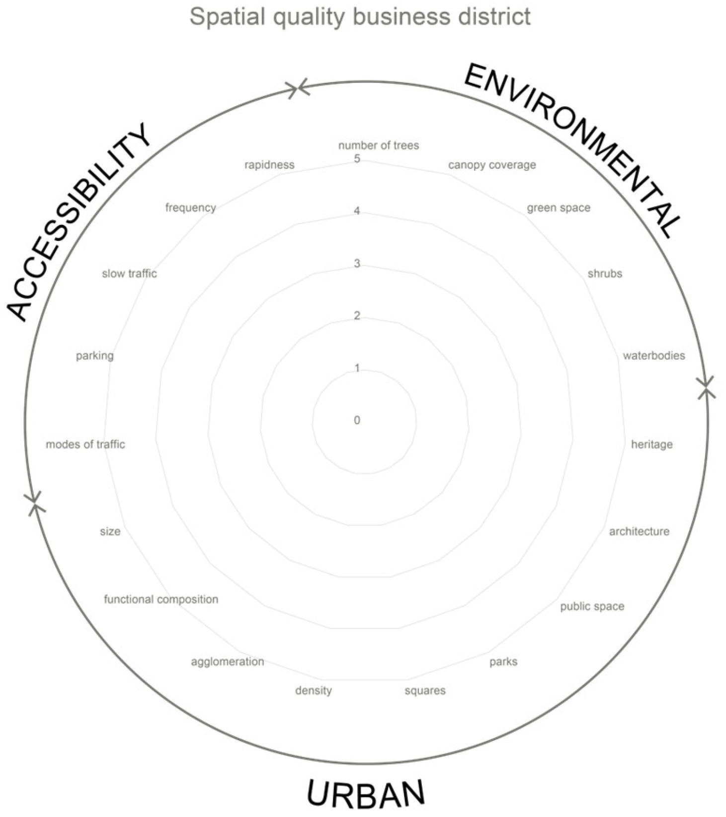
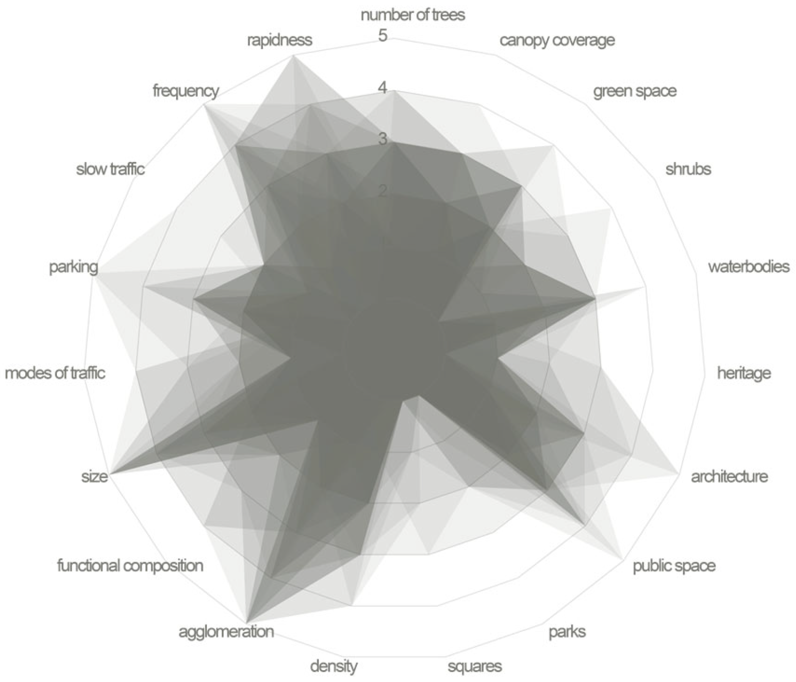
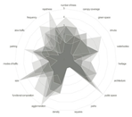
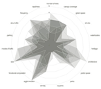
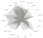
| Indicators | Number of trees, canopy coverage, green space, shrubs, water bodies | Heritage, architecture, public space, parks, squares, density, agglomeration, functional mix/composition, size of the districts and buildings | Modes of traffic, slow traffic, rapidness, frequency, parking |
| District | Characteristics | Exemplary Case |
|---|---|---|
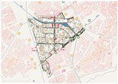
| Inner-city | Surrounded by a residential neighborhood nearby on at least 3 sides of the district. Potential to benefit from proximity to a vibrant urban environment and amenities. Environmental class relates to this position. | 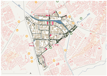 |
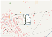
| Edge-city | Located on the edge of the city, forming a barrier between the residential district and the rural landscape. Potential to benefit from proximity to a more vibrant urban environment and amenities. Environmental class relates to this position. | 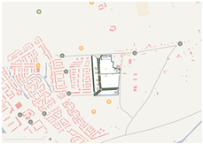 |
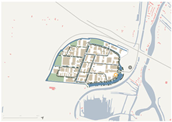
| Waterway districts | Positioned along a waterway. Often, a barrier between the district and residential neighborhood separates the district from the vibrant urban environment on at least one side of the district; however, it might benefit from the proximity of its amenities. Environmental class can relate to this position. | 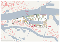 |
| Highway districts | Positioned along the highway and oriented on this. No vibrant urban environment to benefit from in proximity. Environmental class can relate to this position. |  |
3. Results
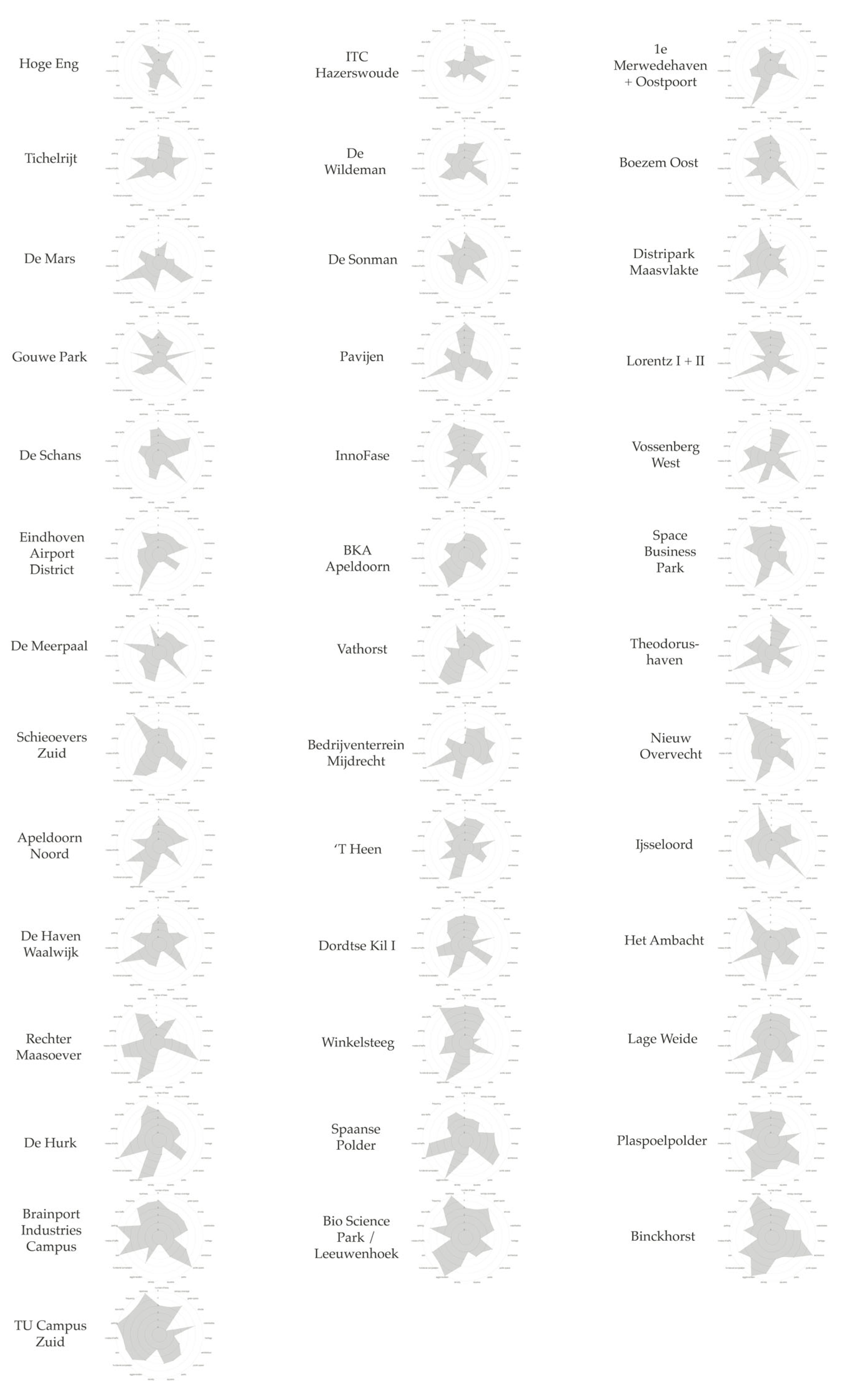
- Defining a framework to identify the spatial quality of business districts. The framework is validated by a spatial analysis and identifies the quality of 40 business districts.
- Understanding business districts as potential workscapes by identifying the spatial quality.
- Formulating a first set of action perspectives for workscape development.
3.1. The Framework to Identify Spatial Quality of Business Districts
3.2. Understanding Business Districts as Potential Workscapes
- Their repetitive geometries.
- Rows of large and rectangular buildings, often with little variation in height or architectural style.
- The streets in the districts align in grid patterns, emphasizing efficiency and predictability.
- The public space in the business districts is predominantly infrastructural, including roads and parking places, with extremely limited public squares and parks.
- The infrastructure is merely car-oriented, lacking comfortable and safe slow-traffic-friendly space. With little space for slow traffic use of the infrastructure and a lack of objects that stimulate this use, such as street furniture, the little public space does not promote activity or interaction.
- The business districts include vegetation mostly on main axes of infrastructure and along its borders. The vegetation is often single-layered and includes little species diversity.
- Though many districts are located along waterways, within the districts themselves little waterbodies are present.
- The little green spaces present often comprise vacant lots. Therefore, the districts do not meet the 3-30-300 rule.
3.3. Action Perspectives
- From an environmental perspective, business districts require substantial redesign to include additional qualitative and diverse vegetation and water bodies to generate climate-adaptive, healthy, comfortable, and nature-inclusive environments. Many districts already feature green main axes with space for safe, slow traffic, which should be extended throughout the inner district.
- Both the quantity and quality of public spaces must be enhanced. Often, the scarcity of the quantity of public space requires involving private stakeholders in urban redevelopment to significantly improve spatial quality. Repurposing the many unused, vacant plots for public use is a potential strategy when there is a deficiency of public space.
- The functional composition of each site indicates potential site-specific diversification opportunities. The implementation of mixed-use developments that integrate the often dominant industrial and office spaces with amenities that focus on leisure and, if possible, with residential functions stimulates activity. For this, re-evaluation and modernization of environmental zones may permit a more diverse range of functions.
- Regarding infrastructure, the creation of pedestrian- and cyclist-friendly routes is imperative. Transforming existing street and lot parking into shared-built parking facilities can enhance spatial esthetics. Together with promoting transit accessibility, this makes business districts more attractive workplaces that facilitate interaction among workers, visitors, and potential residents.
4. Discussion
5. Conclusions
- Including additional qualitative and diverse vegetation and water bodies and extending the green axis throughout the inner district.
- Enhancing the quality and quantity of public spaces. With a lack of public space, involve private stakeholders in urban redevelopment and repurpose unused, vacant plots for public use.
- Implementing mixed-use development. Re-evaluate and modernize the environmental classes to optimize the development potential.
- Creating pedestrian- and cyclist-friendly routes, shared-built parking facilities and transit accessibility.
Author Contributions
Funding
Data Availability Statement
Conflicts of Interest
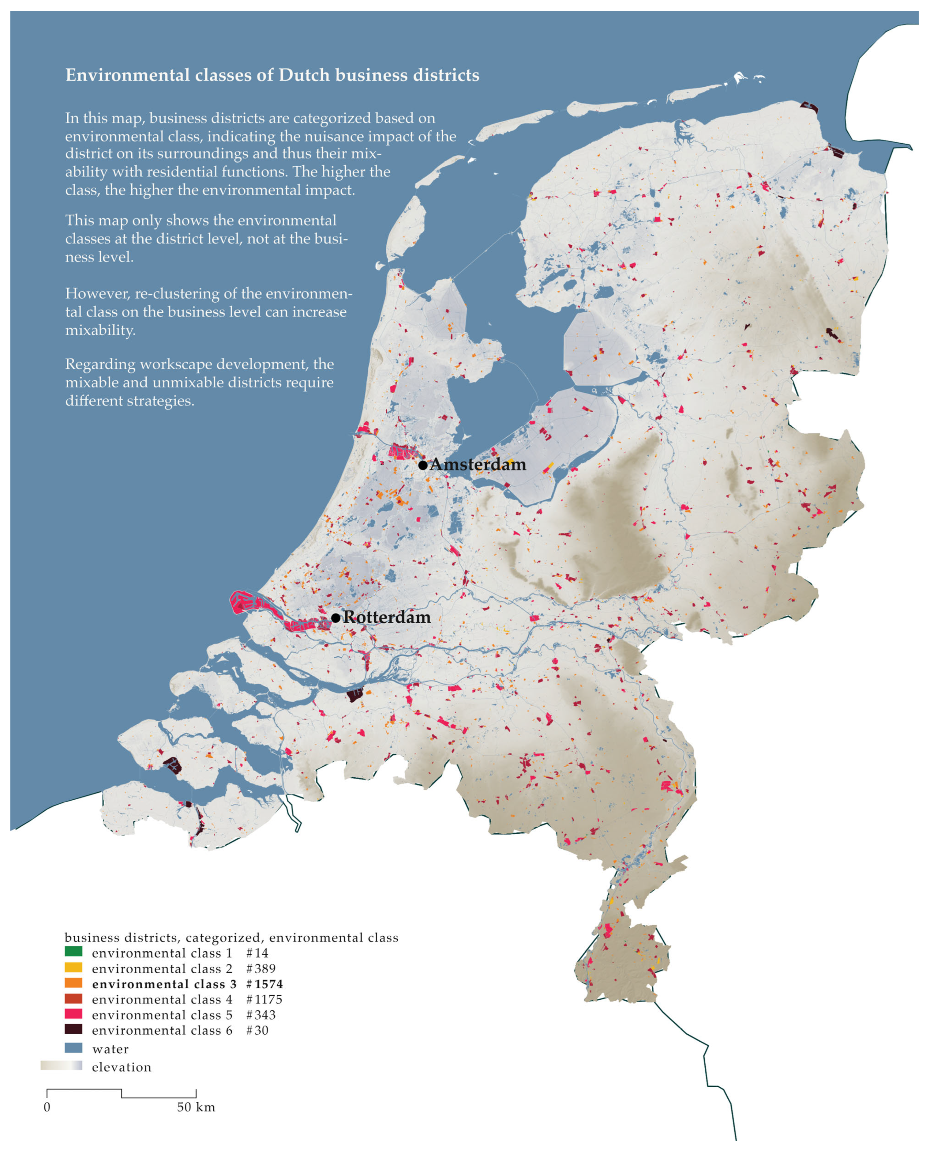
Appendix A. National Maps Context 3800 Dutch Business Districts


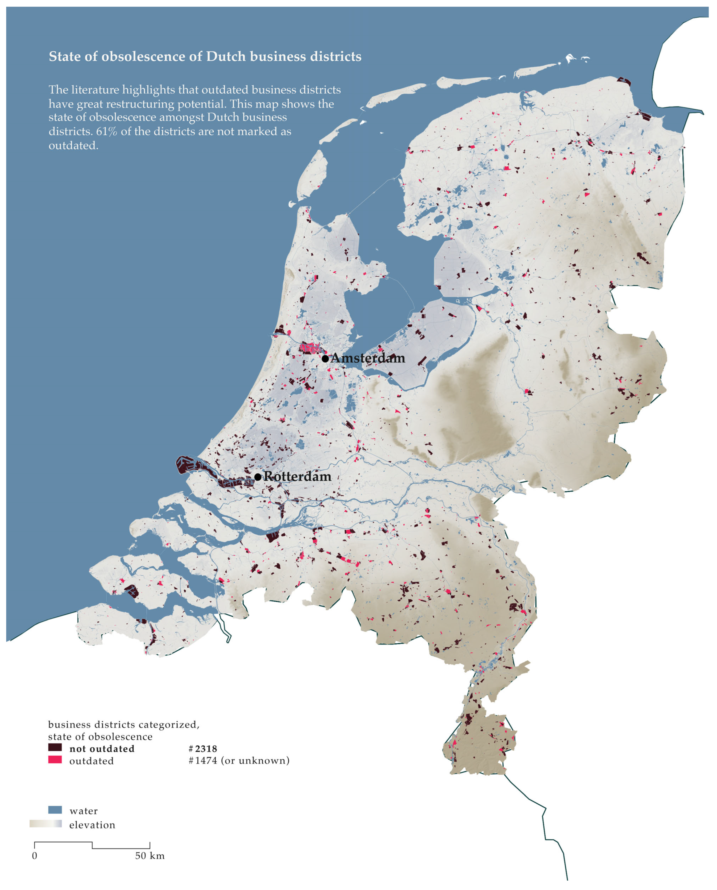
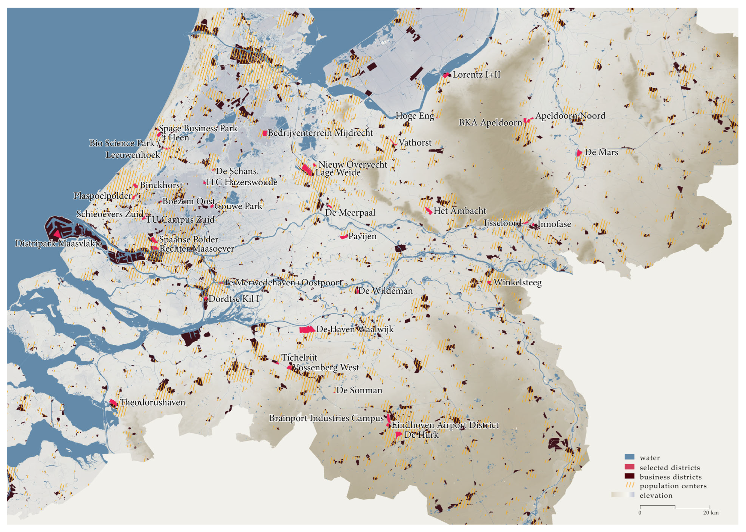
Appendix B. Geographical Scope of the Spatial Analysis
Appendix C. Table Overview Districts
| Business District | Surface (HA) | Public Space (%) | GSI | Maximum Environmental Zone | Start (Year) | Province | Outdated | Soil | Landscape Typology | District Type | Transformation Type | Average Elevation (−/+ NAP) |
|---|---|---|---|---|---|---|---|---|---|---|---|---|
| Space Business Park | 15 | 20 | 0.07 | 3 | 2005 | Zuid-Holland | No | Sand | Estuarium, strandvlakten | Edge-city | Integral | +1.5 m |
| Brainport Industries Campus | 179 | 63 | 0.11 | 4 | 2018 | Noord-Brabant | No | Loam | Dekzandvlakten, dekzandruggen, droogdalbodems | Highway | Cherish | +18 m |
| TU Campus Zuid | 105 | 24 | 0.17 | 3 | 1985 | Zuid-Holland | No | Clay | Kwelders | Highway | Integral | +1.5 m |
| Bio Science Park/Leeuwenhoek | 101 | 11 | 0.25 | 3 | 1967 | Zuid-Holland | No | Built | Stroomcrevcasseruggen, overstromingsvlakte | Inner-city | Integral | +0.5 m |
| Binckhorst | 100 | 20 | 0.38 | 4 | 1939 | Zuid-Holland | No | Built | Strandvlakten, strandwallen, lage duinen, kwelders | Inner-city | Zoning | +1 m |
| Plaspoelpolder | 95 | 34 | 0.42 | 3 | 1954 | Zuid-Holland | No | Built | Kwelders/kreekruggen | Inner-city | Integral | +0.5 m |
| Rechter Maasoever | 116 | 14 | 0.36 | 4 | 2022 | Zuid-Holland | No | Built | Kwelders | Waterway | Zoning | +3 m |
| Winkelsteeg NXP | 64 | 8 | 0.29 | 4 | N/A | Gelderland | N/A | Built | Sandrs | Inner-city | Zoning | +12 m |
| Vathorst | 45 | 28 | 0.44 | 3 | 1999 | Utrecht | No | Sand | Dekzandvlakten, dekzandruggen, rivierduinen | Edge-city | Integral | +2 m |
| Ijseloord | 60 | 46 | 0.36 | 4 | N/A | Gelderland | N/A | Silt | Stroom- en crevasseruggen, overstromingsvlakte | Edge-city | Zoning | +10 m |
| De Mars | 189 | 22 | 0.37 | 5 | N/A | Gelderland | N/A | Built | Beekdalbodems, uiterwaarden | Waterway | Zoning | +8 m |
| Boezem Oost | 21 | 36 | 0.41 | 4 | 2014 | Zuid-Hollans | No | Clay | Wadden | Highway | Cherish | −4 m |
| Gouwe Park | 65 | 30 | 0.46 | 4 | 2005 | Zuid-Holland | No | Peat | Wadden, overstromingsvlakte | Highway | Cherish | −5 m |
| De Schans II | 20 | 35 | 0.33 | 4 | 2001 | Zuid-Holland | No | Clay | Overstromingsvlakte, stroomcrevasseruggen, veenvlakten | Edge-city | Zoning | −1 m |
| ‘T Heen | 78 | 13 | 0.49 | 3 | 1967 | Zuid-Holland | Yes | Built | Estuarium | Waterway | Integral | +1 m |
| Hoge Eng | 11 | 20 | 0.41 | 3 | N/A | Gelderland | N/A | Sand | Hellingen | Edge-city | Integral | +15 m |
| De Meerpaal | 50 | 30 | 0.58 | 4 | 1999 | Utrecht | No | Clay | Overstromingsvlakte | Edge-city | Zoning | +1 m |
| Bedrijventerrein Mijdrecht | 175 | 18 | 0.38 | 5 | 1960 | Utrecht | No | Clay | Wadden, kreekruggen | Edge-city | Zoning | −5.5 m |
| Apeldoorn Noord | 107 | 23 | 0.43 | 3&4 | N/A | Gelderland | N/A | Sand | Plateaus, hellingen, droogdalbodems, dekzandvlakten | Edge-city | Zoning | +8 m |
| Lorentz I + II | 152 | 16 | 0.44 | 5 | N/A | Gelderland | N/A | Built | Dekzandvlakten | Waterway | Zoning | +1.5 m |
| De Sonman | 10 | 25 | 0.56 | 3 | 1985 | Noord-Brabant | No | Sand | Dekzandvlakten, droogdalbodems, dekzandruggen | Edge-city | Integral | +12 m |
| Tichtelrijt | 134 | 22 | 0.06 | 3&4 | 1983 | Noord-Brabant | Partly | Sand | Droogdalbodems, dekzandvalkten, beekdalbodems | Waterway | Cherish | +4.5 m |
| Pavijen | 167 | 21 | 0.50 | 4 | N/A | Gelderland | N/A | Clay | Overstromingsvlakte, stroom- en crevasseruggen | Edge-city | Zoning | +1 m |
| Lage Weide | 408 | 24 | 0.41 | 5 | 1945 | Utrecht | No | Clay | Overstromingsvlakte, stroom- en crevasseruggen | Waterway | Zoning | +1.5 m |
| De Hurk | 212 | 22 | 0.52 | 5 | 1955 | Noord-Brabant | No | Built | Dekzandvlakten, dekzandruggen, droogdalbodems | Inner-city | Zoning | +18 m |
| Distripark Maasvlakte | 165 | 11 | 0.37 | 4 | N/A | Zuid-Holland | No | Built | Kwelders | Waterway | Cherish | +5 m |
| Vossenberg West | 122 | 35 | 0.55 | 5 | 2012 | Noord-Brabant | No | Sand | Dekzandvlakten, droogdalbodems | Waterway | Zoning | +6 m |
| InnoFase | 46 | 22 | 0.15 | 5 | N/A | Gelderland | N/A | Silt | Overstromingsvlakte | Highway | Cherish | +9 m |
| Theodorushaven | 237 | 14 | 0.17 | 5 | 1960 | Noord-Brabant | Yes | Built | Kwelders, kreekruggen | Waterway | Cherish | +1.5 m |
| 1e Merwedehaven + Oostpoort | 43 | 4 | 0.30 | 4 | 1938 | Zuid-Holland | No | Built | Kwelders | Waterway | zoning | +3 m |
| Dordtse Kil I | 62 | 23 | 0.43 | 4 | 1965 | Zuid-Holland | No | Built | Kwelders | Edge-city | Zoning | 0 m |
| Spaanse Polder | 171 | 32 | 0.51 | 5 | 1946 | Zuid-Holland | No | Built | Kwelders | Waterway | Zoning | +0.5 m |
| De Wildeman | 98 | 23 | 0.34 | 4 | N/A | Gelderland | N/A | Silt | Overstromingsvlakte | Highway | Cherish | +3 m |
| Eindhoven Airport District | 57 | 11 | 0.41 | 4 | 1950 | Noord-Brabant | No | Sand | Dekzandvlakten, dekzandruggen | Highway | Cherish | +6 m |
| Schieoevers Zuid | 48.3 | 28 | 0.37 | 4 | 1969 | Zuid-Holland | No | Built | Kwelders | Edge-city | Zoning | 0 m |
| BKA Apeldoorn | 87 | 15 | 0.04 | 5 | N/A | Gelderland | N/A | Built | Hellingen | Edge-city | Cherish | +11 m |
| De Haven Waalwijk | 630 | 34 | 0.28 | 5 | 1960 | Noord-Brabant | Partly | Clay | Kwelders, kreekruggen, open water, dekzandvlakten | Edge-city | Cherish | +1 m |
| Het Ambacht | 183 | 25 | 0.44 | 5 | 1960 | Utrecht | No | Sand | Dekzandvlakten | Edge-city | Cherish | +7 m |
| Nieuw Overvecht | 51 | 29 | 0.50 | 3 | 1970 | Utrecht | Yes | Built | Overstromingsvlakte | Edge-city | Integral | +1.5 m |
| Sierteeltcentrum ITC Hazerswoude | 42 | 20 | 0.36 | 3 | 1990 | Zuid-Holland | No | Clay | Wadden, veenvlakten | Highway | Cherish | −5 m |
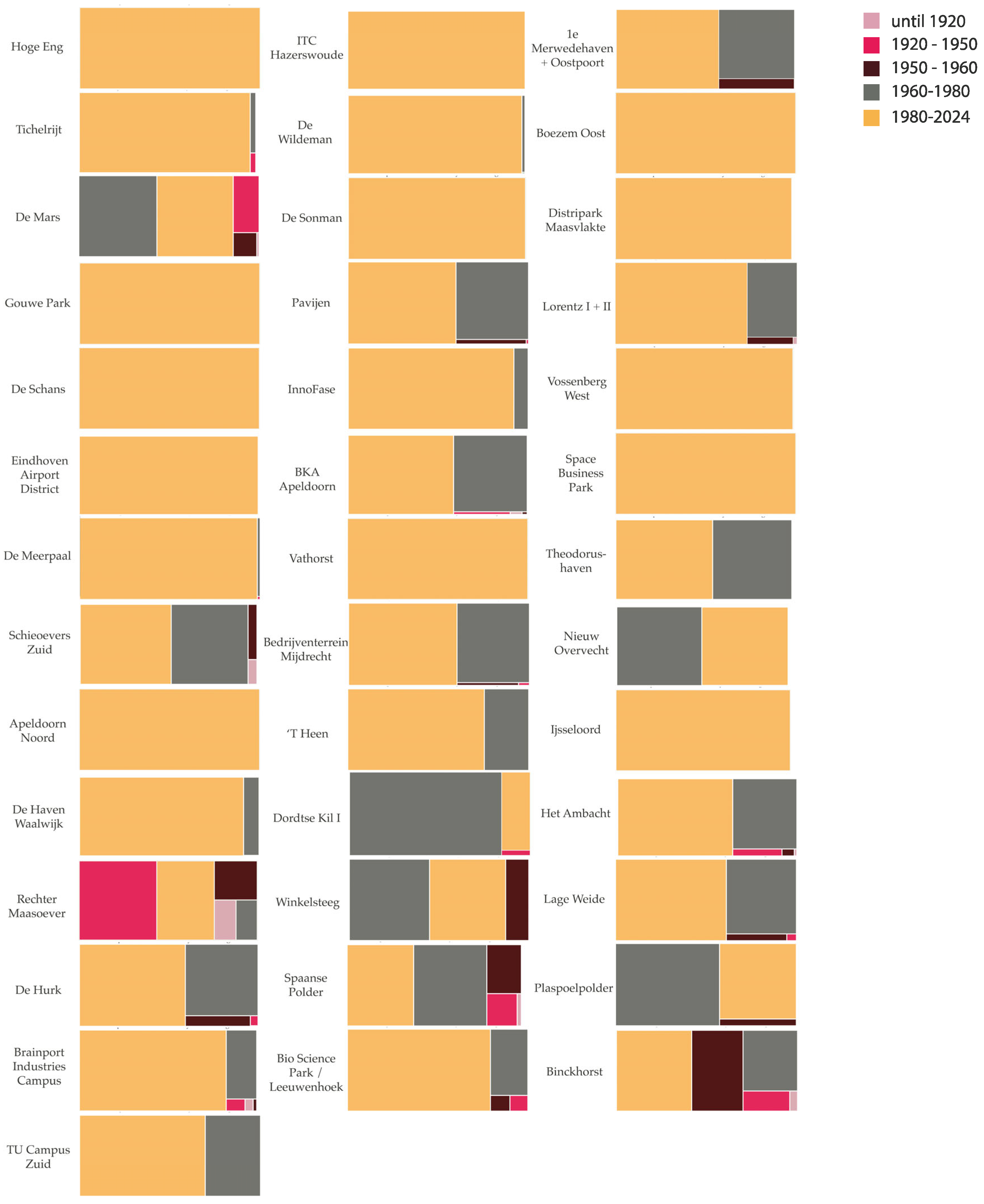
Appendix D. Spatial Analysis 40 Business Districts

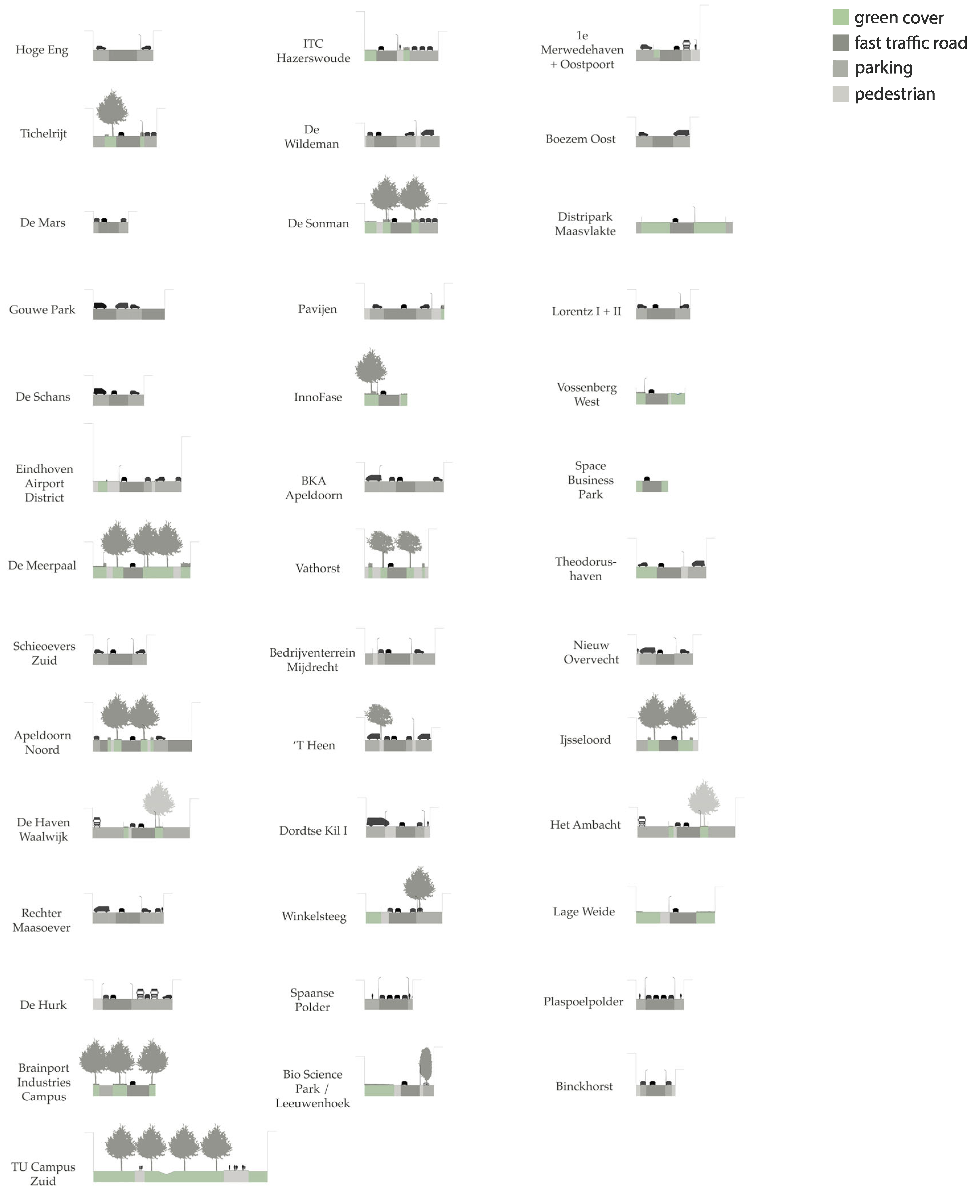
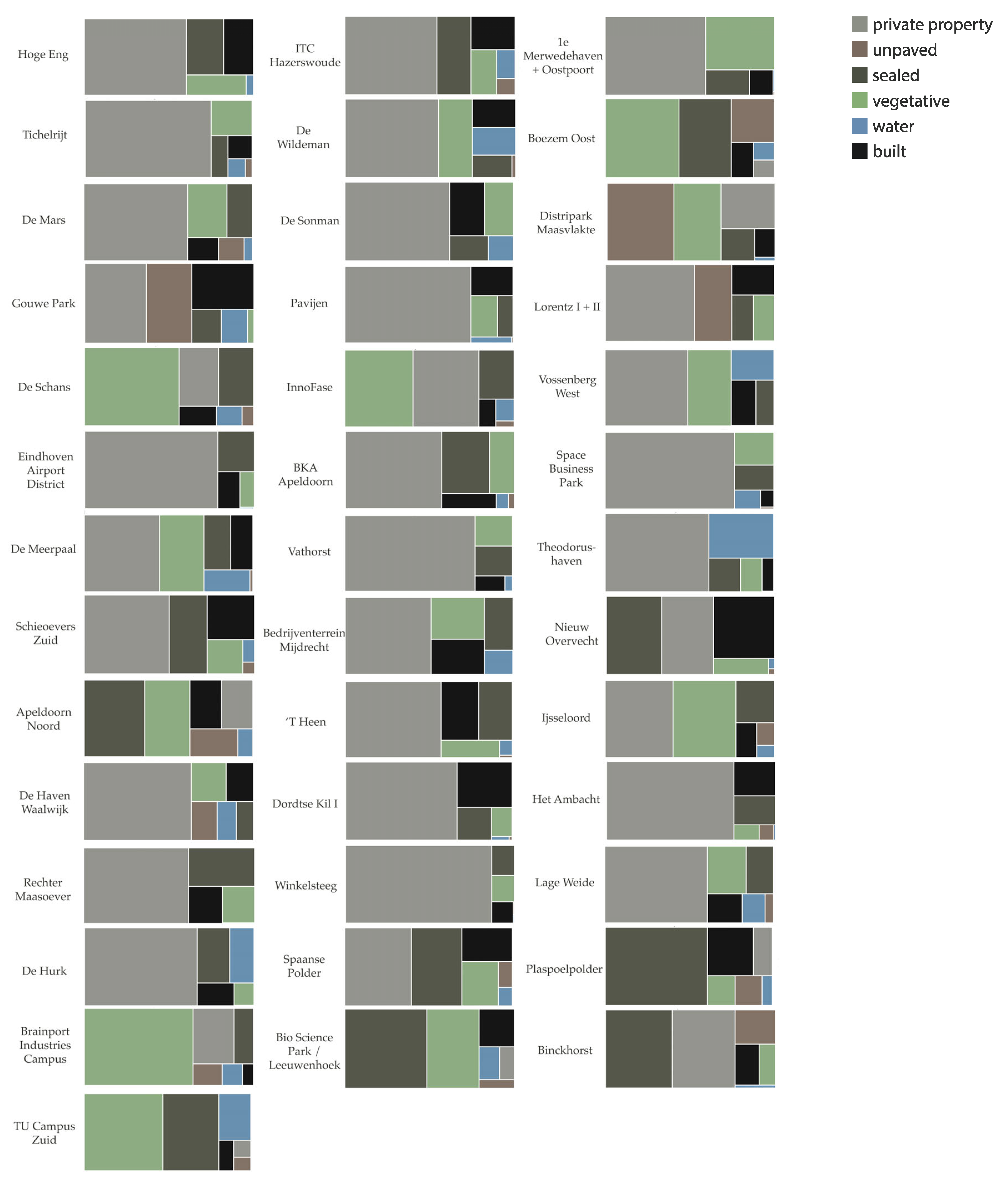
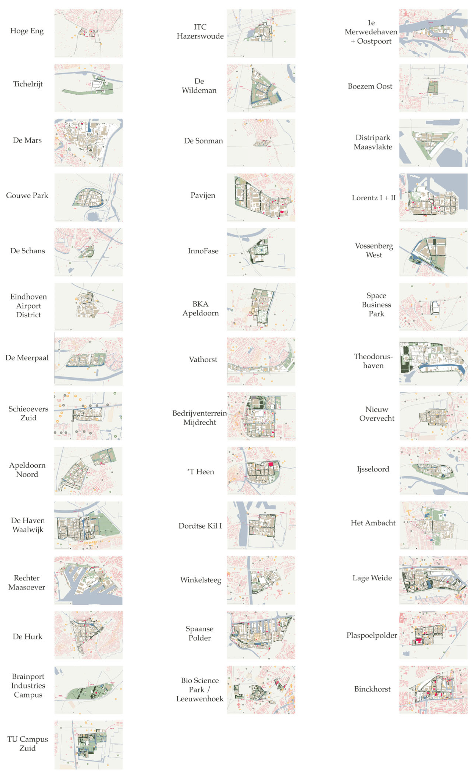
Appendix E. Weighing
| 0 | 1 | 2 | 3 | 4 | 5 | |
|---|---|---|---|---|---|---|
| Urban Characteristics | ||||||
| Heritage | No heritage elements nearby. | A heritage element close to the district. | A heritage element within the district. | A heritage element and landmark within the district. | Some heritage elements within the district. | Several heritage elements and atmospheres. |
| Architecture | Fully uninspiring. | One dominant construction period, including monotonous architecture. | Two dominant construction periods. | A dominant construction period with several less dominant ones. | Interesting mix in construction years. | Attractive and diverse architecture generates a pleasant atmosphere in the public space. |
| Parks | No public parks present in the district. | One public green space without any furniture. | One public green space with some street furniture. | One public green space with furniture and activities surrounding it. | Several public green spaces with some furniture. | Several public green spaces in strategic locations with street furniture and activities. |
| Squares | No public squares in the district. | One public square without any furniture. | One public square with some street furniture. | One public square with furniture and activities surrounding it. | Several public squares with some furniture. | Several public squares in strategic locations with furniture, activities, and shelter from diverse weather conditions. |
| Public space | 0–5%. | 5–10%. | 10–20%. | 20–30%. | 30–40%. | >40%. |
| Agglomeration | Not close to agglomeration nor population center. | Close to population center. | In a population center, far from agglomeration. | In population centers near agglomeration, out-population centers on the edge of agglomeration. | In population centers partly on the edge of agglomeration. | In population centers and in agglomeration cores. |
| Density | No housing around the district. | Housing present close to the district. | Housing close to one side of the district. | Housing on two sides of the district and some housing within. | Housing on three sides of the district and some housing in. | Residential area continues in the district. |
| Functional Composition | One single function. | One extremely dominant industrial function. | Industry and offices being extremely dominant functions. | Industry and offices being dominant, several less dominant functions included. | Substantial part of functional composition other than industry and offices. | A business district with many urban amenities and facilities. |
| Size | <5 ha. | 5–20 ha. | 20–60 ha. | 60–100 ha. | 100–140 ha. | >140 ha |
| Accessibility | ||||||
| Modes of Traffic | Car-oriented infrastructure only. | Car-oriented infrastructure with unsafe and insufficient slow traffic. | Fast and slow traffic, together with sufficient infrastructure for motorized infrastructure. | Fast and safe slow traffic, public transport, and infrastructure for motorized infrastructure. | Excellent multimodal connections. | Multimodal connections in safe and comfortable use. |
| Parking | No parking available while needed. | Street parking only. | Street parking combined with parking lots. | Parking lots, clustered parking only. | Parking lots combined with built parking. | Mobility hubs. |
| Slow Traffic | No infrastructure for slow traffic. | Unsafe slow traffic infrastructure: dead-ends and shared lanes only. | Separated slow traffic lanes on main routes. | Separated slow traffic lanes in the whole district. | Safe, prioritized and wide slow traffic infrastructure in the whole district. | Safe, prioritized, wide, and comfortable slow traffic infrastructure in the whole district. |
| Frequency | No public transport in the district. | Public transport lines are hourly during working hours (09:00–17:00 on weekdays). | Public transport lines are frequent during working hours (09:00–17:00 on weekdays). | Public transport lines are frequent during working hours (09:00–17:00 on weekdays) and hourly on weekend days. | Public transport lines are frequently busy during the daytime on all days. | Public transport lines are always frequent. |
| Rapidness | No highway exits or public transport stops nearby. | Highway exit near district; no public transport stops near. | Highway exit near district; no public transport stops in the district or multiple not accessible by slow traffic or infrequent. | Highway exit near district; public transport stops in districts that are frequent. | Highway exit near district; public transport stops in districts that are frequent and easily accessible by slow traffic. | Highway exit near the district; public transport stops in districts that are frequent and comfortably and safely accessible. |
| Environmental | ||||||
| Number of Trees | No trees present in the district. | Trees along the border of the district. | Trees along the border of the district and some along main routes. | Trees along the border of the district and along main routes, some on side streets. | Trees along the border of the district and along main routes, on side streets and on private plots. | Sightlines to trees from every building’s façade. |
| Canopy Coverage | Individual trees only. | Some clusters of canopy coverage. | Clusters of canopy coverage along main infrastructure. | Clusters of canopy coverage along all infrastructure. | Full canopy coverage along all slow traffic infrastructure. | 30% canopy coverage. |
| Green Space | No green space present in district. | Green space on vacant lots only. | Green space on vacant lots and minimal green space along infrastructure. | Green space on vacant lots and minimal green space along infrastructure and strategic locations. | Green space on vacant lots and minimal green space along infrastructure and strategic locations, including the building envelope. | Private green space and maximum public green space. |
| Shrub Layer | No significant shrub layer present in district. | Very few shrubs on private plots. | Shrubs strategically positioned along infrastructure. | Some shrub layers linked to ground cover or trees. | Many multilayered systems along infrastructure. | Many multilayered green spaces enhance the ecological network. |
| Water Bodies | No water bodies present in the districts. | Some standalone ponds in the districts. | Some water bodies present form corridors and connect the district with its surrounding landscape. | Different types of water bodies present in the district. | Different types of water bodies present in the district, a large surface. | Different types of water bodies present in the district, creating a pleasant public space. |
References
- Centraal Bureau Voor De Statistiek. (n.d.). Bevolkingsteller. Available online: https://www.cbs.nl/nl-nl/visualisaties/dashboard-bevolking/bevolkingsteller#:~:text=Eind%20januari%202025%20telde%20Nederland,mannen%20en%20vrouwen%20dat%20zijn (accessed on 17 March 2025).
- Planbureau Voor De Leefomgeving & Centraal Bureau Voor De Statistiek. Prognose: In 2035 Vooral Meer Inwoners in En Om Grotere Gemeenten. Available online: https://www.pbl.nl/actueel/nieuws/prognose-in-2035-vooral-meer-inwoners-in-en-om-grotere-gemeenten (accessed on 10 January 2025).
- Louw, E. Bedrijventerreinen als urbanisatiemotor. AGORA Mag. 2022, 2016, 32. [Google Scholar] [CrossRef][Green Version]
- Harbers, A.; Pols, L. Mening van wonen en werken. Ruimte Maatsch. Beleid Prakt. 2010, 2, 52–65. [Google Scholar]
- Louw, E.; van Der Krabben, E.; Van Amsterdam, H. The spatial productivity of industrial land. Reg. Stud. 2012, 46, 137–147. [Google Scholar] [CrossRef]
- Meinsma, H.C. De Logica Van de Lelijkheid: De Ontwikkeling Van Bedrijventerreinen in Noord Holland; Stichting Welstandszorg Noord-Holland: Alkmaar, The Netherlands, 2004. [Google Scholar]
- Werklandschappen Van De Toekomst. Groene, Gezonde en Toekomstbestendige Bedrijventerreinen: Aanvraag Nationaal Groeifonds 2021. Available online: https://www.scribd.com/document/643564547/Werklandschappen-van-de-Toekomst-Voorstel-geactualiseerd-1-pdf (accessed on 1 November 2023).
- Ministerie van VROM. Leefbaarometer 2008; Ministerie van VROM: Den Haag, The Netherlands, 2008. [Google Scholar]
- VROM-raad. Werklandschappen; VROM-raad: Den Haag, The Netherlands, 2006. [Google Scholar]
- Taskforce (her)Ontwikkeling Bedrijventerreinen. Kansen Voor Kwaliteit, Een Ontwikkelingsstrategie Voor Bedrijventerreinen; Taskforce (her)Ontwikkeling Bedrijventerreinen: Den Haag, The Netherlands, 2008. [Google Scholar]
- Croxford, B.; Domenech, T.; Hausleitner, B.; Hill, A.V.; Meyer, H.; Orban, A.; Warden, J. Foundries of the Future: A Guide for 21st Century Cities of Making; TU Delft OPEN Publishing: Delft, The Netherlands, 2020. [Google Scholar]
- MacLachlan, I.; Gong, Y. Community formation in talent worker housing: The case of silicon valley talent apartments, Shenzhen. Urban Geogr. 2023, 44, 707–728. [Google Scholar] [CrossRef]
- Zwysen, W. Krapte Op De Europese Arbeidsmarkt? Vooral Een Probleem Bij Slechtere Jobs; Denktank Minerva: Brussel, Belgium, 2023. [Google Scholar]
- van Dinteren, J. Een nieuw type werklocatie: “Enjoy work!” als leidend principe. Real Estate Mag. 2007, 75, 24–29. [Google Scholar]
- Jakobsson, P.; Stiernstedt, F. Googleplex and Media Houses: Architecture, Media and the Production of Centrality; Peter Lang Publishing Inc.: New York, NY, USA, 2010; p. 113. [Google Scholar]
- Boelhouwer, P.; Remøy, H. De markt voor transformatie naar woningen. In Transformatie Naar Woningen; Remøy, H., van Bortel, G., Heurkens, E., van Venrooij, R., Eds.; Delft University of Technology, Faculteit Bouwkunde: Delft, The Netherlands, 2024; pp. 11–19. [Google Scholar]
- Van ’t Hoff, M.; Wall, R. Business districts: The spatial characteristics of FDI within cities. Eur. Plan. Stud. 2020, 28, 273–295. [Google Scholar] [CrossRef]
- van der Voordt, D.J.M. Scoren met kantoren: Nieuwe bestemming voor lege kantoren-Vroeger kantoor, nu huis. Aedes-Mag. 2006, 24, 20–23. [Google Scholar]
- Breda, R. Bestuurlijke Nota: Ombouw Kantoren Naar Woningen in BREDA in De Periode 2011–Juni 2021; Gemeente Breda: Breda, The Netherlands, 2021. [Google Scholar]
- Louw, E.; Needham, D.B.; Holden, H.; Pen, C.J. Planning Van Bedrijventerreinen; Sdu Uitgevers: Den Haag, The Netherlands, 2004. [Google Scholar]
- Ecorys. Investeringsplan Toekomstbestendige Bedrijventerreinen Provincie Zuid-Holland. 2022. Available online: https://www.ecorys.com/app/uploads/files/2022-07/Investeringsplan%20Toekomstbestendige%20Bedrijventerreinen%20PZH%20-%20Kwaliteit,%20duurzaamheid%20en%20beter%20benutten.pdf (accessed on 17 May 2024).
- Stec Groep. Next Economy: Welke Megatrends Cruciaal Voor Bedrijventerreinen? 2018. Available online: https://stec.nl/wp-content/uploads/2018/03/Stec-Groep-whitepaper-Next-Economy.pdf (accessed on 8 August 2024).
- Interprovinciaal Overleg (Provincie). Definities Integraal Bedrijventerreinen Informatie Systeem (IBIS). 2022. Available online: https://provincies.pleio.nl/file/download/91f81a21-f3e8-482e-87c9-9932bf05d6fe/1544710303definities_ibis_nl_20170331.pdf (accessed on 1 November 2023).
- Hall, P. Global city-regions in the twenty-first century. In Global Cityregions: Trends, Theory, Policy; Scott, A.J., Ed.; Oxford University Press: Oxford, UK, 2002; pp. 59–77. [Google Scholar]
- Katz, B.; Wagner, J. The Rise of Innovation Districts: A New Geography of Innovation in America; The Brookings Institution’s Metropolitan Policy Program: Washington, DC, USA, 2014. [Google Scholar]
- Pratt, A. New media, the new economy and new spaces. Geoforum 2000, 31, 425–436. [Google Scholar] [CrossRef]
- Nijhuis, S. Landscape Logic; Jap Sam Books: Prinsenbeek, The Netherlands, 2024. [Google Scholar]
- Hunter, G.J.; Bregt, A.K.; Heuvelink, G.B.; De Bruin, S.; Virrantaus, K. Spatial data quality: Problems and prospects. In Research trends in Geographic Information Science; Springer: Berlin/Heidelberg, Germany, 2009; pp. 101–121. [Google Scholar]
- Hooimeijer, P.; Kroon, H.; Luttik, J. Kwaliteit in Meervoud. Conceptualisering en Operationalisering Van Ruimtelijke Kwaliteit Voor Meervoudig Ruimtegebruik; Habiforum: Gouda, The Netherlands, 2001. [Google Scholar]
- Jacobs, M.H. Kwaliteit leefomgeving. In Kennisontwikkeling; Alterra-Rapport: Wageningen, The Netherlands, 2000; p. 122. [Google Scholar]
- Nasar, J.L. (Ed.) Environmental Aesthetics: Theory, Research, and Application; Cambridge University Press: Cambridge, UK, 1992. [Google Scholar]
- Kaplan, R.; Kaplan, S. The Experience of Nature: A Psychological Perspective; Cambridge university Press: Cambridge, UK, 1989. [Google Scholar]
- Zoest, J.V. Landschapskwaliteit: Uitwerking Van De Kwaliteitscriteria in De Nota Landschap; DLO-Staring Centrum: Wageningen, The Netherlands, 1994. [Google Scholar]
- Fresco, L.O.; Kroonenberg, S.B. Time and spatial scales in ecological sustainability. Land Use Policy 1992, 9, 155–168. [Google Scholar] [CrossRef]
- Hermans, C.; Vereijken, P.H. Duurzame graasveehouderij. Naar landbouwkundig vermogen en ecologische draagkracht. Landsch. Tijdschr. Voor Landschapsecologie En Milieukd. 1991, 8, 241–248. [Google Scholar]
- van Mansvelt, J.D.; van der Lubbe, M.J. Checklist for Sustainable Landscape Management: Final Report of the EU Concerted Action AIR3-CT93-1210; Elsevier: Amsterdam, The Netherlands, 1998. [Google Scholar]
- Roggema, R. The future of sustainable urbanism: Society-based, complexity-led, and landscape-driven. Sustainability 2017, 9, 1442. [Google Scholar] [CrossRef]
- Sijmons, D.; Feddes, F. Landkaartmos, En Andere Beschouwingen over Landschap; Uitgeverij 010: Rotterdam, The Netherlands, 2002. [Google Scholar]
- Stockholm Resilience Centre. The SDGs Wedding Cake. 2016. Available online: https://www.stockholmresilience.org/research/research-news/2016-06-14-the-sdgs-wedding-cake.html (accessed on 8 August 2024).
- Balany, F.; Muttil, N.; Muthukumaran, S.; Wong, M.S.; Ng, A.W. Studying the effect of blue-green infrastructure on microclimate and human thermal comfort in melbourne’s central business district. Sustainability 2022, 14, 9057. [Google Scholar] [CrossRef]
- Wang, Y.; Zacharias, J. Landscape modification for ambient environmental improvement in central business districts–a case from Beijing. Urban For. Urban Green. 2015, 14, 8–18. [Google Scholar] [CrossRef]
- Konijnendijk, C.C. Evidence-based guidelines for greener, healthier, more resilient neighbourhoods: Introducing the 3–30–300 rule. J. For. Res. 2023, 34, 821–830. [Google Scholar] [CrossRef] [PubMed]
- Ram, M.; Gerretsen, P. Veel Ruimte! Maar Durven We Het Ook te Benutten? 2014. Available online: https://deltametropool.nl/app/uploads/2019/08/201412_Artikel_Veel-Ruimte_Maar-Durven_we-het-ook-te-benutten.pdf (accessed on 24 July 2024).
- Sun, M.; Chen, C. Renovation of industrial heritage sites and sustainable urban regeneration in post-industrial Shanghai. J. Urban Aff. 2023, 45, 729–752. [Google Scholar] [CrossRef]
- Vukmirović, M.; Nikolić, M. Industrial heritage preservation and the urban revitalisation process in Belgrade. J. Urban Aff. 2023, 45, 191–216. [Google Scholar] [CrossRef]
- Wei, Y.; Yuan, H.; Li, H. Exploring the Contribution of Advanced Systems in Smart City Development for the Regeneration of Urban Industrial Heritage. Buildings 2024, 14, 583. [Google Scholar] [CrossRef]
- Gospodini, A. Portraying, classifying and understanding the emerging landscapes in the post-industrial city. Cities 2006, 23, 311–330. [Google Scholar] [CrossRef]
- Interprovinciaal Overleg (Provincie). Integraal Bedrijventerreinen Informatie Systeem (IBIS). 2022. Available online: https://data.overheid.nl/en/dataset/ibis-bedrijventerreinen (accessed on 1 November 2023).
- Rijkswaterstraat. Actueel Hoogtebestand Nederland (AHN). 2022. Available online: https://www.pdok.nl/atom-downloadservices/-/article/actueel-hoogtebestand-nederland-ahn (accessed on 1 November 2023).
- Centraal Bureau Voor de Statistiek. Bestand Bodemgebruik: Water, Bos, Nat Natuurlijk Terrein, Droog Natuurlijk Terrein, Recreatie. 2022. Available online: https://geodata.cbs.nl/files/Bodemgebruik/ (accessed on 1 November 2023).
- Centraal Bureau Voor de Statistiek. Bevolkingskernen. 2011. Available online: https://www.pdok.nl/introductie/-/article/cbs-bevolkingskernen-2011 (accessed on 17 February 2025).
- Wageningen Environmental Research. Geomorfologische Kaart. 2023. Available online: https://bodemdata.nl/basiskaarten (accessed on 17 February 2025).
- Rensink, E.; Weerts, H.J.T.; Kosian, M.; Feiken, H.; Jansen, D.; Smit, B.I. Archeologische Landschappenkaart van Nederland, version 3.0; Rijksdienst voor het Cultureel Erfgoed; DANS: Amersfoort, The Netherlands, 2019. [Google Scholar]
- Kadaster. Basisregistratie Adressen en Gebouwen (BAG). 2024. Available online: https://www.pdok.nl/introductie/-/article/basisregistratie-adressen-en-gebouwen-ba-1 (accessed on 17 February 2025).
- Centraal Bureau Voor de Statistiek. Grootstedelijke Agglomeratie Gegeneraliseerd. 2015. Available online: https://service.pdok.nl/cbs/gebiedsindelingen/2000/wms/v1_0?request=GetCapabilities&service=WMS (accessed on 17 February 2025).
- ProRail. Spoorwegen. 2024. Available online: https://www.pdok.nl/ogc-webservices/-/article/spoorwegen (accessed on 17 February 2025).
- Moovit. (n.d.). Lines. Available online: https://moovitapp.com/netherlands-101/lines (accessed on 16 August 2024).
- Data Rijkswaterstaat. Nationaal Wegenbestand. Available online: https://downloads.rijkswaterstaatdata.nl/nwb-wegen (accessed on 17 March 2025).
- Ministerie van Economische Zaken en Klimaat. Wetlands. 2024. Available online: https://www.pdok.nl/introductie/-/article/wetlands (accessed on 17 February 2025).
- Ministerie van Economische Zaken en Klimaat. Natura 2000. 2024. Available online: https://www.pdok.nl/ogc-webservices/-/article/natura-2000 (accessed on 17 February 2025).
- Kadaster. (n.d.). Basisregistratie Grootschalige Topografie (BGT). Available online: https://app.pdok.nl/lv/bgt/download-viewer/ (accessed on 12 August 2024).
- RIVM. Boomhoogte in Nederland. 2024. Available online: https://www.atlasleefomgeving.nl/kaarten?config=3ef897de-127f-471a-959b-93b7597de188&gm-x=150000&gm-y=455000&gm-z=3&gm-b=1544180834512,true,1;1553765818779,true,0.8;&activateOnStart=info&deactivateOnStart=layercollection (accessed on 17 February 2025).
- Rijksdienst voor Cultureel Erfgoed (n.d.). Rijksmonumenten. Available online: https://www.cultureelerfgoed.nl/onderwerpen/rijksmonumentenregister/rijksmonumenten-kaartlagen (accessed on 29 August 2024).
- Rijksdienst voor Cultureel Erfgoed. Archeologische Monumentenkaart. 2014. Available online: https://www.cultureelerfgoed.nl/onderwerpen/bronnen-en-kaarten/overzicht/archeologie-in-nederland-amk-en-ikaw (accessed on 29 August 2024).
- Google. (n.d.). Google Images, Street View. Available online: https://www.google.com/maps/ (accessed on 1 November 2024).
- Kadaster 2024. Luchtfoto 2024 Quick Ortho 8 cm RGB. Available online: https://www.pdok.nl/introductie/-/article/pdok-luchtfoto-rgb-open- (accessed on 1 November 2024).
- Alexander, C.; Ishikawa, S.; Silverstein, M.; Jacobson, M.; Fiksdahl-King, I.; Angel, S. A Pattern Language: Towns, Buildings, Construction; Oxford University Press: New York, NY, USA, 1977. [Google Scholar]
- Salingaros, N.A. The structure of pattern languages. ARQ Archit. Res. Q. 2000, 4, 149–162. [Google Scholar] [CrossRef]
- Rooij, R.; van Dorst, M. A pattern language approach to learning in planning. Urban Plan. 2020, 5, 58–64. [Google Scholar] [CrossRef]


| Economic | Social | Ecologic | Cultural | |
|---|---|---|---|---|
| Utility value | Allocation efficiency Accessibility External effects Multipurpose | Access Distribution Participation Choice | Safety, nuisance Pollution Desiccation Fragmentation | Freedom of choice Diversity Encounter |
| Experience value | Image Attractiveness | Inequality Connectedness Safety | Space, Peace Beauty Health | Uniqueness Beauty Contrast |
| Future value | Stability/Flexibility Agglomeration Cumulative attraction | Inclusion Cultures of poverty | Resources Ecosystems | Heritage Integration Renewal |
| Biological | Social | Psychological | Metaphysical | |
|---|---|---|---|---|
| Coherence | Coherence as a condition for stability of spatial components, coherence that makes a collection of elements into an entity = coherence of ecotope, hydrological unity, habitat, geological unity, metapopulation, soil unity. | Coherence as the whole of functional relationships between spatial units, coherence as spatial organization (ordering patterns structure) of the landscape = coherence of logistical functioning and parcelization occupation patterns, etc. | Coherence as comprehensibility and information value related: clarity [31] coherence [32] = coherence of origin, functioning, structure, construction [33]. | Coherence as harmony, coherence between previous coherences, that makes the area into a unity, into a ‘world of its own’ = coherence as integration of spatial units, functional relationships and ordering, comprehensibility and information value into a harmonious whole. |
| Variation | Diversity of species, variation in environments = variation as biodiversity, variation in environmental types, geomorphological variation. | Variation in land use and variation in approaches to landscape management and functioning = variation in functionality, spatial patterns, rules for different areas. | Variation as a spectrum of choices for individuals, variation in shapes, textures, colors, smells, etc.; variation in behavioral possibilities for meaning-making (degree of unprogrammedness, absence of socially constructed experiences), shapes, processes, colors, etc. | Variation in ‘worlds’ (with their own forms, processes and laws; thus, variation in value systems), variation in unusual characteristics, variation in symbiological references variation as representation of different eras, presence of different worlds, presence of multiple unknowable values. |
| Sustainability | Sustainability as the continued existence of the carrying capacity of the environment and the continued existence of biological life = maintenance of (dynamic) input/output balance [34], nutrient balances [35], stable biosphere, parameters of undisturbed areas, clean environment [36], healthy nutrition [36]. | Sustainability as the continuation of habits and the continuation of functioning = maintenance of (rational) efficiency, profitability, social support and acceptance, employment. | Sustainability as the continued existence of opportunities for personality development and personal associations = maintenance of emotional ties with landscape and species, recreational opportunities, places with personal associations. | Sustainability as the continued existence of characteristics that transcend the current (daily) = maintenance of cultural-historical values (past), symbols that refer to (cultural) worldview (transcending), symbols that refer to other regions (elsewhere), other worlds (for example, autonomous nature). |
| Inner-City | Edge-City | Waterway | Highway |
|---|---|---|---|
 |  |  |  |
 |  |  |  |
Disclaimer/Publisher’s Note: The statements, opinions and data contained in all publications are solely those of the individual author(s) and contributor(s) and not of MDPI and/or the editor(s). MDPI and/or the editor(s) disclaim responsibility for any injury to people or property resulting from any ideas, methods, instructions or products referred to in the content. |
© 2025 by the authors. Licensee MDPI, Basel, Switzerland. This article is an open access article distributed under the terms and conditions of the Creative Commons Attribution (CC BY) license (https://creativecommons.org/licenses/by/4.0/).
Share and Cite
de Wolf, R.; Roggema, R.; Nijhuis, S.; Tillie, N. The Design of Workscapes: A Scoping Study. Land 2025, 14, 1072. https://doi.org/10.3390/land14051072
de Wolf R, Roggema R, Nijhuis S, Tillie N. The Design of Workscapes: A Scoping Study. Land. 2025; 14(5):1072. https://doi.org/10.3390/land14051072
Chicago/Turabian Stylede Wolf, Rosa, Rob Roggema, Steffen Nijhuis, and Nico Tillie. 2025. "The Design of Workscapes: A Scoping Study" Land 14, no. 5: 1072. https://doi.org/10.3390/land14051072
APA Stylede Wolf, R., Roggema, R., Nijhuis, S., & Tillie, N. (2025). The Design of Workscapes: A Scoping Study. Land, 14(5), 1072. https://doi.org/10.3390/land14051072


