

The Emergence of Terrace Farming in the Arid Zone of the Levant—Past Perspectives and Future Implications

Abstract
1. Introduction
1.1. The Importance of Terrace Farming in Arid Environments
1.2. Terrace Farming in the Arid Levant
1.3. Previous Research on Runoff Agriculture in the Southern Levant
1.3.1. The Negev Highlands, Southern Israel
1.3.2. Eastern Marmarica, Northwestern Egypt
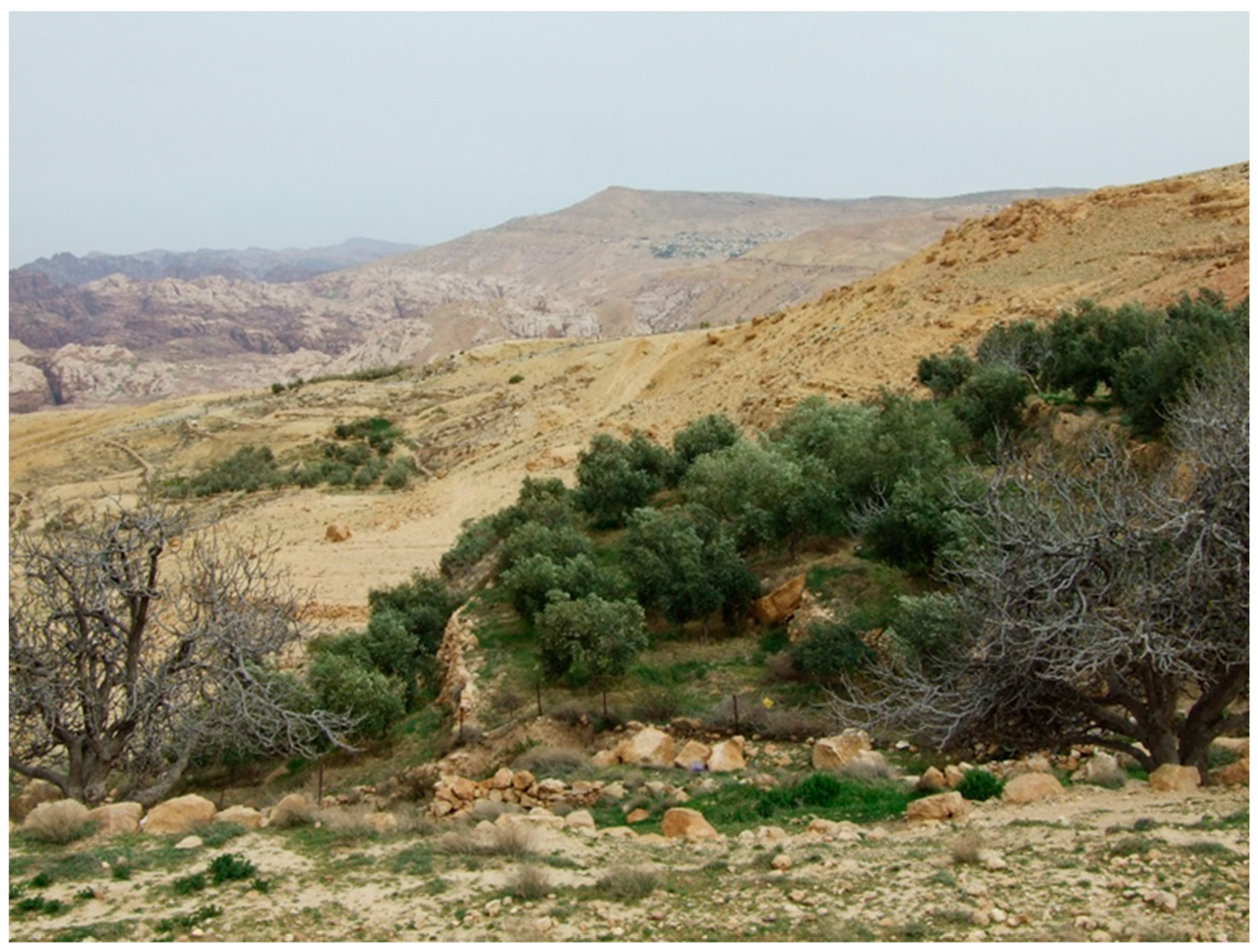
1.3.3. The Hinterland of Petra, Southern Jordan
1.4. The Aim of the Present Study
2. Methods and Data Sources
- New observations and data collection achieved during intensive fieldwork in the Negev Highlands of southern Israel. These observations include the following:
- (1)
- Ongoing observations of the agricultural enterprises run by the local Bedouin population in the most arid regions of the Negev Highlands. Data assemblage was conducted during the years 1990–2022;
- (2)
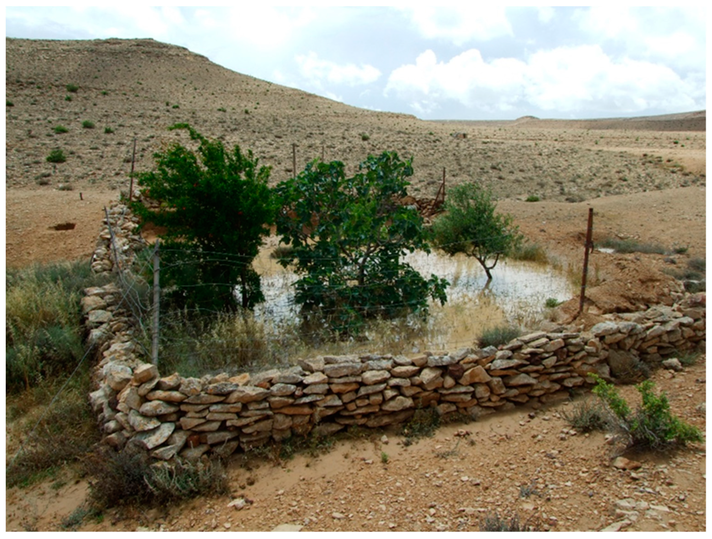
- Observations on the long-term survival of domesticated fruit trees planted within ancient agricultural plots in the Negev Highlands. Data collection was conducted during the years 1995–2022;
- (3)
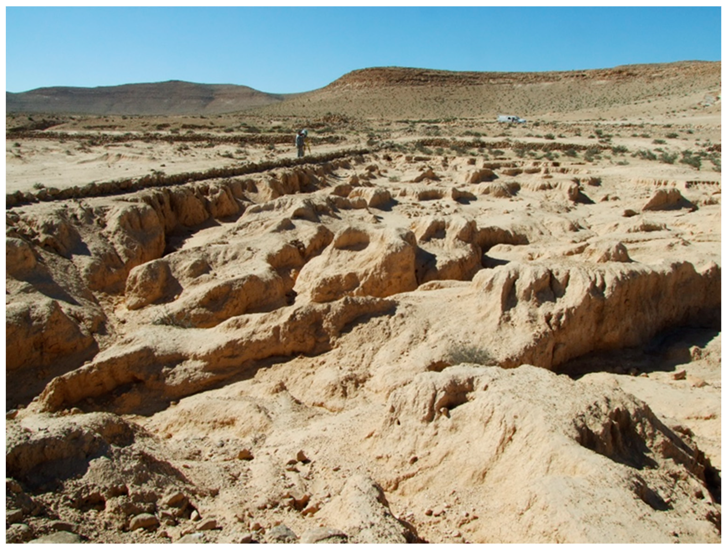
- Long-term monitoring of soil erosion features in designated ancient agricultural plots, collected during the years 1990–2022.
- Field excursions carried out in the Marmarica region of Northwestern Egypt and in the Petra region of Southern Jordan during the years 2000–2022;
- Previously published materials citied in the text. These materials included data on natural conditions, archeological surveys, and OSL sampling locations and OSL dates yield at various sites. Regarding the OSL dates, Avni et al. [50,51] published the most important data from the Negev Highlands, Vetter et al. [22,23,28] from the Marmarica Region, and Beckers et al. [27] from the Petra Region;
3. Results
3.1. Natural Conditions Enabling the Development of Desert Terrace Farming in the Southern Levant
3.1.1. Negev Highlands (Southern Israel)
3.1.2. Marmarica (North-Western Egypt)
3.1.3. Petra Region (Southern Jordan)
3.2. Design Patterns and Raw Materials of Agricultural Terraces
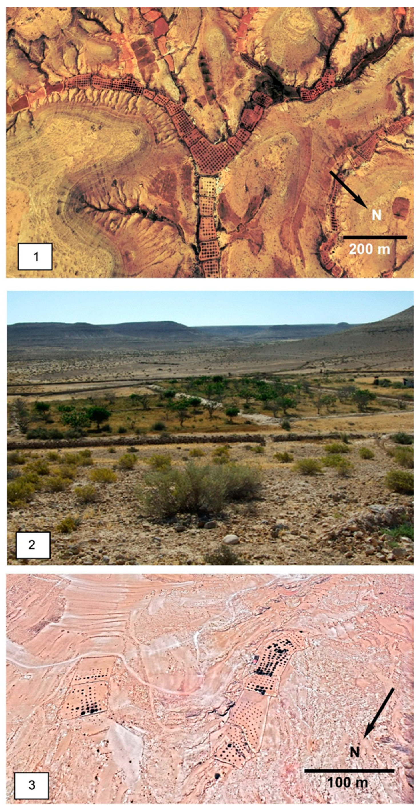
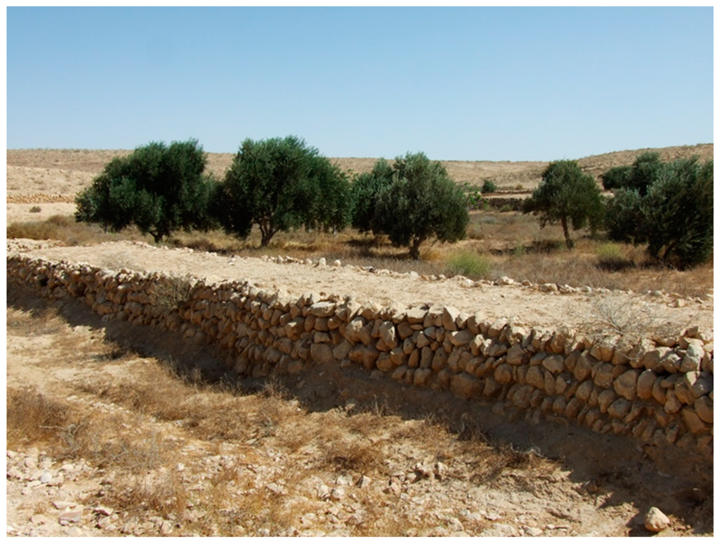
3.2.1. Negev Highlands
3.2.2. Marmarica
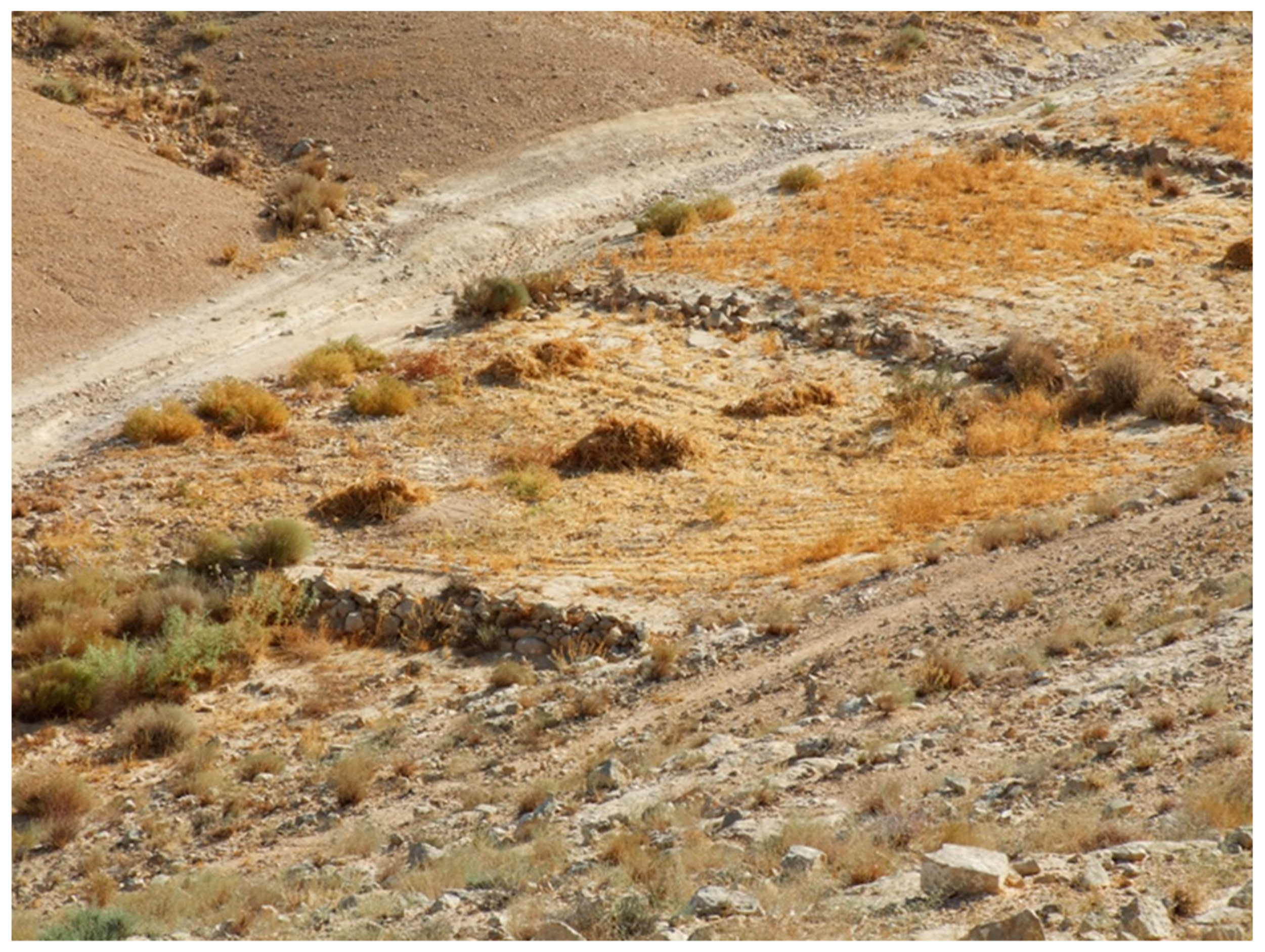
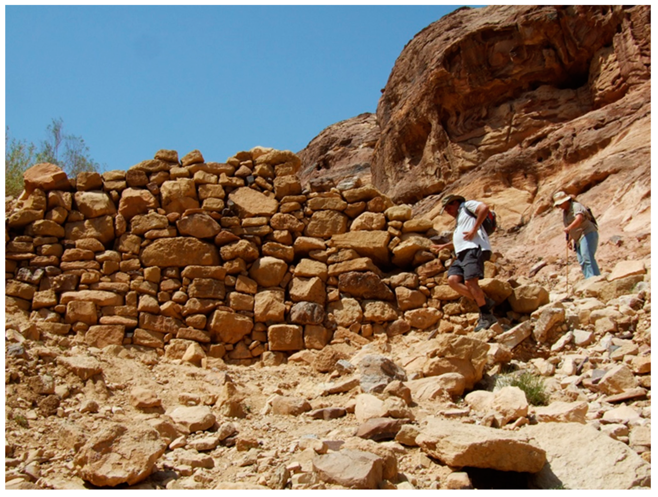
3.2.3. Petra Region
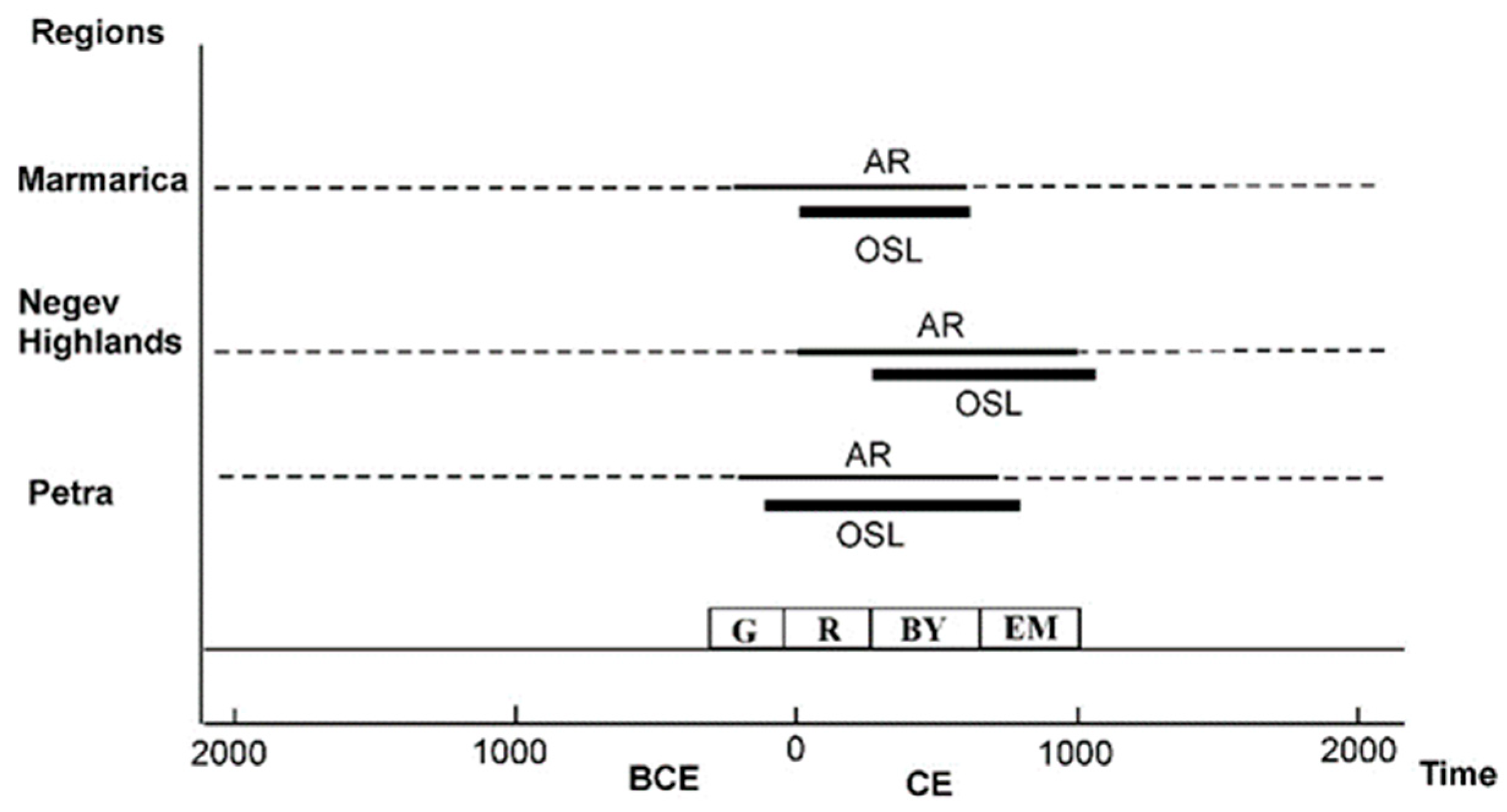
3.3. Radiometric Dating of Terraces: The OSL Dating Method
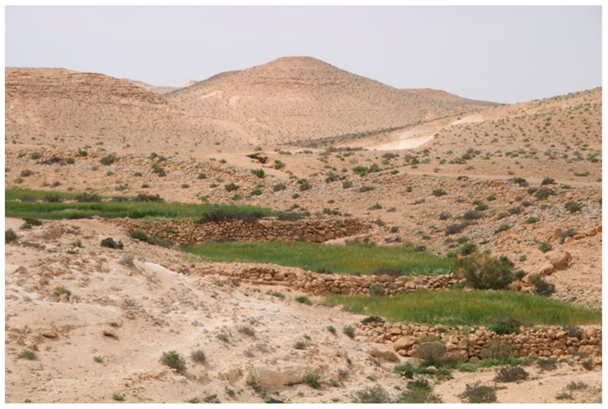
3.4. Time of Construction and Abandonment of Terrace Farming across the Southern Levant
3.4.1. Negev Highlands
3.4.2. Marmarica
3.4.3. Petra Region
3.5. Present Practice of Terrace Farming
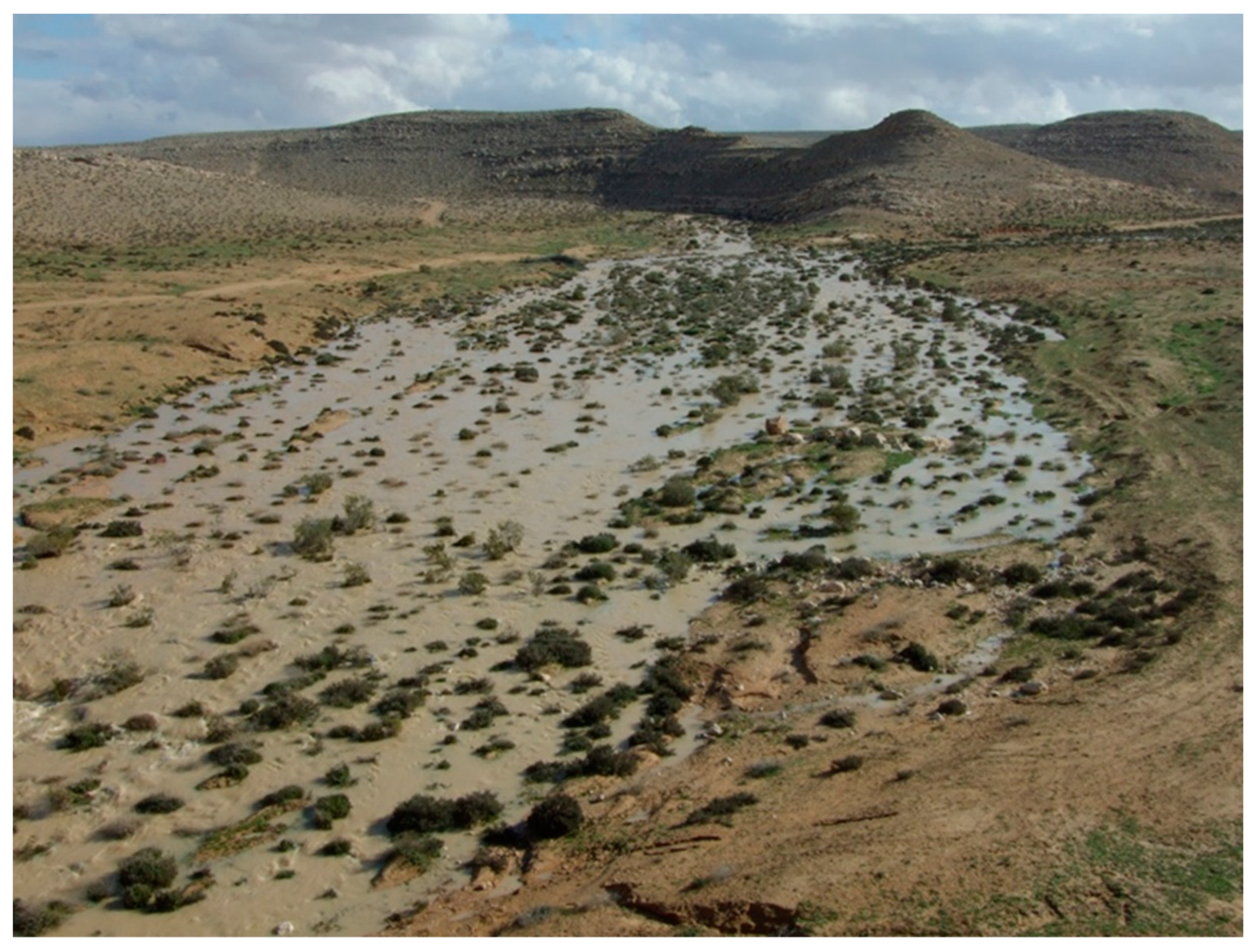
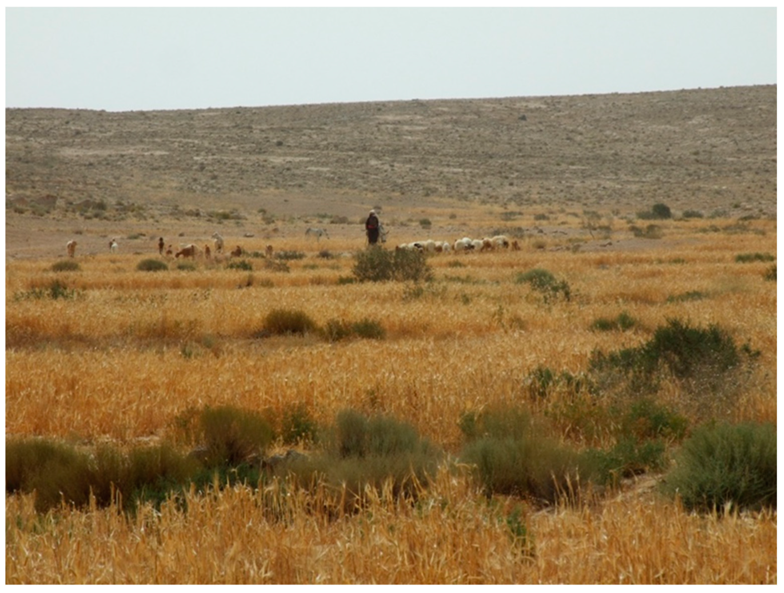
3.5.1. Terrace Farming in the Negev Highlands
The Southern Boundary of Terrace Farming in the Negev Highlands—The Experimental Site near Mizpe Ramon
3.5.2. Marmarica
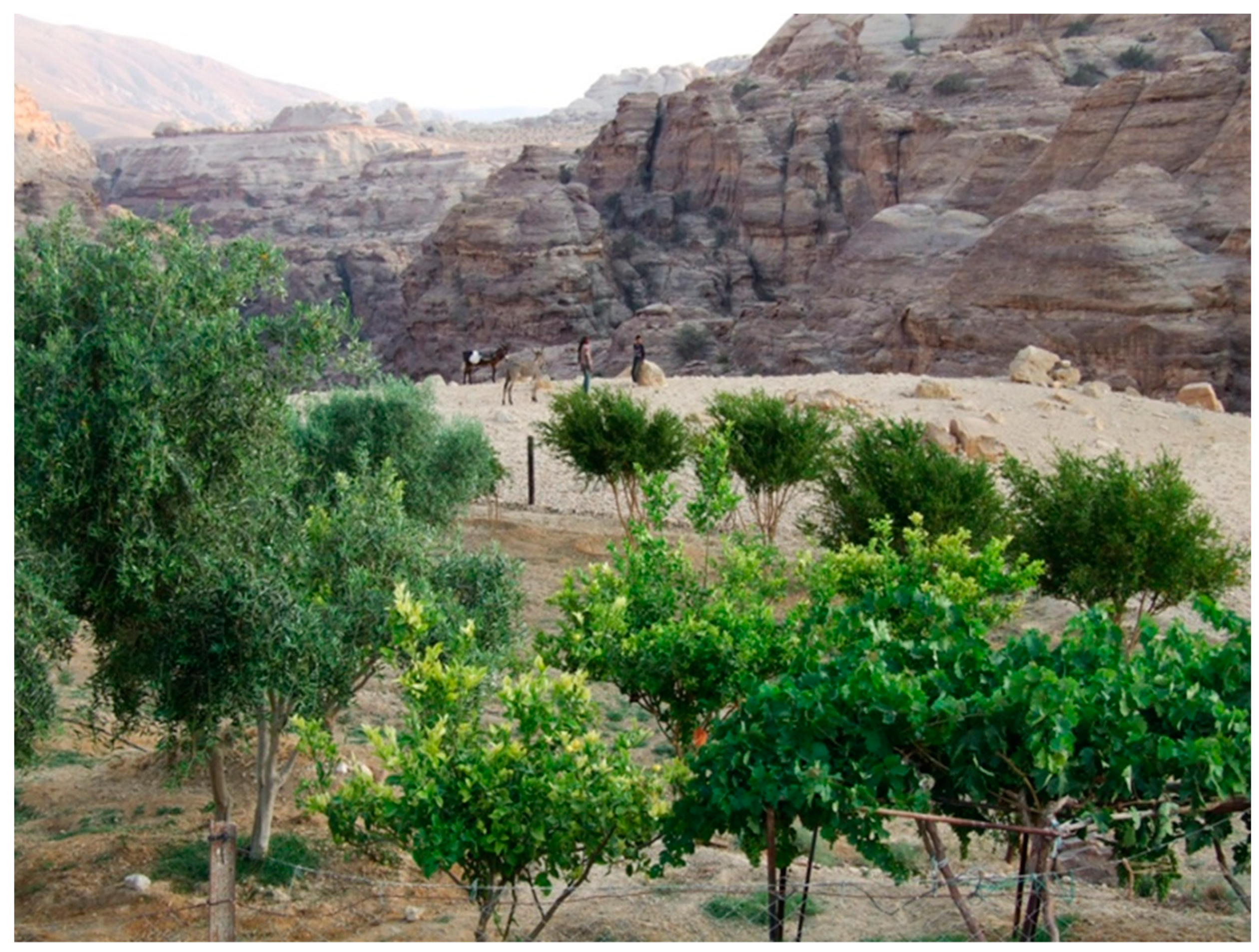
3.5.3. Petra Region
4. Discussion
4.1. Local Environmental Conditions Enabling Terrace Farming in the Arid Southern Levant
4.2. The Establishment of Terrace Farming in the Arid Southern Levant
4.3. Political and Economic Circumstances Promoting the Establishment of Arid Terrace Farming across the Southern Levant
General Remarks
4.4. Long-Term Function of Farming Installations: Terrace Farming as an Indication of Near-Stable Climate Conditions in the Levant during the Last Two Millennia
4.5. Future Implications of Arid Zone Terrace Farming in a Warming World
5. Conclusions
Funding
Institutional Review Board Statement
Informed Consent Statement
Data Availability Statement
Acknowledgments
Conflicts of Interest
References
- Evenari, M.; Shanan, L.; Tadmor, N.H. The Negev: The Challenge of a Desert; Harvard University Press: Cambridge, MA, USA, 1982; 456p. [Google Scholar]
- Barker, G.W.W.; Gilbertson, D.D.; Jones, B.; Mattingly, D. Farming the Desert. The UNESCO Libyan Valleys Archaeological Survey; UNESCO: Paris, French; Department of Antiquities: Tripoli, Libya; Society for Libyan Studies: London, UK, 1996; 404p. [Google Scholar]
- Spencer, J.E.; Hale, G.A. Origin, nature and distribution of agricultural terracing. Pac. Viewp. 1961, 2, 1–40. [Google Scholar] [CrossRef]
- Tarolli, P.; Preti, F.; Romano, N. Terraced landscapes: From an old best practice to a potential hazard for soil degradation due to land abandonment. Anthropocene 2014, 6, 10–25. [Google Scholar] [CrossRef]
- Tarolli, P. Agricultural Terraces Special Issue Preface. Land Degrad. Dev. 2018, 29, 3544–3548. [Google Scholar] [CrossRef]
- Dan, J.; Yaalon, D.H.; Moshe, R.; Nissim, S. Evolution of Reg soils in southern Israel and Sinai. Geoderma 1982, 28, 173–202. [Google Scholar] [CrossRef]
- Crouvi, O.; Amit, R.; Enzel, Y.; Porat, N.; Sandler, A. Sand dunes as a major proximal dust source for late Pleistocene loess in the Negev Desert, Israel. Quat. Res. 2008, 70, 275–282. [Google Scholar] [CrossRef]
- Crouvi, O.; Amit, R.; Porat, N.; Gillespie, A.R.; McDonald, E.V.; Enzel, Y. Significance of primary hill top loess in reconstructing dust chronology, accretion rates, and sources: An example from the Negev Desert, Israel. J. Geophys. Res. –Earth Surf. 2009, 114, F02017. [Google Scholar] [CrossRef]
- Yaalon, D.H.; Dan, J. Accumulation and distribution of loess-derived deposits in the semidesert and desert fringe areas of Israel. Z. Fur Geomorphol. Suppl. 1974, 20, 91–105. [Google Scholar]
- Yair, A. Hillslope hydrology water harvesting and areal distribution of some ancient agricultural systems in the northern Negev desert. J. Arid Environ. 1983, 6, 283–301. [Google Scholar] [CrossRef]
- McLarena, S.J.; Gilbertsonb, D.D.; Grattanc, J.P.; Huntd, C.O.; Duller, G.A.T.; Barker, G.A. Quaternary palaeogeomorphologic evolution of the Wadi Faynan area, Southern Jordan. Paleogeography Paleoclimatology Paleoecol. 2004, 205, 131–154. [Google Scholar] [CrossRef]
- Avni, Y.; Porat, N.; Plakht, J.; Avni, G. Geomorphologic changes leading to natural desertification processes versus anthropogenic land conservation in an arid environment, the Negev Highlands, Israel. Geomorphology 2006, 82, 177–200. [Google Scholar] [CrossRef]
- Bertrams, M.; Protze, J.; Löhrer, R.; Schyle, D.; Richter, J.; Hilgers, A.; Klasen, N.; Schmidt, C.; Lehmkuhl, F. Multiple environmental change at the time of the Modern Human passage through the Middle East: First results from geoarcheological investigations on Upper Pleistocene sediments in the Wadi Sabra (Jordan). Quat. Int. 2012, 274, 55–72. [Google Scholar] [CrossRef]
- Faershtein, G.; Porat, N.; Avni, Y.; Matmon, A. Aggradation-incision transition in arid environments at the end of the Pleistocene: An example from the Negev Highlands. southern Israel. Geomorphology 2016, 253, 289–304. [Google Scholar] [CrossRef]
- Avni, Y. Gully incision as a key factor in desertification in an arid environment, the Negev highlands, Israel. CATENA 2005, 63, 185–220. [Google Scholar] [CrossRef]
- Aharoni, Y.; Even-Ari, M.; Shenan, L.; Tadmor, N. The Ancient Desert Agriculture of the Negev V: An Israelite Agricultural Settlement at Ramat Matred. Isr. Explor. J. 1960, 10, 97–111. [Google Scholar]
- Haiman, M. The 10th Century B.C. Settlement of the Negev Highlands and Iron Age Rural Palestine. In The Rural Landscapes of Ancient Israel; BAR International Series 1121; Maeir, A., Dar, S., Safrai, Z., Eds.; Archaeopress: Oxford, UK, 2003; pp. 71–81. [Google Scholar]
- Shahack-Gross, R.; Finkelstein, I. Subsistence Practices in an Arid Environment: A Geoarchaeological Investigation in an Iron Age Site, the Negev Highlands, Israel. J. Archaeol. Sci. 2007, 20, 1–18. [Google Scholar] [CrossRef]
- Shahack-Gross, R.; Finkelstein, I. Settlement Oscillations in the Negev Highlands Revisited: The Impact of Microarchaeological Methods. Radiocarbon 2015, 57, 253–264. [Google Scholar] [CrossRef]
- Barker, G.W.; Creighton, O.H.; Gilbertson, D.D.; Hunt, C.O.; Mattingly, D.J.; McLaren, S.J.; Thomas, D.C.; Morgan, G.C. The Wadi Faynan Project, southern Jordan: A preliminary report on geomorphology and landscape archaeology. Levant 1997, 29, 19–40. [Google Scholar] [CrossRef][Green Version]
- Barker, G. The desert and the sown: Nomad-farmer interactions in the Wadi Faynan, southern Jordan. J. Arid Environ. 2012, 86, 82–96. [Google Scholar] [CrossRef]
- Vetter, T.; Rieger, A.-K.; Klammer, O.; Fuchs, M.; Nicolay, A. Ancient rainwater harvesting systems in the northeastern Marmarica (northwestern Egypt). Libyan Stud. 2009, 40, 9–23. [Google Scholar] [CrossRef]
- Vetter, T.; Rieger, A.K. Water harvesting as a key for understanding adapted ancient livelihoods in an arid environment—Approaches to dryland archaeology in the Eastern Marmarica (NW-Egypt). J. Arid Environ. 2019, 171, 103940. [Google Scholar] [CrossRef]
- Kedar, Y. Water and soil from the Negev. Some ancient achievements in the central Negev. Geogr. J. 1957, 123, 179–187. [Google Scholar] [CrossRef]
- Kouki, P. Archaeological evidence of land Tenure in the Petra region, Jordan: Nabataean-Early Roman to Late Byzantine. J. Mediterr. Archaeol. 2009, 22, 29–56. [Google Scholar] [CrossRef]
- Lavento, M. Archaeological investigations of ancient water systems in Jordan. In Transference; Interdisciplinary Communications 2008/2009; Ostreng, W., Ed.; CAS: Oslo, Norway, 2010. [Google Scholar]
- Beckers, B.; Schütt, B.; Tsukamoto, S.; Frechen, M. Age determination of Petra’s engineered landscape—Optically stimulated luminescence (OSL) and radiocarbon ages of runoff terrace systems in the Eastern Highlands of Jordan. J. Archaeol. Sci. 2013, 40, 333–348. [Google Scholar] [CrossRef]
- Vetter, T.; Rieger, A.K.; Nicolay, A. Disconnected runoff contributing areas: Evidence provided by ancient watershed management systems in arid northeastern Marmarica (NW-Egypt). Geomorphology 2014, 212, 41–57. [Google Scholar] [CrossRef]
- Robinson, E.; Smith, E. Biblical Studies in Palestine, Mount Sinai and Arabia Petraea; Murray: London, UK, 1841. [Google Scholar]
- Palmer, E.H. The Desert of Exodus; Deighton, Bell: Cambridge, UK, 1871. [Google Scholar]
- Woolley, C.L.; Lawrence, T.E. The Wilderness of Zin; Palestine Exploration Fund: London, UK, 1914–1915. [Google Scholar]
- Mayerson, P. The Ancient Agricultural Regime of Nessana and the Central Negev; British School of Archaeology in Jerusalem: London, UK, 1960. [Google Scholar]
- Negev, A. Nabatean Archaeology Today; New York University Press: New York, NY, USA, 1986. [Google Scholar]
- Rubin, R. The Negev as Settled Land: Urbanisation and Settlement in the Desert in the Byzantine Period; Yad Ben Zvi: Jerusalem, Israel, 1990. (In Hebrew) [Google Scholar]
- Haiman, M. Archaeological Survey of Israel: Map of Har Hamran–Southwest (198); Archaeological Survey of Israel: Jerusalem, Israel, 1986. [Google Scholar]
- Haiman, M. Archaeological Survey of Israel: Map of Mizpeh Ramon Southwest (200); Israel Antiquities Authority: Jerusalem, Israel, 1991.
- Haiman, M. Archaeological Survey of Israel: Map of Har Hamran–Southeast (199); Israel Antiquities Authority: Jerusalem, Israel, 1993.
- Haiman, M. Archaeological Survey of Israel: Map of Har Ramon (203); Israel Antiquities Authority: Jerusalem, Israel, 1999.
- Lender, Y. Map of Har Nafha (196); Israel Antiquities Authority: Jerusalem, Israel, 1990.
- Avni, G. Map of Har Saggi Northeast (225); Israel Antiquities Authority: Jerusalem, Israel, 1992.
- Avni, G. Nomads, Farmers and Town-Dwellers: Pastoralist-Sedentist Interaction in the Negev Highlands, Sixth–Eighth Centuries CE; Israel Antiquities Authority: Jerusalem, Israel, 1996.
- Baumgarten, Y. Archaeological Survey of Israel: Map of Shivta (166); Israel Antiquities Authority: Jerusalem, Israel, 2004.
- Bruins, H. Desert Environment and Agriculture in the Central Negev and Kadesh Barnea During Historical Times; Midbar Foundation: Nijkerk, The Netherlands, 1986. [Google Scholar]
- Tsafrir, Y. Some Notes on the Settlement and Demography of Palestine in the Byzantine Period: The Archaeological Evidence. In Retrieving the Past: Essays on Archaeological Research and Methodology in Honor of Gus W. Van Beek; Seger, J.D., Ed.; Eisenbrauns: Winonna Lake, IN, USA, 1996; pp. 269–283. [Google Scholar]
- Vetter, T.; Mortada, W. The Agricultural Soil Information System of LUPEM; Reports of the Marsa Matrouh Project: Marsa Matrouh, Egypt, 1994; 24p. [Google Scholar]
- Byrd, B.F. The Natufian Encampment at Beidha: Late Pleistocene Adaptation in the Southern Levant, Excavations at Beidha; Jysk arkæologisk selskab: Højbjerg, Danmark, 1989. [Google Scholar]
- Barker, G.; Hunt, C.; McLaren, S.; Reynolds, T.; el-Rishi, H.; Gilbertson, D.; Grattan, J. Early Holocene environments and early farming c.11,000–7000 cal. BP, c.9500–5000 cal. BC. In Archaeology and Desertification: The Wadi Faynan Landscape Survey, Southern Jordan; Barker, G., Gilbertson, D., Mattingly, D., Eds.; Council for British Research in the Levant: London, UK, 2007; pp. 199–225. [Google Scholar]
- Schmid, S.G. The Hellenistic period and the Nabataeans. In Jordan: An Archaeological Reader; Adams, R., Ed.; Equinox Pub: Oakville, CT, USA, 2008. [Google Scholar]
- IPCC, Climate Change 2022—Impacts, Adaptation and Vulnerability. Summary for Policy-Makers; WMO: Geneva, Switzerland; UNEP: Nairobi, Kenya; Cambridge University Press: Cambridge, UK; New York, NY, USA. [CrossRef]
- Avni, G.; Porat, N.; Avni, Y. Byzantine–Early Islamic agricultural systems in the Negev Highlands: Stages of development as interpreted through OSL dating. J. Field Archaeol. 2013, 38, 329–343. [Google Scholar] [CrossRef]
- Avni, Y.; Porat, N.; Avni, G. A review of the rise and fall of ancient desert runoff agriculture in the Negev Highlands—A model for the southern Levant deserts. J. Arid Environ. 2019, 163, 127–137. [Google Scholar] [CrossRef]
- Survey of Palestine 1:100,000. Available online: https://catalogue.nla.gov.au/Record/5009161 (accessed on 23 August 2022).
- Sneh, A.; Bartov, Y.; Weissbrod, T.; Rosensaft, M. Israel’s 1:200,000 Geological Map. Available online: https://www.gov.il/en/departments/general/israel-map-1-200k (accessed on 23 August 2022).
- Geological Map of Egypt, 1: 2,000,000; Egyptian Geological Survey and Mining Authority: Alexandria, Egypt, 1981.
- Bender, F. Geology of Jordan. Gebruüder Borntraeger: Berlin, Germany, 1974. [Google Scholar]
- Barjous, M.O. Supplement Text to the Geological Map Petra & Wadi Al-Lahyana. In Sheet: 3050I/3050IV, 1:50,000; Natural Resources Authority: Amman, Jordan, 1995. [Google Scholar]
- Said, R. (Ed.) The Geology of Egypt; Balkema: Rotterdam, The Netherlands, 1990; 734p. [Google Scholar]
- Sharon, D.; Kutiel, H. The distribution of rainfall intensity in Israel, its regional and seasonal variations and its climatological evaluation. J. Hydrol. 1986, 6, 277–291. [Google Scholar] [CrossRef]
- Avni, Y.; Porat, N.; Avni, G. Pre-farming environment and OSL chronology in the Negev Highlands, Israel. J. Arid Environ. 2012, 86, 12–27. [Google Scholar] [CrossRef]
- Wieler, N.; Avni, Y.; Rosenzaft, M. The significance of the geological section on desert runoff agriculture in southern Israel: Indications for stable desert environment over the last 1600 years. J. Arid Environ. 2016, 135, 147–163. [Google Scholar] [CrossRef]
- Bruins, H.J.; Ore, G. Runoff from loess or bedrock? Hillslope geoarchaeology of ancient runoff farming systems at Horvat Haluqim and Har Eldad in the central Negev Desert. Isr. J. Earth Sci. 2009, 57, 231–247. [Google Scholar] [CrossRef]
- Vaiglova, P.; Hartman, G.; Marom, N.; Ayalon, A.; Bar-Matthews, M.; Zilberman, T.; Yasur, G.; Buckley, M.; Bernstein, R.; Tepper, Y.; et al. Climate stability and societal decline on the margins of the Byzantine empire in the Negev Desert. Sci. Rep. 2020, 10, 1512. [Google Scholar] [CrossRef] [PubMed]
- Al-Weshah, R.A.; El-Khoury, F. Flood analysis and mitigation for Petra area in Jordan. J. Water Resour. Plan. Manag. 1999, 125, 170–177. [Google Scholar] [CrossRef][Green Version]
- Rambeau, C.; Finlayson, B.; Smith, S.; Black, S.; Inglis, R.; Robinson, S. Palae-oenvironmental reconstruction at Beidha, southern Jordan (c. 1800–8500 BP): Implications for human occupation during the Natufian and prepottery Neolothic. In Water, Life & Civilisation: Climate, Environment, and Society in the Jordan Valley; International Hydrology Series; Mithen, S.J., Black, E., Eds.; Cambridge University Press: Cambridge, UK; New York, NY, USA, 2011. [Google Scholar]
- Amireh, B.S. New occurrences of the Disi sandstone Formation (Early Ordovician) in Central Jordan. Diraset 1993, 20(B 3), 21–44. [Google Scholar]
- Ashkenazi, E.; Avni, Y.; Avni, G. A comprehensive characterization of ancient desert agricultural systems in the Negev Highlands of Israel. J. Arid Environ. 2012, 86, 55–64. [Google Scholar] [CrossRef]
- Aitken, M.J. An Introduction to Optical Dating; Oxford University Press: Oxford, UK, 1998. [Google Scholar]
- Wintle, A.G. Luminescence Dating: Where It Has Been and Where It Is Going. Boreas 2008, 37, 471–482. [Google Scholar] [CrossRef]
- Tepper, Y.; Porat, N.; Bar-Oz, G. Sustainable farming in the Roman-Byzantine period: Dating an advanced agriculture system near the site of Shivta, Negev Desert, Israel. J. Arid Environ. 2020, 177, 104134. [Google Scholar] [CrossRef]
- Rieger, A.-K.; Möller, H. Kilns, Commodities and Consumers—Greco-Roman Pottery Production in Eastern Marmarica (Northwestern Egypt). Archäologischer Anz. 2011, 1, 141–170. [Google Scholar]
- Meraiot, A.; Avinoam Meir, A.; Steve Rosen, S. Scale, landscape and indigenous Bedouin land use: Spatial order and agricultural sedentarisation in the Negev Highlands. Nomadic Peoples 2021, 25, 4–35. [Google Scholar] [CrossRef]
- Ashkenazi, E.; Chen, Y.; Avni, Y.; Lavee, S. Fruit trees survival ability in an arid desert environment without irrigation in the Negev-Highlands of Southern Israel. Isr. J. Plant Sci. 2014, 62, 5–16. [Google Scholar] [CrossRef]
- Lucke, B.; Roskin, J.; Vanselow, K.A.; Bruins, H.J.; Abu-Jaber, N.; Deckers, K.; Lindauer, S.; Porat, N.; Reimer, P.J.; Bäumler, R.; et al. Character, Rates, and Environmental Significance of Holocene Dust Accumulation in Archaeological Hilltop Ruins in the Southern Levant. Geosciences 2019, 9, 190. [Google Scholar] [CrossRef]
- Kahana, R.; Ziv, B.; Enzel, Y.; Dayan, U. Synoptic climatology of major floods in the Negev Desert, Israel. Int. J. Climatol. 2002, 22, 867–882. [Google Scholar] [CrossRef]
- Gibson, S.; Ibbs, B.; Kloner, A. The Sataf Project of Landscape Archaeology in the Judaean Hills: A Preliminary Report on Four Seasons of Survey and Excavation (1987–89). Levant 1991, 23, 29–54. [Google Scholar] [CrossRef]
- Gibson, S. Agricultural Terraces and Settlement Expansion in the Highlands of Early Iron Age Palestine: Is There a Correlation Between the Two? In Studies in the Archaeology of the Iron Age in Israel and Jordan; Journal for the Study of the Old Testament Supplementary Series 331; Mazar, A., Ed.; Sheffield University Press: Sheffield, UK, 2001; pp. 113–146. [Google Scholar]
- Paz, Y.; Ackermann, O.; Avni, Y.; Ben-Hur, M.; Birkenfeld, M.; Langgut, D.; Sivan-Mizrahi, A.; Weiss, E.; Porat, N. An early bronze age fertilized agricultural plot discovered near Tel Yarmouth, Ramat Bet Shemesh, Israel. J. Archaeol. Sci. Rep. 2017, 15, 226–234. [Google Scholar] [CrossRef]
- Finkelstein, I. The Archaeology of the Israelite Settlements; Israel Exploration Society: Jerusalem, Israel, 1988; 380p. [Google Scholar]
- Finkelstein, I.; Gophna, R. Settlement, demographic, and economic patterns in the highlands of Palestine in the Chalcolithic and Early Bronze periods and the beginning of urbanism. Bull. Am. Sch. Orient. Res. 1993, 289, 107–144. [Google Scholar] [CrossRef]
- Turner, S.; Kinnaird, T.; Varinlioğlu, G.; Şerifoğlu, T.; Koparal, E.; Demirciler, V.; Athanasoulis, D.; Ødegård, K.; Crow, J.; Jackson, M.; et al. Agricultural terraces in the Mediterranean: Medieval intensification revealed by OSL profiling and dating. Antiquity 2021, 95, 773–790. [Google Scholar] [CrossRef]
- Rosen, S.A. An Investigation into Early Desert Pastoralism: Excavations at the Camel Site, Negev; Cotsen Institute of Archaeology, UCLA: Los Angeles, CA, USA, 2011. [Google Scholar]
- Riger, A.K. ‘Un-Central’ Landscapes of NE-Africa and W-Asia—Landscape Archaeology as a Tool for Socio-Economic History in Arid Landscapes. Land 2019, 8, 1. [Google Scholar] [CrossRef]
- Issar, A.; Zohar, M. Climate Change-Environment and Civilization in the Middle East: Environment and Civilization in the Middle East; Springer Science & Business Media: Berlin/Heidelberg, Germany, 2004. [Google Scholar]
- Issar, A.; Zohar, M. Facing Global Environmental Change. Climate Change Impacts on the Environment and Civilization in the Near East; Springer: Berlin/Heidelberg, Germany, 2009. [Google Scholar]
- Londoño, A.C. Pattern and rate of erosion inferred from Inca agricultural terraces in arid southern Peru. Geomorphology 2008, 99, 13–25. [Google Scholar] [CrossRef]
- Londoño, A.C.; Williams, P.R.; Hart, M.L. A Change in Landscape: Lessons Learned from Abandonment of Ancient Wari Agricultural Terraces in Southern Peru. J. Environ. Manag. 2017, 202, 532–542. [Google Scholar] [CrossRef] [PubMed]
- Sandor, J.A.; Gersper, P.L.; Hawley, J.W. Prehistoric agricultural terraces and soils in the Mimbres area, New Mexico. World Archaeol. 1990, 22, 70–86. [Google Scholar] [CrossRef]


| Site Name | Geographic Position | Distance from the Mediterranean Sea | Elevation | Geological Composition | Precipitation | Main Archaeological Periods of Terrace Farming | OSL Age of Agricultural Soil | Present Operation of Terrace Farming |
|---|---|---|---|---|---|---|---|---|
| Marmarica | Northwestern Egypt | 0–30 km | 0–200 | Fossiliferous limestone of Miocene age | 150–100 mm | Greco-Roman 2nd century BCE–6th century CE | 0–500 CE | Yes |
| Negev Highlands | Southern Israel | 80–100 km | 300–1000 | Limestone, chalk, and chert, Late Cretaceous and Eocene | 150–80 mm | 1st–10th century CE | 200–1000 CE | Yes |
| Petra | Southern Jordan | 160 km | 900–1200 | Sandstone and limestone Paleozoic–Mesozoic | 200–180 mm | 2nd century BCE–8th century CE | 100 BCE–800 CE | Yes |
Publisher’s Note: MDPI stays neutral with regard to jurisdictional claims in published maps and institutional affiliations. |
© 2022 by the author. Licensee MDPI, Basel, Switzerland. This article is an open access article distributed under the terms and conditions of the Creative Commons Attribution (CC BY) license (https://creativecommons.org/licenses/by/4.0/).
Share and Cite
Avni, Y. The Emergence of Terrace Farming in the Arid Zone of the Levant—Past Perspectives and Future Implications. Land 2022, 11, 1798. https://doi.org/10.3390/land11101798
Avni Y. The Emergence of Terrace Farming in the Arid Zone of the Levant—Past Perspectives and Future Implications. Land. 2022; 11(10):1798. https://doi.org/10.3390/land11101798
Chicago/Turabian StyleAvni, Yoav. 2022. "The Emergence of Terrace Farming in the Arid Zone of the Levant—Past Perspectives and Future Implications" Land 11, no. 10: 1798. https://doi.org/10.3390/land11101798
APA StyleAvni, Y. (2022). The Emergence of Terrace Farming in the Arid Zone of the Levant—Past Perspectives and Future Implications. Land, 11(10), 1798. https://doi.org/10.3390/land11101798