Advances in the Coordination between the Cadastre and Land Registry


Abstract
1. Introduction
2. Cadastre and Land Registry in Spain
2.1. Cadastre in Spain
2.2. Land Registry and Notaries in Spain
2.3. Comparative Scheme Cadastre–Land Registry in Spain
3. Spanish Regulations on Map Coordination between the Cadastre and Land Registry
4. Study Made Prior to the Coordination from the Perspective of Various Specialised Authors
4.1. Methodology
- -
- Late 19th and early 20th century
- -
- Early 20th century up to Act 13/1996
- -
- Subsequent to Act 13/1996.
4.2. Analysis of the Information Gathered
5. Analysis of the Relation between Cadastre and Land Registry from the General Public Perspective
5.1. Methodology
5.2. Analysis of the Results of the Survey in the City of Gandia
- -
- People were asked which words they associated with the cadastre and land registry. Most of the words associated with the cadastre were related to property, tax, money, census, and cadastral values. The land registry was associated with documents, money, properties, and public registration. Some people confused the cadastre with the land registry.
- -
- Almost 60% of respondents said that the organisations do not work in coordination: on a scale of 1 to 10, some 56.5% of respondents selected the low level of 1 for coordination and said that the technical resources existed for a better coordination. Some 30.5% of the sample gave a score higher than 5 for coordination, and 12.5% believe that there was a certain level of coordination that could be improved for the benefit of the public.
- -
- Many of the procedures could be completed online through the SEC, but not everyone is able to use the internet for these procedures.
- -
- For a standard profile, the words associated with the cadastre were property tax, and the words associated with the land registry were property deeds or payment due. People reported that they had needed to visit the same office twice to complete a single procedure, and that when at the office, they needed to queue for between one and two hours. Once they had reached the head of the queue, they reported that the procedure was completed in a period of between 2 and 30 min. People considered that the quality of service was good.
5.3. Other Questionnaires
6. Analysis of the Solutions Proposed in Spain for the Problems of Coordination
6.1. Methodology
6.2. Results Analysis
- -
- Design of a good protocol for the provision of reciprocal information between both organisations and adaptation of operational techniques.
- -
7. Conclusions
Author Contributions
Funding
Institutional Review Board Statement
Informed Consent Statement
Data Availability Statement
Acknowledgments
Conflicts of Interest
References
- FAO; CFS. Voluntary Guidelines on the Responsible Governance of Tenure (VGGT); FAO: Rome, Italy, 2012; ISBN 9789251072776. [Google Scholar]
- United Nations. Transforming our World: The 2030 Agenda for Sustainable Development; United Nations: New York, NY, USA, 2015. [Google Scholar]
- Lübeck, D. Airborne Dual-band Radar for Cadastre. GIM Int. 2016, 30, 26–27. [Google Scholar]
- Dangermond, J. Secure land rights is the path to end global poverty. Available online: https://news.trust.org/item/20190403095129-em0c7 (accessed on 10 December 2020).
- Collier, P. Embedding the sustainability development goals in Survey Review ’s remit. Surv. Rev. 2020, 52, 287–288. [Google Scholar] [CrossRef]
- Kaufmann, J.; Steudler, D. Cadastre 2014: A vision for a future cadastral systems. In Proceedings of the FIG XXI International Congress, Brighton, UK, 19–25 July 1998; p. 44. [Google Scholar]
- Slack, K. Mapping the bigger picture: Using mapping to promote better development outcomes from extractive industries. Appl. Geogr. 2014, 54, 237–242. [Google Scholar] [CrossRef]
- World Bank Group. Lessons from Land Administration Projects: A Review of Project Performance Assessments; World Bank: Washington, DC, USA, 2016. [Google Scholar]
- Segura i Mas, A. El Catastro en Europa. In Inmaculada Canet Rives; Ministerio de Economía y Hacienda, Centro de Gestión Catastral y Cooperación Tributaria: Madrid, Spain, 1990. [Google Scholar]
- Durán Boo, I.; Velasco Martín-Vares, A. La relación entre el Catastro y el Registro de la Propiedad en los países de la Unión Europea. CT Catastro 2007, 61, 7–30. [Google Scholar]
- MOLA (Meeting of Officials on Land Administration). Land Administration Inventory in Europe; MOLA, 1997; Available online: https://unece.org/housing/working-party (accessed on 10 December 2020).
- United Nations Economic Commission for Europe. Survey on Land Administration Systems; United Nations Economic Commission for Europe: Geneva, Switzerland, 2014. [Google Scholar]
- Rajabifard, A.; Steudler, D.; Williamson, I.; Enemark, S. Cadastral Template 2.0. Available online: https://www.fig.net/organisation/comm/7/cadastraltemplate/index.htm (accessed on 10 December 2020).
- Rajabifard, A.; Williamson, I.; Steudler, D.; Binns, A.; King, M. Assessing the worldwide comparison of cadastral systems. Land Use Policy 2007, 24, 275–288. [Google Scholar] [CrossRef]
- Williamson, I.; Enemark, S.; Wallace, J.; Rajabifard, A. Land Administration for Sustainable Development; ESRI Press Academic: New York, NY, USA, 2010; ISBN 978-1-58948-041-4. [Google Scholar]
- OICRF International Office for Cadastre and Land Records. Available online: https://www.oicrf.org (accessed on 10 December 2020).
- Ho, S.; Pattyn, V.; Broucker, B.; Crompvoets, J. Needs assessment in land administration: The potential of the Nominal Group Technique. Land 2018, 7, 87. [Google Scholar] [CrossRef]
- Krigsholm, P.; Riekkinen, K. Applying text mining for identifying future signals of land administration. Land 2019, 8, 181. [Google Scholar] [CrossRef]
- Choi, H.O. An evolutionary approach to technology innovation of cadastre for smart land management policy. Land 2020, 9, 50. [Google Scholar] [CrossRef]
- González, L. Paraguay: Lecciones aprendidas de la Coordinación Catastro-Registro. In Proceedings of the Land and Poverty Conference 2019: Catalyzing Innovation. Red Interamericana de Catastro y Registro de la Propiedad, Washington, DC, USA, 25–29 March 2019. [Google Scholar]
- Schumacher, M.; Durán-Díaz, P.; Kurjenoja, A.K.; Gutiérrez-Juárez, E.; González-Rivas, D.A. Evolution and collapse of ejidos in Mexico-To what extent is communal land used for urban development? Land 2019, 8, 146. [Google Scholar] [CrossRef]
- CPCI Comité Permanente sobre el Catastro en Iberoamérica (CPCI). Available online: http://www.catastrolatino.org/ (accessed on 10 December 2020).
- Alvarez Morales, Y. Catastro y Registro en Cuba: ¿Integración o coordinación? In Proceedings of the I Jornada Internacional Sobre Fundamentos Teóricos y Prácticos de la Publicidad Registral, La Habana, Cuba, 22–26 April 2019. [Google Scholar]
- OAS Organization of American States (OAS). Available online: http://portal.oas.org/Portal/Sector/SAP/DepartamentoparalaGestiónPúblicaEfectiva/NPA/MuNetCatastro/OASCadastreProjects/tabid/1821/Default.aspx (accessed on 10 December 2020).
- PCC Permanent Committee on Cadastre in the European Union (PCC). Available online: http://www.eurocadastre.org/ (accessed on 10 December 2020).
- de los Reyes Sánchez Moreno, M. El “kadaster” holandés. El Notario del Siglo XXI 2012, 41. Available online: https://www.elnotario.es/index.php/hemeroteca/revista-41/555-el-kadaster-holandes-0-7001401667484456 (accessed on 10 December 2020).
- Molendijk, M.; Kadaster, P.B. Farst, affordable and good enough. New concepts in land administration. In Proceedings of the XI Simposio del Comité Permanente Sobre el Catastro en Iberoamérica, Cancún, Mexico, 5–7 September 2018. [Google Scholar]
- Raškovič, V.; Muchová, Z.; Petrovič, F. A new approach to the registration of buildings towards 3D land and property management in Slovakia. Sustainability 2019, 11, 4652. [Google Scholar] [CrossRef]
- Mika, M. Modernisation of the Cadastre in Poland as a tool to improve the land management and administration process. Surv. Rev. 2020, 52, 224–234. [Google Scholar] [CrossRef]
- de Vries, W.; Lewis, J. Are urban land tenure regulations in Namibia the solution or the problem? Land use policy 2009, 26, 1116–1127. [Google Scholar] [CrossRef]
- Todorovski, D.; Potel, J. Exploring the nexus between displacement and land administration: The case of Rwanda. Land 2019, 8, 55. [Google Scholar] [CrossRef]
- Abubakari, Z.; Richter, C.; Zevenbergen, J. Evaluating some major assumptions in land registration: Insights from Ghana’s context of land tenure and registration. Land 2020, 9, 281. [Google Scholar] [CrossRef]
- Aditya, T.; Maria-Unger, E.; vd Berg, C.; Bennett, R.; Saers, P.; Syahid, H.L.; Erwan, D.; Wits, T.; Widjajanti, N.; Santosa, P.B.; et al. Participatory land administration in Indonesia: Quality and usability assessment. Land 2020, 9, 79. [Google Scholar] [CrossRef]
- Chekole, S.D.; de Vries, W.T.; Shibeshi, G.B. An evaluation framework for urban cadastral system policy in Ethiopia. Land 2020, 9, 60. [Google Scholar] [CrossRef]
- CPCI Declaración del Catastro en Iberoamérica. In Proceedings of the IX Seminario sobre Catastro Inmobiliario, Cartagena de Indias, Colombia, 8–12 May 2006.
- IPRA-CINDER Conclusions: The collaboration between Cadasters and Land Registries. In Proceedings of the 21st IPRA-CINDER Congress, Cartagena de Indias, Colombia, 2–4 May 2018.
- Ley 13/2015, de 24 de junio, de Reforma de la Ley Hipotecaria aprobada por Decreto de 8 de febrero de 1946 y del texto refundido de la Ley de Catastro Inmobiliario, aprobado por Real Decreto Legislativo 1/2004, de 5 de marzo. Available online: https://www.boe.es/buscar/doc.php?id=BOE-A-2015-7046 (accessed on 11 December 2020).
- Seminario Presencial Sobre la Colaboración Interadministrativa como Base del Mantenimiento Catastral. Coordinación del Catastro y el Registro de la Propiedad; Agencia Española de Cooperación Internacional para el Desarrollo, AECID: La Antigua, Guatemala, 2018. [Google Scholar]
- Red Expertos Catastro. Ciclo Webinar: Coordinación Catastro y Registro de la Propiedad; Red Expertos Catastro: Madrid, Spain, 2019. [Google Scholar]
- INE España en cifras. Available online: https://www.ine.es/prodyser/espa_cifras/2018/ (accessed on 11 December 2020).
- International Monetary Fund (IMF) Report for Selected Country Groups and Subjects (PPP Valuation of Country GDP); IMF: Washington, DC, USA, 2019.
- Zevenbergen, J. What would title registration bring to a deed system with quality land information? In Proceedings of the Commission 7 2018 Annual Meeting and International Seminar, Bergen, Norway, 29 January 2018. [Google Scholar]
- Femenia-Ribera, C. Caso de Estudio en España. Ley 13/2015 Sobre Coordinación Catastro-Registro. In Proceedings of the FIG Commisision 7 and 9. Annual Conference and Meeting, Cartagena de Indias, Colombia, 4–8 December 2017. [Google Scholar]
- Rosabal Robaina, Y. El Registro de la Propiedad y el Catastro en Cuba. Rev. Crítica Derecho Inmob. 2016, 92, 2745–2758. [Google Scholar]
- DGC El Catastro en Cifras. Available online: http://www.catastro.meh.es/esp/catastroencifras.asp (accessed on 11 December 2020).
- Vandegraft, D.L. A cadastral geodatabase for the U.S. fish and wildlife service. Cartogr. Geogr. Inf. Sci. 2011, 38, 313–319. [Google Scholar] [CrossRef]
- Fernandez, R.; Olivares, J.M.; Sierra-Requena, R.; Alonso, J.; Irigoyen, C. Nuevo visualizador web de cartografía catastral (DGC) realizado con la librería openlayers. In Proceedings of the IX Jornadas de Ibéricas de Infraestructuras de Datos Espaciales, Menorca, Spain, 17–19 October 2018. [Google Scholar]
- Sengupta, A.; Lemmen, C.; Devos, W.; Bandyopadhyay, D.; van der Veen, A. Constructing a seamless digital cadastral database using colonial cadastral maps and VHR imagery—an Indian perspective. Surv. Rev. 2016, 48, 258–268. [Google Scholar] [CrossRef]
- Velasco Martín-Vares, A. Política y resultados del catastro abierto español. In Proceedings of the II Reunión y Conferencia de la Red Interamericana de Catastro y Registro de la Propiedad, Ciudad de Panamá, Panamá, 27–30 September 2016. [Google Scholar]
- Gragera Ibáñez, G. Las bases gráficas registrales: La historia de un proyecto por definir. AIRE 2011, 2013, 133–155. [Google Scholar]
- Velasco Martín-Vares, A. The “back office” of the Spanish cadastre that makes possible the interaction with partners. In Proceedings of the Conference of PCC, EuroGeographics-Cadastre and Land Registry KEN and EULIS, Bratislava, Slovakia, 17–18 November 2016. [Google Scholar]
- Ley 13/1996, de 30 de Diciembre, de Medidas Fiscales, Administrativas y del Orden Social. Available online: https://www.boe.es/buscar/doc.php?id=BOE-A-1996-29117 (accessed on 11 December 2020).
- Zevenbergen, J.; Ploeger, H. What Would Title Registration Bring to A Deeds System with High Quality Land Information? In Proceedings of the FIG Working Week 2019, Hanoi, Vietnam, 22–26 April 2019. [Google Scholar]
- Femenia-Ribera, C.; Mora-Navarro, G. La información geográfica en la aplicación de la Ley 13/2015: Representación Gráfica georreferenciada. Boletín del Col. Regist. España 2015, 24, 1043–1055. [Google Scholar]
- Resolución de 29 de octubre de 2015, de la Subsecretaría, por la que se publica la Resolución conjunta de la DGRN y de la DGC, por la que se regulan los requisitos técnicos para el intercambio de información entre Catastro y los Registros. Available online: https://www.boe.es/buscar/doc.php?id=BOE-A-2015-11655 (accessed on 11 December 2020).
- De la Fuente Sancho, A. Resumen Resolución suministro de información de Notarios al Catastro. Notarios y Regist. 2015. Available online: https://www.notariosyregistradores.com/web/secciones/oficina-notarial/varios/resumen-resolucion-suministro-de-informacion-de-notarios-al-catastro/ (accessed on 11 December 2020).
- Resolución de 7 de octubre de 2020, de la Subsecretaría, por la que se publica la Resolución Conjunta de la Dirección General de Seguridad Jurídica y Fe Pública y de la Dirección General del Catastro, por la que se Aprueban Especificaciones técnicas compl. Available online: https://www.boe.es/diario_boe/txt.php?id=BOE-A-2020-12111 (accessed on 11 December 2020).
- Alonso Peña, C. Productos y Servicios Sobre Estándares Internacionales (INSPIRE): Aceptación y Uso en el Tráfico Inmobiliario. In Proceedings of the III Conferencia y Asamblea de la Red Interamericana de Catastro y Registro de la Propiedad, Montevideo, Uruguay, 14–17 November 2017. [Google Scholar]
- Alonso Peña, C. The Spanish Cadastre and Property Rights Registry: A smart model of coordinated interaction. In Proceedings of the UNECE WPLA Workshop: State and Market: Cadastres and Property Rights Registries, The Need for Smart Interaction to Better Serve Citizens and Public Administrations, Madrid, Spain, 24–25 November 2016. [Google Scholar]
- Femenia-Ribera, C. Sistema de Administración Territorial en España para el Siglo XXI (SAT XXI). Análisis de Características físicas en el Registro de la Propiedad y su Coordinación con el Catastro en Zonas Rústicas de la Comunidad Valenciana. Ph.D. Thesis, Universidad Politècnica de Valencia, Valencia, Spain, 2002. [Google Scholar]
- Berné Valero, J.L.; Femenia-Ribera, C.; Benítez Aguado, E. Catastro en España; Universitat Politècnica de València: Valencia, Spain, 2008; ISBN 978-84-8363-242-0. [Google Scholar]
- Femenia-Ribera, C.; Berné Valero, J.L. Gestión de la Propiedad: Coordinación Registro de la Propiedad y Catastro. Estud. Geográficos 2003, LXIV, 579–604. [Google Scholar]
- Pro-Ruíz, J. Estado, Geometría y Propiedad: Los Orígenes del Catastro en España: 1715–1941; Centro de Gestión Catastral y Cooperación Tributaria: Madrid, Spain, 1992. [Google Scholar]
- Krigsholm, P.; Riekkinen, K.; Ståhle, P. The changing uses of cadastral information: A user-driven case study. Land 2018, 7, 83. [Google Scholar] [CrossRef]
- Navratil, G.; Andrew, U. Frank’s impact on research in land administration. Int. J. Geogr. Inf. Sci. 2018, 32, 2501–2513. [Google Scholar] [CrossRef]
- Carazony-Liceras, F. Coordinación Entre el Registro de la Propiedad y el Catastro; Asociación Nacional de Ingenieros Agrónomos: Madrid, Spain, 1943; p. 27. [Google Scholar]
- Mora, M. Identidad física y jurídica de la propiedad; plataforma del Estado de Derecho, la igualdad y la transparencia. In Proceedings of the Acto de Apertura Master Internacional en Catastro Multipropósito y Avalúos; y Master en Catastro, Urbanismo y Valoración, Jaén, Spain, 2018. [Google Scholar]
- Dale, P.F. Cadastres and Cadastral Maps. Cartogr. J. 2014, 14, 44–48. [Google Scholar] [CrossRef]
- La Realidad Catastral en España; Defensor del Pueblo: Madrid, Spain, 2012.
- Sanchis-Ibiza, A.-A. Análisis de la situación entre Catastro y Registro de la Propiedad Desde el Punto de Vista del Ciudadano; Universidad Politécnica de Valencia: Valencia, Spain, 2012. [Google Scholar]
- Pérez-Moreno, O. Análisis de la situación entre Catastro y Registro de la Propiedad Desde el Punto de Vista del Ciudadano; Universidad Politécnica de Valencia: Valencia, Spain, 2012. [Google Scholar]
- ETSIGCT. UPV Cadastre; Universitat Politècnica de València: Valencia, Spain, 2020. [Google Scholar]
- CORPME Estadística Registral Inmobiliaria. Anuario 2017; CORPME: Madrid, Spain, 2018. [Google Scholar]
- Rocamora Esquiva, J. Colegio Oficial de Ingeniería Geomática y Topográfica, COIGT. Delegación Alicante. Available online: https://www.coigt.com/ (accessed on 11 December 2020).
- RTVE Mi casa es ilegal 2014. Available online: http://www.rtve.es/alacarta/videos/comando-actualidad/comando-actualidad-casa-ilegal/2585113/ (accessed on 11 December 2020).
- Trystuła, A.; Dudzińska, M.; Źróbek, R. Evaluation of the completeness of spatial data infrastructure in the context of cadastral data sharing. Land 2020, 9, 272. [Google Scholar] [CrossRef]
- Lemmen, C.; Van Oosterom, P.; Kalantari, M.; Unger, E.-M.; De Zeeuw, C. OGC White Paper on Land Administration; Open Geospatial Consortium: Wayland, MA, USA, 2019. [Google Scholar]
- UNE-EN ISO 19152:2013 Información Geográfica. Modelo para el Ámbito de la Administración del Territorio (LADM) (ISO 19152:2012); ISO: Geneva, Switzerland, 2013. [Google Scholar]
- Real Decreto 195/2017, de 3 de marzo, por el que se modifica la demarcación de los Registros de la Propiedad, Mercantiles y de Bienes Muebles. Available online: https://www.boe.es/diario_boe/txt.php?id=BOE-A-2017-2307 (accessed on 11 December 2020).
- Fandos Pons, P.; Alonso Peña, C. The Spanish Cadastre and Property Rights: A smart model of coordinated interaction. In Proceedings of the Common Vision Conference 2016. Migration to a Smart World, Amsterdam, The Netherlands, 5–7 June 2016; pp. 1–18. [Google Scholar]
- Blanco-Urzáiz, J. The coordination between the Property Registry and the Cadastre in the aftermath of Law 13/2015 in Spain. In Proceedings of the UNECE WPLA Workshop: State and Market: Cadastres and Property Rights Registries. The Need for Smart Interaction to Better Serve Citizens and Public Administrations, Madrid, Spain, 24–25 November 2016. [Google Scholar]
- Fandos Pons, P. El Sistema de Información Geográfica Registral Español. In Proceedings of the III Conferencia y Asamblea de la Red Interamericana de Catastro y Registro de la Propiedad, Montevideo, Uruguay, 15–17 November 2017. [Google Scholar]
- Sierra-Requena, R.; Martinez-Llario, J.; Coll-Aliaga, E. Extracción de datos estadísticos espaciales con R a partir de información geográfica catastral. In Proceedings of the IX Jornadas Ibéricas de Infraestructuras de Datos Espaciales, Menorca, Spain, 17–19 October 2018; pp. 1–2. [Google Scholar]
- Steudler, D.; Comtesse, X. Beyond Dimensional Limits. GIM Int. 2015, 29, 20–23. [Google Scholar]
- Real Decreto 1464/2007, de 2 de noviembre, por el que se aprueban las normas técnicas de valoración catastral de los bienes inmuebles de características especiales. Available online: https://www.boe.es/buscar/doc.php?id=BOE-A-2007-19881 (accessed on 11 December 2020).
- Tomandl, L. Publicity—One of the Main Principles of the Czech Cadastre. In Proceedings of the FIG Commisision 7 and 9. Annual Conferencia ad Meeting, Cartagena de Indias, Colombia, 4–8 December 2017. [Google Scholar]
- Velasco Martín-Vares, A. Cadastral Regularization Plan 2013-2017. In Proceedings of the Conference and Plenary Meeting of the Permanent Committee on Cadastre in the E.U., Riga, Latvia, 12–13 May 2015. [Google Scholar]
- Velasco Martín-Vares, A. Spanish Cadastre: Collaborative maintenance and dissemination. In Proceedings of the Meeting of the Permanent Committee on Cadastre in the European Union, Rome, Italy, 20–21 November 2014. [Google Scholar]
- Velasco Martín-Vares, A. Smart Successful Cadastral New Tools for Real Estate Registration: “all in 16 digits”. In Proceedings of the Joint PCC & EULIS Conference—The Current Technological Trends in Land Registration, Vittoriosa, Malta, 16–17 June 2017. [Google Scholar]
- Velasco Martín-Vares, A.; Alonso Peña, C. Smart Cadastral Tools for Real Estate Registration. GIM Int. 2017, 31, 33–35. [Google Scholar]
- Regulatory framework IGN, Spain. Available online: http://www.ign.es/web/ign/portal/qsm-marco-normativo (accessed on 11 December 2020).
- Ureña-Cámara, M.A.; Nogueras-Iso, J.; Lacasta, J.; Ariza-López, F.J. A method for checking the quality of geographic metadata based on ISO 19157. Int. J. Geogr. Inf. Sci. 2019, 33, 1–27. [Google Scholar] [CrossRef]
- Harvey, F. The Power of Mapping: Considering Discrepancies of Polish Cadastral Mapping. Ann. Assoc. Am. Geogr. 2013, 103, 824–843. [Google Scholar] [CrossRef]
- Tong, X.; Liang, D.; Xu, G.; Zhang, S. Positional accuracy improvement: A comparative study in Shanghai, China. Int. J. Geogr. Inf. Sci. 2011, 25, 1147–1171. [Google Scholar] [CrossRef]
- Berk, S.; Ferlan, M. Accurate area determination in the cadaster: Case study of Slovenia. Cartogr. Geogr. Inf. Sci. 2018, 45, 1–17. [Google Scholar] [CrossRef]
- Puebla Blasco, J.; García Rodíguez, I.; Serrano Martínez, F. Fortalecimiento de la colaboración entre el Catastro y los Fedatarios públicos: El reto de la coordinación. CT Catastro 2018, 92, 77–103. [Google Scholar]
- El Catastro es Nuestro Amigo; Programa Fortalecimiento del Régimen Municipal y el Desarrollo Local: Tegucigalpa, Honduras, 2012.
- Zakout, W.; Wehrmann, B.; Törhönen, M.-P. Good Governance in Land Administration. Principles and Good Practices; World Bank: Washington, DC, USA, 2006. [Google Scholar]
- Bennett, R.; Rajabifard, A.; Williamson, I.; Wallace, J. On the need for national land administration infrastructures. Land Use Policy 2012, 29, 208–219. [Google Scholar] [CrossRef]
- UN-GGIM. United Nations Expert Group on Land Administration and Management. Available online: https://ggim.un.org/UN-EG-LAM/ (accessed on 20 November 2020).
- Svensson, A. Information quality—A critical success factor. Coordinates 2018, XIV. Available online: https://mycoordinates.org/information-quality-a-critical-success-factor/ (accessed on 20 November 2020).
- Muñoz, J. Land Administration at the World Bank: An Expanding Agenda. In Proceedings of the FIG Commisision 7 and 9. Annual Conferencia ad Meeting, Cartagena de Indias, Colombia, 12–16 June 2017. [Google Scholar]
- Bandeira, P.; Sumpsi, J.M.; Falconi, C. Evaluating land administration systems: A comparative method with an application to Peru and Honduras. Land use policy 2010, 27, 351–363. [Google Scholar] [CrossRef]


| Concept | Cadastre | Land Registry |
|---|---|---|
| Ministry | Tax | Justice |
| Supervisory organisation | General Directorate for Cadastre (DGC) | Spanish Land and Trade Registrars Association (CORPME) |
| Main objective | Tax (+ other purposes) | Legal (preventive legal security) |
| Role | Collect property tax | Register of rights |
| Type of management | State administration | Private management (land registrars are publicly appointed self-employed professionals) |
| Year of legislation originating current system | Cadastre Act 1906 (current legislation 2004) | Registration Act 1861 |
| Basic unit | Cadastral parcel | Land registry unit |
| Basic unit identifier | Cadastral reference (RC) | Unit registry number—IDUFIR Current: CRU (Unique Registration Code) |
| Registration | Obligatory | Voluntary except when a mortgage exists |
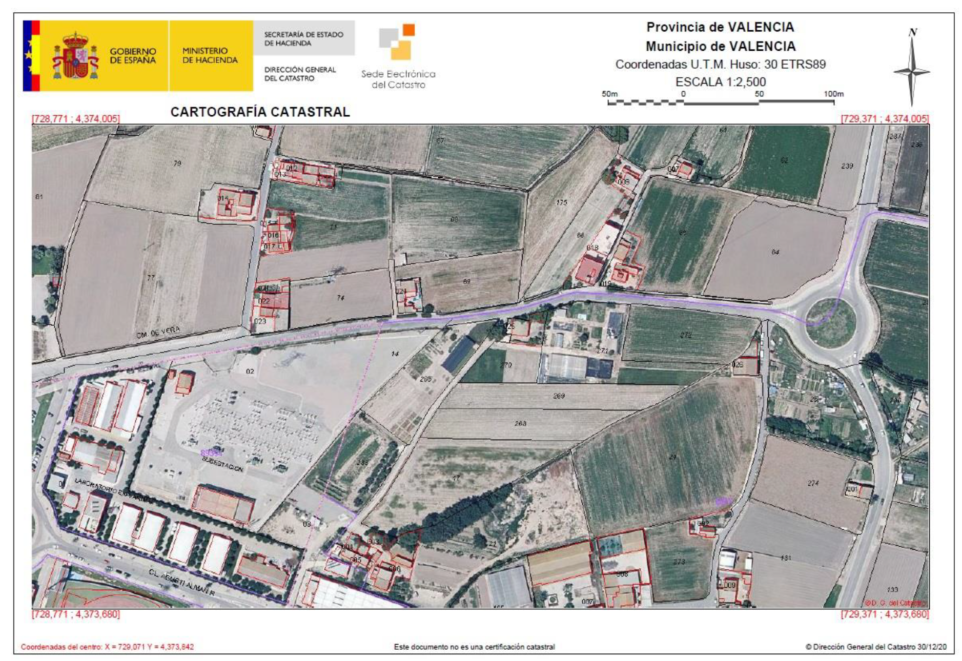
| Maps | From the beginning. Rural: 1/2000 and 1/5000 Urban: 1/500 and 1/1000 Various techniques | Mainly written descriptions. Cadastral maps have started to be included by some land registries since the 1990s |
| Territorial continuity | Continuous | Discontinuous |
| Organisation | DGC in almost all of Spain Rest: four independent regional systems (in provinces of Navarra, Vizcaya, Álava and Guipúzcoa) | 1058 land registries within geographical territories |
| Access and confidentiality | Data on ownership and tax value is confidential | Public data |
| Challenges to Be Overcome for Improving Cadastre–Land Registry Coordination | ||||
|---|---|---|---|---|
| Problem-Challenge | Aspect Analysed | Solved | Partly Solved | Unsolved |
| Creation of specific budgets. | X | ||
| X | |||
| Use of standards and technological advances to integrate territorial information from various sources. | X | ||
| Cadastre and land registry | ||||
| Under different ministries. | X | ||
| Specific legislation on coordination. | X | ||
| Introduction of connection element. | X | ||
| Effective normative attempts. Approval and majority support in parliament. | X | ||
| Current system and improvements. | X | ||
| Current system with improvements. | X | ||
| Joint meetings and events. | X | ||
| Cadastre is adapting so that its maps serve as a basis for legal security | X | ||
| Cadastre and IGN | ||||
| Shared initiatives. | X | ||
| Land registry | ||||
| Maps indicate land registry units. | X | ||
| X | |||
| Current system. | X | ||
| Cadastre | ||||
| Adaptation to new international initiatives. | X | ||
| Current system. | |||
| Greater metric precision demanded. | X | ||
| Initiatives planned to heighten public awareness. | X | ||
| Current situation. | X | ||
| Existence and classification of sources of surveying of cadastral maps. | X | ||
| Improvements in the quality of cadastral information. | X | ||
| Collaboration agreements for updates are being studied. | X | ||
| Efforts being made to reduce response times. | X | ||
| Study current control mechanisms. | X | ||
| Cadastral maps | ||||
| Specific legislation regarding mapping. | X | ||
| Study of related projects based on mapping techniques used, budget, and response time. | X | ||
| Historical study of the evolution of mapping in terms of quality improvements. | X | ||
| Considering as experts the analysed specialist authors and studying if the problems and solutions proposed have received consideration. | X | ||
| Who currently does cadastral mapping? | X | ||
| Alternatives Solutions for the Pending Challenges in Table 2 | |
|---|---|
| Challenges | Alternative Solutions |
| 1,2. | Although cadastral maps are complete, budgets are needed to improve procedures, computer applications, and the metric quality. A budget of €4,530,000 was included in 2018 to improve the positional accuracy of urban cadastral mapping using orthophotos. This is considered insufficient. |
| 3. | International standards and new technologies enable the integration of territorial information from various sources. The Spanish Spatial Data Infrastructure (IDEE) is managed by the IGN. Adaptation to European INSPIRE Directive [76]. Following Act 13/2015, the standard GML format adapted to the INSPIRE regulations is being used. Applications continue to be developed to integrate territorial information with international standards. At the international level, there is an ISO 19152 standard on the Land Administration Domain Model for integrating information, and actions are needed for the design and development of implementation standards in this domain [77]. Not currently used in Spain, although it is being studied, and a first step was the participation of DGC staff in the Spanish translation of the ISO standard [78]. |
| Cadastre and land registry | |
| 4. | Continue in different ministries. Proposed solution: the maximum possible coordination is sought with information exchange agreements. |
| 5. | Existing specific legislation: first step taken with Act 13/1996 and then with Act 13/2015. |
| 6. | Since Act 13/1996, the 20-digit cadastral reference is unique for each cadastral parcel. |
| 7. | The effectiveness of Act 13/1996 depends on the land registries—and the act is generally complied with—although not uniformly. Act 13/2015 was widely supported in parliament, which implies that a change of government will not mean its repeal. Compliance between notaries and registrars, and its application in the cadastre, is still being studied. Its final implementation has not yet happened, and the coordinated cadastral parcel–land registry units that show changes in the cadastral maps are still in test phase. The managers responsible for these issues at DGC and CORPME have changed posts several times in recent years, and this has slowed communication. Proposed solution: effective communication between the organisations so that agreements can be reached. |
| 8. | There are different ways to register and identify alterations such as aggregations and groupings of units between the two registries Proposed solution: the legislation for registering units between two registries has been modified [79] so that an entry is made in just one land registry in a similar way to cadastral parcels in the cadastre. |
| 9. | There are still two different basic units. Proposed solution: Since Act 13/2015, the land registry has also changed its own identifier (registration number or IDUFIR), and it is now unique throughout Spain and known as the Unique Registration Code (CRU). |
| 10. | In recent years, there has been a rapprochement between both organisations, and they now participate jointly in many forums and events, as well as jointly presenting the theme of coordination in international forums [58,80,81,82]. Such cooperation did not occur in previous decades. |
| 11. | Although the ultimate purpose of each organisation remains the same, there are continuous improvements in the cadastre that serve many other uses and purposes. The cadastre is adapting to greater demands so that its maps serve as a basis to provide legal security in the demarcation of property of land registry units (challenges 1 and 2). |
| Cadastre and IGN | |
| 12. | Coordination in mapping subjects is led by the IGN through the Spanish Spatial Data Infrastructure (IDEE) and in the technical working groups on the LISIGE-INSPIRE regulations. The cadastral parcel group is led by a representative of the DGC. There is also representation of the DGC in Eurogeographics. |
| Land registry | |
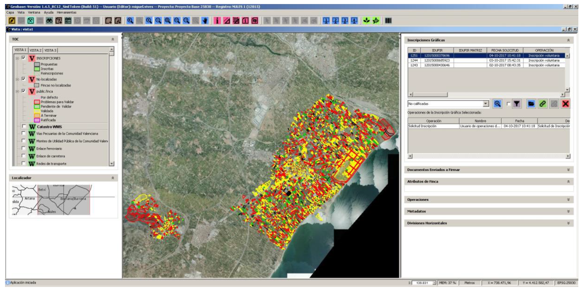
| 13,14. | Cadastral maps have been used as an auxiliary graphical base by the land registry since the end of the 1990s (Geobase Project), and these maps were recognised as the official map reference following Act 13/2015. Map referencing is not mandatory in all cases, and purely written descriptions are still allowed. Proposed solution: there is the possibility of voluntary mapped registration of the land registry units in the land registry in cases of non-compliance. |
| 15. | Continued voluntary registration in the land registry, except in cases of mortgages where registration is mandatory. Registration involves a cost that the state does not wish to force people to pay. Proposed solution: The possibility of mandatory registration in areas of public domain is being studied. |
| Cadastre | |
| 16. | Continuous maps of all Spain are now freely available in digital format through the SEC. Maps adapted to international standards and standard formats (such as INSPIRE and GML) are available using open source collaborative environments [83] (challenge 3). The cadastre and the land registry already have uniform resource identifiers (URI) [84], which are known as CSV [59], to identify documents that can be accessed online. |
| 17. | See challenge 11. |
| 18. | See challenge 11. There are two descriptions in the cadastre (one written and the other mapped) with a tolerance level of up to 10% [85], and Act 13/2015 stated that a mapped description is the only description that can be registered in the land registry. The positional accuracy of the cadastral maps is to be improved (challenges 1 and 2). |
| 19. | Citizens continue to have their own interpretation of the role of the cadastre, depending on their country of origin. Spaniards see the cadastre as closely linked to collecting taxes, and so the DGC is not generally popular. No citizen awareness campaign has been carried out by the cadastre or the administration, although there are initiatives led by organisations such as CORPME or the Spanish Official Corporation of Engineering in Geomatics and Land Surveying (COIGT) to make Act 13/2015 better known for its usefulness in preventive legal security. |
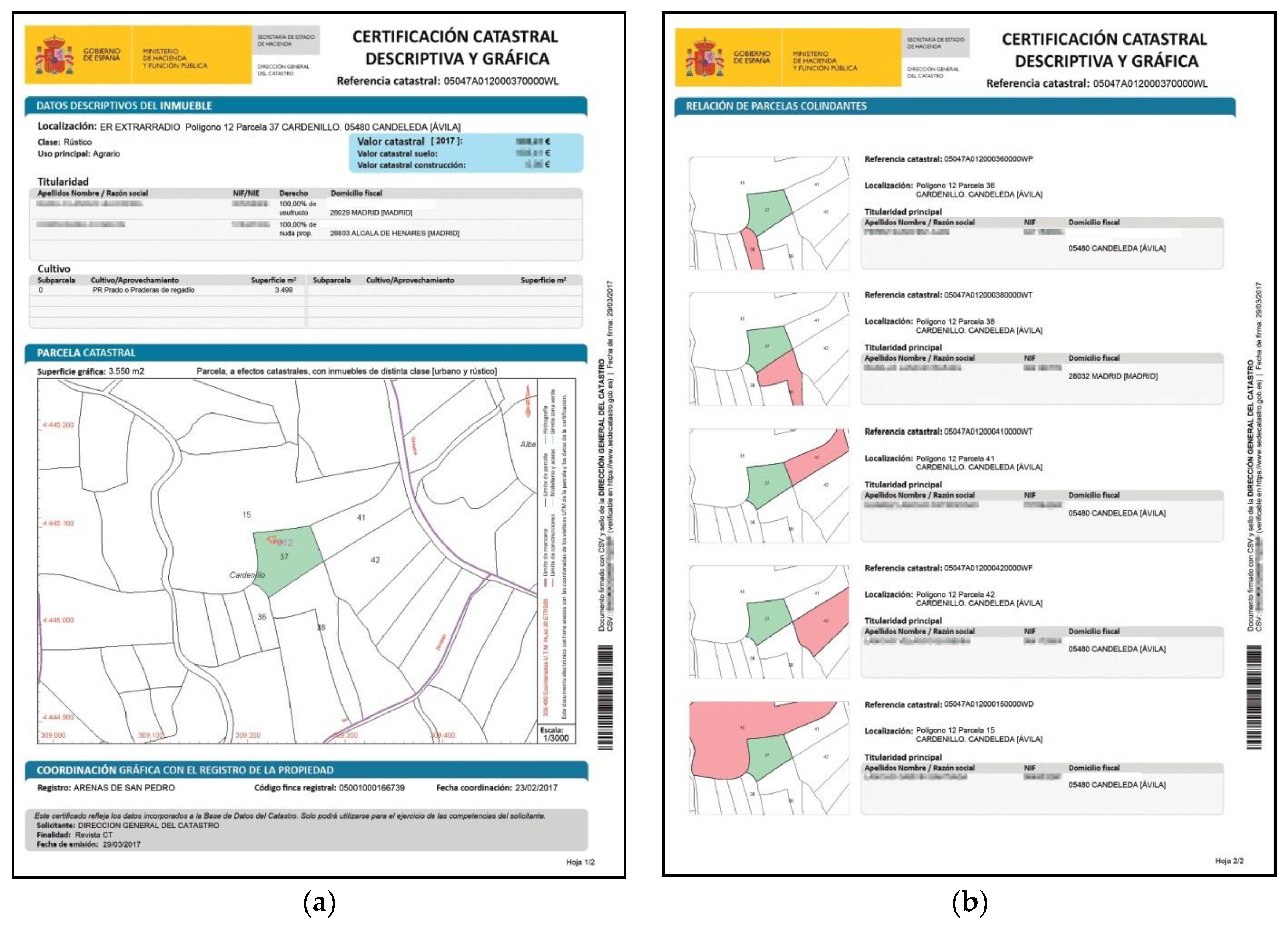
| 20. | Cadastral maps were never legally valid for indicating boundaries. Proposed solution: under Act 13/2015, the registration of an RGA that means creating a new boundary, or modifying an existing cadastral boundary, implies the participation and consent of neighbouring owners—and so finally the land registry unit can be coordinated. An RGA cannot be registered without this consent. This is why adjoining parcels are generally cited in documents by notaries and/or registrars. Although there are still problems of interpretation between legal practitioners about when, whom, and in which cases, it is necessary to notify neighbouring owners. |
| 21. | There are still maps made with different techniques in the same database in digital format with various and unknown metric precisions. Old cadastral maps are frequently demanded in the courts to resolve conflicts: especially the Topographical Cadastral Map (MTP), as it was made using classical topography and offers greater metric precision. Proposed solution: The possibility of including metadata, including precision, in cadastral maps is being studied, as it is employed in the Czech Republic [86]. The possibility of making cadastral maps available to the public is also being studied. |
| 22. | For alphanumeric information, there is collaboration with notaries and registrars in reporting changes of ownership: recent automatic changes have been made in just one minute in tests. For maps, improvements have been proposed (challenges 1, 2, 11, and 18). Due to insufficient budgets, these improvements do not cover all of Spain, and according to technical specialists and jurists, greater metric precision is also necessary. |
| 23. | Cadastral project for the detection of unregistered buildings [87]. Signing of agreements with city councils and professional associations [88]. Agreements with local administrations are being improved and expanded. |
| 24. | A lack of resources (fundamentally people) means slow responses. Proposed solution: Cooperation agreements (challenge 23). The automation of processes is planned with direct access to the cadastral database for collaborators to make modifications. To accelerate modifications of cadastral maps in accordance with Act 13/2015, an alternative map validation system has been devised that helps avoid errors (prior to checking) when loading GML files sent by notaries and registrars. The system is already widely used, although the exchange of graphic information between land registry and cadastre still does not work completely [89,90]. |
| 25. | There is an inspection process in the cadastre, although due to lack of resources, very few inspections are made. A specific updating campaign was made to detect unregistered buildings between 2013 and 2017; and the cadastre also uses cooperation agreements to detect unregistered activity (challenge 23). |
| Cadastral maps | |
| 26. | The most important specific legislation: mapping regulations (1986) on geodetic reference system (2007); National Mapping System (2007); transposition of INSPIRE Directive: LISIGE (2010); and the first National Mapping Plan (2017-2020) [91]. |
| 27. | The last two major DGC projects have been studied (challenges 1, 2, 11, 23, and 15). Both were for constructions and urban cadastre (not for rural land) given its greater economic value. Photogrammetry techniques were used because they are quicker and cheaper than classical topography; budget limitations (challenges 1 and 2). |
| 28. | Efforts being made to improve the quality of maps and clear improvements can be seen, although much remains to be done [92]. |
| 29. | The list presented in the table mostly includes problems raised by experts; although in general, the proposed solutions revolve around solving problems that have been analysed in this table. Many of the solutions are still in process. |
| 30. | Since the 1980s, the DGC has handled cadastral map-making (previously done by the IGN) mostly using collaborating companies and aerial photography (photogrammetry, orthophotos, etc.). |
Publisher’s Note: MDPI stays neutral with regard to jurisdictional claims in published maps and institutional affiliations. |
© 2021 by the authors. Licensee MDPI, Basel, Switzerland. This article is an open access article distributed under the terms and conditions of the Creative Commons Attribution (CC BY) license (http://creativecommons.org/licenses/by/4.0/).
Share and Cite
Femenia-Ribera, C.; Mora-Navarro, G.; Martinez-Llario, J.C. Advances in the Coordination between the Cadastre and Land Registry. Land 2021, 10, 81. https://doi.org/10.3390/land10010081
Femenia-Ribera C, Mora-Navarro G, Martinez-Llario JC. Advances in the Coordination between the Cadastre and Land Registry. Land. 2021; 10(1):81. https://doi.org/10.3390/land10010081
Chicago/Turabian StyleFemenia-Ribera, Carmen, Gaspar Mora-Navarro, and Jose Carlos Martinez-Llario. 2021. "Advances in the Coordination between the Cadastre and Land Registry" Land 10, no. 1: 81. https://doi.org/10.3390/land10010081
APA StyleFemenia-Ribera, C., Mora-Navarro, G., & Martinez-Llario, J. C. (2021). Advances in the Coordination between the Cadastre and Land Registry. Land, 10(1), 81. https://doi.org/10.3390/land10010081