Water Collection and Distribution Systems in the Palermo Plain during the Middle Ages


Abstract
:1. Introduction
2. Background
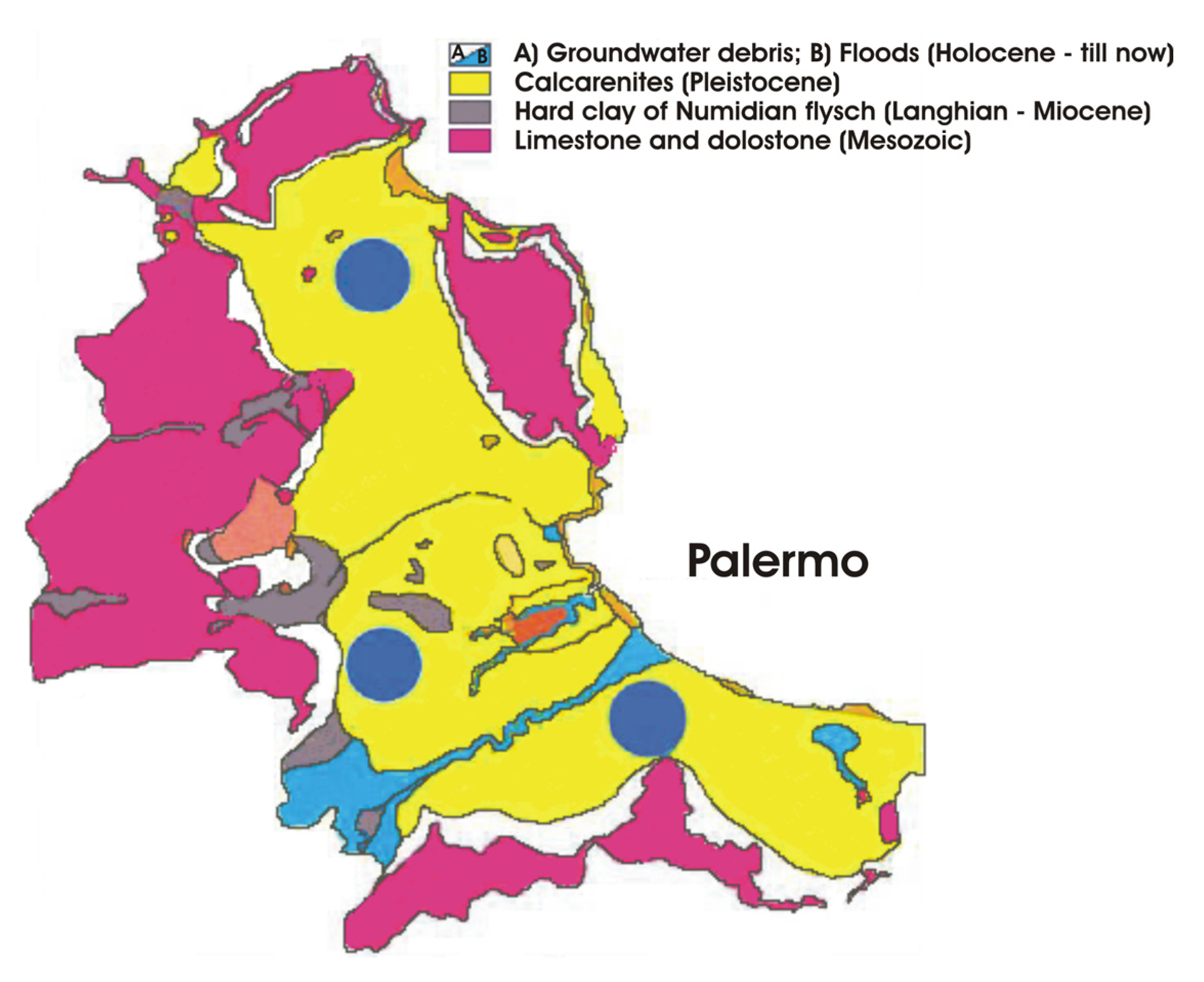
2.1. Hydrogeological Characteristics of Palermo Plain

2.2. Bal’harm
3. Water Collection
3.1. Water Sources
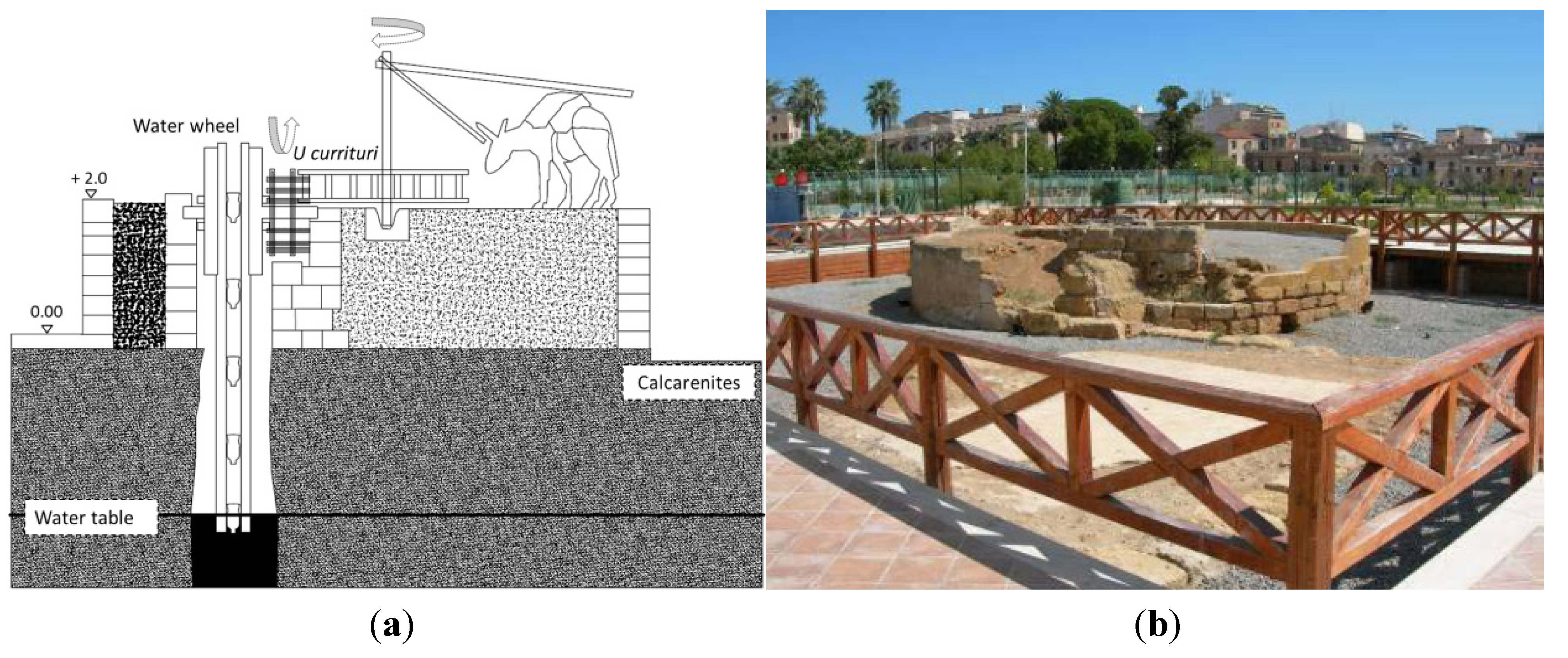
3.2. Vertical Wells
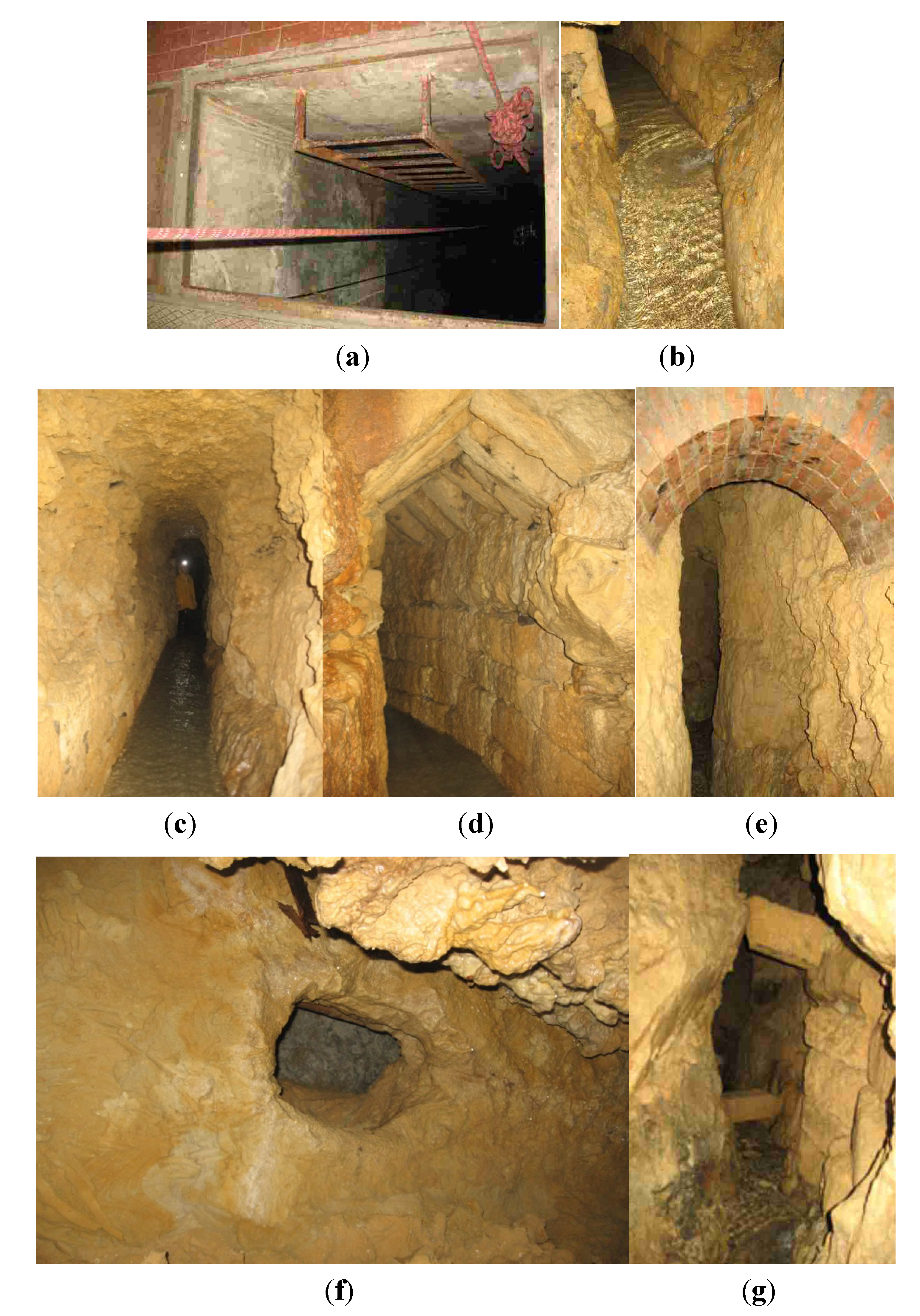
3.3. Qanāts
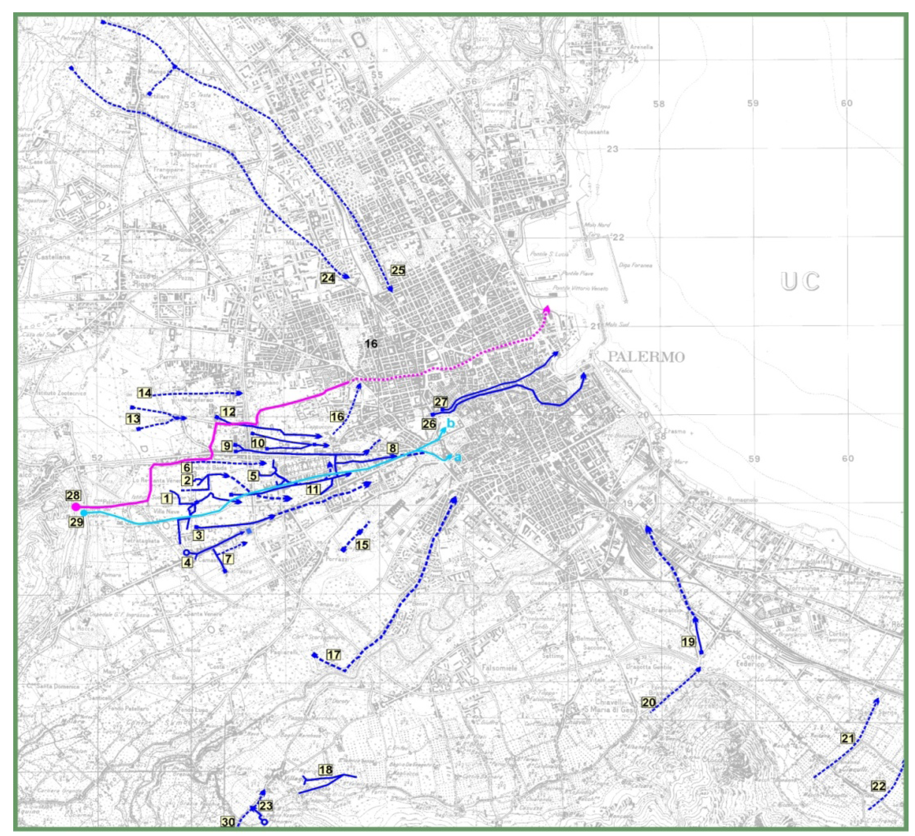
3.3.1. Qanāts’ Discovery
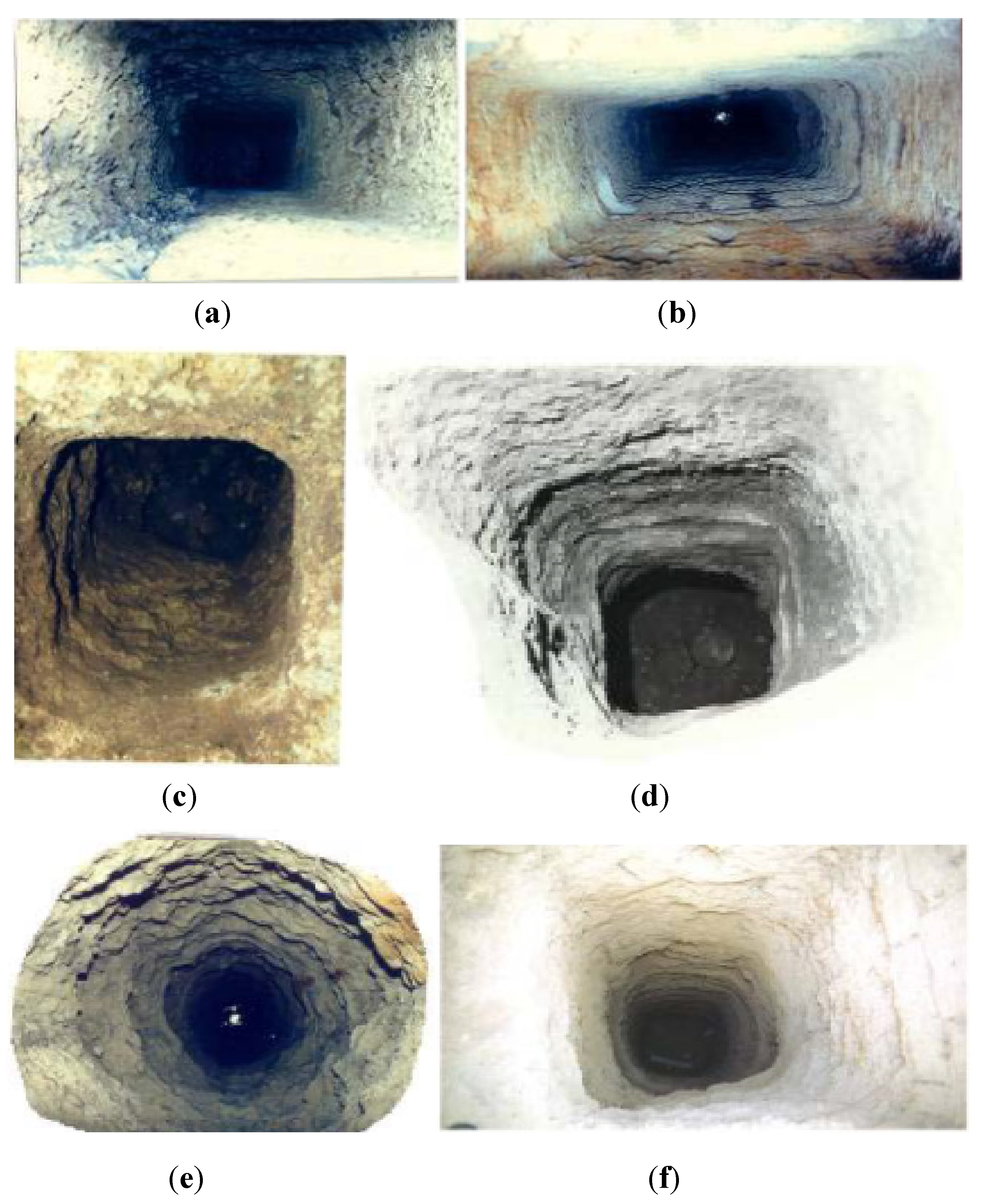

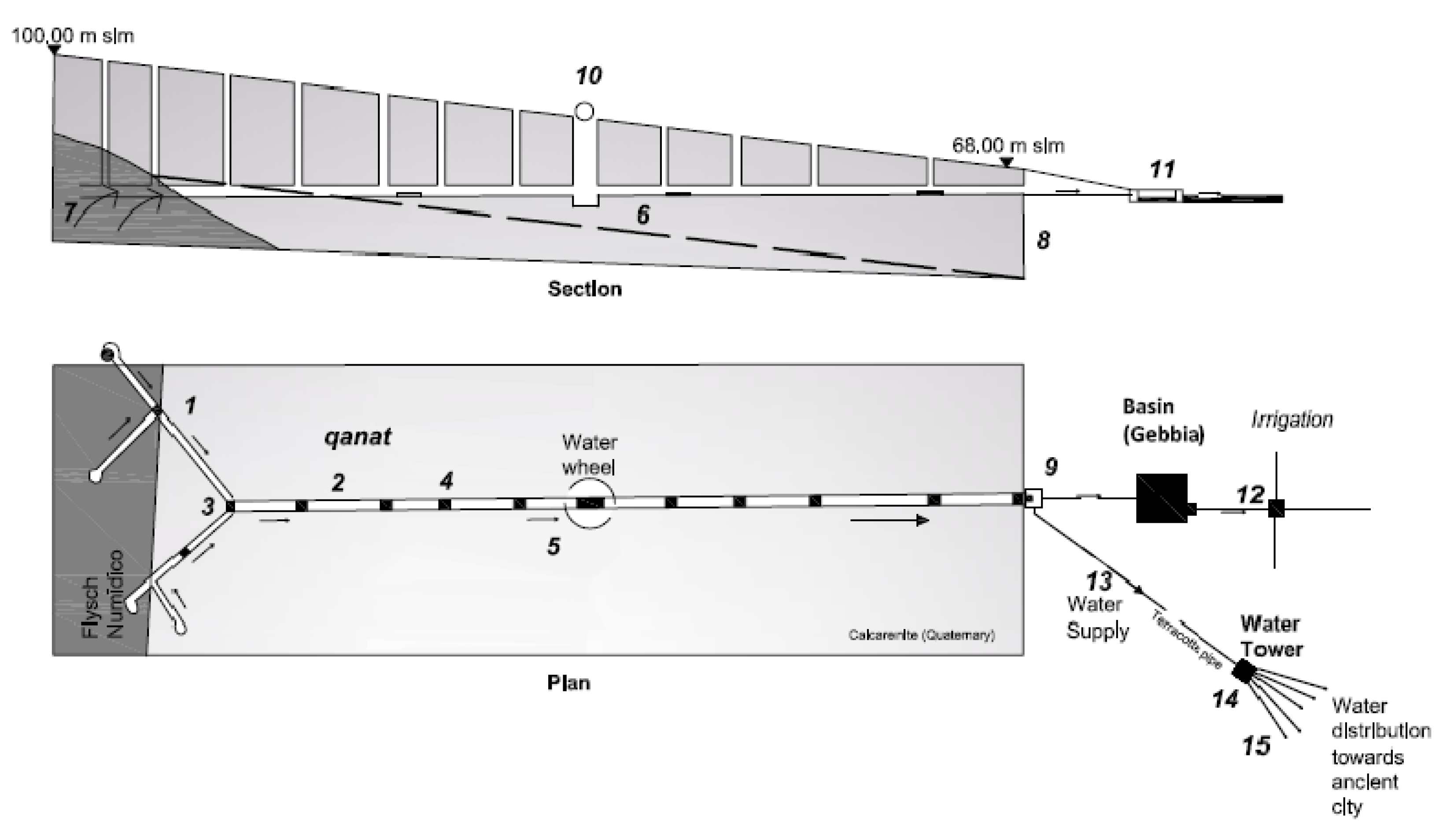
3.3.2. Technical Features

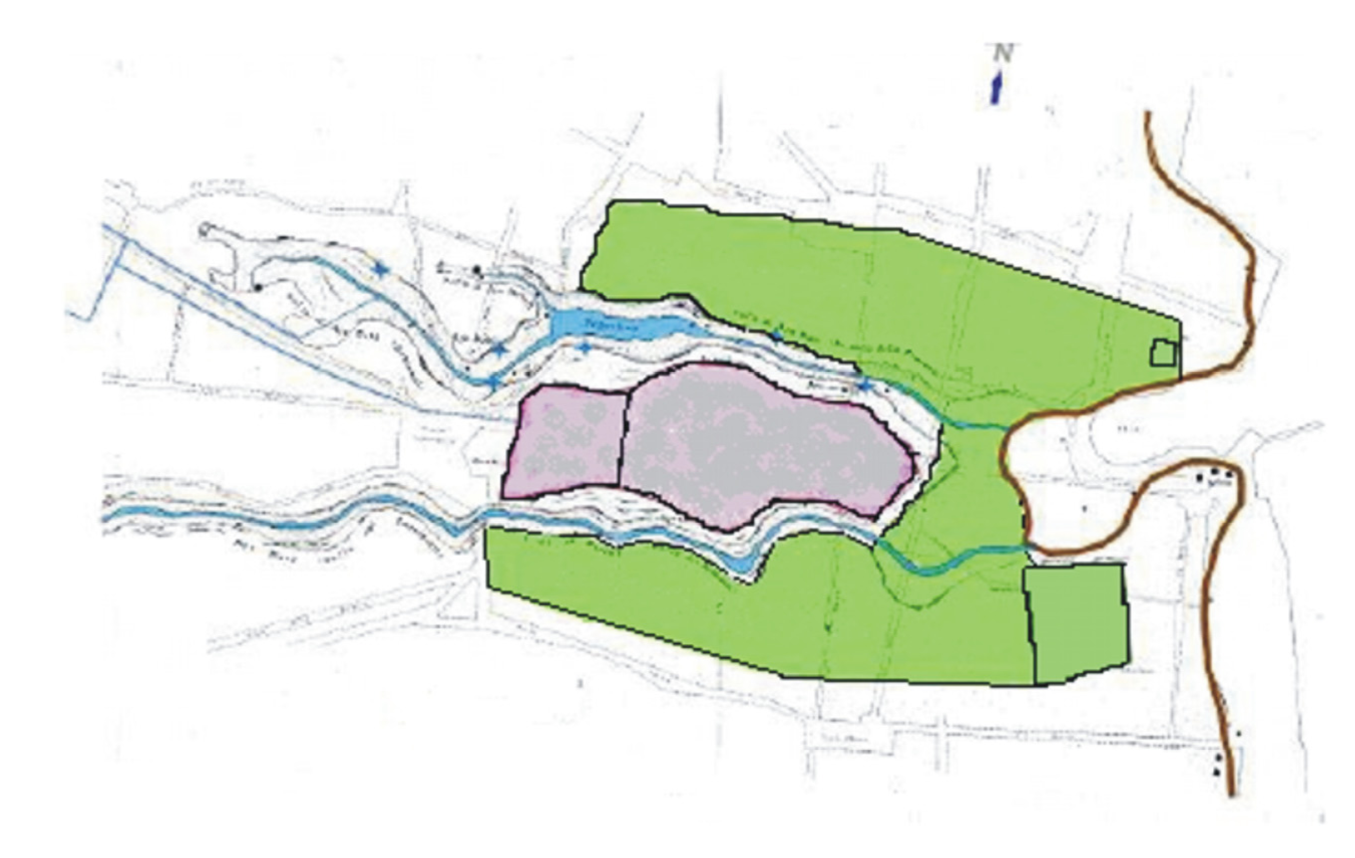
3.3.3. Characteristics of Some qanāts in Palermo Plain
3.3.4. Ecological Aspects
4. Water Distribution
4.1. Senie

4.2. Gebbia
4.3. Saje
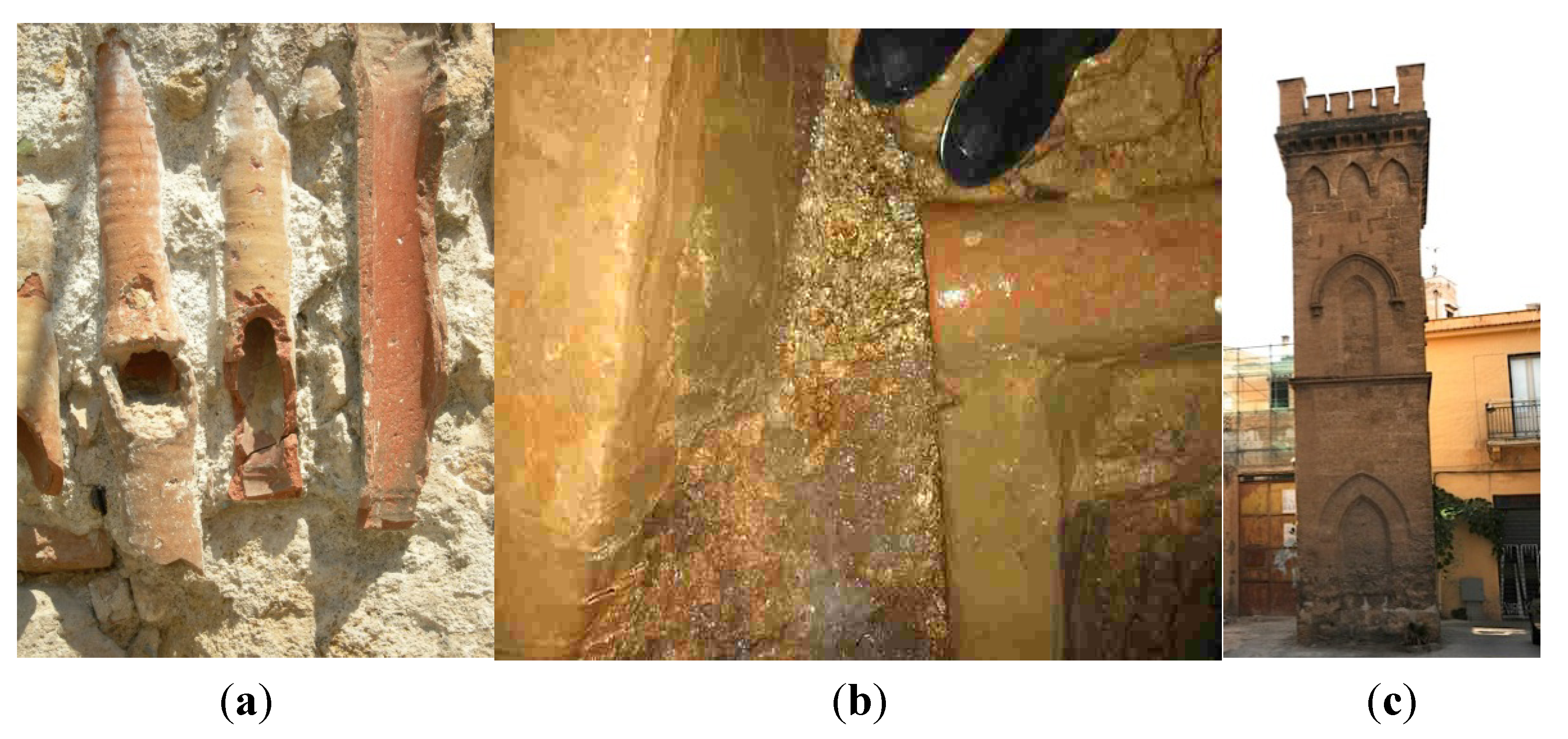
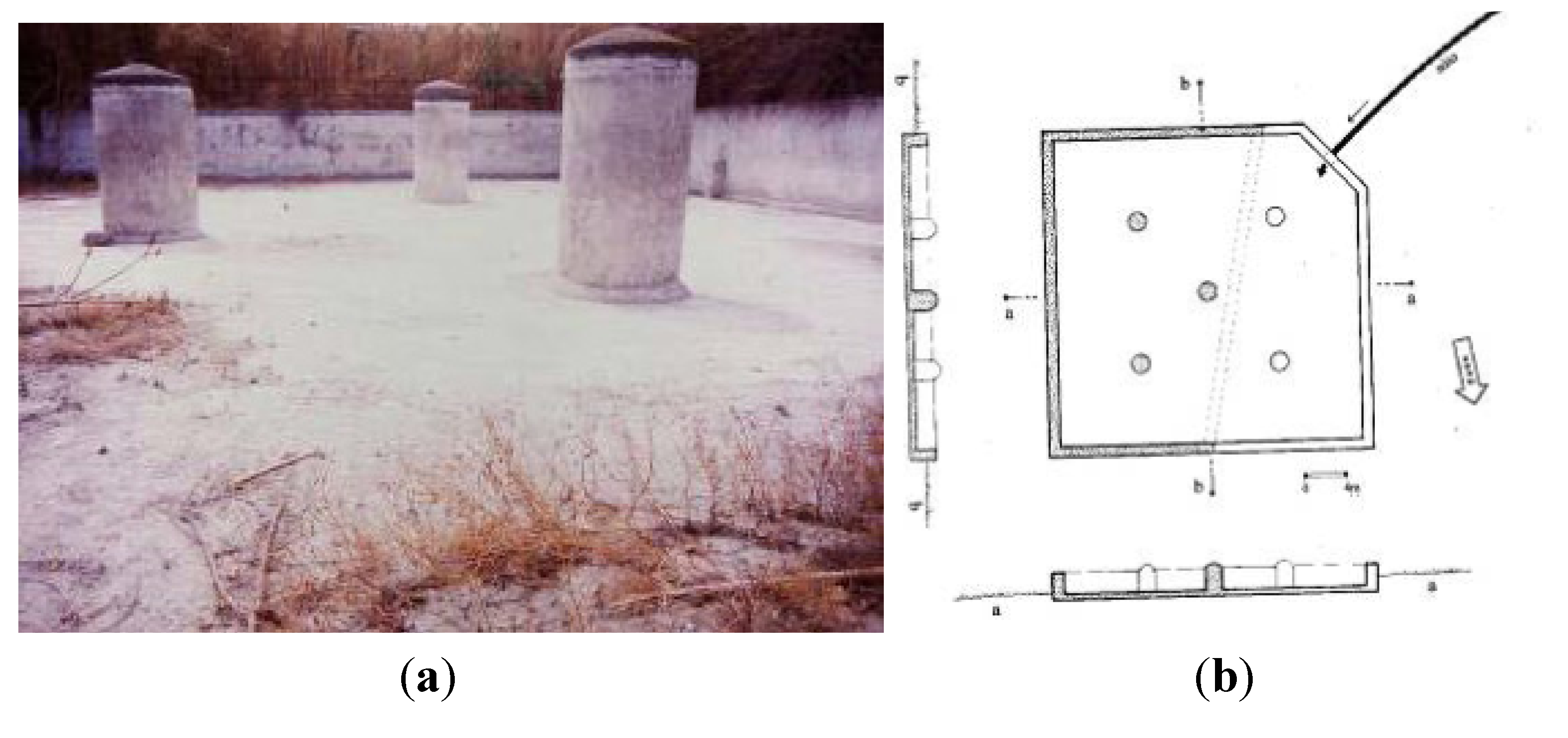
4.4. Water Towers

5. Conclusions
References
- Di Piazza, M. Palermo Città D’acqua. Aspetti Storici e Naturalistici Dell’acquedotto; (in Italian). Gulotta Editore: Palermo, Italy, 2008. [Google Scholar]
- Todaro, P. Sistemi Di Captazione e Gestione Dell’acqua Nella Piana di Palermo Nel Medioevo. In Proceedings of the International Workshop “Giardini Islamici”, Palermo, Italy, 12–14 October 2006.
- Todaro, P. Lotta Alla Desertificazione: Il progetto Foggara per il Recupero dei Sistemi Idrici Tradizionali del Sahara Algerino, Wilaya D’adrar. In Proceedings of XIII Geologists National Conference, Matera, Italy, 10–12 May 2007.
- Lofrano, G.; Carotenuto, M.; Maffettone, R.; Todaro, P.; Sammataro, S.; Kalavrouziotis, I.K. Palermo’s qanāts system: History, ecology and technology of an underground heritage. In Proceedings of the 1th IWA Workshop on Traditional Qanats Technologies, Marrakech, Morocco, 24–26 October 2013.
- English, P.W. The origin and spread of qanats in the old world. Proc. Am. Philos. Soc. 1968, 112, 170–181. [Google Scholar]
- Al-Taiee, T.M. A groundwater harvesting technology in arid and semiarid regions. In Proceedings of IWA Specialized Conference on Water & Wastewater Technologies in Ancient Civilizations, Istanbul, Turkey, 22–24 March 2012.
- Motiee, H.; Mcbean, E.; Semsar, A.; Gharabaghi, B.; Ghomashchi, V. Assessment of the contributions of traditional qanats in sustainable water resources management. Water Resour. Dev. 2006, 22, 575–588. [Google Scholar] [CrossRef]
- Mostafaeipour, A. Historical background, productivity and technical issues of qanats. Water Hist. 2010, 2, 61–80. [Google Scholar] [CrossRef]
- Juncà Ubierna, J.A. Tunnel heritage in Spain: Roots of the underground. Tunn. Undergr. Space Technol. 1998, 13, 131–141. [Google Scholar] [CrossRef]
- Semsar, Y.A.; Tafti, M. An analysis of the actual situation of Qanats of Yazd city. In Proceedings of the International Conference in Qanats, Yazd, Iran, 9–22 November 2000.
- Stiros, S.C. Accurate measurements with primitive instruments: The “paradox” in the qanat design. J. Archaeol. Sci. 2006, 33, 1058–1064. [Google Scholar] [CrossRef]
- Kamasch, Z. Irrigation technology, society and environment in the Roman Near East. J. Arid Environ. 2012, 86, 65–74. [Google Scholar] [CrossRef]
- Lightfoot, D.R. Syrian qanat Romani: History, ecology, abandonment. J. Arid Environ. 1996, 33, 321–336. [Google Scholar] [CrossRef]
- Mahmoudi, S. Possibility of reusing Tehran’s qanats. Water Wastewater J. Iran 2001, 35, 10–12. [Google Scholar]
- De Feo, G.; de Gisi, S.; Malvano, C.; Capolongo, D.; del Prete, S.; Manco, M.; Maurano, F.; Tropeano, E. Historical, biological and morphological aspects of the roccarainola qanāt in the district of Naples, Italy. Water Sci. Technol. Water Supply 2010, 10, 647–655. [Google Scholar] [CrossRef]
- Hodge, AT. Roman Aqueducts & Water Supply, 2nd ed.; Gerald Duckworth & Co. Ltd.: London, UK, 2002. [Google Scholar]
- Barbera, G.; Corselli d’Ondes, G.; Ala, M.; Basile, A.; Fiammella, F. Il Giardino Della Fawarah. In Proceedings of International Workshop “Giardini Islamici”, Palermo, Italy, 12–14 October 2006.
- Lofrano, G.; Brown, J.; de Feo, G. Water pathways through the ages: from early aqueducts to next generation of wastewater treatment plants. Adv. Water Treat. Pollut. Prev. 2012. [Google Scholar] [CrossRef]
© 2013 by the authors; licensee MDPI, Basel, Switzerland. This article is an open access article distributed under the terms and conditions of the Creative Commons Attribution license (http://creativecommons.org/licenses/by/3.0/).
Share and Cite
Lofrano, G.; Carotenuto, M.; Maffettone, R.; Todaro, P.; Sammataro, S.; Kalavrouziotis, I.K. Water Collection and Distribution Systems in the Palermo Plain during the Middle Ages. Water 2013, 5, 1662-1676. https://doi.org/10.3390/w5041662
Lofrano G, Carotenuto M, Maffettone R, Todaro P, Sammataro S, Kalavrouziotis IK. Water Collection and Distribution Systems in the Palermo Plain during the Middle Ages. Water. 2013; 5(4):1662-1676. https://doi.org/10.3390/w5041662
Chicago/Turabian StyleLofrano, Giusy, Maurizio Carotenuto, Roberta Maffettone, Pietro Todaro, Silvia Sammataro, and Ioannis K. Kalavrouziotis. 2013. "Water Collection and Distribution Systems in the Palermo Plain during the Middle Ages" Water 5, no. 4: 1662-1676. https://doi.org/10.3390/w5041662
APA StyleLofrano, G., Carotenuto, M., Maffettone, R., Todaro, P., Sammataro, S., & Kalavrouziotis, I. K. (2013). Water Collection and Distribution Systems in the Palermo Plain during the Middle Ages. Water, 5(4), 1662-1676. https://doi.org/10.3390/w5041662