
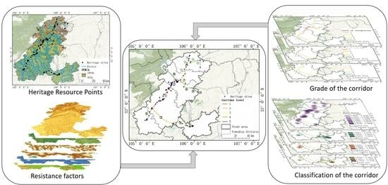
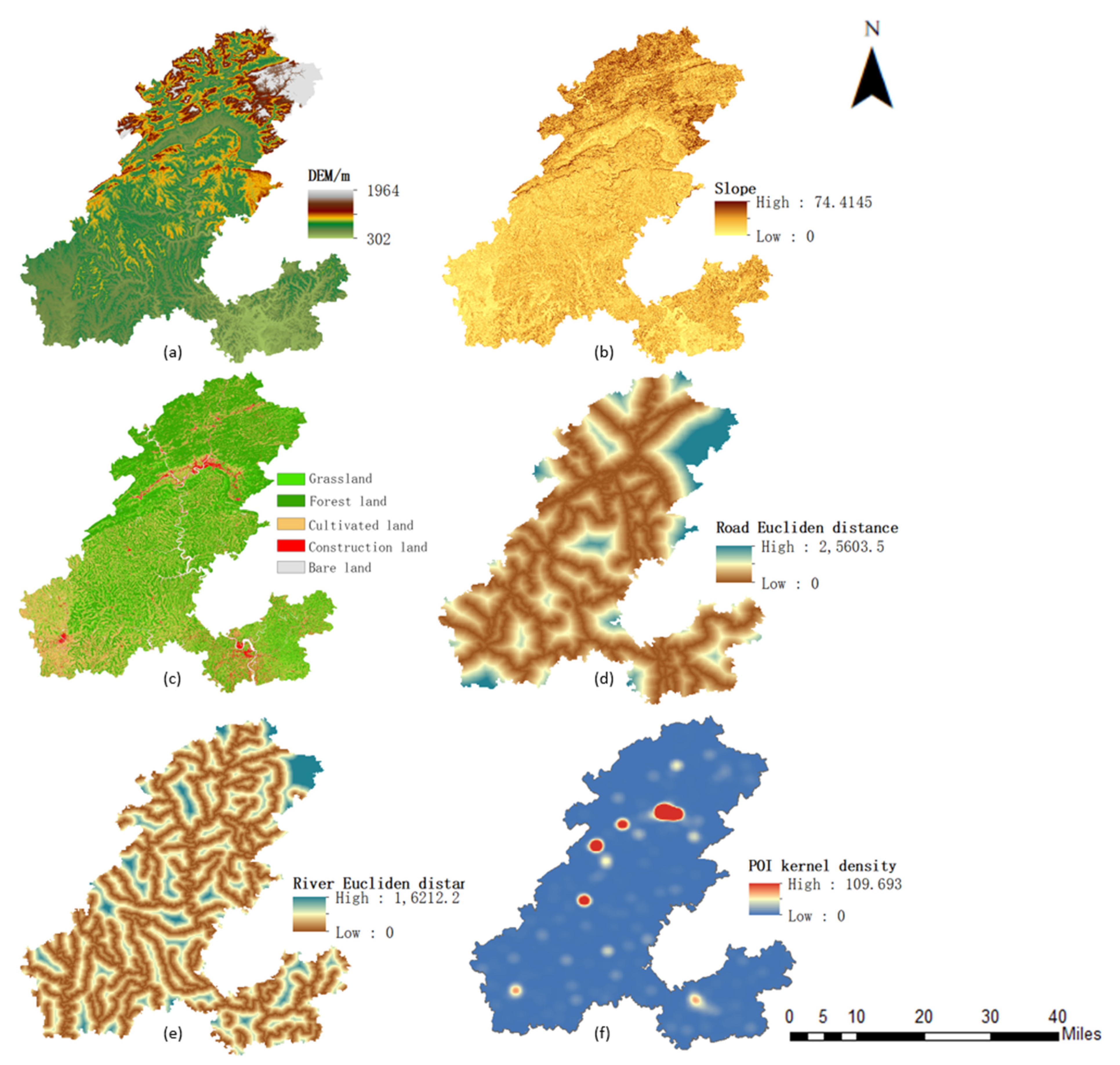
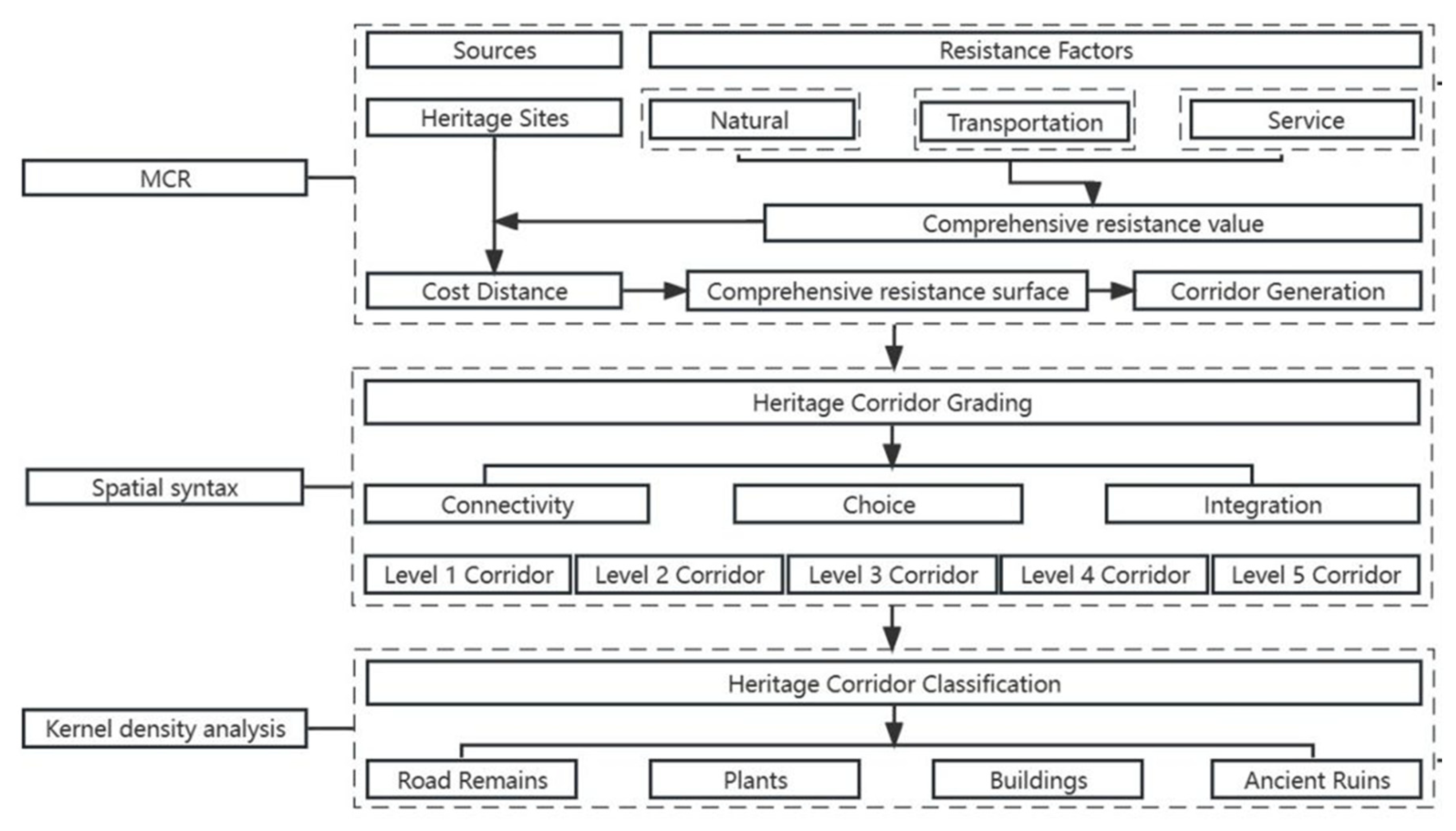
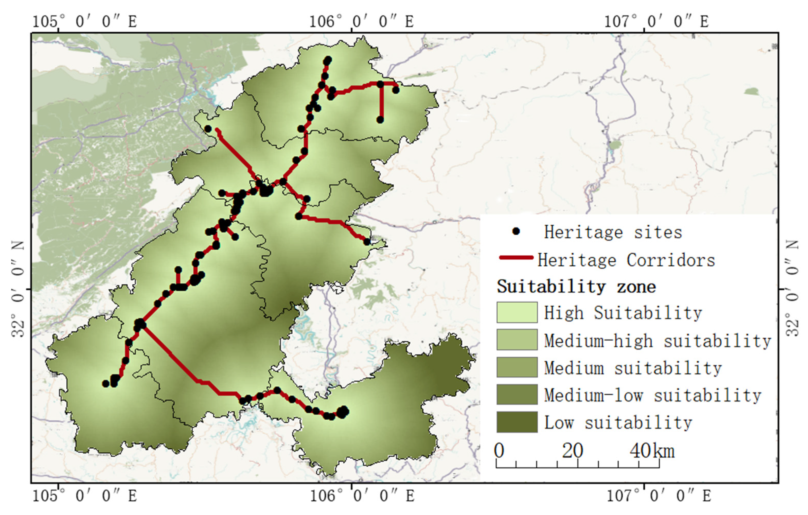
A Framework for the Construction of a Heritage Corridor System: A Case Study of the Shu Road in China

Abstract
Share and Cite
Yue, F.; Li, X.; Huang, Q.; Li, D. A Framework for the Construction of a Heritage Corridor System: A Case Study of the Shu Road in China. Remote Sens. 2023, 15, 4650. https://doi.org/10.3390/rs15194650
Yue F, Li X, Huang Q, Li D. A Framework for the Construction of a Heritage Corridor System: A Case Study of the Shu Road in China. Remote Sensing. 2023; 15(19):4650. https://doi.org/10.3390/rs15194650
Chicago/Turabian StyleYue, Fengting, Xiaoqin Li, Qian Huang, and Dan Li. 2023. "A Framework for the Construction of a Heritage Corridor System: A Case Study of the Shu Road in China" Remote Sensing 15, no. 19: 4650. https://doi.org/10.3390/rs15194650
APA StyleYue, F., Li, X., Huang, Q., & Li, D. (2023). A Framework for the Construction of a Heritage Corridor System: A Case Study of the Shu Road in China. Remote Sensing, 15(19), 4650. https://doi.org/10.3390/rs15194650