Article

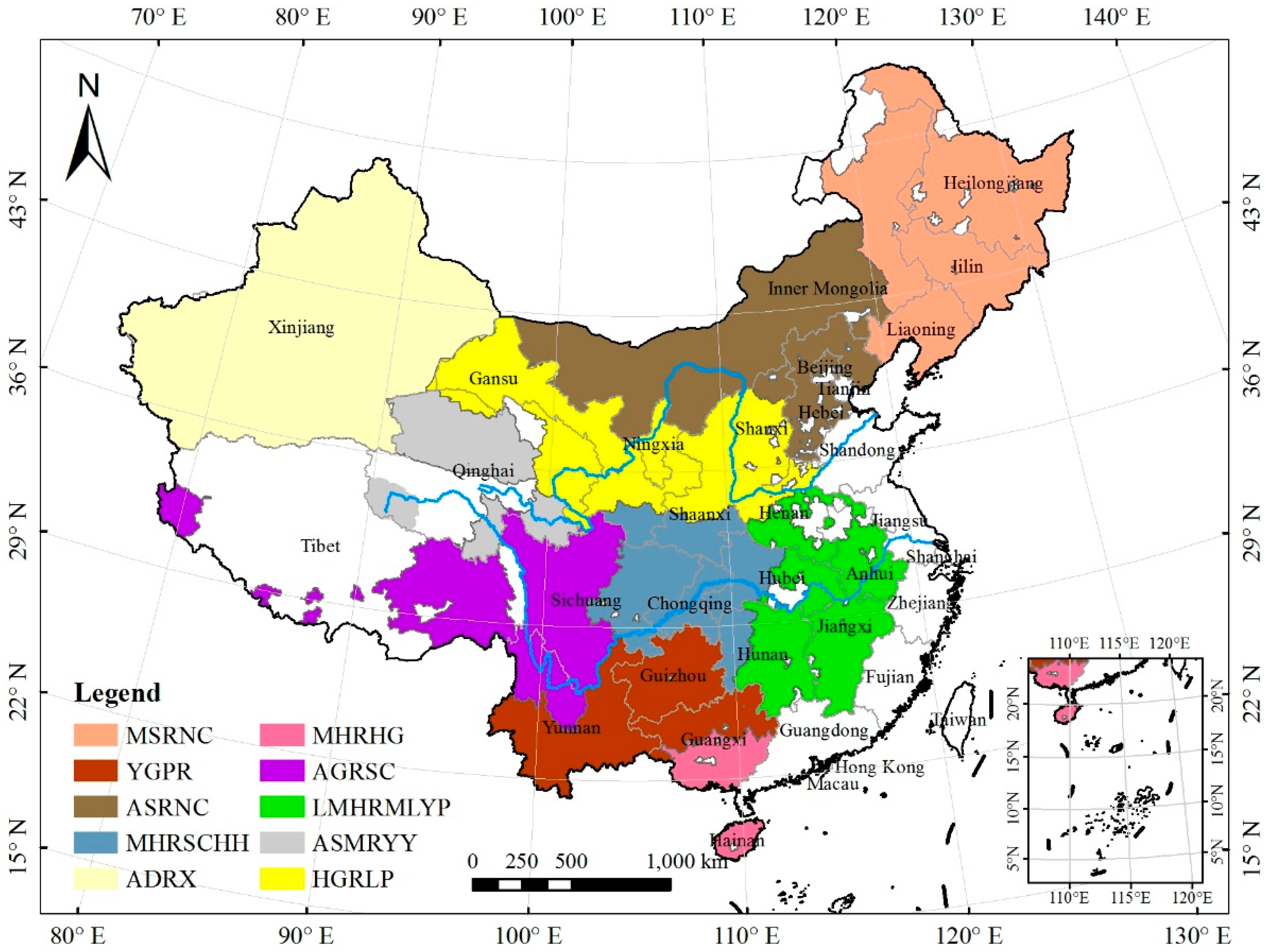
Did Ecological Restoration Hit Its Mark? Monitoring and Assessing Ecological Changes in the Grain for Green Program Region Using Multi-source Satellite Images

1
Key Laboratory of Land Surface Pattern and Simulation, Institute of Geographic Sciences and Natural Resources Research, Chinese Academy of Sciences, Beijing 100101, China
2
University of Chinese Academy of Sciences, Beijing 100049, China
3
Nanjing Institute of Environmental Sciences, Ministry of Ecology and Environment, Nanjing 210042, China
4
Shanxi Institute of Energy, Taiyuan 030006, China
*
Author to whom correspondence should be addressed.
Remote Sens. 2019, 11(3), 358; https://doi.org/10.3390/rs11030358
Submission received: 18 December 2018 / Revised: 5 February 2019 / Accepted: 6 February 2019 / Published: 11 February 2019

Abstract

Ecological restoration programs are expected to control environmental deterioration and enhance ecosystem functions under a scenario of increasing human disturbance. The largest ecological restoration program ever implemented in China, the first round of the countrywide Grain for Green Program (GGP), finished in 2010. However, it is not known whether the ecological changes that resulted from the GGP met the restoration goal across the whole implementation region. In this study, we monitored and assessed the ecological changes in the whole GGP region in China over the lifetime of the first round of implementation (2000–2010), by establishing a comprehensive assessment indicator system composed of ecosystem pattern, ecosystem quality (EQ), and key ecosystem services (ESs). Remote sensing interpretation, ecological model simulations based on multi-source images, and trend analysis were used to generate land use and land cover (LULC) datasets and estimate ES and ESs indicators. Results showed that while forest increased by 0.77%, artificial land increased more intensely by 22.38%, and cropland and grassland decreased by 1.81% and 0.68%, respectively. The interconversion of cropland and forest played a primary role in ecosystem pattern change. The increase in ecosystem quality measures, including fractional vegetation cover (0.1459% yr−1), leaf area index (0.0121 yr−1), and net primary productivity (2.6958 gC m−2 yr−1), and the mitigation of ecosystem services deterioration in soil water loss (−0.0841 t ha yr−1) and soil wind loss (−1.0071 t ha yr−1) in the GGP region, indicated the positive ecological change in the GGP region to some extent, while southern GGP subregions improved more than the those in the north on the whole. The GGP implementation other than climate change impacted ecological change, with contributions of 14.23%, 9.94%, 8.23%, 30.45%, and 18.05% in the ecological outputs mentioned above, respectively. However, the water regulation did not improve (−2283 t km−2 yr−1), revealing trade-offs between ecosystem services and inappropriate afforestation in ecological restoration programs. Future GGP implementation should change the practice of large-scale afforestation, and focus more on the restoration of existing forest and cultivation of young plantings, formulating rational and specific plans and designs for afforestation areas through the establishment of near-natural vegetation communities, instead of single-species plantations, guided by regional climate and geographical characteristics.
Keywords: Grain for Green Program; ecological monitoring and assessment; land use and land cover; ecosystem services; trade-offs; remote sensing Grain for Green Program; ecological monitoring and assessment; land use and land cover; ecosystem services; trade-offs; remote sensing
Graphical Abstract

