Article

EQ-DIRECTION Procedure towards an Improved Urban Seismic Resilience: Application to the Pilot Case Study of Sanremo Municipality

1
Department of Civil, Chemical and Environmental Engineering (DICCA), Polytechnic School, University of Genoa, 16145 Genoa, Italy
2
CIMA Foundation, 17100 Savona, Italy
*
Author to whom correspondence should be addressed.
Sustainability 2024, 16(6), 2501; https://doi.org/10.3390/su16062501
Submission received: 21 January 2024 / Revised: 9 March 2024 / Accepted: 12 March 2024 / Published: 18 March 2024

Abstract

:
This paper discusses the critical importance of effective mitigation policies to enhance earthquake resilience in urban systems, especially in light of recent seismic events in Italy. The Italian Civil Protection Department (ICPD) has delineated specific Limit Conditions (LCs) for urban settlements, serving as benchmarks for targeted mitigation policies, and akin to Limit States for buildings in Codes. While the ICPD has already developed operational procedures for some LCs, concentrating on evaluating the structural operational efficiency of strategic functions during emergency management, only a conceptual outline exists for other LCs involving preparedness and recovery/reconstruction phases. To address this gap, this paper introduces the EQ-DIRECTION (EarthQuake Disaster-REsilient City acTIOn plan) procedure. This method aims to analyze and assess the “Limit Condition for Safeguarding the Existence of the Settlement” (referred to as SLC). The procedure entails identifying the “minimum urban system” required for effective recovery and evaluating the performance of this system in terms of structural damage and economic losses against the SLC requirement. The practical application of this methodology to a real-world case study in Sanremo municipality on the western coast of Liguria (Italy) demonstrates the feasibility and potential effectiveness of the procedure for earthquake resilience in urban planning and management.

1. Introduction

Resilience and resilient thinking have gained attraction among decision-makers [1] as well as academics across disciplines, sectors, and different spatial–temporal scales as a way to survive in the uncertain, risky environment of today’s world and deal with incremental unforeseen events of various natures (from natural hazards to terroristic attacks) [2,3]. According to [4], resilience can be defined as “the ability of a system, community or society exposed to hazards to resist, absorb, accommodate, adapt to, transform and recover from the effects of a hazard in a timely and efficient manner, including through the preservation and restoration of its essential basic structures and functions through risk management”.
Among the various contexts where notions of resilience are employed, this research focuses on urban seismic resilience [5]. Several researchers have presented a detailed definition of urban resilience by focusing on many networks and subsystems that are present in urban systems [3,6,7]. The 25 most influential urban resilience definitions were collected by [3] after reviewing 40 years of urban resilience-related publications. According to these definitions, the main characteristics of urban resilience include the following:
  • Absorb and tolerate the impacts of disasters;
  • Recover from disasters and “bouncing back” or “bouncing forward”;
  • Remain as a functional urban system after a disaster;
  • Improve to cope better with future risks.
Despite the fact that there are generic definitions of resilience in relation to natural hazards, academics and policymakers argue that the idea of community resilience is very context-specific and depends on the type, location, and scale of the hazard [8,9,10]. Roughly half of the urban resilience definitions are presented in the context of a specific threat (e.g., climate change or flooding, earthquakes), while the other half focus on the resilience of an urban system to respond to all risks [3]. Definitions of seismic resilience and resilient systems against earthquakes specifically have been offered in certain studies in this regard [11,12]. One of the most referable definitions for seismic resilience in the literature is provided by [13], that defines seismic resilience as “the ability of the exposed system (e.g., urban system, organization, …) to decrease risk, encompass the impact of disasters when they happen, and carry out recovery operations in a way that minimizes social disruption and reduces the effects of future earthquakes”. They argue that resilience could be achieved by strengthening structures, reducing their probability of failure during an earthquake, and putting measures in place to quickly return to pre-disaster or other acceptable levels of functioning following disaster occurrence [13,14].
The resilience concept’s temporal span extends from before a disaster happens to after it has occurred, during the recovery period, as well as during the time the disaster takes place. In other words, the state of the system and the actions taken throughout each phase of the disaster risk management cycle (that includes mitigation, preparedness response, and recovery) determine how resilient the urban system would be [15]. Therefore, carrying out interventions to lessen the built environment’s vulnerability before the event [16,17], planning an effective emergency management strategy [18], and executing quick and efficient recovery [19] are all effective measures that raise the system’s resilience. The actions performed in each phase not only affect the overall resilience of the urban system but also the ability of the urban system in subsequent phases to continue functioning and take the planned actions [20].
Some actions, such as strengthening vital structures and infrastructure, can help the system be more resilient [21] from two aspects and throughout two different time domains. On the one hand, it can reduce the likelihood of failure of the system during the disaster occurrence, and on the other, it can result in the preservation of critical structures that can facilitate the recovery and emergency process following an earthquake [22]. One of the primary issues in this context is identifying and determining the important infrastructures and structures, especially when resources are limited and decision-makers must select among several buildings to invest in [23,24,25]. Resilience could be measured in terms of a person’s, a community’s, or a country’s primary survival values or assets, such as life, livelihood, and culture. From this viewpoint, the objective of any “disaster resilience” program ought to be to preserve the fundamental values, assets, and resources that can be used in the process of adapting to challenging situations [26].
L’Aquila 2009 [27] and Central Italy 2016/2017 [28,29] earthquake experiences are examples that highlight the need to improve the response of strategic buildings beside the residential ones and their capability to satisfy their role in emergency and recovery phases. An overview of the impact of the recent Italian earthquake from different perspectives (i.e., social, economic, and disaster management) is provided in [30]. As shown in Figure 1, emergency operations are hampered by the collapse of the Prefecture (a) and hospital (b) buildings in L’Aquila and Amendola, respectively, as well as the obstruction of roads due to the failure of the interfering buildings (c). Figure 2 depicts several structures that have cultural value and play an important role in the community’s identity, like churches and historical buildings, that were destroyed by the earthquake, resulting in the emergence of loss feelings amongst inhabitants before they were rebuilt [31]. The huge repercussions of Italian seismic disasters in economic terms have also been documented in [32,33,34].
In this context, the Italian Civil Protection Department (ICPD) outlined specific Limit Conditions (LCs) for urban settlements [35,36], which were intended to specify the explicit target/objectives that mitigation plans have to define accordingly in the course of various risk management cycle’s phases (i.e., pre-, post-, and during disaster [37]). An overview of the potential application of such concepts is provided in [38]. The LCs correspond to different conceptual thresholds. The conceptual thresholds set out by the LCs describe the physical and functional damage levels of an urban system and its constituent parts. Urban systems lose a certain level of functionality if any of the established LC thresholds are exceeded as a result of an earthquake (Figure 3). The main objectives of LCs are in line with the goals of specified limit states in Standards and Codes, but at a larger scale than that of a single building [39,40], and include the following: (i) ensuring the safety of the settlement’s resident life; (ii) protecting the buildings and infrastructures that compose settlement; and (iii) preserving the environmental and the social identity of the urban system.
All of the LCs introduced by the ICPD in [35,36] are summarized in Figure 3, along with a description of the urban system state to which they refer. Some of these LCs, such as the Emergency Limit Condition (ELC), have undergone exploratory investigations, and the ICPD has provided manuals and operational instructions for using them to analyze urban systems and put their concerns into action in practical situations [41]. Moreover, a probabilistic method was developed in 2013 by the ICPD to evaluate the operational effectiveness of a municipal emergency plan in the event of an earthquake. The method is called I.OPà.CLE, which stands for the “Index for Evaluation of Operational Efficiency of Limit Condition of Emergency” [42,43]; it has been used in several research and case study analyses (e.g., [23,44,45,46]). ELC focuses on the response phase of the risk management cycle and evaluates how the urban system can well continue to function for emergency activities immediately following a disaster.
The other LCs are instead crucial for the system’s state in other phases of disaster risk management, such as recovery and preparedness [36]. In particular, the “Limit Condition for Safeguarding the Existence of the Settlement” (hereinafter called SLC) following the occurrence of a disastrous seismic event is the main subject of this paper. The primary objective of SLC is to protect the urban essential functions that are vital for starting the system’s recovery process and are required to ensure the rapid return of all urban system functions. According to [47], recovery is a lengthy process that could take years or decades to complete. Ignoring the socio-economic aspects of this process, which involve the entire affected community, would result in a defective recovery process that eventually would result in a not resilient city with social fragmentation and nonfunctional living conditions [27,48,49,50,51]. In this context, it could be claimed that characterizing the SLC necessitates multidisciplinary analysis and evaluation of a community’s economic, social, cultural, and identity dimensions. Moreover, in general, fulfillment of the SLC requirement presupposes satisfaction of the ELC.
While the ICPD has defined the SLC only conceptually so far, this study specifically establishes an operational procedure for the analysis and assessment of the SLC, which was initially developed within the context of the research conducted on the pilot case study of Sanremo municipality located on the western coast of Liguria (Italy). The procedure is named the EQ-DIRECTION, which stands for “EarthQuake-DIsaster REsilient City acTION plan”. The EQ-DIRECTION aims to introduce a practical tool for mitigating seismic risk that enables decision-makers to take action in the context of urban planning. The output of the methodology is a priority list of the buildings that should continue to be functional during the reconstruction phase, which considers both the built environment’s structural response and its economic and historical relevance. In-depth structural analysis, better resource management, and the strengthening of intervention are all issues that should be tackled in the priority list determination.
Resilience stands as a pivotal aspect of sustainability, especially in the context of post-disaster recovery [13,52,53,54]. Both sustainability and resilience intertwine, highlighting a system’s capability to progress towards favorable developmental trajectories [55]. They share a fundamental objective of safeguarding societal health, well-being, and local economies [56]. In the current study, resilience underscores the aim of enhancing an area’s capacity to mitigate risks and facilitate recovery from future disasters.
After having illustrated the general goals and principles of the proposed procedure (Section 2), the specific methodology and practical outlined tools are presented (Section 3). Then, the procedure is tentatively applied to a pilot case study consisting of the Sanremo municipality (Section 4) to show its feasibility in real-world situations. The application to this pilot case study was supported by the funding of Sanremo Municipality and Liguria region within mitigation national programs supported by the ICPD.

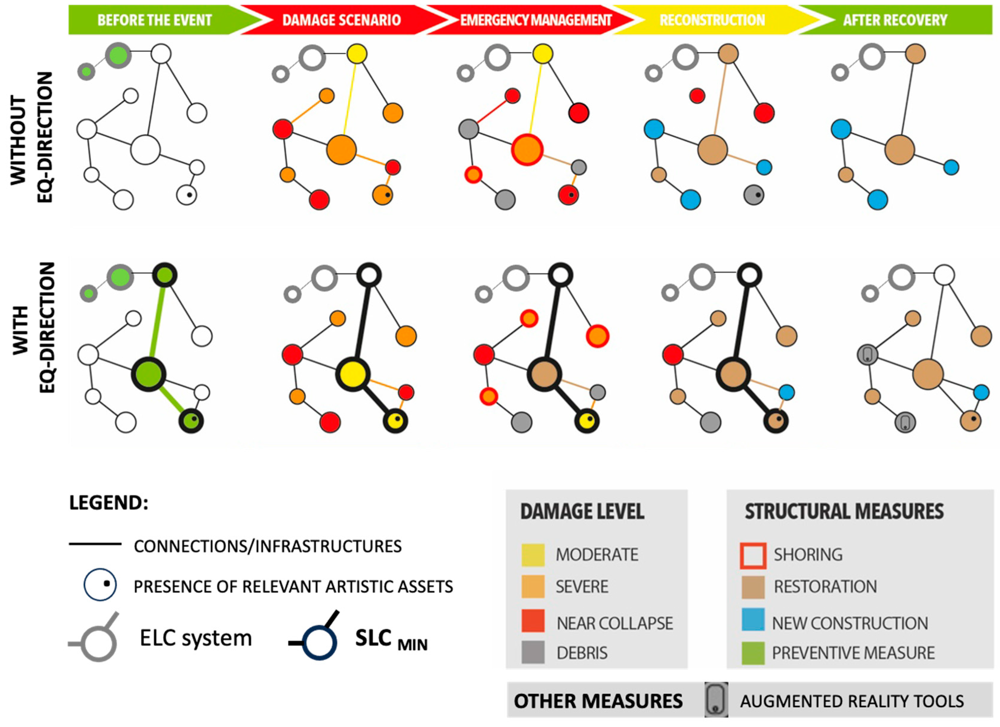
2. EQ-DIRECTION: Goals and Key Principles

2.1. Basics of the Proposed Procedure for Assessing the SLC Condition

According to [35,36], the Limit Condition for Safeguarding the Existence of the Settlement (SLC) following an earthquake represents the condition for which the urban settlement—as a whole—suffers physical and functional damage that interrupts some urban functions for its entire or partial extension.
Urban systems offer a variety of functions. According to how they are utilized and the type of services that they provide within the system, system components can be categorized into functions [57]. In an upper-level classification, a group of these functions could make up a major functions class. If the major functions classes are categorized by their significance and involvement in risk management following the occurrence of the disaster, the following four distinct major classes could be found:
(i)
The strategic urban functions in emergency management that concern buildings for emergency coordination, medical relief, operational intervention, road networks, and emergency areas;
(ii)
The main urban functions in the recovery phase that consist of the most important buildings and activities from the social, productive, and cultural point of view, considering the socio-economic characteristics of the city;
(iii)
Normal urban functions and services;
(iv)
Dwellings (housing).
According to the SLC’s principles, the urban settlement is assumed to preserve the functionality of strategic functions for the emergency and post-event recovery and the connection and accessibility with the territorial context. Moreover, the possibility of partially maintaining or resuming residential functions is guaranteed, according to extensions and within times compatible with the maintenance and recovery of the essential characteristics of the settlement, also following a substantial limitation or interruption of use. In summary, the SLC must therefore meet the following three objectives:
  • Ensure emergency management following a disastrous event.
  • Guarantee the main urban functions after the event for the start of the recovery.
  • Ensure the rapid recovery of other major urban functions.
The first item, as already mentioned, in practice, presupposes the fulfillment of the ELC, while the second and the third items characterize more specifically the SLC.
Figure 4 provides a synthetic illustration of the EQ-DIRECTION procedure aimed at providing a first tentative operative tool to address the SLC. The preliminary but essential step is the definition of the strategic urban functions (SUFs) of the system, which is the individuation of the different activities with a key role in the community from the perspective of the recovery of the settlement following a disastrous event. They consist of the main services of the city (e.g., schools, policies, pharmacies, markets, …), the relevant economic activities (e.g., productive structures, hotels in the case of urban systems funded on touristic activities, …), the fundamental cultural assets (e.g., monumental buildings), and the most representative urban and social places (e.g., religious buildings, relevant squares, …). Then, the strategic buildings for the emergency have to be added too, being the fulfillment of the ELC implicitly included in the SLC objectives.
This preliminary step is followed by two phases, i.e., “analysis” and “assessment”.
The analysis phase is aimed, firstly, at the listing and reconnaissance of all the buildings that potentially have a role in carrying out the full strategic urban functions of the SLC (i.e., the identification of all eligible buildings); secondly, at the analytical quantification of their potential performance to prioritize them; and thirdly, at defining—within the set identified in the first phase—a subset of buildings (called SLCMIN, where MIN stands for “minimum”) representative of the minimum core necessary to guarantee an effective recovery following a calamitous event.
The assessment phase then aims to provide a more detailed estimate of the seismic performance of the components of the SLCMIN to eventually assign them mitigation actions. In the assessment phase, the evaluation is not limited only to the subset of strategic buildings that compose the SLCMIN, but it is extended also to all the interfering buildings whose damage could potentially compromise their performance.
Both phases, i.e., “analysis” and “assessment”, make use of vulnerability models based on different approaches and require a different burden of data acquisition (through expeditious inspections of the territory, archive research, or more detailed inspections of buildings) as well as computational effort. Their use is therefore diversified depending on the number of buildings to be examined. In general, where possible, the criterion is to adopt more simplified approaches in the analysis phase and for the evaluation of buildings interfering with the SLCMIN; greater detail is required for the evaluation of the buildings that make up the SLCMIN. In general, the approach is to prioritize simplified methods for the analysis phase and for evaluating interfering buildings neighboring the connections of the SLCMIN while opting for more detailed methods for buildings of SLCMIN like the ones corresponding to SUFs and strategic buildings.
The following sections aim to illustrate the objectives and role of SLCMIN (Section 2.2) in more detail as well as those of the “analysis” and “assessment” phases (Section 2.3) and the operative tools proposed for the latter ones (Section 3).

2.2. Minimum Urban System: Objectives and Role

Considering the limitation of the available resources for investments necessary to pursue the SLC objectives, the identification and recognition of an urban sub-system is very useful for more effectively orienting and prioritizing the mitigation action.
As a result, in addition to the SLC general principles, which have already been established by ICDP [35,36], the SLCMIN concept was introduced in the proposal of the EQ-DIRECTION procedure. Figure 5 illustrates a graphical representation of the goals that the SLCMIN concept aims to pursue in the change in the perspective for the actions to be planned in the disaster risk management (DRM) circle (i.e., before the event or after the completion of a whole recovery phase—in green, during the emergency phase after the disastrous event—in red, and during the reconstruction/recovery time—in yellow).
The first row of Figure 5 depicts a scenario in which mitigation actions in the pre-event phase are mainly oriented to guarantee an adequate seismic response of just the sub-system addressed to manage the emergency phase (e.g., as the result of decisions taken following the ELC analysis of the urban system). As a consequence of a severe seismic event, the system suffers severe damage that makes the full restoration of some components impossible, leading to the loss of them or the complete new construction of others. The fact during the emergency phase, some components are subjected to an even worsening of the damage highlights the possible impact of damage accumulation phenomena not effectively countered by prompt actions, such as shoring or delay in the damage surveys. The second row of Figure 5 instead hypothesizes actions in the “green” period also on additional components, identified as crucial for preserving the cultural, social, and economic identity of the urban system (i.e., the SLCMIN system), leading not only to lower overall damage but to a configuration after recovery that leads to maintaining almost all components (even if, in some cases, recurring to the only solutions compatible with the very huge damage that occurred, like augmented reality for assets relevant to the cultural identity of the community).
The SLCMIN aims to comprise the bare minimum structures required to establish the necessary critical core system for starting the post-event recovery process and is intended in this research to form a strict relationship also with the ELC system. This crucial core system must be able to maintain and create the social and economic connections and circulation required in order to make the urban system capable of functioning and, if not improve, at least return it to the pre-disaster state. The speeding up of the recovery process is greatly impacted by the core system preservation as well. To prevent population displacement, which could have irreparable effects, it is imperative that the recovery process be quick and effective. The SLCMIN would serve as a planning guide for decision-makers to prioritize the core system for risk-reduction measures and optimize their investment.
Therefore, for the SLCMIN recognition it is required to complete the following:
  • Identify the SLC strategic buildings that are critical components in the urban system, in the particular context under consideration, and whose presence is crucial for the recovery regardless of their current structural performance;
  • Select the eligible buildings from strategic buildings in accordance with decision criteria and importance aspects.

2.3. Analysis and Assessment Phases

The general framework of the EQ-DIRECTION is divided into two sub-steps, as shown in Figure 4. The following steps are the ones that characterize the analysis phase in more detail:
(A1) Recognition of the eligible buildings (i = 1, …, N), which entails locating and collecting in a GIS environment all the structures that support the continuance of SUF services.
(A2) Assigning a score (Pi) to each eligible building using an analytical process that strives to combine the various physical, environmental, social, and economic factors for the determination of the importance of different urban system components and their contribution to ensure the SLC of the whole system (Section 3.1).
(A3) Identifying the SLCMIN, which is a subset of the eligible buildings (i’ = 1 …N’, with N’ < N) that allows for the urban system to achieve the required SLC state and ensure the beginning of recovery. The A2 phase scores and the location of the buildings in the urban context (i.e., proximity to the other strategic buildings or infrastructures included in the ELC system) are the factors that are considered primary criteria for identifying the optimized SLCMIN.
After recognition of SLCmin, the procedure passes to the assessment. In fact, the analysis phase concentrates mostly on the SLC from a systemic point of view by taking into account the function of buildings in the urban context, whereas the assessment phase primarily focuses on the behavior of the recognized building in SLCmin. This phase entails evaluating the structural performance, expected damage, and consequent loss of functionality of the associated buildings to SLC in accordance with the socio-economic aspects that are considered in this limit condition. The assessment phase should be followed by the adoption of vulnerability models. Different vulnerability models have been developed using various methodologies, including empirical-heuristic, mechanical (based on analytical techniques), and numerical (based on detailed models) models [58]. Although the volume and details of the data needed vary depending on the vulnerability model that is chosen, all the aforementioned methodologies that are preferred to be applied in the assessment phase require more effort in the data gathering and computing processes than in the analysis phases. For this reason, the SLCmin is established before the assessment phase rather than following it to reduce the required computing time power of the assessment phase. Once the assessment has been carried out on SLCmin buildings, it is useful to represent the results on a map, taking advantage of the GIS representation, and showing them at the scale of the urban settlement. In particular, the assessment is performed on the following:
  • All the buildings of the SLCMIN and their relative connections;
  • All the structures that interfere with SLCMIN accessibility, particularly those whose structural response or damage can impair the correct utilization of SLCMIN connections and structures. They could be identified based on parameters relating to the height of the building fronts (H) compared to the width of the street (L) they overlook. According to rules established for the ELC assessment in [41], the interfering buildings are those characterized by H > L.

3. Methodology and Tools Proposed for the Analysis and Assessment Phases

3.1. Analysis

A rapid field survey (compatible with large-scale analysis), research archival investigation, and an evaluation of administrative documents (i.e., the results of structural safety analyses previously carried out) are the main sources of data collection in the analysis phase.
Additionally, semi-structured interviews with stakeholders must be conducted in order to identify the primary SUF for the city, identify the most significant buildings that should be included in the minimum urban system regardless of the building scores, and, finally, assign weights to the various examination categories in order to evaluate the final scores, which will be discussed in more detail in this section.
As aforementioned, the identification of the list of strategic buildings and the individuation of those buildings for supporting strategic urban functions constitute the first step of the analysis phase (A1—Figure 4). Since this recognition necessitates in-depth contact with the community and understanding of the urban area, this step should be taken in close collaboration with the local government (i.e., municipal) and decision-makers. Depending on the case study of analysis and the characteristics of the examined urban area, some SUFs can be further explored. For instance, the productive structures may include public, industrial, or touristic buildings depending on the primary economic source or the activities of the local populations.
For the second step (A2—Figure 4), as already introduced, the main methodology that is used is scoring. To complete this step, an equation was defined to calculate the score of each asset considering different performance categories. More specifically, the total score Pi is determined through the following expression:
P i = P i SE + P i SV = w i , s S E P i , s S E + w i , m S V P i , m S V
where PiSE and PiSV are normalized scores derived from the fusion of the various criteria that contribute to defining the significance of the i-th eligible building in the SLC of the urban system, taking into account the socio-economic (SE) importance and structural vulnerability (SV) of the building. The partial scores attributed to the building (PiSE and PiSV) vary from 0 to 1. For both the SE and SV factors, various performance categories are defined, which are identified by the counters s (=1,…, 3) and m (=1,…, 3), respectively. Moreover, wsSE and wmSV represent the weight factors that vary based on the SUF being examined. The total of the weights for each SE and SV is 1. Then, the values of the two scores (Pi,sSE and Pi,mSV) are renormalized to be employed in Equation (1).
In particular, the following performance categories are considered:
  • Concerning socio-economic (SE) importance:
Occupancy (s = 1), which expresses the value of an asset in terms of its size, adjacent area, and occupant number;
Economy (s = 2), which indicates the significance of an asset in terms of its contribution to the urban system’s economic activities;
Heritage conservation and cultural identity (s = 3), which expresses the asset’s artistic value as well as its cultural significance for the area, highlighting in particular how the asset is crucial for the preservation of the settlement’s identity and history.
  • Concerning structural vulnerability (SV):
Structural response (m = 1). This factor quantifies the seismic vulnerability of the building and its potential to be subjected to damage. It is expressed by a safety index (SI) computed by considering the reference return period of the seismic action selected by the municipality (in general, the one also compatible with ELC evaluations, which are usually carried out referring to at least 475 years). At this stage of the procedure (i.e., the analysis phase), the SI is primarily computed through simplified approaches that require a very limited number of parameters, in other words, by selecting a few attributes of taxonomies that describe the seismic vulnerability [58,59] and that are capable, at the same time, of discriminating structural behavior while being easily collectable. A typical example, adopted also by the ICPD for carrying out the national seismic risk assessment [60], is the taxonomy based on ISTAT census data [61], i.e., describing the building seismic behavior as a function of the structural type, the number of stories, and the age of construction. A key issue is to adopt a method that is comparable (i.e., based on the same type of information and characterized by the same level of uncertainty and accuracy), as much as possible, among all building types (or at least within the same building type belonging to an analogous function) to avoid introducing possible bias.
Consequent hazard risk (m = 2). This factor considers the probability that subsequent potential hazards, such as landslides, will occur either immediately after or simultaneously with the earthquake.
Relation with the ELC system (m = 3). This factor enables considering the proximity of the building to both internal connections within the urban system and access routes from the outside to the urban system, all of which are required for emergency management. Additionally, the possible risk imposed by the existence of faults and liquefaction phenomena in all those connections that link the building under examination with the ELC system is taken into consideration. To effectively integrate the risk mitigation policies already initiated in the domain concerning ELC, it is crucial to develop a relationship across ELC and SLC.
For each of these performance categories, it is necessary to define the proper quantitative criteria and then it is necessary to provide a range for grading the score between 0 and 1 for each of those criteria (as exemplified in Section 4 for the case study of Sanremo). When a single category’s score is determined by multiple partial criteria, each of them is given a score between 0 and 1, and the sum is then normalized such that it is comparable to the scores of the other categories.
As far as the weight factors wsSE and wmSV are concerned, their assignments are performed in consultation with the administrative sector and in accordance with the opinions of the stakeholders using a semi-structured interview approach. To take into account the various aspects of the role played by the strategic function in the urban system and compare them, the stakeholders should be chosen from a variety of disciplines. This multidisciplinary partnership approach in weighting the categories allows for comparing various aspects of the strategic function and gives each category the appropriate amount of weight so that the significance of the strategic function can be assessed based on how it is used in the urban system.
The results of the scores attribution to the complete set of eligible buildings (having ordered the results of the scores in ascending order to obtain a relative reference of their performances) constitute a first tool to address the choice of the SLCMIN system, aimed to include the minimum number of buildings to ensure the critical mass able to guarantee recovery after the event. Such a minimum number reflects the critical mass that should be able, on the one hand, to create the appropriate economic recirculation through new investments and jobs and, on the other one, to preserve the identity of the system, i.e., to return it at least to the pre-event condition or, even better, to an improved condition. However, it should be noted that while the scores may be used as a guide in choosing the buildings, they are not the only factor to consider. As previously mentioned, the active involvement of stakeholders plays a crucial role during the final selection of the buildings, and the position of the buildings from the other candidate buildings in the SLC and the connection infrastructures, already present in the ELC, must be considered as well.

3.2. Assessment

This step entails evaluating the structural performance and expected economic losses of the buildings that compose and interact with SLCMIN. Different approaches may be adopted for the buildings that strictly compose the SLCMIN and for the interfering buildings; moreover, also among the first ones, different criteria may be suitable depending on their function, i.e., if mainly related to an economic or functional role or, conversely, to a social one.
For the buildings included in the SLCMIN, due to their economic or functional importance, it is recommended to assign a “seismic risk performance class”, referring to principles associated not only with the safety index but also with the expected annual loss (EAL), as discussed in [62,63]. The EAL represents the likely average economic loss for any given year (seen as a fraction of the overall value of the building) [64] and may be expressed by the area under the loss curve that correlates the mean annual frequency of exceedance of each LSs (λLS) and its economic losses (CR—repair cost) (see Figure 6a). Various works in the literature explored the use of EAL as a decision variable for both the assessment of existing buildings ([65]) and, also, the design of new constructions [65,66,67]. However, because merely taking into account EAL does not offer sufficient assurances for the safety of those dwelling inside the structure, consideration of the safety index (SI) is also required (Figure 6b). In fact, highly stiff fragile structures can have low EAL values, which correlate with a good EAL class, despite having insufficient safety in the event of a collapse, which would endanger the lives of many occupants. The proposal discussed in [63] and adopted in [68] at the Italian national scale goes in this direction, illustrating a seismic risk classification of constructions from G to A+, according to which the risk class is determined as the lower of the two classes: one that is associated with the EAL and the other that is defined as a function of the SI at the ultimate limit state.
For other buildings primarily included in the SLCMIN to preserve the identity of the community through their social aspect and cultural values, it is difficult to always apply an analogous approach. Often, these buildings consist of monumental and religious structures for which assigning an economic value is difficult besides being very arbitrary in most cases; in addition to that, their specific architectural features present challenges in the reference values that must be used for the EAL computation. As a consequence, in that case, it is suggested to evaluate these buildings using only the SI.
Finally, the assessment of interfering structures is mainly addressed to evaluate if the damage level (DL) may potentially compromise the connections or the performance of buildings effectively inserted in the SLCMIN. This is why, in this case, the parameter proposed as a reference is the probability (PDL,lim) associated with the DL, assumed as the one that compromises the functionality of the SLCMIN. Establishing a threshold damage level and calculating the likelihood of exceeding it is required for this purpose and can be performed differently depending on the structural type (e.g., if masonry or reinforced concrete). The deployment of simplified vulnerability models is advised due to the generally high number of interfering buildings.
Additional practical hints on the vulnerability models that may be adopted for addressing the analysis and assessment phases are illustrated in the following section that focuses on the application to the Sanremo case study.

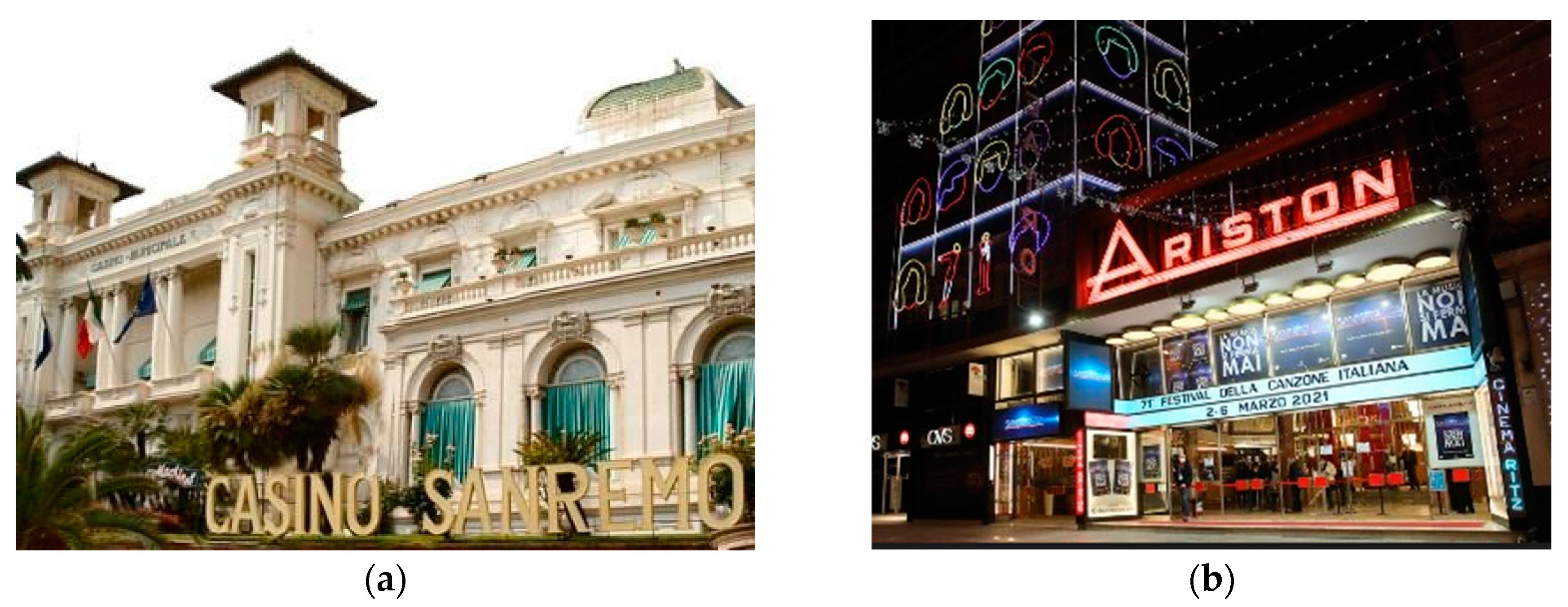
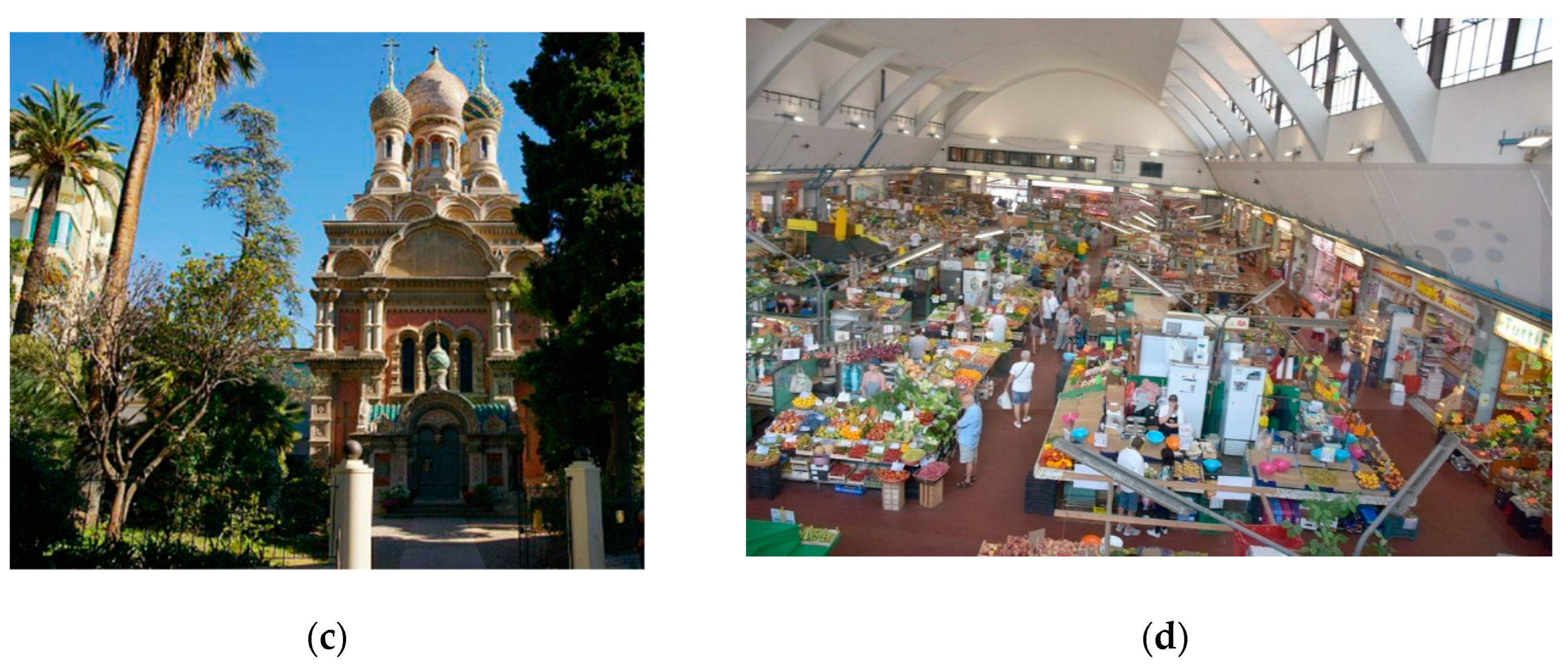
4. The Sanremo Pilot Case Study

4.1. General Overview

The pilot case study of Sanremo municipality, which is located on the western coast of Liguria (Italy), was examined using the methodology proposed in the previous section. Located in Liguria, in northwest Italy, Sanremo is a city on the Mediterranean coast (Figure 7). It was established during the Roman era and has 57,000 inhabitants. The municipality has an elongated shape in accordance with the configuration of Liguria. Numerous cultural events are held there, including the Milan–San Remo cycling classic and the Sanremo Music Festival.
Its Mediterranean climate and attractive seacoast setting on the Italian Riviera make it a popular tourist destination. In addition to tourism, the city is engaged in the manufacture of extra virgin olive oil, which has a protected “designation of origin”. The city is a significant agricultural center in the province of Imperia and in western Liguria. Sanremo is referred to as the “City of Flowers,” and the flower industry plays a significant role in the city’s economy. The Municipal Casino (Figure 8a), an example of an Art Nouveau structure established in 1905, and the Ariston Theatre (Figure 8b), which presents a yearly schedule of renowned concerts, operas, and stage productions, are additional significant landmarks in Sanremo. Accordingly, it is apparent that tourism is the crucial element for the various SUFs in this municipality and, consequently, that accommodation facilities represent one of the primary economic productive activities. Additional information regarding the data collection and methodology application is provided in the following sections, which illustrate the approach used in this case study in more detail. Figure 7 also provides a partial view of the ELC system where some of the most significant connections are indicated (i.e., Volta and the Aurelia roads); the green area identifies the part of Sanremo municipality where most of the significant components are concentrated and where, in fact, the SLCMIN is mainly located.

4.2. Data Collection and Tools Adopted for Implementing the Analysis Phase in the Sanremo Municipality

Stakeholder consultation resulted in the identification of five major SUFs, including schools, churches, historical buildings, hotels, and supermarkets. All data of the buildings belonging to these SUFs were collected by first referring to the archive and Google Street View and the in situ surveys performed in strict collaboration with local technicians [69]. Ad hoc forms were conceived to collect the data necessary to assign the scores, as detailed in the following.
As introduced in Section 3.1 (phase A2 of Figure 4), in the analysis phase, to apply Equation (1), appropriate weight factors (wsSE and wmSV) must be defined. The weights adopted for the Sanremo case study are shown in Table 1, which were obtained by taking into account the opinions of municipality staff. The weight factors vary based on the examined SUF. For instance, compared with churches, the socio-economic factor “heritage conservation and cultural identity” has much less weight in the case of schools and supermarkets.
Then, the scoring of each building was assigned in light of two main aspects, including socio-economic (SE) significance and structural vulnerability (SV), as was already mentioned in Section 3.1. Distinct criteria were proposed for each SUF taking into account the heterogeneity in the analyzed functions in the case of Sanremo. Table 2 shows the various criteria that are used to assess the occupancy (s = 1) and economy (s = 2) categories as well as the scores that should be given to each building based on those criteria. Additionally, different criteria and scoring rationale are presented in Table 3 for the category of heritage conservation and cultural identity (s = 3) as well.
Regarding the structural vulnerability, the safety index (SI) is the metric used for the first category, i.e., the structural response (m = 1); scores were assigned according to the range of variation summarized in Table 4. For determining the consequent hazard risk (m = 2), according to the score classes listed in Table 4, the results available from the study of Seismic Microzonation Level 1 [70] were employed. Table 5 shows that the only consequent risk considered was a landslide, and the score for this category was assigned based on four separate classes of susceptibility.
Regarding the SI, as aforementioned, the adopted methods need to balance the effort in acquiring the necessary data and executing the analyses with the capability of discriminating the seismic structural behavior. For the whole stock of school buildings in the Sanremo municipality, the results from the adoption of a mechanical–analytical approach combined with the use of detailed numerical models set through the equivalent frame approach were already available [71]; these data allowed for the direct evaluation of the SI. Although such a mechanical–analytical approach [72,73] is based on a limited number of geometrical and mechanical factors (as better illustrated in Section 4.3), the collection of all these data was unfeasible for the other eligible buildings in the SLC. This is why, for the other SUFs, the macroseismic model originally proposed in ([72,74]) was preferred.
The macroseismic model can be considered an empirical–heuristic method. It is directly derived from the concept of the European Macroseismic Scale (EMS98) [75], which defines six vulnerability classes (named from A to F). The macroseismic scales are not instrumental based, and they implicitly contain a vulnerability model. According to the original proposal of [74], the linguistic definitions of EMS98 were translated in quantitative terms by the fuzzy set theory, and the completion to Damage Probability Matrix (DPM) was carried out by using the binomial probability distribution. In this model, the vulnerability is synthetically expressed by a vulnerability curve, which gives the mean damage μD (= k p D S k ) as a function of the macroseismic intensity (I) according to:
μ D = 2.5 + 3   t a n h I + 6.25 V 12.7 Q       0 μ D 5
where the vulnerability index V and the ductility index Q are parameters representative of the seismic behavior of a group of buildings characterized by a homogeneous seismic behavior. The vulnerability index was assigned according to the following expression:
V = V 0 + Δ V m
where V0 is a typological vulnerability index defined by [74] based on the consistency with EMS-98 buildings typologies, while ΔVm corresponds to vulnerability modifiers aimed to account for a possible worsening or improvement in the seismic response based on specific structural factors. Table 5 and Table 6 show the values of V0 and Vm,k adopted in the present study. The values of V0 associated with monumental buildings were assumed accordingly to [76]; these values highlight the higher vulnerability expected for such monumental structures than residential buildings due to their architectural features (e.g., high slenderness ratio of walls). They were attributed based on the information carried out from ad hoc expeditious in situ surveys made in collaboration with the technicians of Sanremo municipality.
In this work, Equation (2) was applied by assuming a ductility index equal to 2.3, as originally proposed in [74], for RC buildings and URM structures assimilable to residential building configurations, and equal to 3 for monumental buildings. Such a method has been recently validated against real observed damage data and further developed in [77,78]. The computation of the SI via the use of the macroseismic approach requires the introduction of the following assumptions: (1) the adoption of a reference damage level as a proxy for the attainment of the ultimate limit state (i.e., the Life Safety—LS) and (2) the adoption of an appropriate correlation law between the macroseismic intensity (I) and the peak ground acceleration (PGA), used as an intensity measure to characterize the seismic hazard in this study. As far as issue (1) is concerned, DL3 was assumed as a reference that corresponds to the value of the mean damage μD equal to 2.5; instead, for issue (2), the law proposed in [79] was selected. These two assumptions allow for the computation of PGAC,LS, i.e., the maximum intensity measure corresponding to the fulfillment of the LS limit state. The safety index was then computed as the ratio of PGAC,LS to the corresponding seismic demand, i.e., PGAD,LS. The latter was derived from the Seismic Microzonation study of Level 3 [80], developed by the research group coordinated by Prof. G. Ferretti from the Department of Earth, Environment and Life Sciences (DiSTAV) at the University of Genoa. The Microzonation of Level 3 studies take into account the specific amplification phenomena that are expected in the area and provide reference ground acceleration peak values that are higher than those suggested in the Italian Seismic Hazard Maps [81]; more specifically, the values estimated for the Sanremo municipality by this study vary from a reference value of 0.145 m/s2 for soil A to a range of variation between 0.22 and 0.265 m/s2 (excluded topographical effects).
Lastly, three separate factors were taken into account in determining the scores that are associated with the category relation with the ELC (m = 3) (see Table 7). The exact minimum distance from the ELC system was the first factor considered, and the scores were assigned in accordance, classifying the building into five groups. The second factor concerns the road connection between the building under examination and the ELC system and its landslide susceptibility, as can be seen in Table 7. The third factor, which is the density of the buildings along either side of the road connection between the building and the ELC system, was computed by dividing the sum of the width of buildings that are based along both sides of the connection by the overall length of the connection multiplied by 2. Therefore, the ratio would be 0 if the entire length of both sides of the road connection was occupied by buildings. The corresponding scores assigned to this factor are defined in Table 7 as well.

4.3. Tools Adopted in the Sanremo Municipality for Implementing the Assessment Phase

The assessment phase involves both the buildings of the SLCMIN and all the interfering buildings and, as aforementioned, usually requires the adoption of vulnerability models with a different computational/data collection effort for such two categories.
For the interfering buildings, which are usually higher in number than those selected for the SCLMIN system, the macroseismic model [74], already introduced in the description of how the analysis phase was implemented in Sanremo, was used. However, in this case, the primary goal is not a first estimate of the safety index but that of the probability of attaining a damage level (DL) incompatible with the adequate performance of connection (i.e., PDL,lim). From the in situ survey, carried out by filling in the forms proposed in [41] for the ELC by the ICDP, integrated with the collection of some vulnerability factors, the data concerning the number of floors, type of construction, age, and position in the aggregate were acquired for every interfering building, which allowed for the computation of the vulnerability index (V). From Equation (2), it was then possible to compute μd and rebuild the damage probability distribution according to the binomial assumption, which is consistent with the main hypothesis of the mascroseismic approach. Finally, the reference DL equal to 4, for URM structures, and 3, for the RC ones, were adopted. The choice considers damage levels that could cause interference with the system by means of partial or total collapses. In the case of URM, this mainly refers to the complete activation of out-of-plane mechanisms [82,83,84], while, in the case of RC, it is mainly associated with the response of infills. As far as the last point is concerned, indeed, various works highlighted how the response of infills may strongly affect the first DLs in the response of RC structures [85,86,87].
For the buildings of the SLCMIN system, the assessment phase implies the evaluation alternatively of the seismic risk class or that of the safety index. As stated in Section 3.1, the seismic risk class aims to combine safety needs with economic principles and was adopted in Sanremo applications for schools, historical buildings, hotels, and supermarkets; conversely, in the case of churches, only the SI was adopted as a reference.
The seismic risk class was attributed according to criteria proposed in [63], as briefly clarified in Table 8. The computation of EAL presupposes that the maximum intensity measure (usually the PGA) is compatible with the fulfillment of various limit states (see Figure 6a). The latter may be estimated from more or less accurate vulnerability approaches by varying the degree of accuracy of the available data. Also, the macroseismic approach may be used (as explicitly recommended in [63] for URM structures, according to the so-called “conventional approach”) and, in such a case, it is recommended at least the use of modifier factors listed in Table 6 to better discriminate the seismic behavior of various buildings.
However, the limited number of buildings that compose the SLCMIN system, at least compared with the interfering buildings, makes it feasible to also apply mechanical–analytical approaches, which are based on a limited number of geometrical and mechanical parameters. This option, besides being a more accurate evaluation able to explicitly account for the various parameters that determine the structural response, also allows us to account for a more detailed seismic hazard characterization (e.g., instrumental IMs, seismic input in the spectral form) and exploit results of probabilistic seismic hazard analyses, when available. An interesting overview and discussion on the analogies and differences among different approaches, i.e., if empirical, mechanical–analytical, mechanical–numerical, or hybrid, is provided in [88,89], while in [90], a focus on analytical methodologies to derive vulnerability functions is presented. Among the mechanical–analytical approaches, some proposals specifically developed for RC structures are presented in [91,92,93,94], while those specifically for URM are developed in the works by [73,95,96,97,98].
In this work, by way of example, and given the availability of more detailed data from the archive, the mechanical–analytical Displacement-Based Vulnerability (DBV)-masonry method [73,98] was deployed for masonry buildings. The DBV-masonry method primarily refers to the global in-plane response of URM structures, starting from the shear-type idealization and evaluating the total base shear by assuming that all masonry piers fail simultaneously. This is true if the masonry piers are more or less the same size and the building has a regular floor plan. The vulnerability of actual structures that do not adhere to these hypothesis assumptions is calculated using the appropriate corrective factors. Through them, also weak spandrel-strong piers or intermediate behavior can be captured; moreover, in recent applications presented in [73], additional corrective factors have been introduced to account also for the possible activation of out-of-plane mechanisms. The model defines the capacity curve by the following three variables: the pseudo-elastic period of the structure Ty; the spectral acceleration at yielding Ay (equal to the ultimate one Au because no hardening is assumed); and the ultimate displacement capacity DDL4. In order to evaluate these variables, it is necessary to define a small number of mechanical and geometrical parameters, assume a basic modal shape, and assign specific correction factors that are intended to account for the impacts of a wide variety of constructive and morphological details (such as the presence of tie-rods, ring beams, etc.). The fundamental steps for using such a mechanical model are as follows: (1) analyzing the data that are available from archives or site surveys, (2) defining all necessary parameters and factors in two directions (X and Y), (3) assessing the capacity curves, (4) defining the seismic demand by an Acceleration–Displacement Response Spectrum (ADRS), and (5) evaluating the value PGALS of the PGA that generates any LS threshold using overdamped spectra [98]. In that way, the EAL may be computed as well. A more detailed description of this method is out of the scope of this paper; thus, interested readers are invited to refer to [73,89,98].
For religious buildings, the vulnerability model proposed in the Italian G.U. no. 47 Guidelines [99] and inspired by the work of [100] was adopted. This allowed us to compute the vulnerability index (V) linked to the specific features (vulnerability indicators and earthquake-resistant details) of a church, in terms of possible collapse mechanisms of each macro element of the asset. This coefficient allowed us to quantify the seismic capacity that, compared with the demand PGA values obtained from microzonation studies, provides the safety index.

5. Results

The main results of the application of the EQ-DIRECTION procedure to Sanremo municipality are presented in this section, which is also supported by a graphic representation via the GIS platform. As partially depicted in Figure 9, in the zoom-in concentrated in the main historical area of the municipality, there are 184 eligible buildings in Sanremo (phase A1 of Figure 4) that correspond to the five identified SUFs and are potential candidates for the SLCMIN. The numbers for each category are as follows: schools (45), churches (24), historical structures (51), supermarkets (21), and hotels (43). The latter serve as Sanremo’s primary productive function, as stated in the case study description.
Figure 10a illustrates, by way of example, the resulting scores for the hotels in Sanremo assigned at the end of the analysis phase implemented, as described in Section 4.2. Both scores are illustrated, i.e., the partial scores associated with the ES vs. factors and the final ones after their combination through the weight factors in Table 1 and renormalization to 1. In orange and yellow, two hotels are marked, for which quite different structural or socio-economic performance is expected; however, in the end, they belong to the same class (i.e., with Pi ranging from 0.3 to 0.6). Although the result is sensitive to the weight factors assumed, the procedure allows us to account for various aspects that potentially contribute altogether to defining the overall resilience of the system. Instead, Figure 10b helps in identifying such hotels in the urban system; each hotel is colored in a shade of blue to clarify its corresponding final score value.
The scores assigned in the analysis phase were useful in addressing the selection of buildings for SLCMIN (Figure 11a), even if they were integrated with other factors. In particular, some crucial buildings for the recovery were determined after consultation with municipality staff regardless of the scores given to them. They consist of five buildings, i.e., the Annonario Market, the Russian Church, the Sanremo Casino, the San Siro Church, and the Ariston Theater (shown in purple in Figure 11a). Some streets were selected as the crucial network for connecting the most significant buildings to one another and to the ELC system; Figure 11a shows the additional streets, which are referred to as the SLC link and are shown as blue lines. According to the findings of the stakeholder interviews, the five most significant buildings and the corresponding road network should be regarded as the core system in SLC because, given the characteristics of Sanremo and its primary sources of income, preserving those elements is the most crucial issue for sustaining the socio-economic functionality and livelihood of the city. Because of this, identifying more buildings with regard to SLC should, to some extent, take into account their proximity to the most significant building and the networks that connect them, in addition to the scores they receive. More specifically, the SLCMIN includes 19 regular and monumental masonry structures constructed before 1919 with the number of floors ranging from three to seven; five buildings made of reinforced concrete constructed between 1945 and 1971 with the number of floors ranging from five to seven; one steel supermarket constructed in accordance with seismic regulations; and four churches.
Figure 11b shows the buildings of SLCMIN with a graphic representation of their score. Each eligible building is identified by a thicker outline color, which matches the relevant SUF according to the legend, and an internal color that indicates which range of the final score (>0.3, 0.3–0.6, >0.6) the building falls into. The 29 SLCMIN-eligible buildings were optimally chosen from those with the highest scores (e.g., greater than 0.3), preferring those close to the ELC strategic buildings and SLC’s most significant buildings or easily accessible from them through the established connections (e.g., red and blue road networks) (Figure 11a).
Figure 12 illustrates the main intermediate results of the assessment phase, namely, (a) the estimate of PDL,lim for the interfering buildings (the strategic buildings of the ELC and SLC system are highlighted in dark and light blue, while the other colors identify the probability of attaining the selected reference DL) and (b) the loss curves evaluated for URM and RC buildings.
The main geometric characteristics necessary for the application of the DBV-masonry method and the evaluation of EAL are the inter-story height, the number of floors, and the resistant area compared to the floor area. These data were obtained by conducting a documentary study of the municipal archive. In more detail, the geometrical parameters were considered as random variables, while for the mechanical properties of the masonry and floors, where unknown, reference was made to studies carried out on site on the construction typologies common in Sanremo; these studies were carried out according to the CARTIS approach [101]. In particular, the URM buildings analyzed are considered to be made of cleft stone masonry with good texture and square stone block masonry with tie rods and wooden-flexible and semi-flexible floors. Figure 12b shows how the Damage Limit State (SLD) value has the greatest influence on the value of the Average Annual Loss. Contrary to performance-based assessment strictly focused on safety aspects, where the Life Safety Limit State is typically the most important, the lower limit states are also crucial when evaluating structures from an economic perspective.
Finally, Figure 13 provides an overall overview of the final result of the assessment phase in terms of risk class or safety index (only for religious structures) of SLCMIN buildings as well as the likelihood that the damage level of reference will occur for each interfering building.

6. Conclusions

The procedure proposed in this paper represents a pioneering effort to operationalize some general principles articulated by the Italian Civil Protection Department (ICPD), which seek to establish the desired targets of specific Limit Conditions on an urban settlements scale, in contrast to the prevalent focus in the literature on performance-based seismic assessment at the individual building level. The primary focus is on ensuring the safety and resilience of the urban system. This involves introducing a novel procedure named EQ-DIRECTON, designed to serve as a tool supporting risk mitigation policies enacted by local authorities at the urban scale. Specifically, EQ-DIRECTON can be employed to prioritize mitigation actions on selected buildings identified during peaceful times. This proactive approach aims to expedite and enhance the recovery phase following a potentially hazardous event, making it more efficient and effective.
The proposed approach highlights some key aspects including the following:
  • Recognizing the paramount importance of actively involving local stakeholders in defining factors that significantly influence the decision-making process of the proposed procedure. This feature also enables the procedure to be adaptable to various urban contexts.
  • Introducing tools aimed at striking a balance between the necessity for an assessment capable of discerning the performance of diverse buildings and the challenges associated with data collection and computation efforts.
  • Taking into account a comprehensive set of factors crucial for recovery. This not only involves safety and structural considerations but also extends to socio-economic needs.
This paper tentatively demonstrates the feasibility of the proposed approach by applying it to the pilot case study of Sanremo. The visualization of results in a GIS environment proves to be highly effective. Moreover, once the collected data are implemented in such a tool, it may help the administration to monitor and continuously update the status of the urban settlements. For instance, it facilitates the updating of information on strengthening interventions carried out in the assets.
While this approach has yet to be implemented in any real-world case study to validate its applicability, numerous studies suggest that failing to adopt this approach results in inefficient and prolonged recovery following a disaster [102]. For instance, the aftermath of the L’Aquila earthquake and subsequent reconstruction efforts, which led to the displacement of the population from the city’s central historic area, underscored the detrimental effects of lacking SLCMIN. These effects include the loss of community identity [103], depopulation of the area, social fragmentation, and isolation [104,105], heightened social and economic vulnerability post-reconstruction [104], decreased spatial connectivity [106], limited community participation in recovery efforts [107,108], decreasing resilience of the community after reconstruction [107], and protracted recovery processes [31].
In addition, it is worth noting that the Italian Civil Protection’s introduction of the concepts of SLC and the minimum urban system underscores the importance of moving towards implementing these concepts in real-world scenarios.
Certainly, the potential for enhancing the procedure is extensive and primarily includes the following:
  • Testing more structured methods to promote stakeholder involvement, thereby addressing the definition of SUFs and the calibration of the weight factors w. Ongoing efforts in this direction involve the testing of fuzzy cognitive maps and other participatory approaches.
  • Extending the approach beyond a single hazard perspective, which currently focuses solely on seismic risk, to encompass a multi-risk perspective [109]. This expansion aligns with the increasing need for mitigation policies, as recently explored in-depth in [110].

Author Contributions

Conceptualization/methodology/supervision/visualization/resources: S.C.; data curation/methodology/formal analysis: D.O.; writing—original draft preparation: S.C. and D.O.; writing—original draft preparation of Section 1 and review of the overall paper: S.M. All authors have read and agreed to the published version of the manuscript.

Funding

This research received no external funding.

Institutional Review Board Statement

Not applicable.

Informed Consent Statement

Not applicable.

Data Availability Statement

The data presented in this study are available on request from the corresponding author.

Acknowledgments

The authors express their gratitude to the staff of Sanremo municipality that made the application presented in this paper possible, in particular Geol. Fulvio Franco (technical Responsible of this activity for the Municipality of Sanremo), Eng. Tommaso Buschiazzo, Geol. Valerio Vivaldi and Geol. Andrea Guardiani. The staff of Sanremo municipality contributes to collecting all the necessary data for the EQ-DIRECTION application and defining the buildings composing the SLCMIN system. The Sanremo municipality provided the financial support of this research activity. Moreover, the authors thankfully acknowledge the Liguria Region and, in particular, Geol. D. Bottero for the technical support and the contribution given to the development of the procedure, particularly related to the implications for public administrations. Note that the opinions and conclusions presented by the authors do not necessarily reflect those of the Italian Department of Civil Protection, even if the SLC general principles were established by such an institution.

Conflicts of Interest

The authors declare no conflicts of interest.

References

  1. Baldassarre, B.; Conticelli, E.; Santangelo, A. Planning for More Resilient and Safer Cities: A New Methodology for Seismic Risk Assessment at the Urban Scale, Applied to a Case Study in Italy. Sustainability 2024, 16, 1892. [Google Scholar] [CrossRef]
  2. Davoudi, S.; Shaw, K.; Haider, L.J.; Quinlan, A.E.; Peterson, G.D.; Wilkinson, C.; Fünfgeld, H.; McEvoy, D.; Porter, L.; Davoudi, S. Resilience: A Bridging Concept or a Dead End? “Reframing” Resilience: Challenges for Planning Theory and Practice Interacting Traps: Resilience Assessment of a Pasture Management System in Northern Afghanistan Urban Resilience: What Does It Mean in Planning Practice? Resilience as a Useful Concept for Climate Change Adaptation? The Politics of Resilience for Planning: A Cautionary Note. Plan. Theory Pract. 2012, 13, 299–333. [Google Scholar] [CrossRef]
  3. Meerow, S.; Newell, J.P.; Stults, M. Defining Urban Resilience: A Review. Landsc. Urban Plan. 2016, 147, 38–49. [Google Scholar] [CrossRef]
  4. UNDRR Online Glossary. Available online: https://www.undrr.org/terminology (accessed on 8 August 2022).
  5. Banica, A.; Rosu, L.; Muntele, I.; Grozavu, A. Towards Urban Resilience: A Multi-Criteria Analysis of Seismic Vulnerability in Iasi City (Romania). Sustainability 2017, 9, 270. [Google Scholar] [CrossRef]
  6. Ernstson, H.; van der Leeuw, S.E.; Redman, C.L.; Meffert, D.J.; Davis, G.; Alfsen, C.; Elmqvist, T. Urban Transitions: On Urban Resilience and Human-Dominated Ecosystems. Ambio 2010, 39, 531–545. [Google Scholar] [CrossRef] [PubMed]
  7. Pickett, S.T.A.; Cadenasso, M.L.; Grove, J.M. Resilient Cities: Meaning, Models, and Metaphor for Integrating the Ecological, Socio-Economic, and Planning Realms. Landsc. Urban Plan. 2004, 69, 369–384. [Google Scholar] [CrossRef]
  8. Kafle, S.K. Measuring Disaster-Resilient Communities: A Case Study of Coastal Communities in Indonesia. J. Bus. Contin. Emerg. Plan. 2012, 5, 316–326. [Google Scholar]
  9. Moore, M.; Chandra, A.; Feeney, K.C. Building Community Resilience: What Can the United States Learn From Experiences in Other Countries? Disaster Med. Public Health Prep. 2013, 7, 292–301. [Google Scholar] [CrossRef] [PubMed]
  10. Ostadtaghizadeh, A.; Ardalan, A.; Paton, D.; Khankeh, H.; Jabbari, H. Community Disaster Resilience: A Qualitative Study on Iranian Concepts and Indicators. Nat. Hazards 2016, 83, 1843–1861. [Google Scholar] [CrossRef]
  11. Cimellaro, G.P.; Reinhorn, A.M.; Bruneau, M. Quantification of Seismic Resilience. In Proceedings of the 8th U.S. National Conference on Earthquake Engineering, San Francisco, CA, USA, 18–22 April 2006. [Google Scholar]
  12. Maroufi, H.; Borhani, M. A Measurement of Community Seismic Resilience in Sub-City Districts of Mashhad, Iran. J. Environ. Plan. Manag. 2021, 65, 675–702. [Google Scholar] [CrossRef]
  13. Bruneau, M.; Chang, S.E.; Eguchi, R.T.; Lee, G.C.; O’Rourke, T.D.; Reinhorn, A.M.; Shinozuka, M.; Tierney, K.; Wallace, W.A.; von Winterfeldt, D. A Framework to Quantitatively Assess and Enhance the Seismic Resilience of Communities. Earthq. Spectra 2003, 19, 733–752. [Google Scholar] [CrossRef]
  14. Bruneau, M.; Reinhorn, A. Overview of the Resilience Concept. In Proceedings of the 8th US National Conference on Earthquake Engineering, San Francisco, CA, USA, 18–22 April 2006; Volume 2040, pp. 18–22. [Google Scholar]
  15. Rus, K.; Kilar, V.; Koren, D. Resilience Assessment of Complex Urban Systems to Natural Disasters: A New Literature Review. Int. J. Disaster Risk Reduct. 2018, 31, 311–330. [Google Scholar] [CrossRef]
  16. Russo, M.; Angelosanti, M.; Bernardini, G.; Severi, L.; Quagliarini, E.; Currà, E. Factors Influencing the Intrinsic Seismic Risk of Open Spaces in Existing Built Environments: A Systematic Review. Sustainability 2022, 14, 42. [Google Scholar] [CrossRef]
  17. Privitera, R.; La Rosa, D. Reducing Seismic Vulnerability and Energy Demand of Cities through Green Infrastructure. Sustainability 2018, 10, 2591. [Google Scholar] [CrossRef]
  18. Zuccaro, G.; De Gregorio, D.; Leone, M.F.; Sessa, S.; Nardone, S.; Perelli, F.L. CAESAR II Tool: Complementary Analyses for Emergency Planning Based on Seismic Risks Impact Evaluations. Sustainability 2021, 13, 9838. [Google Scholar] [CrossRef]
  19. Yi, F.; Tu, Y. An Evaluation of the Paired Assistance to Disaster-Affected Areas Program in Disaster Recovery: The Case of the Wenchuan Earthquake. Sustainability 2018, 10, 4483. [Google Scholar] [CrossRef]
  20. Zhang, J.; Zhang, M.; Li, G. Multi-Stage Composition of Urban Resilience and the Influence of Pre-Disaster Urban Functionality on Urban Resilience. Nat. Hazards 2021, 107, 447–473. [Google Scholar] [CrossRef]
  21. Sivakumar, R.; Jatin, M.; Mangnani, K.; Agarwal, A.; Ghosh, S.; Sridhar, S.S. Seismic Disaster Resilience by Improving Infrastructure Strength in Active Seismotectonic Zones of Sikkim Himalaya, India—An Integrated in-Situ and Laboratory Based Approach. Nat. Hazards 2024. [Google Scholar] [CrossRef]
  22. Fang, Y.-P.; Zio, E. An Adaptive Robust Framework for the Optimization of the Resilience of Interdependent Infrastructures under Natural Hazards. Eur. J. Oper. Res. 2019, 276, 1119–1136. [Google Scholar] [CrossRef]
  23. Cara, S.; Aprile, A.; Pelà, L.; Roca, P. Seismic Risk Assessment and Mitigation at Emergency Limit Condition of Historical Buildings along Strategic Urban Roadways. Application to the “Antiga Esquerra de L’Eixample” Neighborhood of Barcelona. Int. J. Archit. Herit. 2018, 12, 1055–1075. [Google Scholar] [CrossRef]
  24. Lin, Z.; Jia, C. The Optimization Model in the Disaster Risk Mitigation Investment. Syst. Eng. Procedia 2012, 5, 191–197. [Google Scholar] [CrossRef]
  25. D’Alpaos, C.; Valluzzi, M.R. Protection of Cultural Heritage Buildings and Artistic Assets from Seismic Hazard: A Hierarchical Approach. Sustainability 2020, 12, 1608. [Google Scholar] [CrossRef]
  26. Manyena, S.B. The Concept of Resilience Revisited. Disasters 2006, 30, 434–450. [Google Scholar] [CrossRef] [PubMed]
  27. Mannella, A.; Di Ludovico, M.; Sabino, A.; Prota, A.; Dolce, M.; Manfredi, G. Analysis of the Population Assistance and Returning Home in the Reconstruction Process of the 2009 L’Aquila Earthquake. Sustainability 2017, 9, 1395. [Google Scholar] [CrossRef]
  28. Di Ludovico, M.; Digrisolo, A.; Moroni, C.; Graziotti, F.; Manfredi, V.; Prota, A.; Dolce, M.; Manfredi, G. Remarks on Damage and Response of School Buildings after the Central Italy Earthquake Sequence. Bull. Earthq. Eng. 2019, 17, 5679–5700. [Google Scholar] [CrossRef]
  29. Sorrentino, L.; Cattari, S.; da Porto, F.; Magenes, G.; Penna, A. Seismic Behaviour of Ordinary Masonry Buildings during the 2016 Central Italy Earthquakes. Bull. Earthq. Eng. 2019, 17, 5583–5607. [Google Scholar] [CrossRef]
  30. Dolce, M.; Di Bucci, D. Comparing Recent Italian Earthquakes. Bull. Earthq. Eng. 2017, 15, 497–533. [Google Scholar] [CrossRef]
  31. Contreras, D.; Blaschke, T.; Kienberger, S.; Zeil, P. Myths and Realities about the Recovery of L׳Aquila after the Earthquake. Int. J. Disaster Risk Reduct. 2014, 8, 125–142. [Google Scholar] [CrossRef] [PubMed]
  32. De Martino, G.; Di Ludovico, M.; Mannella, A.; Speranza, E.; Fico, R.; Provenzano, S.; Prota, A.; Dolce, M. Reconstruction Process after 2009 Abruzzo Earthquake Outside and inside Historical Centers: Funding Models and Strengthening Costs. Procedia Struct. Integr. 2022, 44, 1800–1807. [Google Scholar] [CrossRef]
  33. Di Ludovico, M.; Prota, A.; Moroni, C.; Manfredi, G.; Dolce, M. Reconstruction Process of Damaged Residential Buildings Outside Historical Centres after the L’Aquila Earthquake: Part I—“light Damage” Reconstruction. Bull. Earthq. Eng. 2017, 15, 667–692. [Google Scholar] [CrossRef]
  34. Di Ludovico, M.; Prota, A.; Moroni, C.; Manfredi, G.; Dolce, M. Reconstruction Process of Damaged Residential Buildings Outside Historical Centres after the L’Aquila Earthquake: Part II—“Heavy Damage” Reconstruction. Bull. Earthq. Eng. 2017, 15, 693–729. [Google Scholar] [CrossRef]
  35. Dolce, M.; Bramerini, F.; Castenetto, S.; Naso, G. The Italian Policy for Seismic Microzonation. In Earthquake Geotechnical Engineering for Protection and Development of Environment and Constructions; CRC Press: Boca Raton, FL, USA, 2019; pp. 925–937. [Google Scholar]
  36. Bramerini, F.; Cavinato, G.P.; Fabietti, V. Strategie Di Mitigazione Del Rischio Sismico e Pianificazione. CLE: Condizione Limite per l’Emergenza. 2013. Available online: https://governancerischio.protezionecivile.gov.it/documents/20182/206005/CLE+Dossier/69f9ee40-4752-451d-80e2-4033713d7f15 (accessed on 20 January 2024).
  37. Terzi, S.; De Angeli, S.; Miozzo, D.; Massucchielli, L.S.; Szarzynski, J.; Carturan, F.; Boni, G. Learning from the COVID-19 Pandemic in Italy to Advance Multi-Hazard Disaster Risk Management. Prog. Disaster Sci. 2022, 16, 100268. [Google Scholar] [CrossRef]
  38. Anelli, A.; Mori, F.; Mendicelli, A.; Bramerini, F. Mapping Urban Limit Conditions in the Perspective of Disaster Risk Prevention and Land Management. IJG 2022, 141, 167–183. [Google Scholar] [CrossRef]
  39. Code, P. Eurocode 8: Design of Structures for Earthquake Resistance—Part 3: Assessment and Retrofitting of Buildings. 2010. Available online: https://www.saiglobal.com/PDFTemp/Previews/OSH/IS/EN/2005/I.S.EN1998-3-2005.pdf (accessed on 20 January 2024).
  40. Null, N. Seismic Evaluation and Retrofit of Existing Buildings; American Society of Civil Engineers: Reston, VI, USA, 2014; ISBN 978-0-7844-1285-5. [Google Scholar]
  41. Bramerini, F.; Castenetto, S. Manuale per l’analisi Della Condizione Limite per l’Emergenza (CLE) Dell’insediamento Urbano; BetMultimedia: Roma, Italy, 2014. [Google Scholar]
  42. Dolce, M.; Speranza, E.; Bocchi, F.; Conte, C. Probabilistic Assessment of Structural Operational Efficiency in Emergency Limit Conditions: The I.OPà.CLE Method. Bull. Earthq. Eng. 2018, 16, 3791–3818. [Google Scholar] [CrossRef]
  43. Dolce, M.; Speranza, E.; Conte, C.; Bocchi, F. Structural Operational Efficiency Indices for Emergency Limit Condition (I.OPà.CLE): Experimental Results. Boll. Geofis. Teor. Appl. 2019, 60, 243–262. [Google Scholar] [CrossRef]
  44. Dolce, M.; Speranza, E.; De Martino, G.; Conte, C.; Giordano, F. The Implementation of the Italian National Seismic Prevention Plan: A Focus on the Seismic Upgrading of Critical Buildings. Int. J. Disaster Risk Reduct. 2021, 62, 102391. [Google Scholar] [CrossRef]
  45. Giuliani, F.; De Falco, A.; Sevieri, G.; Cutini, V. Managing Emergency into Historic Centres in Italy: Seismic Vulnerability Evaluation at Urban Scale. In Proceedings of the COMPDYN Proceedings; 7th ECCOMAS Thematic Conference on Computational Methods in Structural Dynamics and Earthquake Engineering, Crete, Greece, 24–26 June 2019; Volume 1, pp. 1641–1652. [Google Scholar]
  46. Skrame, K.; Gaudiosi, I.; Muçi, R.; Mancini, M.; Simionato, M.; Benigni, M.S.; Ramollari, A.; Giuffrè, M.; Moscatelli, M. Earthquake-Resistant Cities in Albania: The Seismic Microzonation Studies (SMS) and Limit Condition in Emergency (LCE) Integrated Approach. In Proceedings of the 4th International Balkans Conference on Challenges of Civil Engineering, Tirana, Albania, 18–19 December 2020; p. 7. [Google Scholar]
  47. Dunford, M.; Li, L. Earthquake Reconstruction in Wenchuan: Assessing the State Overall Plan and Addressing the ‘Forgotten Phase’. Appl. Geogr. 2011, 31, 998–1009. [Google Scholar] [CrossRef]
  48. Clemente, M.; Salvati, L. ‘Interrupted’ Landscapes: Post-Earthquake Reconstruction in between Urban Renewal and Social Identity of Local Communities. Sustainability 2017, 9, 2015. [Google Scholar] [CrossRef]
  49. Alexander, D. An Evaluation of the Recovery Strategy after 6 April 2009 Earthquake in L’Aquila, Central Italy. Disaster Plan. Emerg. Manag. 2010, 12, 1–13. [Google Scholar]
  50. Contreras, D.; Blaschke, T.; Hodgson, M.E. Lack of Spatial Resilience in a Recovery Process: Case L’Aquila, Italy. Technol. Forecast. Soc. Change 2017, 121, 76–88. [Google Scholar] [CrossRef]
  51. Özerdem, A.; Rufini, G. L’Aquila’s Reconstruction Challenges: Has Italy Learned from Its Previous Earthquake Disasters? Disasters 2013, 37, 119–143. [Google Scholar] [CrossRef]
  52. Paton, D.; Johnston, D. Disaster Resilience: An Integrated Approach, 2nd ed.; Charles C Thomas Publisher: Springfield, IL, USA, 2017; ISBN 978-0-398-09169-9. [Google Scholar]
  53. He, L.; Xie, Z.; Peng, Y.; Song, Y.; Dai, S. How Can Post-Disaster Recovery Plans Be Improved Based on Historical Learning? A Comparison of Wenchuan Earthquake and Lushan Earthquake Recovery Plans. Sustainability 2019, 11, 4811. [Google Scholar] [CrossRef]
  54. Holling, C.S. Resilience and Stability of Ecological Systems. Annu. Rev. Ecol. Syst. 1973, 4, 1–23. [Google Scholar] [CrossRef]
  55. Fitzgibbons, J.; Mitchell, C.L. Just Urban Futures? Exploring Equity in “100 Resilient Cities”. World Dev. 2019, 122, 648–659. [Google Scholar] [CrossRef]
  56. Zeng, X.; Yu, Y.; Yang, S.; Lv, Y.; Sarker, M.N.I. Urban Resilience for Urban Sustainability: Concepts, Dimensions, and Perspectives. Sustainability 2022, 14, 2481. [Google Scholar] [CrossRef]
  57. Van Broekhoven, S.; Vernay, A.L. Integrating Functions for a Sustainable Urban System: A Review of Multifunctional Land Use and Circular Urban Metabolism. Sustainability 2018, 10, 1875. [Google Scholar] [CrossRef]
  58. Pitilakis, K.; Crowley, H.; Kaynia, A.M. (Eds.) SYNER-G: Typology Definition and Fragility Functions for Physical Elements at Seismic Risk; Geotechnical, Geological and Earthquake Engineering; Springer: Dordrecht, The Netherlands, 2014; Volume 27, ISBN 978-94-007-7871-9. [Google Scholar]
  59. Brzev, S.; Scawthorn, C.; Charleson, A.W.; Allen, L.; Greene, M.; Jaiswal, K.; Silva, V. GEM Building Taxonomy (Version 2.0); GEM Foundation: Kampala, Uganda, 2013. [Google Scholar]
  60. Dolce, M.; Prota, A.; Borzi, B.; da Porto, F.; Lagomarsino, S.; Magenes, G.; Moroni, C.; Penna, A.; Polese, M.; Speranza, E.; et al. Seismic Risk Assessment of Residential Buildings in Italy. Bull. Earthq. Eng. 2021, 19, 2999–3032. [Google Scholar] [CrossRef]
  61. Istat. It Censuses. Available online: https://www.istat.it/en/archivio/censuses (accessed on 1 March 2024).
  62. Calvi, G.M.; Sullivan, T.J.; Welch, D.P. A Seismic Performance Classification Framework to Provide Increased Seismic Resilience. In Perspectives on European Earthquake Engineering and Seismology; Springer: Cham, Switzerland, 2014; pp. 361–400. [Google Scholar]
  63. Cosenza, E.; Del Vecchio, C.; Di Ludovico, M.; Dolce, M.; Moroni, C.; Prota, A.; Renzi, E. The Italian Guidelines for Seismic Risk Classification of Constructions: Technical Principles and Validation. Bull. Earthq. Eng. 2018, 16, 5905–5935. [Google Scholar] [CrossRef]
  64. O’Reilly, G.J.; Perrone, D.; Fox, M.; Monteiro, R.; Filiatrault, A. Seismic Assessment and Loss Estimation of Existing School Buildings in Italy. Eng. Struct. 2018, 168, 142–162. [Google Scholar] [CrossRef]
  65. O’Reilly, G.J.; Monteiro, R.; Nafeh, A.M.B.; Sullivan, T.J.; Calvi, G.M. Displacement-Based Framework for Simplified Seismic Loss Assessment. J. Earthq. Eng. 2020, 24, 1–22. [Google Scholar] [CrossRef]
  66. Gentile, R.; Calvi, G.M. Direct Loss-Based Seismic Design of Reinforced Concrete Frame and Wall Structures. Earthq. Eng. Struct. Dyn. 2023, 52, 4395–4415. [Google Scholar] [CrossRef]
  67. Calvi, G.M.; O’Reilly, G.J.; Andreotti, G. Towards a Practical Loss-Based Design Approach and Procedure. Earthq. Eng. Struct. Dyn. 2021, 50, 3741–3753. [Google Scholar] [CrossRef]
  68. Decreto Ministeriale Numero 58 Del 28/02/2017 | Ministero Delle Infrastrutture e Dei Trasporti. Available online: https://www.mit.gov.it/normativa/decreto-ministeriale-numero-58-del-28022017 (accessed on 29 February 2024).
  69. Cattari, S.; Ottonelli, D.; Franco, F.; Buschiazzo, T.; Guardiani, A.; Vivaldi, V. Towards an improved urban seismic resilience: The pilot case study of sanremo municipality. In Proceedings of the 17th World Conference on Earthquake Engineering, Sendai, Japan, 27 September–2 October 2021; Volume 17. [Google Scholar]
  70. Microzonation Study of Level 1 for the Sanremo Municipality. Available online: https://trasparenza.comune.sanremo.im.it/ (accessed on 20 January 2024).
  71. Cattari, S.; Frumento, S.; Lagomarsino, S.; Parodi, S.; Resemini, S. Multi-Level Procedure for the Seismic Vulnerability Assessment of Masonry Buildings: The Case of Sanremo (North-Western Italy). In Proceedings of the 1st ECEES, Geneva, Switzerland, 3–8 September 2006; pp. 3–8. [Google Scholar]
  72. Lagomarsino, S.; Cattari, S. Seismic Vulnerability of Existing Buildings. In Seismic Vulnerability of Structures; John Wiley & Sons, Ltd.: Hoboken, NJ, USA, 2013; pp. 1–62. ISBN 978-1-118-60392-5. [Google Scholar]
  73. Lagomarsino, S.; Cattari, S. Fragility Functions of Masonry Buildings. In SYNER-G: Typology Definition and Fragility Functions for Physical Elements at Seismic Risk: Buildings, Lifelines, Transportation Networks and Critical Facilities; Pitilakis, K., Crowley, H., Kaynia, A.M., Eds.; Geotechnical, Geological and Earthquake Engineering; Springer: Dordrecht, The Netherlands, 2014; pp. 111–156. ISBN 978-94-007-7872-6. [Google Scholar]
  74. Lagomarsino, S.; Giovinazzi, S. Macroseismic and Mechanical Models for the Vulnerability and Damage Assessment of Current Buildings. Bull. Earthq. Eng. 2006, 4, 415–443. [Google Scholar] [CrossRef]
  75. Grünthal, G. European Macroseismic Scale 1998: EMS-98; European Seismological Commission, Subcommission on Engineering Seismology, Working Group Macroseismic Scales: Luxembourg, 1998; ISBN 978-2-87977-008-6. [Google Scholar]
  76. Lagomarsino, S. On the Vulnerability Assessment of Monumental Buildings. Bull. Earthq. Eng. 2006, 4, 445–463. [Google Scholar] [CrossRef]
  77. Lagomarsino, S.; Cattari, S.; Ottonelli, D. The Heuristic Vulnerability Model: Fragility Curves for Masonry Buildings. Bull. Earthq. Eng. 2021, 19, 3129–3163. [Google Scholar] [CrossRef]
  78. Di Ludovico, M.; Cattari, S.; Verderame, G.; Del Vecchio, C.; Ottonelli, D.; Del Gaudio, C.; Prota, A.; Lagomarsino, S. Fragility Curves of Italian School Buildings: Derivation from L’Aquila 2009 Earthquake Damage via Observational and Heuristic Approaches. Bull. Earthq. Eng. 2023, 21, 397–432. [Google Scholar] [CrossRef]
  79. Faccioli, E.; Cauzzi, C. Macroseismic Intensities for Seismic Scenarios Estimated from Instrumentally Based Correlations. In Proceedings of the 1st ECEES, Geneva, Switzerland, 3–8 September 2006. [Google Scholar]
  80. Microzonation Study of Level 3 for the Sanremo Municipality. Available online: https://trasparenza.comune.sanremo.im.it/ (accessed on 20 January 2024).
  81. Stucchi, M.; Meletti, C.; Montaldo, V.; Akinci, A.; Faccioli, E.; Gasperini, P.; Malagnini, L.; Valensise, G. Pericolosità Sismica Di Riferimento per Il Territorio Nazionale MPS04; Istituto Nazionale di Geofisica e Vulcanologia (INGV): Roma, Itaty, 2004. [Google Scholar]
  82. Nale, M.; Minghini, F.; Chiozzi, A.; Tralli, A. Fragility Functions for Local Failure Mechanisms in Unreinforced Masonry Buildings: A Typological Study in Ferrara, Italy. Bull. Earthq. Eng. 2021, 19, 6049–6079. [Google Scholar] [CrossRef]
  83. Lagomarsino, S. Seismic Assessment of Rocking Masonry Structures. Bull. Earthq. Eng. 2015, 13, 97–128. [Google Scholar] [CrossRef]
  84. D’Ayala, D.; Speranza, E. Definition of Collapse Mechanisms and Seismic Vulnerability of Historic Masonry Buildings. Earthq. Spectra 2003, 19, 479–509. [Google Scholar] [CrossRef]
  85. Del Gaudio, C.; De Martino, G.; Di Ludovico, M.; Manfredi, G.; Prota, A.; Ricci, P.; Verderame, G.M. Empirical Fragility Curves from Damage Data on RC Buildings after the 2009 L’Aquila Earthquake. Bull. Earthq. Eng. 2017, 15, 1425–1450. [Google Scholar] [CrossRef]
  86. Del Gaudio, C.; De Risi, M.T.; Verderame, G.M. Seismic Loss Prediction for Infilled RC Buildings via Simplified Analytical Method. J. Earthq. Eng. 2022, 26, 5477–5510. [Google Scholar] [CrossRef]
  87. Ricci, P.; De Luca, F.; Verderame, G.M. 6th April 2009 L’Aquila Earthquake, Italy: Reinforced Concrete Building Performance. Bull. Earthq. Eng. 2011, 9, 285–305. [Google Scholar] [CrossRef]
  88. da Porto, F.; Donà, M.; Rosti, A.; Rota, M.; Lagomarsino, S.; Cattari, S.; Borzi, B.; Onida, M.; De Gregorio, D.; Perelli, F.L.; et al. Comparative Analysis of the Fragility Curves for Italian Residential Masonry and RC Buildings. Bull. Earthq. Eng. 2021, 19, 3209–3252. [Google Scholar] [CrossRef]
  89. Cattari, S.; Alfano, S.; Manfredi, V. National Risk Assessment of Italian School Buildings: The MARS Project Experience 2024. In Proceedings of the 3rd European Conference on Earthquake Engineering and Seismology, Bucharest, Romania, 4–9 September 2022. [Google Scholar]
  90. Silva, V.; Crowley, H.; Varum, H.; Pinho, R.; Sousa, R. Evaluation of Analytical Methodologies Used to Derive Vulnerability Functions. Earthq. Eng. Struct. Dyn. 2014, 43, 181–204. [Google Scholar] [CrossRef]
  91. Gattesco, N.; Rita, F.; Zorzini, F. A Strategy for the Seismic Vulnerability Assess of Heritage Architecture. In Proceedings of the 15th World Conference on Earthquake Engineering, Losboa, Portugal, 24–28 September 2012. [Google Scholar]
  92. Del Gaudio, C.; Ricci, P.; Verderame, G.M.; Manfredi, G. Development and Urban-Scale Application of a Simplified Method for Seismic Fragility Assessment of RC Buildings. Eng. Struct. 2015, 91, 40–57. [Google Scholar] [CrossRef]
  93. Borzi, B.; Pinho, R.; Crowley, H. Simplified Pushover-Based Vulnerability Analysis for Large-Scale Assessment of RC Buildings. Eng. Struct. 2008, 30, 804–820. [Google Scholar] [CrossRef]
  94. Gaetani d’Aragona, M.; Polese, M.; Prota, A. Stick-IT: A Simplified Model for Rapid Estimation of IDR and PFA for Existing Low-Rise Symmetric Infilled RC Building Typologies. Eng. Struct. 2020, 223, 111182. [Google Scholar] [CrossRef]
  95. Borzi, B.; Crowley, H.; Pinho, R. Simplified Pushover-Based Earthquake Loss Assessment (SP-BELA) Method for Masonry Buildings. Int. J. Archit. Herit. 2008, 2, 353–376. [Google Scholar] [CrossRef]
  96. Bernardini, A.; Gori, R.; Modena, C.; Valluzzi, M.; Benincà, G.; Barbetta, E.; Munari, M. Vulnus Vb 4.0: Procedura Automatica per Analisi Di Vulnerabilità Sismica Di Edifici in Muratura. 2009. Available online: https://www.research.unipd.it/handle/11577/3150148?mode=complete (accessed on 20 January 2024).
  97. Valluzzi, M.R.; Follador, V.; Sbrogiò, L. Vulnus Web: A Web-Based Procedure for the Seismic Vulnerability Assessment of Masonry Buildings. Sustainability 2023, 15, 6787. [Google Scholar] [CrossRef]
  98. Cattari, S.; Alfano, S.; Ottonelli, D.; Saler, E.; da porto, F. Comparative Study on Two Analytical Mechanical-Based Methods for Deriving Fragility Curves Targeted to Masonry School Buildings. In Proceedings of the 8th International Conference on Computational Methods in Structural Dynamics and Earthquake Engineering Methods in Structural Dynamics and Earthquake Engineering, Athens, Greece, 28–30 June 2021; p. 3175. [Google Scholar]
  99. Raccomandazioni PCM. Valutazione e Mitigazione Del Rischio Sismico Dei Beni Culturali Con Riferimento al Regolamento Edilizio Italiano (NTC2008). Direttiva Del Primo Ministro, 9/02/2011. GU. NO. 47, 26/02/2011 2011. Available online: https://www.soprintendenzapdve.beniculturali.it/la-soprintendenza-informa/atti-di-indirizzo/linee-guida-per-la-valutazione-e-riduzione-del-rischio-sismico-del-patrimonio-culturale/ (accessed on 20 January 2024).
  100. Lagomarsino, S.; Podestà, S. Seismic Vulnerability of Ancient Churches: II. Statistical Analysis of Surveyed Data and Methods for Risk Analysis. Earthq. Spectra 2004, 20, 395–412. [Google Scholar] [CrossRef]
  101. Zuccaro, G.; Dolce, M.; Perelli, F.L.; De Gregorio, D.; Speranza, E. CARTIS: A Method for the Typological-Structural Characterization of Italian Ordinary Buildings in Urban Areas. Front. Built Environ. 2023, 9, 1129176. [Google Scholar] [CrossRef]
  102. Staniscia, S.; Spacone, E.; Fabietti, V. Performance-Based Urban Planning: Framework and L’Aquila Historic City Center Case Study. Int. J. Archit. Herit. 2017, 11, 656–669. [Google Scholar] [CrossRef]
  103. Thomalla, F.; Lebel, L.; Boyland, M.; Marks, D.; Kimkong, H.; Tan, S.B.; Nugroho, A. Long-Term Recovery Narratives Following Major Disasters in Southeast Asia. Reg. Environ. Chang. 2018, 18, 1211–1222. [Google Scholar] [CrossRef]
  104. Alexander, D. An Evaluation of Medium-Term Recovery Processes after the 6 April 2009 Earthquake in L’Aquila, Central Italy. Environ. Hazards 2013, 12, 60–73. [Google Scholar] [CrossRef]
  105. Forino, G. Disaster Recovery: Narrating the Resilience Process in the Reconstruction of L’Aquila (Italy). Geogr. Tidsskr.-Dan. J. Geogr. 2015, 115, 1–13. [Google Scholar] [CrossRef]
  106. Contreras, D.; Blaschke, T.; Kienberger, S.; Zeil, P. Spatial Connectivity as a Recovery Process Indicator: The L’Aquila Earthquake. Technol. Forecast. Soc. Change 2013, 80, 1782–1803. [Google Scholar] [CrossRef]
  107. Imperiale, A.J.; Vanclay, F. Top-down Reconstruction and the Failure to “Build Back Better” Resilient Communities after Disaster: Lessons from the 2009 L’Aquila Italy Earthquake. Disaster Prev. Manag. Int. J. 2020, 29, 541–555. [Google Scholar] [CrossRef]
  108. Verlinghieri, E.; Venturini, F.; Verlinghieri, E.; Venturini, F. Disaster Recovery and the Need for Community Participation: The C.A.S.E. Project in L’Aquila as a Case Study. In Multiple Geographical Perspectives on Hazards and Disasters; Calandra, L.M., Forino, G., Porru, A., Eds.; Valmar: Rome, Italy, 2014; pp. 95–104. [Google Scholar]
  109. De Angeli, S.; Malamud, B.D.; Rossi, L.; Taylor, F.E.; Trasforini, E.; Rudari, R. A Multi-Hazard Framework for Spatial-Temporal Impact Analysis. Int. J. Disaster Risk Reduct. 2022, 73, 102829. [Google Scholar] [CrossRef]
  110. Mohammadi, S.; De Angeli, S.; Boni, G.; Pirlone, F.; Cattari, S. Review Article: Current Approaches and Critical Issues in Multi-Risk Recovery Planning of Urban Areas Exposed to Natural Hazards. Nat. Hazards Earth Syst. Sci. 2024, 24, 79–107. [Google Scholar] [CrossRef]
Figure 1. (a) L’Aquila 2009; (b) Amendola 2016; and (c) Accumoli 2016.
Sustainability 16 02501 g001
Figure 2. (a) View of the Accumoli historical center; (b) S. Benedetto square in Norcia after the Centre Italy 2016/2017 earthquake; and (c) Santa Maria in Paganica Church after L’Aquila 2009.
Sustainability 16 02501 g002
Figure 3. Conceptual graphical representation of the Limit Conditions proposed by the ICPD (adapted from [35]) and their definitions [36].
Sustainability 16 02501 g003
Figure 4. Schematic representation of the procedure.
Sustainability 16 02501 g004
Figure 5. Graphical representation of the goals that the SLCMIN concept aims to pursue.
Sustainability 16 02501 g005
Figure 6. Assessment phase: (a) theoretical loss curve and EAL and (b) computation of the safety index according to nonlinear static procedures (in blue the seismic input and in black the capacity curve).
Sustainability 16 02501 g006
Figure 7. Overview of the location of Sanremo municipality in the Liguria Region and zoom-in on the ELC system (the green area identifies the part of the urban system where most of the significant components of ELC and SLCMIN are concentrated, in red the main connections are identified).
Sustainability 16 02501 g007
Figure 8. Some of the emblematic buildings that characterize the Sanremo municipality: (a) the casino; (b) the ARISTON theatre; (c) the Russian church; and (d) the foodstuff (“Annonario”, in Italian) market.
Sustainability 16 02501 g008aSustainability 16 02501 g008b
Figure 9. Analysis phase applied to Sanremo municipality (A1—identification of buildings belonging to the most important SUFs identified: the figure refers to a zoom-in on the urban system where the majority of buildings analyzed for the SLC are located).
Sustainability 16 02501 g009
Figure 10. (a) Resulting scores for hotels in Sanremo from the analysis phase. (b) Localization of the hotels on the Sanremo map together with a graphic representation of the score Pi assigned to each eligible building.
Sustainability 16 02501 g010
Figure 11. (a) Identification of buildings belonging to the SLCMIN system including SLC and ELC connections (step A3 of the analysis phase). (b) Graphic representation of the Pi score assigned to each eligible building and relative SUF for Sanremo (step A2 of the analysis phase).
Sustainability 16 02501 g011
Figure 12. Assessment phase: (a) assessment of the performance of interfering buildings and (b) loss curves for the URM and RC buildings of SLCMIN.
Sustainability 16 02501 g012
Figure 13. Overall representation of the final results of the EQ-DIRECTION procedure in Sanremo municipality.
Sustainability 16 02501 g013
Table 1. Phase A2: definition of the weights wsSE (a) and wmSV (b) for Sanremo.
SUFwSEwSV
w1SE
Occupancy
w2SE
Economy
w3SE
Heritage/Cultural
w1SV
Hazard Risk
w2SV
Relation with ELC
w3SV
Structural Response
Schools0.500.350.150.700.100.20
Religious0.200.100.700.700.100.20
Historical0.250.250.500.700.100.20
Hotels0.200.700.100.700.100.20
Supermarkets0.400.600.000.700.100.20
Table 2. Criteria assigned to the socio-economic fields—occupancy and economy.
Strategic Urban FunctionsCriteria for the Score—Occupancy and EconomyPi,1–2SE
SchoolsNumber of alumni or staff<100<100.2
100–20010–200.4
200–50020–500.6
500–100050–1000.8
>1000>1001
SupermarketsSales area<200 m20.25
200–500 m20.5
500–1000 m20.75
>1000 m21
HotelsNumber of beds<200.2
20–500.4
50–1000.6
100–2000.8
>2001
ReligiousSize Small0.3
Medium0.6
Large1
Adjacent areaNo0
Yes1
Historical Intended useOther0
Residential0.3
Museum0.4
Tourist0.6
Public1
Table 3. Criteria assigned to the socio-economic fields—heritage conservation and cultural identity.
Strategic Urban FunctionsCriteria for the Score—Heritage Conservation and Cultural IdentityPi,3SE
Schools, Hotels, and SupermarketNo restrictions from the authorities0
Historical—artistic value recognized0.5
Historical restrictions from the authorities1
Religious and Historical buildingsPresence of decorative elements on the facadeNo0
Yes1
Presence of frescoes and/or pictorial decorationsNo0
Yes1
Presence of decorative plaques, headstones and coat of armsNo0
Yes1
Presence of historical collectionsNo0
Yes1
Table 4. Criteria assigned to the structural vulnerability fields—structural response and hazard.
Structural ResponsePresence of Hazard
CriterionPi,1SVCriteriaPi,2SV
IS ≤ 0.40.2Relation with MOPS *: building on unstable or liquefiable zoneExcluded from the list
0.4 < IS ≤ 0.60.4Susceptibility to landslide failure high0.25
0.6 < IS ≤ 0.80.6Susceptibility to landslide failure medium0.50
0.4 < IS ≤ 10.8Susceptibility to landslide failure low0.75
IS > 11Susceptibility to landslide failure very low1
* Maps of the homogeneous micro zones in seismic perspective.
Table 5. Vulnerability index V0 adopted for unreinforced masonry (URM) and RC structures (from [56,58] for monumental buildings).
Structural TypeV0
Ordinary buildings Masonry [55]M3Simple stone0.74
M4Massive stone0.616
Reinforced concrete [55]RC1Frame in r.c. (without ERD)0.644
Palaces [57] 0.62
Churches [57] 0.89
Theaters [57] 0.70
Table 6. Values of vulnerability modifiers Vm,k adopted from [74].
Behaviour ModifiersMasonryReinforced Concrete
ERD LevelAbsentModerateHigh
State of preservationGood
Bad
−0.04
+0.04
Good
Bad
-
+0.04
-
+0.02
-
0
Number of floorsLow (1 ÷ 2)
Medium (3 ÷ 5)
High (>5)
−0.08
0
+0.08
Low (1÷3)
Medium (4÷7)
High (>7)
−0.02
0
+0.04
−0.02
0
+0.04
−0.02
0
+0.04
Plan irregularityGeometry
Mass distribution
+0.04Geometry
Mass distribution
+0.04
+0.02
+0.02
+0.01
0
Vertical irregularityGeometry
Mass distribution
+0.04Geometry
Mass distribution
+0.04+0.020
Aggregate building positionMiddle
Corner
Header
−0.04
+0.04
+0.06
Insufficient aseismic joints+0.0400
Table 7. Criteria assigned to the structural vulnerability fields—relation with the ELC.
Criteria for the Score—Relation with the ELCPi,3SV
Distance from the ELC system>500 m0
From 250 to 500 m0.25
From 100 to 250 m0.50
From 50 to 100 m0.75
From 0 to 50 m1
Presence/absence of active faults that insists on the connection that correlates the building under examination with the ELC systemSusceptibility to landslide failure very high0
Susceptibility to landslide failure high0.25
Susceptibility to landslide failure medium0.5
Susceptibility to landslide failure low0.75
Susceptibility to landslide failure very low1
Ratio of the front length and distance from ELCFrom 1 to 2 0
From 0.6 to 1 0.3
From 0.3 to 0.6 0.6
From 0 to 0.3 1
Table 8. Criteria adopted for assigning the seismic risk class (according to [46]).
Sustainability 16 02501 i001 Risk Class from SI (LS LS)Risk Class from EAL
A+100% ≥ SIEAL ≤ 0.5%
A80% ≤ SI < 100% 0.5% < EAL ≤ 1.0%
B60% ≤ SI < 80%1.0% < EAL ≤ 1.5%
C45% ≤ SI < 60%1.5% < EAL ≤ 2.5%
D30% ≤ SI < 45%2.5% < EAL ≤ 3.5%
E15% ≤ SI < 30%3.5% < EAL ≤ 4.5%
FSI ≤ 15%4.5% < EAL ≤ 7.5%
G 7.5% ≤ EAL
Disclaimer/Publisher’s Note: The statements, opinions and data contained in all publications are solely those of the individual author(s) and contributor(s) and not of MDPI and/or the editor(s). MDPI and/or the editor(s) disclaim responsibility for any injury to people or property resulting from any ideas, methods, instructions or products referred to in the content.

