

Development of Smart Mobility Infrastructure in Saudi Arabia: A Benchmarking Approach

Abstract
:1. Introduction
2. Intelligent Transportation System (ITS)
2.1. Intelligent Infrastructure
2.2. Intelligent Vehicles
3. Methods
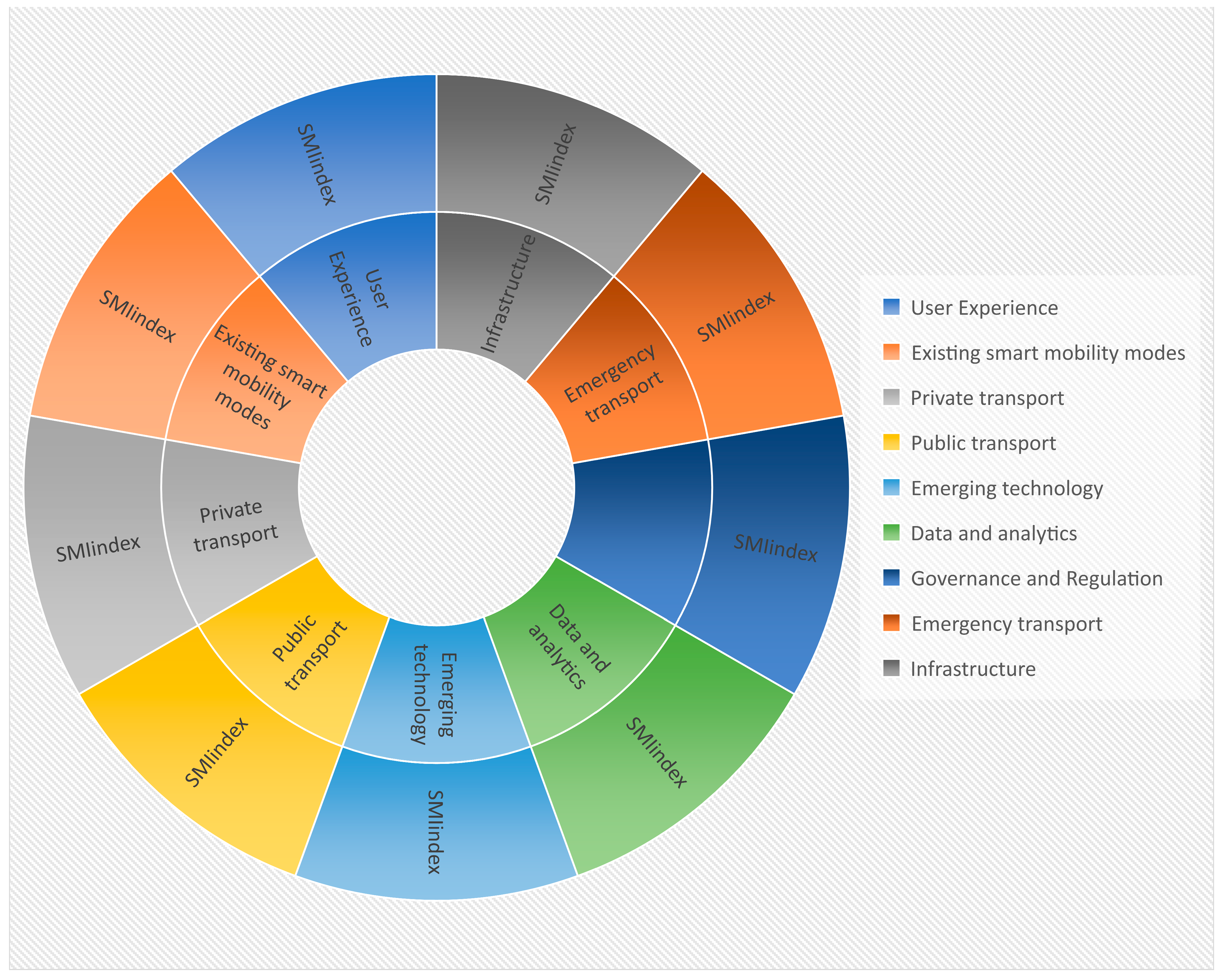
3.1. Data
3.2. Building a Smart Mobility Evaluation Framework for the Three Asia-Pacific Countries and KSA
3.3. Composite Indicator Development and Analysis
3.3.1. Normalization of Indicators
3.3.2. Aggregation and Weighting
3.4. Smart Mobility Development in Asia-Pacific Countries and Saudi Arabia
3.4.1. Japan
3.4.2. Singapore
3.4.3. South Korea
3.4.4. Saudi Arabia
4. Results
5. Conclusions
Supplementary Materials
Funding
Institutional Review Board Statement
Informed Consent Statement
Data Availability Statement
Conflicts of Interest
References
- Van Audenhove, F.-J.; Korniichuk, O.; Dauby, L.; Pourbaix, J. The Future of Urban Mobility 2.0: Imperatives to Shape Extended Mobility Ecosystems of Tomorrow. 2014. Available online: https://www.egr.msu.edu/aesc310/resources/Mobility/ADL_FUM_2_0_p1to8.pdf (accessed on 26 January 2023).
- Schafer, A.; Victor, D.G. The Future Mobility of the World Population. Transp. Res. Part A Policy Pract. 2000, 34, 171–205. [Google Scholar] [CrossRef]
- Khamis, A. Smart Mobility: Exploring Foundational Technologies and Wider Impacts; Springer: Berlin/Heidelberg, Germany, 2021. [Google Scholar]
- Joshi, S.; Saxena, S.; Godbole, T. Developing Smart Cities: An Integrated Framework. Procedia Comput. Sci. 2016, 93, 902–909. [Google Scholar] [CrossRef]
- Song, H.; Srinivasan, R.; Sookoor, T.; Jeschke, S. Smart Cities: Foundations, Principles, and Applications; John Wiley & Sons: Hoboken, NJ, USA, 2017. [Google Scholar]
- Choosakun, A.; Chaiittipornwong, Y.; Yeom, C. Development of the Cooperative Intelligent Transport System in Thailand: A Prospective Approach. Infrastructures 2021, 6, 36. [Google Scholar] [CrossRef]
- Xiong, Z.; Sheng, H.; Rong, W.; Cooper, D.E. Intelligent Transportation Systems for Smart Cities: A Progress Review. Sci. China Inf. Sci. 2012, 55, 2908–2914. [Google Scholar] [CrossRef]
- Saudi Arabia—Vision 2030 Homepage: The Progress & Achievements of Saudi Arabia—Vision 2030. Available online: https://www.vision2030.gov.sa/ (accessed on 26 January 2023).
- Doheim, R.M.; Farag, A.A.; Badawi, S. Smart City Vision and Practices across the Kingdom of Saudi Arabia—A Review. In Smart Cities: Issues and Challenges; Elsevier: Amsterdam, The Netherlands, 2019; pp. 309–332. ISBN 978-0-12-816639-0. [Google Scholar]
- Alshammari, T.O. Future Vision For Improving Riyadh City To Become A Smart Mobility City. Nat. Volatiles Essent. Oils J. NVEO 2021, 8, 398–417. [Google Scholar]
- Chen, Y.; Silva, E.A. Smart Transport: A Comparative Analysis Using the Most Used Indicators in the Literature Juxtaposed with Interventions in English Metropolitan Areas. Transp. Res. Interdiscip. Perspect. 2021, 10, 100371. [Google Scholar] [CrossRef]
- Debnath, A.K.; Chin, H.C.; Haque, M.M.; Yuen, B. A Methodological Framework for Benchmarking Smart Transport Cities. Cities 2014, 37, 47–56. [Google Scholar] [CrossRef]
- Dia, H. The real-time city: Unlocking the potential of smart mobility. In Proceedings of the Australasian Transport Research Forum 2016 Proceeding, Melbourne, Australia, 16–18 November 2016; pp. 16–18. [Google Scholar]
- Koegler Ulrich; Bejjani Marwan; Per-Ola Karlsson; Mark Haddad Smart Mobility in GCC Cities: Fast Track to the Future. Available online: https://www.strategyand.pwc.com/m1/en/reports/2019/smart-mobility-gcc-cities.html (accessed on 19 December 2022).
- Meneguette, R.I.; De Grande, R.; Loureiro, A.A. Intelligent Transport System in Smart Cities; Springer: Berlin/Heidelberg, Germany, 2018. [Google Scholar]
- Mirboland, M.; Smarsly, K. BIM-Based Description of Intelligent Transportation Systems for Roads. Infrastructures 2021, 6, 51. [Google Scholar]
- Shen, Y. Intelligent Infrastructure, Ubiquitous Mobility, and Smart Libraries—Innovate for the Future. Data Sci. J. 2019, 18, 1. [Google Scholar] [CrossRef]
- ETSI EN 302 665 V1.1.1; Intelligent Transport Systems (ITS). Communications Architecture; European Standard, 2010. Available online: https://www.etsi.org/deliver/etsi_en/302600_302699/302665/01.01.01_60/en_302665v010101p.pdf (accessed on 26 January 2023).
- Broggi, A.; Zelinsky, A.; Özgüner, Ü.; Laugier, C. Intelligent Vehicles. In Springer Handbook of Robotics; Siciliano, B., Khatib, O., Eds.; Springer Handbooks; Springer International Publishing: Cham, Swizterland, 2016; pp. 1627–1656. ISBN 978-3-319-32550-7. [Google Scholar]
- UN ESCAP. Guidelines for the Regulatory Frameworks of Intelligent Transport Systems in Asia and the Pacific; ESCAP: Bangkok, Thailand, 2019. [Google Scholar]
- MLIT Japan. Ministry of Land, Infrastructure, Transport and Tourism. 2022. Available online: https://www.mlit.go.jp/index_e.html (accessed on 25 January 2023).
- UTMS Society Japan. Available online: https://utms.or.jp/english/ (accessed on 26 December 2022).
- MOLIT Ministry of Land. Infrastructure and Transport. Available online: http://molit.go.kr/english/intro.do (accessed on 26 December 2022).
- KEC Korea Expressway Corporation. Available online: https://www.ex.co.kr/eng/ (accessed on 26 December 2022).
- ITS Korea ITS Korea. Available online: https://itskorea.kr/english/sub010401.do (accessed on 26 December 2022).
- Koti the Korea Transport Institute. Available online: https://english.koti.re.kr/eng/index.do (accessed on 26 December 2022).
- CETRAN CETRAN—Centre of Excellence for Testing and Research of Autonomous Vehicles—NTU. Available online: https://cetran.sg/ (accessed on 26 December 2022).
- SAHER. The Saher System. Available online: https://www.my.gov.sa/wps/portal/snp/aboutksa/nationalDevelopmentPlans/download/Saher%20System/!ut/p/z0/04_Sj9CPykssy0xPLMnMz0vMAfIjo8zi_QxdDTwMTQz9_YPcjAwCfQ3cDU38A4zdnU31g1Pz9L30o_ArAppiVOTr7JuuH1WQWJKhm5mXlq8fEZyYkVqkEFxZXJKaq1-Q7R4OAAlrHpI!/ (accessed on 26 December 2022).
- Battarra, R.; Gargiulo, C.; Zucaro, F.; Tremiterra, M.R. Smart Mobility in Italian Metropolitan Cities: A Comparative Analysis through Indicators and Actions. Sustain. Cities Soc. 2018, 41, 556–567. [Google Scholar] [CrossRef]
- Pindarwati, A.; Wijayanto, A.W. Measuring Performance Level of Smart Transportation System in Big Cities of Indonesia Comparative Study: Jakarta, Bandung, Medan, Surabaya, and Makassar. In Proceedings of the 2015 International Conference on Information Technology Systems and Innovation (ICITSI), Bandung, Indonesia, 16–19 November 2015; IEEE: Bandung, Indonesia; pp. 1–6. [Google Scholar]
- Castillo, H.; Pitfield, D.E. ELASTIC—A Methodological Framework for Identifying and Selecting Sustainable Transport Indicators. Transp. Res. Part Transp. Environ. 2010, 15, 179–188. [Google Scholar] [CrossRef]
- Becker, W.; Caperna, G.; Del Sorbo, M.; Norlén, H.; Papadimitriou, E.; Saisana, M. COINr: An R package for developing composite indicators. J. Open Source Softw. 2022, 7, 4567. [Google Scholar] [CrossRef]
- Mahmoud Mohieldin; Nancy Vandycke Sustainable Mobility for the 21st Century. Available online: https://www.worldbank.org/en/news/feature/2017/07/10/sustainable-mobility-for-the-21st-century (accessed on 26 January 2023).
- Makino, H.; Tamada, K.; Sakai, K.; Kamijo, S. Solutions for Urban Traffic Issues by ITS Technologies. IATSS Res. 2018, 42, 49–60. [Google Scholar] [CrossRef]
- Kazama, H.; Hokazono, A.; Goshima, K.; Tajima, T. Field experiment with logistics mobile operation control system using existing infrastructure. In Proceedings of the 7th World Congress on in Telligent Systems, Turin, Italy, 6–9 November 2000. [Google Scholar]
- Hatakeyama, M. Introduction of Pilot Projects of Driving Safety Support Systems (DSSS). In Proceedings of the 15th World Congress on Intelligent Transport Systems and ITS America’s 2008 Annual MeetingITS AmericaERTICOITS JapanTransCore, New York, NY, USA, 16–20 November 2008. [Google Scholar]
- Hiroshi, M. C-ITS and Connected Automated Driving in Japan. Available online: https://routesroadsmag.piarc.org/en/Routes-Roads-Magazine-Issue-373-Connected-Vehicles-Automous-Vehicles/4546,Magazine-Routes-Roads-373-Features-C-ITS-Connected-Automated-Driving-Japan (accessed on 3 November 2022).
- ITS Japan Frequency Allocation for Intelligent Transport Systems (ITS) in Japan 2021. Available online: https://www.its-jp.org/english/files/2021/11/%E7%B7%8F%E5%8B%99%E7%9C%81ITS%E4%B8%96%E7%95%8C%E4%BC%9A%E8%AD%B0%E5%B1%95%E7%A4%BA%E3%83%91%E3%83%8D%E3%83%AB2021_rev3.pdf (accessed on 5 November 2022).
- Smart Nation Singapore Smart Nation Singapore. Available online: https://www.smartnation.gov.sg/ (accessed on 26 December 2022).
- Shamsuzzoha, A.; Nieminen, J.; Piya, S.; Rutledge, K. Smart City for Sustainable Environment: A Comparison of Participatory Strategies from Helsinki, Singapore and London. Cities 2021, 114, 103194. [Google Scholar] [CrossRef]
- LTA Land Transport Authority (LTA). Available online: https://www.lta.gov.sg/content/ltagov/en.html (accessed on 26 December 2022).
- IMDA Statistics on Telecom Services for 2014 Jan. Available online: http://www.imda.gov.sg/About-IMDA/Research-and-Statistics/telecommunications/statistics-on-telecom-services/statistics-on-telecom-services-for-2014-jan (accessed on 20 January 2023).
- Sangole, K. Intelligent Transport System-Study of Intelligent Transportation Systems for Urban Transport Planning. Int. J. Res. Appl. Sci. Eng. Technol. 2020, 8, 421. [Google Scholar]
- LTA|Green Link Determining System. Available online: https://www.lta.gov.sg/content/ltagov/en/getting_around/driving_in_singapore/intelligent_transport_systems/green_link_determining_system.html (accessed on 26 January 2023).
- Sukawan, H.A.R.; Rachmawati, R. MyTransport. SG as a New Communication Platform in Implementing Smart Mobility in Singapore. J. Phys. Conf. Ser. 2021, 1834, 012006. [Google Scholar]
- LTA|Green Man+. Available online: https://www.lta.gov.sg/content/ltagov/en/getting_around/driving_in_singapore/intelligent_transport_systems/green_man.html (accessed on 26 January 2023).
- Agarwal, V.; Sharma, S. IoT Based Smart Transport Management System. In Proceedings of the Advanced Informatics for Computing Research: 4th International Conference, ICAICR 2020, Gurugram, India, 26–27 December 2020; Springer: Berlin/Heidelberg, Germany, 2021; pp. 207–216. [Google Scholar]
- ITSS ITS Singapore—ITS Singapore. Available online: https://www.itssingapore.org.sg/ (accessed on 26 December 2022).
- Vander Laan, Z.; Franz, M.; Marković, N. Scalable Framework for Enhancing Raw GPS Trajectory Data: Application to Trip Analytics for Transportation Planning. J. Big Data Anal. Transp. 2021, 3, 119–139. [Google Scholar]
- Fu, Y.; Li, C.; Yu, F.R.; Luan, T.H.; Zhang, Y. A Survey of Driving Safety with Sensing, Vehicular Communications, and Artificial Intelligence-Based Collision Avoidance. IEEE Trans. Intell. Transp. Syst. 2021, 23, 6142–6163. [Google Scholar] [CrossRef]
- Huseien, G.F.; Shah, K.W. A Review on 5G Technology for Smart Energy Management and Smart Buildings in Singapore. Energy AI 2022, 7, 100116. [Google Scholar]
- Berdyorova, I. Intelligent Transport Systems Apps in South Korea. Nexus J. Adv. Stud. Eng. Sci. 2022, 1, 55–58. [Google Scholar]
- Kang, M.; Im, I.; Song, J.; Hwang, K. Is Only the Dedicated Lane for Automated Vehicles Essential in the Future? The Dedicated Lanes Optimal Operating System Evaluation. Sustainability 2022, 14, 11490. [Google Scholar] [CrossRef]
- Yao, E.; Hong, J.; Pan, L.; Li, B.; Yang, Y.; Guo, D. Forecasting Passenger Flow Distribution on Holidays for Urban Rail Transit Based on Destination Choice Behavior Analysis. J. Adv. Transp. 2021, 2021, 1–13. [Google Scholar]
- Xue, Y.; Zhong, M.; Xue, L.; Tu, H.; Tan, C.; Kong, Q.; Guan, H. A Real-Time Control Strategy for Bus Operation to Alleviate Bus Bunching. Sustainability 2022, 14, 7870. [Google Scholar]
- Bae, S.; Kim, S. Evaluation of freeway traffic management system (ftms) in Korea. In Proceedings of the Intelligent Transportation: Realizing the Future. Abstracts of the Third World Congress on Intelligent Transport SystemsITS America, Orlando, Florida, 14–18 October 1996. [Google Scholar]
- C-ITS. Available online: https://www.c-its.kr/english/introduction.do (accessed on 26 December 2022).
- SAPTCO—Home. Available online: https://saptco.com.sa/Home.aspx?lang=en-US (accessed on 26 December 2022).


| Country | Internet Coverage | Laboratories | Test Beds | Connected and Autonomous Vehicles | Surveillance | GIS | ITS Traffic Management Center |
|---|---|---|---|---|---|---|---|
| Japan (JPN) | 92.70% | YES | YES | 3.233 | A | A | FC |
| Korea (KOR) | 96.50% | YES | YES | 3.525 | A | A | FC |
| Singapore (SGP) | 89.73% | YES | YES | 3.379 | A | A | FC |
| Saudi Arabia (SAU) | 92.50% | NO | NO | 1 | A | A | TP |
| Country | Road Network | Electric Vehicle Charging | Smart Motorways | Smart Parking Facilities | Traffic Signs and Signals | Intermodal Mobility Hubs | Internet of Things (IoT) |
| Japan (JPN) | 1.13 | 44 | YES | FC | FC | YES | FC |
| Korea (KOR) | 3.23 | 50 | YES | FC | FC | YES | FC |
| Singapore (SGP) | 4.79 | 42 | YES | FC | FC | YES | FC |
| Saudi Arabia (SAU) | 10.3 | 20 | NO | PC | FC | NO | PC |
Disclaimer/Publisher’s Note: The statements, opinions and data contained in all publications are solely those of the individual author(s) and contributor(s) and not of MDPI and/or the editor(s). MDPI and/or the editor(s) disclaim responsibility for any injury to people or property resulting from any ideas, methods, instructions or products referred to in the content. |
© 2023 by the author. Licensee MDPI, Basel, Switzerland. This article is an open access article distributed under the terms and conditions of the Creative Commons Attribution (CC BY) license (https://creativecommons.org/licenses/by/4.0/).
Share and Cite
Alanazi, F. Development of Smart Mobility Infrastructure in Saudi Arabia: A Benchmarking Approach. Sustainability 2023, 15, 3158. https://doi.org/10.3390/su15043158
Alanazi F. Development of Smart Mobility Infrastructure in Saudi Arabia: A Benchmarking Approach. Sustainability. 2023; 15(4):3158. https://doi.org/10.3390/su15043158
Chicago/Turabian StyleAlanazi, Fayez. 2023. "Development of Smart Mobility Infrastructure in Saudi Arabia: A Benchmarking Approach" Sustainability 15, no. 4: 3158. https://doi.org/10.3390/su15043158
APA StyleAlanazi, F. (2023). Development of Smart Mobility Infrastructure in Saudi Arabia: A Benchmarking Approach. Sustainability, 15(4), 3158. https://doi.org/10.3390/su15043158