
Methods of Conserving and Managing Cultural Heritage in Classical Chinese Royal Gardens Based on 3D Digitalization

Abstract
:1. Introduction
- Meshing, which consists of creating triangulated surfaces to be turned into 3D models afterwards, performed using specific software [34].
- Survey techniques: different methods have been used, from traditional approaches to advanced automated methods, such as TLS integrated with GIS, digital photogrammetry, and UAVs. Using these methods, a point cloud digitally representing a real building is obtained. However, a common problem is optimizing the conversion from point clouds to 3D models. The exportation step is still difficult and time-consuming, even if some attempts have been made to automate this process.
- Point clouds: the latest survey techniques used to build a heritage model present the data in a point cloud format, which has the capacity to capture very fine details; however, this conversion to a 3D model is also intricate and time-consuming. Further research is needed to identify which LoD is required to facilitate different tasks (analysis, monitoring, and recording the conditions).
- Parametric smart object libraries are an attempt to square the circle: to create generalizable objects that can represent the individual features of historic buildings. Their advantage is that they contain virtual representations of existing constructive elements that only need to be modelled once. Their parametric nature provides a great advantage, as they can be modified and updated as needed, e.g., with maintenance, changes, new discoveries, etc. Parametric libraries can also contain different kinds of objects: constructive elements, architecture-language components, constructive techniques, etc. Two main libraries have been constructed so far: HBIM and JHBIM, which is a specific HBIM extension for Old Jeddah. These libraries were created following the procedural modelling rules and were coded with GDL scripts to automatically create elements that are based on shape grammars. Nevertheless, using parametric smart object libraries can be slightly restrictive; if a specific architectural style is not present in parametric libraries, they need to be manually modified. As new libraries for historical styles are developed, new research will be needed to identify the limitations of this approach.
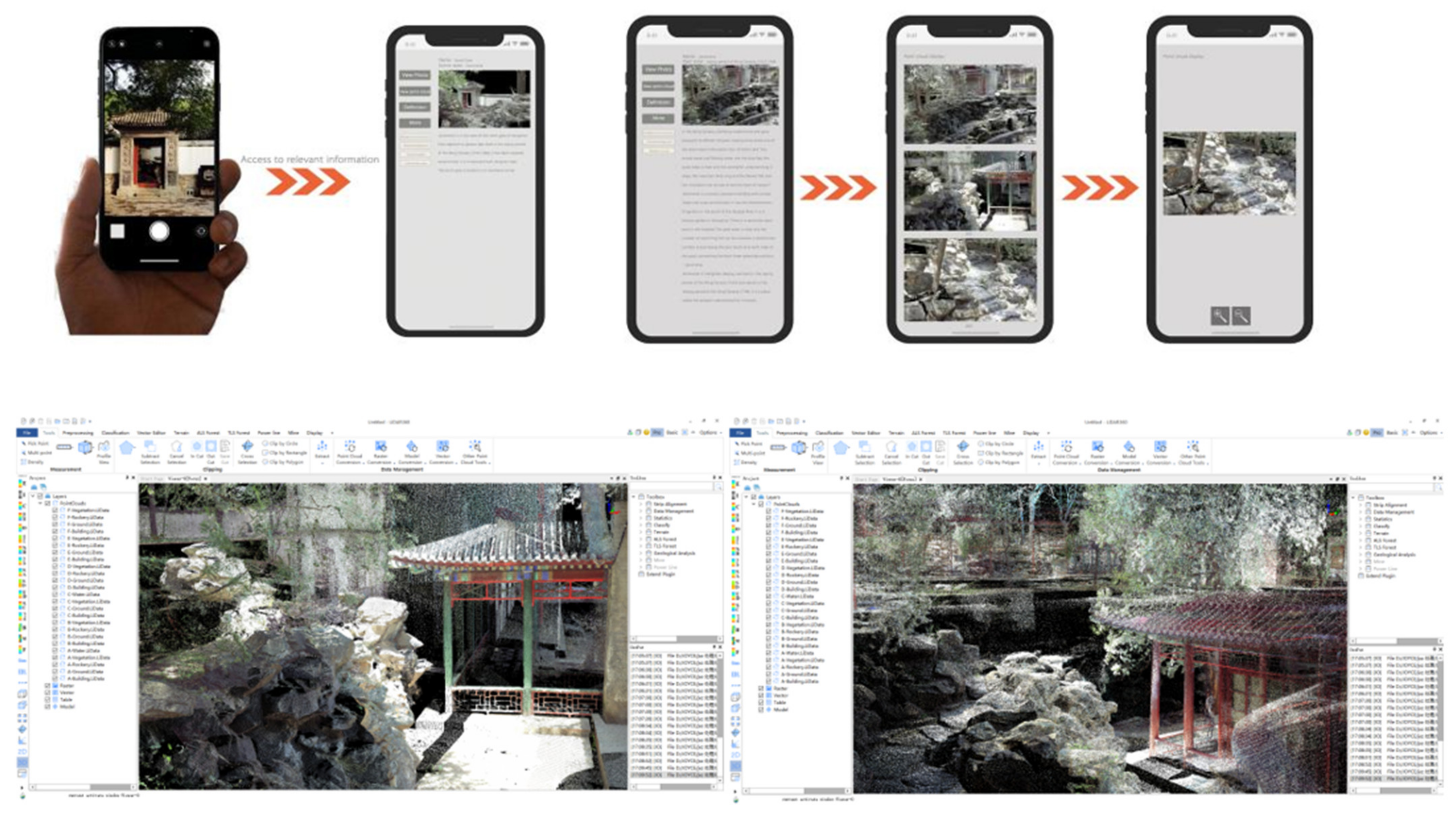
- Unified visualization between 3D model and metadata: the most advantageous feature of BIM for heritage science is perhaps its ability to link 3D models to metadata. Interesting experiences have been reported in the use of video game engines to perform virtual tours of 3D models populated with related metadata. However, research is urgently needed in the development of a heritage-specific technology that can sustain and display heritage science information, including historical data, the conditions of the site, environmental parameters, risks to the materials, and forecasts.
2. Materials and Methods
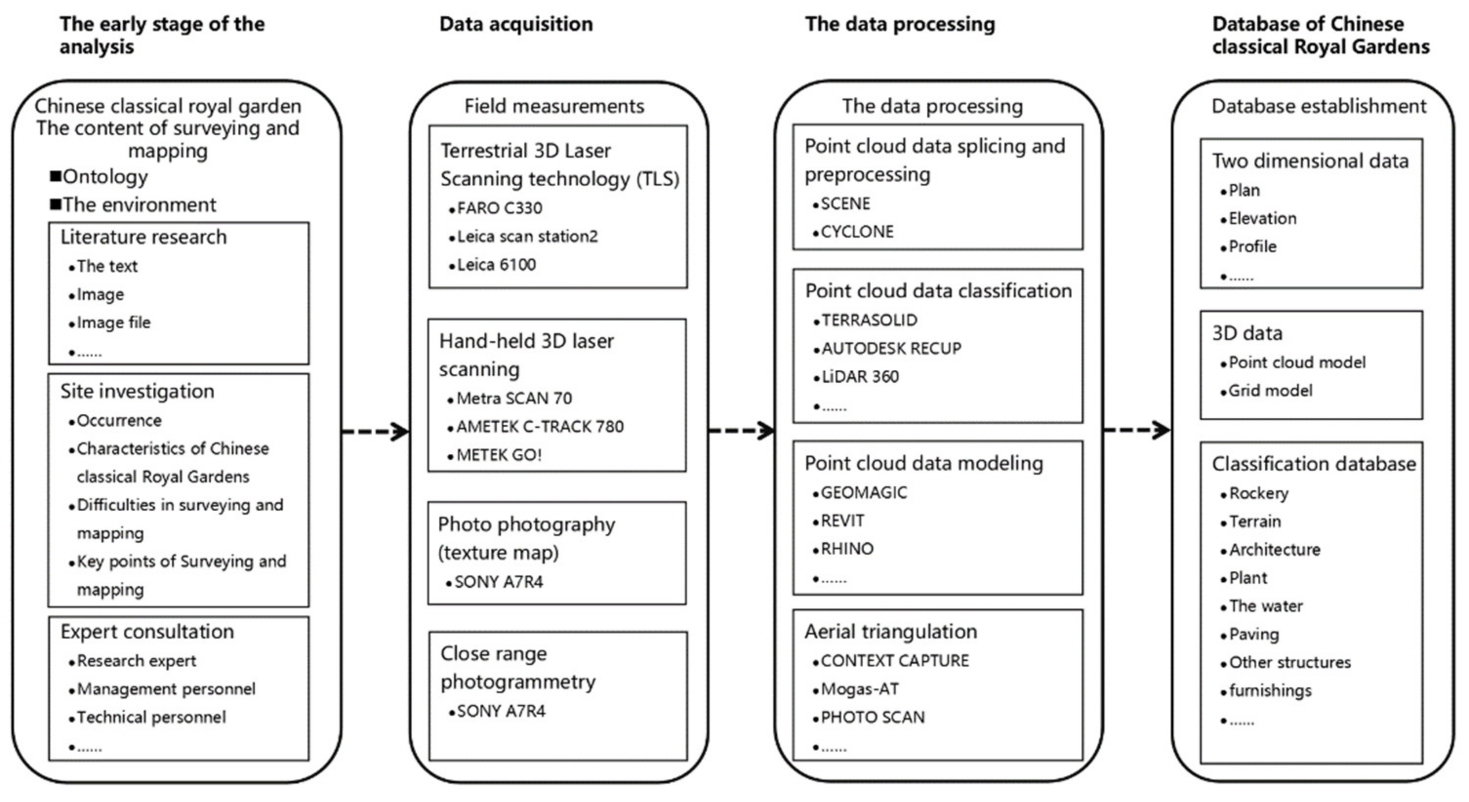
2.1. Methodological Approach
- Historical analysis; surveying and 3D metric data processing; identification of the characteristic elements and their modelling;
- Digitization of semantic, documentary, and graphic information; point cloud data processing based on the garden element characteristics of a Chinese royal garden; and informatization, conservation, and management of garden elements;
- Construction of a cultural heritage protection platform and application of the 3D information system. Figure 1. showed the flowchart for building a database of classical Chinese royal gardens.
2.2. Materials and Equipment
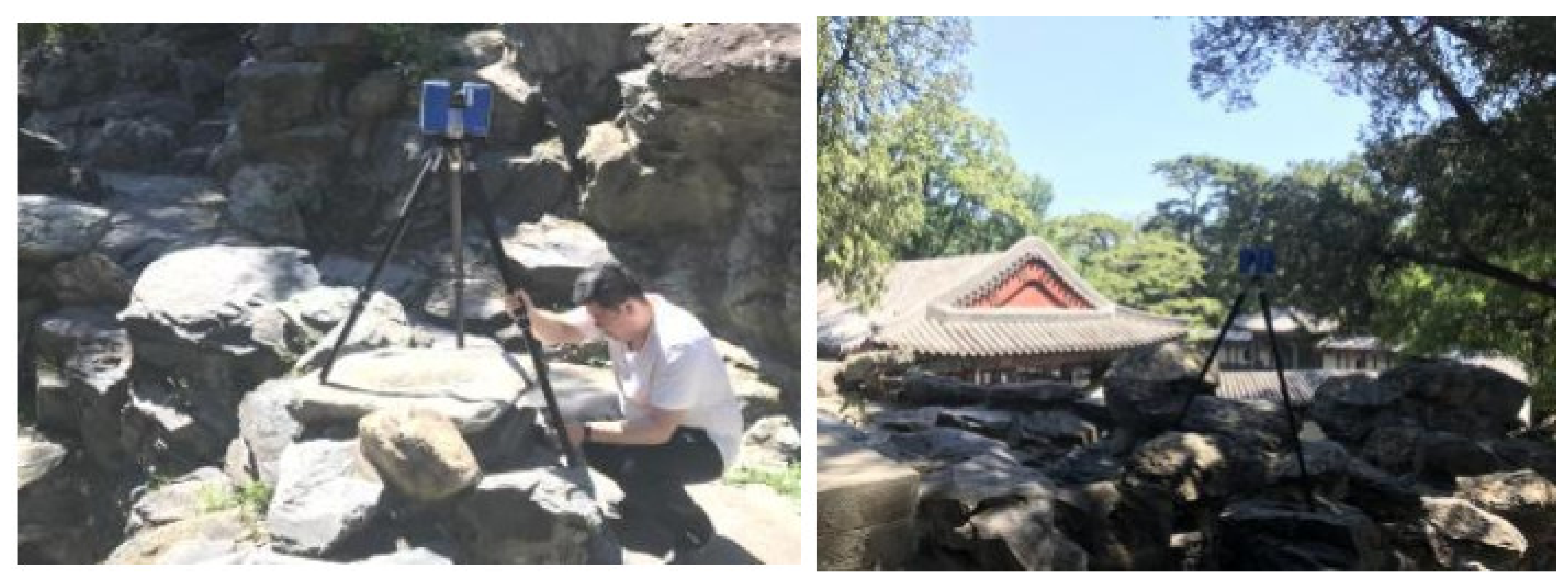
- The ground 3D laser scanning equipment used in this study was a Focus 3D X 330, a phase 3D laser scanner based on pulse ranging from the FARO Company. The equipment used was a type of high-speed 3D scanner with an ultralong measuring distance that can scan objects 330 m away under direct sunlight, with a measuring speed of 976,000 points per second, an actual error ±2 mm, and a scanning range of 360° horizontally and 300° vertically.
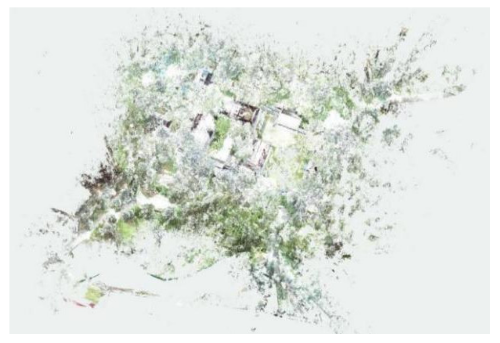
- A digital camera allowed us to employ oblique photogrammetry and to provide color in the point cloud generated by the scanner. We used a SONY A7R4 and a tripod to maintain the same camera location and angle. The scanning site is shown in Figure 2.
2.3. Data Collection and Site Survey
2.3.1. Historical Analysis and Site Location
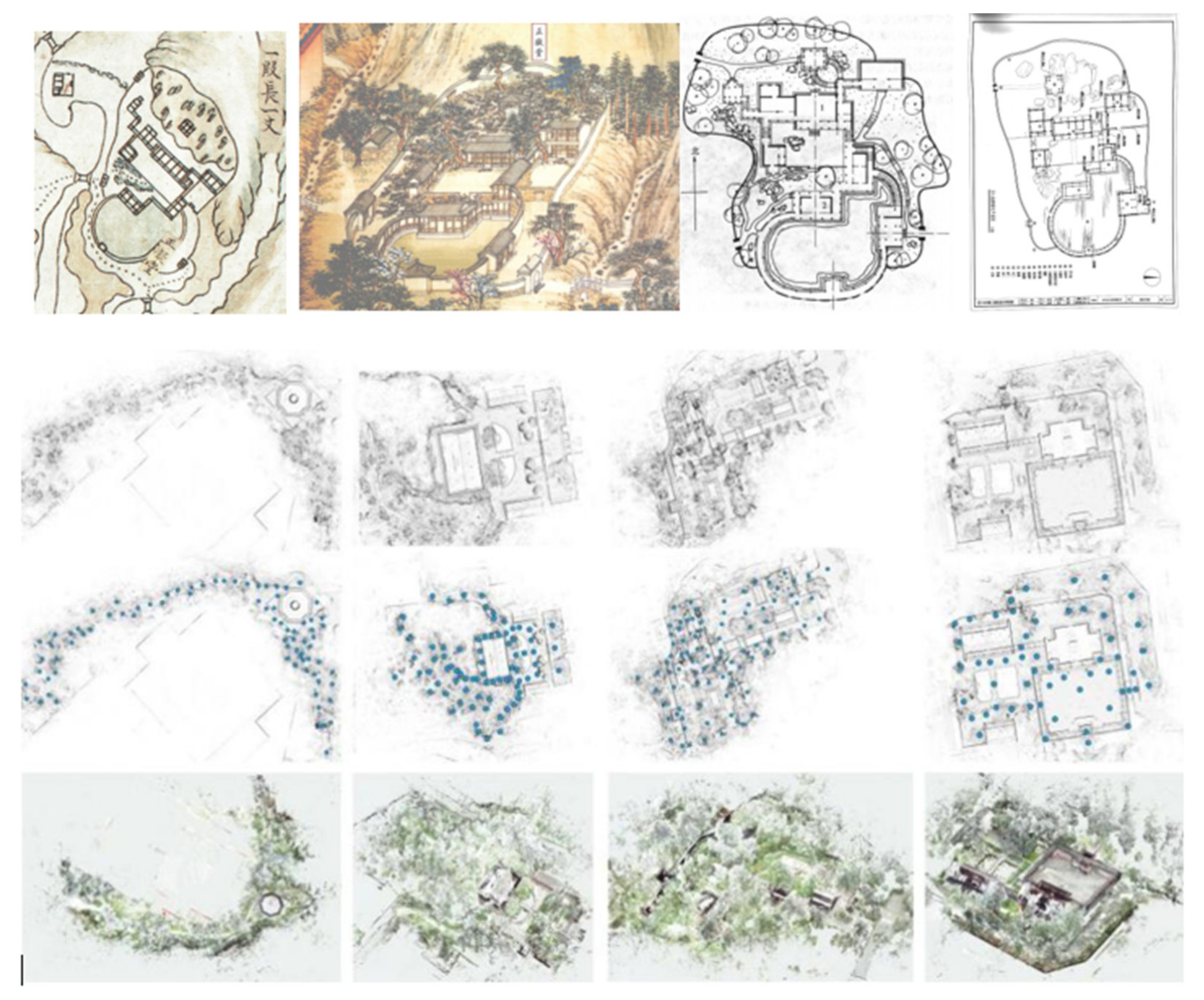
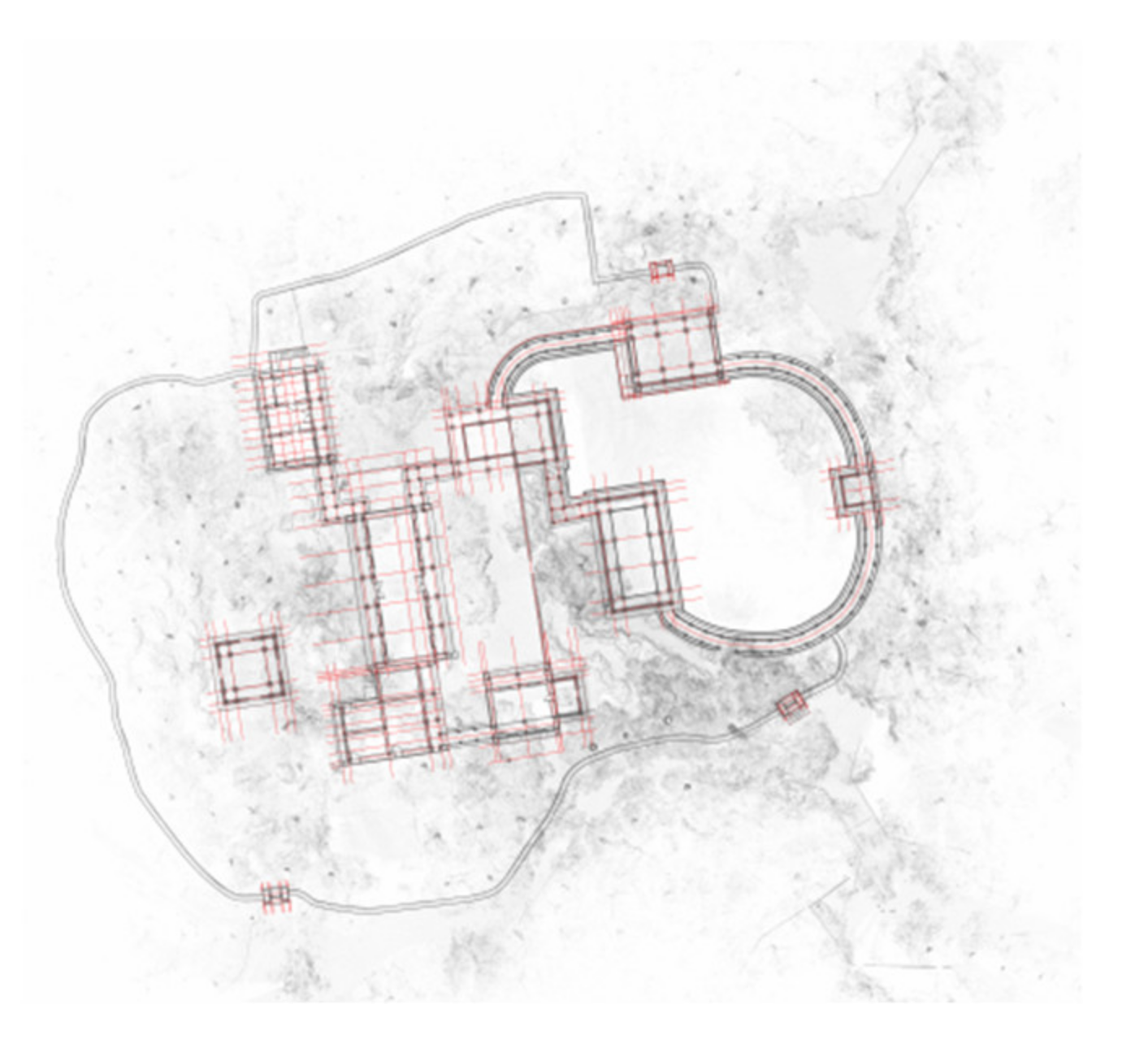
2.3.2. Optimization of the Site Layout Method
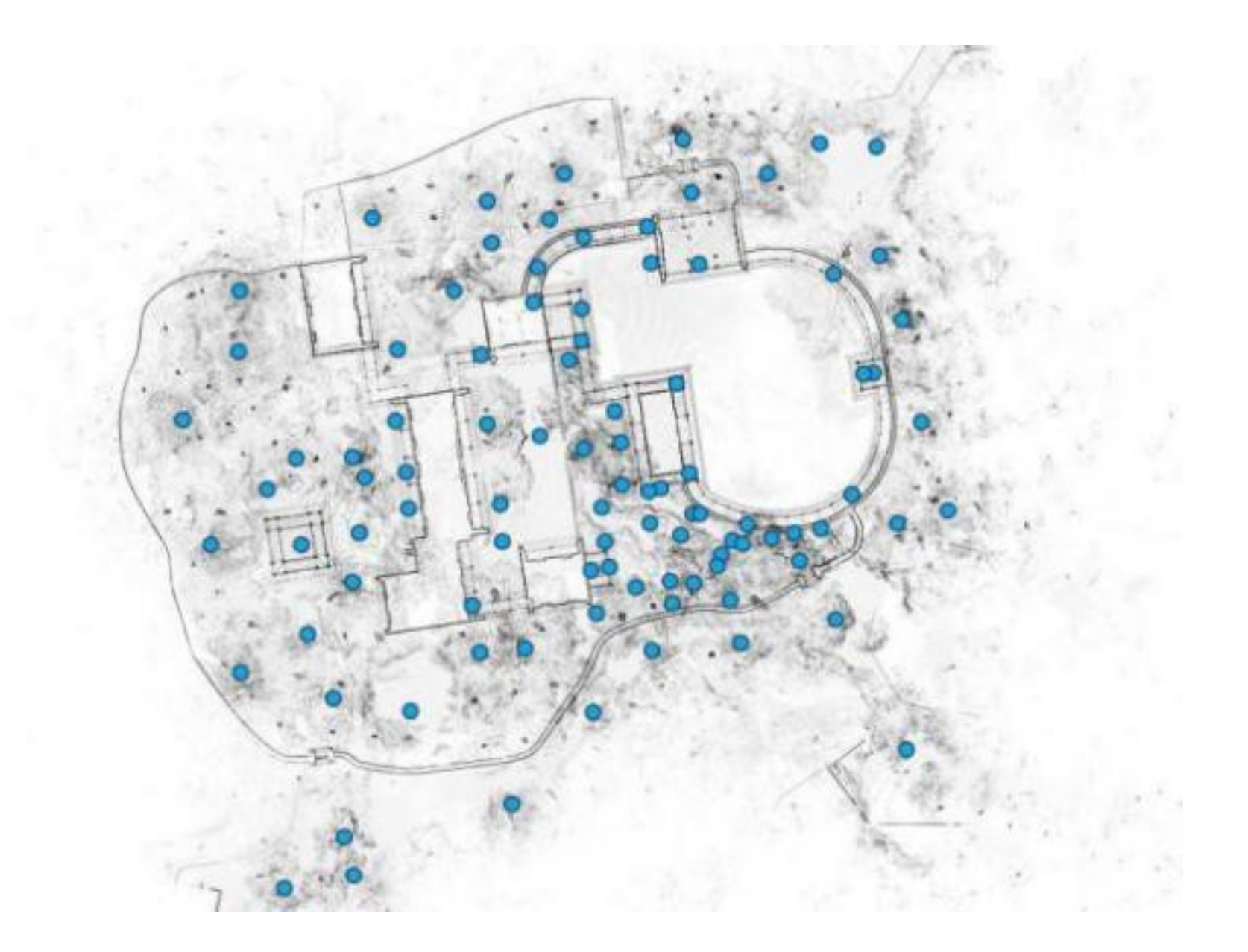
2.3.3. Garden-Wide Data Acquisition for the Jianxin Courtyard
2.4. Basic Processing of Various Garden Elements of the Jianxin Courtyard
2.5. Sampling and Processing Method for Garden Element Characteristics
3. Results and Discussion
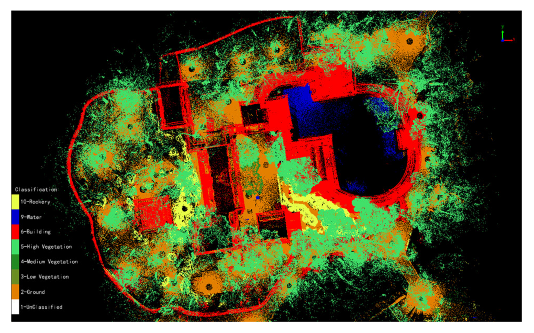
3.1. Results of the Element Classification
3.1.1. Element Classification
3.1.2. Classification Collection and Processing Results
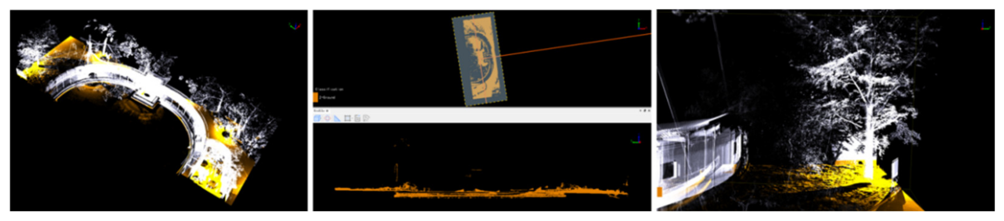
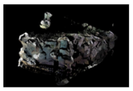
- Filter extraction and manual refinement of ground pointsGround point filtering is a primary step in 3D laser point cloud processing; it is also a prerequisite for the reasonable classification of other surface features. In this classification, an improved progressive encryption triangulation filtering algorithm was adopted, in which the computer constructs a triangulation network with the maximum building size as the parameter for the initial ground points, and iterative encryption is continuously carried out. In the experiment, we found that, because of the complex terrain conditions, the many buildings and the high plant coverage rate of the Jianxin Courtyard, the automatic filtering results of ground points based on building size parameters could not meet the experimental requirements, so quadratic surface filtering was applied instead. In this method, the point cloud is meshed, the lowest point of the mesh in a certain size range is selected to build a quadric surface, and the distance between the point cloud and the fitting surface in the calculation range are compared with the set distance threshold; this method is more suitable for an environment with topographic relief such as in the Jianxin Courtyard Garden, and can obtain more complete information about the ground points. When dealing with a high-precision point cloud model, manual checking and editing are carried out at the same time. Polygon and profile editing are used to select and refine the point cloud with TIN filtering, and the point clouds mistakenly divided into ground points are classified according to their attributes. The process of manual refinement of a ground point cloud is shown in Figure 10.
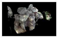
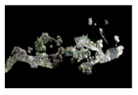
- Rockery Point Cloud Processing InformationConsidering the particularities of rockery elements, the exclusion method can be adopted for the fine classification of rockery spaces, and the remaining parts can be obtained after extracting other elements [45]. The irregularities of the rockery structure and the complexity of the topographic relief in the Jianxin Courtyard caused overlap in the rockery foundation and ground, which led to the rockery point cloud being mistakenly divided into ground points and to the root system of large trees caused by the combination of rockery elements and plant elements being misjudged as rockery points. On the basis of automatic classification, it was necessary to artificially refine the selection and to convert it into rockery points according to the classification of attributes. According to the data processing, the corresponding rockery information was obtained, as shown in Figure 11 and Table 3 below.
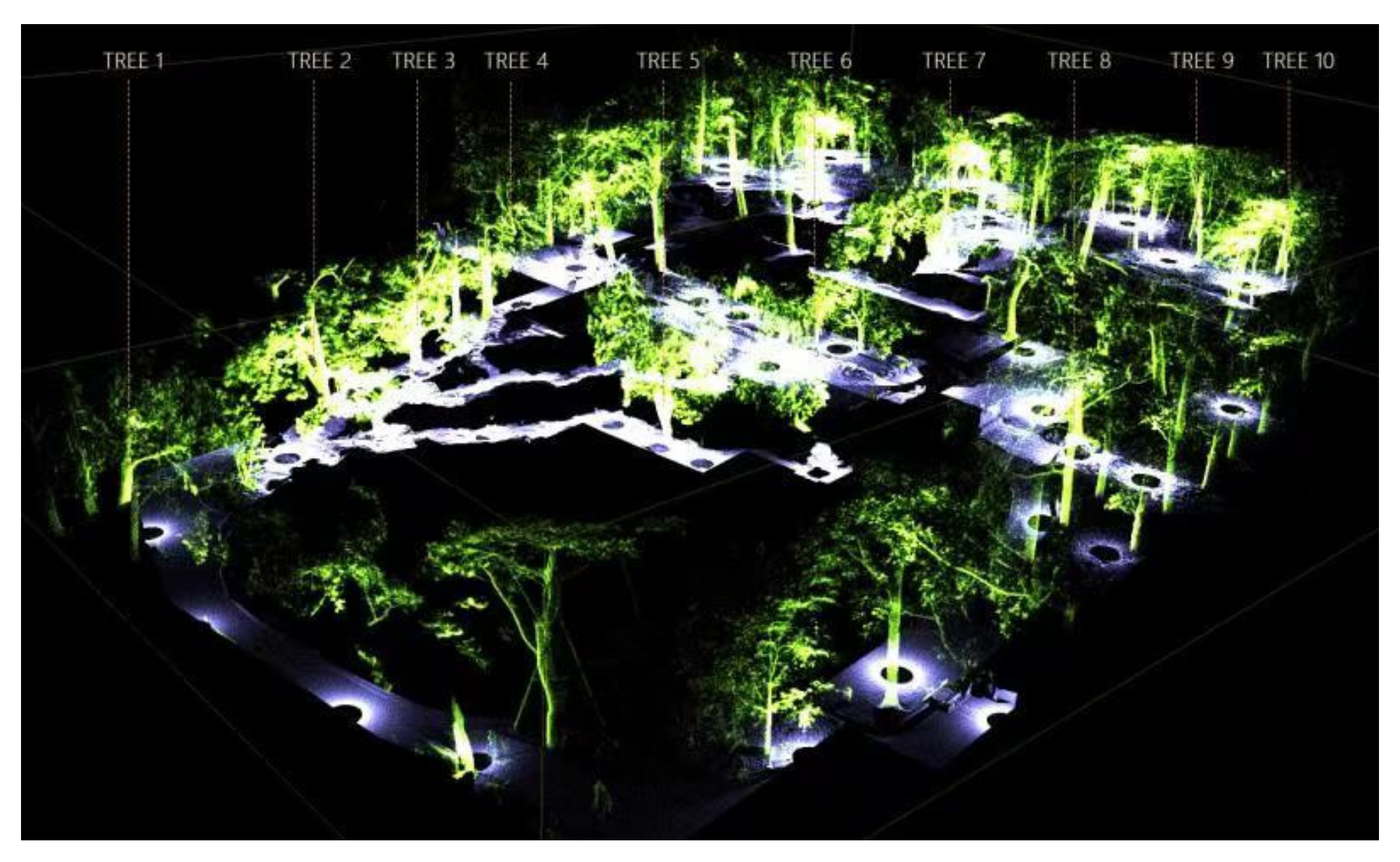
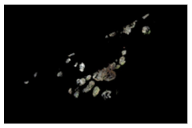
- Fine differentiation of vegetation monomer information from the Jianxin CourtyardThe method of plant segmentation mainly follows the top-down segmentation of an airborne Lidar point cloud and the down-top segmentation of a ground laser Lidar point cloud. Through ground laser scanning, we could clearly identify trunks in the gardens, so the attributes except DBH for a single tree could be measured. Before single tree segmentation, the filtering and normalization of ground points in the Jianxin Courtyard were necessary to prevent elevations such as undulating terrain from influencing single plant segmentation. In addition to big trees such as Sophora japonica and Pinus tabulae, there were also many shrubs with a smaller DBH and crown breadths, which were easy to ignore. Therefore, during actual operations, it was necessary to reduce the minimum threshold for elevation in the DBH point cloud (the default minimum in the software is 1.2m) and to adjust the maximum threshold (the default minimum in the software is 1.4m) accordingly, so that the data covered all possible DBH dimensions of plants, which was beneficial to automatic identification by the software and for avoiding subsequent manual fitting due to size mismatches. After dividing single trees based on point cloud data, unique color correspondences and ID information were assigned to each tree and a seed point file CSV was generated simultaneously, which could be superimposed onto the point cloud and present information on the attributes of each plant in the garden more intuitively. Figure 12 showed the point classification and single tree division of garden-wide plants in the Jianxin Courtyard. Table 4. showed the statistical table of plant information from Zone A in the Jianxin Courtyard.In our study, a total of 116 trees in the Jianxin Courtyard were obtained. The plant with the largest DBH was 0.962 m; the plant with the smallest DBH was 0.051 m; the plant with the largest crown breadth was 23.854 m; the plant with the smallest crown breadth was 0.546 m; the plant with the largest height was 11.912 m; and the plant with the smallest height was 1.299m.
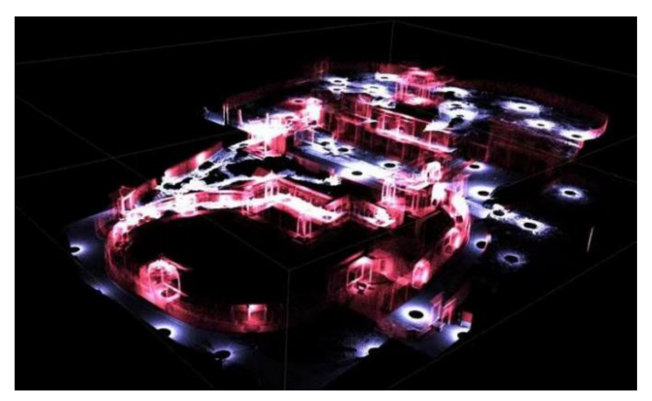
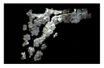
- Garden-wide building monomer separationRelative to the terrain, rockery, and vegetation elements, the garden architecture is more regular regarding its overall composition, and its classification was relatively simple. For convenience in classification, the ground points, rockery points, and plant points could be close to reduce occlusion, and the remaining point clouds could be observed by rotation and then classified from unclassified points to building points, using a profile tool or a polygon selection tool. A garden-wide architectural point cloud classification and orthogonal map of the Jianxin Courtyard is shown in Figure 13.
3.2. Garden Elements in 3D Data Information Management
- Garden architecture objects: graphic data were drawn and stored based on the surface data type. After opening attribute information from the surface data, it was linked to all of the basic information contained in the element code and the 3D real-life model.
- Garden water objects: graphic data were drawn and stored based on the surface data type to realize a visual representation of the water information. Because the ground 3D laser scanner could not collect echoes when scanning and mapping the water body, it was necessary to manually establish the shape and depth of the water body when establishing a real-life model for subsequent management.
- Plant objects: graphic data were drawn and stored based on the point data type. Ancient trees are a very important part for combing through the history of gardens. In the above classification operations, the plant elements in the Jianxin Courtyard were segmented. In this study, the positions of ancient trees were located point by point in the 3D real-life model of the Jianxin Courtyard, and such information included the basic attribute information about ancient trees such as position, DBH, crown breadth, and tree height.
- Rockery objects: graphic data were drawn and stored based on the surface data type. The types of rockeries in the Jianxin Courtyard could be classified into single peaks, pavilion hills, terrace hills, pool hills, etc., which were combined with other garden elements in a variety of ways.
3.3. Application of 3D Information System
4. Conclusions
Author Contributions
Funding
Institutional Review Board Statement
Informed Consent Statement
Data Availability Statement
Acknowledgments
Conflicts of Interest
References
- Lerma, J.L.; Navarro, S.; Cabrelles, M.; Villaverde, V. Terrestrial laser scanning and close range photogrammetry for 3D archaeological documentation: The Upper Palaeolithic Cave of Parpalló acute as a case study. J. Archaeol. Sci. 2010, 37, 499–507. [Google Scholar] [CrossRef]
- Logothetis, S.; Delinasiou, A.; Stylianidis, E. Building Information Modelling for cultural heritage: A review. ISPRS Ann. Photogramm. Remote Sens. Spat. Inf. Sci. 2015, 2, 177–183. Available online: http://www.isprs-ann-photogramm-remote-sens-spatial-inf-sci.net/II-5-W3/177/2015/ (accessed on 11 November 2015). [CrossRef] [Green Version]
- Allegra, V.; Di Paola, F.; Brutto, M.L.; Vinci, C. Scan-to-BIM for the management of heritage buildings: The case study of the castle of maredolce (Palermo, Italy). Int. Arch. Photogramm. Remote Sens. Spat. Inf. Sci. 2020, 43, 1355–1362. [Google Scholar] [CrossRef]
- Fassi, F.; Fregonese, L.; Ackermann, S.; De Troia, V. Comparison between Laser Scanning and Automated 3D Modelling Techniques to Reconstruct complex and extensive Cultural Heritage Areas. Int. Arch. Photogramm. Remote Sens. Spat. Inf. Sci. 2013, 5, 73–80. [Google Scholar] [CrossRef] [Green Version]
- Virtanen, J.-P.; Kukko, A.; Kaartinen, H.; Jaakkola, A.; Turppa, T.; Hyyppä, H.; Hyyppä, J. Nationwide Point Cloud—The Future Topographic Core Data. ISPRS Int. J. Geo-Inf. 2017, 6, 243. [Google Scholar] [CrossRef]
- Wang, C.; Hou, S.; Wen, C.; Gong, Z.; Li, Q.; Sun, X.; Li, J. Semantic line framework-based indoor building modeling using backpacked laser scanning point cloud. ISPRS J. Photogramm. Remote Sens. 2018, 143, 150–166. [Google Scholar] [CrossRef]
- Pepe, M.; Costantino, D.; Alfio, V.S.; Restuccia, A.G.; Papalino, N.M. Scan to BIM for the digital management and representation in 3D GIS environment of cultural heritage site. J. Cult. Heritage 2021, 50, 115–125. [Google Scholar] [CrossRef]
- Liang, H.; Li, W.; Lai, S.; Zhu, L.; Jiang, W.; Zhang, Q. The integration of terrestrial laser scanning and terrestrial and unmanned aerial vehicle digital photogrammetry for the documentation of Chinese classical gardens—A case study of Huanxiu Shanzhuang, Suzhou, China. J. Cult. Heritage 2018, 33, 222–230. [Google Scholar] [CrossRef]
- Liang, H.; Li, W.; Zhang, Q. Semantic-based 3D information modelling and documentation of rockeries in Chinese classical gardens: A case study on the rockery at Huanxiu Shanzhuang, Suzhou, China. J. Cult. Heritage 2018, 37, 247–258. [Google Scholar] [CrossRef]
- Yen, Y.N.; Weng, K.H.; Huang, H.Y. Study on information management for the conservation of traditional Chinese Architectural Heritage—3D modelling and metadata representation. ISPRS Ann. Photogramm. Remote Sens. Spat. Inf. Sci. 2013, 2, 331–336. Available online: http://www.isprs-ann-photogramm-remote-sens-spatial-inf-sci.net/II-5-W1/331/2013/ (accessed on 2 November 2015). [CrossRef] [Green Version]
- Zlot, R.; Bosse, M.; Greenop, K.; Jarzab, Z.; Juckes, E.; Roberts, J. Efficiently capturing large, complex cultural heritage sites with a handheld mobile 3D laser mapping system. J. Cult. Heritage 2014, 15, 670–678. [Google Scholar] [CrossRef]
- Zhang, L. Deep Learning-Based Classification and Reconstruction of Residential Scenes From Large-Scale Point Clouds. IEEE Trans. Geosci. Remote Sens. 2017, 56, 1887–1897. [Google Scholar] [CrossRef]
- Margottini, C.; Bobrowsky, P.T.; Vlcko, J. Rupestrian World Heritage Sites: Instability Investigation and Sustainable Mitigation Paleotsunamis and Paleoearthquakes View Project PETRA Siq Stability Project View Project. 2017. Available online: https://www.researchgate.net/publication/324227516 (accessed on 2 November 2015).
- Higuchi, R.; Sugawara, H.; Gülyaz, M.E. Photogrammetry using virtual restoration of wall-paintings of the rock-hewn churches in the gÖreme valley, cappadocia and its value for the museum’s contents. ISPRS Ann. Photogramm. Remote Sens. Spat. Inf. Sci. 2019, 4, 83–89. [Google Scholar] [CrossRef] [Green Version]
- Mutis, I.; Hartmann, T. Advances in Informatics and Computing in Civil and Construction Engineering; Springer: Berlin/Heidelberg, Germany, 2019. [Google Scholar] [CrossRef]
- Baik, A.; Boehm, J.; Robson, S. Jeddah historical building information modeling “JHBIM” Old Jeddah-Saudi Arabia. Int. Arch. Photogramm. Remote Sens. Spat. Inf. Sci. 2013, 40, 73–78. Available online: http://www.scopus.com/inward/record.url?eid=2-s2.0-84924289373&partnerID=40&md5=8c861677387fca1ecba46c9b02343a33 (accessed on 2 November 2015). [CrossRef] [Green Version]
- Guidi, G.; Russo, M.; Ercoli, S.; Remondino, F.; Rizzi, A.; Menna, F. A multi-resolution methodology for the 3D modeling of large and complex archeological areas. Int. J. Archit. Comput. 2009, 7, 39–55. [Google Scholar] [CrossRef]
- Saygi, G.; Agugiaro, G.; Hamamcıoğlu-Turan, M.; Remondino, F. Evaluation of GIS and BIM roles for the information management of historical buildings. ISPRS Ann. Photogramm. Remote Sens. Spat. Inf. Sci. 2013, 2, 283–288. [Google Scholar] [CrossRef] [Green Version]
- Pepe, M.; Costantino, D.; Garofalo, A.R. An efficient pipeline to obtain 3D model for HBIM and structural analysis purposes from 3D point clouds. Appl. Sci. 2020, 10, 1235. [Google Scholar] [CrossRef] [Green Version]
- Garagnani, S. Building Information Modeling and real world knowledge: A methodological approach to accurate semantic documentation for the built environment. In Proceedings of the Digital Heritage 2013-Federating the 19th Int’l VSMM, 10th Eurographics GCH, and 2nd UNESCO Memory of the World Conferences, Marseille, France, 28 October 2013; pp. 489–496. [Google Scholar]
- Micoli, L.; Guidi, G.; Angheleddu, D.; Russo, M. A multidisciplinary approach to 3D survey and reconstruction of historical buildings. In Proceedings of the Digital Heritage 2013-Federating the 19th Int’l VSMM, 10th Eurographics GCH, and 2nd UNESCO Memory of the World Conferences, Marseille, France, 28 October 2013; pp. 241–248. [Google Scholar]
- Dore, C.; Murphy, M. 20 geometry from laser and image data. J. Inf. Technol. Constr. 2014, 19, 20–46. Available online: http://www.itcon.org/2014/2 (accessed on 5 August 2015).
- Kurdy, M.; Biscop, J.L.; De Luca, L.; Florenzano, M. 3D virtual anastylosis and reconstruction of several buildings in the site of Saint-Simeon, Syria. Int. Arch. Photogramm. Remote Sens. Spat. Inf. Sci. 2012, 38, 45–52. [Google Scholar] [CrossRef] [Green Version]
- Allen, P.K.; Troccoli, A.; Smith, B.; Murray, S. New Methods for Digital Modeling of Historic Sites. IEEE Comput. Graph. Appl. 2003, 23, 32–41. [Google Scholar] [CrossRef]
- Volk, R.; Stengel, J.; Schultmann, F. Building Information Modeling (BIM) for existing buildings-Literature review and future needs. Autom. Constr. 2014, 38, 109–127. [Google Scholar] [CrossRef] [Green Version]
- Arias, P.; Armesto, J.; di Capua, D.; Gonzalez-Drigo, R. Digital photogrammetry, GPR and computational analysis of structural damages in a mediaeval bridge. Eng. Fail. Anal. 2007, 14, 1444–1457. [Google Scholar] [CrossRef]
- Quattrini, R.; Malinverni, E.S.; Clini, P.; Nespeca, R.; Orlietti, E. From tls to hbim. high quality semantically-aware 3d modeling of complex architecture. Int. Arch. Photogramm. Remote Sens. Spat. Inf. Sci.—ISPRS Arch. 2015, 40, 367–374. [Google Scholar] [CrossRef] [Green Version]
- Barazzetti, L.; Banfi, F.; Brumana, R.; Gusmeroli, G.; Previtali, M.; Schiantarelli, G. Cloud-to-BIM-to-FEM: Structural simulation with accurate historic BIM from laser scans. Simul. Model. Pract. Theory 2015, 57, 71–87. [Google Scholar] [CrossRef]
- PAS 1192-2013; Specification for Information Management for the Capital/Delivery Phase of Construction Projects Using Building Information Modelling. British Standards Institution: London, UK, 2013.
- Baila, A.; Mazza, L.; Anzani, A. Design for knowledge and restoration—Instrumental survey at Santa Maria in Celso. In Proceedings of the Cultural Heritage: Ocumentation, Preservation and Protection: 5th International Conference, EuroMed 2014, Limassol, Cyprus, 3–8 November 2014; Lecture Notes in Computer Science. Springer International Publishing: Cham, Switzerland, 2014; Volume 8740, pp. 427–437. [Google Scholar]
- Balletti, C.; Brussa, N.; Gottardi, C.; Guerra, F. The documentation and reinte-gration of a lost past. ISPRS Ann. Photogramm Remote Sens. Spat. Inf. Sci. 2014, 2, 49–55. [Google Scholar] [CrossRef] [Green Version]
- Cuca, B.; Agapiou, A.; Kkolos, A.; Hadjimitsis, D. Integration of innovative surveying technologies for purposes of 3D documentation and valorisation of St. In Proceedings of the Cultural Heritage: Documentation, Preservation and Protection: 5th International Conference, EuroMed 2014, Limassol, Cyprus, 3–8 November 2014; Springer International Publishing: Cham, Switzerland, 2014; pp. 387–395. [Google Scholar]
- Suwardhi, D.; Menna, F.; Remondino, F.; Hanke, K.; Akmalia, R. Digital 3D Borobudur-integration of 3D surveying and modeling techniques. ISPRS Int. Arch. Photogramm. Remote Sens. Spat. Inf. Sci. 2015, 40, 417–423. Available online: http://www.int-arch-photogramme-remote-sens-spatial-inf-sci.net/XL-5-W7/417/2015/ (accessed on 15 November 2015). [CrossRef] [Green Version]
- Manferdini, A.M.; Galassi, M. Assessments for 3D reconstructions of cultural heritage using digital technologies. ISPRS Int. Arch. Photogramm. Remote Sens. Spat. Inf. Sci. 2013, 40, 167–174. [Google Scholar] [CrossRef] [Green Version]
- BIM Industry Working Group. A Report for the Government Construction Client Group; Department for Business, Innovation and Skills: London, UK, 2011. Available online: http://www.bimtaskgroup.org/wp-content/uploads/2012/03/BIS-BIM-strategy-Report.pdf (accessed on 25 October 2017).
- Stefani, C.; Busayarat, C.; Renaudin, N.; De Luca, L.; Véron, P.; Florenzano, M. An image-based approach for the architectural modeling of past states. Int. Arch. Photogramm. Remote Sens. Spat. Inf. Sci. 2011, 8, 2–4. Available online: http://sam.ensam.eu/handle/10985/9806 (accessed on 15 November 2015). [CrossRef] [Green Version]
- Williams, J. NHSS Report 2—The Use of Science to Enhance Our Understanding of the Past 2009. Available online: https://www.heritagesciencestrategy.org.uk (accessed on 23 February 2016).
- Liang, H.; Li, W.; Zhang, Q.; Zhu, W.; Chen, D.; Liu, J.; Shu, T. Using unmanned aerial vehicle data to assess the three-dimension green quantity of urban green space: A case study in Shanghai, China. Landsc. Urban Plan. 2017, 164, 81–90. [Google Scholar] [CrossRef]
- Bruno, A., Jr.; Spallone, R. Cultural heritage conservation and communication by digital modeling tools. Case studies: Minor architectures of the thirties in the Turin area. ISPRS Ann. Photogramm. Remote Sens. Spat. Inf. Sci. 2015, 2, 25–32. Available online: http://www.isprs-ann-photogramm-remote-sens-spatial-inf-sci.net/II-5-W3/25/2015/ (accessed on 2 November 2015). [CrossRef] [Green Version]
- Yang, C.; Han, F. Digital Heritage Landscape: Research on Spatial Character of the Grand Rockery of Yuyuan Garden in Shanghai Based on 3D Point Cloud Technologies. Chin. Landsc. Archit. 2018, 34, 20–24. [Google Scholar]
- Liu, Q.; Li, C.; Liu, R.; Meng, P.; Zhang, J.; Yang, H. Application of Multi-baseline Digital Close-range Photogrammetry System in 3D Modeling of Classical Garden Buildings. J. Northwest For. Univ. 2009, 4, 224–227. [Google Scholar]
- Zhang, L.; Li, Z.; Li, A.; Liu, F. Large-scale urban point cloud labeling and reconstruction. ISPRS J. Photogramm. Remote Sens. 2018, 138, 86–100. [Google Scholar] [CrossRef]
- Pei, Q.Q.; Wang, X.D.; Zhao, L.Y.; Zhang, B.; Guo, Q.L. A sticky rice paste preparation method for reinforcing earthen heritage sites. J. Cult. Heritage 2020, 44, 98–109. [Google Scholar] [CrossRef]
- Ervin, S.M. Digital landscape modeling and visualization: A research agenda. Landsc. Urban Plan. 2001, 54, 49–62. [Google Scholar] [CrossRef]
- Khodeir, L.M.; Aly, D.; Tarek, S. Integrating HBIM (Heritage Building Information Modeling) Tools in the Application of Sustainable Retrofitting of Heritage Buildings in Egypt. Procedia Environ. Sci. 2016, 34, 258–270. [Google Scholar] [CrossRef] [Green Version]
- Ewart, I.J.; Zuecco, V. Heritage building information modelling (HBIM): A review of published case studies. In Proceedings of the 35th CIB W78 2018 International Conference: IT in Design, Construction, and Management, Chicago, IL, USA, 1 October 2018; Springer International Publishing: New York, NY, USA, 2019; pp. 35–41. [Google Scholar] [CrossRef]
- Xue, C.X.; Yang, W.; Zhang, J. Research and Application of Three-Dimensional Digital Surveying and Mapping of Garden. Mod. Surv. Mapp. 2011, 34, 53–55. [Google Scholar] [CrossRef]
- Lassandro, P.; Lepore, M.; Paribeni, A.; Zonno, M. 3D modelling and medieval lighting reconstruction for rupestrian churches. Int. Arch. Photogramm. Remote Sens. Spatial Inf. Sci. 2019, 42, 417–423. [Google Scholar] [CrossRef] [Green Version]
- Remondino, F.; Rizzi, A. Reality-based 3D documentation of natural and cultural heritage sites—Techniques, problems, and examples. Appl. Geomat. 2010, 2, 85–100. [Google Scholar] [CrossRef] [Green Version]
- Yu, M.; Lin, X. Study on the Surveying Methods Based upon the 3D Laser Scanning and Close range Photogrammetry Techniques of the Rockery and Pond in the Classical Chinese Gardens. Landsc. Archit. 2017, 2, 117–122. [Google Scholar] [CrossRef]
- Guo, X.; Yang, C.; Han, F. Research on Digital Record and Innovative Conservation of Cultural Landscape Heritage. Chin. Landsc. Archit. 2020, 36, 84–89. [Google Scholar] [CrossRef]
- Yang, C.; Han, F. Research on Methods for Recording and Visualising Spatial Information of Rural Landscape Heritage with Point Cloud Technology. Landsc. Archit. 2018, 25, 37–42. [Google Scholar] [CrossRef]
- Tang, P.; Huber, D.; Akinci, B.; Lipman, R.; Lytle, A. Automatic reconstruction of as-built building information models from laser-scanned point clouds: A review of related techniques. Autom. Constr. 2010, 19, 829–843. [Google Scholar] [CrossRef]


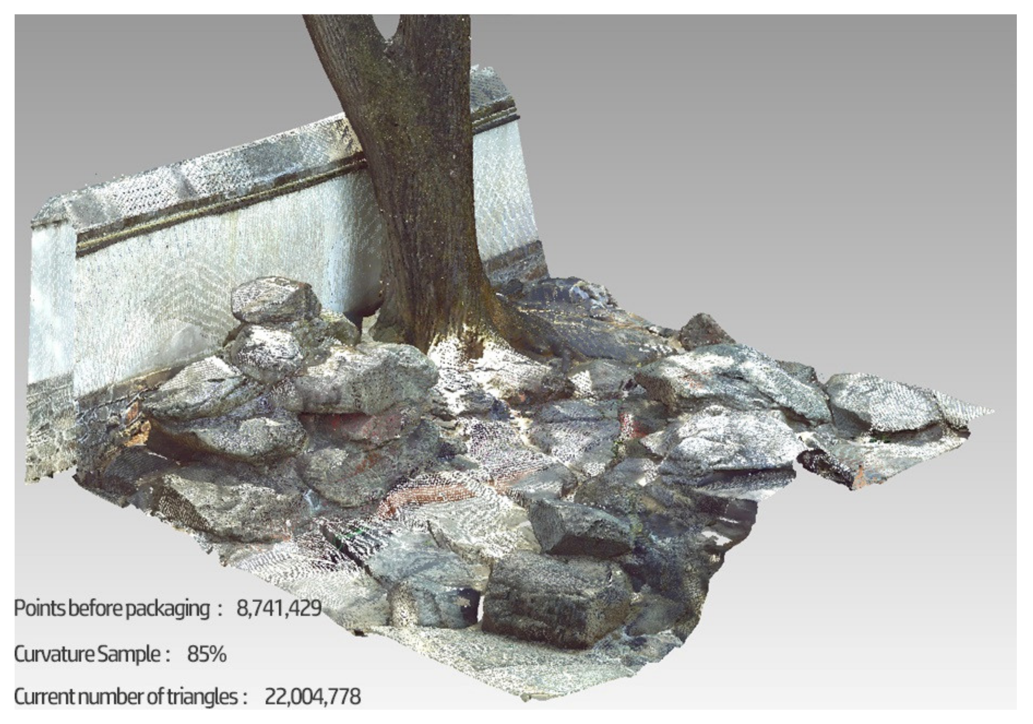
| Sampling Rate of Rockery Points | ||||
|---|---|---|---|---|
| Curvature Sampling Rate | Curvature Sampling Rate of 35% | Curvature Sampling Rate of 65% | Curvature Sampling Rate of 85% | Curvature Sampling Rate of 95% |
| Number of points | 1,917,808 | 3,561,643 | 4,657,533 | 5,205,478 |
| Number of triangles | 3,705,153 | 6,820,175 | 8,411,795 | 9,906,289 |
| Number of holes | 3711 | 9024 | 13,031 | 14,278 |
| Encapsulation result | 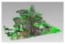 | 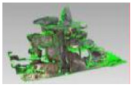 | 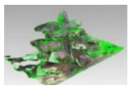 | 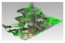 |
| Information Category | Specific Contents |
|---|---|
| Water body | Water body, revetment, slope protection, facilities, etc. |
| Plant | Trees, shrubs, vines, bamboos, herbs, etc. |
| Environment | Outside terrain, outside transportation, other outside elements, etc. |
| Rockery | Rockeries, stacked stones, etc. |
| Architecture | Building monomers, structures, decorations, interior pavements, etc. |
| Transportation | Garden roads, sites, etc. |
| Others | Interior furnishings, sketches, etc. |
| Mountain Preview | Projected Area /m2 | Surface Area /m2 | Rockery Volume /m3 |
|---|---|---|---|
 | 5.9941 | 14.3998 | 7.7295 |
 | 321.3985 | 825.1359 | 1194.1027 |
 | 350.7361 | 932.2432 | 1187.3004 |
 | 21.6262 | 58.2563 | 52.265 |
 | 482.0896 | 1072.2976 | 248.29 |
| Statistics for the Plant Information from Zone A of the Jianxin Courtyard | |||||||
|---|---|---|---|---|---|---|---|
| Tree ID | X | Y | Tree Height | DBH | Crown Diameter | Crown Area | Crown Volume |
| 1 | 1877.96 | 254.988 | 9.38 | 0.666 | 9.366 | 68.896 | 300.514 |
| 2 | 1881.71 | 253.501 | 6.182 | 0.058 | 5.873 | 27.087 | 92.033 |
| 3 | 1885.647 | 248.68 | 10.5 | 0.962 | 13.413 | 141.299 | 721.399 |
| 4 | 1885.714 | 251.668 | 2.723 | 0.216 | 2.737 | 5.883 | 10.4 |
| 5 | 1884.294 | 253.254 | 2.302 | 0.082 | 1.929 | 2.923 | 4.008 |
| 6 | 1893.42 | 215.085 | 2.378 | 0.247 | 3.047 | 7.293 | 11.777 |
| 7 | 1894.236 | 220.025 | 9.594 | 0.452 | 7.174 | 40.421 | 207.195 |
| 8 | 1886.011 | 249.834 | 3.261 | 0.096 | 1.343 | 1.417 | 0.73 |
| 9 | 1891.506 | 214.464 | 2.174 | 0.12 | 0.642 | 0.324 | 0.389 |
| 10 | 1877.48 | 252.606 | 6.739 | 0.065 | 7.526 | 44.486 | 185.014 |
Publisher’s Note: MDPI stays neutral with regard to jurisdictional claims in published maps and institutional affiliations. |
© 2022 by the authors. Licensee MDPI, Basel, Switzerland. This article is an open access article distributed under the terms and conditions of the Creative Commons Attribution (CC BY) license (https://creativecommons.org/licenses/by/4.0/).
Share and Cite
Jia, S.; Liao, Y.; Xiao, Y.; Zhang, B.; Meng, X.; Qin, K. Methods of Conserving and Managing Cultural Heritage in Classical Chinese Royal Gardens Based on 3D Digitalization. Sustainability 2022, 14, 4108. https://doi.org/10.3390/su14074108
Jia S, Liao Y, Xiao Y, Zhang B, Meng X, Qin K. Methods of Conserving and Managing Cultural Heritage in Classical Chinese Royal Gardens Based on 3D Digitalization. Sustainability. 2022; 14(7):4108. https://doi.org/10.3390/su14074108
Chicago/Turabian StyleJia, Shizhen, Yi Liao, Yuqing Xiao, Bo Zhang, Xiangbin Meng, and Ke Qin. 2022. "Methods of Conserving and Managing Cultural Heritage in Classical Chinese Royal Gardens Based on 3D Digitalization" Sustainability 14, no. 7: 4108. https://doi.org/10.3390/su14074108
APA StyleJia, S., Liao, Y., Xiao, Y., Zhang, B., Meng, X., & Qin, K. (2022). Methods of Conserving and Managing Cultural Heritage in Classical Chinese Royal Gardens Based on 3D Digitalization. Sustainability, 14(7), 4108. https://doi.org/10.3390/su14074108