1. Introduction
“Digital technology offers unprecedented means to transmit and store information. Documents and data in digital form are important for science, education, culture and economic and social development, but assuring their continuity over time is far from resolved problem. …Closer collaboration in managing these resources will be beneficial for all.”
“Memory of the World in the Digital Age”, Vancouver Declaration, 2012.
Rapid growth in digital technologies such as 3D photogrammetry, terrestrial laser scanning, virtual augmented and mixed reality is bringing new modes of interaction to the public presentation of cultural heritage [
1]. Interactive thematic virtual environments, in particular, offer the potential to place the visitor within a world that, by its immersive 3D nature, is intuitively more engaging of the visitor’s imagination and understanding than traditional static museum displays [
2]. The proximity of these experiences to the users’ regular interaction with the natural world gives the narratives that they present decisive significance. At the same time, single discipline perspectives of the past often do not reflect the fluidity of lived experiences of cultural heritage and can limit its perceived value to a single view that further entrenches inequalities and division. Addressing this through participatory approaches that engage local communities as co-producers of heritage knowledge has become an essential aspect in recent cultural heritage research. However, it is often noted that the final presentation of plural perspectives to public audiences can be a challenge. Interactive virtual environments of cultural heritage (tangible and intangible) have the flexibility to present multiple views of a particular submission or context and thus provide a mechanism of answering this challenge. Additionally, virtual reconstructions are particularly suited to addressing the challenge of archaeological sites and intangible heritage, where the context and meaning of heritage assets may not be directly apparent.
Much of the initial effort in digital heritage was directed towards digital preservation as an accurate representation of archaeological objects and sites. Digital documentation methods have become particularly significant as a critical tool to support heritage conservation and management, recording at-risk heritage threatened by nature, conflict, terrorism, climate change, uncontrolled development and urbanization [
3]. In response to these challenges, 3D digital documentation of damaged or destroyed heritage has become a critical tool to aid in its physical reconstruction (see examples at Notre Dame, Aleppo and Palmyra [
4,
5,
6]. Engaging the public with virtual reconstruction aids greater awareness of neglected heritage sites and the importance of work to prevent further loss [
7]. Digitization of such damaged heritage before reconstruction and conservation often reveals their evolution over time. The malleable nature of virtual reality provides a unique opportunity to visualize change over time, offering a greater understanding of the hidden histories of heritage sites [
8]. Testing new forms of reality that no longer exist raises intriguing aspects of re-reading and reinterpreting history in the eyes of the audience rather than the curator. More recently, digital approaches are increasingly seen as potential tools for analysis to aid interpretation of heritage sites [
9] and assemblages [
10] to assist in our understanding of the past.
Whilst perfectly modelled virtual buildings can recreate a realistic sense of physical spaces of the past and illustrate spatial rationale and proximity, these often lack human aspects, i.e., cultural, social or affective connections between people and cultural practices, to which people can relate [
11]. Virtual Heritage Environments (VHE) also lack ‘thematic interactivity’ due to the limited cultural content to incorporate intangible aspects of human attitudes, behaviours, rituals and cultural traditions to enable users to engage with heritage visualization [
12]. In this scope, the cultural content of Virtual Heritage focuses on reducing technical limitations and the addition of cultural terrains to attain a degree of reality and a photorealistic impression of a culture.
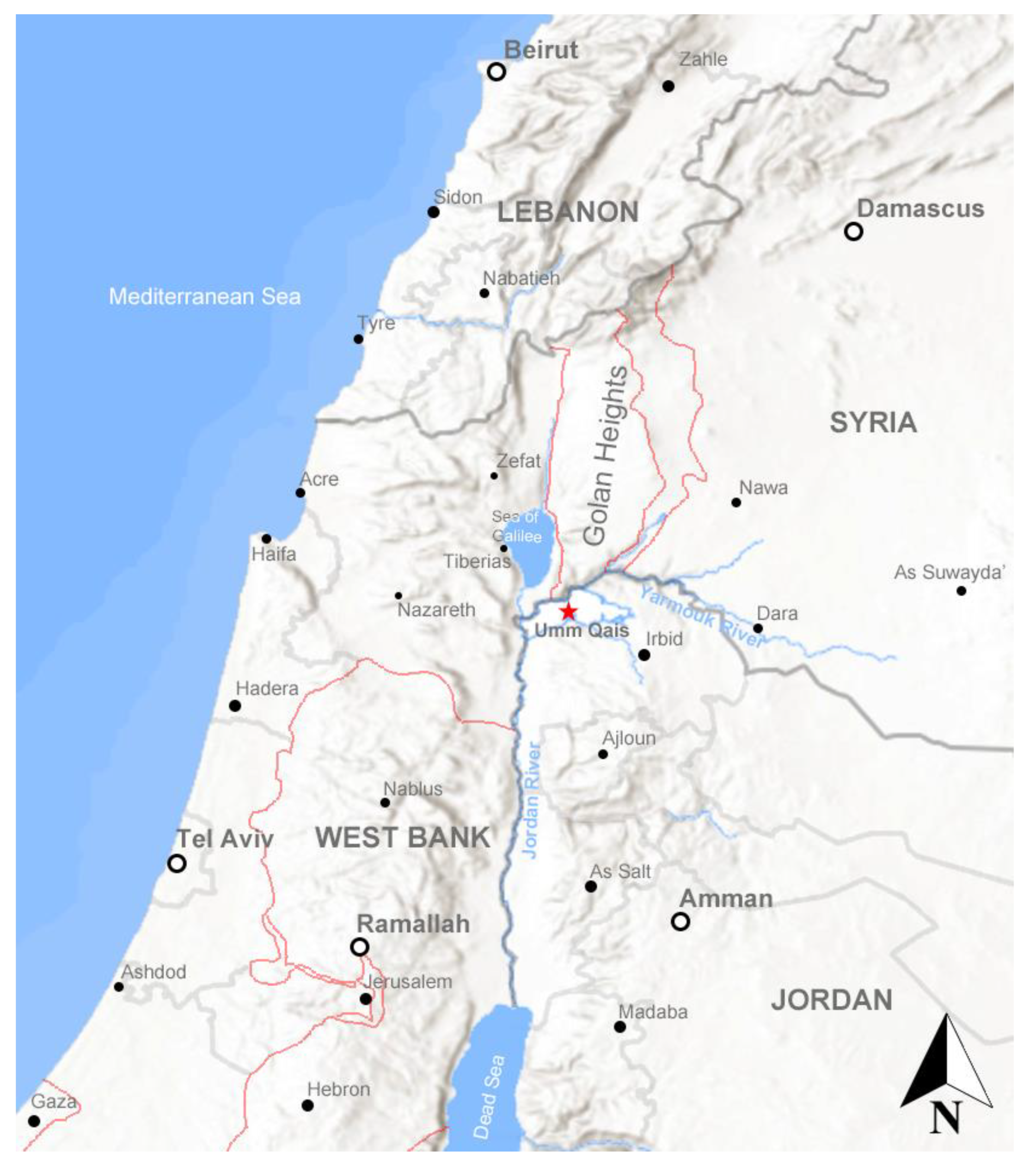
The village of Umm Qais is located c.120km north of Amman in the northwest of Jordan (
Figure 1). The village was built on top of and from extensive archaeological remains of a city whose foundation in the fourth century BCE was named Gadara, a Greek version of a local Semitic name meaning fortress [
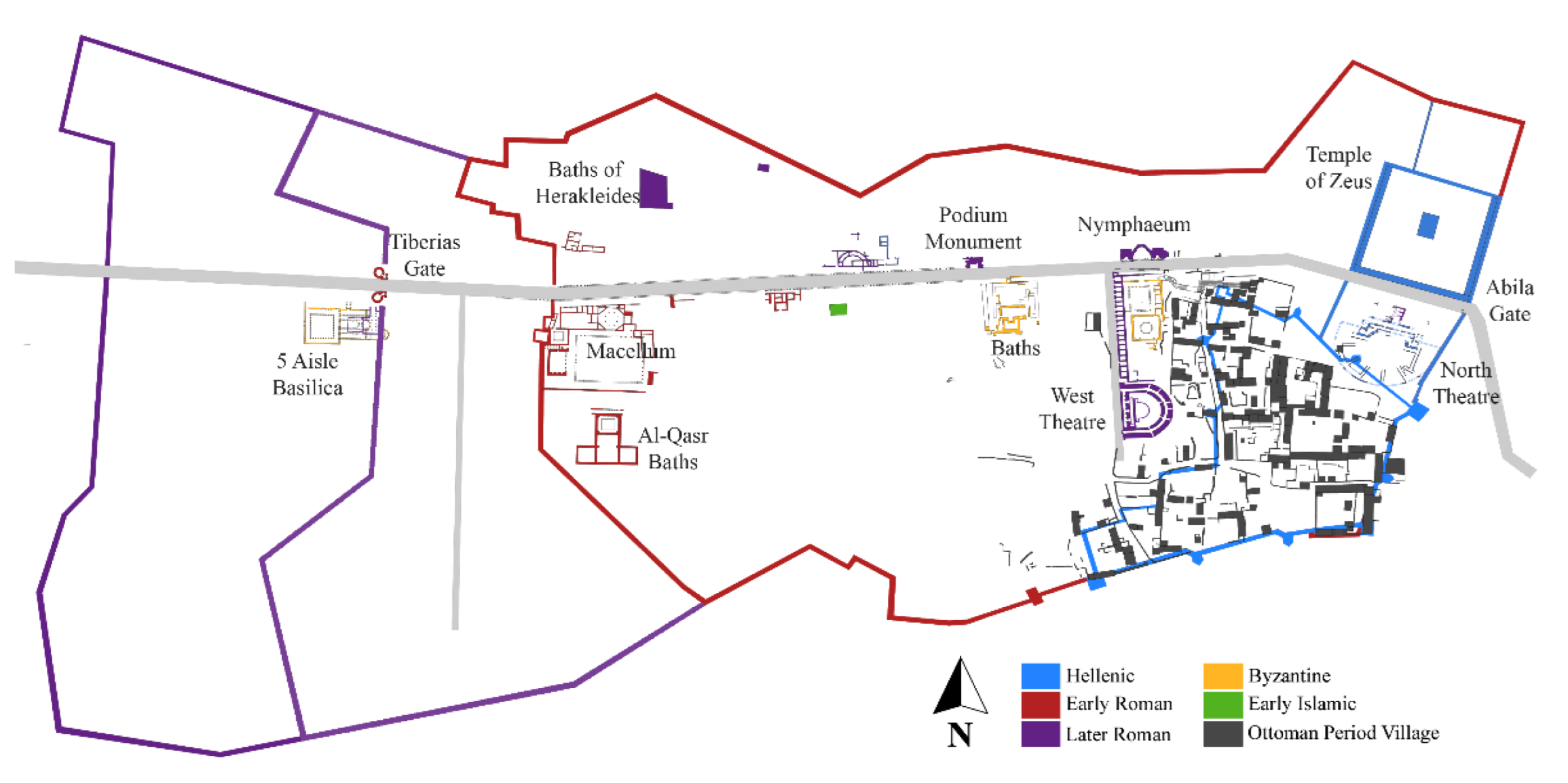
13]. Umm Qais/Gadara was registered on the Tentative List of the UNESCO World Heritage Sites in 2001. It exemplifies the multi-layered complexity of cultural influences that have marked this region over the last two and a half millennia: Greek, Roman, Byzantine, Islamic and Ottoman influences have all left their mark on the location, and the extant remains of the ancient city include theatres, temples, churches, bathhouses, tombs, markets and shops all arranged on a street plan formed either side of the main east–west road connecting the eastern Mediterranean port cities to Arabia and southern Syria (
Figure 2). The present community’s historical accounts refer to an influx of tribal families to the area during the mid-nineteenth century and construction of the current courtyard houses in the Upper Quarter (Harat al-Fouqa) utilizing the supply of dressed stone from the archaeological remains of ancient Gadara [
14]. The reuse of earlier walls as foundations meant that the village had a more structured layout compared to other rural Ottoman settlements, and the decorative reuse of Gadara’s contrasting grey basalt and white limestone gave the site its characteristic architectural appearance.
3. Methods: Building a Multi-Layered Living Museum for Umm Qais
The making of a virtual museum is a rather complex and long-term endeavour that requires multiple actors, processes and the involvement of both professionals and communities. Our methodology worked towards a four-phased process of research, documentation, recording and engaging with local stakeholders in history, archaeology, culture and technology to dig deeper not only into preserved artefacts but more importantly, into the psyche of the local community, their historic homes, the connection between the ancient and the recent past and what was Roman, Greek or Ottoman. These processes involved: (a) archival research and laser scanning to digitally survey, record and model existing conditions and features of the site; (b) a spatial and architectural analysis of both ancient and Ottoman period structures; (c) socio-cultural survey of local cultural practices, traditions of the local community and the identification of ancient versus Ottoman and Roman versus Ottoman period; and finally (d) development of an interactive virtual heritage interface and experience that enables ordinary people to experience the site as a walkthrough in an active public engagement platform that shares their stories, histories and connections to the site that they lost over forty years ago.
We deployed terrestrial laser scanning, modelling and drone imaging and photogrammetric modelling and developed a workflow (
Figure 3) to process and model collected data and integrate them with archival and other data sources. The model of living heritage provides a model for a sustainable ecosystem of cultural heritage preservation and development for Umm Qais that involves three principal aspects:
(a) To capture the physical heritage of the site through utilizing innovative digital methodologies to document, register and digitize the site’s ancient and Ottoman remains. The process of registration allows for highly precise and detailed documentation of the site, as well as the initiation of an investigation of potentially overlooked archaeological evidence. This is achieved using laser 3D scanning and VR technologies and aims to produce an immersive virtual environment to engage wider audiences in the history of the city.
(b) To capture objects that contain historical narratives and connect them to their places and contexts, using the latest technologies of photogrammetry. We focused on ensuring the sustainability of narratives and stories within the digital registration process, as well as continued connectedness of the physical objects to the immaterial heritage and local narratives and stories.
(c) To enquire, register, and record narratives as told by locals, as well as arts and crafts, traditions and cultural heritage, through qualitative methods of interviews and focus groups. This aimed to register the immaterial layer of the history, as a means to overlap it with the physical layer. Collectively, the layers produce a comprehensive view of the overarching heritage of Umm Qais, and the layers intersect to exchange the recorded information.
3.1. From the Physical to the Virtual: Laser Scanning and Generation of the Mesh Model
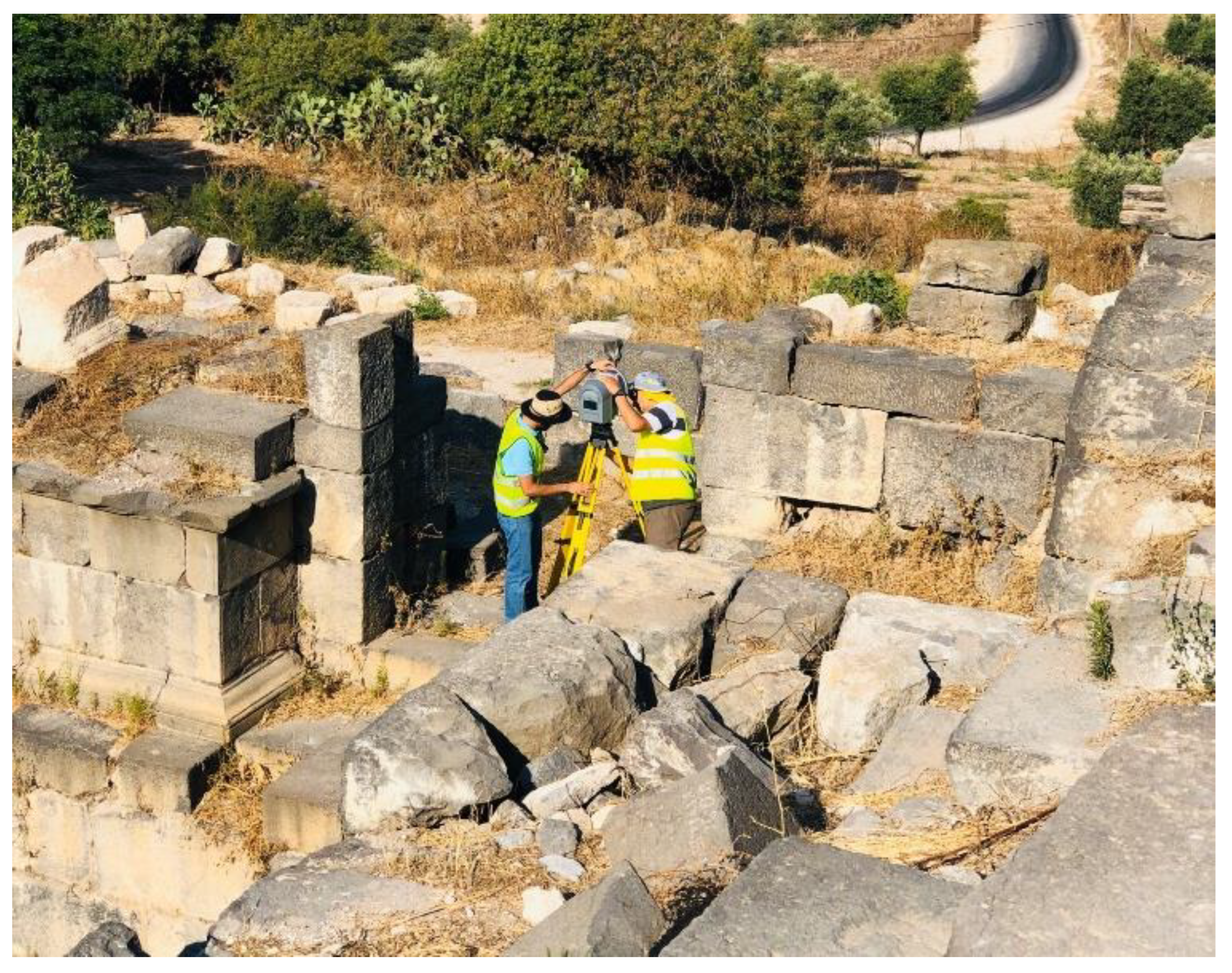
With a site of such scale and complex topography, a series of systematic surveys, terrestrial laser scanning, drone-mounted and aerial photography enabled us to capture the full 3D data of the site from almost all angles. The central areas of ancient Gadara and the adjacent Ottoman houses were scanned using a Trimble TX8 terrestrial laser scanner that provides a full 360° × 317° field of view, collecting 1 million points per second. Distance measurements were determined by the time of flight of an invisible infrared laser (1.5 µm wavelength) for surface distances in the range of 0.6 m to 120 m. Level 2 laser scans with a point spacing of 11.3 mm at 30 m were recorded in standard mode at multiple scan locations used to cover the full extent of the site and to overcome occluded areas from each of the scanning stations (
Figure 4).
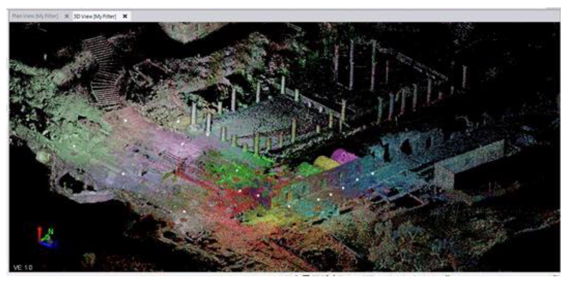
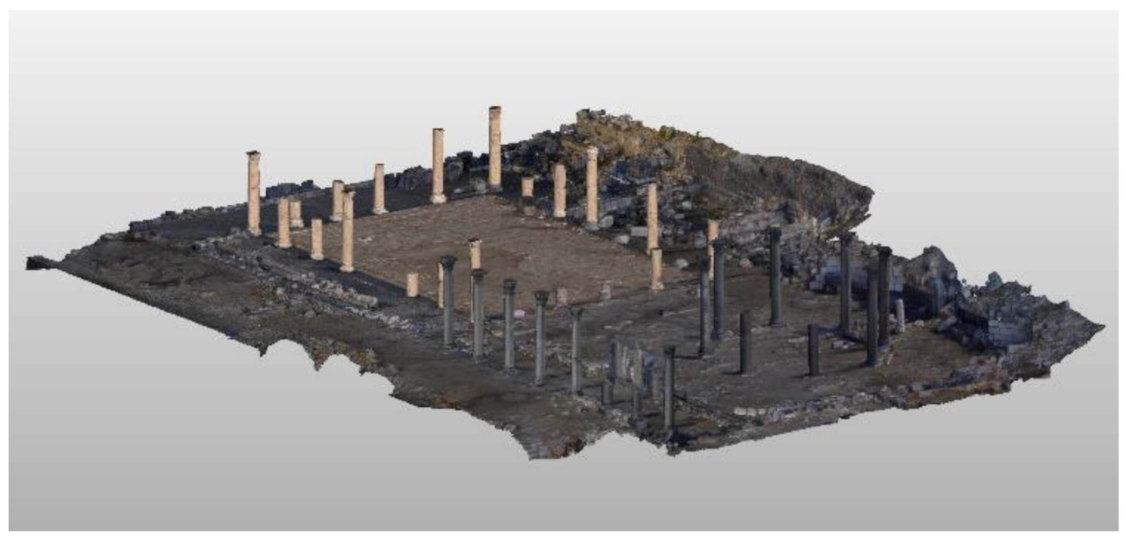
Point cloud models derived from each scan station were each imported into Trimble Realworks (Trimble Inc., Sunnydale, CA, USA) and registered using the cloud-to-cloud registration to generate an aligned surface point-cloud of the atrium, octagonal church, cardo street and shops, western theatre and the adjacent Ottoman houses (
Figure 5). The site was divided into six investigative areas allowing the results of the archival research to be considered prior to laser scanning whilst also reducing the RAM and VRAM and processor loads for each area to streamline the workflow of all subsequent steps. Once successfully registered and fine aligned, the point clouds from each of the scan stations were merged into a single cloud before being subdivided into point clouds covering each of the six archaeological areas.
For each of the 6 investigative areas, the E57 file was imported into Cloud Compare version 2.12 (CloudCompare.org, Paris) and erroneous points derived from instrument, atmospheric and reflectance noise were removed along with points representing low level vegetation. A combination of manual cleaning using the Segmentation tool and the Statistical Outlier Removal tool (using eight nearest neighbour points to calculate the mean distance estimation and a standard deviation multiplier threshold of 1) were used to clean the point clouds. Additionally, points representing the surface of modern features on the site (e.g., interpretation boards, refuse bins and fencing) were also removed at this stage.
An additional point cloud was generated from the aerial photogrammetry mesh (see below) using the Sample Points on a Mesh tool. As expected with such vast and complex topography, it was impossible to capture all data using one methodology, nor would the data captured from each method initially match without additional processing, due to variation in the calibration, expected accuracy and measurement errors with each method. The photogrammetry mesh was cleaned using the same process described above and then aligned and scaled to match the laser point cloud using the Align tool. Areas of the photogrammetry point cloud were then used to fill small areas of missing data where the line of sight could not provide adequate reflections from any of the laser scan positions by cutting them out using the Segment tool before combining them with the laser point cloud using the Merge Multiple Clouds tool.
The normal direction for each point was determined with the
Calculate Normals tool using a quadric local surface approximation model and a minimum spanning tree using a value of 8 for the known nearest neighbour’s domain calculation. Areas of the cloud with inverted normals were isolated using the
Segmentation tool and then flipped with
Invert Normals. The finalized cloud point was exported in a binary PLY format. Meshes were created using a
Poisson Surface Reconstruction at an Octree depth of 11 and exported in Wavefront OBJ format before being retopologised at a lower triangle density using Atangeo Balancer (Atangeo, Haifa, Israel). The simplified meshes were manually UV mapped in Blender v.2.91.2 (Blender Foundation, Amsterdam, Netherlands) before being imported into MeshLab version 1.3.3 (ISTR/CNR, Pisa/Rome) alongside the corresponding cleaned point cloud PLY file. The per-vertex colour data from the point cloud PLY was transferred to the texture of the mesh using the
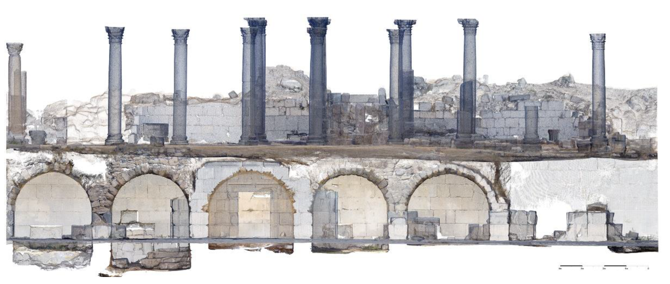
Transfer Vertex Attributes to Texture filter, and the finalized mesh was exported in Wavefront OBJ format. Additional outputs were generated from the finalised point clouds including architectural style elevation images (
Figure 6) for use in public engagement materials, the project website and exhibition displays.
3.2. Capturing and Remaking Context: Aerial Survey, Photography and Modelling
A critical aspect of Gadara and later Umm Qais is its geographical and topographical supremacy at the intersection of many trade routes which remain as contested today as in the past, being situated adjacent to the highly volatile Golan Heights, where the borders of Jordan, Israel, Palestine and Syria meet. It was therefore essential for the model to capture an ancient landscape of conflict that remains as inherent to the site’s identity today as it was centuries ago. Drone-based aerial photography and videography were undertaken with the primary aim of providing a photogrammetric survey of the site, obtaining low-level photographic data of the site and its topographical setting.
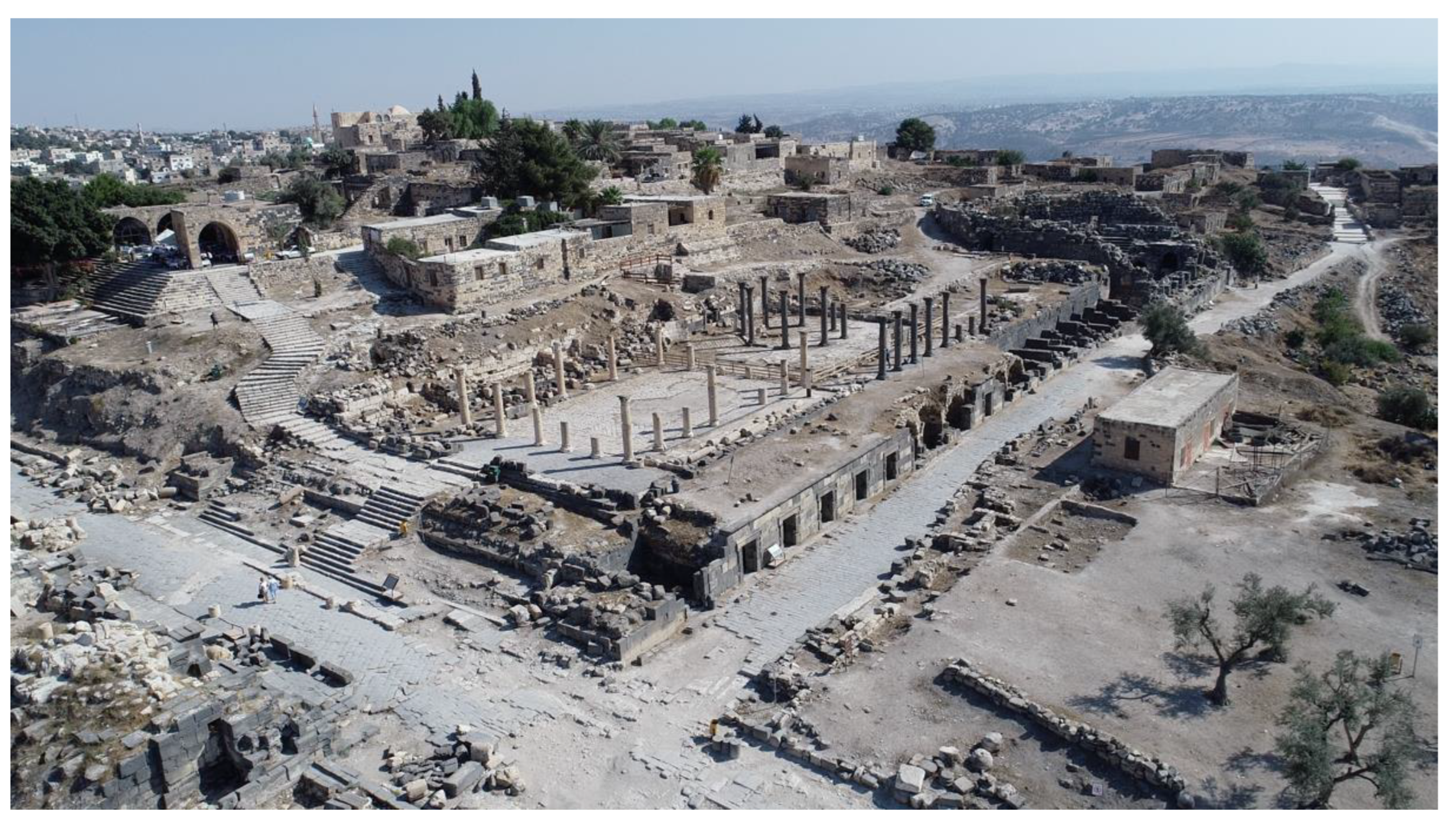
Aerial survey was carried out using multiple DJI drones capturing still photography and video (
Figure 7) at multiple altitudes between 10 m and 30 m AGL. Overlapping photographs with an overlap of at least 50% were captured using a plan and four oblique views. Following typical Greco-Roman street planning, the orientation of Umm Qais’ original layout allowed the oblique photography to be oriented facing each of the four cardinal directions simplifying the data collection.
To build the three-dimensional spatial model, the still and video photographs recorded by the drone surveys were processed using Metashape v 1.7.1 (Agisoft, St. Petersburg, Russia). Metashape’s
Align Photos toolset was used at low accuracy, creating a fast initial alignment and a sparse point cloud to help identify areas of limited coverage. Where areas of limited coverage were identified within the still photography, individual video frames covering those areas were extracted as still images from the drone videos using the
Import Video tool. Blurred and poor-quality images that could reduce the quality of the photogrammetric model were filtered out using the
Estimate Image Quality. The
Align Photos tool was then re-run at high accuracy to create the sparse cloud. The
Build Dense Cloud tool was then applied using a quality of ultra-high and aggressive depth filtering resulting in a point cloud for the site. Ground points with known coordinates and distances (identified during the fieldwork) were identified within the point cloud, and markers were added to allow the point cloud to be scaled to its real-world dimensions and to aid later merging with the terrestrial laser scan data (see
Section 3.1 above). A 3D surface mesh was reconstructed using the
Build Mesh tool based on the dense cloud using the highest face count in the first instance, and an 8K diffuse texture map was generated using the
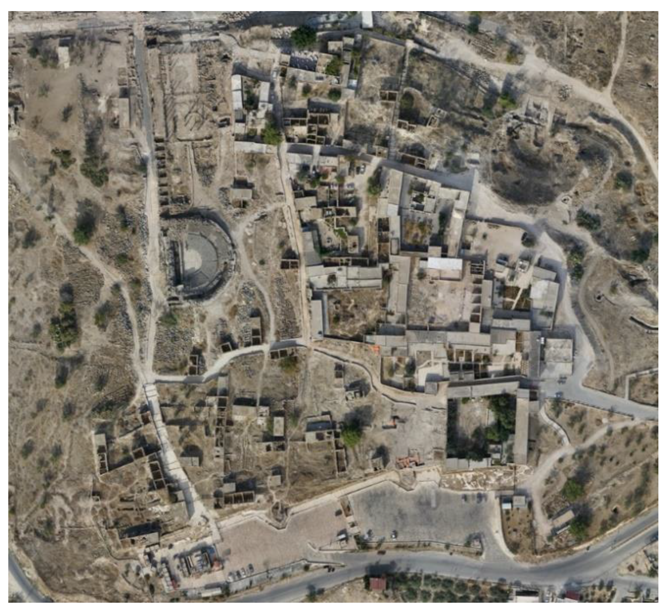
Build Texture tool. The model was then exported in multiple formats, including a full-resolution Wavefront OBJ model for utilization in the virtual reality environment development and orthomosaic images of the site (
Figure 8), for use in public engagement materials, the project website and exhibition displays.
4. Theory of Virtual Heritage Technology and the Evolution of Models of Living Museums for Heritage Sites
The use of computer and digital applications for the presentation of heritage changes the conceptualization of museums from collections of objects to collections of information [
15,
16,
17,
18] and more recently demonstrate the potential of digital technologies to “humanize” museums in their relationship with their visitors [
19]. The earliest virtual museums were characterized by offline multimedia and hypermedia applications on CD-ROM, slowly transitioning online with increasing public access to the world wide web in the 1990s [
20,
21]. Although initially, virtual museums were superficial reflections of the physical museum, they have slowly evolved as they integrated the expanded capabilities presented by the development of non-intrusive digital imaging, 3D modelling, graphics, visualization and more recently, smartphones and virtual environments [
22]. These digital and virtual technologies have opened up new and exciting possibilities for exhibitors, archaeologists, architects and curators; they also provoke much debate in museums and user groups over
real versus
virtual and priorities for investment. This debate instigated resistance around the issues of authenticity, ownership and value [
23]. As authenticity, accuracy and realistic simulation gained traction with the evolution of equipment, laser scanners and hi-level visualizations, reproductions and virtual reconstruction became closer to the intrinsic values that often determine which version of history is at play. Indeed, user acceptance and perceptions of the authenticity of digital presentations of heritage are now recognised to be strongly linked to both the richness and realism of the presented media as well as the level to which it aligns to users’ expectations of heritage [
24].
Whilst virtual experiences may lack the direct knowledge intuitively gained through physical immersion in the landscapes, architectures and cultures in experiencing heritage sites in person, virtual versions of heritage sites enable interpretation, experimentation and accessibility to fields and information that is otherwise inaccessible in real-life visitor experiences. Virtual heritage therefore provides an additional, and complimentary, avenue to experience and investigate the past alongside real-life experiences of heritage sites, rather than as a substitute for such visits. In his BBC series
Incredible Invisible Cities, Michael Scott argues that virtual models opened up spatial connections to layers of embedded history and archaeology that could never be seen if not for technology. He made an example of following up the underground ancient tunnels and infrastructure through Istanbul by using laser scanning and digital modelling to understand how the great Constantinople operated [
25]. Similarly, in the Rome Reborn project, several years of continuous work enabled us to see the architectural and spatial complexity of the ancient empire at work [
26]. In neither case did scientists, archaeologists nor architectural historians claim absolute facts or authenticity in the virtual reconstruction. Instead, virtual heritage models have become essential tools to test long-standing theories, verify historical narratives, and open new fields of inquiry. As history is contested by nature due to different interpretations of evidence, tangible or intangible, virtual heritage becomes accustomed to interpretation, contestation and analytical debate.
Virtual heritage became the catalyst for several virtual reality systems, experiences and applications to engage communities, industries and technology developers with heritage. Thanks to the technological leap into a new generation of devices and supporting software, virtual heritage has become more inclusive than 20 years ago. On the other hand, cultural geographers and anthropologists tend to associate culture and heritage with what is not seen, the immeasurable aspects of everyday practice [
27]. According to Yi-Fu Tuan [
28], perceiving the intangible is the foundation of all human culture; a space is meaningful only when associated with humans and their practices. Thus, as cultural heritage refers to historical periods and societies that no longer exist, we face the troubling task of virtualising aspects that are not visible and whose evidence of existence is scattered items, objects, spaces and a series of unconnected narratives.
In this context, the “Living Museum” typology becomes the virtual twin of a living story for a heritage site. It surpasses the mere physical image and spatial arrangements of objects and spaces to include people, stories and aspects of everyday life in space. It reflects the embodiment of culture within space to place users within the recreated cultural, environmental and historic setting. Through visitors’ experiential interpretation, this generates the emotional connections with the past that Othman argues are the foundation to making heritage a meaningful experience with relevance to the living [
29]. Artefacts have always drawn meaning from their contextual settings and understanding. Therefore, only through simulating such knowledge and contextual setup will their presentation and display in museums or 3D objects in virtual heritage collections have a meaningful impact.
By contrast, techniques of virtual heritage are ideally suited to the creation of living museums in a virtual space. Virtual heritage, in this sense, reflects an attempt to recreate environments, not objects, whilst living museums enable people and audiences to interact with them in a historically authentic manner. Both aim to present historical information, context and practices as accurately and authentically as possible, yet with room for interpretation and open for creative additions [
30]. Unlike physical reconstructions, living museums can evolve and grow with new knowledge to remain relevant. However, those virtual modes of display and engagement in the virtual space facilitate further and open-ended evolution as a space for dialogue around heritage, offering wider opportunities for participation in the curation of heritage. In doing so, participants experience a transformation in their relationship to cultural heritage, shifting from being passive receivers of knowledge to researchers exploring their connections to a place, its history and culture.
Virtual living museums revolutionize our perception of museums as institutions of knowledge and guardians of the past into a place of exploration and enquiry that directly relates to the living. They can address the tendency of traditional museums to award disproportionate value to the object and artefact over the narratives and the story [
31]. They enable participants with a mechanism to document and value living traditions, food, music, personal experiences and other emerging practices as an integral part of the heritage site experiences and to be in place on-site, physically or virtually. The integration of such co-produced knowledge and multiple perspectives on heritage within living museums provides more angles and a fresh perspective towards authenticity and enhances the build-up of a sense of place that virtual heritage reconstructions were often critiqued for lacking [
32,
33].
When combined with online platforms
Living Museums, facilitate dialogue amongst dispersed communities and therefore offer new methods of community-making around shared heritage. They often exhibit a strong intergenerational element reconnecting community members displaced from their heritage through factors such as socio-economic deprivation, job creativity, and, through increased intergenerational communication around heritage they promote improved community wellbeing [
34]. Living museums provide a mechanism for the adaptive and personalized navigation of cultural heritage information by users, allowing individuals and communities to take control of their own experiences of heritage [
35], making heritage meaningful to local communities and contributing to the sustainability of heritage sites.
5. Results and Discussion: Bridging Narratives and Technologies
At the heart of a living museum is the attachment of a story to object, space and place. However, just as museums need to be accessible to different users and age groups with diverse interests, the virtual topology of a digital living museum must incorporate a range of outcomes, scenarios and methods of display and engagement [
22]. It needs to cater to the interests of foreign tourists whilst equally intriguing domestic residents. It must be accurate across a broad temporal span, reflecting the facts of living families and their personal narratives as much as its distant past and ancient archaeology. In creating the living museum our methods of analysis and processing in this context moved through parallel routes: the tangible yet virtual models of physical settings and architectural and spatial characteristics, historical and archaeological analysis, and social history and anthropological mapping, culminating in creative designs for scenarios and story boards. A range of expertise that included archaeologists, engineers, architects, historians, digital modelling and computer scientists led on the analysis of each dataset, creating one layer of displayed narratives.
5.1. Digital Umm Qais
The documentation process of 3D scanning was undertaken over four periods of fieldwork during a span of 18 months in 2019 and 2020. This work was conducted in collaboration with local Jordanian teams whilst the processing and modelling was largely undertaken by the UK team. Each fieldwork period commenced with the assessment of current progress and the production of a map of planned implementation for the fieldwork, pinpointing the positions of individual scanning stations and the areas they should cover. Our earliest trial laser scans on the site highlighted the challenges of digitising both internal and external spaces on the site where the afternoon sunlight produced heavy shadows. Whilst in other environments, overcast and cloudy days with resultant diffuse lighting might be preferentially used for scanning, the environment in northern Jordan is rarely cloudy for most of the year. Scanning therefore took place between 7:00 and 14:00 when the sun was to the east of the main settlement, allowing heavy shadows within the final 3D model to be minimised. A total of 151 scan stations in the ancient Gadara segments of the site were captured by our survey partners (Al-Mutaz and ASFAN.co). Additionally, the Department of Antiquities of Jordan (DoA) scanned the attached Ottoman village using a Leica P10 scanner providing an additional 13 scan stations for inclusion in our research. All data were transferred to the UK research team in an E57 format (See
Section 3.1 above) to enable further processing. An initial analysis of the unprocessed scan data was used to assess the quality of the data and their ability to be delivered as a detailed VR model. This analysis functioned as a diagnostic tool to investigate where the data was incomplete, contained shadowed and noisy data or where line of sight was occluded within the agreed site border, and fed back into the planning for later fieldwork.
Due to the site’s geography and its proximity to unsettled international borders, the aerial photography and drone surveys were not easily accessible to the UK team. Additionally, the proximity of a Jordanian army facility made the aerial survey subject to extensive regulatory requirements before permission to fly was granted. The aerial survey of the site was therefore undertaken by two local partners (MARS Robotics and Actual Productions), who were able to facilitate the flight consents. Three sessions of aerial survey produced over 1200 digital photographs augmented by c75,000 extracted 4K video frames. These resulted in the production of a large-scale photogrammetric 3D model of the site in both mesh and point cloud formats, as well as smaller 3D photogrammetric models of specific archaeological features within the site. In addition, the drone survey also afforded the project the opportunity to capture 34 cinematic aerial flyover videos for use on the website, exhibition and other user engagements. The flight path and viewpoint of the drone-based videos flyovers of the site were later duplicated in virtual flyovers of the combined point cloud data allowing video transitions from video recorded in real life to matching views of the virtualized site.
The site was divided into multiple areas during laser scanning to aid in planning the data capture; however, these divisions related only to the physical challenges of positioning scan stations and capturing data with only broad correlation to archaeological period or the historic and socio-cultural narratives of the site. Once the data from all 164 laser scans were aligned into a giant point-cloud and combined with the drone-based photogrammetry derived point cloud, the size of the data was prohibitively large within a single file. The site was therefore subdivided into four sectors, aiding post processing, rendering and application of the real-life simulations for both VR and animated displays (
Figure 9).
In processing the digital scans, it typically took several months to register, clean, align and match different datasets to generate the initial models and maps of the archaeological site and fragmented structures and objects in an inclusive database of Umm Qais. All the models were processed in high quality and were sufficiently detailed to be incorporated within the VR experience.
Whilst the results of the fieldwork provided a digital resource of the site, the research also aimed to build digital heritage capacity within both Jordan’s heritage professionals and the local community at Umm Qais. Working with local teams resulted in research-led training on state-of-the-art terrestrial laser scanning and virtual digitization modelling for cultural heritage that has supported both young researchers in the community and the Department of Antiquities, as well as the entrepreneurs at project partner organizations and start-ups in digital and virtual heritage technology. In this sense, the project fieldwork went beyond site recording and provided educational training and practical experience, transferring knowledge from participating academics and advanced local knowledge and practice in heritage preservation, modern technology and the application of virtual reality in cultural heritage.
5.2. Engaging Narratives: Working with the Heritage Community
Whilst the archaeological site has been the subject of many missions and excavations to date, its history and artefacts continue to emerge and will continue to do so in the future. However, one key segment of the site’s history that has been consistently, if not deliberately overlooked, is the social history and cultural practices of its local communities. Having been through wars, invasions, attacks and intensive bombing, the Hara Fouqa community has lasted for over two centuries of continuous habitation and cultural practices, many of which date back to the Roman traditions. They made use of the archaeological site and guarded it before tourism was even contemplated in the area. Nonetheless, there are no detailed or coherent surveys of those stories, even after forty years of displacement and expropriation. Historians and archaeologists often become obsessed with mysterious pasts that are hard to evidence yet overlook recording accessible and well inherited cultural practices, memory and knowledge embodied by community members’ living practices.
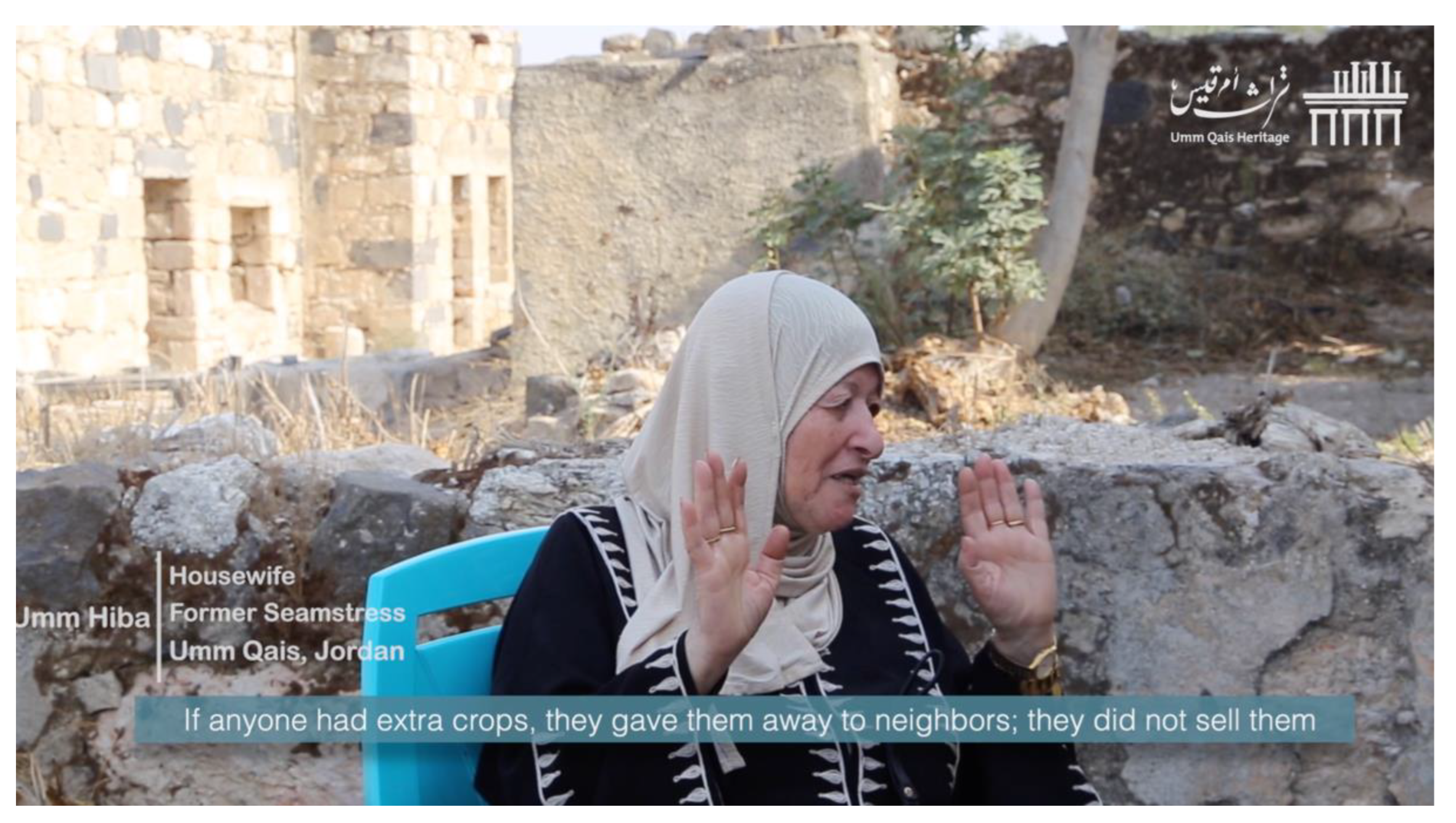
Alert to the critical importance of lived history and cultural practices in constructing a living museum, we worked closely with the community, family members, young and old, and enjoyed having a young generation of families collecting and recording the narratives of their ageing family members, restoring the sense of pride and belonging and overcoming four decades of separation between people and places (
Figure 10). We ran workshops hosted within the buildings of the Ottoman village, trained local members on what, how and when to record cultural practices and oral history of their families. We are training young heritage professionals and family members on the use of photogrammetry to record local archaeological artefacts, but more importantly on how to interview and record historical narratives of their senior members, creating cross-generation dialogue but also generating rich datasets that changed our perception of the use of some spaces, houses and streets.
The workshop was held over three days and included 15 young professionals from the community. Many of these participants have subsequently gone on to work with the Department of Antiquities, ensuring digital heritage approaches are integrated into the future of cultural heritage presentation in Jordan.
Given the ubiquity of digital photography, either as low-cost digital cameras or the relatively high-resolution cameras within mobile phones and free or low-cost structure from motion software, photogrammetry offers a cheap and relatively simple process for the acquisition of cultural heritage objects [
36]. As part of the data gathering to build a database of archaeological artefacts and historical elements in Umm Qais, we trained local and young professionals from the community on the use and production of photogrammetric models of various site elements.
The collected images were later processed using both Metashape and the freely available Meshroom to generate the digital 3D models. Skills and knowledge training enabled local members to continue their own production of 3D digital resources and helped establish the crowdsourcing of this digital archive by both tourist visitors and local community members alike.
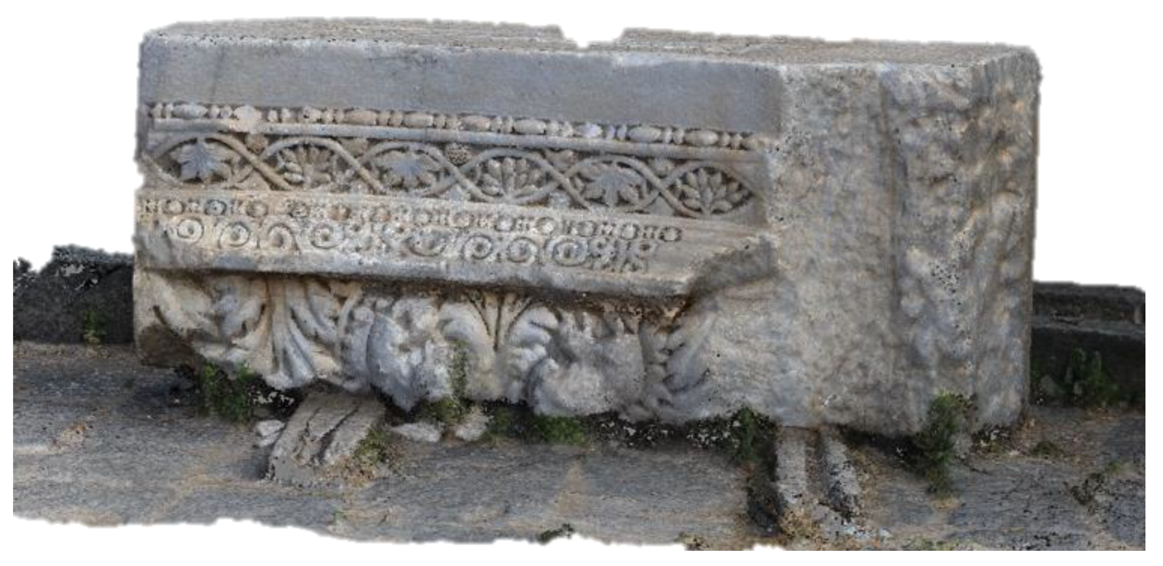
During the training, we demonstrated the process by recording nine different objects, with an average of 90 images per object. Objects were chosen due to their known historical significance or for the potential of their utilization within the Point Cloud model produced from the laser scanning mentioned above; for instance, our team identified a piece of marble decoration (
Figure 11) that was a part of a repeated element from the
Nymphaeum at the side of the
Decumanus Maximus (the east–west-oriented Roman street). This piece was then photographed in high quality and the 3D model was duplicated and repeated to illustrate the Roman
Nymphaeum.
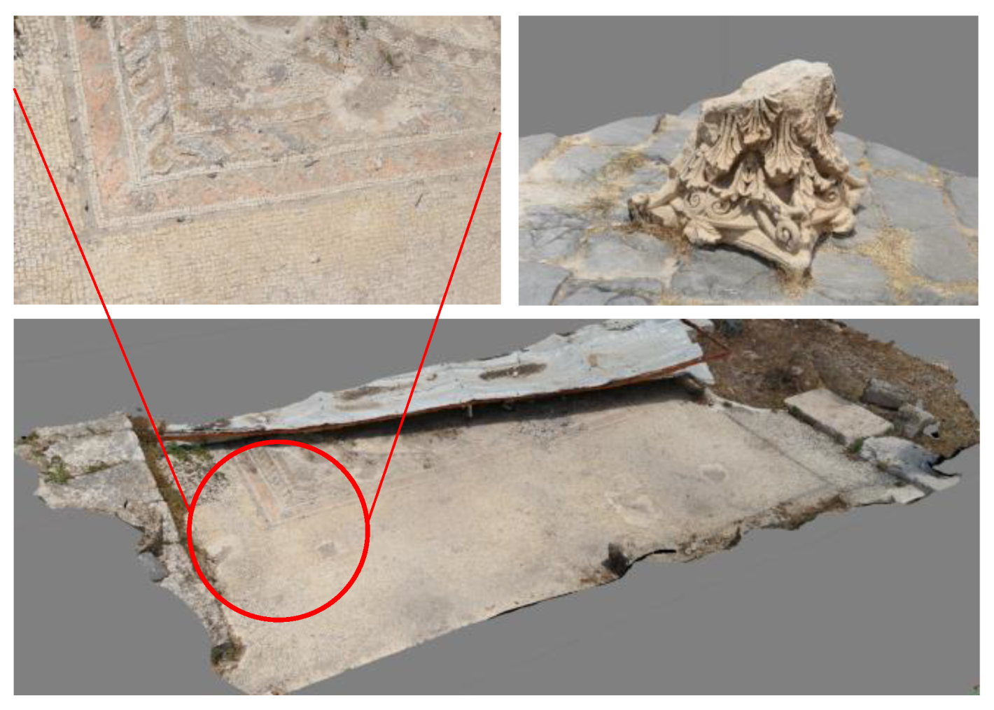
Our community volunteers then captured additional artefacts they identified, including ancient statues, archaeological objects, craft objects produced historically by community members and models of visual elements of the site such as mosaics (
Figure 12). In the first phase, 14 objects were photographed by local participants and processed at a basic resolution on site. The objects were later re-processed at the higher resolutions possible using the computing resources at NTU and Leeds University in the UK. These objects are accompanied by both infographics as well as audio narration that explain their history, significance and, more importantly, the local cultural stories attached to them.
The positive community response led to greater collaboration in heritage management at Umm Qais between the community and the Department of Antiquities. The training resulted in the formation of a team of five young local women, who are using the principles of photogrammetry to support documentation of the site, as well as volunteering to aid the process of recording oral heritage narratives and stories within site. The team provides a conduit to facilitate interviews with older members of the community, whilst also appearing in videos and providing a voice to explain the local heritage significance of objects illustrated through their photogrammetry models.
6. Conclusions
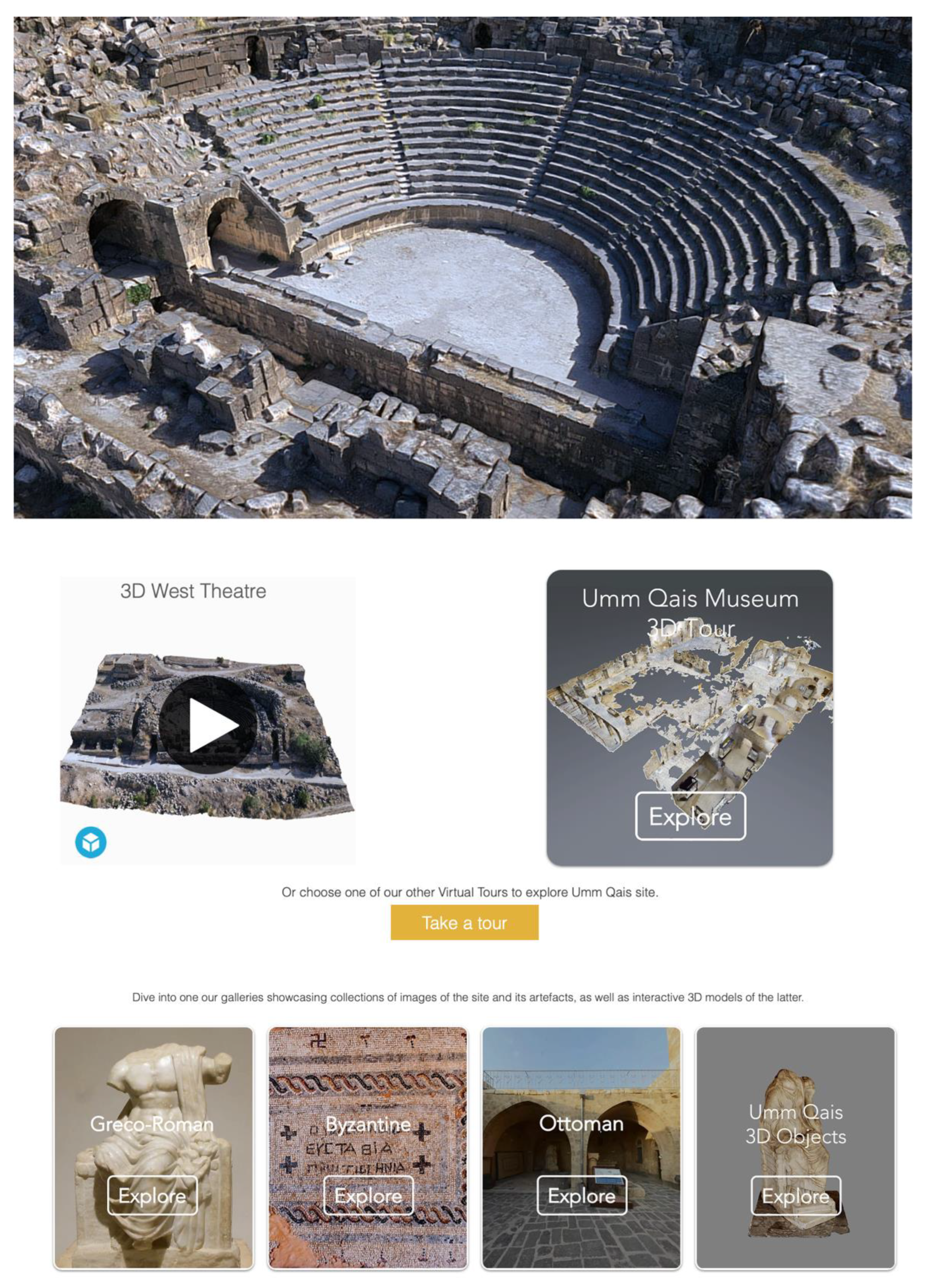
Over 24 months of the project’s survey, analysis, modelling and experimentation, it was our collective conviction that engaged the local communities, introduced specific systems, methods and training programmes and made the vision possible. However, the collective buy-in can be somewhat problematic. Content creation cannot be solely done by technologies, modellers or virtual technology experts. It is a process of education and collaborative learning on each side, the researchers having technical expertise, as much as the local community know where and what. The mutual contribution of the human/technology and the tangible/intangible provide a forum for interesting and novel knowledge creation and enquiry which represents the development of a new phase of the cultural heritage of the site through new products and outcomes (
Figure 13). The creation of the living museum is not merely a process of replication and digitalization, nor just simulation, but rather it is a genuine process of reconstruction to create new original heritage content that adds value and accessibility and is an enabler for cross-generation, cross-time agency.
As part of our endeavour for a long-term and sustainable model of living heritage, the methods implemented were used as the basis for long-term training programmes that benefited local communities and associated local businesses. Whilst these were central to the conduct of the project, they also provided significant impact helping the participants develop necessary and transferable skills which are sustaining the use of virtual heritage skills within cultural heritage presentation in Jordan more widely. Through our initially selected participants, we generated significant wider interest resulting in a broader representative group of community members. The living museum as a typology has evolved during the past two years of its life, moving from being a site and history-based project to become a more integrated project of cultural programmes that engaged many local and national stakeholders, creating a bond between researchers and local communities and between people and places, as a revival of a long-forgotten relationship. Every voice counted, and every story mattered. The living museum typologies are an open-ended, technology-enabled approach toward a more fluid, interactive and co-produced and preserved cultural heritage. It has created a critical forum for exchanging ideas and communication between stakeholders and continues to enable and disseminate the story of the site and its narratives to wider, domestic and global, audiences.
