
Changes in the Water Resources of Selected Lakes in Poland in the Period 1916–2020 as Information to Increase Their Availability


1
Department of Hydrology and Water Management, Adam Mickiewicz University, Krygowskiego 10, 61-680 Poznań, Poland
2
Department of Land Improvement, Environmental Development and Spatial Management, Poznań University of Life Sciences, Piątkowska 94E, 60-649 Poznań, Poland
3
College of Hydraulic Science and Engineering, Yangzhou University, Yangzhou 225127, China
*
Author to whom correspondence should be addressed.
Sustainability 2021, 13(13), 7298; https://doi.org/10.3390/su13137298
Submission received: 24 May 2021
/
Revised: 17 June 2021
/
Accepted: 25 June 2021
/
Published: 29 June 2021
(This article belongs to the Special Issue Water Resources and Sustainable Development: Social, Economic, Psychological and Educational Perspectives)
Abstract
:The historical effects of land development on water management currently require a new approach, in many cases involving attempts at the restoration of the quasi-natural state. This is evident in reference to many regions in Poland, where the hydrographic network has been diminishing over the centuries, among others in favour of obtaining new agricultural land. Such activities overlap with natural processes causing transformations of the hydrosphere. The most serious problems currently include water deficits resulting from climate change and human activity. This paper employed archival bathymetric maps from the beginning of the 20th century for the determination of the scale of changes in the morphometric parameters of six lakes in western Poland. It was determined that over a period of more than a hundred years, the surface area (12.2%) and original volume of water bodies (13.9%) were largely reduced. This situation was caused by both natural (overgrowing and shallowing) and anthropogenic (change in water level) factors. The obtained information points to the need of an inventory of historical bathymetric maps of lakes. In combination with modern research, this will allow for the determination of changes in the water resources of lakes and, in a longer-term perspective, potential possibilities of their renaturisation. This knowledge is important in the context of the reconstruction of water resources in the territory of Poland, where their deficits are recorded increasingly frequently. It should also be emphasised that the restoration of the natural capacity of water retention in lakes is a more economical solution and, most importantly, it is not invasive for the environment.
1. Introduction
Changes in the natural environment constitute its permanent element determined by the exchange of energy and matter between its particular components. Due to the physico-chemical properties of water (e.g., the dynamics of movement and the solubility of various substances), considerable changes have been observed in the environment, particularly referring to its quality and quantity. The response of surface waters to the supply of pollutants or changes in the components of the water balance in a given catchment are observed relatively rapidly, with broad consequences for other water-related components (including hydrobiological conditions) [1,2,3,4]. The human perception of water in the natural environment has been subject to evolution determined by the civilisation needs of a given epoch. For example, analysis of the function of water bodies in south-eastern Poland has shown that they fulfill different functions that have changed throughout centuries, including defence, economic, industrial, and recreational functions [5]. Recent decades have revealed intensification of the problem of water deficits in many regions around the globe [6,7], determined by purely climatic factors (e.g., global warming), but also improperly conducted water management. In the context of access to water resources, lakes are an important element of the hydrosphere. They show a high capacity for water retention, and due to their stability, they provide the possibility of easy access for use. Moreover, their presence contributes to the mitigation of extreme hydrological situations such as draughts and floods in the surrounding areas [8]. As they evolve, however, a vast majority of lakes are subject to successive disappearance. According to the current research in the scope, this process is usually associated with changes in the surface area [9,10,11], whereas the lake basin as a three-dimensional concave landform is also subject to the process of accumulation (filling) of sediment, consequently leading to the disappearance of a lake. The disproportion between the analysis of changes in the surface area of lakes and their complex disappearance (identified as a reduction in water resources) is determined by insufficient comparative data, namely, bathymetric maps from two or more periods [12]. It should also be emphasised that the availability of bathymetric maps permits the determination of the primary morphometric properties of lakes, and is important for the calculation of the water, thermal, and chemical balances of these elements of the hydrosphere [13]. Therefore, knowledge concerning lake bottom relief is a frequently discussed issue in hydrological research [14,15,16,17,18]. In this context, studies concerning changes in isobaths reflecting the transformations of bottom topography should be considered scarce [19,20,21].
This paper presents a comparative analysis of bathymetric maps of six lakes in the Wielkopolskie Lakeland (western Poland; Figure 1) in the period 1916–2020. The objective of this article is the analysis of changes in water resources of lakes, allowing for the determination of their direction, rate, and causes. Next to the purely scientific character showing changes occurring in reference to selected elements of the hydrosphere, the objective also has an applicative character: It points to a new direction of activities aimed at the restoration of natural water resources that requires detailed data regarding the scale of the related transformations to date.
2. Materials and Methods
The analysed lakes are of post-glacial origin, located on a moraine plateau, and their basins are primarily incised into glacial tills. Both the inflows and outflows through streams are negligible, and in certain periods of droughts, they completely disappear. The lake catchments are under intensive agricultural use, dominated by arable land, with a small share of forest areas.
Research on transformations of the natural environment requires detailed knowledge, which, next to the purely theoretical aspect, is necessary from the point of view of economic conditions. In the case the study area, this can be referred to as the problem of water deficits. The average unitary runoff from the area is 2–3 dm3·km2, constituting one of the lowest values in Poland. The implementation of the adopted research objective was based on the analysis of historical and modern bathymetric maps. The adopted starting point for determining changes in water resources and other lake parameters (i.e., area and depth) was information from the beginning of the 20th century Geologische Karte von Preussen und benachbarten Bundesstaaten (1:25,000). Next to rich, extensive geological content, the maps provided valuable information on other components of the environment. Considering the complete cartometricity of the documents, the information provided by the bathymetric maps of the lakes (Figure 2) is exceptionally valuable, because it refers to the shape of the lake basins from before intensified human pressure on the environment.
The situation from the early 20th century was referred to as the current state through preparation of current bathymetric maps. On the date of performing bathymetric measurements, the measurement of the water level was conducted by means of GPS RTK. Bathymetric measurements were conducted from a boat by means of a Garmin Fishfinder 100 echosounder. The data file included information on the location of the measurement point (x and y coordinates) and information on depth (z). During the measurements with the echosounder, point measurements were simultaneously conducted by means of a traditional probe—a weight suspended on a cord. Such an approach aimed at normalising the modern technique to that from a century ago. Moreover, the data were used for the verification of measurements performed by means of the echosounder. The results obtained from the echosounder in the postprocessing were corrected based on manual measurements. The measurements performed by means of the echosounder and weight probe differed by an average of approximately 0.07 m. In the next stage, the data were fed into ArcMap software for the purpose of developing a digital model of the lake basin. This employed the topo to raster function, permitting the interpolation of point data to the continuous surface of the lake basin. Then, by means of the contour function, an isobath map was developed, with a depth contour corresponding to that presented in the historical maps. The obtained digital models of the lake basins were integrated with the digital terrain models available in Poland that were developed based on data from aerial laser scanning (LIDAR). The digital terrain model had a spatial resolution of 1 m and mean error of up to 0.2 m. This way, a three-dimensional terrain model with the lake basin was obtained. The developed model permitted the development of modern curves of the surface area and volume of the lakes. In the case of the historical maps, in the first stage, they were converted to the ETRS 1989 UWPP 1992 coordinate system. This process employed the methodology proposed by Kubiak-Wójcicka et al. [22] to convert raster maps to digital form and to validate the obtained products. Moreover, taking into account the information presented by Manowska and Szuba [23] regarding the precision of height measurements at the end of the 19th century declining with distance from the reference points, the development of digital terrain models of the areas adjacent to the lake basins involved referring them to the PL-KRON86-NH geodetic height system used in Poland. In order to reduce the errors associated with the direct transfer of heights found in the archival bathymetric maps, the surface relief of the terrain surrounding the lakes was also vectorised based on the contour lines. This way, an archival digital terrain model with lake bathymetry was obtained. The model was compared to the actual digital terrain model in the ArcMap software using the raster calculator and difference function. The differences in elevation in the areas adjacent to the lakes resulting from the overlaying of digital terrain models did not exceed 0.2 m. The second stage of the validation of the archival data involved overlaying the lake water surface ordinates recorded on the archival maps on the actual digital terrain model. This permitted the determination of the surface and spatial extent of the lakes. In the case of height differences, the digital terrain models developed based on archival data were matched with the actual models. The extracted volume and surface area from the archival and actual digital terrain models were used to plot graphs of depth against volume and surface area. The obtained results allowed for a comparative analysis in reference to changes in the surface area and volume of the lakes.
3. Results
This study revealed considerable changes in the morphometry of the analysed lakes that occurred over the last hundred years. For the six cases analysed in this paper, a total decrease in their surface area by 12.2% was recorded (Table 1), as well as a reduction in water resources of 13.9%.
The changes in the particular lakes were variable, largely due to their morphometric parameters and factors affecting particular objects. The smallest transformation occurred in the case of Lake Zajączkowskie, whose surface area decreased by only 4.4% and whose volume decreased by only 4%. It should be emphasised that the recorded changes primarily concerned the northern and southern parts of the lake, where in the first designation, development of an island was recorded (with a surface area of 918.0 m2), whereas in the map from the early 20th century, the zone was only occupied by a belt of rush vegetation. The southern part covers a shallow bay isolated with a narrow isthmus, subject to considerable shallowing over the last hundred years, as confirmed by a 5 m isobath shift towards the middle of the lake. Moreover, the conducted field research suggests that the section connecting the main part of the lake with the bay is subject to intensive overgrowing and shallowing processes, and its current depth is approximately 0.9 m. Due to this, it can be assumed that, from a short-term perspective, this part will become completely separated from the main lake basin (Figure 3).
Intensive overgrowing processes also concerned Lake Wielkie, which are favourable for the vegetation succession of small depth—mostly below 1.5 m (80%). Vegetation succession covered the entire length of the shoreline, consequently reducing the surface area by 25% in comparison to the state from the beginning of the previous century. A particularly intensive overgrowing process occurred in the western and northern parts of the lake, contributing to enlarging the peninsula and a considerable reduction in the size of the bay (Figure 3). The intensive process of disappearance of the lake was confirmed by a cartographic study from the early 19th century (Figure 4). Although the presented map fragment is not cartometric, notice that the outline of Lake Wielkie is considerably larger, with an elongated southern bay, already separated in the later period. Interestingly, substantial diminishment of the lake was recorded, along with an increase in the water level in comparison to the starting point from the early 20th century. This is related to the obstructed outflow of the Ostroroga River feeding the lake, limited by the overgrowing and shallowing of the bay in the northern part of the lake.
A decrease in the water level was a key factor causing changes in Lakes Buszewskie and Lubosińskie (in the latter case later during the division into two independent lakes). The lakes are of flow-through character, connected by a system of ditches [24]. According to earlier research from the area, in terms of transformations of water relations, it was subject to melioration, among other things, resulting in a network of ditches and melioration canals, drainage of large areas, and a decrease in the level of shallow groundwaters [25]. An example of such activities is the dense network of ditches approximately 1.5 km below Lake Lubosińskie Małe, draining water into Lubosiński Canal. As a consequence of these works, the water level in the aforementioned lakes was considerably reduced, resulting in a reduction in their surface area, in the case of Lake Buszewskie by 7% and in Lake Lubosińskie by 12.5%, and division into two independent lakes (Figure 3).
4. Discussion
The study results point to an evident transformation of the analysed lakes, corresponding with the broad research trend. The surface area of lakes has been declining at a global scale [26,27,28,29], and the rate and scale of such transformations is determined by the local factors and properties of particular lakes. Based on a similar methodology supported by historical cartographic materials [30,31,32,33], a similar direction of changes in the surface area of lakes has also been determined in the case of other regions of Poland. The scale of the process has been variable, depending on the volume of the analysed data set and morphometric properties of the lakes. In reference to research employing cartometric archival maps (i.e., from the mid-19th century onwards), it can be stated that such an approach has no limitations, and the studies are of reference value to the modern scope of data. Limitations occur in the case of using maps older than the temporal scope specified above [34].
Referring the obtained study results to other scarce papers addressing changes in bathymetry over a period of more than a hundred years confirms the earlier findings [35,36], pointing to the progressing reduction of water resources with a rate dependent on local conditions. One of the key properties of lakes distinguishing them from other elements of the hydrosphere is the high capacity for water retention, whose volume depends on the size of the lake basin. The volume of lakes is not permanent and is subject to changes—usually a decrease, considering their natural course of evolution leading to their disappearance as concave landforms. The rate of the process is largely variable, determining the size of lakes and the effect of natural and anthropogenic factors in the catchment. The supply of nutrients is important in this context. According to Gradke [37], high amounts supplied in the 20th century accelerated the overgrowing process. The amount of accumulated water resources in the lake affects the rate of water circulation in the catchment. This is of key importance for shaping environmental (biodiversity) as well as economic conditions (agricultural irrigation, industrial purposes, transport, etc.). Using historical bathymetric maps and conducting modern sounding of lakes has permitted the determination of changes in the amount of water accumulated in lakes. Such a comparison does not only show the direction and scale of the transformation, but also the applicative character. Water deficits, increasingly frequent due to the evidently observed climate change, require activities permitting the mitigation of such situations. Due to this, projects are implemented aimed at increasing the water resources in Poland through the expansion of objects accumulating water. The highest increase in scope has been obtained through damming natural lakes and the construction of retention reservoirs [38]. The construction of artificial lakes is not always positively received by society, and the appearance of a new object in the environment substantially changes its functioning, not only in the vicinity of the lake, but throughout the catchment. Due to the cascade responses of many components of the environment, the effects of such decisions are difficult to predict in the context of their further functioning. Therefore, next to invasive hydrotechnical infrastructure, other solutions should be considered, including works aimed at the reconstruction of the lost water resources. The melioration of wetlands and a decrease in the water level of rivers and lakes have been determined by obtaining new agricultural areas. According to Kaniecki [39], these activities have caused large-scale effects evident in an increase in the rate of water circulation in Wielkopolska and a decrease in the level of groundwaters. As a result, over a relatively short period of time, the newly obtained arable land became excessively dry, and the maintenance of appropriate soil class properties required additional costs. It should be emphasised that in the period analysed in the paper, the agrarian culture was subject to a radical change—primarily through an increase in the intensity of production to surface area. Due to such an approach, the perception of water changed. In the past, it limited the expansion of agricultural land; today, its deficits in particular vegetation phases of plants can affect production yields. As a result of various hydrotechnical works, the water level of many lakes has reduced [40,41] and, in extreme situations, completely drained [42,43]. In the context of civilisation changes, many melioration works previously undertaken, originally aimed at the optimal use of the environmental resources for economic purposes, can be currently considered inappropriate or undesirable for the current state. This has been confirmed by refilling previously dried lakes with water [44], caused by the abandonment of relevant measures regulating hydrological relations, among others, due to their cost inefficiency. Therefore, one of the optimal solutions in the context of an increase in water resources is lake renaturisation, which aims to restore their water retention capacity. Such an approach corresponds with the research undertaken in this paper, assessing the magnitude of changes in water resources over the last hundred years, i.e., both the progressing natural processes of lake evolution and successively intensifying human pressure. The postulate concerning the reclamation and expansion of the retention function of lakes transformed as a result of human activity has been reported before in reference to north-eastern Poland [45], where the first activities related to the restoration of lakes to their original state have already commenced. Next to water resources, other benefits of lake renaturisation can be illustrated based on the example of Lake Ardung. From the long-term perspective, the lake will become less prone to degradation, the shore zone with high primary production serving as a biofilter for pollutants supplied from the catchment will increase, and soil moisture will improve, among other things [46].
The effects of climate change have been increasingly commonly observed in recent years. The close relationships of the atmosphere and hydrosphere point to a considerable transformation of the latter. This concerns, for example, thermal and ice conditions and water level fluctuations [47,48,49,50]. Climate conditions overlap with human activity, additionally intensifying their impact [51]. In this context, access to water is becoming of key importance in many regions of the world, and its amount may continue to decrease due to the forecasted further climate warming.
5. Conclusions
The conducted analysis of the water resources of selected lakes in Central Europe showed their evident decline over the last hundred years, varying in particular cases from 4% to 37%. This situation has resulted from their natural evolution (shallowing and overgrowing) and human activity (hydrotechnical works). In the context of environmental transformations (natural and artificial), it is important to provide conditions for an increase in water resources through new technical solutions aimed at an increase in retention, but also through the reconstruction of many elements of the hydrosphere that have become redundant at different stages of civilisation development or have restricted such development (according to the contemporary assumptions). The current and future situation faced by humanity appears completely different, and its further optimal functioning depends on access to water. The study results revealed the magnitude of the lost water resources and encourage undertaking broader research aimed at the development of a framework for their renaturisation.
Author Contributions
Conceptualisation, M.P.; writing—original draft preparation, M.P., A.C., and M.S.; writing—review and editing, M.P.; data collection and analysis, M.P. and A.C.; methodology, M.S. and S.Z.; visualisation, M.P.; supervision M.P., A.C., M.S., and S.Z. All authors have read and agreed to the published version of the manuscript.
Funding
This research received funding from an internal grant from the Faculty of Geographical and Geological Sciences, Adam Mickiewicz University in Poznan.
Institutional Review Board Statement
Not applicable.
Informed Consent Statement
Not applicable.
Data Availability Statement
Contact with corresponding author.
Conflicts of Interest
The authors declare no conflict of interest.
References
- Staniszewski, R.; Szoszkiewicz, J. Changes in the quality of water in Brdowskie Lake in 1997–2006. J. Elem. 2010, 15, 705–712. [Google Scholar] [CrossRef]
- Choiński, A.; Ławniczak, A.; Ptak, M. Changes in water resources of Polish lakes as influenced by natural and anthropogenic factors. Pol. J. Environ. Stud. 2016, 25, 1883–1890. [Google Scholar] [CrossRef]
- Kuriqi, A.; Pinheiro, A.N.; Sordo-Ward, A.; Garrote, L. Water-energy-ecosystem nexus: Balancing competing interests at a run-of-river hydropower plant coupling a hydrologic–ecohydraulic approach. Energy Convers. Manag. 2020, 2231, 113267. [Google Scholar] [CrossRef]
- Kuriqi, A.; Pinheiro, A.N.; Sordo-Ward, A.; Bejarano, M.D.; Garrote, L. Ecological impacts of run-of-river hydropower plants—Current status and future prospects on the brink of energy transition. Renew. Sustain. Energy Rev. 2021, 142, 110833. [Google Scholar] [CrossRef]
- Chabudziński, Ł.; Szulc, D.; Brzezińska-Wójcik, T.; Michalczyk, Z. Changes in the location and function of small water bodies in the upper Sanna River catchment—case study (SE Poland). Landsc. Res. 2018, 43, 112–123. [Google Scholar] [CrossRef]
- Stikker, A. Water today and tomorrow: Prospects for overcoming scarcity. Futures 1998, 30, 43–62. [Google Scholar] [CrossRef]
- Oelkers, E.H.; Hering, J.G.; Zhu, C. Water: Is there a global crisis? Elements 2011, 7, 157–162. [Google Scholar] [CrossRef]
- Liu, H.; Deng, B.; Liu, Y.; Jiang, C.; Wu, Z.; Long, Y. Preliminary numerical analysis of the efficiency of a central lake reservoir in enhancing the flood and drought resistance of Dongting Lake. Water 2018, 10, 225. [Google Scholar] [CrossRef] [Green Version]
- Czaja, K. Zmiana powierzchni jeziora Małego, Ząbrowskiego, Orzechowo, Rąty, Kamionko, Jasień, Trzebno, Karczemnego oraz Głębokiego i ich zlewni bezpośredniej w XX wieku. In Proceedings of the Naturalne i Antropogeniczne Przemiany Jezior: XV Ogólnopolska Konferencja Limnologiczna, Toruń, Poland, 21–23 December 2011; Uniwersytet Mikołaja Kopernika: Torun, Poland, 2011. [Google Scholar]
- Fabich, A.; Kwidzińska, M. Changes in the water surface area of Lakes Udzierz and Mątasek in the light of cartographic materials. Limnol. Rev. 2012, 12, 169–177. [Google Scholar] [CrossRef] [Green Version]
- Skowron, R.; Jaworski, T. Changes in lake area as a consequence of plant overgrowth in the South Baltic Lakelands (Northern Poland). Bull. Geogr. Phys. Geogr. Ser. 2017, 2, 19–30. [Google Scholar] [CrossRef] [Green Version]
- Choiński, A.; Ptak, M. Lake Infill as the Main Factor Leading to Lake’s Disappearance. Pol. J. Environ. Stud. 2009, 18, 347–352. [Google Scholar]
- Naumenko, M.A. Lake Ladoga digital bathymetric models: Development approaches and insight for limnological investigations. Limnol. Rev. 2020, 20, 65–80. [Google Scholar] [CrossRef]
- Wang, J.; Zhu, L.; Daut, G.; Ju, J.; Lin, X.; Wang, Y.; Zhen, X. Investigation of bathymetry and water quality of Lake Nam Co. the largest lake on the central Tibetan Plateau. China. Limnology 2009, 10, 149–158. [Google Scholar] [CrossRef]
- Arsen, A.; Crétaux, J.-F.; Berge-Nguyen, M.; del Rio, R.A. Remote sensing-derived bathymetry of Lake Poopó. Remote Sens. 2013, 6, 407–420. [Google Scholar] [CrossRef] [Green Version]
- Onorato, M.R.; Coronato, A.; Perucca, L.P.; Rabassa, J.; López, R. Morpho-bathymetry and surficial morphology of Udaeta Lake. along the Magallanes-Fagnano fault system. Tierra del Fuego. Argentina. J. S. Am. Earth Sci. 2017, 76, 1–10. [Google Scholar] [CrossRef]
- De Maisonneuve, C.B.; Eisele, S.; Forni, F.; Park, E.; Phua, M.; Putra, R. Bathymetric survey of lakes Maninjau and Diatas (West Sumatra), and lake Kerinci (Jambi). J. Phys. Conf. Ser. 2019, 1185, 012001. [Google Scholar] [CrossRef]
- Deswal, S.; Sharma, M.C.; Saini, R.; Dalal, P.; Kumar, P. Preliminary results of hybrid bathymetry and GLOF risk assessment for Neelkanth lake. Lahaul Himalaya. India. Curr. Sci. 2020, 119, 1555–1557. [Google Scholar]
- Wiśniewski, B.; Wolski, T. Changes in Dąbie Lake bathymetry in the period 1962–1996. Limnol. Rev. 2005, 5, 255–262. [Google Scholar]
- Mîndrescu, M.; Cristea, I.A.; Hutchinson, S.M. Bathymetric and sedimentological changes of glacial lake Ştiol. Rodna Masiff. Carpath. J. Earth Environ. 2010, 5, 57–65. [Google Scholar]
- Ceylan, A.; Karabork, H.; Ekizoglu, I. An analysis of bathymetric changes in Altinapa reservoir. Carpath. J. Earth Environ. 2011, 6, 15–24. [Google Scholar]
- Kubiak-Wojcicka, K.; Piątkowski, K.; Juskiewicz, W.W. Lake surface changes of the Osa River catchment, (northern Poland), 1900–2010. J. Maps 2021, 17, 18–29. [Google Scholar] [CrossRef]
- Manowska, M.; Szuba, M. Wykorzystanie numerycznych modeli terenu w badaniach zmian środowiska geograficznego miasta Mysłowice. Acta Univ. Lodz. Folia Geogr. Socio Oecon. 2015, 22, 109–126. [Google Scholar] [CrossRef]
- Objaśnienia do Mapy Geośrodowiskowej Polski 1:50,000; Arkusz Pniewy (431); Państwowy Instytut Geologiczny, Ministerstwo Środowiska: Warszawa, Poland, 2005.
- Graf, R. Komentarz do Mapy Hydrograficznej Polski w Skali 1:50,000; Arkusz Pniewy N-33-129-B; Geomat: Rzeszów, Poland, 2003. [Google Scholar]
- Bulow-Olsen, A. Disappearance of ponds and lakes in southern Jutland, Denmark, 1954–1984. Ecol. Bull. Swed. Nat. Sci. Res. 1988, 39, 180–182. [Google Scholar]
- Gao, H.; Bohn, T.J.; Podest, E.; McDonald, K.C.; Lettenmaier, D.P. On the causes of the shrinking of Lake Chad. Environ. Res. Lett. 2011, 6, 034021. [Google Scholar] [CrossRef] [Green Version]
- Kapusta, J.; Petrovic, F.; Hresko, J. Monitoring open water area changes in a small tarn using historical orthophotomaps and a historical bathymetric map: A case study of the Litworowy Staw lake, the High Tatras. J. Mt. Sci. 2018, 15, 2089–2102. [Google Scholar] [CrossRef]
- He, S.-C.; Dong, H.; Zhang, C.-F. Analysis on dynamic changes and driving force of lake area in Wuhan city circle from 1994 to 2015. J. Ecol. Rural. Environ. 2020, 36, 1260–1267. [Google Scholar]
- Marszelewski, W.; Adamczyk, A. Changes in the area of the Mazurian Lakes in the light of the cartographic materials at the scale 1:25000. Limnol. Rev. 2004, 4, 167–176. [Google Scholar]
- Ptak, M. Lake evolution in the Żnin region in the years 1912–1960 (central Poland). Quaest. Geogr. 2013, 32, 21–26. [Google Scholar] [CrossRef] [Green Version]
- Kubiak-Wójcik, K.; Lewandowska, I. Changes in the surface area of lakes in the Gwda River basin. Limnol. Rev. 2014, 14, 121–129. [Google Scholar]
- Marynowska, W.C. Analysis and visualisation of lake disappearance process in Iława Lakeland Landscape Park. Quaest. Geogr. 2018, 37, 115–124. [Google Scholar] [CrossRef] [Green Version]
- Choiński, A. Changes in the area of lakes from the Obra River drainage basin taking place from the beginning of the 19th century. Limnol. Rev. 2009, 9, 159–164. [Google Scholar]
- Choiński, A.; Ptak, M.; Strzelczak, A. Present-day evolution of coastal lakes based on the example of Jamno and Bukowo (the Southern Baltic coast). Oceanol. Hydrobiol. Stud. 2014, 43, 178–184. [Google Scholar] [CrossRef]
- Kubinsky, D.; Weis, K.; Fuska, J.; Lehotsky, M.; Petrovic, F. Changes in retention characteristics of 9 historical artificial water reservoirs near Banská Štiavnica. Slovakia. Open Geosci. 2015, 7, 880–887. [Google Scholar] [CrossRef]
- Gradke, M. Zmiany powierzchni jezior Breńskie i Białe-Miałkie (Pojezierze Sławskie) w latach 1778–2008. Studia Limnol. Telmatologica 2009, 3, 3–24. [Google Scholar]
- Kowalewski, Z.; Mioduszewski, W.; Bury, C. Stan realizacji programów rozwoju małej retencji. Gospod. Wodna 2002, 12, 506–511. [Google Scholar]
- Kaniecki, A. The influence of anthropopressure on water relations in the Wielkopolska Lowland. Geogr. Pol. 1997, 68, 78–80. [Google Scholar]
- Barabach, J. The history of Lake Rzecin and its surroundings drawn on maps as a background to palaeoecological reconstruction. Limnol. Rev. 2012, 12, 103–114. [Google Scholar] [CrossRef] [Green Version]
- Grzywna, A.; Bochniak, A.; Nieścioruk, K. Transformation of density hydrographic network in headwaters of Piwonia river. Rocz. Ochr. Sr. 2019, 21, 1567–1578. [Google Scholar]
- Choiński, A.; Ptak, M.; Strzelczak, A. Examples of Lake disappearance as an effect of reclamation Works in Poland. Limnol. Rev. 2012, 4, 161–167. [Google Scholar] [CrossRef]
- Ptak, M.; Choiński, A.; Strzelczak, A.; Targosz, A. Disappearance of Lake Jelenino since the end of the XVIII century as an effect of anthropogenic transformations of the natural environment. Pol. J. Environ. Stud. 2013, 22, 191–196. [Google Scholar]
- Ptak, M. Odtworzenie warunków wodnych osuszonych jezior w Polsce—wybrane przykłady. Bad. Fizjogr. 2018, 69, 179–188. [Google Scholar]
- Skwierawski, A. Past anthropogenic changes in the lake ecosystems of late glacial landscapes in north-eastern Poland. Landsc. Res. 2018, 43, 37–49. [Google Scholar] [CrossRef]
- Koc, J.; Glińska-Lewczuk, K.; Nowicki, Z.; Sidoruk, M. Koncepcja renaturyzacji jeziora Ardung—problemy środowiskowe. Zesz. Probl. Postępów Nauk Rol. 2005, 506, 227–237. [Google Scholar]
- Salamat, A.; Abuduwaili, J.; Shaidyldaeva, N. Impact of climate change on water level fluctuation of Issyk-Kul Lake. Arab. J. Geosci. 2015, 8, 5361–5371. [Google Scholar] [CrossRef]
- Choiński, A.; Ptak, M.; Strzelczak, A. Changeability of accumulated heat content in alpine-type lakes. Pol. J. Environ. Stud. 2015, 24, 2363–2369. [Google Scholar] [CrossRef]
- Filazzola, A.; Blagrave, K.; Imrit, M.A.; Sharma, S. Climate Change Drives Increases in Extreme Events for Lake Ice in the Northern Hemisphere. Geophys. Res. Lett. 2020, 47, e2020GL089608. [Google Scholar] [CrossRef]
- Woolway, R.I.; Jennings, E.; Carrea, L. Impact of the 2018 European heatwave on lake surface water temperature. Inland Waters 2020, 10, 322–332. [Google Scholar] [CrossRef]
- Wrzesiński, D.; Ptak, M. Water level changes in Polish lakes during 1976–2010. J. Geogr. Sci. 2016, 26, 83–101. [Google Scholar] [CrossRef] [Green Version]
Figure 1.
Location of the study objects.
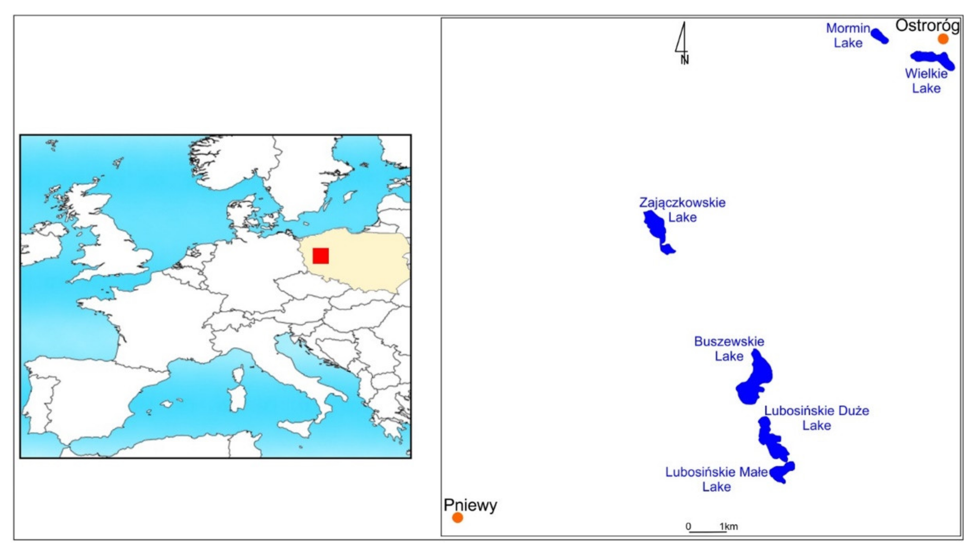
Figure 2.
Bathymetric map of Lake Zajączkowskie from the early 20th century (Geologische Karte von Preussen und benachbarten Bundesstaaten, 1:25,000, Ottorowo 1916).
Figure 2.
Bathymetric map of Lake Zajączkowskie from the early 20th century (Geologische Karte von Preussen und benachbarten Bundesstaaten, 1:25,000, Ottorowo 1916).

Figure 3.
Changes in the bathymetry of the analysed lakes in the years 1916–2020: (a) Lake Buszewskie, (b) Lake Mormin, (c) Lake Lubosińskie, (d) Lake Wielkie, and (e) Lake Zajączkowskie.
Figure 3.
Changes in the bathymetry of the analysed lakes in the years 1916–2020: (a) Lake Buszewskie, (b) Lake Mormin, (c) Lake Lubosińskie, (d) Lake Wielkie, and (e) Lake Zajączkowskie.

Figure 4.
Analysed lakes at the beginning of the 19th century (map fragment: Gilly Spezialkarte von Suedpreussen, 1803).
Figure 4.
Analysed lakes at the beginning of the 19th century (map fragment: Gilly Spezialkarte von Suedpreussen, 1803).


Table 1.
Changes in the basic morphometric parameters of the lakes in the period 1916–2020.
| Lake | Area (ha) | Volume (mln m3) | Mean Depth (m) | Altitude m a.s.l. | ||||
|---|---|---|---|---|---|---|---|---|
| 1916 | 2020 | 1916 | 2020 | 1916 | 2020 | 1916 | 2020 | |
| Buszewskie | 79.1 | 73.6 | 3.91 | 3.54 | 4.9 | 4.8 | 94.1 | 93 |
| Lubosińskie Wielkie | 77.9 | 47.0 | 2.53 | 1.12 | 3.2 | 2.4 | 93.9 | 93 |
| Lubosińskie Małe * | 21.2 | 0.46 | 2.2 | |||||
| Zajączkowskie | 45.5 | 43.5 | 4.80 | 4.61 | 10.5 | 11.3 | 72.6 | 73 |
| Wielkie | 37.9 | 28.4 | 0.34 | 0.28 | 0.9 | 1.0 | 67.3 | 68 |
| Mormin | 12.4 | 8.9 | 0.24 | 0.17 | 1.9 | 1.9 | no data | |
| Total/average | 252.7 | 222.1 | 11.82 | 10.18 | 4.3 | 3.9 | ||
* Entirety as Lake Lubosińskie.
Publisher’s Note: MDPI stays neutral with regard to jurisdictional claims in published maps and institutional affiliations. |
© 2021 by the authors. Licensee MDPI, Basel, Switzerland. This article is an open access article distributed under the terms and conditions of the Creative Commons Attribution (CC BY) license (https://creativecommons.org/licenses/by/4.0/).
Share and Cite
MDPI and ACS Style
Ptak, M.; Choiński, A.; Sojka, M.; Zhu, S. Changes in the Water Resources of Selected Lakes in Poland in the Period 1916–2020 as Information to Increase Their Availability. Sustainability 2021, 13, 7298. https://doi.org/10.3390/su13137298
AMA Style
Ptak M, Choiński A, Sojka M, Zhu S. Changes in the Water Resources of Selected Lakes in Poland in the Period 1916–2020 as Information to Increase Their Availability. Sustainability. 2021; 13(13):7298. https://doi.org/10.3390/su13137298
Chicago/Turabian StylePtak, Mariusz, Adam Choiński, Mariusz Sojka, and Senlin Zhu. 2021. "Changes in the Water Resources of Selected Lakes in Poland in the Period 1916–2020 as Information to Increase Their Availability" Sustainability 13, no. 13: 7298. https://doi.org/10.3390/su13137298
Note that from the first issue of 2016, this journal uses article numbers instead of page numbers. See further details here.