Article

Estimated Sediment Protection Efficiences for Increasing Levels of Best Management Practices on Forest Harvests in the Piedmont, USA

1
College of Agriculture, Communities, and the Environment, Kentucky State University, Frankfort, KY 40601, USA
2
Department of Forest Resources and Environmental Conservation, Virginia Polytechnic Institute and State University, Blacksburg, VA 24061, USA
*
Author to whom correspondence should be addressed.
Forests 2019, 10(11), 997; https://doi.org/10.3390/f10110997
Submission received: 9 October 2019 / Revised: 31 October 2019 / Accepted: 1 November 2019 / Published: 7 November 2019
(This article belongs to the Section Forest Ecology and Management)

Abstract

:
In-stream watershed level evaluations confirm that application of recommended forestry best management practices (BMPs) can minimize sedimentation following management, while on-site erosion research shows that BMPs reduce erosion from individual forest operations, thus implying watershed-level sediment reductions. Assessments of forest operations and sediment have developed very few sediment delivery ratios (SDR). Linking BMP levels (low, standard recommendation, high) within specific forest operations to sedimentation could enable managers to evaluate BMP effects. Reported data regarding forest operations, erosion rates and SDR by forest operation, and BMP implementation levels were sufficient within the Piedmont region to allow approximations of sediment delivery and BMP efficiency. Existing United States Department of Agriculture (USDA) Forest Service reports and published erosion and sediment research were used to comprise the following method. For regional annual harvests, estimated sediment deliveries (Mg year−1) = annual harvest area (ha year−1) × weighted average erosion rate from all forest operations (Mg ha−1 year−1) × SDR (unitless ratio). Weighted average erosion rates for all forest operations were determined by applying areas in each operational activity (%) × estimated erosion per operation (Mg ha−1 year−1). In comparing published data, standard BMPs reduced estimated sedimentation by 75% compared to low BMP implementation levels. This supports forestry BMP efficiency findings reported for sediment removals in watershed studies. Higher levels of BMP implementation were estimated to potentially remove nearly all forest operation-produced sediment. Values of this pilot study should be viewed cautiously, as estimates were based on limited data, estimated operations, and limited SDRs; are based on BMP categories that vary between states; and address only one year following harvests. However, the approach provided approximations that facilitate BMP evaluations and can be improved with additional data. This methodology highlights the importance of accurate estimates of erosion rates, SDRs, sediment masses, and area for operations. This supports the importance of state programs, which have increased BMP implementation rates and compliance options with BMP program maturation.

1. Introduction

During initial development of the forestry profession in the United States, the 1897 Organic Act provided guidance themes that still resonate within the profession: forest improvements and protection, watershed protection, and ensured timber supply [1,2]. The U.S. forestry profession, now in its third century, still maintains focus on these overlapping and sometimes diverging goals. Currently, watershed protection and timber supply are exemplified by continual development, refinement, and implementation of forestry best management practices (BMPs) by the states [3].
The first generation of state forestry best management practices (BMPs) were formally developed in the 1970s through 1980s in order to address water quality goals specified by the Federal Water Pollution Control Act of 1972 (33 U.S.C. §1251–1387). BMPs include planning and implementing mechanical, physical, and biological methods or practices that either control erosion or direct the placement of runoff before stream entry [4]. Forestry BMPs were designed to coincide with timber harvests while protecting water quality in a cost-efficient manner, while minimizing disruptions of the operational flow [5,6]. Anthropogenic sediments are a focus of forestry BMPs because they are associated with numerous deleterious effects on water quality [7] and they are the leading non-point source pollutant associated with forest operations in the United States [8] and globally [4]. BMPs are not static; rather, the maturation of state BMPs since the 1970s reflect changes in technical specifications, monitoring methods, reporting protocols, and incorporation of new research and improved forest operations technology [9].
Across the United States, individual states have elected to adopt different BMP administrative strategies. Some states have adopted regulatory forest practices acts that govern BMPs (e.g., some Pacific northwest and northeastern states), while others (e.g., southeastern states) have opted for a voluntary approach that is generally non-regulatory if water quality is protected [8]. As state BMP programs have matured, additional focus has developed regarding the water quality benefits associated with different levels and quality of BMP implementation [5,10].
Numerous reviews have been conducted to examine the reported research regarding general effects of forestry BMPs on sedimentation, and these reviews have consistently concluded that properly implemented forestry BMPs protect streams and waterbodies from increases in anthropogenic sedimentation [5,6,7,8,9,11,12,13]. Furthermore, recent research has documented that overall BMP implementation levels (based on the percentage of instances where appropriate BMPs were applied) are quite high across the United States, averaging 91% for the entire country, 93.2% for the western U.S., 86.4% for the northeastern U.S., and 91.7% for the southeastern U.S., [3] (Table 1).
Croke and Hairsine [11] reviewed research addressing forest erosion and sedimentation and explained that data can be generated by two different techniques: (1) watershed-level studies that monitor in-stream sediment levels, or (2) on-site erosion estimation or estimation approaches that are used to compare individual forest activities. Watershed-level sediment studies typically involve calibration of paired watersheds followed by subsequent treatment of watersheds while maintaining a control or reference watershed [14]. Such research is exemplified by a variety of BMP studies conducted by the U.S. Forest Service at facilities such as the Fernow Experimental Forest and the Coweeta Hydrologic Laboratory. Adams et al. [15] and Jackson et al. [16] provided long-term overviews of projects, which have provided experimental justification for many BMPs. Watershed- level studies typically apply a before-after-control-impact (BACI) approach [17] to monitor stream sedimentation changes due to watershed forest management effects. These types of studies, which were instrumental in the development of forestry BMPs, can provide excellent results regarding overall forestry BMP effects on water quality. However, these types of studies do not typically facilitate comparisons of individual forestry operational effects.
Conversely, on-site monitoring of soil erosion on differing forest operations with differing levels of forestry BMPs have been monitored through the application of erosion models [18], yet the soil erosion monitoring approach requires sediment delivery ratio (SDR) values in order to estimate actual sedimentation rates. Models such as the Universal Soil Loss Equation as modified for forestry (USLE-Forest) [19], the Revised Universal Soil Loss Equation (RUSLE), and the Water Erosion Prediction Project (WEPP) [20], have been widely applied to forest operations, but the USLE-Forest is most commonly employed because of its ease of use. The USLE-Forest is an empirical model that multiplies rainfall and runoff coefficient (R), soil erodibility (K), slope length and steepness factor (LS), and cover and management factor (CP) to estimate the annual soil loss (A) in Mg ha−1 year−1. Ideally, stream sedimentation rates would be available for multiple combinations of BMP implementation rates and forest operations, but our review indicated that only erosion rates were available for three levels of BMP implementations by forest operation areas. The majority of the data were collected using the USLE-Forest.
The USLE-Forest has been criticized because it is an estimate of erosion rather than sedimentation, but Trimble and Crosson [21] defended it and advocated its use as an excellent planning tool. Furthermore, several comparisons of the USLE-Forest, RUSLE, and WEPP to direct measures of trapped sediment have supported the use of the USLE-Forest for erosion estimates of bladed skid trails [22,23], overland skid trails [24], and forest roads [25]. Christopher and Visser [26] used the USLE-Forest to evaluate harvest sites in Virginia that had been inspected by the Virginia Department of Forestry. Our approach extends their methodology by incorporating BMP implementation levels and estimates of sediment delivery.
Erosion models have a variety of strengths and weaknesses [20,27] and perhaps should be viewed as ranking techniques [22]. Furthermore, the most commonly applied erosion models predict erosion rates, but cannot predict sediment delivery to the stream without SDRs. Walling [28] emphasized this sediment delivery problem over 35 years ago, yet significant gains in developing SDRs for forest operations are limited.
Research indicates that BMP programs are effective in protecting water quality, and state forestry organizations report that forestry BMPs are implemented at high levels. However, several research questions relating to BMP sediment control still exist. Edwards and Williard [29] conducted an extensive literature review of forestry BMPs and concluded that only three studies allowed sediment reduction efficiencies of forestry BMPs to be calculated, and efficiencies ranged from 53% to 94%. Anderson and Lockaby [7] identified research gaps associated with forestry BMPs, including the need for additional research designed to identify optimal BMP applications and the need to consider the effects of sediment reduction with varied silvicultural activities and BMPs across time and space. Croke and Hairsine [11] reviewed sediment delivery in managed forests and concluded that an understanding of sediment delivery from forest operations (harvest, roads, skid trails) and BMPs is incomplete and emphasized that development and refinement of better forest management practices requires a more complete understanding of sediment delivery. Additionally, BMP reporting agencies, such as the Southern Group of State Foresters, have been collaborating in order to increase organizations abilities to more thoroughly evaluate and compare the relative effectiveness and efficiency of various levels of BMP implementation [5,10]. Cristan et al. [8] provided one of the most recent reviews of the BMP-erosion-sediment literature, which clearly revealed that a large body of BMP research exists. However, the review also revealed that relatively few studies examined a range of BMPs within different operational activities. The review also suggested that the Southern Piedmont physiographic province was the only region within the Southeastern United States where enough range of BMP implementation levels and erosion/sedimentation data existed that could allow examination of the relationships between BMP implementation levels and water quality protection. Cristan et al. [8] also determined that most existing SDRs for forestry operations have been reported in the Piedmont region.
The literature indicates that soil erosion models have been used to estimate soil erosion from a variety of forest operations and that BMP implementation rates are negatively related to erosion rates. Therefore, our objectives were to develop a methodology that could link the existing knowledge regarding erosion rates from forest operations with existing knowledge about BMP implementation levels and SDRs to estimate the potential effects of forest operations on soil erosion and sediment delivery. This information will allow forest managers or forest management agencies to anticipate potential erosion rates for larger areas based on BMP implementation levels and compare relative efficiencies of BMP programs as they change over time. The overall goal of this paper is to present a conceptual methodology that can be applied by forest managers or water protection agencies to allow relatively simple evaluations of the effectiveness and efficiency of erosion control and inferred sediment protection.

2. Materials and Methods
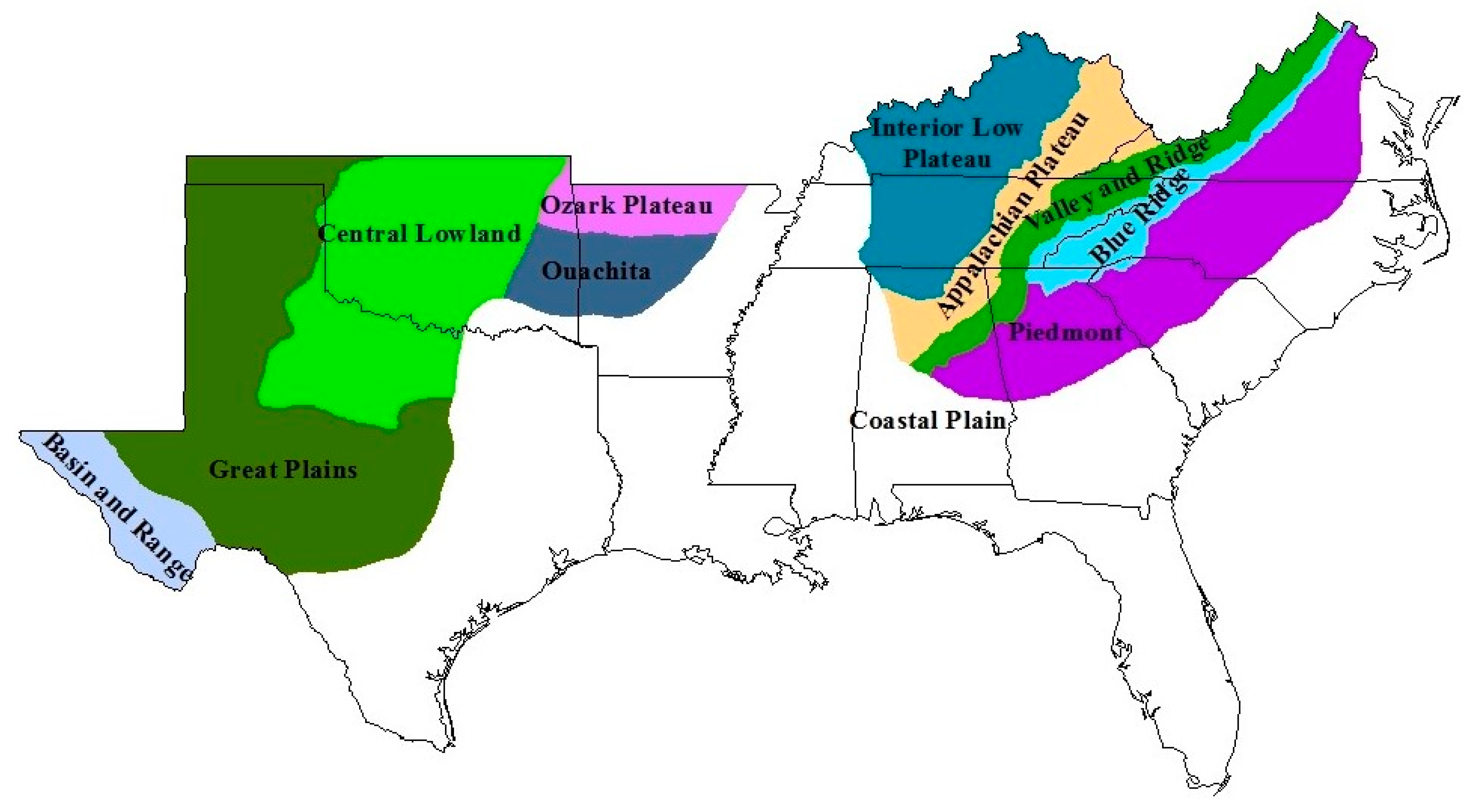
2.1. Study Sites

The total Appalachian Piedmont (northern and southern) encompasses approximately 21 million ha and extends from Alabama northeastward to New Jersey; however, this evaluation focused on the Southern Piedmont (17.3 million ha and 11.4 million ha of forestland), which is located between Virginia and Alabama (Figure 1). The Southern Piedmont is bounded by the Blue Ridge Mountains to the north and west and the Coastal Plain region to the south and east [30]. The rolling terrain of the Piedmont allowed widespread agricultural development by European settlers, and as a result, the region was extensively converted from pine and hardwood forests during the 18th and 19th centuries. Due to a variety of factors, including accelerated soil erosion, extensive agricultural abandonment occurred during the late 1800s and early 1900s [31], and the Southern Piedmont states are currently over 60% forested [32,33,34,35,36]. The regeneration of pine in old fields, followed by hardwood succession, led to extensive new growth forests, particularly “old field” pines [37]. During the 1950s, the establishment of pine plantations became common on industrially owned lands, and this practice is still widespread. Silvicultural and forest operations are common within the Piedmont region on both nonindustrial and industrial lands [37], and the region is subject to soil erosion if appropriate soil and water conservation measures are not applied [31]. Due to widespread forest management, harvesting, and susceptibility to soil erosion, the Southern Piedmont region is an appropriate site for an evaluation of the potential sedimentation effects of forest harvesting operations as influenced by BMPs.

2.2. Categorization of Forest Operational Areas and BMP Levels

Six common forest operation activities (harvest area, roads, decks, skid trails, stream crossings, and streamside management zones (SMZs)) were selected for evaluation, as these activities are typically included within information reported by the Piedmont states (Table 1), and research could be identified that characterized the percentages of area contained within each operation [38]. These categories of forest operation activities capture the basic harvest operations within the region.
Three BMP levels were included in the evaluation: low BMP implementation (BMP−); recommended level of BMP implementation (BMP-standard); and high level of BMP implementation (BMP+). These categories were used in several research projects [27,39,40,41,42]. Brown et al. [43] and Morris et al. [40] evaluated the effects of a range of experimentally applied BMPs on sedimentation at Piedmont forest stream crossings and used the terms BMP−, BMP-standard, and BMP+ to categorize low, standard, and high levels of BMP implementation. These studies concluded that increased levels of BMPs decreased both erosion and stream sediment levels. Dangle et al. [42] and Nolan et al. [39] evaluated the erosion effects of skid trail and haul road stream crossings in the Piedmont region and found that increased levels of BMPs, as characterized with BMP−, BMP-standard, and BMP+, were associated with decreased soil erosion.
Ideally, percentages of BMP−, BMP-standard, and BMP+ could be quantified within each operation, but such data do not currently exist for all operational categories. Thus, subsequent calculations apply BMP categories individually. Therefore, BMP categorizations are hypothetical, yet the BMP categorizations also provide a reflection of BMPs during differing eras of BMP implementation. For example, BMP− reasonably reflects the BMP implementation and effects during the beginning phases of the BMP program, BMP-standard encompasses the current BMP programs as the states began comparing and sharing data as evidenced in Table 1, and BMP+ estimates what might be expected with continued improvements and related costs to the program.

2.3. Estimates of Harvest Areas, Portions of Operational Activities, Erosion Rates, SDRs, Sediment Mass, and Sediment Removal Efficiencies

Christopher and Visser [26] used the USLE-Forest [19] to estimate erosion rates in three regions of Virginia (Coastal Plain, Piedmont, Mountains) and five forest operation activities (roads, skid trails, landings, stream crossings, and harvests). Their methodology consisted of conducting USLE-Forest erosion estimates on all appropriate forest operational areas and subsequently using maps of the timber harvest to estimate area of each operational activity. Finally, they multiplied the estimated erosion rates (Mg ha−1 year−1) by estimated area of each forest operational activity (ha) to obtain an estimate of the erosion mass (Mg) and percent contribution from each operational activity in percent and mass per unit area. This research expands their soil erosion concept to potential sedimentation rates at a regional level by use of documented erosion rates and SDRs. The selection of appropriate erosion rates and SDRs that encompass different levels of BMPs within the region are limited, but a limited body of SDRs were identified within the Piedmont region and these SDRs allow an estimation of sediment delivery to streams [44,45,46].
The sequential conceptual method that was applied to the Southern Piedmont Region consisted of the following steps:
  • Total and harvested areas within the Piedmont region were determined, based on recently reported USFS Forest Inventory and Analysis (FIA) harvest data (final and partial harvest), for the five states containing portions of the Piedmont region (Alabama, Georgia, North Carolina, South Carolina, and Virginia). Unfortunately, FIA data and state-reported data for harvest areas differ, but use of the USFS FIA data provided a uniform methodology of estimation across the five states. The USFS FIA reports used to estimate the harvested areas within each Piedmont state were Hartsell [36] for Alabama, Brandeis [33] for Georgia, Brown and Vogt [32] for North Carolina, Brandeis et al. [34] for South Carolina, and Brandeis et al. [35] for Virginia.
  • Areas of forest operation activities within harvested areas were estimated using the percentages reported by Barrett et al. [38] for harvest-only areas, roads, decks, skid trails, stream crossings, and partially harvested streamside management zones (SMZs). Percentages from this study were used because they represented average operational activities from 20 harvests in the Piedmont region during the same general time frame as the FIA data. Thus, areas within each operation were calculated by multiplying estimated harvest area (ha year−1) by the percentage in each forest operation.
  • Soil erosion from different forest operation activities with different levels of BMPs were estimated based on research studies within the Piedmont that provided soil erosion rates (measured or modelled) for specific forest operations under a range of BMPs. Although multiple erosion-related studies were identified, the need for a range of BMP levels and specific forest operation areas eliminated many studies. After identification of erosion rates for the combinations of harvest operation areas and BMP levels, total erosion masses were estimated as follows: area within each forest operation activity (ha year−1) multiplied by the weighted average erosion rate (Mg ha−1 year−1) per BMP level (BMP−, BMP-std, BMP+).
  • SDRs were found in existing literature for the Piedmont region that approximated each combination of forest operation and BMP level. Sediment delivery was calculated by multiplying estimates of erosion (Mg year−1) per forest operation area and BMP level by an appropriate SDR (unitless ratio).
  • BMP efficiency for sediment removal was calculated based on the method used by Edwards and Williard [29]. Estimated total sediment mass within the forest operational activity and BMP levels were used to calculate sediment efficiencies. This calculation entails using the sediment generated by each BMP level, using the lower BMP level as the control, as: (Low BMP sediment – Higher BMP sediment)/Low BMP sediment.

3. Results

Forested and harvested areas in the Piedmont were derived from recently published USDA Forest Inventories. Harvested acres included final harvests and partial harvests, but do not include thinned stands, as we did not have appropriate erosion and sediment metrics for thinning. Interpretations should be considered as general approximations, as the states may report regions that differ somewhat from the exact geologic regions. It appears that some states report by agency work unit structure which are inexact approximations of physiographic regions. Furthermore, the data were acquired during differing years between 2009 and 2016, which would also involve different wood demand and market dynamics. For example, FIA information for Virginia [35] estimates final harvests and partial harvests within the Piedmont to be 33,522 ha. However, the Virginia Department of Forestry estimate for the central region, which approximates the Piedmont, is 40,769 ha. The state estimate includes all counties that include Piedmont forests, so the state estimate is known to include county estimates that include both the Coastal Plain and Blue Ridge harvest areas. Another potential explanation is simply that the reported harvest acreages are sometimes actually much smaller or larger than estimated. At the tract level such discrepancies have minimal effects, but at the regional levels accumulated differences may be significant. Regardless of the discrepancies of area estimates, estimated harvest areas appear to reflect the general pattern of harvests across the region; however, they must not be considered exact values. The estimated forest statistics for the five states with Piedmont area that we used in our calculations are provided in Table 2.
The next step was to estimate representative areas for each of the forest operations. We used the information provided by Barrett et al. [38], who evaluated 20 operational harvests in the Virginia Piedmont and recorded the areas (ha and %) within each of the major operational activities (harvest, roads, decks, skid trails, stream crossings, and partially harvested SMZs). Barrett et al. [38] found that the harvest-only (not including other operational activities) was the majority of the harvest site (91.28%). The combined skid trails (3.73%), decks/landings (1.3%), roads (0.81%), and stream crossings (0.09%) of the in-woods access covered 5.93% of the harvest area, and the low percentages of road and stream crossings appear to reflect that some harvests do not have any forest roads and some sites do not have stream crossings. Average percentages within each operational activity were multiplied by the total estimated harvest area within the Piedmont region for each state to develop the total areas for each operation within the entire region (Table 3). It is important to note that the percentages applied to each operation are based on a limited number of Piedmont sites (20 harvests), and other approaches such as a GIS-based approach could perhaps be used to acquire a larger dataset; however, this was beyond the scope of the present research project.
As noted by Croke and Hairsine [11], watershed and stream evaluation of sedimentation provide excellent information regarding the overall cumulative effects of BMPs, yet they do not generally allow examinations of individual forest operation activities or BMPs. Erosion estimates of forest operation activities within the Piedmont that evaluated a range of BMPs were used. These studies often used some variation of the USLE, which estimates sheet and rill erosion. All identified Piedmont research studies are provided in Table 4, while studies that had the most complete data sets and were selected for estimation of erosion at different BMP implementation levels are provided in Table 5.
Edwards and Williard [29] evaluated the efficiencies of forestry BMPs for pollutant removals in the eastern United States and concluded that BMP sediment removal efficiencies ranged from 53% to 94% during the first year following harvests. Their estimates included two studies from the Allegheny and Cumberland Mountain regions [62,63] and one Coastal Plain site [64]. All of these studies used a paired watershed approach to contrast different levels of BMPs and the Edwards and Williard [29] methodology calculated the sediment mass removal efficiency of an increased level of BMP implementation as
Efficiency (%) = (lower level BMP − higher level BMP)/lower level BMP × 100%
However, this calculation is intended for use with water quality data such as total suspended sediment, but many BMP evaluations are based on soil erosion estimates. Therefore, it is necessary to quantify the proportion of sediment that is transported from the erosion site and delivered to the stream channel, which is known as the SDR.
SDRs represent the proportion of total eroded soil that moves from the operational activity to the stream, thereby becoming stream sedimentation. Trimble and Crosson [21] cautioned that SDRs are essential for understanding the true water quality effects of soil erosion and concluded that SDRs from land uses across the United States were between 2% and 12.5% of total estimated erosion. Ward and Jackson [44] evaluated the SDR on two sites in the Georgia Piedmont that had been clearcut, followed by mechanical and chemical site preparation. The SDR was calculated as 25%. Lakel et al. [46] evaluated 16 operational clearcut harvests with chop-burn site preparation and 24 sub-watersheds in the Virginia Piedmont region and found that 7.5% of the total eroded material from roads, decks, skid trails, firelines, stream crossings, and harvests actually reached the stream; thus, the mean SDR was 1:0.075 with a range of 1:0.03 to 1:0.14.
Trimble and Crosson [21] cautioned that lack of adequate SDRs favored overestimation of water quality pollution effects associated with land use across the entire United States. Fortunately, over the past 15 years, several studies have been conducted within the Piedmont region that have enhanced knowledge regarding SDRs (Table 6). This project reemphasized that SDRs for forest operations are still lacking in many of the other regions.
Ward and Jackson [44] conducted a pivotal study within the southeastern United States that provided an SDR. They estimated soil erosion using the RUSLE combined with sediment traps located at the stream on two Piedmont clearcuts that included mechanical and chemical site preparation. They found that the SMZs trapped 71% to 99% of the estimated erosion and concluded that the mean SDR was 1:0.25; thus, 25% of eroded soil could enter the stream and be considered sediment. Lakel et al. [46] used a similar approach on 16 watersheds and 24 subwatersheds that received clearcut harvests and less intensive site preparation (chopping with prescribed burning), and harvests including roads, landings, skid trails and firelines, and a range of SMZ widths. They concluded that harvest SDRs ranged from 3% to 14%.
Wear et al. [56] evaluated nine operational skidder stream crossings (18 approaches) in the Piedmont. Using this study data, sediment delivery data were obtained for bare soil conditions (1.0 SDR), seeded approaches (0.24 SDR), and approaches covered with slash (0.01 SDR).
Brown et al. [43] evaluated three Piedmont truck haul road stream crossings (six approaches) using direct measures of stream sedimentation combined with USLE-Forest erosion estimates from the road surfaces without gravel, low gravel, and high gravel, thus representing a range of BMPs. Their results were used to calculate SDRs of 1.0, 0.607, and 0.192 for the no gravel, low gravel, and high gravel BMPs, respectively.
Morris et al. [40] evaluated stream sedimentation from three Piedmont stream crossings with increasing levels of BMPs and used the phrase BMP−, BMP standard, and BMP+ to identify poor, adequate or standard, and high levels of BMP application. This study also provides the erosion and sediment data that can be used to generate SDRs for the BMP− (1.0), BMP-standard (0.46), and BMP+ (0.21) for forest truck haul road stream crossings.

3.1. Timber Harvesting

The estimated sedimentation effects of timber harvest with different levels of BMP implementation are provided in Table 7. Since the basic calculations are the same across every state, differences within states merely reflect the Piedmont area and reported harvest acreage differences and do not imply any differences in the quality of BMP implementation. However, the effects of BMP levels are large across the region. Comparison of the BMP levels indicated that the BMP− level could potentially produce 1.8 times and 3 times more erosion than the BMP-standard and BMP+ levels of BMP implementation, respectively. Potential sedimentation was found to be 3.2 times and 25 times more than the BMP-standard and BMP+ levels, respectively. Such values are in general agreement with Phillips [65], who evaluated sediment budgets in the North Carolina Piedmont and concluded that only 10% of eroded materials in watersheds are deposited in streams. Primary mechanisms of increasing BMP levels are to minimize soil erosion through maintenance of cover and through ensuring use of sediment trapping BMPs such as SMZs. The overall efficiency of the BMP-standard level was 68%, and the BMP+ level efficiency increased to 96%, which falls with the efficiencies reported by Edwards and Williard [29].

3.2. Forest Roads

Total estimated erosion and sedimentation from the Piedmont are provided in Table 8. Based on our estimates of acres, erosion rates, and sediment delivery, the BMP− level would potentially produce 20 times more erosion and 1.6 times greater sediment than the BMP-standard level, while the BMP− level would potentially produce 1.6 times more erosion and 500 times more sediment than the BMP-standard level. The greater rates of erosion and sediment produced by the BMP− level for forest roads reflect the bare soil conditions and the nature of the roads that were selected for the SDRs, which had ditches. Ditched roads with inadequate BMPs are often more readily connected to streams; thus, the effects of the BMP applications are quite striking. Both the BMP-standard and BMP+ levels had estimated sediment removal efficiencies greater than 95%.

3.3. Log Decks and Landings

Erosion from log decks/landings under BMP− conditions was estimated to be 1.6 times and 2.3 times greater than with BMP-standard and BMP+ levels, respectively (Table 9). Sediment delivery was estimated to be 2.6 times and 12.1 times greater than with the increased BMP levels. This estimate is perhaps the most suspect of the entire project, as we could not find a specific SDR from decks and were forced to use those from the more generic harvest values reported by Ward and Jackson [44] and Lakel et al. [46].

3.4. Skid Trails

Skid trail erosion masses with BMP− levels were estimated to be 1.8 times and 7.3 times greater than with BMP-standard and BMP+ levels, respectively (Table 10). Sediment differences were more pronounced, with the BMP− estimate being 7.4 times and 733 times greater than the BMP standard and BMP+ levels, respectively. Sediment removal efficiencies were estimated to be 86.5% for the BMP-standard level and 98.6% for the BMP+ level.

3.5. Stream Crossings

Stream crossings, which included both truck and skidder crossings, were estimated to benefit from increasing levels of BMPs. The BMP− level was estimated to produce 2.8 times and 11.6 times more erosion and sediment, respectively, than the BMP-standard level, and 6.3 times and 62.6 times more sediment and erosion, respectively, than the BMP+ level (Table 11). Estimated BMP efficiencies were greater than 90% for both BMP-standard and BMP+ levels.

3.6. Streamside Management Zones

Erosion and sedimentation rates within SMZs for BMP− levels were based on the SMZ failures documented by Lang et al. [59], as contrasted with the BMP− which was based on thinned SMZs as documented by Lakel [61] and the pre-harvest SMZs as documented by Walker-Easterbrook et al. [60] (Table 12). Because the BMP− level was based on the premise of BMP failures, the predicted effects of the BMP-standard and BMP+ levels reduced erosion estimates by 49.6 and 63.8 times, respectively, and reduced sediment predictions by 88.6 and 531.2 times, respectively. Sediment reduction efficiencies were greater than 98% for both BMP-standard and BMP+ levels.

4. Discussion

One of the more surprising impediments of the evaluation was obtaining area estimates for the Piedmont, Piedmont forest land, Piedmont harvests, and forest operations within those disturbances. With current GIS technology and existing soil erosion models, researchers around the globe are estimating water quality as affected by a variety of land uses. For example, several studies used the USLE or RUSLE combined with GIS estimates of land use areas in order to estimate soil erosion losses from multiple land uses. Examples include Pacheco et al. [66] in Portugal; Ganasri and Ramesh [67] and Prasannakumar et al. [68] in India; Tadesse et al. [69] in Ethiopia; Fayas et al. [70] in Sri Lanka; and Pham et al. [71] in Vietnam. However, it should be noted that these studies did not address the different level of BMPs that would modify potential erosion rates. A similar approach might improve our area estimates, as well as reconcile some differences between existing state and federal estimates.
The estimated combined effect of BMP levels on forest operations across the entire Southern Piedmont region (Table 13) indicated that the BMP-standard level has an overall efficiency of 75.6% and the BMP+ efficiency is 98.5%. These Piedmont BMP efficiencies correspond well with the three sediment removal efficiencies between 53% and 94% reported by Edwards and Williard [29] for the Mountain and Coastal Plain regions with standard BMPs. Broadmeadow and Nisbet [72] reviewed the literature regarding the effectiveness of SMZs and found that most studies reported that recommended SMZ widths provided ecosystem protection efficiencies of between 50% and 75%.
Brown and Froemke [73] evaluated the major nonpoint sources of sediment pollution threats to the United States and concluded that the major sediment problems in the eastern United States were due to housing density, cultivation, livestock grazing, road density, mining, and wildfires. They specifically stated that sediment problems were only marginally related to forest cover. In the Piedmont estimates, the estimated sediment delivery from the BMP-standard equates to less than 1 kg ha−1 year−1, which is so low compared to other potential sources of sediment that enhanced BMP+ levels seem unwarranted, except in situations or locales that justify the expense, such as a situation involving protection of municipal water supplies or threaten and endangered aquatic species. Aust et al. [18] suggested that strategic implementation of BMPs at stream crossings, where road and skid trail networks often have the opportunity to input sediment directly into the stream, might be a more reasonable approach. Dangle et al. [42] estimated that the increased costs of using BMP+ level BMPs for truck and skid trails would be approximately $60 and $120 for each crossing, respectively. Such increases seem feasible, yet Hickey and Doran [74] emphasized that excessive BMP costs and complexities may lead to lower implementation rates.
Examination of the sources of the sediment (Table 13) reveals that harvest-only areas conducted at the BMP-standard level produce only 16.1% of the total estimated erosion, although harvests represent 92% of the area. In contrast, roads, decks, skid trails, and stream crossings are predicted to produce 84% of the sediment, yet the combined in-woods transportation infrastructure represents less than 6% of the area. Germain and Munsell [75] reported similar values for timber harvests in northern hardwoods, where 43 harvests were found to have an average area in transportation infrastructure of 6%, and the authors estimated that these areas contributed 90% of the erosion and sedimentation. These data again reemphasize the importance of minimizing road networks, which may require additional preharvest planning by foresters. Howell et al. [76] found that road areas and BMPs were clearly improved when a forester designed the road and skid trail networks as opposed to leaving access design to loggers’ choice.
Comparison of the sedimentation values as influenced by BMP level within any operational activity supports the efficacy of the state BMP programs. Estimates of sediment reductions indicate that the BMP-standard level clearly protects water quality much better than the BMP−, and the BMP+ provides higher protection. Examination of the BMP implementation percentages reported by the states (Table 1) suggests that current BMPs are being applied at high levels, but the distributions of the state-monitored BMPs are not easily determined. However, Nolan et al. [39] evaluated 42 truck and skid trail crossings in the Piedmont and found that 24% met the BMP−, 50% met the BMP-standard, and 26% met the BMP+ levels. Similarly, Dangle et al. [42] evaluated 50 skidder and truck crossings in the Piedmont and found that 18% met the BMP−, 60% met the BMP-standard, and 22% met the BMP+ levels. These data suggest that current BMP implementation averages slightly higher than BMP-standard. It is also important to emphasize that BMP implementation has been on an upward trajectory [10]. Sugden [77] evaluated the sediment reduction improvements in the northern Rockies that occurred within 10 monitored watersheds where road BMP upgrades had occurred normally over a 10- to 15-year period. Standard BMP improvements resulted in a 46% decrease in measured sediment.
The Southern Piedmont-wide estimation approach indicates that the BMP+ level may provide increased sedimentation protection, but it is important to consider the benefits and costs of such measures in light of the current level of BMP implementation. Montgomery et al. [78] estimated that Arkansas loggers spent $12 million in 2001 to comply with existing BMPs and Sustainable Forestry Initiative guidelines. Furthermore, the uncertainties associated with this evaluation do not justify an alteration of existing BMP recommendations.
This research also emphasizes the importance of considering areas of erosion, rates of erosion and sediment delivery, and masses of erosion and sediment. For example, stream crossings potentially have higher rates of erosion and sediment delivery than skid trails, yet skid trails have the potential to deliver greater masses of erosion simply due to greater area. The areas with higher rates of erosion are easier to detect and BMP improvements are more discernible with regard to rate of erosion and sedimentation, but erosion-prone operational activities of greater area may be more important.

5. Conclusions

This project used available estimates of Piedmont area, harvest area, forest operations, erosion rates, and sediment delivery ratios to estimate the effects of three levels of BMP implementation on sediment delivery and BMP level efficiencies. Standard BMPs appear to be approximately 75% efficient for sediment removal, and sediment yields across the regions from harvest operations appear far below those of alternative land uses. While this methodology could benefit from more precise data, the general approach seems to be of sufficient merit for use in other regions as data become available.
Several research gaps were also highlighted by this project. There have been few documented efforts to determine the effects of differing levels of BMPs on sedimentation. This lack is exacerbated by the lack of SDRs for the southeastern United States. There is excellent documentation from watershed-level research that proves that combined BMPs reduce sedimentation, and there is excellent documentation from erosion studies that show that BMP implementation levels reduce erosion, yet it is difficult to effectively relate these two research efforts due to the lack of SDRs. Such research is needed to continue to advance the water quality protection programs, and this project is a beginning step in the process. It is hoped that additional SDRs for a variety of operations and regions will allow additional similar documentation efforts.
We fully acknowledge that our approach is a relatively simplistic and imperfect methodology that relies heavily on estimated areas, erosion rates, and SDRs. All such values could be improved as additional data becomes available and accessible, but application of the methodology highlights some of the deficiencies in BMP knowledge. We are applying reported harvest areas, BMP levels, erosion rates, SDRs, and forest operation areas acquired from multiple sources across the entire Piedmont, and our report is only as good as the data we entered. Furthermore, before state level effects can be determined, we need to know how the different state BMPs compare across a region. For example, do skid trail BMPs in the Piedmont of Alabama reflect similar efficacy to skid trail BMPs in North Carolina? We also do not feel the methodology adequately addresses the multi-year effects of harvesting, which have generally been reported to decrease within 3–8 years following harvesting with appropriate BMPs [6], yet we did not attempt to do address time as adequate information for this evaluation is lacking. However, despite inadequacies, we consider this a valid pilot study to evaluate the efficacy of BMPs within the region and to highlight the information gaps and deficiencies. Although the forestry profession has been acknowledging and applying BMPs since the 1970s and BMP water quality research has been widespread, it is still difficult to estimate the effects of BMPs on the harvested acreages by operation and region. The methodology was applied to the Piedmont region, but a similar approach might be appropriate for other regions as additional data are acquired and reported.

Author Contributions

R.C. collected and organized available literature and data, then subsequently developed the original draft of the manuscript. He also reviewed and edited subsequent drafts. W.M.A., M.C.B., and S.M.B. developed the original concept for the project, co-authored the proposal to fund the research, and edited all subsequent drafts of the manuscript.

Funding

The project received financial and logistical support from the National Association of State Foresters, the Southern Group of State Foresters, the USDA National Institute of Food and Agriculture McIntire-Stennis Program, the Virginia Tech Forest Operations and Business Research Cooperative, the Virginia Department of Forestry, and the Virginia Tech College of Natural Resources and Environment, Department of Forest Resources and Environmental Conservation.

Acknowledgments

This project was funded and sponsored by the Virginia Department of Forestry, Southern Group of State Foresters, USDA Forest Service, National Council for Air and Stream Improvement, and McIntire-Stennis Program of the National Institute of Food and Agriculture, U.S. Department of Agriculture.

Conflicts of Interest

The authors declare no conflict of interest.

References

  1. Glasser, S.P. History of watershed management in the U.S. Forest Service: 1897–2005. J. For. 2005, 103, 255–258. [Google Scholar] [CrossRef]
  2. Balogh, B. Scientific forestry and the roots of the modern American state: Gifford Pinchot’s path to progressive reform. Environ. Hist. 2002, 7, 198–225. [Google Scholar] [CrossRef]
  3. Cristan, R.; Aust, W.M.; Bolding, M.C.; Barrett, S.M.; Schilling, E.B. National status of state developed and implemented best management practices for protecting water quality in the United States. Forest Ecol. Manag. 2018, 418, 73–84. [Google Scholar] [CrossRef]
  4. Holz, D.J.; Williard, K.W.J.; Edwards, P.J.; Schoonover, J.E. Soil erosion in humid regions: A review. J. Contemp. Water Res. Educ. 2015, 154, 48–59. [Google Scholar] [CrossRef]
  5. Prud’homme, B.A.; Greis, J.G. Best management practices in the South. In Southern Forest Resource Assessment; Wear, D.N., Greis, J.G., Eds.; Gen. Tech. Rep. SRS-53; USDA Forest Service: Asheville, NC, USA, 2002; pp. 519–535. [Google Scholar]
  6. Aust, W.M.; Blinn, C.R. Forestry best management practices for timber harvesting and site preparation in the eastern United States: An overview of water quality and productivity research during the past 20 years (1982–2002). Water Air Soil Pollut. 2004, 4, 5–36. [Google Scholar] [CrossRef]
  7. Anderson, C.J.; Lockaby, B.G. The effectiveness of forestry best management practices for sediment control in the southeastern United States: A literature review. South. J. Appl. For. 2011, 35, 170–177. [Google Scholar] [CrossRef]
  8. Cristan, R.; Aust, W.M.; Bolding, M.C.; Barrett, S.M.; Munsell, J.F. Effectiveness of forestry best management practices in the United States: Literature review. Forest Ecol. Manag. 2016, 360, 133–151. [Google Scholar] [CrossRef] [Green Version]
  9. Shepard, J.P. Water quality protection in bioenergy production: The U.S. system of forestry best management practices. Biomass Bioenerg. 2006, 30, 378–384. [Google Scholar] [CrossRef]
  10. Southern Group of State Foresters Water Resources Committee. Implementations of Forestry Best Management Practices: 2018 Southern Region Report. Available online: www.southernforests.org/resources/publications/SGSF%20Water%20BMP%20Report%20FINAL.pdf/view (accessed on 17 September 2019).
  11. Croke, J.C.; Hairsine, P.B. Sediment delivery in managed forests: A review. Environ. Rev. 2006, 14, 59–87. [Google Scholar] [CrossRef]
  12. Stuart, G.W.; Edwards, P.J. Concepts about forests and water. North. J. Appl. For. 2006, 23, 11–19. [Google Scholar] [CrossRef]
  13. Ice, G.G.; Schilling, E.; Vowell, J. Trends for forestry best management practices implementation. J. Forest. 2010, 108, 267–273. [Google Scholar] [CrossRef]
  14. Edwards, P.J.; Schoonover, J.E.; Williard, K.W.J. Guiding principles for management of forested, agricultural, and urban watersheds. J. Contemp. Water Res. Educ. 2015, 154, 60–84. [Google Scholar] [CrossRef]
  15. Adams, M.B.; Edwards, P.J.; Ford, W.M.; Schuler, T.M.; Thomas Van-Gundy, M.; Wood, F. Fernow Experimental Forest: Research History and Opportunity; EFR-2; USDA Forest Service: Washington, DC, USA, 2012. [Google Scholar]
  16. Jackson, C.R.; Sun, G.; Amatya, D.; Swank, W.T.; Riedel, M.; Patric, J.; Williams, T.; Vose, J.M.; Trettin, C.; Aust, W.M.; et al. Fifty years of forest hydrology in the southeast. In A Century of Forest and Wildland Watershed Lessons; Ice, G.G., Stednick, J.D., Eds.; Society of American Foresters: Bethesda, MD, USA, 2004; pp. 33–111. [Google Scholar]
  17. Smokorowski, K.E.; Randall, R.C. Cautions on using the Before-After Control-Impact design in environmental effects monitoring programs. Facets 2017, 2, 212–232. [Google Scholar] [CrossRef]
  18. Aust, W.M.; Bolding, M.C.; Barrett, S.M. Best management practices for low-volume forest roads in the Piedmont region: Summary and implications of research. Transport. Res. Rec. J. Transport. Res. Board 2015, 2472, 51–55. [Google Scholar] [CrossRef]
  19. Dissmeyer, G.E.; Foster, G.R. A Guide for Sheet and Rill Erosion on Forest Land; South. Region Tech. Pub. R8-TP-6; USDA Forest Service, Southern Region: Atlanta, GA, USA, 1984. [Google Scholar]
  20. Fu, B.; Newham, L.T.H.; Ramos-Scharron, C.E. A review of surface erosion and sediment delivery models for unsealed roads. Environ. Modell. Softw. 2010, 25, 1–14. [Google Scholar] [CrossRef]
  21. Trimble, S.W.; Crosson, P. U.S. soil erosion rates–myth and reality. Science 2000, 289, 248–250. [Google Scholar] [CrossRef]
  22. Wade, C.; Bolding, M.C.; Aust, W.M.; Lakel, W.A.; Schilling, E. Comparing sediment trap data with the USLE-Forest, RUSLE2, and WEPP-Road erosion models for evaluation of bladed skid trail BMPs. Trans. ASABE 2012, 55, 403–414. [Google Scholar] [CrossRef]
  23. Vinson, J.A.; Barrett, S.M.; Aust, W.M.; Bolding, M.C. Suitability of soil erosion models for the evaluation of bladed skid trail BMPs in the southern Appalachians. Forests 2017, 8, 482. [Google Scholar] [CrossRef]
  24. Sawyers, B.C.; Bolding, M.C.; Aust, W.M.; Lakel, W.A. Effectiveness and implementation costs of overland skid trail closure techniques in the Virginia Piedmont. J. Soil Water Conserv. 2012, 67, 300–310. [Google Scholar] [CrossRef]
  25. Lang, A.J.; Aust, W.M.; Bolding, M.C.; McGuire, K.J.; Schilling, E.B. Comparing sediment trap data with erosion models for evaluation of forest haul road stream crossing approaches. Trans. ASABE 2017, 60, 393–408. [Google Scholar] [CrossRef]
  26. Christopher, E.A.; Visser, R. Methodology for evaluating post-harvest erosion risk for the protection of water quality. N. Z. J. For. 2007, 2007, 20–25. [Google Scholar]
  27. Brown, K.R.; McGuire, K.J.; Hession, W.C.; Aust, W.M. Can the water erosion prediction project model be used to estimate best management practice effectiveness from forest roads? J. For. 2016, 114, 17–26. [Google Scholar] [CrossRef]
  28. Walling, D.E. The sediment delivery problem. J. Hydrol. 1983, 65, 209–237. [Google Scholar] [CrossRef]
  29. Edwards, P.J.; Williard, K.W.J. Efficiencies of forestry best management practices for reducing sediment and nutrient losses in the eastern United States. J. For. 2010, 108, 245–249. [Google Scholar]
  30. Daniels, R.B. Soil erosion and degradation in the southern Piedmont of the USA. In Land Transformation in Agriculture; Wolman, M.G., Fournier, F.G.A., Eds.; Wiley and Sons: New York, NY, USA, 1987; pp. 407–428. [Google Scholar]
  31. Trimble, S.W. Man-Induced Soil Erosion in the Southern Piedmont, 1700–-1970; Soil and Water Conservation Society: Ankeny, IA, USA, 1974. [Google Scholar]
  32. Brown, M.J.; Vogt, J.T. North Carolina’s Forests, 2013; Resour. Bull. SRS-205; USDA Forest Service: Asheville, NC, USA, 2015. [Google Scholar]
  33. Brandeis, T.J. Georgia’s Forests, 2009; Resour. Bull. SRS-207; USDA Forest Service: Asheville, NC, USA, 2015. [Google Scholar]
  34. Brandeis, T.J.; Brandeis, C.; Hartsell, A.J. South Carolina’s Forests, 2016; Resour. Bull. SRS-215; USDA Forest Service: Asheville, NC, USA, 2018. [Google Scholar]
  35. Brandeis, T.J.; Hartsell, A.J.; Randolph, K.C.; Oswalt, C.M. Virginia’s Forests, 2016; Resour. Bull. SRS-223; USDA Forest Service: Asheville, NC, USA, 2018. [Google Scholar]
  36. Hartsell, A.J. Alabama’s Forests, 2015; Resour. Bull. SRS-220; USDA Forest Service: Asheville, NC, USA, 2015. [Google Scholar]
  37. Fox, T.R.; Jokela, E.J.; Allen, H.L. The development of pine plantation silviculture in the southern United States. J. For. 2007, 105, 337–347. [Google Scholar] [CrossRef]
  38. Barrett, S.M.; Aust, W.M.; Bolding, M.C.; Lakel, W.A.; Munsell, J.F. Estimated erosion, ground cover, and best management practices audit details for post-harvest evaluations of biomass and conventional clearcut harvests. J. For. 2016, 114, 9–16. [Google Scholar] [CrossRef]
  39. Nolan, L.; Aust, W.M.; Barrett, S.M.; Bolding, M.C.; Brown, K.; McGuire, K. Estimating costs and effectiveness of upgrades in forestry best management practices for stream crossings. Water 2015, 7, 6946–6996. [Google Scholar] [CrossRef]
  40. Morris, B.C.; Bolding, M.C.; Aust, W.M.; McGuire, K.J.; Schilling, E.B.; Sullivan, J. Differing levels of forestry best management practices at stream crossings affect sediment delivery and installation costs. Water 2016, 8, 92. [Google Scholar] [CrossRef]
  41. Lang, A.J.; Aust, W.M.; Bolding, M.C.; McGuire, K.J.; Schilling, E.B. Best management practices influence sediment delivery from road stream crossings to mountain and Piedmont streams. For. Sci. 2018, 64, 682–695. [Google Scholar] [CrossRef]
  42. Dangle, C.L.; Aust, W.M.; Bolding, M.C.; Barrett, S.M.; Schilling, E.B. The effectiveness of forestry best management practices at skidder stream crossings in Virginia. J. Soil Water Conserv. 2019, 74, 199–208. [Google Scholar] [CrossRef]
  43. Brown, K.R.; McGuire, K.J.; Aust, W.M.; Hession, W.C.; Dolloff, C.A. The effect of increasing gravel cover on forest roads for reduced sediment delivery to stream crossings. Hydrol. Proc. 2014, 29, 1129–1140. [Google Scholar] [CrossRef]
  44. Ward, J.M.; Jackson, C.R. Sediment trapping within forestry streamside management zones: Georgia Piedmont, USA. J. Am. Water Res. Assoc. 2004, 40, 1421–1431. [Google Scholar] [CrossRef]
  45. White, W.J.; Morris, L.A.; Pinho, A.P.; Jackson, C.R.; West, L.T. Sediment retention by forested filter strips in the Piedmont of Georgia. J. Soil Water Conserv. 2007, 62, 453–463. [Google Scholar]
  46. Lakel, W.A., III; Aust, W.M.; Bolding, M.C.; Dolloff, C.A.; Keyser, P.; Feldt, R. Sediment trapping by streamside management zones of various widths after forest harvest and site preparation. For. Sci. 2010, 56, 541–551. [Google Scholar]
  47. Jackson, C.R.; Martin, J.K.; Leigh, D.S.; West, L.T. A southeastern Piedmont watershed sediment budget: Evidence for a multi-millennial agricultural legacy. J. Soil Water Conserv. 2005, 60, 298–310. [Google Scholar]
  48. Grace, J.M. Soil erosion following forest operations in the southern Piedmont of central Alabama. J. Soil Water Conserv. 2004, 59, 160–166. [Google Scholar]
  49. Dewlett, J.; Hewlett, J.D. Forest Water Quality: An Experiment in Harvesting and Regenerating Piedmont Forests; University of Georgia, School of Forest Resources: Athens, GA, USA, 1979. [Google Scholar]
  50. Fraser, N.; Jackson, R.; Radcliffe, D. A paired watershed investigation of silvicultural best management practices revisited: B. F. Grant Memorial Forest, Georgia. For. Sci. 2012, 58, 652–662. [Google Scholar] [CrossRef]
  51. Williams, T.W.; Hook, D.D.; Lipscomb, D.J.; Zend, X.; Albison, J.W. Effectiveness of best management practices to protect water quality in the South Carolina Piedmont. In Proceedings of the 10th Biennial Southern Silvicultural Research Conference, Shreveport, LA, USA, 16–18 February 1999; Haywood, J.D., Ed.; USDA Forest Service: Asheville, NC, USA, 1999; pp. 271–276. [Google Scholar] [CrossRef]
  52. Wear, L.R. Unpublished Data Collected from Skid Trail Stream Crossings Closure Techniques for Protecting Water Quality. Master’s Thesis, Virginia Polytechnic Institute and State University, Blacksburg, VA, USA, 2012. [Google Scholar]
  53. Brown, K.R.; Aust, W.M.; McGuire, K.J. Sediment delivery from bare and graveled forest road stream crossing approaches in the Virginia Piedmont. For. Ecol. Manag. 2013, 310, 836–846. [Google Scholar] [CrossRef]
  54. Wade, C.R.; Bolding, M.C.; Aust, W.M.; Lakel, W.A. Comparison of five erosion control techniques of bladed skid trails in Virginia. South. J. Appl. For. 2012, 36, 191–197. [Google Scholar] [CrossRef]
  55. Dangle, C.L.; Aust, W.M.; Bolding, M.C.; Barrett, S.M.; Schilling, E.B.; Poirot, M. Characteristics, predicted erosion, and costs for different levels of forestry best management practices at skidder and truck stream crossings in the Mountains, Piedmont, and Coastal Plain of Virginia, USA. Int. J. For. Eng. 2018, 30, 76–86. [Google Scholar] [CrossRef]
  56. Wear, L.R.; Aust, W.M.; Bolding, M.C.; Strahm, B.D.; Dolloff, A.C. Effectiveness of best management practices for sediment reduction at operational forest stream crossings. For. Ecol. Manag. 2013, 289, 551–561. [Google Scholar] [CrossRef]
  57. Morris, B.C. Effectiveness, Cost, and Implications of Forest Haul Road Stream Crossing Structures and Best Management Practices in Virginia. Ph.D. Dissertation, Virginia Polytechnic Institute and State University, Blacksburg, VA, USA, 2015. [Google Scholar]
  58. Aust, W.M.; Carroll, M.B.; Bolding, M.C.; Dolloff, C.A. Operational forest stream crossings effects on water quality in the Virginia Piedmont. South. J. Appl. For. 2011, 35, 123–127. [Google Scholar] [CrossRef]
  59. Lang, A.J.; Aust, W.M.; Bolding, M.C.; Barrett, S.M.; McGuire, K.J.; Lakel, W.A., III. Streamside management zones compromised by stream crossings, legacy gullies, and over harvest in the Piedmont. J. Am. Water Res. Assoc. 2015, 51, 1153–1164. [Google Scholar] [CrossRef]
  60. Walker-Easterbrook, A.C.; Aust, W.M.; Dolloff, C.A. Watershed and SMZ Characterization in the Piedmont of Virginia. In Proceedings of the MeadWestvaco Annual Research Symposium, Charleston, SC, USA, 28 January 2003. [Google Scholar]
  61. Lakel, W.A., III. Effects of Forestry Streamside Management Zones on Stream Water Quality, Channel Geometry, Soil Erosion, and Timber Management in the Virginia Piedmont. Ph.D. Dissertation, Virginia Polytechnic Institute and State University, Blacksburg, VA, USA, 2008. [Google Scholar]
  62. Kochenderfer, J.N.; Hornbeck, J.W. Contrasting timber harvesting operations illustrate the values of BMPs. In Proceedings of the 12th Central Hardwood Forest Conference, Lexington, KY, USA, 28 February–2 March 1999; Stringer, J.W., Loftis, D.L., Eds.; USDA Forest Service: Asheville, NC, USA, 1999; pp. 128–136. [Google Scholar]
  63. Arthur, M.A.; Coltharp, G.B.; Brown, D.L. Effects of best management practices on forest streamwater quality in eastern Kentucky. J. Am. Water Res. Assoc. 1998, 34, 481–495. [Google Scholar] [CrossRef]
  64. Wynn, T.M.; Mostaghimi, S.; Frazee, J.W.; McClellan, P.W.; Shaffer, R.M.; Aust, W.M. Effects of forest harvesting best management practices on surface water quality in the Virginia Coastal Plain. Trans. ASAE 2000, 43, 927–936. [Google Scholar] [CrossRef]
  65. Phillips, J.D. Fluvial sediment budgets in the North Carolina Piedmont. Geomorphology 1991, 4, 231–241. [Google Scholar] [CrossRef]
  66. Pacheco, F.A.L.; Varandas, S.G.P.; Sanches Fernandes, L.F.; Valle, R.F., Jr. Soil losses in rural watersheds with environmental use conflicts. Sci. Total Environ. 2014, 485–486, 110–120. [Google Scholar] [CrossRef]
  67. Ganasri, B.P.; Ramesh, H. Assessment of soil erosion by RUSLE model using remote sensing and GIS-a study of Nethravathi basin. Geosci. Front. 2016, 7, 953–961. [Google Scholar] [CrossRef]
  68. Prasannakumar, V.; Vijith, H.; Abinod, S.; Geetha, N. Estimation of soil erosion risk within a small mountainous sub-watershed in Kerala, India, using Revised Universal Soil Loss Equation (RUSLE) and geo-information technology. Geosci. Front. 2012, 3, 209–215. [Google Scholar] [CrossRef] [Green Version]
  69. Tadesse, L.; Suryabhagavan, K.V.; Sridhar, G.; Legesse, G. Land use and land cover changes and soil erosion in Yezat Watershed, North Western Ethiopia. Int. Soil Water Conserv. Res. 2017, 5, 85–94. [Google Scholar] [CrossRef]
  70. Fayas, C.M.; Abeysingha, N.S.; Nirmanee, K.G.S.; Samaratunga, D.; Mallawatantri, A. Soil loss estimation using rusle model to prioritize erosion control in Kelani river basin in Sri Lanka. Int. Soil Water Conserv. Res. 2019, 7, 130–137. [Google Scholar] [CrossRef]
  71. Pham, T.G.; Degener, J.; Kappas, M. Integrated universal soil loss equation (USLE) and geographical information system (GIS) for soil erosion estimation in A Sap basin: Central Vietnam. Int. Soil Water Conserv. Res. 2018, 6, 99–110. [Google Scholar] [CrossRef]
  72. Broadmeadow, S.; Nisbet, T.R. The effects of riparian forest management on the freshwater environment: A literature review of best management practices. Hydrol. Earth Syst. Sci. 2004, 8, 286–305. [Google Scholar] [CrossRef]
  73. Brown, T.C.; Froemke, P. Nationwide assessment of nonpoint source threats to water quality. Bioscience 2012, 62, 136–146. [Google Scholar] [CrossRef]
  74. Hickey, M.B.C.; Doran, B. A review of the efficiency of buffer strips for the maintenance and enhancement of riparian ecosystems. Water Qual. Res. J. Can. 2004, 39, 311–317. [Google Scholar] [CrossRef]
  75. Germain, R.H.; Munsell, J.F. How much land is needed for the harvest access system on nonindustrial private forestlands dominated by northern hardwoods? North. J. Appl. For. 2005, 22, 243–247. [Google Scholar] [CrossRef]
  76. Howell, R.; Aust, W.M.; Bolding, M.C. Forestry best management practices and modeled erosion on planned and logger-selected bladed skid trails in the ridge and valley region, Virginia, USA. Int. J. For. Eng. 2019, 30, 68–79. [Google Scholar] [CrossRef]
  77. Sugden, B. Estimated sediment reduction with forestry best management practices implementation on a legacy road network in the northern Rocky Mountains. For. Sci. 2018, 64, 214–224. [Google Scholar] [CrossRef]
  78. Montgomery, R.A.; Pelkki, M.H.; Mehmood, S.R. Use and cost of best management practices (BMPs) and BMP-related Sustainable Forestry Initiative Guidelines to Arkansas timber producers. For. Prod. J. 2005, 55, 67–73. [Google Scholar]
Figure 1. Physiographic regions of the southeastern U.S., including Piedmont. The Southern Piedmont region was selected for this study due to availability of forest operations research evaluating soil erosion and BMP implementation levels. Five southeastern states include areas within the Piedmont region.
Forests 10 00997 g001
Table 1. BMP implementation rates (%) in 2013 by forest operational activity (partial) for the 13 southeastern states, with Piedmont states in bold. Adapted from [3].
Forest OperationSoutheastern States BMP Implementation Rate (%)
ALARFLGAKYLAMSNCOKSCTNTXVA
Timber harvests989599988896**9294***
Forest roads93859994929684849498889585
Skid trails**100959296848275*859890
Log landings**10099929694*96*929994
Stream crossings96849893969692729381828592
SMZs97869895969694919692889092
Overall BMP implementation rates reported by state96.087.599.095.792.796.089.682.291.091.287.093.490.6
Overall southeastern states reported mean = 91.7
* No data reported.
Table 2. Areas of forestland, forestland in Piedmont, and Piedmont final and partial (not thinning) harvests (bold) as estimated from USDA Forest Service Forest Inventory Analyses report.
State
(Data Year)
Area of Forestland in All Regions
(ha × million)
Percentage of Forestland in All Regions
(%)
Area of Forestland in Piedmont Region
(ha × million)
Annual Harvests (Final and Partial) in Piedmont
(ha)
USDA-FS FIA Sources of Area Estimates
Alabama
(2015)
9.35690.8427,834Hartsell [36]
Georgia
(2009)
10.04653.0152,496Brandeis [33]
North Carolina
(2013)
7.53542.1630,455Brown & Vogt [32]
South Carolina
(2016)
5.22672.7850,081Brandeis et al. [34]
Virginia
(2016)
6.52592.5733,522Brandeis et al. [35]
Five-state Total38.6662.8
(average)
11.36194,388
Table 3. Estimated area within each state and operational area for the Piedmont region based on the average percentage for each operation by Barrett et al. [38].
State with Piedmont ForestlandEstimated Annual Harvest Area in Piedmont (Table 2)Estimated Annual Harvest Only
× 91.28%
Estimated Annual Road Area
× 0.81%
Estimated Annual Deck Area
× 1.3%
Estimated Skid Trail Area
× 3.73%
Estimated Stream Crossing Area
× 0.09%
Estimated SMZ with Partial Harvests
× 2.79%
----------------------------------------------------------------- ha -----------------------------------------------------------
Alabama27,83425,406.9225.5361.81038.225.1776.6
Georgia52,49647,918.3425.2682.41958.147.21464.6
North Carolina30,45527,799.3246.7395.91136.027.4849.7
South Carolina50,08145,713.9405.7651.11868.045.11397.3
Virginia33,52230,598.9271.5435.81250.430.2935.3
Total194,388177,437.31574.62527.07250.7175.05423.5
Table 4. Research studies located within the Southern Piedmont that provided an estimate of erosion for a forest operation area and an identified BMP level.
Forest Operation Area (No. of Sites)Erosion Estimate for BMP Implementation Level
BMP−
(Mg ha−1 year−1)
BMP-Standard
(Mg ha−1 year−1)
BMP+
(Mg ha−1 year−1)
Literature Source of Erosion Estimate
Clearcut harvest area excluding roads, decks, skid trails (20)0.3–4.0
Median = 0.9
0.2–1.0
Median = 0.5
0.1–0.3
Median = 0.3
Barrett et al. [38], using <80% BMP implementations for BMP−, 80–90% BMP compliance for BMP-standard, and >90% BMP implementation for BMP+
Clearcut harvest, watershed study (1) 2.64 Jackson et al. [47]
Clearcut harvest with machine planting (1) 0.13 Grace [48], used sediment traps
Clearcut harvest with mechanical site preparation (1) 0.8 Grace [48], used sediment traps
Clearcut (1)Clearcut with 1976 BMPs
0.5
Clearcut with 2009 BMPs
0.4
Hewlett [49] as cited by Fraser et al. [50]
Clearcut and site prep (1)2.50.2 Hewlett [49] as cited by Fraser et al. [50]
Clearcut with natural regeneration (1) 0.7Williams et al. [51], used direct measurement of erosion
Clearcut with chemical and burn site preparation (1) .06Williams et al. [51], used direct measurement of erosion
Clearcut with mechanical site preparation (1) 0.5Williams et al. [51], used direct measurement of erosion
Thinning of pine plantation (1) 0.8 Williams et al. [51], used direct measurement of erosion
Decks (20) 8.3–14.3
Mean = 11.4
Barrett et al. [38]
Decks (8)6.2–47.7
Median = 12.9
2.5–12.8
Median = 8.0
1.7–6.5
Median = 5.6
Wear [52]
Decks (16) 2.9–12.1 Lakel et al. [46]
Legacy truck roads (16)43.0–86.1 Lakel et al. [46]
Truck roads (37)0.3–290.7
Median = 28.9
0.1–115
Median = 1.4
0.1–3.8
Median = 0.3
Lang et al. [41]
Truck road stream crossing approaches (9)No gravel
34–287
With gravel
10–16
Brown et al. [53]
Bladed skid trails (30)Waterbars only
Mean = 137.7
Waterbars and grass
Mean = 31.5
Waterbars with grass and hardwood slash:
Mean = 1.5
Pine slash:
Mean = 1.1
Mulch and grass seed:
Mean = 0.6
Wade et al. [54]
Overland skid trails (20)Waterbars only
Mean = 24.2
Waterbars and seeded grass Mean = 13.6Waterbars plus mulch with grass seed:
Mean = 3.3
Waterbars plus hardwood slash:
Mean = 5.1
Waterbars plus pine slash:
Mean = 5.4
Sawyers et al. [24]
Truck road stream crossings (25) 0.40.1–0.30.06Dangle et al. [42]
Overland skid trail stream crossings (25)0.1–118
Median = 11.0
0.1–73.0
Median = 8.2
0.1–19
Median = 6.0
Dangle et al. [55]
Truck stream crossings (20)40.18.83.1Nolan et al. [39]
Skidder stream crossings (9) 0.1–19.6
Mean = 5.0
0.1–0.9
Mean = 0.43
Wear et al. [56]
Skidder stream crossings (22)56.912.02.0Nolan et al. [39]
Truck road and skid trail stream crossings (50)21.97.83.5Dangle et al. [55]
Site preparation (16) Chop and burn
7.1–15.6
Lakel et al. [46]
Mature mixed forest0.02 Jackson et al. [47]
Mature pine plantation0.20 Jackson et al. [47]
20-year-old loblolly pine plantation (1)0.07 Grace [48]
Legacy road bridge stream crossing (1)53.364.472.7Morris et al. [40], Brown et al. [43], Morris [57]
Legacy road culvert stream crossing (1)262.776.060.0Morris et al. [40], Brown et al. [43], Morris [57]
Legacy road ford stream crossing (1)300189.159.4Morris et al. [40], Brown et al. [43], Morris [57]
Skidder and truck bridge stream crossings (6)41.434.3 Aust et al. [58]
Truck road culvert stream crossings (6)188.5110.9 Aust et al. [58]
Truck road ford stream crossings (6)51.545.3 Aust et al. [58]
Skidder pole stream crossings (5)9.922.7 Aust et al. [58]
Streamside management zones (16)SMZ failures
13.4
Thinned SMZs
0.27
Pre-harvest SMZs
0.21
Lang et al. [59], Walker-Easterbrook et al. [60], Lakel [61]
Table 5. Soil erosion estimates for different forest operations and BMP implementation levels from research studies within the Piedmont.
Forest Operation Area (No. of Sites)Erosion Estimate for BMP Implementation LevelLiterature Source of Erosion Estimate
BMP−
(Mg ha−1 year−1)
BMP-Standard
(Mg ha−1 year−1)
BMP+
(Mg ha−1 yr−1)
Harvest:
Clearcut harvest area excluding roads, decks, skid trails (20)
0.3–4.0
Median = 0.9
0.2–1.0
Median = 0.5
0.1–0.3
Median = 0.3
Barrett et al. [38], using <80% BMP implementations for BMP−, 80–90% BMP compliance for BMP-standard, and >90% BMP implementation for BMP+
Roads:
Truck roads (37)
0.3–290.7
Median = 28.9
0.1–115
Median = 1.4
0.1–3.8
Median = 0.3
Lang et al. [41]
Decks (8)6.2–47.7
Median = 12.9
2.5–12.8
Median = 8.0
1.7–6.5
Median = 5.6
Wear [52]
Skid:
Overland skid trails (20)
Waterbars only
Mean = 24.2
Waterbars & seeded grass
Mean = 13.6
Waterbars plus mulch with grass seed
Mean = 3.3
Waterbars plus hardwood slash
Mean = 5.1
Waterbars plus pine slash
Mean = 5.4
Sawyers et al. [24]
Stream crossings:
Truck road and skid trail stream crossings (50)
21.97.83.5Dangle et al. [55]
Streamside management zones (16)SMZ failures
13.4
Thinned SMZ
0.27
Pre-harvest SMZs
0.21
Lang et al. [59], Walker-Easterbrook et al. [60], Lakel [61]
Table 6. Research studies located in the Piedmont region that provided an estimate of sediment delivery for a particular forest operation.
Forest Operational AreaEstimated BMP− SDREstimated BMP− standard SDREstimated BMP+ SDRLiterature Source
Harvest with site prep including roads, decks, and skid trails0.250.140.03Ward and Jackson [44], Lakel et al. [46]
Skid trails1.00.240.1Wear et al. [56]
Truck roads1.00.610.19Brown et al. [43]
Truck road stream crossings1.00.460.21Morris et al. [40]
Skid trails and skidder stream crossings1.00.240.01Wear et al. [56]
Streamside management zones0.250.140.03Ward and Jackson [44], Lakel et al. [46], Walker-Easterbrook et al. [60]
Table 7. Estimated erosion rates, erosion, masses, sediment delivery, and sediment removal efficiencies due to BMP implementation levels by state harvest area (harvest only).
StateAnnual Harvest Area Harvest Only
(ha year−1)
Potential Range of BMP Implemen-tation Ratings
(Table 5)
Estimated Erosion Rate
(Table 5)
(Mg ha−1 year−1)
Estimated Erosion Mass 1
(Mg/year)
Estimated SDR
(from Table 6)
(Unitless)
Estimated Sediment Mass 2
(Mg/year)
Sediment Removal Efficiency Improvement Due to BMPs 3
(%)
Alabama25,406.9BMP−0.922,866.20.255716.6---
BMP-std0.512,703.50.141778.568.9
BMP+0.37622.10.03228.796.0
Georgia47,918.3BMP−0.943,126.50.2510,781.6---
BMP-std0.523,959.20.143354.368.9
BMP+0.314,375.50.03431.396.0
North Carolina27,799.3BMP−0.925,019.40.256254.9---
BMP-std0.513,899.70.141946.068.9
BMP+0.38339.80.03250.296.0
South Carolina45,713.9BMP−0.941,142.50.2510,285.7---
BMP-std0.522,857.00.143200.068.9
BMP+0.313,714.20.03411.496.0
Virginia30,598.9BMP−0.927,539.00.256884.8---
BMP-std0.515,299.50.142141.968.9
BMP+0.39179.70.03275.496.0
All Piedmont States177,437.3BMP−0.9159,693.60.2539,923.4---
BMP-std0.588,718.70.1412,420.668.9
BMP+0.353,231.20.031596.996.0
1 Annual harvest area × annual erosion rate. 2 Estimated erosion × SDR. 3 (BMP− - BMP-std or BMP+)/BMP− × 100%.
Table 8. Estimated erosion rates, erosion, masses, sediment delivery, and sediment removal efficiencies due to BMP implementation levels by state for forest roads.
StateAnnual Harvest Area Harvest Only
(ha year−1)
Potential Range of BMP Implemen-tation RatingsEstimated Erosion Rate
(Table 5)
(Mg ha−1 year−1)
Estimated Erosion Mass 1
(Mg year−1)
Estimated SDR
(from Table 6)
(Unitless)
Estimated Sediment Mass 2
(Mg year−1)
Sediment Removal Efficiency Improvement Due to BMPs 3
(%)
Alabama225.5BMP−28.96517.01.06517.0---
BMP-std1.4315.70.61192.697.0
BMP+0.367.70.1912.999.8
Georgia425.2BMP−28.912,288.31.012,288.3---
BMP-std1.4595.30.61363.197.0
BMP+0.3127.60.1924.299.8
North Carolina246.7BMP−28.97129.71.07129.7---
BMP-std1.4345.40.61210.797.0
BMP+0.374.00.1914.199.8
South Carolina405.7BMP−28.911,724.71.011,724.7---
BMP-std1.4568.00.61346.597.0
BMP+0.3121.70.1923.199.8
Virginia271.5BMP−28.97846.41.07846.4---
BMP-std1.4380.10.61231.997.0
BMP+0.381.50.1915.699.8
All Piedmont States1574.6BMP−28.945,505.91.045,505.9---
BMP-std1.42204.40.6127,758.697.0
BMP+0.3472.40.1989.899.8
1 Annual harvest area × annual erosion rate. 2 Estimated erosion × SDR. 3 (BMP− - BMP-std or BMP+)/ BMP− × 100%.
Table 9. Estimated erosion rates, erosion, masses, sediment delivery, and sediment removal efficiencies due to BMP implementation levels by state for decks.
StateAnnual Harvest Area Harvest Only
(ha year−1)
Potential Range of BMP Implemen-tation RatingsEstimated Erosion Rate
(Table 5)
(Mg ha−1 year−1)
Estimated Erosion Mass 1
(Mg year−1)
Estimated SDR
(from Table 6)
(Unitless)
Estimated Sediment Mass 2
(Mg year−1)
Sediment Removal Efficiency Improvement Due to BMPs 3
(%)
Alabama361.8BMP−12.94667.21.04667.2---
BMP-std8.02894.40.611765.662.1
BMP+5.62026.10.19385.091.8
Georgia682.4BMP−12.98803.01.08803.0---
BMP-std8.05459.20.613330.162.1
BMP+5.63821.40.19726.191.8
North Carolina395.9BMP−12.95107.11.05107.1---
BMP-std8.03167.20.611932.062.1
BMP+5.62217.00.19421.291.8
South Carolina651.1BMP−12.98399.21.08399.2---
BMP-std8.05208.80.613177.462.1
BMP+5.63646.20.19692.891.8
Virginia435.8BMP−12.95621.91.05621.9---
BMP-std8.03486.40.612126.762.1
BMP+5.62442.50.19464.191.8
All Piedmont States2527.0BMP−12.932,598.31.032,598.3---
BMP-std8.020,216.00.6112,331.862.1
BMP+5.614,151.20.192688.791.8
1 Annual harvest area × annual erosion rate. 2 Estimated erosion × SDR. 3 (BMP− - BMP-std or BMP+)/ BMP− × 100%.
Table 10. Estimated erosion rates, erosion, masses, sediment delivery, and sediment removal efficiencies due to BMP implementation levels by state for skid trails.
StateAnnual Harvest Area Harvest Only
(ha year−1)
Potential Range of BMP Implemen-tation RatingsEstimated Erosion Rate
(Table 5)
(Mg ha−1 year−1)
Estimated Erosion Mass 1
(Mg year−1)
Estimated SDR
(from Table 6)
(Unitless)
Estimated Sediment Mass 2
(Mg year−1)
Sediment Removal Efficiency Improvement Due to BMPs 3
(%)
Alabama1038.2BMP−24.225,124.41.0025,124.4---
BMP-std13.614,119.50.243388.786.5
BMP+3.33426.10.1342.698.6
Georgia1958.1BMP−24.247,386.01.0047,386.0---
BMP-std13.626,630.20.246391.286.5
BMP+3.36461.70.1646.298.6
North Carolina1136.0BMP−24.227,491.21.0027,491.2---
BMP-std13.6154,490.60.2437,077.786.5
BMP+3.33748.80.1374.998.6
South Carolina1868.0BMP−24.245,205.61.0045,205.6---
BMP-std13.625,404.80.246097.286.5
BMP+3.36164.40.1616.498.6
Virginia1250.4BMP−24.230,259.71.0030,259.7---
BMP-std13.617,005.40.241479.586.5
BMP+3.34126.30.1412.698.6
All Piedmont States7250.7BMP−24.2175,466.91.00175,466.9---
BMP-std13.698,609.50.2423,666.386.5
BMP+3.323,927.30.1239.398.6
1 Annual harvest area × annual erosion rate. 2 Estimated erosion × SDR. 3 (BMP− - BMP-std or BMP+)/BMP− × 100%.
Table 11. Estimated erosion rates, erosion, masses, sediment delivery, and sediment removal efficiencies due to BMP implementation levels by state for stream crossings.
StateAnnual Harvest Area Harvest Only
(ha year−1)
Potential Range of BMP Implemen-tation RatingsEstimated Erosion Rate
(Table 5)
(Mg ha−1 year−1)
Estimated Erosion Mass 1
(Mg year−1)
Estimated SDR
(from Table 6)
(Unitless)
Estimated Sediment Mass 2
(Mg year−1)
Sediment Removal Efficiency Improvement Due to BMPs 3
(%)
Alabama25.1BMP−21.9549.71.00549.7---
BMP-std7.8195.80.2447.091.4
BMP+3.587.90.18.898.3
Georgia47.2BMP−21.91033.71.001033.7---
BMP-std7.8368.20.2488.491.4
BMP+3.5165.20.116.598.3
North Carolina27.4BMP−21.9600.11.00600.1---
BMP-std7.8213.70.2451.391.4
BMP+3.595.90.19.698.3
South Carolina45.1BMP−21.9987.71.00987.7---
BMP-std7.8351.80.2484.591.4
BMP+3.5157.90.115.898.3
Virginia30.2BMP−21.9661.41.00661.4---
BMP-std7.8235.60.2456.591.4
BMP+3.5105.70.110.698.3
All Piedmont States175.0BMP−21.93832.51.003832.5---
BMP-std7.81365.00.24327.691.4
BMP+3.5612.50.161.298.3
1 Annual harvest area × annual erosion rate. 2 Estimated erosion × SDR. 3 (BMP− - BMP-std or BMP+)/ BMP− × 100%.
Table 12. Estimated erosion rates, erosion, masses, sediment delivery, and sediment removal efficiencies due to BMP implementation levels by state for streamside management zones (SMZs).
StateAnnual Harvest Area Harvest Only
(ha year−1)
Potential Range of BMP Implemen-tation RatingsEstimated Erosion Rate
(Table 5)
(Mg ha−1 year−1)
Estimated Erosion Mass 1
(Mg year−1)
Estimated SDR
(from Table 6)
(Unitless)
Estimated Sediment Mass 2
(Mg year−1)
Sediment Removal Efficiency Improvement Due to BMPs 3
(%)
Alabama776.6BMP−13.410,406.40.252601.6---
BMP-std0.27209.70.1429.498.8
BMP+0.21163.10.034.999.8
Georgia1464.6BMP−13.419,625.60.254906.4---
BMP-std0.27395.40.1455.498.8
BMP+0.21307.60.039.299.8
North Carolina849.7BMP−13.411,386.00.252846.5---
BMP-std0.27229.40.1432.198.8
BMP+0.21178.40.035.499.8
South Carolina1397.3BMP−13.418,723.80.254681.0---
BMP-std0.27377.30.1452.898.8
BMP+0.21293.40.038.999.8
Virginia935.3BMP−13.412,533.00.253133.3---
BMP-std0.27252.50.1435.398.8
BMP+0.21196.40.035.999.8
All Piedmont States5423.5BMP−13.472,674.90.2518,168.7---
BMP-std0.271464.30.14205.098.8
BMP+0.211138.90.0334.299.8
1 Annual harvest area × annual erosion rate. 2 Estimated erosion × SDR. 3 (BMP− - BMP-std or BMP+)/ MP− × 100%.
Table 13. Total estimated sediment delivery and overall efficiency by BMP implementation level for all Piedmont harvests in the five-state area (all operational sources).
Forest Operational AreaBMP Implementation LevelEstimated Sediment Delivery for Piedmont
(Mg year−1)
Percentage of Total Erosion Controlled for Each BMP Level (Sediment/Erosion) × 100%
(%)
Overall Efficiency of BMPs for Sediment Removal
(%)
Harvest only (no roads, decks, skid trails, stream crossings)BMP−39,923.412.7---
BMP-std12,420.616.168.9
BMP+1596.933.996.0
RoadsBMP−45,505.914.4---
BMP-std27,758.636.239.0
BMP+89.81.999.8
DecksBMP−32,598.310.3---
BMP-std12,331.816.162.2
BMP+2688.757.191.8
Skid trailsBMP−175,466.955.6---
BMP-std23,666.330.986.5
BMP+239.35.199.8
Stream crossingsBMP−3832.51.2---
BMP-std327.60.491.4
BMP+61.21.398.4
Streamside management zonesBMP−18,168.75.8---
BMP-std205.00.398.8
BMP+34.20.799.8
Total (sum of all forest operational areas)BMP−315,495.7100---
BMP-std76,709.910075.6
BMP+4710.110098.5

