Research on the Health Assessment Method of the Safety Retaining Wall in a Dump Based on UAV Point-Cloud Data
Abstract
1. Introduction
2. Materials and Methods
2.1. The Dump Point-Cloud Data Acquisition
2.1.1. UVA Platform
2.1.2. UVA Aerial Survey
2.2. Extraction of Dump Safety Retaining Wall Point-Cloud
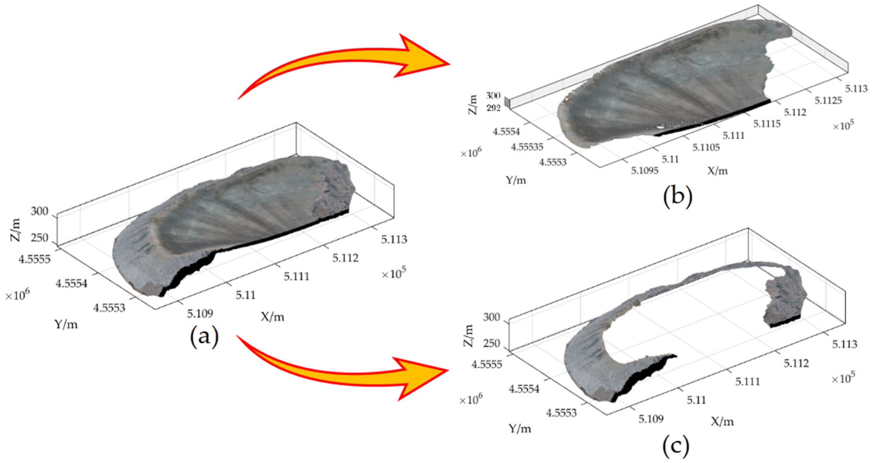
2.2.1. Extraction of the Dump Platform and Slope
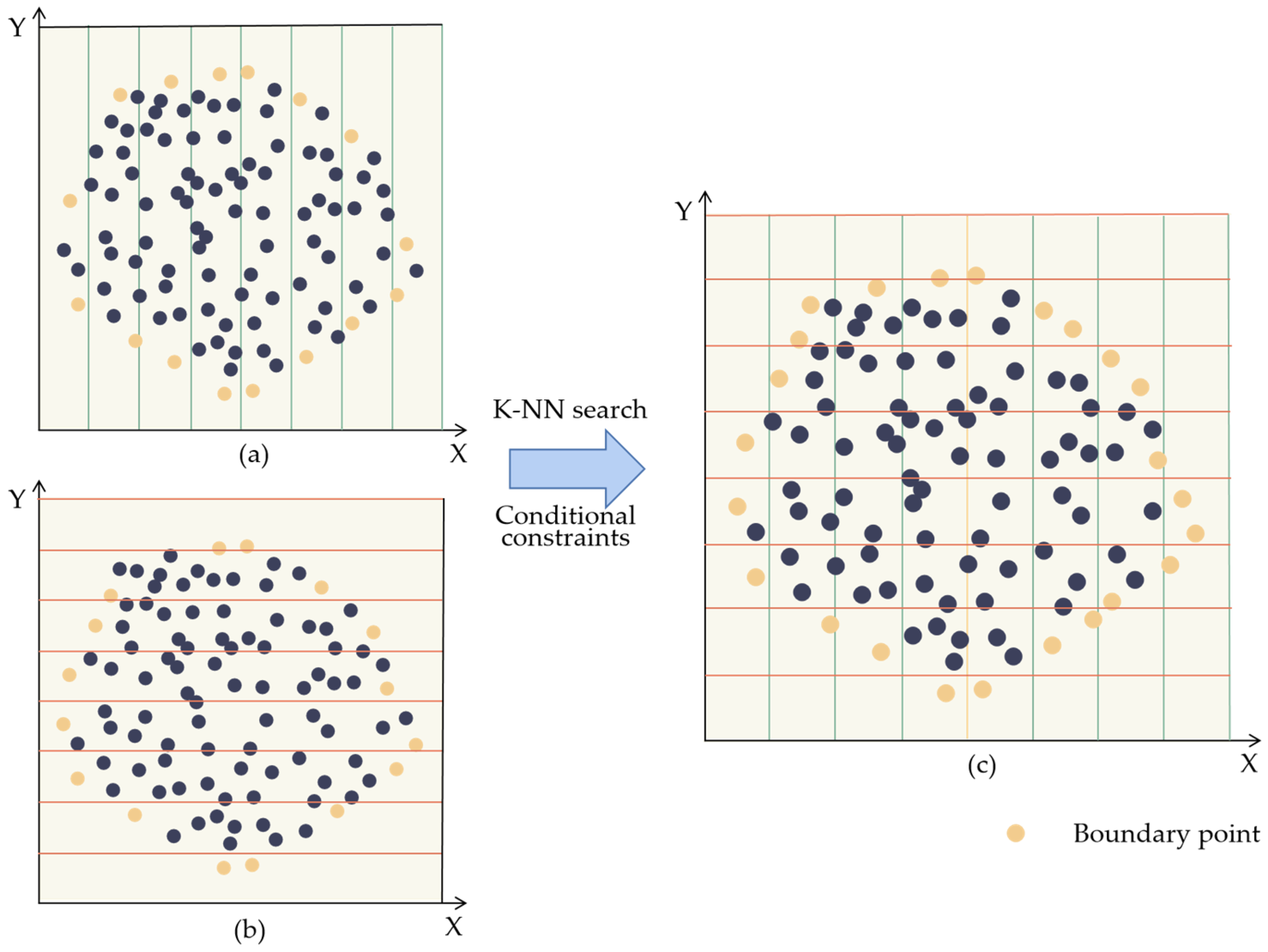
2.2.2. Extraction of the Ordered Unloading Rock Point-Cloud Boundary
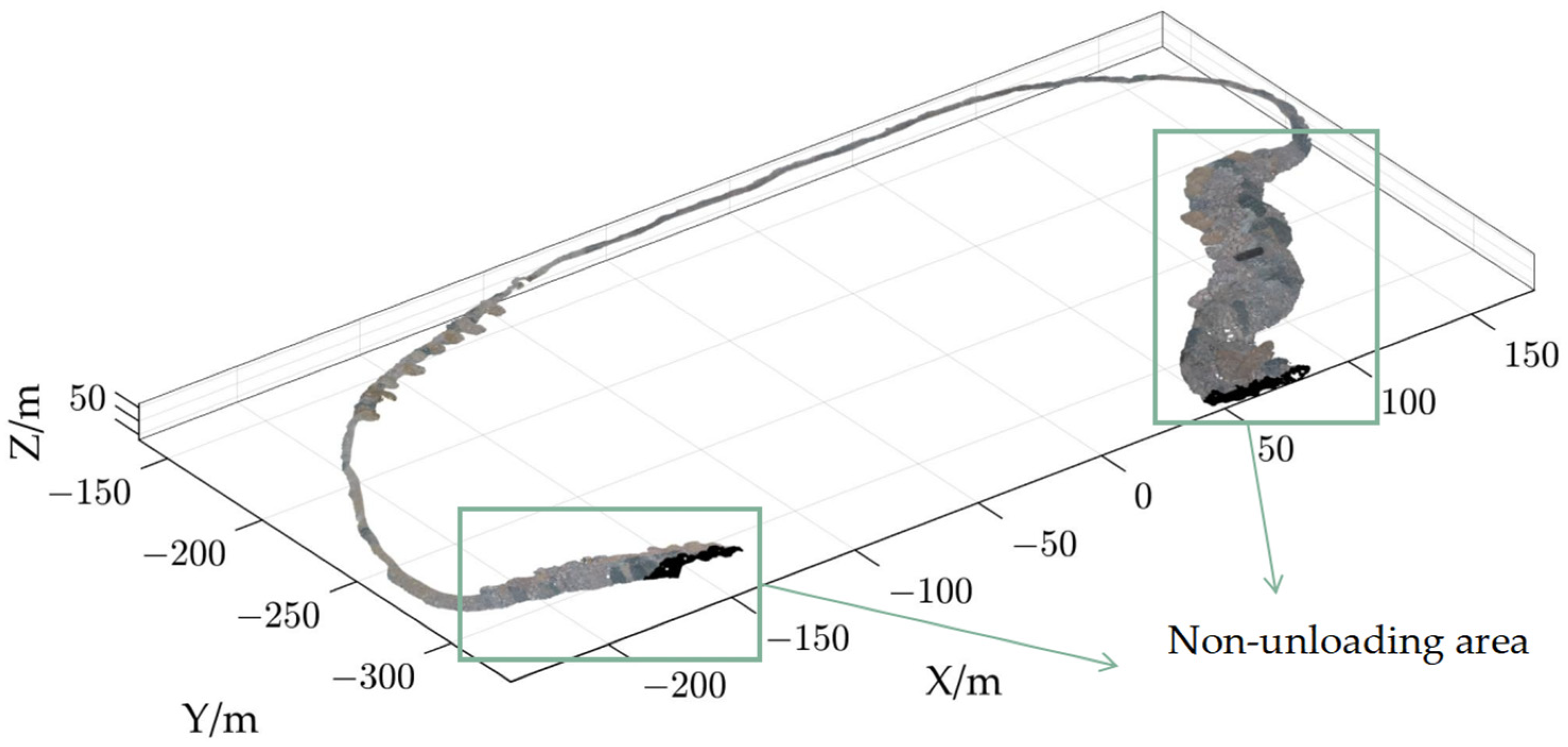
2.2.3. Extraction of the Safety Retaining Wall of the Dump Point-Cloud
2.3. Health Assessment of the Safety Retaining Wall
2.3.1. The Surface Reconstruct of the Safety Retaining Wall Point-Cloud
2.3.2. Mesh Model Profile of the Safety Retaining Wall Point-Cloud
2.3.3. Health Assessment of the Safety Retaining Wall
3. Results
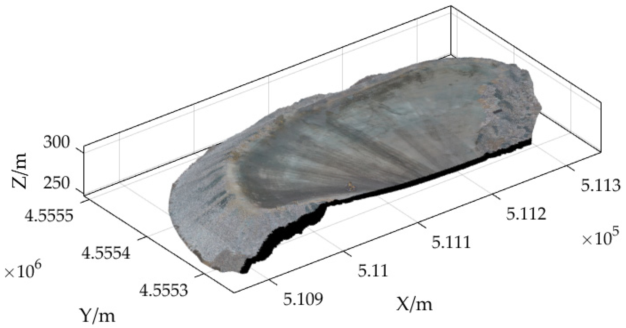
3.1. UAV Point-Cloud Data
3.2. Extraction of Dump Safety Retaining Wall Point-Cloud
3.2.1. Extraction of the Dump Platform and Slope
3.2.2. Extraction of the Ordered Unloading Rock Point-cloud Boundary
3.2.3. Extraction of the Safety Retaining Wall of the Dump Point-Cloud
3.3. Health Assessment of the Safety Retaining Wall
3.3.1. The Surface Reconstruct of the Safety Retaining Wall Point-Cloud
3.3.2. Mesh Model Profile of the Safety Retaining Wall Point-Cloud
3.3.3. Health Assessment of the Safety Retaining Wall
4. Discussion
4.1. Quantitative Evaluation of Extraction of Dump Safety Retaining Wall Point-Cloud
4.2. Quantitative Evaluation of Health Assessment of the Safety Retaining Wall
5. Conclusions
Author Contributions
Funding
Institutional Review Board Statement
Informed Consent Statement
Data Availability Statement
Acknowledgments
Conflicts of Interest
References
- Yang, H.; Yu, W.; Rpg, C.; Kai, Z.; Hza, B.; Yca, B.; Ming, L.; Pan, L. New insights on ground control in intelligent mining with Internet of Things. Comput. Commun. 2020, 150, 788–798. [Google Scholar]
- Barnewold, L.; Lottermoser, B.G. Identification of digital technologies and digitalisation trends in the mining industry. Int. J. Min. Sci. Technol. 2020, 30, 747–757. [Google Scholar] [CrossRef]
- Farrelly, C.T.; Davies, J. Interoperability, Integration, and Digital Twins for Mining—Part 2: Pathways to the Network-Centric Mine. IEEE Ind. Electron. Mag. 2021, 15, 22–31. [Google Scholar] [CrossRef]
- Wang, J.; Bi, L.; Wang, L.; Jia, M.; Mao, D. A Mining Technology Collaboration Platform Theory and Its Product Development and Application to Support China’s Digital Mine Construction. Appl. Sci. 2019, 9, 5373. [Google Scholar] [CrossRef]
- Kim, Y.; Baek, J.; Choi, Y. Smart Helmet-Based Personnel Proximity Warning System for Improving Underground Mine Safety. Appl. Sci. 2021, 11, 4342. [Google Scholar] [CrossRef]
- Seleznev, V.S.; Liseikin, A.V.; Emanov, A.F.; Solov’Ev, V.M. Seismological Observations during a Landslide on the Dump at the Kolyvan Anthracite Deposit (Novosibirsk Region). Dokl. Earth Sci. 2021, 499, 585–589. [Google Scholar] [CrossRef]
- Li, S.; Qiu, C.; Huang, J.; Guo, X.; Hu, Y.; Mugahed, A.-S.Q.; Tan, J. Stability Analysis of a High-Steep Dump Slope under Different Rainfall Conditions. Sustainability 2022, 14, 11148. [Google Scholar] [CrossRef]
- Vuong, N.P.M.; Aleksander, W.; Sylwester, R.; Zenon, R.; Robert, F. Slope Stability Numerical Analysis and Landslide Prevention of Coal Mine Waste Dump under the Impact of Rainfall—A Case Study of Janina Mine, Poland. Energies 2022, 15, 8311. [Google Scholar]
- Ya, T.; Wei, Z.; Mithal, J.I.; Cai, Q.; Li, Z.; Xiang, L. Stability analysis of varying height waste dump in open-pit mine under particle size gradation and reconstruction effect of waste materials. Int. J. Min. Reclam. Environ. 2022, 36, 587–604. [Google Scholar]
- Chang, L.S.; Yang, T.Y.; Deng, H.J. Disaster Prediction and Preventive Measures of Constructing a Waste Dump on an Abandoned Tailing Pond. Appl. Mech. Mater. 2013, 2685, 2427–2430. [Google Scholar] [CrossRef]
- Zhou, T.; Hasheminasab, S.M.; Habib, A. Tightly-coupled camera/LiDAR integration for point cloud generation from GNSS/INS-assisted UAV mapping systems. ISPRS J. Photogramm. Remote Sens. 2021, 180, 336–356. [Google Scholar] [CrossRef]
- Huang, R.; Xu, Y.; Hoegner, L.; Stilla, U. Semantics-aided 3D change detection on construction sites using UAV-based photogrammetric point clouds. Autom. Constr. 2022, 134, 104057.1–104057.14. [Google Scholar] [CrossRef]
- Liu, X.; Zhu, W.; Lian, X.; Xu, X. Monitoring Mining Surface Subsidence with Multi-Temporal Three-Dimensional Unmanned Aerial Vehicle Point Cloud. Remote Sens. 2023, 15, 374. [Google Scholar] [CrossRef]
- Zhang, K.; Chen, S.C.; Whitman, D.; Shyu, M.L.; Yan, J.; Zhang, C. A progressive morphological filter for removing nonground measurements from airborne LIDAR data. IEEE Trans. Geosci. Remote Sens. 2003, 41, 872–882. [Google Scholar] [CrossRef]
- Kim, K.H.; Jie, S. Adaptive morphological filtering for DEM generation. In Proceedings of the 2011 IEEE International Geoscience and Remote Sensing Symposium, IGARSS 2011, Vancouver, BC, Canada, 24–29 July 2011. [Google Scholar]
- Axelsson, P. DEM generation from laser scanner data using adaptive TIN models. Int. Arch. Photogramm. Remote Sens. 2000, XXXIII, 109–110. [Google Scholar]
- Xza, B.; Qga, C.; Ys, C.; Bx, A. Improved progressive TIN densification filtering algorithm for airborne LiDAR data in forested areas. ISPRS J. Photogramm. Remote Sens. 2016, 117, 79–91. [Google Scholar]
- Zhang, J.; Lin, X. Filtering airborne LiDAR data by embedding smoothness-constrained segmentation in progressive TIN densification. ISPRS J. Photogramm. Remote Sens. 2013, 81, 44–59. [Google Scholar] [CrossRef]
- Vosselman, G. Slope based filtering of laser altimetry data. Int. Arch. Photogramm. Remote Sens. 2000, XXXIII, 935–942. [Google Scholar]
- He, X.; Wang, R.; Feng, C.; Zhou, X. A Novel Type of Boundary Extraction Method and Its Statistical Improvement for Unorganized Point Clouds Based on Concurrent Delaunay Triangular Meshes. Sensors 2023, 23, 1915. [Google Scholar] [CrossRef]
- Bazazian, D.; Casas, J.R.; Ruiz-Hidalgo, J. Fast and Robust Edge Extraction in Unorganized Point Clouds. In Proceedings of the 2015 International Conference on Digital Image Computing: Techniques and Applications (DICTA), Adelaide, Australia, 23–25 November 2015. [Google Scholar]
- Varytimidis, C.; Rapantzikos, K.; Avrithis, Y.; Kollias, S. α-shapes for local feature detection. Pattern Recognit. 2016, 50, 56–73. [Google Scholar] [CrossRef]
- Nie, Y.-Z.; Cheng, Y.-L.; Qiu, L.-B.; He, M.-Y.; Lei, P. An algorithm of LiDAR building outline extraction by Delaunay triangle. In Proceedings of the Eighth International Conference on Digital Image Processing (ICDIP 2016), Chengdu, China, 20–23 May 2016. [Google Scholar]
- Wu, B.; Xie, L.; Hu, H.; Zhu, Q.; Yau, E. Integration of aerial oblique imagery and terrestrial imagery for optimized 3D modeling in urban areas. ISPRS J. Photogramm. Remote Sens. 2018, 139, 119–132. [Google Scholar] [CrossRef]
- Mineur, Y.; Lichah, T.; Castelain, J.M.; Giaume, H. A shape controled fitting method for Bézier curves. Comput. Aided Geom. Des. 1998, 15, 879–891. [Google Scholar] [CrossRef]
- Gálvez, A.; Iglesias, A.; Cobo, A.; Puig-Pey, J.; Espinola, J. Bézier Curve and Surface Fitting of 3D Point Clouds through Genetic Algorithms, Functional Networks and Least-Squares Approximation. In Proceedings of the Computational Science and Its Applications—ICCSA 2007, International Conference, Proceedings, Part II, Kuala Lumpur, Malaysia, 26–29 August 2007. [Google Scholar]
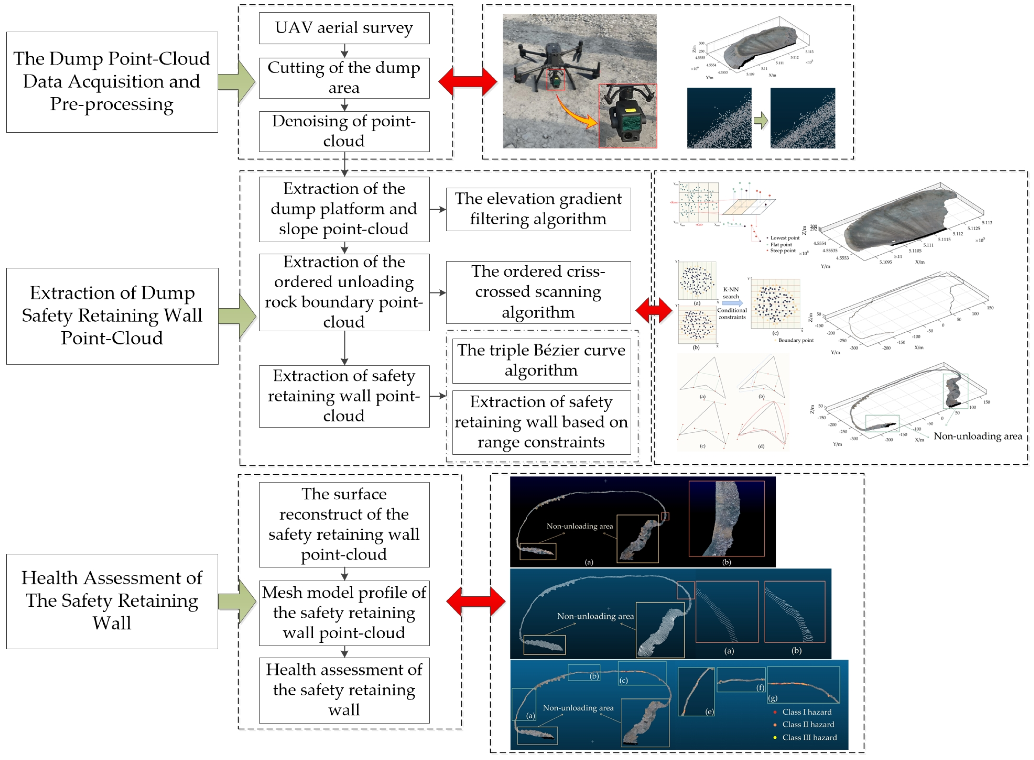
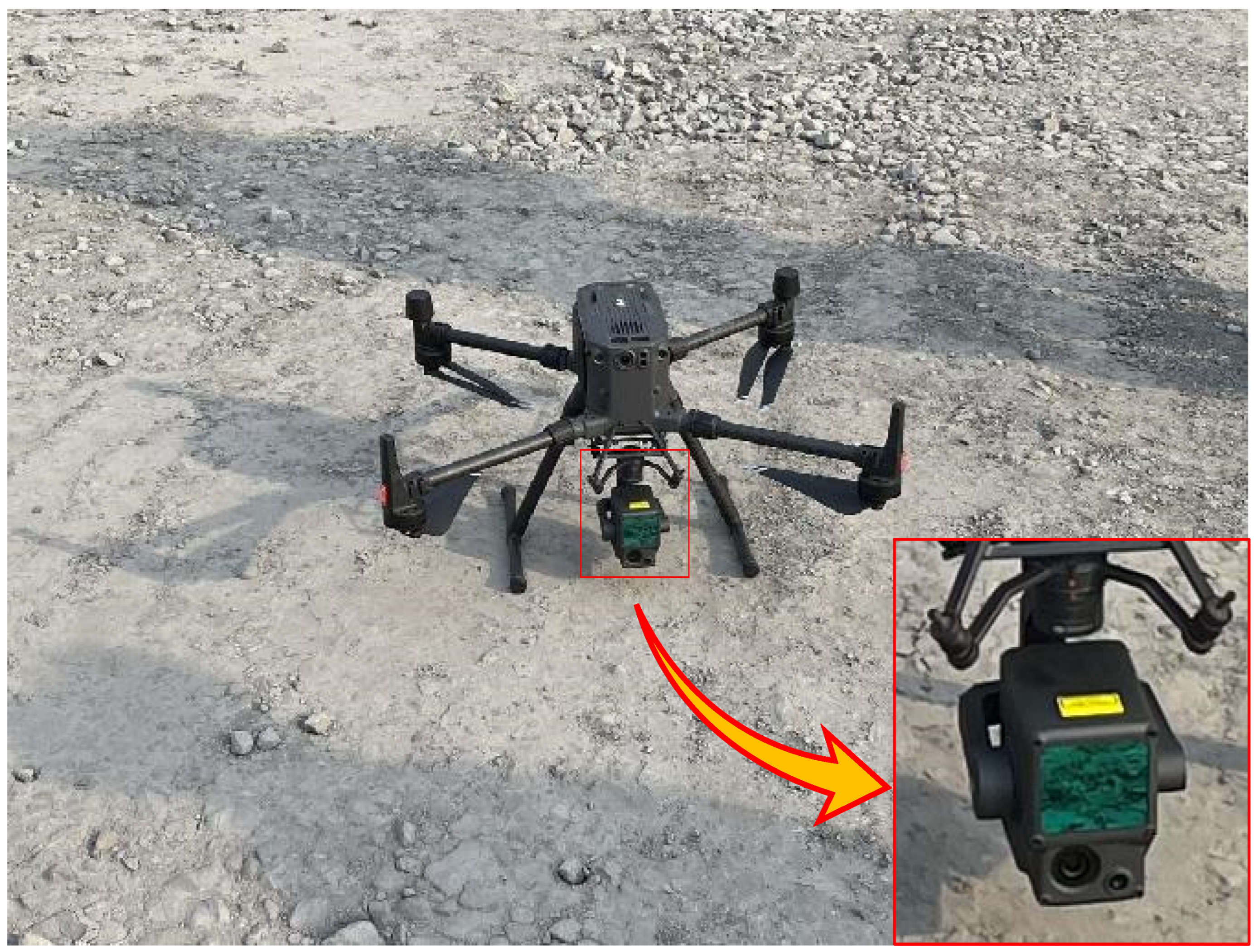
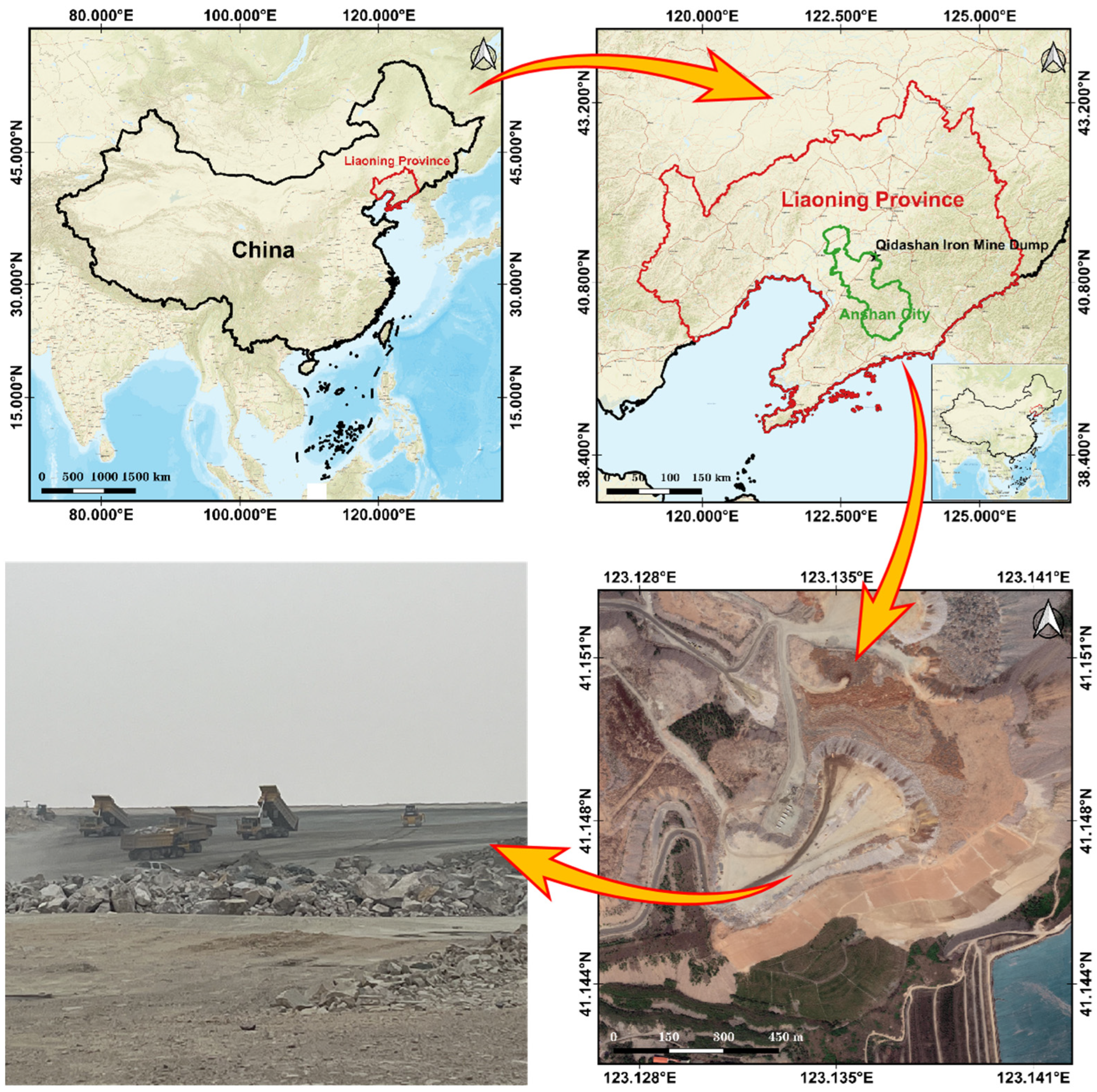
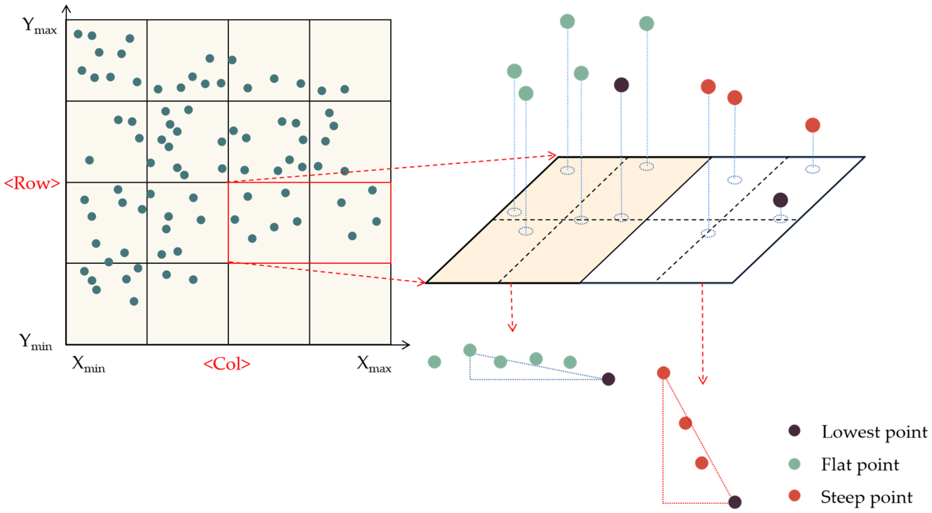



| Aerial-Survey Equipment | Parameter | Value |
|---|---|---|
| UVA | Hovering accuracy (P-GNSS) | Vertical: ±0.1 m (visual positioning normal operation) ±0.5 m (GNSS normal operation) ±0.1 m (RTK positioning normal operation) Horizontal: ±0.3 m (visual positioning normal operation) ±1.5 m (GNSS normal operation) ±0.1 m (RTK positioning normal) |
| RTK Position Accuracy | At RTK FIX: 1 cm + 1 ppm (horizontal) 1.5 cm + 1 ppm (vertical) | |
| Max. withstandable wind speed | 15 m/s (12 m/s for take-off and landing phases) |
| Aerial-Survey Equipment | Parameter | Value |
|---|---|---|
| Lidar | Distance measuring accuracy (RMS 1σ)2 | 3 cm @ 100 m |
| Max. number of echoes supported | 3 | |
| FOV | Repeated scans: 70.4° × 4.5°; Non-repetitive scans: 70.4° × 77.2° |
| Parameter | Value |
|---|---|
| Number of point-cloud | 22,218,142 |
| Average point distance (m) | 0.049 |
| Range (m × m × m) | 486.993 × 258.232 × 58.316 |
| Elevation (m) | 250.467–308.783 |
| a | b | c | d | α/% | β/% | θ/% |
|---|---|---|---|---|---|---|
| 4,504,392 | 9873 | 105,994 | 17,607,756 | 0.22 | 0.60 | 0.52 |
| Area | Measured | Model | Error | Level | ||||||
|---|---|---|---|---|---|---|---|---|---|---|
| Height (m) | Top Width (m) | Bottom Width (m) | Height (m) | Top Width (m) | Bottom Width (m) | Height (m) | Top Width (m) | Bottom Width (m) | ||
| 1 | 0.700 | 0.358 | 1.781 | 0.707 | 0.313 | 1.770 | 0.007 | 0.045 | 0.011 | Class II hazard |
| 2 | 0.636 | 0.461 | 2.753 | 0.655 | 0.436 | 2.770 | 0.019 | 0.025 | 0.017 | Class I hazard |
| 3 | 1.009 | 0.749 | 2.523 | 1.024 | 0.730 | 2.493 | 0.015 | 0.019 | 0.03 | qualified |
| 4 | 0.901 | 0.787 | 2.912 | 0.889 | 0.795 | 2.884 | 0.012 | 0.008 | 0.028 | qualified |
| 5 | 0.726 | 0.756 | 2.088 | 0.710 | 0.660 | 2.086 | 0.016 | 0.096 | 0.002 | qualified |
| 6 | 0.755 | 0.327 | 2.028 | 0.753 | 0.284 | 2.035 | 0.002 | 0.043 | 0.007 | Class I hazard |
| 7 | 0.998 | 0.700 | 2.824 | 1.001 | 0.678 | 2.803 | 0.003 | 0.022 | 0.021 | qualified |
| 8 | 0.975 | 1.020 | 2.813 | 1.002 | 1.001 | 2.803 | 0.027 | 0.019 | 0.01 | qualified |
| 9 | 0.744 | 0.678 | 2.037 | 0.753 | 0.677 | 2.035 | 0.009 | 0.001 | 0.002 | qualified |
| 10 | 0.983 | 0.815 | 1.916 | 0.909 | 0.813 | 1.929 | 0.074 | 0.002 | 0.013 | qualified |
Disclaimer/Publisher’s Note: The statements, opinions and data contained in all publications are solely those of the individual author(s) and contributor(s) and not of MDPI and/or the editor(s). MDPI and/or the editor(s) disclaim responsibility for any injury to people or property resulting from any ideas, methods, instructions or products referred to in the content. |
© 2023 by the authors. Licensee MDPI, Basel, Switzerland. This article is an open access article distributed under the terms and conditions of the Creative Commons Attribution (CC BY) license (https://creativecommons.org/licenses/by/4.0/).
Share and Cite
Mao, Y.; Zhang, X.; Cao, W.; Fan, S.; Wang, H.; Yang, Z.; Ding, B.; Bai, Y. Research on the Health Assessment Method of the Safety Retaining Wall in a Dump Based on UAV Point-Cloud Data. Sensors 2023, 23, 5686. https://doi.org/10.3390/s23125686
Mao Y, Zhang X, Cao W, Fan S, Wang H, Yang Z, Ding B, Bai Y. Research on the Health Assessment Method of the Safety Retaining Wall in a Dump Based on UAV Point-Cloud Data. Sensors. 2023; 23(12):5686. https://doi.org/10.3390/s23125686
Chicago/Turabian StyleMao, Yachun, Xin Zhang, Wang Cao, Shuo Fan, Hui Wang, Zhexi Yang, Bo Ding, and Yu Bai. 2023. "Research on the Health Assessment Method of the Safety Retaining Wall in a Dump Based on UAV Point-Cloud Data" Sensors 23, no. 12: 5686. https://doi.org/10.3390/s23125686
APA StyleMao, Y., Zhang, X., Cao, W., Fan, S., Wang, H., Yang, Z., Ding, B., & Bai, Y. (2023). Research on the Health Assessment Method of the Safety Retaining Wall in a Dump Based on UAV Point-Cloud Data. Sensors, 23(12), 5686. https://doi.org/10.3390/s23125686


