
Smart Watch Versus Classic Receivers: Static Validity of Three GPS Devices in Different Types of Built Environments

 ,
,  ,
,  , ,
, ,  and
and 
Abstract
:1. Introduction
2. Materials and Methods
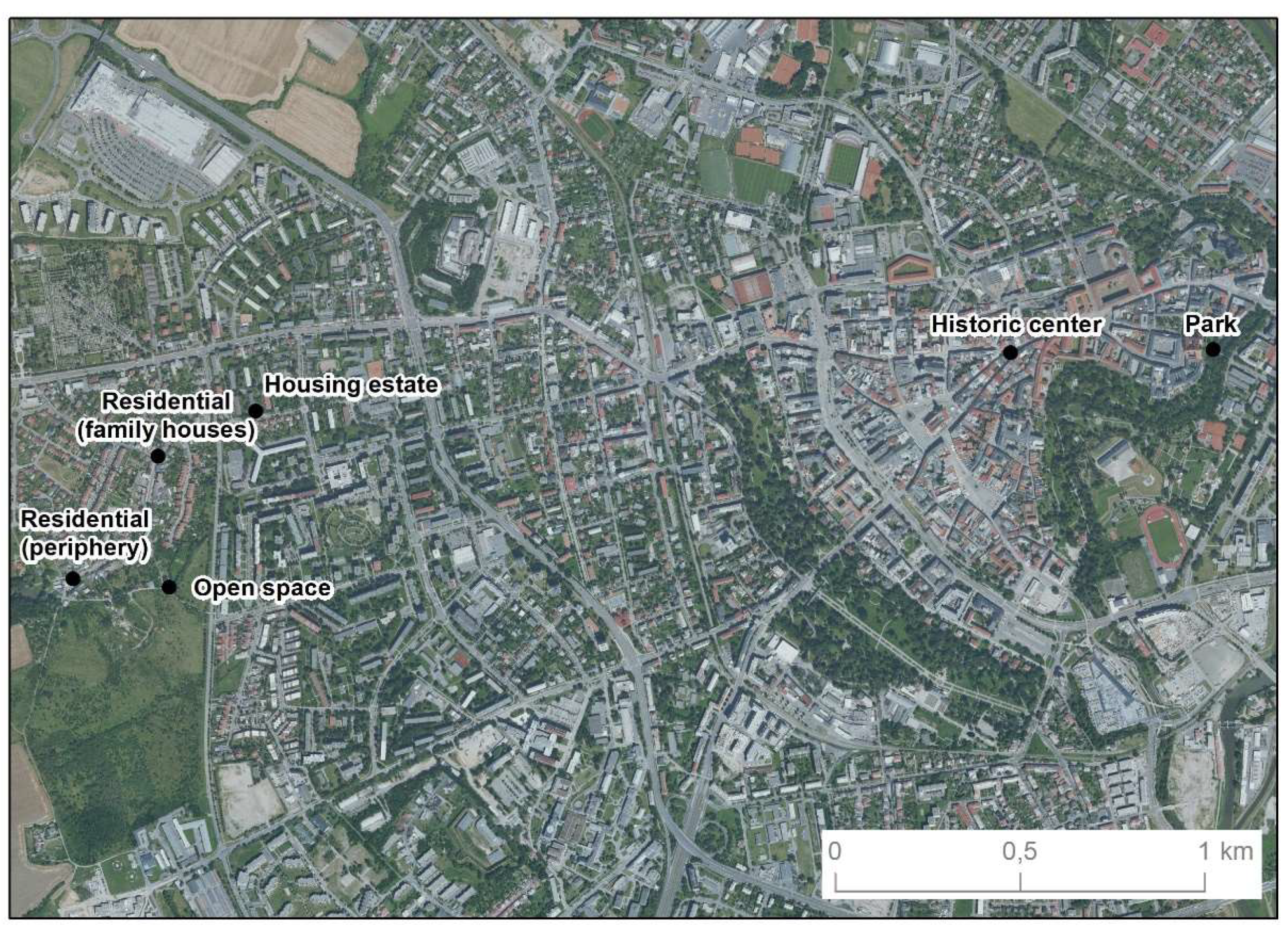
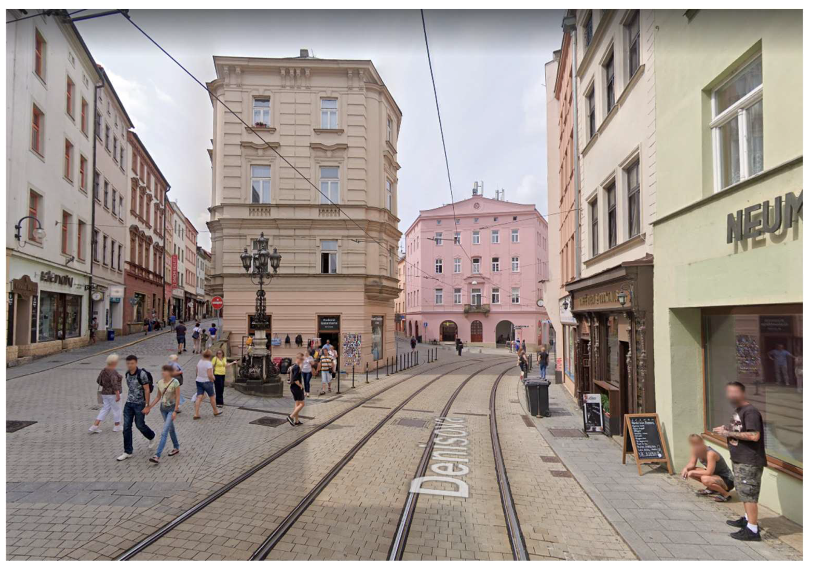
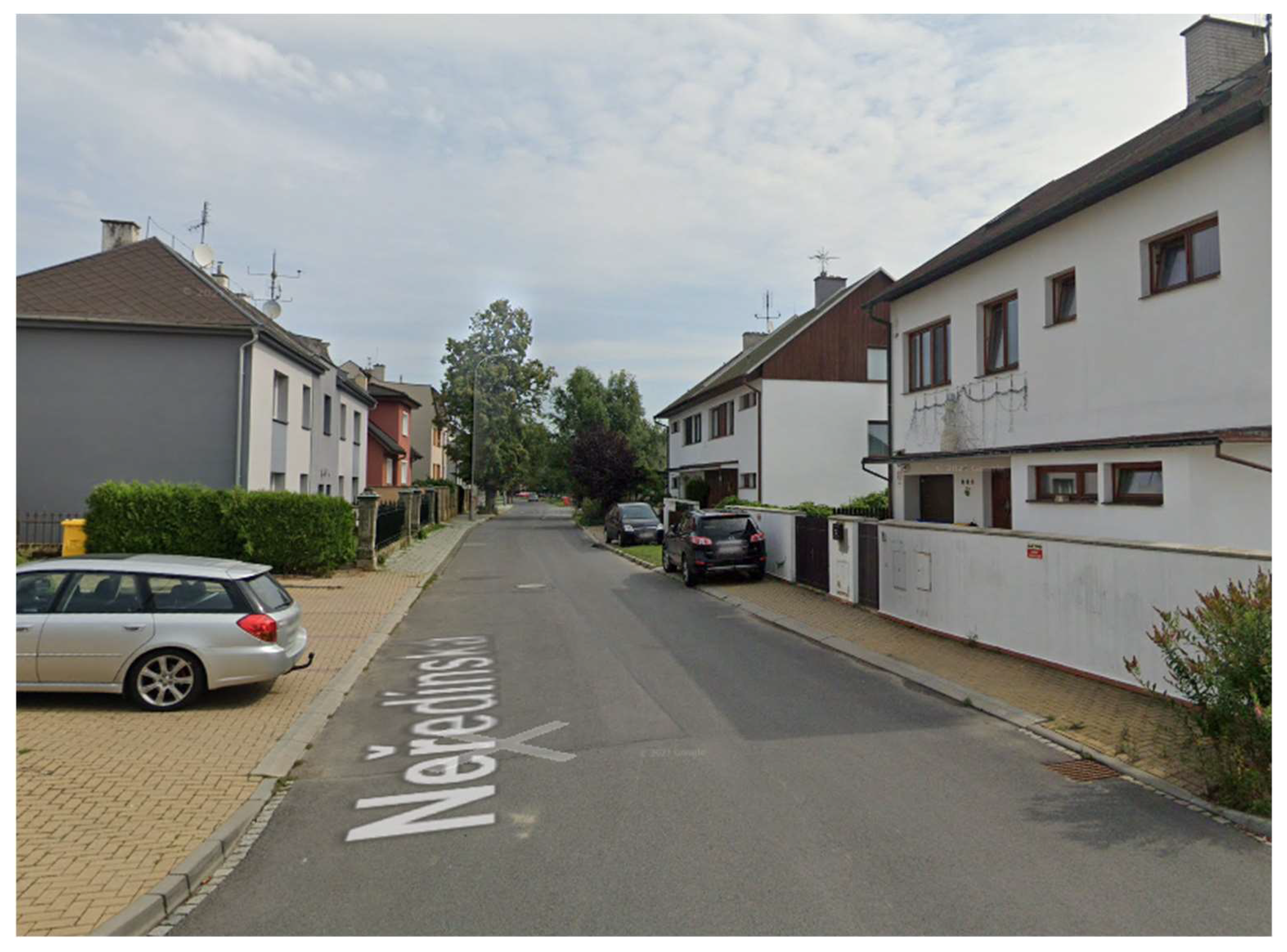
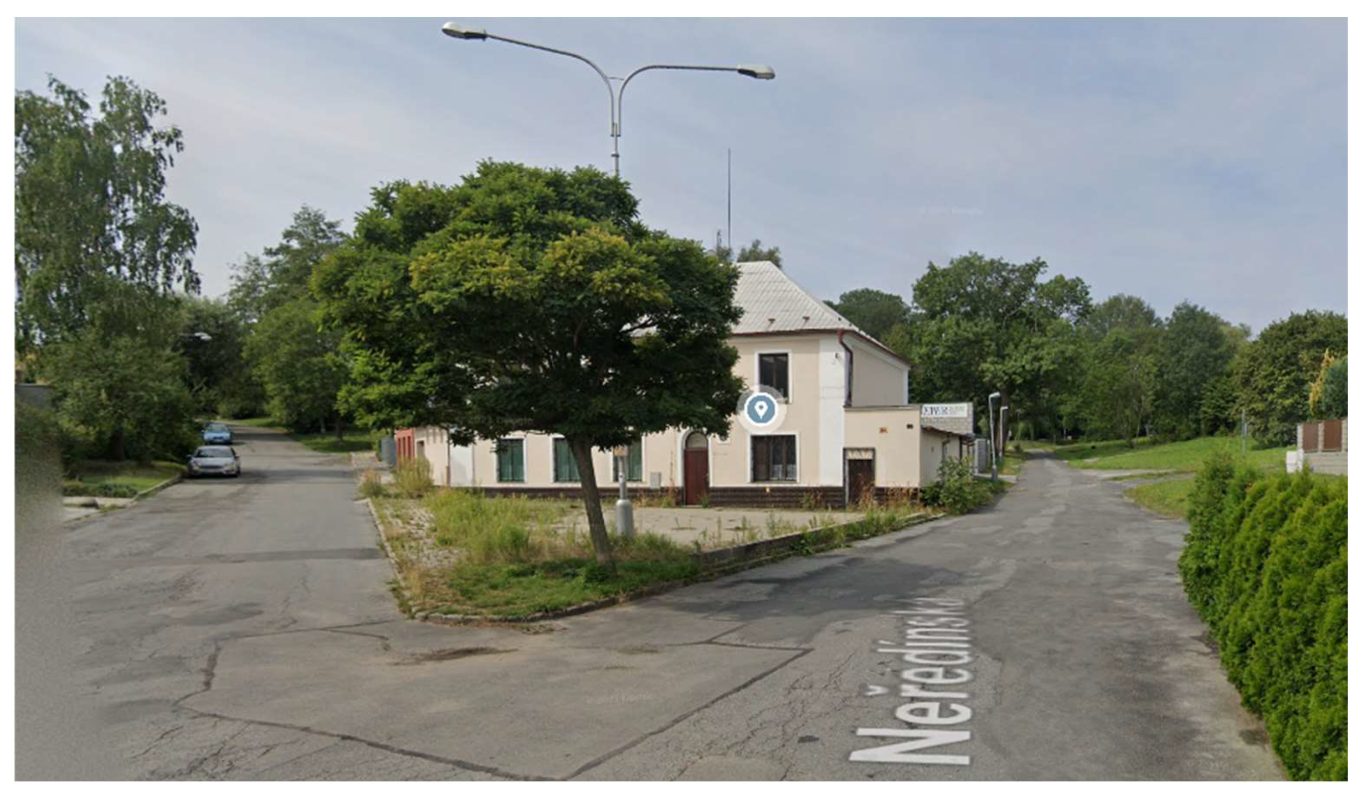
2.1. Procedure
2.2. Devices
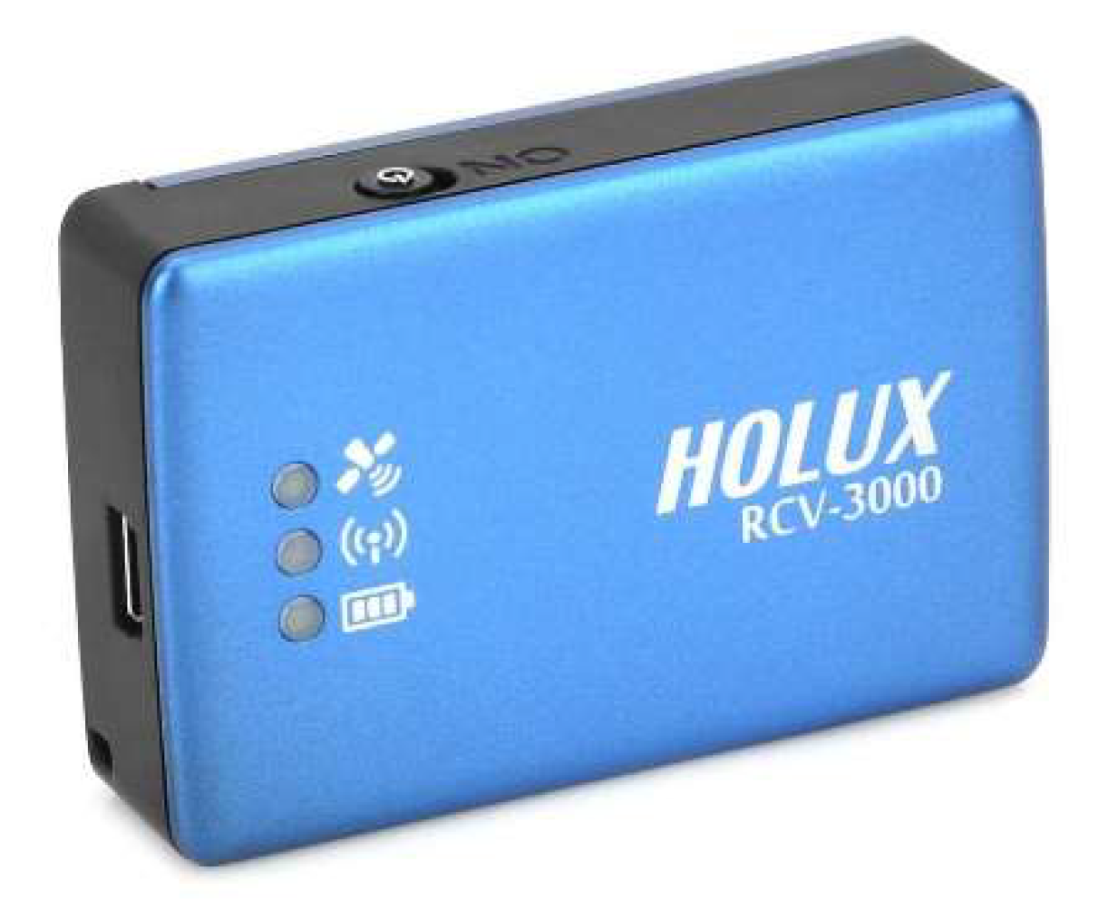
2.2.1. Holux RCV-3000
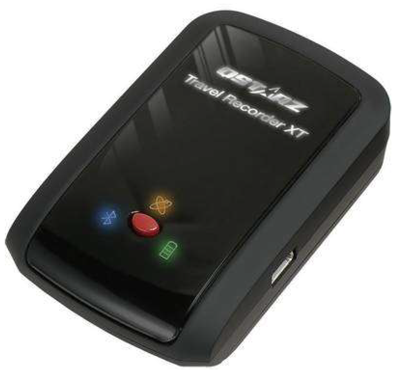
2.2.2. Qstarz BT-Q1000XT
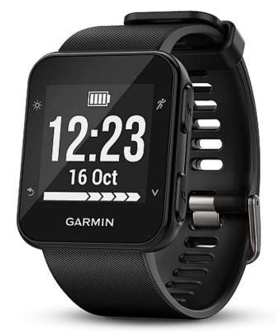
2.2.3. Garmin Forerunner 35
2.3. Data Processing
2.4. Statistical Analysis
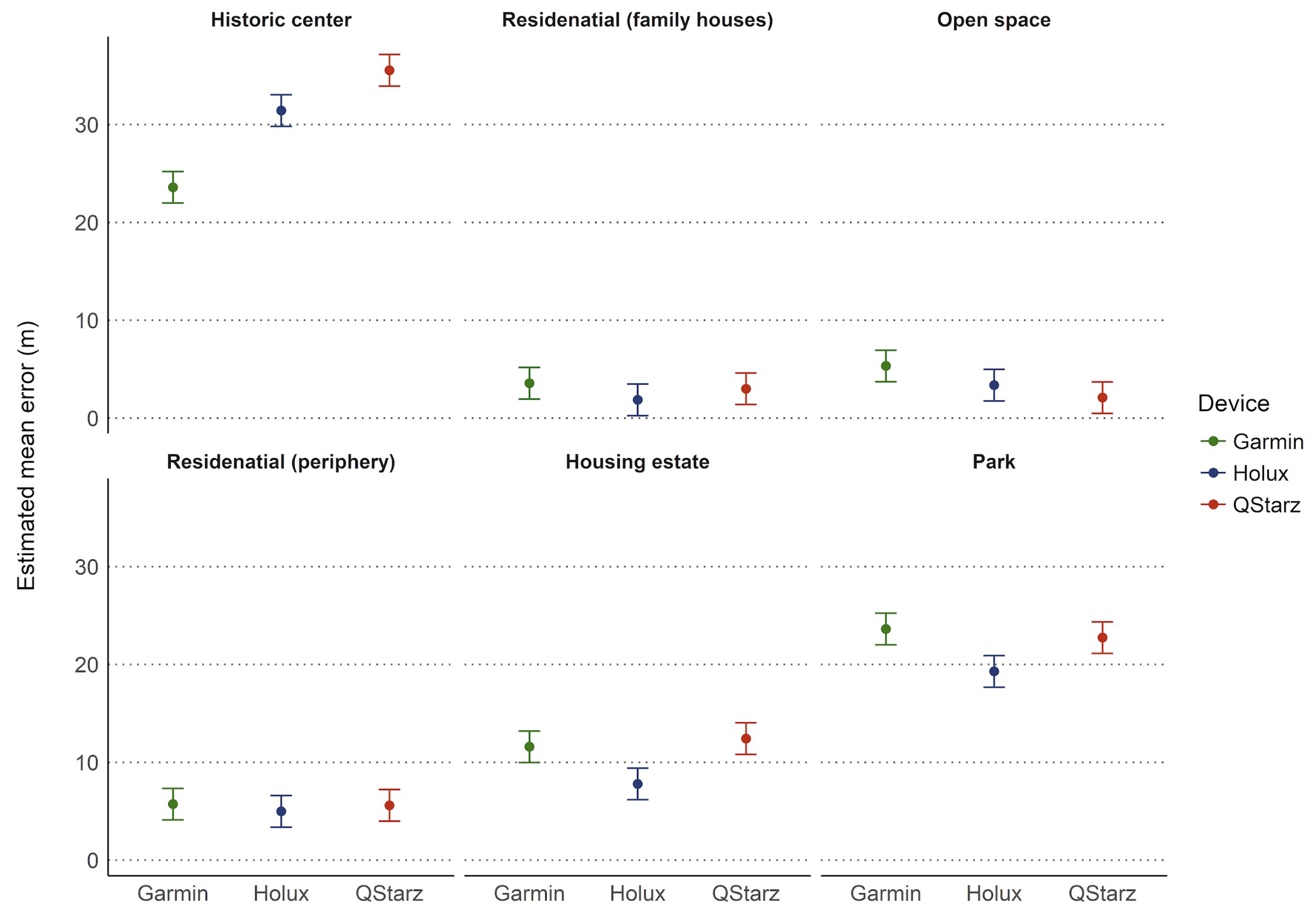
3. Results
4. Discussion
5. Conclusions
Author Contributions
Funding
Data Availability Statement
Acknowledgments
Conflicts of Interest
References
- Frank, L.; Giles-Corti, B.; Ewing, R. The influence of the built environment on transport and health. J. Transp. Health 2016, 3, 423–425. [Google Scholar] [CrossRef]
- Sallis, J.F.; Cerin, E.; Conway, T.L.; Adams, M.A.; Frank, L.D.; Pratt, M.; Salvo, D.; Schipperijn, J.; Smith, G.; Cain, K.L.; et al. Physical activity in relation to urban environments in 14 cities worldwide: A cross-sectional study. Lancet 2016, 387, 2207–2217. [Google Scholar] [CrossRef] [Green Version]
- Sallis, J.F.; Conway, T.L.; Cain, K.L.; Carlson, J.A.; Frank, L.D.; Kerr, J.; Glanz, K.; Chapman, J.E.; Saelens, B.E. Neighborhood built environment and socioeconomic status in relation to physical activity, sedentary behavior, and weight status of adolescents. Prev. Med. 2018, 110, 47–54. [Google Scholar] [CrossRef] [PubMed]
- Kerr, J.; Emond, J.A.; Badland, H.; Reis, R.; Sarmiento, O.; Carlson, J.; Sallis, J.F.; Cerin, E.; Cain, K.; Conway, T.; et al. Perceived Neighborhood Environmental Attributes Associated with Walking and Cycling for Transport among Adult Residents of 17 Cities in 12 Countries: The IPEN Study. Environ. Health Perspect. 2016, 124, 290–298. [Google Scholar] [CrossRef] [PubMed] [Green Version]
- Oreskovic, N.M.; Blossom, J.; Field, A.E.; Chiang, S.R.; Winickoff, J.P.; Kleinman, R.E. Combining global positioning system and accelerometer data to determine the locations of physical activity in children. Geospat. Health 2012, 6, 263–272. [Google Scholar] [CrossRef]
- Oliver, M.; Badland, H.; Mavoa, S.; Duncan, M.J.; Duncan, S. Combining GPS, GIS, and accelerometry: Methodological issues in the assessment of location and intensity of travel behaviors. J. Phys. Act. Health 2010, 7, 102–108. [Google Scholar] [CrossRef] [PubMed] [Green Version]
- Vorlíček, M.; Rubín, L.; Dygrýn, J.; Mitáš, J.; Voženílek, V. The use of GPS devices to monitor physical activity—Potencial and limits. Stud. Kinanthropologica 2016, 17, 131–138. [Google Scholar] [CrossRef]
- Krenn, P.J.; Titze, S.; Oja, P.; Jones, A.; Ogilvie, D. Use of global positioning systems to study physical activity and the environment: A systematic review. Am. J. Prev. Med. 2011, 41, 508–515. [Google Scholar] [CrossRef] [PubMed] [Green Version]
- Yi, L.; Wilson, J.P.; Mason, T.B.; Habre, R.; Wang, S.; Dunton, G.F. Methodologies for assessing contextual exposure to the built environment in physical activity studies: A systematic review. Health Place 2019, 60, 102226. [Google Scholar] [CrossRef]
- Jones, A.P.; Coombes, E.G.; Griffin, S.J.; van Sluijs, E.M. Environmental supportiveness for physical activity in English schoolchildren: A study using Global Positioning Systems. Int. J. Behav. Nutr. Phys. Act. 2009, 6, 42. [Google Scholar] [CrossRef] [Green Version]
- Quigg, R.; Gray, A.; Reeder, A.I.; Holt, A.; Waters, D.L. Using accelerometers and GPS units to identify the proportion of daily physical activity located in parks with playgrounds in New Zealand children. Prev. Med. 2010, 50, 235–240. [Google Scholar] [CrossRef]
- Troped, P.J.; Wilson, J.S.; Matthews, C.E.; Cromley, E.K.; Melly, S.J. The Built Environment and Location-Based Physical Activity. Am. J. Prev. Med. 2010, 38, 429–438. [Google Scholar] [CrossRef] [PubMed] [Green Version]
- Cho, G.H.; Rodríguez, D.A.; Evenson, K.R. Identifying walking trips using GPS data. Med. Sci. Sports Exerc. 2011, 43, 365–372. [Google Scholar] [CrossRef]
- Troped, P.J.; Oliveira, M.S.; Matthews, C.E.; Cromley, E.K.; Melly, S.J.; Craig, B.A. Prediction of activity mode with global positioning system and accelerometer data. Med. Sci. Sports Exerc. 2008, 40, 972–978. [Google Scholar] [CrossRef]
- Schipperijn, J.; Kerr, J.; Duncan, S.; Madsen, T.; Klinker, C.D.; Troelsen, J. Dynamic Accuracy of GPS Receivers for Use in Health Research: A Novel Method to Assess GPS Accuracy in Real-World Settings. Front. Public Health 2014, 2, 21. [Google Scholar] [CrossRef] [Green Version]
- Vorlicek, M.; Stewart, T.; Dygryn, J.; Rubin, L.; Mitas, J.; Schipperijn, J. The comparison of Holux and Qstarz GPS receivers in free living conditions: Dynamic accuracy in different active transport modes. Acta Gymnica 2019, 49, 109–114. [Google Scholar] [CrossRef] [Green Version]
- Cooper, A.R.; Page, A.S.; Wheeler, B.W.; Hillsdon, M.; Griew, P.; Jago, R. Patterns of GPS measured time outdoors after school and objective physical activity in English children: The PEACH project. Int. J. Behav. Nutr. Phys. Act. 2010, 7, 31. [Google Scholar] [CrossRef] [Green Version]
- Kerr, J.; Duncan, S.; Schipperijn, J. Using global positioning systems in health research: A practical approach to data collection and processing. Am. J. Prev. Med. 2011, 41, 532–540. [Google Scholar] [CrossRef]
- Andersen, H.B.; Christiansen, L.B.; Klinker, C.D.; Ersbøll, A.K.; Troelsen, J.; Kerr, J.; Schipperijn, J. Increases in use and activity due to urban renewal: Effect of a natural experiment. Am. J. Prev. Med. 2017, 53, e81–e87. [Google Scholar] [CrossRef] [PubMed]
- Carlson, J.A.; Saelens, B.E.; Kerr, J.; Schipperijn, J.; Conway, T.L.; Frank, L.D.; Chapman, J.E.; Glanz, K.; Cain, K.L.; Sallis, J.F. Association between neighborhood walkability and GPS-measured walking, bicycling and vehicle time in adolescents. Health Place 2015, 32, 1–7. [Google Scholar] [CrossRef] [Green Version]
- Klinker, C.D.; Schipperijn, J.; Christian, H.; Kerr, J.; Ersbøll, A.K.; Troelsen, J. Using accelerometers and global positioning system devices to assess gender and age differences in children’s school, transport, leisure and home based physical activity. Int. J. Behav. Nutr. Phys. Act. 2014, 11, 8. [Google Scholar] [CrossRef] [Green Version]
- Pizarro, A.N.; Schipperijn, J.; Ribeiro, J.C.; Figueiredo, A.; Mota, J.; Santos, M.P. Gender differences in the domain-specific contributions to MVPA, accessed by GPS. J. Phys. Act. Health 2017, 14, 474–478. [Google Scholar] [CrossRef]
- Duncan, S.; Stewart, T.I.; Oliver, M.; Mavoa, S.; MacRae, D.; Badland, H.M.; Duncan, M.J. Portable global positioning system receivers: Static validity and environmental conditions. Am. J. Prev. Med. 2013, 44, e19–e29. [Google Scholar] [CrossRef] [PubMed]
- Muñoz-Lopez, A.; Granero-Gil, P.; Pino-Ortega, J.; De Hoyo, M. The validity and reliability of a 5-hz GPS device for quantifying athletes’ sprints and movement demands specific to team sports. J. Hum. Sport Exerc. 2017, 12, 156–166. [Google Scholar] [CrossRef]
- Hoppe, M.W.; Baumgart, C.; Polglaze, T.; Freiwald, J. Validity and reliability of GPS and LPS for measuring distances covered and sprint mechanical properties in team sports. PLoS ONE 2018, 13, e0192708. [Google Scholar] [CrossRef] [PubMed] [Green Version]
- Scott, M.T.; Scott, T.J.; Kelly, V.G. The validity and reliability of global positioning systems in team sport: A brief review. J. Strength Cond. Res. 2016, 30, 1470–1490. [Google Scholar] [CrossRef]
- Garnett, R.; Stewart, R. Comparison of GPS units and mobile Apple GPS capabilities in an urban landscape. Cartogr. Geogr. Inf. Sci. 2015, 42, 1470–1490. [Google Scholar] [CrossRef]
- Lee, L.; Jones, M.; Ridenour, G.S.; Testa, M.P.; Wilson, M.J. Investigating and comparing spatial accuracy and precision of GPS-enabled devices in Middle Tennessee. In Proceedings of the Communications in Computer and Information Science, Ypsilanti, MI, USA, 3–5 October 2014; Springer: New York, NY, USA, 2015; Volume 482. [Google Scholar]
- Wlaź, M.; Kozieł, G. Verification of the precision of GSM and GPS signals available on mobile devices. J. Comput. Sci. Inst. 2020, 15, 143–149. [Google Scholar] [CrossRef]
- Zandbergen, P.A.; Barbeau, S.J. Positional accuracy of assisted GPS data from high-sensitivity GPS-enabled mobile phones. J. Navig. 2011, 64, 381–399. [Google Scholar] [CrossRef] [Green Version]
- Wing, M.G.; Eklund, A. Performance comparison of a low-cost mapping grade global positioning systems (GPS) receiver and consumer grade GPS receiver under dense forest canopy. J. For. 2007, 105, 9–14. [Google Scholar] [CrossRef]
- Edson, C.; Wing, M.G. Tree location measurement accuracy with a mapping-grade GPS receiver under forest canopy. For. Sci. 2012, 58, 567–576. [Google Scholar] [CrossRef]
- Valbuena, R.; Mauro, F.; Rodriguez-Solano, R.; Manzanera, J.A. Accuracy and precision of GPS receivers under forest canopies in a mountainous environment. Span. J. Agric. Res. 2010, 8, 1047–1057. [Google Scholar] [CrossRef]
- Gilgen-Ammann, R.; Schweizer, T.; Wyss, T. Accuracy of distance recordings in eight positioning-enabled sport watches: Instrument validation study. JMIR mHealth uHealth 2020, 8, e17118. [Google Scholar] [CrossRef]
- Ordóñez Galán, C.; Rodríguez-Pérez, J.R.; Martínez Torres, J.; García Nieto, P.J. Analysis of the influence of forest environments on the accuracy of GPS measurements by using genetic algorithms. Math. Comput. Model. 2011, 54, 1829–1834. [Google Scholar] [CrossRef]
- Rodríguez-Pérez, J.R.; Álvarez, M.F.; Sanz-Ablanedo, E. Assessment of Low-Cost GPS Receiver Accuracy and Precision in Forest Environments. J. Surv. Eng. 2007, 133, 159–167. [Google Scholar] [CrossRef] [Green Version]
- Costa, E. Simulation of the effects of different urban environments on gps performance using digital elevation models and building databases. IEEE Trans. Intell. Transp. Syst. 2011, 12, 819–829. [Google Scholar] [CrossRef]
- Pobiruchin, M.; Suleder, J.; Zowalla, R.; Wiesner, M. Accuracy and adoption of wearable technology used by active citizens: A marathon event field study. JMIR mHealth uHealth 2017, 5, e6395. [Google Scholar] [CrossRef] [Green Version]
- Technology H. HOLUX. Available online: http://www.holux.com/JCore/en/products/products_content.jsp?pno=440 (accessed on 1 January 2017).
- Van Brummelen, G. Heavenly Mathematics: The Forgotten Art of Spherical Trigonometry; Princeton University Press: Princeton, NJ, USA, 2012; ISBN 9780691148922. [Google Scholar]
- Carlson, J.A.; Schipperijn, J.; Kerr, J.; Saelens, B.E.; Natarajan, L.; Frank, L.D.; Glanz, K.; Conway, T.L.; Chapman, J.E.; Cain, K.L.; et al. Locations of Physical Activity as Assessed by GPS in Young Adolescents. Pediatrics 2016, 137, e20152430. [Google Scholar] [CrossRef] [PubMed] [Green Version]
- Klinker, C.D.; Schipperijn, J.; Toftager, M.; Kerr, J.; Troelsen, J. When cities move children: Development of a new methodology to assess context-specific physical activity behaviour among children and adolescents using accelerometers and GPS. Health Place 2015, 31, 90–99. [Google Scholar] [CrossRef] [Green Version]
- Nikam, T.; Mathew, R. Comparison of Various Wearable Activity Trackers. In Lecture Notes on Data Engineering and Communications Technologies; Springer: New York, NY, USA, 2020; Volume 31, pp. 173–179. [Google Scholar]
- Dygrýn, J.; Medrano, M.; Molina-Garcia, P.; Rubín, L.; Jakubec, L.; Janda, D.; Gába, A. Associations of novel 24-h accelerometer-derived metrics with adiposity in children and adolescents. Environ. Health Prev. Med. 2021, 26, 66. [Google Scholar] [CrossRef]
- Duncan, S.; Stewart, T.; Mackay, L.; Neville, J.; Narayanan, A.; Walker, C.; Berry, S.; Morton, S. Wear-time compliance with a dual-accelerometer system for capturing 24-h behavioural profiles in children and adults. Int. J. Environ. Res. Public Health 2018, 15, 1296. [Google Scholar] [CrossRef] [PubMed] [Green Version]


| Specification | Qstarz BT-Q1000XT | Holux RCV-3000 | Garmin Forerunner 35 |
|---|---|---|---|
| Price ($) | 100 | 60 | 200 |
| Size (mm) | 72 × 47 × 20 | 63 × 41 × 17 | 36 × 41 × 13 |
| Weight (g) | 65 | 53 | 37 |
| Chipset | MTK II | MTK MT3329 | - |
| Sensitivity (dBm) | −165 | −165 | - |
| Number of channels | 66 | 66 | - |
| Location accuracy [m (%)] | 3 (50) | 3 (95) | - |
| Data storage (MB) | 8 | 4 | - |
| Battery (mAh) | 1000 | 1050 | - |
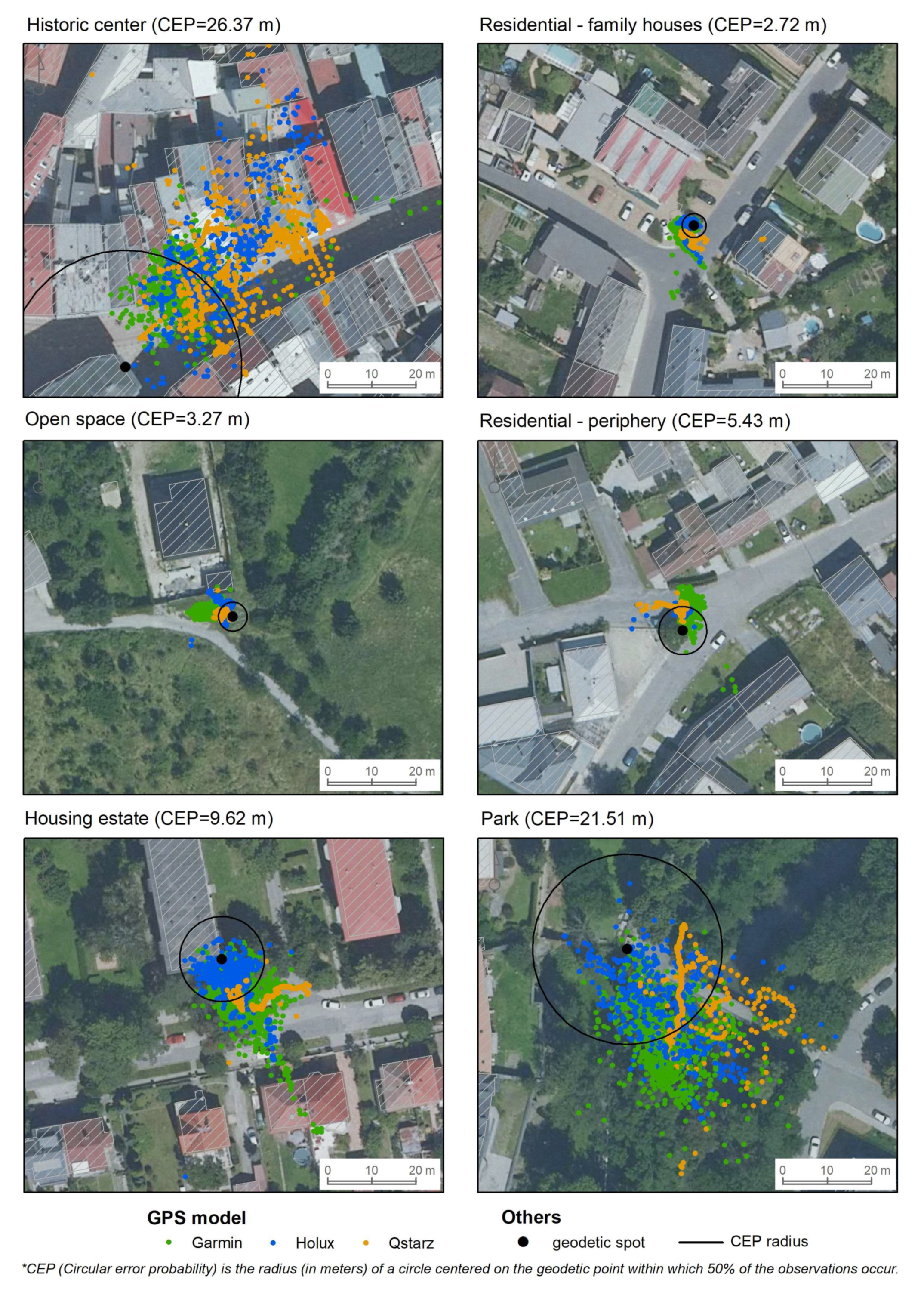
| Device Type | Site | Date | Start Time (GTM+1) | N (GPS Points) | Est. Mean Error | 95% CI | SD | Median |
|---|---|---|---|---|---|---|---|---|
| Garmin | Historic center | 30/11/2018 | 11:27 | 7036 | 23.59 | [21.98, 25.20] | 9.21 | 22.10 |
| Residential (family houses) | 04/12/2018 | 15:36 | 7372 | 3.56 | [1.95, 5.18] | 1.92 | 3.63 | |
| Open space | 05/12/2018 | 14:40 | 7335 | 5.33 | [3.71, 6.94] | 1.36 | 5.10 | |
| Residential (periphery) | 09/12/2018 | 12:38 | 7382 | 5.73 | [4.11, 7.34] | 2.01 | 6.05 | |
| Housing estate | 09/12/2018 | 14:28 | 7386 | 11.59 | [9.98, 13.21] | 6.82 | 10.30 | |
| Park | 10/12/2018 | 16:29 | 7174 | 23.63 | [22.02, 25.24] | 9.40 | 23.80 | |
| Holux | Historic center | 30/11/2018 | 11:27 | 7366 | 31.44 | [29.82, 33.05] | 12.90 | 27.70 |
| Residential (family houses) | 04/12/2018 | 15:36 | 7329 | 1.87 | [0.25, 3.48] | 1.09 | 1.55 | |
| Open space | 05/12/2018 | 14:40 | 7390 | 3.36 | [1.75, 4.98] | 1.37 | 3.11 | |
| Residential (periphery) | 09/12/2018 | 12:38 | 7339 | 4.99 | [3.38, 6.61] | 0.76 | 4.99 | |
| Housing estate | 09/12/2018 | 14:28 | 7400 | 7.80 | [6.18, 9.41] | 5.47 | 5.83 | |
| Park | 10/12/2018 | 16:29 | 7200 | 19.30 | [17.69, 20.92] | 9.59 | 18.40 | |
| Qstarz | Historic center | 30/11/2018 | 11:27 | 7252 | 35.55 | [33.93, 37.16] | 13.5 | 34.00 |
| Residential (family houses) | 04/12/2018 | 15:36 | 7348 | 3.00 | [1.38, 4.61] | 0.85 | 2.90 | |
| Open space | 05/12/2018 | 14:40 | 7358 | 2.09 | [0.48, 3.71] | 0.83 | 2.12 | |
| Residential (periphery) | 09/12/2018 | 12:38 | 7345 | 5.59 | [3.98, 7.21] | 1.19 | 5.68 | |
| Housing estate | 09/12/2018 | 14:28 | 7345 | 12.42 | [10.81, 14.04] | 3.24 | 12.50 | |
| Park | 10/12/2018 | 16:29 | 7186 | 22.75 | [21.13, 24.36] | 7.59 | 22.10 |
| Site | Contrast | Mean Difference (m) | 95% CI | padj |
|---|---|---|---|---|
| Historic center | Garmin-Holux | −7.85 | [−11.29, −4.40] | 0.004 |
| Garmin-Qstarz | −11.96 | [−15.40, −8.51] | 0.001 | |
| Holux-Qstarz | −4.11 | [−7.56, −0.66] | 0.030 | |
| Residential (family houses) | Garmin-Holux | 1.70 | [−1.75, 5.15] | 0.300 |
| Garmin-Qstarz | 0.56 | [−2.89, 4.01] | 1.000 | |
| Holux-Qstarz | −1.13 | [−4.58, 2.32] | 0.648 | |
| Open space | Garmin-Holux | 1.96 | [−1.48, 5.41] | 0.216 |
| Garmin-Qstarz | 3.24 | [−0.21, 6.68] | 0.060 | |
| Holux-Qstarz | 1.27 | [−2.18, 4.72] | 0.533 | |
| Residential (periphery) | Garmin-Holux | 0.73 | [−2.72, 4.18] | 1.000 |
| Garmin-Qstarz | 0.13 | [−3.32, 3.58] | 1.000 | |
| Holux-Qstarz | −0.60 | [−4.05, 2.85] | 1.000 | |
| Housing estate | Garmin-Holux | 3.80 | [0.35, 7.25] | 0.038 |
| Garmin-Qstarz | −0.83 | [−4.28, 2.62] | 1.000 | |
| Holux-Qstarz | −4.63 | [−8.08, −1.18] | 0.022 | |
| Park | Garmin-Holux | 4.33 | [0.88, 7.77] | 0.026 |
| Garmin-Qstarz | 0.88 | [−2.57, 4.33] | 0.935 | |
| Holux-Qstarz | −3.45 | [−6.89, 0.00] | 0.050 |
Publisher’s Note: MDPI stays neutral with regard to jurisdictional claims in published maps and institutional affiliations. |
© 2021 by the authors. Licensee MDPI, Basel, Switzerland. This article is an open access article distributed under the terms and conditions of the Creative Commons Attribution (CC BY) license (https://creativecommons.org/licenses/by/4.0/).
Share and Cite
Vorlíček, M.; Stewart, T.; Schipperijn, J.; Burian, J.; Rubín, L.; Dygrýn, J.; Mitáš, J.; Duncan, S. Smart Watch Versus Classic Receivers: Static Validity of Three GPS Devices in Different Types of Built Environments. Sensors 2021, 21, 7232. https://doi.org/10.3390/s21217232
Vorlíček M, Stewart T, Schipperijn J, Burian J, Rubín L, Dygrýn J, Mitáš J, Duncan S. Smart Watch Versus Classic Receivers: Static Validity of Three GPS Devices in Different Types of Built Environments. Sensors. 2021; 21(21):7232. https://doi.org/10.3390/s21217232
Chicago/Turabian StyleVorlíček, Michal, Tom Stewart, Jasper Schipperijn, Jaroslav Burian, Lukáš Rubín, Jan Dygrýn, Josef Mitáš, and Scott Duncan. 2021. "Smart Watch Versus Classic Receivers: Static Validity of Three GPS Devices in Different Types of Built Environments" Sensors 21, no. 21: 7232. https://doi.org/10.3390/s21217232