Registration of Laser Scanning Point Clouds: A Review

 ,
, 
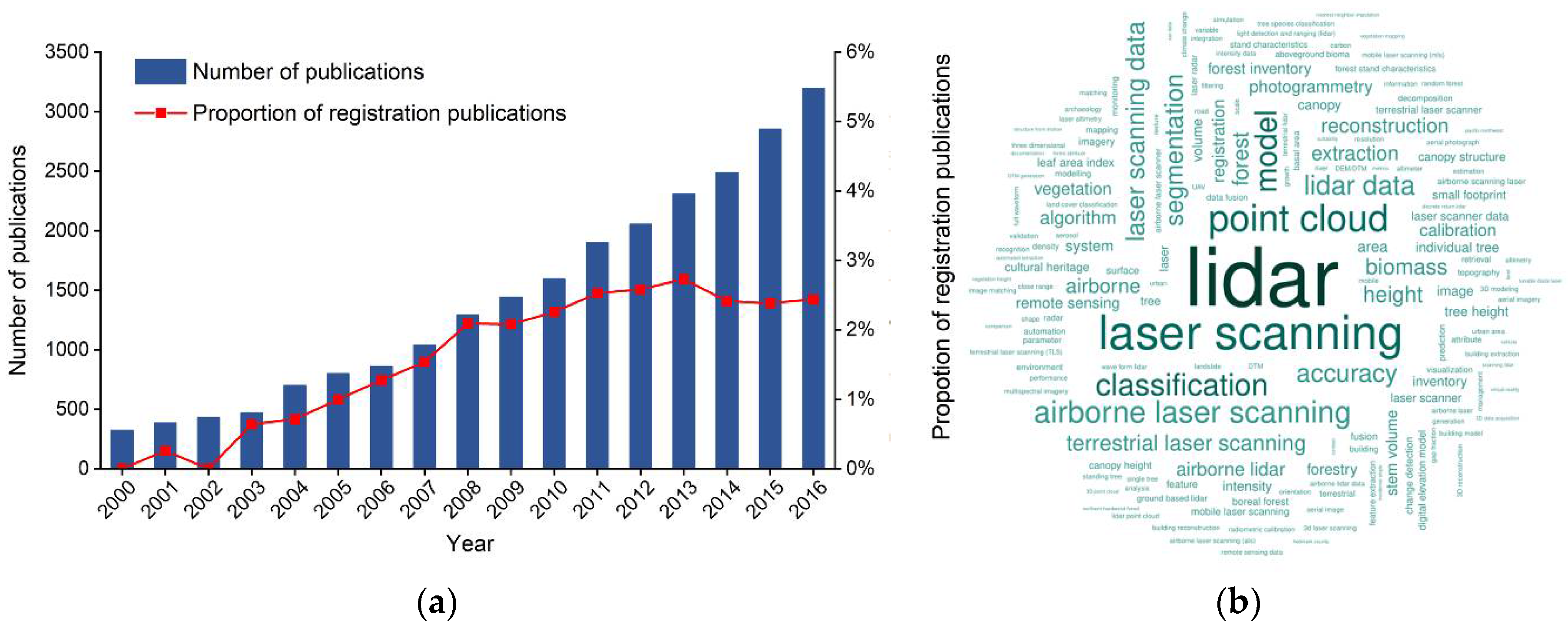
Abstract
Share and Cite
Cheng, L.; Chen, S.; Liu, X.; Xu, H.; Wu, Y.; Li, M.; Chen, Y. Registration of Laser Scanning Point Clouds: A Review. Sensors 2018, 18, 1641. https://doi.org/10.3390/s18051641
Cheng L, Chen S, Liu X, Xu H, Wu Y, Li M, Chen Y. Registration of Laser Scanning Point Clouds: A Review. Sensors. 2018; 18(5):1641. https://doi.org/10.3390/s18051641
Chicago/Turabian StyleCheng, Liang, Song Chen, Xiaoqiang Liu, Hao Xu, Yang Wu, Manchun Li, and Yanming Chen. 2018. "Registration of Laser Scanning Point Clouds: A Review" Sensors 18, no. 5: 1641. https://doi.org/10.3390/s18051641
APA StyleCheng, L., Chen, S., Liu, X., Xu, H., Wu, Y., Li, M., & Chen, Y. (2018). Registration of Laser Scanning Point Clouds: A Review. Sensors, 18(5), 1641. https://doi.org/10.3390/s18051641