Article

Detection of Snow Cover from Historical and Recent AVHHR Data—A Thematic TIMELINE Processor
by
Sebastian Rößler
* and
Andreas J. Dietz
German Remote Sensing Data Center (DFD), Earth Observation Center (EOC), German Aerospace Center (DLR), Oberpfaffenhofen, 82234 Wessling, Germany
*
Author to whom correspondence should be addressed.
Geomatics 2022, 2(1), 144-160; https://doi.org/10.3390/geomatics2010009

Submission received: 12 February 2022 / Revised: 9 March 2022 / Accepted: 17 March 2022 / Published: 18 March 2022

Abstract

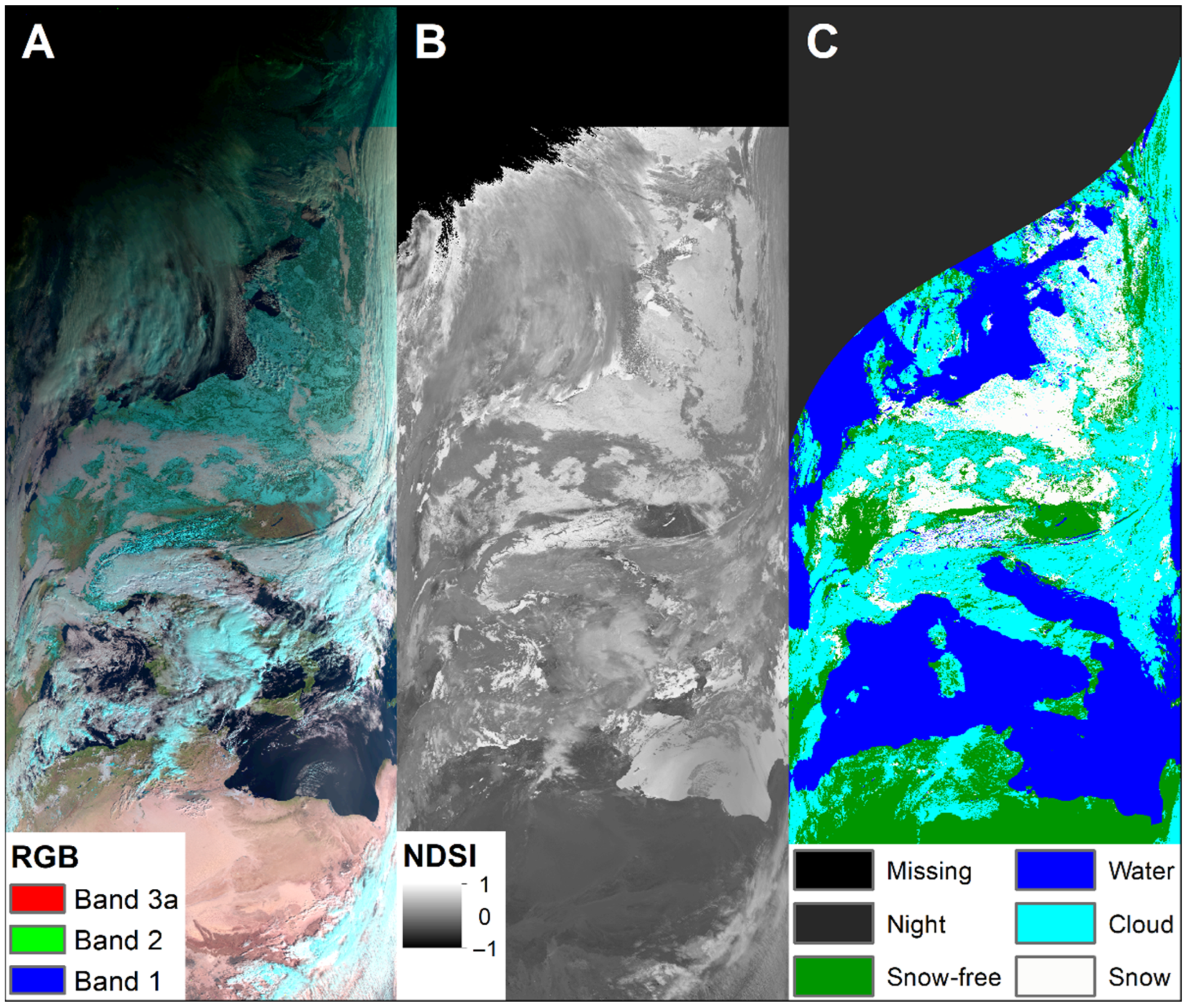
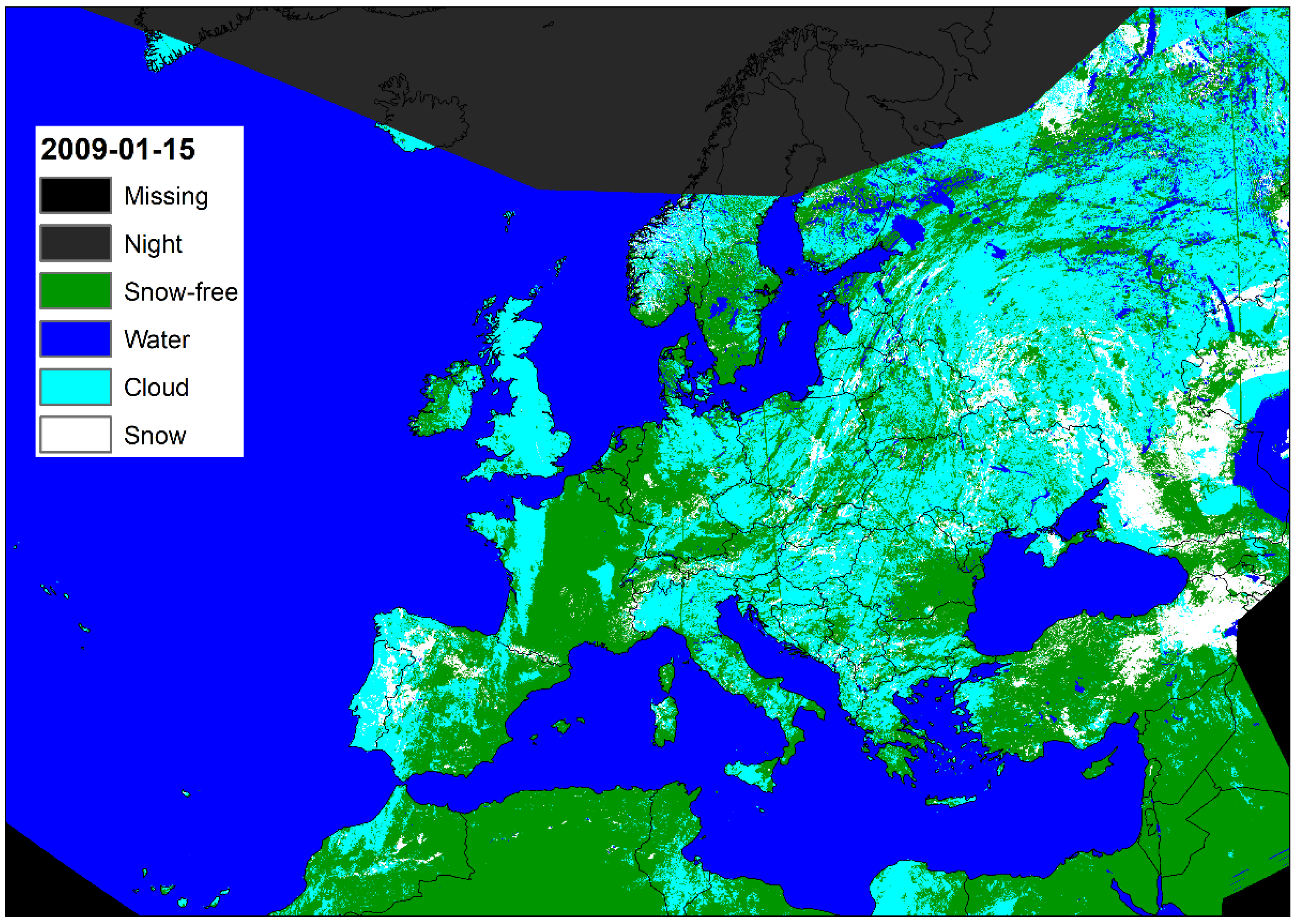
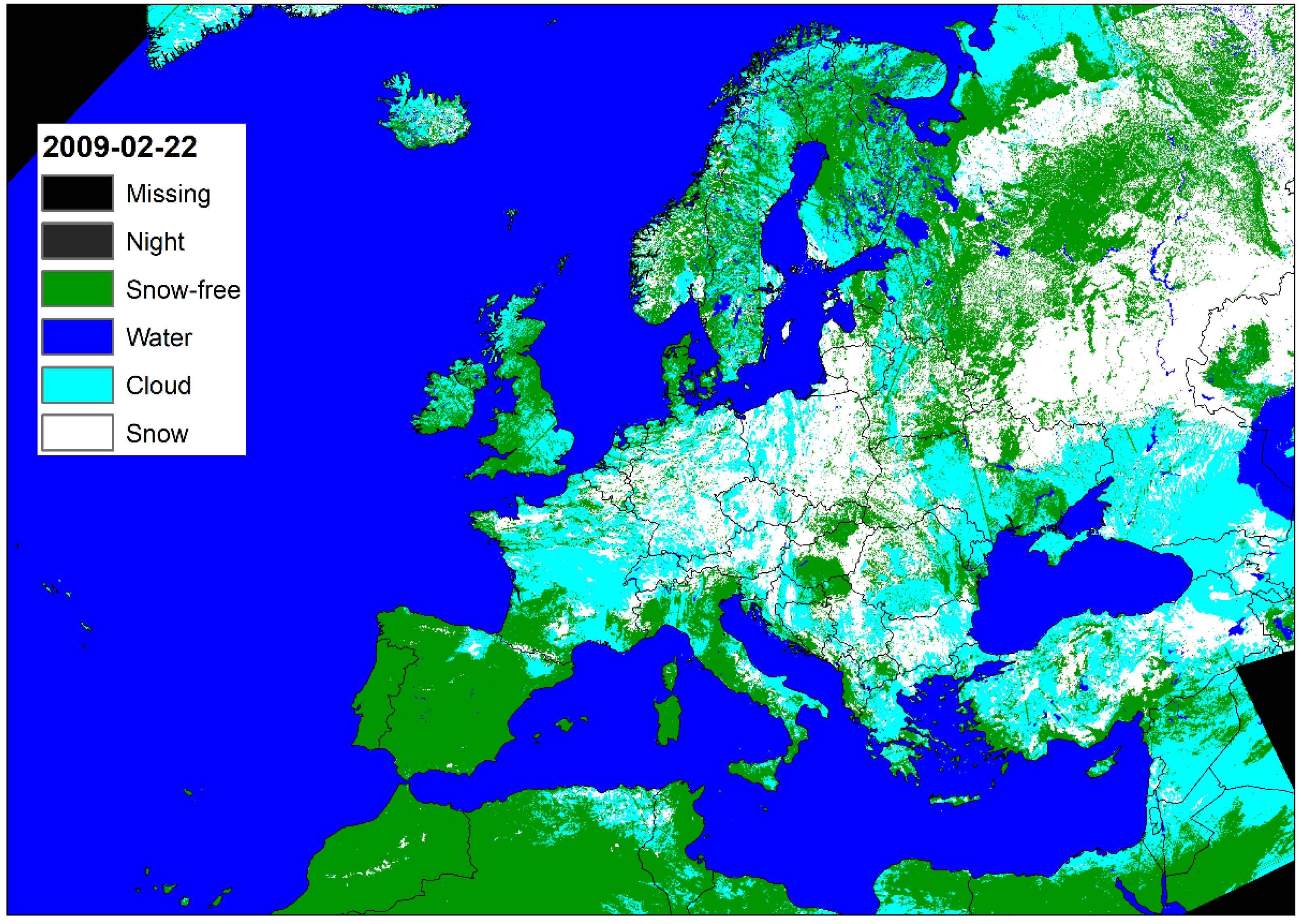
Global snow cover forms the largest and most transient part of the cryosphere in terms of area. On the local and regional scale, small changes can have drastic effects such as floods and droughts, and on the global scale is the planetary albedo. Daily imagery of snow cover forms the basis of long-term observation and analysis, and only optical sensors offer the necessary spatial and temporal resolution to address decadal developments and the impact of climate change on snow availability. The MODIS sensors have been providing this daily information since 2000; before that, only the Advanced Very High-Resolution Radiometer (AVHRR) from the National Oceanographic and Atmospheric Administration (NOAA) was suitable. In the TIMELINE project of the German Aerospace Center, the historic AVHRR archive in HRPT (High Resolution Picture Transmission) format is processed for the European area and, among other processors, one output is the thematic product ‘snow cover’ that will be made available in 1 km resolution since 1981. The snow detection is based on the Normalized Difference Snow Index (NDSI), which enables a direct comparison with the MODIS snow product. In addition to the NDSI, ERA5 re-analysis data on the skin temperature and other level 2 TIMELINE products are included in the generation of the binary snow mask. The AVHRR orbit segments are projected from the swath projection into LAEA Europe, aggregated into daily coverages, and from this, the 10-day and monthly snow covers are finally calculated. In this publication, the snow cover algorithm is presented, as well as the results of the first validations and possible applications of the final product.
Keywords: TIMELINE; AVHRR; snow cover; Europe; NDSI; ERA5; automatic processor TIMELINE; AVHRR; snow cover; Europe; NDSI; ERA5; automatic processor