
Refining IKONOS DEM for Dehradun Region Using Photogrammetry Based DEM Editing Methods, Orthoimage Generation and Quality Assessment of Cartosat-1 DEM †


Abstract
1. Introduction
2. Material and Methods
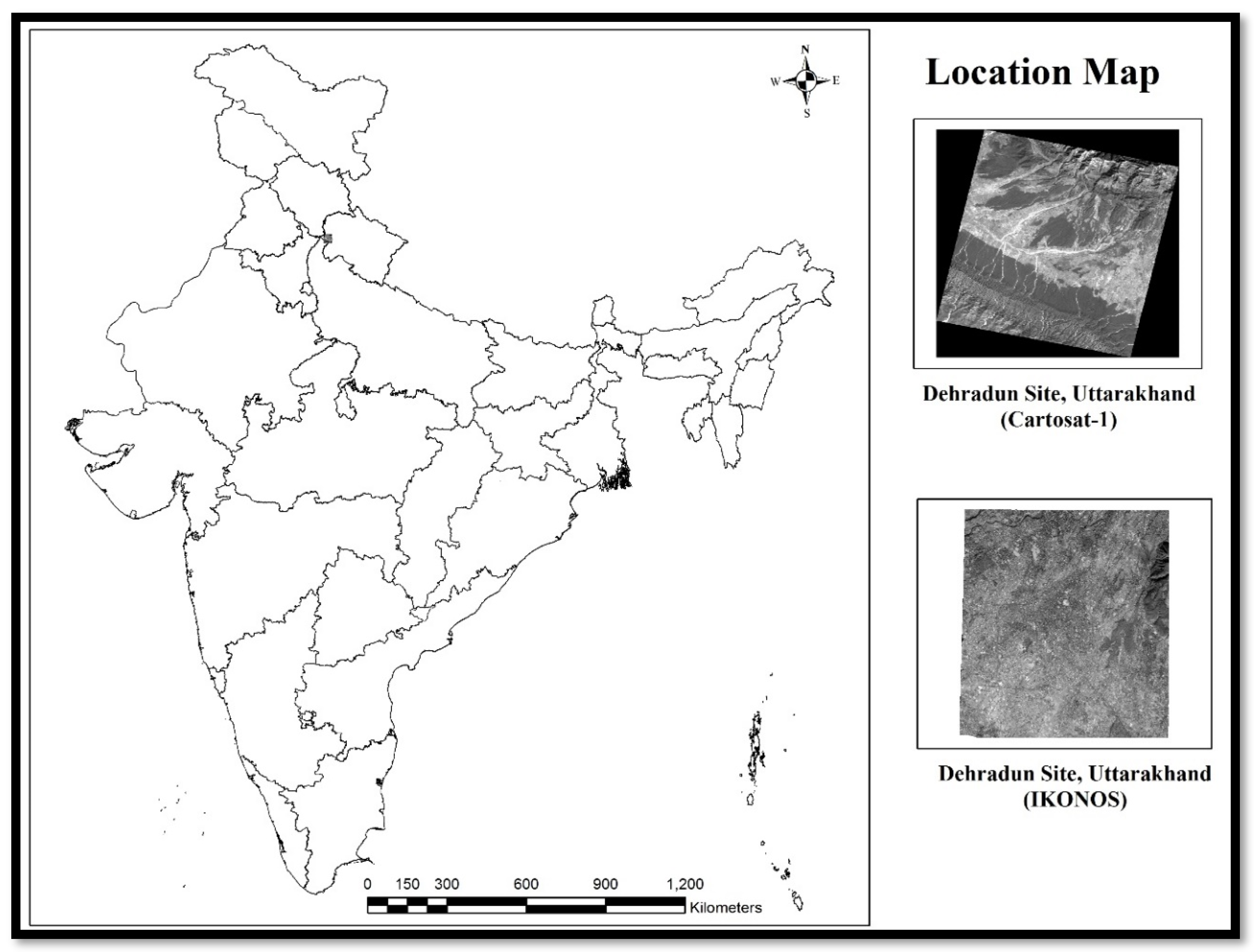
2.1. Study Area
2.2. Data Used
2.2.1. IKONOS-2 Geo Stereo
2.2.2. Cartosat-1 Stereopair
2.3. Toposheets
2.4. GPS Data
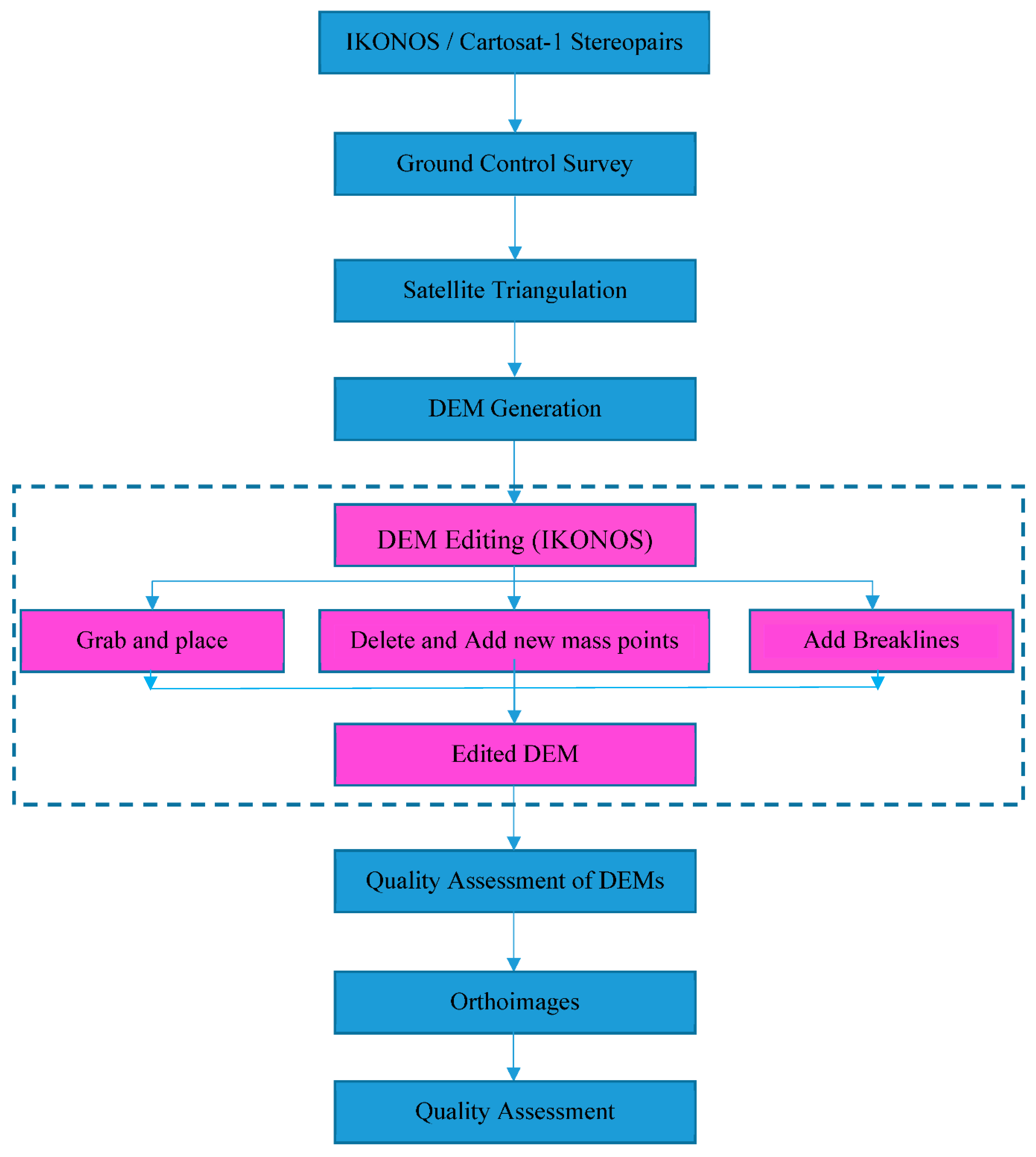
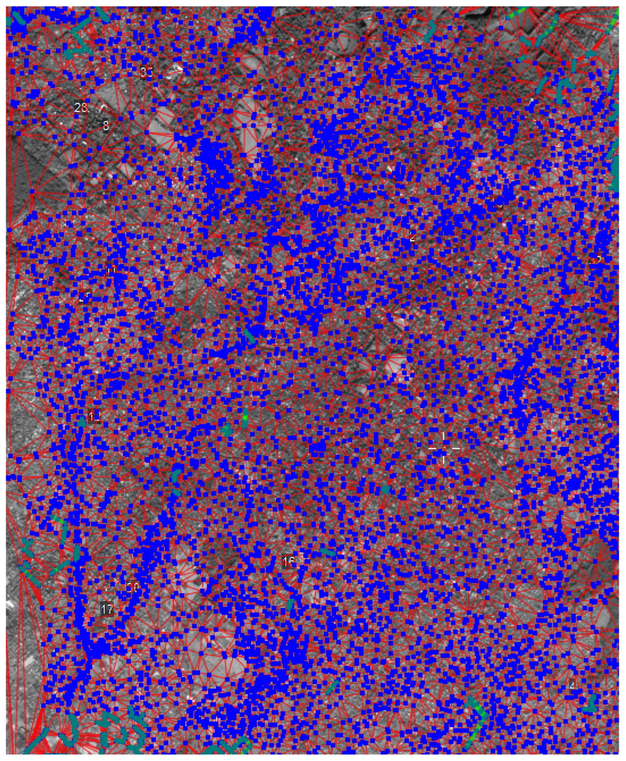
3. Methodology
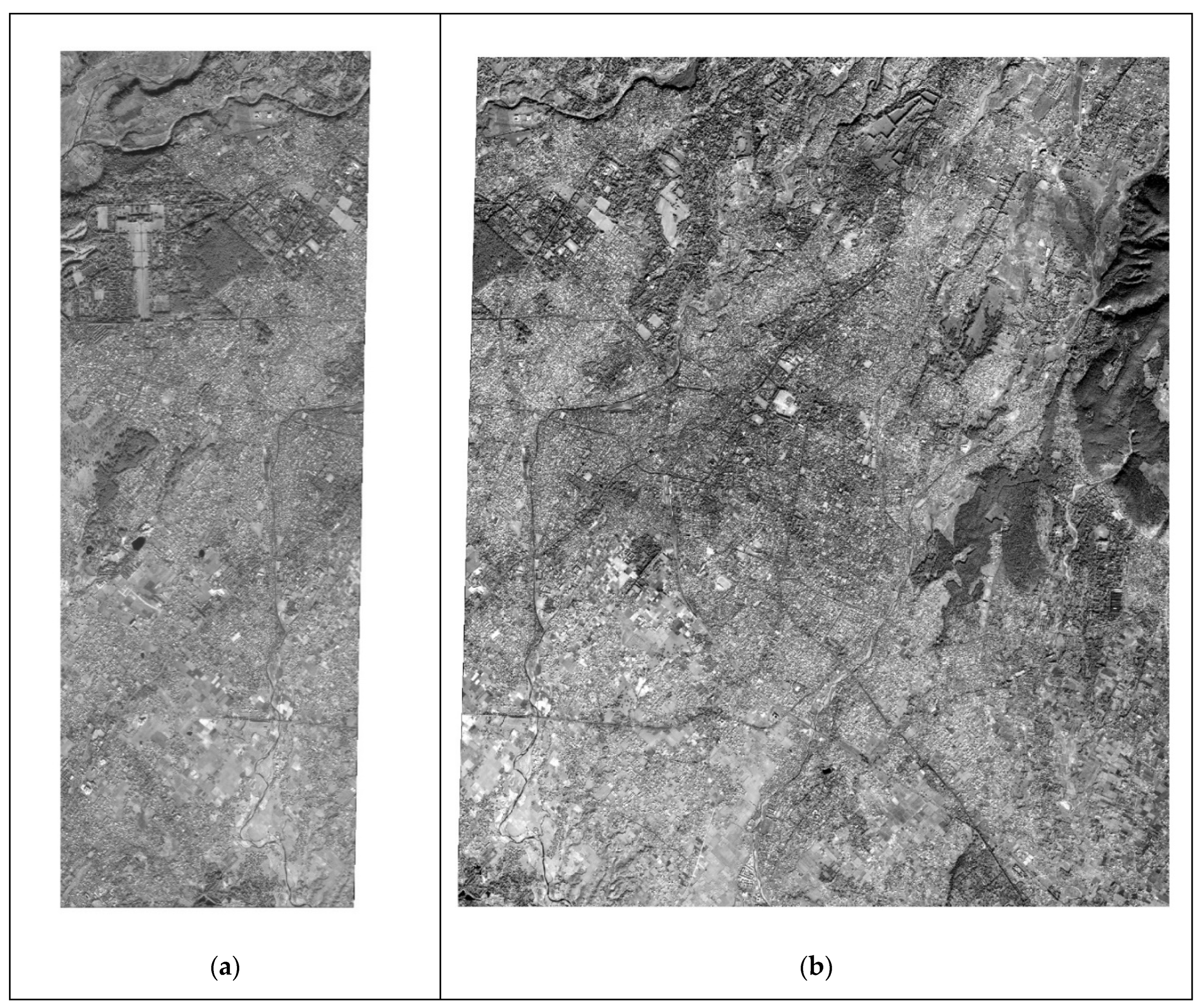
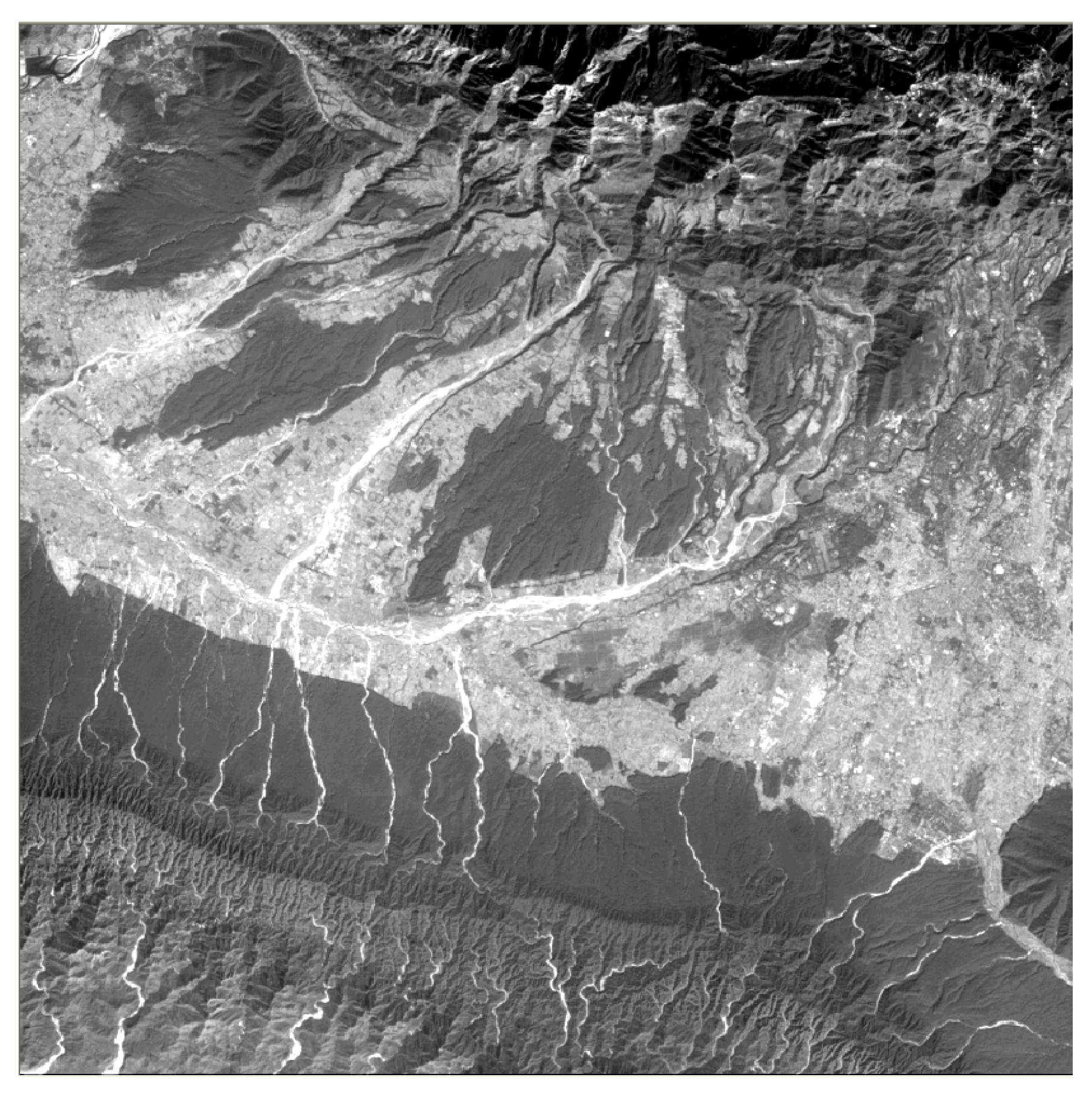
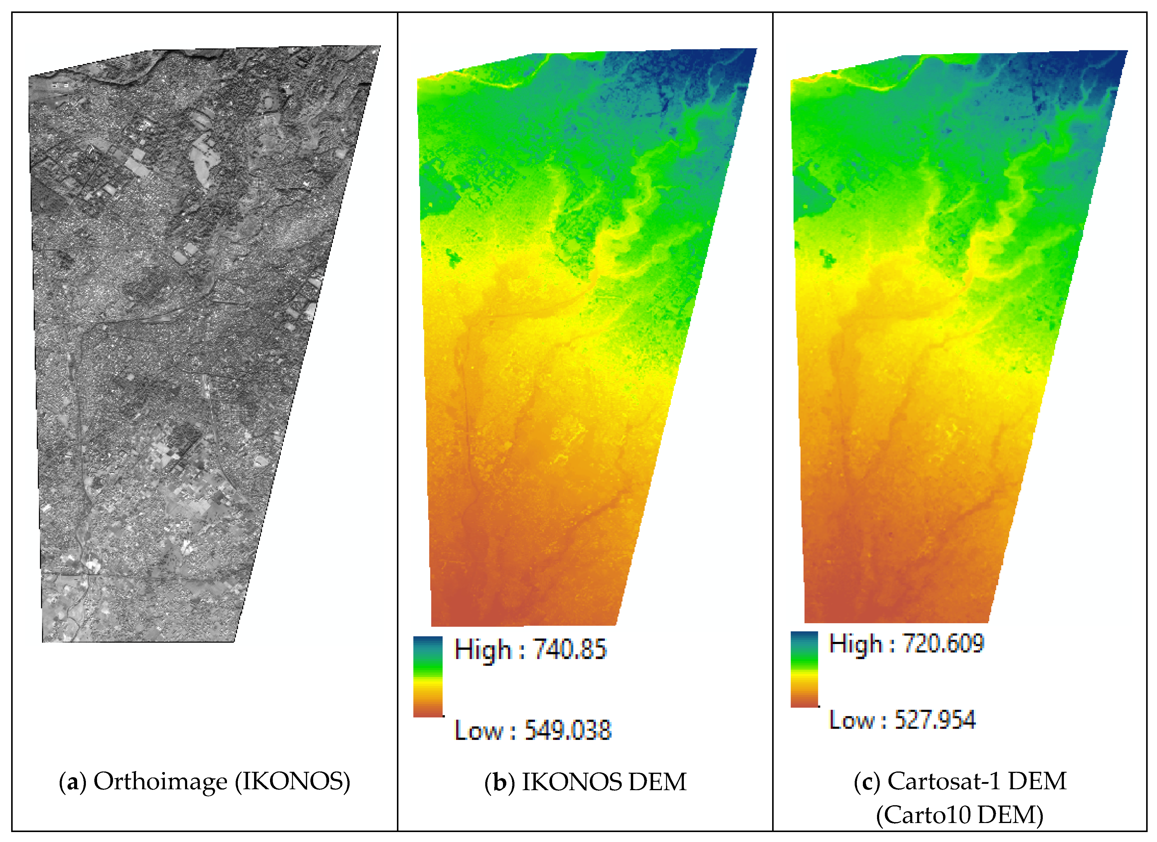
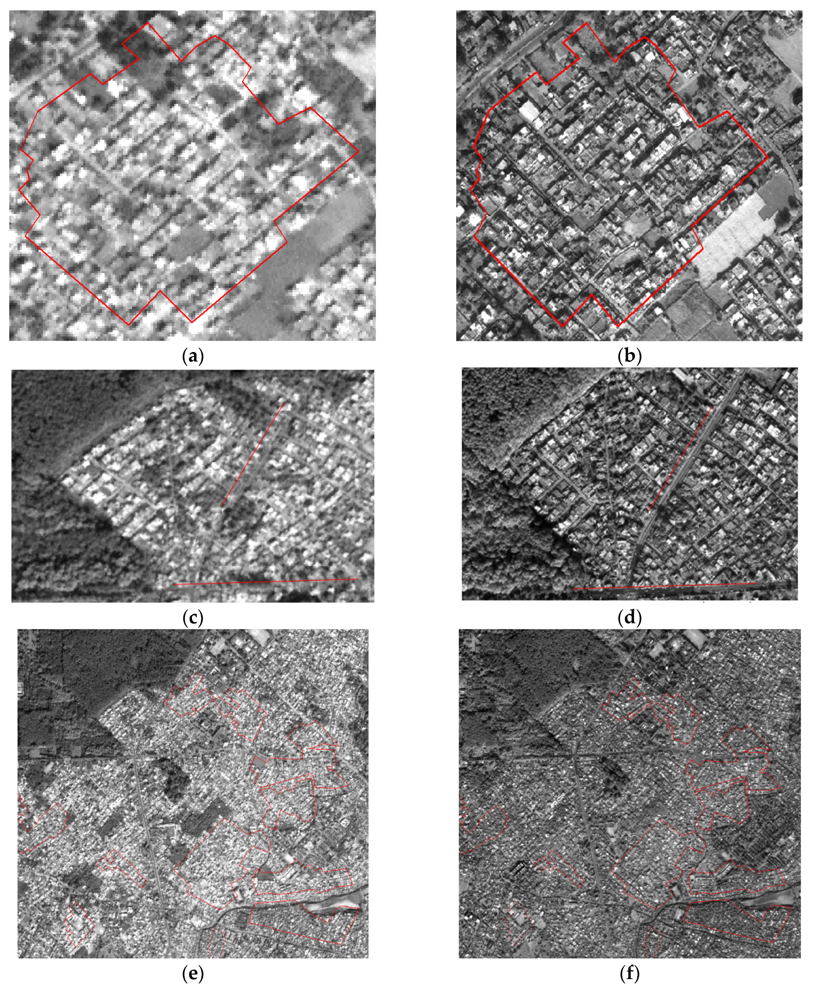
4. Results and Discussion
5. Conclusions
Author Contributions
Acknowledgments
Conflicts of Interest
References
- Lillesand, T.M.; Kiefer, R.W.; Chipman, J.W. Remote Sensing and Image Interpretation; Wiley: Hoboken, NJ, USA, 2014. [Google Scholar]
- Höhle, J.; Potuckova, M. Assessment of the Quality of Digital Terrain Models. Eur. Spat. Data Res. 2011, 60, 91. [Google Scholar]
- Wilson, J.P.; Gallant, J.C. Terrain Analysis : Principles and Applications; Wiley: Hoboken, NJ, USA, 2000. [Google Scholar]
- Li, Z.; Zhu, Q.; Gold, C. Digital Terrain Modeling: Principles and Methodology; CRC Press: Boca Raton, FL, USA, 2005. [Google Scholar]
- Sarma, C.P.; Dey, A.; Krishna, A.M. Influence of digital elevation models on the simulation of rainfall-induced landslides in the hillslopes of Guwahati, India. Eng. Geol. 2020, 268, 105523. [Google Scholar] [CrossRef]
- Rahardjo, H.; Ong, T.H.; Rezaur, R.B.; Leong, E.C. Factors Controlling Instability of Homogeneous Soil Slopes under Rainfall. J. Geotech. Geoenviron. Eng. 2007, 133, 1532–1543. [Google Scholar] [CrossRef]
- Mahalingam, R.; Olsen, M.J. Evaluation of the influence of source and spatial resolution of DEMs on derivative products used in landslide mapping. Geomat. Nat. Hazards Risk 2015, 7, 1835–1855. [Google Scholar] [CrossRef]
- Bhardwaj, A.; Chatterjee, R.S.; Jain, K. Assimilation of DEMs generated from optical stereo and InSAR pair through data fusion. Sci. Res. 2013, 1, 39–44. [Google Scholar] [CrossRef][Green Version]
- Bhardwaj, A.; Jain, K.; Chatterjee, R.S. Generation of high-quality digital elevation models by assimilation of remote sensing-based DEMs. J. Appl. Remote Sens. 2019, 13, 044502. [Google Scholar] [CrossRef]
- Deo, R.; Rossi, C.; Eineder, M.; Fritz, T.; Rao, Y.S. Framework for Fusion of Ascending and Descending Pass TanDEM-X Raw DEMs. IEEE J. Sel. Top. Appl. Earth Obs. Remote Sens. 2015, 8, 3347–3355. [Google Scholar] [CrossRef]
- Robinson, N.; Regetz, J.; Guralnick, R.P. EarthEnv-DEM90: A nearly-global, void-free, multi-scale smoothed, 90 m digital elevation model from fused ASTER and SRTM data. ISPRS J. Photogramm. Remote. Sens. 2014, 87, 57–67. [Google Scholar] [CrossRef]
- Yamazaki, D.; Ikeshima, D.; Sosa, J.; Bates, P.D.; Allen, G.H.; Pavelsky, T.M. MERIT Hydro: A High-Resolution Global Hydrography Map Based on Latest Topography Dataset. Water Resour. Res. 2019, 55, 5053–5073. [Google Scholar] [CrossRef]
- Papasaika, H.; Poli, D.; Baltsavias, E. A framework for the fusion of digital elevation models. Int. Arch. Photogramm. Remote Sens. Spat. Inf. Sci. 2008, XXXVII, 811–818. [Google Scholar]
- Yamazaki, D.; Ikeshima, D.; Tawatari, R.; Yamaguchi, T.; O’Loughlin, F.; Neal, J.C.; Sampson, C.C.; Kanae, S.; Bates, P.B. A high-accuracy map of global terrain elevations. Geophys. Res. Lett. 2017, 44, 5844–5853. [Google Scholar] [CrossRef]
- Betts, H.D.; DeRose, R.C. Digital elevation models as a tool for monitoring and measuring gully erosion. Int. J. Appl. Earth Obs. Geoinf. 1999, 1, 91–101. [Google Scholar]
- Saksena, S.; Merwade, V. Incorporating the effect of DEM resolution and accuracy for improved flood inundation mapping. J. Hydrol. 2015, 530, 180–194. [Google Scholar] [CrossRef]
- Leitão, J.; De Sousa, L. Towards the optimal fusion of high-resolution Digital Elevation Models for detailed urban flood assessment. J. Hydrol. 2018, 561, 651–661. [Google Scholar] [CrossRef]
- Jensen, J.R. Issues involving the creation of digital elevation models and terrain corrected orthoimagery using soft-copy photogrammetry. Geocarto Int. 1995, 10, 5–21. [Google Scholar] [CrossRef]
- Roy, P.S.; Kushwaha, S.P.S.; Murthy, M.S.R.; Roy, A.; Kushwaha, D.; Reddy, C.S.; Behera, M.D.; Mathur, V.B.; Padalia, H.; Saran, S.; et al. Biodiversity Characterization at Landscape Level: National Assessment; Indian Institute of Remote Sensing: Dehradun, India, 2012. [Google Scholar]
- Dowman, I.J.; Jacobsen, K.; Konecny, G.; Sandau, R. High Resolution Optical Satellite Imagery; Whittles Publishing: Caithness, UK, 2012. [Google Scholar]
- Jacobsen, I. Geometric potential of IKONOS- and QuickBird-images. Photogramm. Week 2003, 101–110. [Google Scholar]
- NRSA Data Center. CARTOSAT-1 Data User’s Handbook; NRSA Data Center: Hyderabad, India, 2006. [Google Scholar]
- Bhardwaj, A. Assimilation of Digital Elevation Models Generated from Microwave and Optical Remote Sensing Data; Indian Institute of Technology Roorkee: Roorkee, Uttarakhand, India, 2018. [Google Scholar]
- Bhardwaj, A. Assessment of Vertical Accuracy for TanDEM-X 90 m DEMs in Plain, Moderate, and Rugged Terrain. Proceedings 2019, 24, 8. [Google Scholar]


| Product | Specifications |
|---|---|
| Altitude | 681 km |
| Orbit | Sun-synchronous orbit |
| Nodal crossing | 10:30 a.m. |
| Spectral range | 450–900 nm |
| Dynamic range | 11 bits per pixel |
| Swath | 11.3 km (at nadir) |
| Slew rate | 10 s to slew 200 km |
| Data acquisition | 51 × 112 km maximum mono collection per pass (5 strips) 11 × 120 km maximum stereo collection per pass (1 pair) |
| Datum | WGS84 |
| Ellipsoid | WGS84 |
| Study Area | Dehradun Site | |
|---|---|---|
| Imaging mode | Stereo | Stereo |
| Processing level | STD (Standard Geometrically Corrected) | |
| Product ID | 065121300101 | 065121300102 |
| Product type | Orthokit | Orthokit |
| Image format | GeoTIFF | GeoTIFF |
| Date of acquisition | 05 Feb.2006 | 05 Feb.2006 |
| Image type (sensor) | PAN | PAN |
| Time | 05:34:44:1560 | 05:35:36:2857 |
| Orbit number | 4091 | 4091 |
| Stereo position | FORE | AFT |
| Path-row | 0526–0258 | 0526–0258 |
| SceneCenterLat | 30.35142241 | 30.35141408 |
| SceneCenterLon | 77.91655232 | 77.91245328 |
| Swath | 30 km | |
| Dynamic range | 10 bits | |
| Ellipsoid | WGS84 | |
| Datum | WGS84 | |
| Interpolation method | Cubic convolution | |
Publisher’s Note: MDPI stays neutral with regard to jurisdictional claims in published maps and institutional affiliations. |
© 2020 by the authors. Licensee MDPI, Basel, Switzerland. This article is an open access article distributed under the terms and conditions of the Creative Commons Attribution (CC BY) license (https://creativecommons.org/licenses/by/4.0/).
Share and Cite
Bhardwaj, A.; Jain, K.; Chatterjee, R.S. Refining IKONOS DEM for Dehradun Region Using Photogrammetry Based DEM Editing Methods, Orthoimage Generation and Quality Assessment of Cartosat-1 DEM. Environ. Sci. Proc. 2021, 5, 3. https://doi.org/10.3390/IECG2020-06966
Bhardwaj A, Jain K, Chatterjee RS. Refining IKONOS DEM for Dehradun Region Using Photogrammetry Based DEM Editing Methods, Orthoimage Generation and Quality Assessment of Cartosat-1 DEM. Environmental Sciences Proceedings. 2021; 5(1):3. https://doi.org/10.3390/IECG2020-06966
Chicago/Turabian StyleBhardwaj, Ashutosh, Kamal Jain, and Rajat Subhra Chatterjee. 2021. "Refining IKONOS DEM for Dehradun Region Using Photogrammetry Based DEM Editing Methods, Orthoimage Generation and Quality Assessment of Cartosat-1 DEM" Environmental Sciences Proceedings 5, no. 1: 3. https://doi.org/10.3390/IECG2020-06966
APA StyleBhardwaj, A., Jain, K., & Chatterjee, R. S. (2021). Refining IKONOS DEM for Dehradun Region Using Photogrammetry Based DEM Editing Methods, Orthoimage Generation and Quality Assessment of Cartosat-1 DEM. Environmental Sciences Proceedings, 5(1), 3. https://doi.org/10.3390/IECG2020-06966