The Value of Image. The Design of and Data Streams from the Perception by Design †

Abstract
:1. Introduction
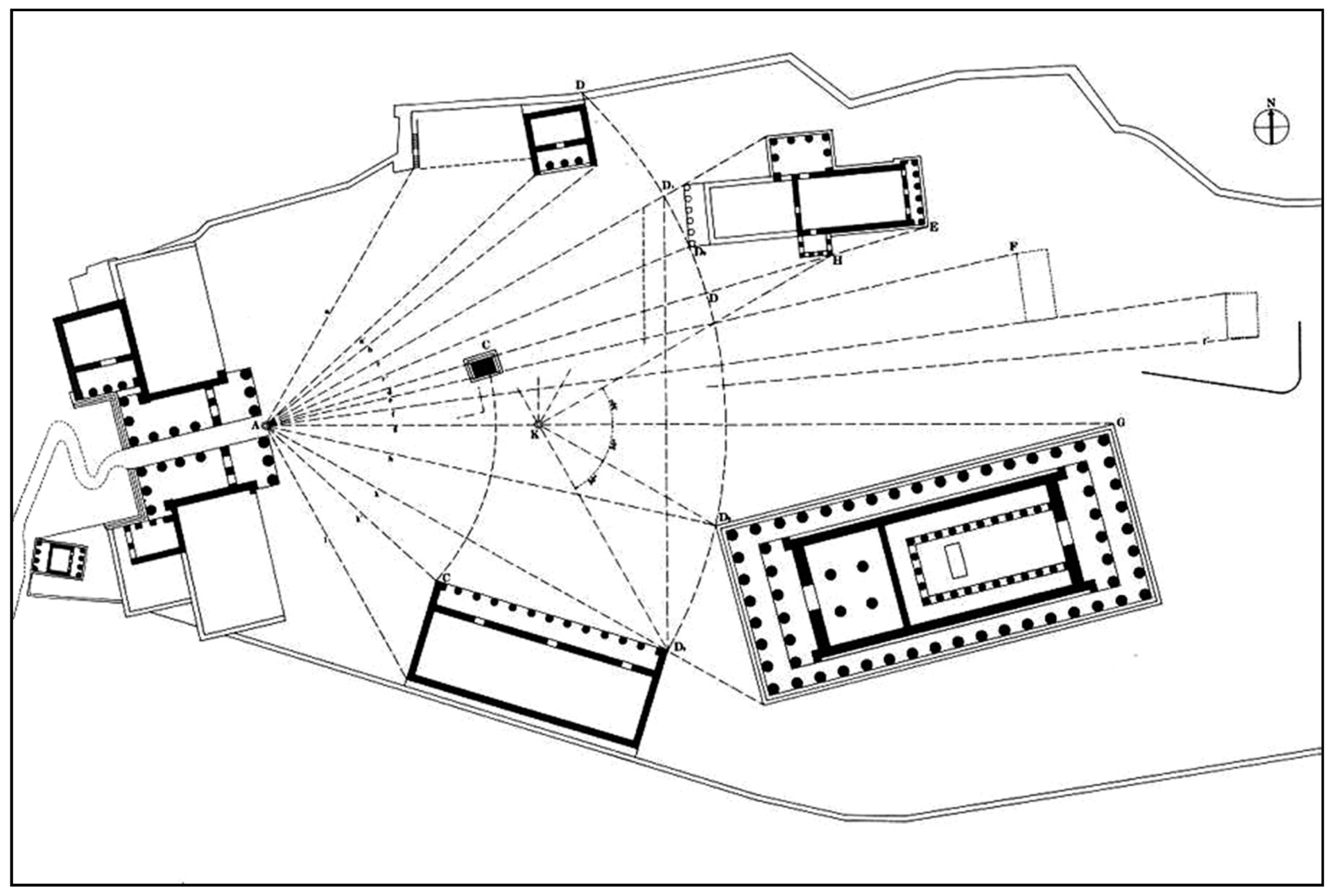
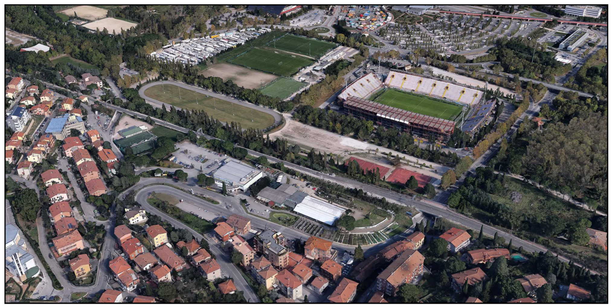
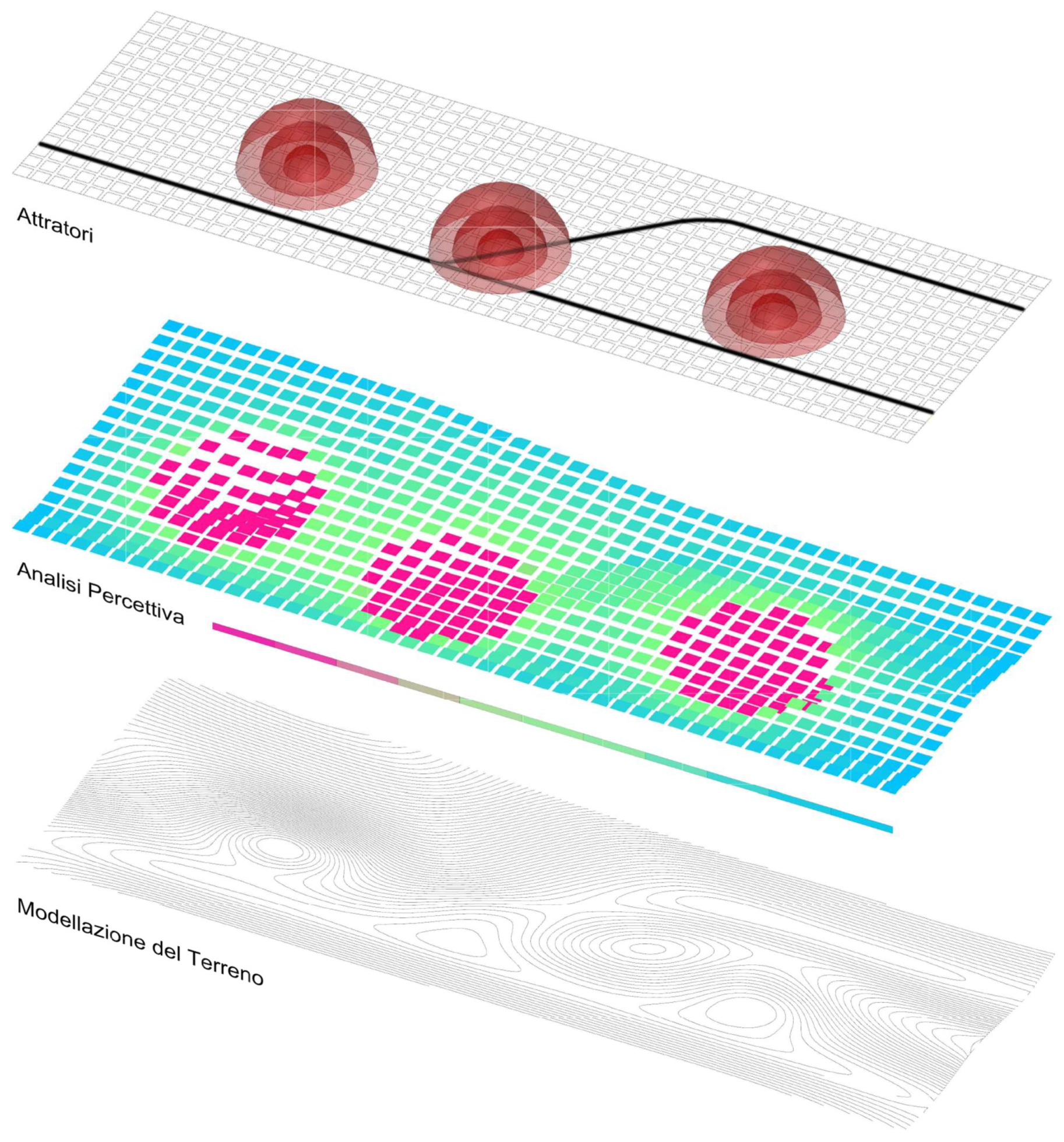
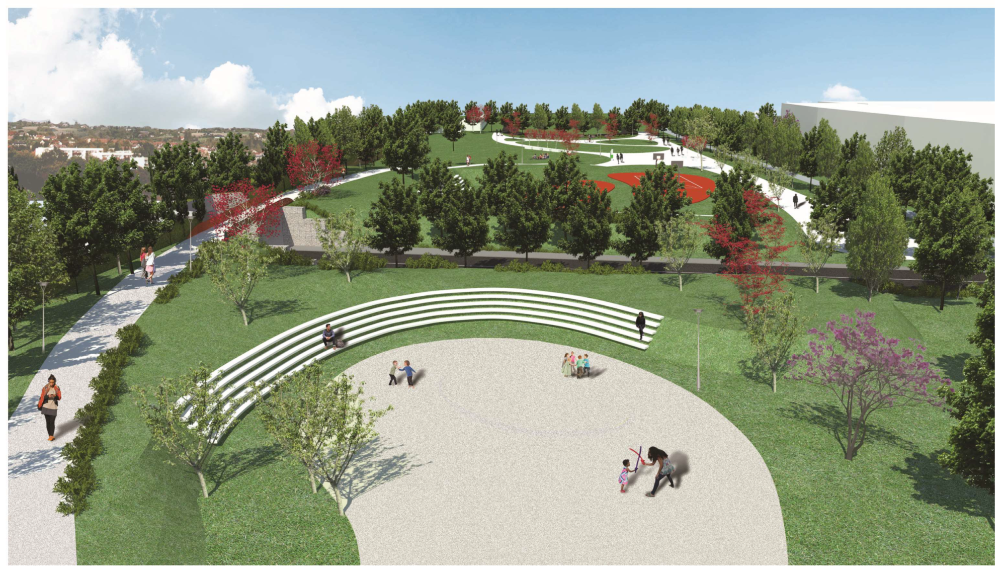
2. Case Study
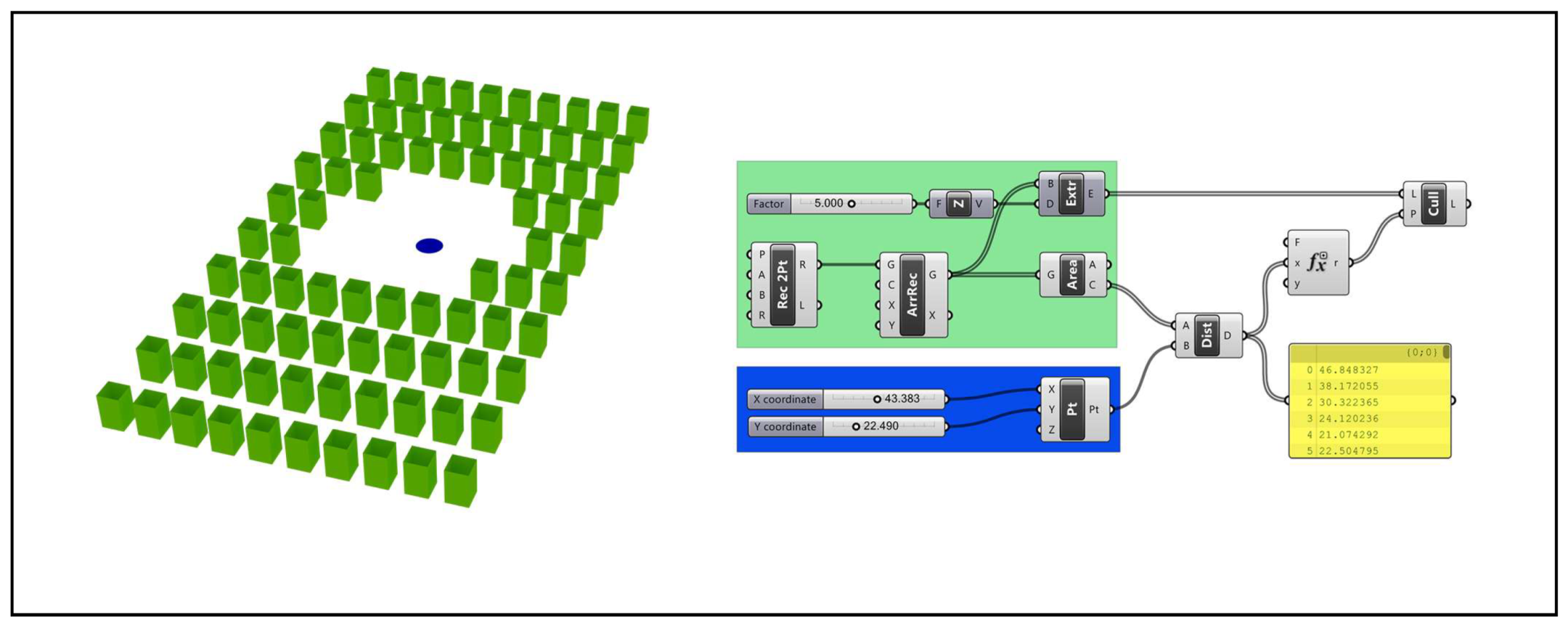
3. Materials and Methods
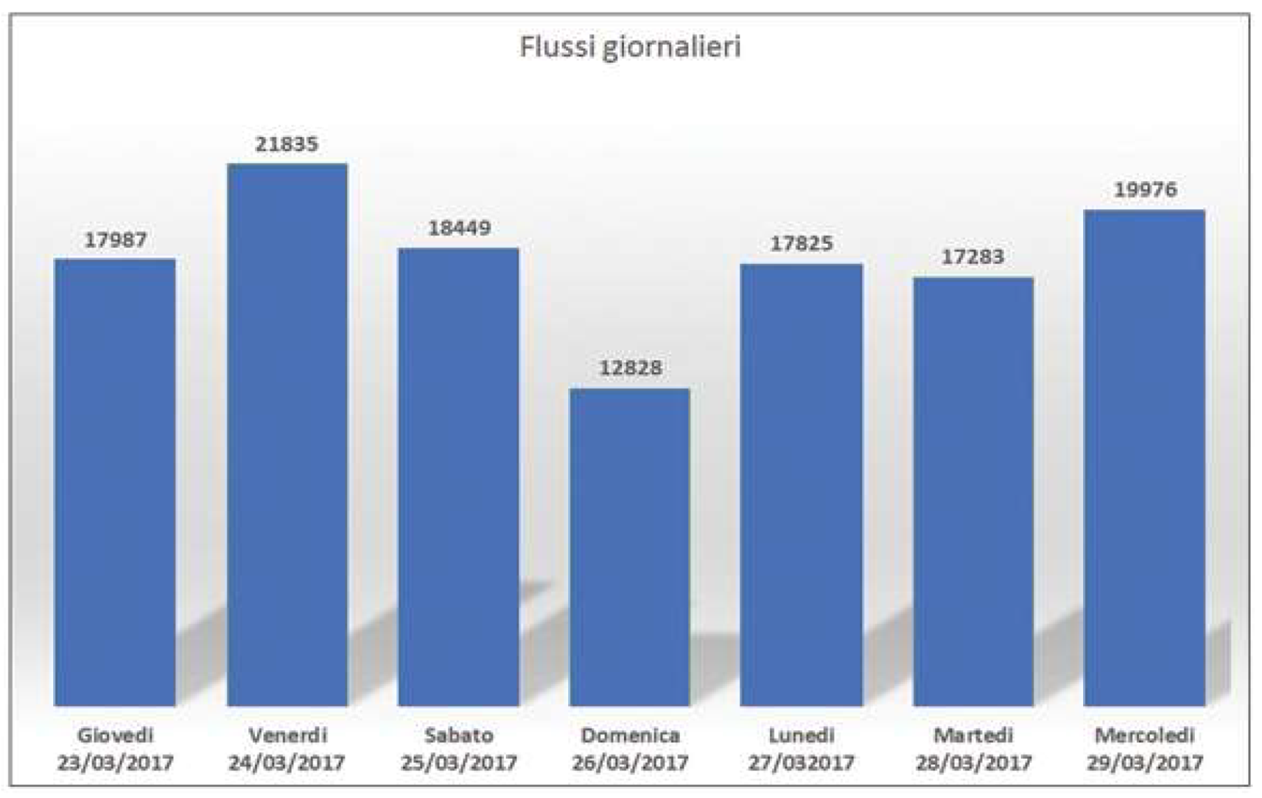
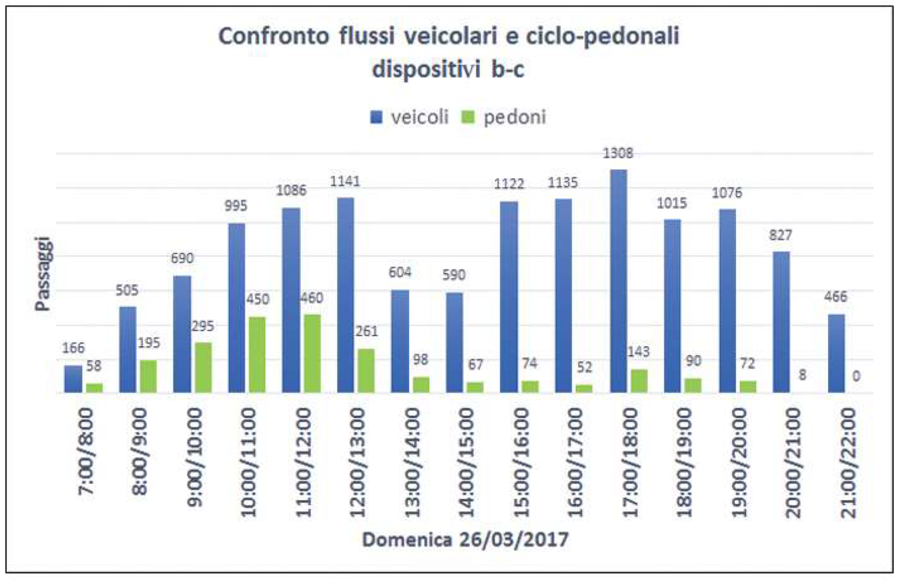
3.1. Finding Participated Data
- the identity, in this issue we wanted to investigate the architectural and functional elements that enhance the individuality of the place, making it recognizable;
- orientation, aimed to identify the sense of orientation/loss that one feels inside the park;
- critical, concern the evaluation of the aspects regarding the usability, the recognizability, accessibility, maintenance, ecology and safety of the area.
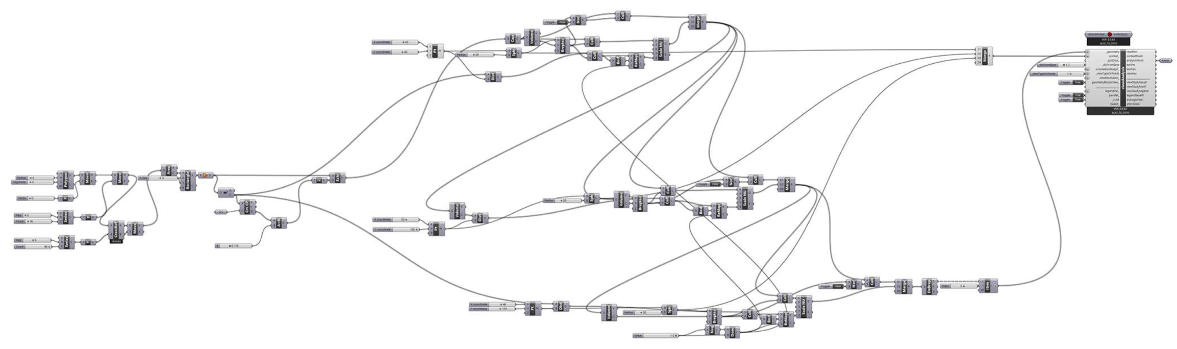
3.2. Project Phase
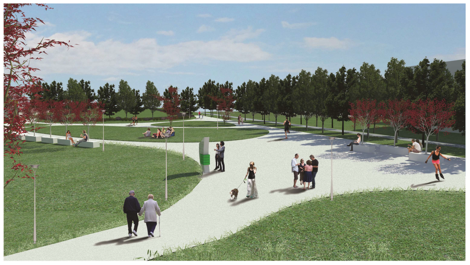
4. Results
Author Contributions
Conflicts of Interest
References and Note
- De Rubertis, R. Il Disegno dell’Architettura; Carocci: Roma, Italia, 2002; p. 11. ISBN 9788843025176. [Google Scholar]
- Coppo, D. Disegno e Immagine Della Città Nell’ottocento; Università Degli Studi di Trieste: Trieste, Italia, 1990. [Google Scholar]
- Rai Cultura Network. Bodei, R. I Sensi Umani. Available online: http://www.filosofia.rai.it/articoli/remo-bodei-i-sensi-umani/4466/default.aspx (accessed on 15 November 2017).
- Arnheim, R. Visual Thinking; University of California Press: Berkeley, CA, USA, 1969; p. 81. ISBN 9780520242265. [Google Scholar]
- Kepes, G. Language of Vision; Paul Theobald: Chicago, IL, USA, 1944; p. 17, ISBNJ: 0-486-28650-9. [Google Scholar]
- Arnheim, R. The Dynamics of Architectural Form; University of California Press: Los Angeles, CA, USA, 1977; p. 128. ISBN 0520035518. [Google Scholar]
- Euclid Incardona, F.; Liquori, A.M.; Giannoli, G.I. (Eds.) Ottica: Immagini di una Teoria Della Visione; Di Renzo: Roma, Italia, 2011; ISBN 9788883232626. [Google Scholar]
- Panofsky, E. Die Perspektive als Symzbolische Form; Teubner: Leipzig-Berlin, Germany, 1927; p. 54. ISBN 9783596147649. [Google Scholar]
- Scully, V. The Earth, the Temple and the Gods: Greek Sacred Architecture; Yale University Press: London, UK, 2013. [Google Scholar]
- Vernant, J.P. Mythe et pensée chez les Grecs. Études de psychologie historique. Revue des Études Anciennes 1966, 68, 158–161. [Google Scholar]
- Farinelli, F. Geografia. Un’introduzione ai Modelli del Mondo; Einaudi: Torino, Italia, 2003; p. 198. ISBN 9788806160203. [Google Scholar]
- Doxiadis, C.; Tyrwhitt, J. Architectural Space in Ancient Greece; Translated and Edited by Jaque-Line Tyrwhitt, J.-L., Ed.; MIT Press: Cambridge, UK, 1972; ISBN 0262540304. [Google Scholar]
- Le Corbusier. Vers une Architecture Éditions Crès; Collection de “L’Esprit Nouveau”: Paris, France, 1923; ISBN 2707304271. [Google Scholar]
- Aristotle De Anima, II. 7 418a27-28.
- Gregoric, P. Aristotle on the Common Sense; Oxford Unversity Press: Oxford, UK, 2007; ISBN 9780191608490. [Google Scholar]
- Boscarol, M.M. Le Dottrine del Colore di Aristotele, in Storia Della Sensazione del Colore. Available online: http://www.boscarol.com/ (accessed on 15 November 2017).
- Alexander, C. Notes on the Synthesis of Urban Form; Basic Books: Milan, Italy, 1964; p. 194. ISBN 0674627512. [Google Scholar]
- Beghini, A. Il Concetto di Spazio, Nuovadidattica, 2011; p. 11. Available online: https://www.nuovadidattica.net/didattica/pdf_didattica/spaziobeghini.html (accessed on 15 November 2017).
- Lynch, K.; Rodwin, L. A Theory of urban form. Ekistics 1959, 7, 479–486. [Google Scholar]
- Lynch, K. The Image of the City; Harvard-MIT Joint Center for Urban Studies Series: Boston, MA, USA, 1960; ISBN 9780262620017. [Google Scholar]
- Barthes, R. Semiologia e urbanistica. Op. Cit. 1967, 9, 13. [Google Scholar]
- Panofsky, E. Meaning in the Visual Arts; Anchor Books: New York, NY, USA, 1955; ISBN 9780226645513. [Google Scholar]
- Bitti, V. La città non si dissolve nell’aria: Metafore urbane e nuovi media. In È Successo Qualcosa Alla Città; Manuale di Antropologia Urbana, Donzelli: Roma, Italy, 2010; ISBN 9788860364623. [Google Scholar]
- Bigi, N. Because Lynch is still relevant. Dialoghi Internazionali 2011, 16, 119–121. [Google Scholar]
- Bianconi, F.; Filippucci, M. Monumenti della modernità. Infrastrutture e paesaggio nell’Umbria del XX secolo. AID MONUMENTS. Conoscere progettare ricostruire. In Proceedings of the AID MONUMENTS. 1st International Conference on Architecture and Engineering for the Defense of the Monuments, Conforti, C., Gusella, V., Eds. Arachne: Rome, Italy, 2014; Volume I, pp. 252–259, ISBN 978-88-548-6506-8. [Google Scholar]
- Battista, C. Frammentazione Ambientale, Connettività, Reti Ecologiche. Un Contributo Teorico e Metodologico con Particolare Riferimento Alla Fauna Selvatica; Assessorato Alle Politiche Ambientali, Agricoltura e Protezione Civile: Roma, Italia, 2004; ISBN 8890029765. [Google Scholar]
- De Rubertis, R.; Soletti, A. De Vulgari Architectura. Indagine Sui Luoghi Urbani Irrisolti; Officina: Roma, Italy, 2000; ISBN 10: 8887570027. [Google Scholar]
- De Rubertis, R. La Città rimossa. Strumenti e Criteri per L’indagine e la Riqualificazione dei Margini Urbani Degradati; Officina: Roma, Italia, 2002; ISBN 13: 9788887570441. [Google Scholar]
- Clément, G. Manifeste du Tiers Paysage; Éditions Sujet/Objet: Paris, France, 2004; ISBN 2845342365. [Google Scholar]
- Brown, J.; Mitchell, N.; Beresford, M. Protected landscapes: A conservation approach that links nature, culture and community. In The Protected Landscape Approach: Linking Nature, Culture and Community; Brown, J., Mitchell, N., Beresford, M., Eds.; GInternational Union for Conservation of Nature: Gland, Switzerland; Cambridge, UK, 2005; pp. 3–18. ISBN 9782831707976. [Google Scholar]
- De Fiore, G. Appunti di Viaggio, in Immagine Della Città Europea; Volta, V., Ed.; Tamellini: Legnago, Italy, 2005. [Google Scholar]
- Farina, A. The cultural landscape as a model for the integration of ecology and economics. Bioscience 2000, 50, 313–320. [Google Scholar] [CrossRef]
- Buzan, T. Le Mappe Mentali e le Relazioni Personali; Frassinelli: Milano, Italy, 2008; ISBN 9788876848520. [Google Scholar]
- Tedeschi, A. Aad_Algorithms Aided Design, Parametric Strategies Using Grasshopper, 1st ed.; Editions Le Penseur: Brienza, Italy, 2014; ISBN 978-88-95315-30-0. [Google Scholar]


Publisher’s Note: MDPI stays neutral with regard to jurisdictional claims in published maps and institutional affiliations. |
© 2017 by the authors. Licensee MDPI, Basel, Switzerland. This article is an open access article distributed under the terms and conditions of the Creative Commons Attribution (CC BY) license (https://creativecommons.org/licenses/by/4.0/).
Share and Cite
Bianconi, F.; Buffi, A.; Calabrò, M.P.; Filippucci, M. The Value of Image. The Design of and Data Streams from the Perception by Design. Proceedings 2017, 1, 933. https://doi.org/10.3390/proceedings1090933
Bianconi F, Buffi A, Calabrò MP, Filippucci M. The Value of Image. The Design of and Data Streams from the Perception by Design. Proceedings. 2017; 1(9):933. https://doi.org/10.3390/proceedings1090933
Chicago/Turabian StyleBianconi, Fabio, Alessandro Buffi, Maria Pia Calabrò, and Marco Filippucci. 2017. "The Value of Image. The Design of and Data Streams from the Perception by Design" Proceedings 1, no. 9: 933. https://doi.org/10.3390/proceedings1090933
APA StyleBianconi, F., Buffi, A., Calabrò, M. P., & Filippucci, M. (2017). The Value of Image. The Design of and Data Streams from the Perception by Design. Proceedings, 1(9), 933. https://doi.org/10.3390/proceedings1090933