


Abstract
This article proposes a multi-agent path planning and decision-making solution for high-tempo field robotic operations, such as search-and-rescue, in large-scale unstructured environments. As a representative example, the subterranean environments can span many kilometers and are loaded with challenges such as limited to no communication, hazardous terrain, blocked passages due to collapses, and vertical structures. The time-sensitive nature of these operations inherently requires solutions that are reliably deployable in practice. Moreover, a human-supervised multi-robot team is required to ensure that mobility and cognitive capabilities of various agents are leveraged for efficiency of the mission. Therefore, this article attempts to propose a solution that is suited for both air and ground vehicles and is adapted well for information sharing between different agents. This article first details a sampling-based autonomous exploration solution that brings significant improvements with respect to the current state of the art. These improvements include relying on an occupancy grid-based sample-and-project solution to terrain assessment and formulating the solution-search problem as a constraint-satisfaction problem to further enhance the computational efficiency of the planner. In addition, the demonstration of the exploration planner by team MARBLE at the DARPA Subterranean Challenge finals is presented. The inevitable interaction of heterogeneous autonomous robots with human operators demands the use of common semantics for reasoning across the robot and human teams making use of different geometric map capabilities suited for their mobility and computational resources. To this end, the path planner is further extended to include semantic mapping and decision-making into the framework. Firstly, the proposed solution generates a semantic map of the exploration environment by labeling position history of a robot in the form of probability distributions of observations. The semantic reasoning solution uses higher-level cues from a semantic map in order to bias exploration behaviors toward a semantic of interest. This objective is achieved by using a particle filter to localize a robot on a given semantic map followed by a Partially Observable Markov Decision Process (POMDP)-based controller to guide the exploration direction of the sampling-based exploration planner. Hence, this article aims to bridge an understanding gap between human and a heterogeneous robotic team not just through a common-sense semantic map transfer among the agents but by also enabling a robot to make use of such information to guide its lower-level reasoning in case such abstract information is transferred to it.
1. Introduction
1.1. Motivation
The past decade has seen significant advancements in robotic exploration solutions for large-scale environments owing to the maturity of certain path-planning solutions such as sampling and graph-based path planners. In a recent attempt to bring together field-robotics researchers in this research area, the DARPA Subterranean (SubT) Challenge [1] aimed at developing robotic solutions to rapidly explore, map, and search austere underground environments. Autonomous underground exploration is critical for obtaining rapid situational awareness and to enhance the accessibility of the environment in disaster situations. The subterranean environments like man-made tunnel systems, natural cave networks, abandoned subway stations, etc., pose significant risk to humans in terms of harsh terrain, poor visibility, extremely narrow passages, intermittent or no communications, and no GPS availability, just to name a few. One prominent example is the Tham Luang cave rescue operation, where 12 soccer players went missing and were eventually rescued after a week from the partially flooded cave, 4 km from the cave’s mouth. Another incident is the Quecreek Mine rescue, where 9 mine workers were trapped underground in the dark for over 77 h until rescued after a challenging rescue operation. Beyond Earth, the subsurface exploration of other planets such as Mars is an active frontier in space exploration. There are 200 lunar and 2000 martian cave-related features reported by the scientific community [2]. Deep planetary caves could be a very likely candidate to harbor life due to their radiation shielding and shielding from cosmic rays. Moreover, exploring these subsurface voids could be a means to knowing the geological history and volcanic processes on other planets. All such applications require autonomy solutions to not only be theoretically sound by themselves but also to be suited for high-tempo operational environments with special focus on limitations and interactions of various components of the overall system.
Path planning is a vital component of a modern autonomous robotic system design. Typically, this component leverages perception information to generate paths in a vehicle’s state space in order to navigate it to parts of an environment that are of interest given a set of mission objectives. The perception information can be obtained as raw or processed sensor data such as occupancy grid, distance field, pointcloud, semantic map, depth image, etc. In case of a human-supervised heterogeneous team of robots, an ideal solution should not only respect diversity in mobility constraints but also cognitive constraints. In order to reduce workload on supervising humans during high-tempo field-robotics operations, the robotic fleet should be smart enough to carry out a mission autonomously on its own in a coordinated way. In cases where human cognition can improve the mission’s efficiency, the information transfer and utilization should be inclusive of human cognition and workload limitations. To further elaborate, an air vehicle, for instance, can treat any physical object as an obstacle, hence it can rather rely on a distance field mapping solution. In contrast, a ground robot needs a different mapping solution to assess positive and negative terrain obstacles. By bringing a heterogeneous robotic team together with a human in the loop, in addition to inter-robot alignment sensitivity and high communication bandwidth requirements for transfer, a geometric map information quickly becomes unintuitive to supervising humans for large-scale environments to an extent where even setting a 3D goal point on these maps during high-tempo missions is an additional burden on human cognition. This article proposes a sampling-based path-planning solution for a heterogeneous robotic team and builds a semantic reasoning framework in it to enable comprehensive human-supervised autonomy.
1.2. Robotic Exploration Problem
This article, more specifically, deals with the problem of robotic exploration of large-scale unstructured environments with special emphasis on deployability of solutions during high-tempo field operations. This section introduces some of the requirements of this problem inspired by the DARPA Subterranean Challenge. This research assumes that the minimal sensor stack on each of the robots includes a 360° 3D LiDAR and an Inertial Measurement Unit (IMU) for localization and mapping. The primary objective of an exploration problem is to make progress towards the frontiers of an environment map. This map is generated as a robot moves through the environment and can be obtained in various forms such as an occupancy grid, pointcloud, and distance field. Planning paths towards potential map frontiers enables a robot to expand the map in a feedforward fashion. A frontier in this article refers to a point on an explored map such that if occupied by a robot, a sufficient amount of volumetric gain is explored. Volumetric gain is proportional to the number of rays hitting the unexplored areas of a map if these rays are casted from the LiDAR sensor mounted on the robot. Sensors are assumed to be symmetrical; therefore, the volumetric gain is considered agnostic to robot orientation. However, sensor extrinsics relative to the robot are taken into account during ray casting. The concept of frontiers and ray casting for volumetric gain calculation is shown in Figure 1.
Figure 1.
Simplified overview of the exploration problem. The path planner is responsible for planning a path towards a frontier of a known environment map. Ray casting is used to calculate expected volumetric gain of a path. Exploration heading, position histories from teammate robots, and map occupancy are some of the other factors determining the optimality of a candidate path. (a) MARBLE Spot robot autonomously enters an unexplored cavern. (b) After exploring the entire cavern, the robot plans a path towards a long-range frontier so a different environment section can be explored. Encircled frontiers are deemed most useful to explore by the planner in this example.
An important metric for efficient exploration is the amount of map volume explored in a unit of time. A more efficient exploration can be achieved if multiple robots are used to explore non-overlapping sections of an environment. Moreover, if these robots are heterogeneous in nature, the diversity in mobility can be leveraged to further improve the exploration efficiency. An aerial robot, for instance, is better adapted to explore vertical and elevated structures, a legged robot can traverse stairs, and wheeled robots, though most limited in mobility, can carry the most amount of payload of the former two. Therefore, an acceptable exploration solution should be able to handle multiple types of robots. Another important ingredient to a large-scale mission success of this kind is the ability of autonomy algorithms to respect human cognition and feedback in order to communicate and coordinate with supervising humans. Moreover, efforts should be made so that the exploration solution is less needy of communication bandwidth required to carry out multi-agent coordination.
This article aims at proposing an exploration solution that is well suited to be used for coordinated exploration of quadrotor air and wheeled and legged ground vehicles while respecting human cognition and feedback in the loop. Figure 2 shows robots used by the team MARBLE at the DARPA Subterranean Challenge. Emphasis has been put on taking care of the practical limitations such as communication bandwidth constraints, inter-robot map alignment errors, and portability and scalability of the solution. Figure 3 shows a block diagram of system-level integration which fits the solutions proposed in this article. For the higher-level system-integration overview, interested readers are referred to team MARBLE’s previously published articles [3,4].
Figure 2.
Robots in team MARBLE’s fleet for DARPA Subterranean Challenge, Reprinted from refs. [3,4]. The primary sensor suite, common to all robots and relevant to this article, includes a horizontally mounted 3D Ouster OS1 LiDAR and a GX5-15 Lord Microstrain IMU for localization and mapping. The target computer for this article is an Intel NUC 7i7DNBE, which is also present on all robots.
Figure 3.
Block diagram of relevant pieces of team MARBLE’s system integration [3,4]. This article concerns the Motion Planning block (bottom right block) for the MARBLE robot fleet. This implies making use of localization, map, and sensor information combined with information from teammate robots to generate paths for the autonomous exploration problem.
1.3. Existing Literature
Robotics exploration for field applications root primarily from two approaches: frontier-based planning and sampling-based planning. The concept of frontier-based planning was first introduced by Yamauchi et al. [5,6]. In a typical frontier-based approach, an occupancy map is first processed to find the physical boundaries between seen and unseen parts of an environment known as frontiers. In case of an occupancy grid map, this boundary can be obtained in the form of large enough clusters of seen voxels adjacent to unseen voxels. Methods such as the ones proposed in [7,8,9,10] take this idea further, providing some performance comparisons and implementation on MAVs. The approach has been extended to multi-robot exploration as well [11]. Initially, the frontier-based method to exploration has been used to navigate to the nearest frontier, but later works incorporate objectives such as minimizing the velocity change into the problem [12]. While various adaptations of the method exist varying greatly in implementation, there are a few commonly faced challenges with this method. Such an approach often times lacks the distinction between reachable and non-reachable frontiers, until a path is planned toward each of them. Other common challenges faced by such an approach are large solution space and myopic one-step look-ahead decision-making. One of the planners used at the SubT challenge is called TARE [13,14]. The planner follows the frontier-based approach while reducing the computational complexity by proposing a two-tier approach. Dense data is maintained locally to a robot to generate a detailed path, which is appended to a coarse path obtained at the global environment scale. Another exploration solution proposed by a SubT challenge team also follows the concept of computing frontiers [15,16]. The method uses a pointcloud visibility approach [17] to calculate the boundary between known and unknown space. Hybrid A* is used for local planning, while long-distance planning relies on parse topometric graphs. An Occupancy Homogeneous Map is used to compute a height map, which is part of the planner cost function. In order to carry out multi-robot coordination, a multi-agent SLAM solution known as Wildcat SLAM [18] is used by the authors to compute global maps on each of the robots.
A sampling-based approach creates a representation of an environment parallel to the geometric SLAM map. This representation is obtained in the form of a graph by sampling the environment [19,20]. The frontiers in this approach are typically the graph vertices that are close to the boundary between seen and unseen parts of the environment. Sampling allows us to obtain a discrete set of paths to choose from, and the path that best satisfies the pre-set exploration objective is the solution to the path-planning problem. These approaches are better suited to plug-n-play different objectives and objectives formulations, which makes the solution search conveniently portable without needing to modify the underlying search algorithm [21]. Since a sampling-based approach provides a finite set of potential paths to choose from, optimization constraints are also easier to impose compared with a frontier-based method, which optimizes over a significantly large solution space. In this article, we leverage this fact extensively to improve the scalability of the planner. Reference [22] introduces the concept of Next-Best-View (NBV) planning, where a series of covering views are calculated to improve the coverage of an unknown environment. The concept is extended to the indoor exploration problem by [19], which uses Rapidly Exploring Random Trees (RRTs) to sample the environment and follow an optimal path in a receding horizon way so that the information gain can be maximized. A commonly known challenge with such approaches is that it is oftentimes not computationally feasible to sample a large-scale environment at once. Moreover, these environments are broken down into several sections, such as small and big room, narrow passages, and such. Therefore, it is undesirable for a robot to target a long-range goal when the exploration should be focused on nearby areas first to improve the overall exploration rate. To rectify such issues, there has been a recent development by Dang et. al. [23] that proposes the use of RRTs* in the local neighborhood of the robot while simultaneously building a global roadmap in the form of a graph. This representation is attractive because it does not sample the whole environment at once and also provides a sense of the range of paths to the solution-search algorithm. Our sampling strategy is an extension of this bifurcation approach to sampling. Limited literature exists on the use of sampling-based approaches to explore complex subterranean environments. These complex 3D environments pose some of the extreme field-robotics challenges, which call for a tightly coupled system design where one subsystem has to be designed by keeping in view the performance and limitations of other connected subsystems. Some of the challenges that the path planner has to be aware of in these environments include adverse terrain, negative and positive obstacles, collapses and closed passages, intermittent communication with other robots and supervising human team, varying scale in different sections of the environment, multi-robot map misalignment and map drifts, heterogeneous robots relying on different perception schemes, etc. The literature on other teams’ entries in the DARPA Subterranean Challenge [15,24,25,26,27] highlight these challenges and lessons learnt from attempting to solve them. The following subsections highlight the contributions brought by ScanPlan with respect to the existing literature.
1.3.1. Terrain Assessment
Terrain assessment is essential to planning collision-free paths for mobile ground robots. One of the SubT challenge’s sampling-based planners that uses the bifurcation approach for sampling relies on using high-resolution depth images to compute a grid-based elevation map using [28] in the local neighborhood of the robot and then segmenting this map to extract terrain features such as ramps, stairs, rails, and rough terrain using [29]. Since this terrain-assessment technique is computationally expensive and only used to generate a local map, the path planner would run into issues with global reachability awareness. Consequently, the road-map graph is built with an over-optimistic view of the terrain wherever the terrain information is not available. For instance, one of the problems faced by the authors [23] is that the robot would occasionally run into bad terrain and had to be backtracked to recompute feasibility. This also makes repeated rewiring of the graph necessary, which, in addition to backtracking, is slow to perform. This method being computationally expensive can only provide local terrain awareness. Another terrain-assessment method used by a belief-aware planning architecture [26,30] generates a multi-layer map to include other robots, communication nodes, and other environment obstacles. Positive obstacles are detected using ground segmentation [31], settling-based collision checks [32] for long ranges, and by applying local ground plane-relative step filters over short ranges. Negative obstacles are calculated using surface discontinuities in a pointcloud. Our terrain-assessment method is similar to the settling-based collision-check method, but we do not perform explicit ground segmentation to create an elevation map. The method is an on-demand method to check for traversabilty, hence it is more suitable for the planners that rely on sampling. Moreover, the proposed strategy performs collision checks at the occupancy grid resolution, which allows us to obtain the traversability information at all times anywhere on the explored map, not just locally, in a computationally feasible way. In our demonstrations, with Boston Dynamics Spot and Clearpath Husky, we used a coarser 0.15 m voxel size for our maps, obtained through a slightly modified version of OctoMap [33], feasible in large subterranean environments.
1.3.2. Solution-Search
Robotic applications have long been relying on multi-objective optimization approaches where performance is a function of user-defined gains [8,34,35,36,37]. For instance, existing solution-search methods [38] for the sampling-based exploration planners formulate an objective function as a combination of volumetric gain, exploration heading, and other necessary variables penalized by penalty gains. Since the subterranean environments vary greatly in structure and size, the tuning of gains to find a sweet spot is a cumbersome and environment-dependent process. Moreover, in this example specifically, the volumetric gain calculation is too expensive to be performed over all possible solutions obtained post-sampling. This research proposes to solve the solution-search problem in a constraint-satisfaction fashion. This approach targets various sections of the feasible solution space to obtain a good-enough solution in terms of exploration metrics such as volumetric gain and separation from teammate position histories instead of optimizing for a single objective function parametrized by penalty gains. This improves the computational efficiency of the planner while also making the performance less dependent on the gains tuning. In our simulation comparisons, with a recent sampling-based planner, we showed that our planner resulted in a significant drop in the number of expensive volumetric gain calculations that are needed to be performed to carry out an exploration mission. Moreover, the planner resulted in being scalable for various environment scales, which is evident by its success in the DARPA Subterranean Challenge.
1.3.3. Multi-Agent Coordination
A common approach to multi-robot coordination in field-robotics applications is to share maps among the teammate robots and use the merged map for planning on any individual robot [15,39,40,41]. This approach, though having a great potential of maximizing global coverage, comes with some pre-requisites. In practice, it is extremely challenging to find an exact transform between origins of multiple robots. Several optimization techniques have been proposed to carry out multi-robot SLAM [42,43] to obtain a coherent environment map from the information coming from different robots. A multi-robot, multi-sensor SLAM solution called Large-scale Autonomous Mapping and Positioning (LAMP) [44] is used for mapping and localization in perceptually degraded environments. A multi-modal solution [45] is used to perform SLAM onboard the robots by one of the SubT challenge teams. These methods come with their own burden on the system integration. Moreover, going from the map sharing technique to coordination often times not only implies sharing the frontiers between different agents but also the occupancy/traversability information. Therefore, unless the maps are very closely aligned, the reachability information becomes fairly corrupted over a long distance. In a heterogeneous robotic system, robots may rely on different types of maps, for instance, a quadrotor UAV generating a distance-field map while a ground robot relies on an elevation map. Transferring and merging robot-specific data types does not result in a scalable and portable system design overall and makes coordination challenging in practice. Another concern related to the graph-based bifurcation approach is that unlike a frontier-based method that directly reacts to any changes in the map, a parallel representation of the environment is built in the form of a graph, where each graph edge represents a traversable path segment. Consequently, any modification and augmentation in the map has to be reflected in the graph for the planner to make informed decisions. In case of dynamic obstacles, it implies modifying edges and nodes in the graph based on the map changes, whereas in case of multi-robot coordination, any new pieces of maps from other robots merged into the planning robot’s map have to be explicitly sampled and included in the graph. Recently, a solution is proposed that creates subgraphs from submaps of the individual robots and merges them to form a global graph [46]. Our work emphasizes the use of individual maps for path planning while biasing the solution search based on the position histories from other robots. This method provides a simpler solution to achieve inter-robot coordination while keeping the traversability decoupled from coordination in order to make the planner robust to map mis-alignments. Also, the position-history data structure is very commonly generated on each kind of robot by widely known SLAM systems. This allows different kinds of robots to have their own planning maps while communicating and coordinating using the common data structure. The idea of using position histories for multi-agent coordination is further developed to include environment semantics for the semantic navigation work proposed by this article in Section 3.
1.3.4. Semantic Navigation
Traditional dense sampling-based approaches have been successfully demonstrated by many to solve motion-planning tasks. However, the recent literature shows that a motion-planning problem, especially in a large-scale environment, can be represented as a higher-level problem. An example of this is [47], where authors use this concept to prevent wastage of state space samples by combining denser lower-level search with a semantic-level decision tree for longer-term maneuver planning. Ref. [48] is another example, where authors used higher-level cues in the form of terrain semantics to guide sampling and graph-based search strategies. Moreover, ref. [49] demonstrates a machine learning-based navigation strategy that leverages semantic information in environment modeling of feature space. Another type of literature on this topic uses semantic cues to improve localization accuracy, such as [50], which uses visual semantics with light-weight high-definition maps for position refinement. The later half of our article builds on the DARPA SubT sampling-based planner to propose a semantic navigation solution so that the higher-level environment cues can be used to minimize the need for high-resolution large-scale geometric maps for multi-robot planning.
1.4. Contributions
This article brings two key contributions to the area of robotic exploration of large-scale unstructured environments.
(1) A sampling-based path planner is proposed and developed to carry out autonomous robotic exploration of complex subterranean environments. The planner uses a bifurcation approach to sample the environment. This approach implies sampling the local neighborhood of a robot using Rapidly Exploring Random Trees (RRTs*) and then building a sparse roadmap graph using these samples for global awareness. (a) This article proposes a sample-and-project solution to terrain assessment that works directly on occupancy grid maps without a need of building an explicit elevation map of an environment. This function serves as the collision function for the path planner. (b) Secondly, a constraint satisfaction strategy is proposed to find an appropriate exploration solution. Multiple objective functions and search strategies are arranged hierarchically so that more preferable solution subsets are searched before the rest. This helps bring down the computational complexity of the planner, especially during replan ticks where exhaustive search is not required to find an appropriate solution. Moreover, the dependency on the gain tuning is relieved compared with the optimization strategy, where a linear combination of costs is optimized over. (c) Further, a multi-robot coordination solution is proposed as part of the solution search that leverages position histories rather than geometric maps to carry out the coordination. The position histories or routes taken by various robots on a team form a light-weight data structure while providing necessary information for the other robots to reason over, therefore reducing the communication bandwidth required to carry out the coordination. Moreover, the proposed coordination strategy brings the idea of having a robot move away from the position histories of other robots in order to carry out efficient exploration. Since the SLAM maps are not merged in the process, the proposed solution is less prone to inter-robot map misalignments. Contribution 2 of this article extends on this notion of carrying out multi-agent coordination. (d) Lastly, the path-planning solution is thoroughly field tested in environments ranging from school buildings and urban environments to man-made tunnels, cave networks, and abandoned subway stations. The planner provided the primary autonomy infrastructure to the DARPA Subterranean Challenge’s third-place finisher, team MARBLE.
(2) The sampling-based planner is extended to introduce a novel Partially Observable Markov Decision Process (POMDP)-based multi-agent coordination solution. In addition to challenges associated with bandwidth overload and inter-robot map mis-alignment, a shared SLAM map is fairly counter-intuitive to supervising humans. In practice, during high-tempo mission scenarios, it is also not convenient for a supervising human to quickly set a goal point for a robot on a SLAM map such as an occupancy grid or a pointcloud. Setting these goal points is often times mission critical and serves as one of the important features to leverage human cognition in the loop. While building and sharing semantic maps has been proposed in the literature as a way to overcome these challenges, the robotic algorithms have evolved over time to be more suited to using SLAM maps rather than compressed semantic maps to carry out the lower-level decision-making such as planning feasible paths. To this end, this article proposes a solution that not only relies on building and sharing semantic maps across various agents but also, unlike the existing literature, provides a way to leverage that semantic map information on a robot to guide its exploration towards semantics of interest while still having the robot plan on its own geometric SLAM map. Hence, the solution is respectful of communication and cognition constraints of both humans and robots in a heterogeneous multi-agent setup.
Contribution 1 of this article is published in part as a conference paper [51]. This article provides an elaborated literature review and description as well as builds on that contribution to further propose the semantic reasoning strategy for multi-agent exploration.
1.5. Outline
The rest of this article is organized as follows. Section 2 presents the sampling-based exploration and coordination planner that has been powering the autonomy stack for team MARBLE in the DARPA Subterranean Challenge, this is mentioned as Contribution 1 in Section 1.4. Further, Section 3 builds on the sampling-based planner and proposes a semantic reasoning solution for improved coordination amongst a supervised team of robots. Section 4 concludes the discussion and suggests some of the potential future directions.
2. Sampling-Based Planner for Autonomous Subterranean Exploration
Robotic exploration of subterranean environments is a classic example of a high-tempo field operation. Such operations require solutions that can operate beyond controlled lab environments, a few requirements for which include robustness, scalability, portability, and computational feasibility. This section presents ScanPlan, the path-planning and coordination solution that powered the autonomy stack of team MARBLE’s entry in the DARPA Subterranean Challenge. All fleet robots, i.e., quadrotor air and wheeled and legged ground robots, used this planner to explore unstructured underground environments in a coordinated way. Special emphasis has been put on the practical feasibility of the solution in outside-lab field environments while designing the solution. Although quadrotor UAVs were not deployed in SubT challenge finals, the planner is designed to cater for UAV needs as well through slight modifications such as using a different collision function. Since collision information for a UAV can conveniently be obtained using Euclidean distance fields (EDFs), the discussion in this article is focused on wheeled and legged ground robots. The SubT planner explained in this section is available at an open-source repository (https://github.com/arpg/scan_plan (accessed on 17 October 2025)).
2.1. Problem Setup and Preliminaries
Before introducing the proposed algorithm, we first outline the notation used throughout this work. The path planner’s objective is to generate a path in three-dimensional Euclidean space, starting from the robot’s current location to enable exploration of an unknown environment. At any point during the mission, the planner relies on several sources of information for decision-making. represents the position history of the robot as a path to its current position from the start. For multi-robot coordination, the position histories of other robots on the team are also considered, with the position history of the ith robot being . The planner follows a bifurcation strategy, i.e., it samples the local environment neighborhood of a robot using RRTs* to construct a tree and then selects representative samples from this tree to build a graph that serves as a sparse global roadmap. Thus, at any moment, the robot can either move toward one of the tree leaves (local planning) or follow a frontier from the global graph (global planning). The global graph is therefore useful when all paths from the local tree fail to yield sufficient information gain, or when returning to base or reaching a human-defined goal. For a detailed overview of the bifurcation approach, we refer interested readers to [23,52]. For the sake of simplicity, in this work, trees and graphs are distinguished as local and global data structures respectively. All candidate solutions to the exploration problem are denoted by the following two sets. The set represents all shortest local paths that start from the robot and end at the tree leaves and is a set of all shortest global paths starting from the robot and ending at the graph frontiers. We use linear interpolation to extract paths between tree or graph vertices, and all candidate solutions follow the standard definition of a path.
The planner operates on a labeled occupancy grid map , which assigns each 3D query point a label from the set . For legged robots, the label set is while for wheeled robots the set is . Roughness is defined as the deviation of the surface normal vector from its ideal orientation within a voxel. This quantity is estimated using high-resolution pointcloud data obtained directly from depth sensor measurements [4]. A voxel is classified as ‘rough’ if it is occupied and its surface roughness exceeds a pre-defined threshold. This labeling is only utilized by wheeled robots, which require fine-grained surface information for the traversability assessment. Given a map , a query robot position and range, field-of-view, and resolution of all the sensors used for mapping, the volumetric gain is calculated using ray-casting followed by calculating the number of unknown voxels that are hit by all rays. Formally, the volumetric gain function is expressed as . In this study, we assume the use of symmetrical sensors for mapping, making the volumetric gain agnostic to the robot’s orientation. Further, successive points of a query path can be used to estimate the robot’s heading along the path. The sets
represent all local and global paths that lead to the areas of at least the threshold volumetric gain , respectively. Similarly, the local and global paths that lead to areas of at least a set amount of separation from the teammate position histories are given by the sets
respectively. The function is defined as
which is the shortest distance between the end point of a candidate path and the closest position history path from teammate robots. In our practical setup, we set to be equal to 2 times the range of the mapping sensors. In this configuration, paths that belong to either or are guaranteed to lead the robot toward areas that are not mapped by any of the teammate robots. The planner aims to solve the constraint-satisfaction problem so that the solution lies in one of the following sets in the order of preference, , , , or . This architecture separates our work from the existing literature on exploration path planners, which primarily focuses on the optimization of objectives and constraints parametrized by some penalty gains. The ScanPlan architecture returns the solution once a good-enough path is available that is acceptable for exploration, reducing latency and computational load, which can worsen with existing planners as the scale of the exploration environment grows. The following subsections detail the three main pieces of the ScanPlan design as some of the contributions brought by the proposed exploration solution.
2.2. Terrain Assessment
An efficient generative model is required to classify environment samples as collision-free or otherwise. For unmanned aerial vehicles (UAVs), collision evaluation is naturally performed using Euclidean distance fields, whereas for ground vehicles, a sample is considered collision-free when the terrain beneath the pose is deemed traversable.
The proposed terrain-assessment framework leverages the fact that traversability checks are only necessary along the footprints of sampled nodes and the straight-line path segments connecting them. To evaluate a linear path segment between two vertices, each interpolated pose along the segment is sequentially tested for collision until all poses are verified as collision-free, or until an under-collision pose is encountered. Each pose corresponds to a rectangular footprint parameterized by the robot’s width and length, oriented along the direction of the path segment. The heading associated with the pose is obtained such that the rectangular geometry is aligned with the straight-line query path segment.
Given a query pose, this rectangular footprint is projected downward along the negative z-axis for a fixed projection distance . Three successive checks are then performed:
- Projection Consistency: If a portion of the footprint fails to intersect any occupied voxel within the projection distance , the number of successful projections is recorded. When the percentage of successful projections falls below a prescribed threshold, the terrain beneath the pose is classified as non-traversable.
- Stair Detection: If the above projection test succeeds and some of the intersected voxels are labeled as ‘stair’, the pose is directly marked and returned as collision-free.
- Elevation Consistency: For all ground voxels within the footprint, the maximum elevation difference is computed. If the maximum elevation difference exceeds a threshold , the pose is marked as under-collision.
For the legged platform (Boston Dynamics Spot), an OctoMap resolution of 0.15 m proved effective in the DARPA SubT challenge to capture obstacles that were potentially non-traversable. This resolution enabled the generation of occupancy grid maps spanning over an hour-long mission, thereby providing computationally lightweight yet global terrain awareness. During field demonstrations, stair voxels were identified using an open-source labeling package [53]. For wheeled platforms (Clearpath Husky), higher-resolution pointclouds were used to assign a surface-roughness value to each voxel in the OctoMap. Traversability checks were then performed at the same map resolution, combining both elevation checks and mean roughness values of ground voxels to determine collision status.
Figure 4 illustrates the terrain-assessment process for several representative query poses, highlighting collision-free and under-collision cases based on elevation change and surface roughness. Algorithm 1 summarizes the terrain-assessment method in pseudo-code.
| Algorithm 1 Terrain assessment for a query pose |
|
Figure 4.
Sample-and-project strategy for terrain assessment using an occupancy grid map, Reprinted from ref. [4]. Four samples are shown. (a) Collision-free sample because the elevation change is within the set threshold. (b) Collision-free sample since the projection happens to contain voxels labeled as ‘stair’. (c) Under-collision sample since not enough of robot geometry could be projected. (d) Under-collision sample because the elevation change is more than the set threshold.
2.3. Solution-Search
The objective of the solution-search module is to identify a feasible path that belongs to one of the preferred sets or , in the order of priority. If neither set contains a valid path, the next best alternative path is selected from or . To evaluate candidate paths, two cost functions are defined for a given path .
where are the tuning gains, and represent the mean heading and height along , respectively, and and are the exploration heading and the height, respectively. is calculated by taking the mean heading of the recent few points of . The function computes the mean of the minimum distance between two paths relative to the second one as
The first cost function, , rewards paths that promote deeper exploration into the environment while penalizing deviations in heading and elevation. Because it avoids volumetric-gain computation, provides a lightweight heuristic for rapid local decision-making. The second cost function, , offers a more comprehensive evaluation of the search’s objective, incorporating volumetric gain and inter-robot separation to favor paths that both expand unexplored volume and maintain teammate spatial separation of position histories.
Step 1: Local Search The search begins by selecting the local path that minimizes . This path is then checked for sufficient volumetric gain and separation from teammate position histories using (2) and (4). In typical large-scale exploration missions, it is reasonable to make an educated guess that the collision-free path that minimizes is the solution to the exploration problem. The exceptions to this assumption are the cases where the robot runs out of local areas with satisfactory amount of volumetric gain, or if the environment section is geometrically too complex, such as a mechanical workshop or a junction where most of the outlets are already explored. While the volumetric gain maximization has been the primary objective of the planners proposed in the literature so far, heading toward a bigger and open area rather than a smaller and tighter passage is seldom fruitful in a typical search-and-rescue operation. Although our proposed planner ends up weighing volumetric gain in some scenarios, it is not the primary concern of the planner. Therefore, the first step ensures that as long as the robot is headed toward a good-enough area, it is better to keep going instead of adopting a greedy strategy in terms of the volumetric gain. Consequently, we save significant computation time during most replan iterations. Only one volumetric gain check is required if a solution is found at this step, saving us from applying that operator on hundreds of candidate paths. This process is mentioned in lines 1–4 of Algorithm 2.
Step 2: Comprehensive Local Search If no solution could be found at the first step, a more thorough search is performed. A conventional approach to optimize for the volumetric gain and exploration heading is to form an objective function from the combination of the multiple objectives parametrized by penalty gains. The scale of an environment under exploration could be massive and can vary significantly during the run, for instance, an open cavern can lead to a very constrained passage. This means that the solution space, or the choice of paths, can vary significantly qualitatively during the mission. This variation makes it challenging to tune the gains that are agnostic to the environment type. Our approach targets the subsets in the space of potential solutions to find a solution so that the preferred potential solutions are checked before the rest. This helps make the solution search less dependent on the tuning gains. To this end, the second step in the solution search involves minimizing the cost function for all while sorting the solutions in sets and . If at least one solution belonging to the former set is found, the minimum cost solution from that set is the solution to the exploration problem. Otherwise, the minimum cost solution from the latter set is saved if it is non-empty and global search is performed. This process is highlighted by Algorithm 3 and lines 5–8 of Algorithm 2.
Step 3: Global Search and Final Arbitration To perform the global solution search, all paths are first sorted in sets and . If the former set is non-empty, then the exploration solution is a path in that set that is either leading to the most recent frontier or the frontier that has the least distance from the robot, depending on which of the two has the least path length. However, if the set is empty then the solution with the maximum from set is kept and compared with the local solution that was saved earlier to output a final solution. In the case when either or is empty, the saved solution from the non-empty set is returned. However, if both sets are empty, the minimum local path, that was calculated during the first step, is returned to encourage the robot to keep moving even when no useful solution exists among the sampled paths. The only scenario in which the solution search does not return a path is if no collision-free paths can be sampled around the robot at the time instant when no global frontier has sufficient volumetric gain, i.e., sets and are empty. If the sampling is dense enough, the former is a rare event which in our experience only happened when the robot was trapped with obstacles from all sides or when the localization drift in extremely narrow passages deteriorated the map, causing phantom occupied voxels to appear around the robot. Improving map uncertainties is, however, outside the scope of this work. The global planning algorithm and final steps of the solution search are shown in Algorithm 4 and lines 9–19 of Algorithm 2, respectively. Figure 5 and Figure 6 show two example scenarios for the search problem.
| Algorithm 2 ScanPlan solution search |
|
Figure 5.
A scenario where third preference solution would be selected. The first least expensive attempt is made in the top left figure to optimize over all local candidate solutions. The result of the optimization is the dark blue path, which neither satisfies the volumetric gain nor the teammate separation constraint. Top-right and bottom-left figures highlight low volumetric gain and low teammate separation sets, respectively. In this case, the non-empty sets are and . Following the order of preference mentioned in Section 2.1, a path to one of the encircled frontiers in the bottom-right figure is the solution to the problem.
Figure 6.
A scenario where fourth preference solution would be selected. The only non-empty sets are and ; therefore, teammate separation is treated as a soft constraint.
| Algorithm 3 PlanLocally(). Returns a path in or in the order of preference |
|
| Algorithm 4 PlanGlobally(). Returns a path in or in the order of preference |
|
2.4. Dynamic Obstacles
To ensure robust operation in real-world environments, the planner must account for dynamic obstacles and map changes that occur during execution. In the proposed approach, this adaptability is achieved by continuously validating the consistency between the global graph representation and the underlying occupancy map (OctoMap). Previous sampling-based planners for subterranean exploration typically assume a static environment, where graph edges are considered permanently traversable once created. In contrast, our method explicitly tracks graph edge traversability to reflect any potential environmental changes. Each edge in the graph is labeled as either occupied or unoccupied. Initially, all newly generated edges are marked unoccupied. While the robot executes a planned path, the planner continuously monitors the planned path for potential collisions using the latest occupancy information. If a collision is detected, indicating that the environment has changed since the edge was last validated, the algorithm triggers a replan. In case a collision is encountered, all edges in the neighborhood of the robot are checked for collisions and are marked accordingly and a replan is triggered. All of the occupied edges in the graph are constantly checked and re-validated at every replan, since they are typically not large in number. However, in order to reduce the computational burden, the validation of all neighborhood edges, regardless of their occupancy, is performed only if a planned path is under collision. Every time the graph is used to plan a path, the occupied edges are ignored during the graph search.
Figure 7 illustrates this process: the initially planned path to home becomes blocked after it is planned, prompting the robot to detect the change, update the corresponding graph edges, and successfully compute an alternate collision-free path.
Figure 7.
Dynamic obstacle avoidance, Reprinted with permission from ref. [51]. Copyright 2025 IEEE. Left figure shows the initially planned home path. As the robot follows it, a closed passage is encountered that was initially open. Right figure shows the robot planning an alternate path in response to the dynamic change in the environment.
2.5. Results
The performance of the proposed planner is evaluated in simulations followed by field deployments at the DARPA SubT challenge final event. The following two subsections discuss these results.
2.5.1. Performance Comparison
We run our simulation comparison against team CERBERUS’s GBPlanner [23]. This planner most closely resembles ours from the DARPA SubT teams in that it uses the local and global planning bifurcation approach. The planner uses an RRT-based local planner that intensively runs volumetric gain calculations on the tree to find an optimal solution. Coupled with frequent global re-plannings, the planner leaves a performance dip that ScanPlan is able to improve on.
The performance of the planner is evaluated in an environment which is composed of a constrained set of corridors and multi-way intersections. This environment is shown as the right section of a simulated room-and-pillar mine in Section 5 of [23]. The robot used for the comparison trials is Super Mega Bot [54] equipped with a horizontal 16-channel Velodyne LiDAR sensor for mapping. The overview of this simulation setup is shown in Figure 8. In a typical exploration planner, volumetric gain calculations dominate other planner computations in terms of the computational time. Despite the actual mapping sensor resolution being dense, the previously proposed graph-based planners have to be used with significantly scaled-down resolution parameters for the sensor model. This is because of the high number of volumetric gain calculations that are required to reach a solution for such planners. In many scenarios, assuming a coarse sensor model will not result in an accurate estimate of the volumetric gain; for instance, a sensor model with low horizontal resolution may not be able to report any volumetric gain in narrow passages when the actual mapping sensor is perceiving a useful amount of unexplored volume. Moreover, as shown in our previous work [10], a robot, especially a UAV, may need to be equipped with multiple mapping sensors for better vertical awareness of the volumetric gain in addition to horizontal, adding to the volumetric gain calculation burden. Our planning solution aims at finding a good-enough solution while not necessarily optimizing over the whole set of potential solutions in every iteration. If a solution is found at the first step of the solution-search process, only one volumetric gain check is required. The effect of such a strategy is depicted in Figure 9. Five simulation trials were performed for each of the three different planner configurations: ScanPlan with a high-resolution sensor model, GBplanner with a high-resolution sensor model, and GBPlanner with a low-resolution sensor model. The sensor field of view is set to 360° horizontal × 30° vertical. Furthermore, the low-resolution and high-resolution sensor models imply that the sensor resolution parameters are set to 5° and 1°, respectively. In comparison to ScanPlan, the GBPlanner can be seen to be struggling to keep up with the exploration performance when the sensor resolution increases because of the large number of volumetric gain computations that it needs to perform at every iteration. The simulations are run on an Intel i7DNBE computer, and the path follower is a PD controller with maximum forward speed and yaw rate set to 0.75 m/s and 1.0 rad/s, respectively.
Figure 8.
A snapshot of the room and pillar mine simulation environment used for performance comparison with [23].
Figure 9.
Performance comparison with an existing sampling-based planner [23], Reprinted with permission from ref. [51]. Copyright 2025 IEEE. The three plots show the explored volumetric gain, number of calls to volumetric gain calculation function and computation time against time elapsed. Upper bounds, lower bounds, and means from 5 trials for each of the 3 planner configurations are shown.
In addition to the above comparison, a dynamic obstacle avoidance test is performed separately by confining the robot to a small section of the same environment. The robot is first set to explore and then commanded to plan home. On its way back home, we blocked a passage that was initially open, and the robot can be seen to plan an alternate path once the dynamic obstacle appears in the map. Figure 7 depicts this experiment.
2.5.2. Field Demonstrations
The planner is demonstrated to competitively perform at the DARPA SubT challenge final event, earning team MARBLE third place in the international challenge. The SubT challenge aimed at developing technologies to rapidly map, navigate, and search underground environments. These environments are expected to span kilometers, with a versatile nature of challenges such as constrained passages, vertical shafts, complex layouts, multiple levels, dust and fog to hamper vision, puddles, rubble, dripping water, and concrete to block communications, just to name a few. In rescue operations concerning these types of environments, it is vital for the robots to be self-sufficient with their autonomy because communications with a human operator may not be possible at all or could cost their attention or valuable time. The challenge was divided into three sub-domains, tunnel systems, urban underground, and cave networks, which have been the respective focus of the three preliminary circuit events conducted by DARPA. The final event held inside the Louisville Mega Cavern at Kentucky in September 2021 included all three types of the underground environments. The environment was divided into so-called sectors to highlight the depth of the environment explored. Team MARBLE participated in the challenge with two legged robots, D01 and D02, and two wheeled robots, H01 and H02, built on Boston Dynamics Spot and Clearpath Husky platforms, respectively. A 64-channel Ouster OS1 LiDAR was used as the primary mapping sensor on each robot. The total mission time allocated to each team was an hour. The subterranean environment meticulously built by the challenge officials would split into urban, tunnel, and cave environments, which were interconnected deeper into the course. Runs for D02 and H01 ended at the 1 h time-out mark as commanded by the DARPA officials, while D01 ended up having a slip-and-fall and H02’s computer went out due to excessive vibrations during the run. Figure 10 shows final OctoMaps generated individually by all four robots. The first robot that was sent into the course by team MARBLE was D02, followed by D01, H02, and H01. While D02 contributed the most to the overall exploration by exploring most of the cave and urban sections, D01 complemented it by exploring the tunnel section of the environment. The wheeled robots, H01 and H02, were constrained by the terrain they could traverse for a large part of the exploration mission. Therefore, the role of H01 and H02 was limited to carrying and dropping communication hardware. They can be seen to redundantly explore areas with relatively flat terrain such as the initial parts of the urban and tunnel sections. Figure 11 shows the volumetric gain explored by each of the robots while also showing the times when a robot was going home and when the planner was intervened on a robot by a higher-level mission management command. These planner interventions were primarily commanded to stop a robot and let another robot pass in case of a potential inter-robot collision, or to teleoperate a robot. The former was triggered autonomously when two robots would come close to each other. While teleoperation was deemed necessary in some cases, often limited by the available communication strength, a robot was never teleoperated due to a planner failure or to improve the volumetric gain but to complement autonomy with human-level cognition and intelligence. We only had teammate separation as soft constraints in our planner. While legged robots had their own local collision avoidance as well, the higher-level human–robot interaction component would automatically preemptively command robots to stop when they were in proximity in the order of priority. Interested readers are referred to [55] for details on the component. Figure 11c shows one instance where D01 teleoperation was initiated during the mission. The robot could be seen to have a path that was not only leading it toward an area of sufficient volumetric gain on its own map but was also guiding the robot to a new area that none of the other robots had visited. However, human-led mission strategies evolve rapidly during such rescue missions depending on when and what piece of information is available to them. Since it seemed to be of a higher value to explore tunnel systems first by that robot, the human supervisor manually drove the robot through the very beginning of the tunnel environment to move it past one of the teammate position histories. From there onward, the planner took over and continued exploration. Figure 11 highlights the activity in blue on D01’s explored volume plot, close to 20 and 30 min marks. Nevertheless, such instances show the robustness of the planner to such human collaboration. Furthermore, Figure 11a shows an instance of the planner dealing with a negative obstacle, i.e., a subway platform. Figure 11b shows an instance of the robot planning away from the teammate position histories, implying multi-robot coordination.
Figure 10.
Explored maps from all 4 MARBLE robots during the DARPA SubT challenge final event, Reprinted with permission from ref. [51]. Copyright 2025 IEEE. For reference, D02’s explored map has dimensions of approx. 75 m × 117 m. The elevation in the figure is color-coded from blue (lowest) to green (heighest).
Figure 11.
Results from the DARPA SubT challenge final event, Reprinted from ref. [4]. The top figure shows the volumetric gain over time for each of the robots along with the times when higher-level mission management commands were activated. D02 was launched first, followed by D01, H02, and H01. Every shade change indicates a new sector explored. The bottom figure shows some of the noteworthy instances during D01’s run. For each sub-figure, dark black lines represent a planned path, translucent black lines show the teammate position histories, while the blue and green lines are the tree and graph edges, respectively. (a) An instance of the planner dealing with a negative obstacle, i.e., a subway platform. (b,c) Instances of the robot planning away from the teammate position histories, implying multi-robot coordination.
Table 1 shows a list of ScanPlan parameters used for the field demonstrations at the SubT challenge finals. Additionally, to calculate volumetric gain, a sensor model with a field of view of 360° (horizontal) and 33° (vertical) and range of 5 m is used. The local planning is performed in a 20 m × 20 m rectangular area around the robot’s position. For terrain-assessment projections, we used 0.3 m (width) × 0.6 m (height) for Spot-based robots and 0.55 m (width) × 0.85 m (height) for Husky-based robots.
Table 1.
Summary of ScanPlan parameters used at the DARPA SubT challenge finals.
Videos of all four robots simultaneously exploring the complex subterranean environment at the SubT challenge final event are posted online (https://youtu.be/oDMKiYRQPow (accessed on 17 October 2025), https://youtu.be/OkmVQVSHaGI (accessed on 17 October 2025)).
4. Conclusions and Future Work
This article brings contributions to the area of autonomous exploration of large-scale unstructured environments. With special emphasis on practicality of the solutions for high-tempo field operations, this article pushes frontiers of the existing literature by proposing solutions that have been the autonomy stack backbone of team MARBLE, third-place finisher of the DARPA Subterranean (SubT) Challenge. Initially, a sampling-based planner is proposed to explore complex subterranean environments. Meanwhile, collision check on aerial vehicles is performed using a readily available Euclidean Signed Distance Fields (ESDF) mapping scheme, and a sample-and-project-based terrain-assessment solution is proposed to be inclusive of ground vehicles. This terrain-assessment solution works directly on an occupancy grid map without the need to create an explicit high-resolution elevation map when not required, for instance, in the case of a legged robot. To solve the solution-search problem, a hierarchical approach is proposed, which targets different subsets of sampled paths to find an appropriate exploration solution in a constraint-satisfaction manner. Exploration objectives and respective search subsets are arranged in a hierarchical fashion in the order of preference based on computational complexity and desirability of the solution. This approach resulted in being minimally sensitive to the tuning gains and better computation times than an existing sampling-based planner also successfully demonstrated at the SubT challenge. This article further emphasized the use of light-weight data structures inclusive of different robot types to carry out multi-robot coordination. To this end, the use of position histories is first proposed and demonstrated at the SubT challenge. This approach adds another constraint to the solution-search problem to prefer solutions that are taking a robot away from the position histories of teammate robots. This solution is demonstrated to be capable of carrying out coordination without the need to merge different types of maps among a heterogeneous robotic team. The method resulted in being less sensitive to inter-robot map misalignments and less needy of communication bandwidth compared with the map-merging solution to coordination. While naively biasing the solution search away from teammate position histories provided a resilient solution with acceptable level of coordination at the SubT challenge, the approach had room for improvement. In order for the coordination solution to be optimal, it should support directed search in addition to merely moving away from position histories. This directed search may be required if moving to a goal point is desired that is not on an individual robot’s explored map, for instance, if this goal point is set by a supervising human or it is a frontier shared by another robot. Moreover, an efficient coordination solution should respect both human cognition and robot capabilities in the loop. To this end, a semantic mapping and decision-making solution is proposed. The primary contribution of this work is to use individual robot maps for exploration while biasing this exploration towards desired semantics on a semantic map, which is assumed to be the only data structure shared between human and robotic agents. The approach is demonstrated to be successful in a complex indoor environment under map-misalignment uncertainty.
The future potential of the work presented in this article primarily lies in the improvements that can be brought to semantic reasoning methods and models. Topological and semantic mapping is not a new concept to the robotics community. However, the relevant methods that exist so far are either concerned with improved semantic mapping or using graph search-like approaches to planning over the semantic map at a high level. As emphasized in this article, while a higher-level semantic map is ideal to infer situational awareness from, robotic decision-making has long been relying on high-resolution low-level map information such as pointclouds, occupancy grids, etc. Therefore, this article makes an effort to use low-level perception information combined with cues from a high-level semantic map to carry out the decision-making. To the best of our knowledge, limited literature exists on this idea, which is a great candidate for further improvements and developments. In our current setup, the error correction between the semantic map origin and origin of the robot that is performing decision-making can be improved. This room for improvement is highlighted in Section 3.6 and Section 3.8. Moreover, since the focus of this research has been on semantic reasoning and decision-making instead of mapping itself, the position history-labeled semantic map could be replaced by other more sophisticated semantic mapping methods that exist in the current literature to further improve the search performance. The POMDP state transition and observation models also have a potential to be extended to various other environment types that do not have a topology necessarily consisting of corridors, rooms, and junctions. In addition, the mapping and reasoning techniques allow for the use of semantic labels that can be inferred from other multiple sensing modalities than just a laser scan. Since the observations are recorded probabilistically, a joint probability distribution of labels inferred using different sensing modalities at the same time can conveniently fit into the proposed framework. This in fact can greatly improve the observation uncertainty because, for instance, if labels inferred using a laser scan are different that those inferred using a vision sensor, a better distinction among semantic nodes can be achieved.
Author Contributions
Conceptualization, S.A. and J.S.H.; methodology, S.A. and J.S.H.; software, S.A.; validation, S.A. and J.S.H.; formal analysis, S.A.; investigation, S.A.; resources, J.S.H.; data curation, S.A.; writing—original draft preparation, S.A.; writing—review and editing, S.A. and J.S.H.; visualization, S.A.; supervision, J.S.H.; project administration, J.S.H.; funding acquisition, J.S.H. All authors have read and agreed to the published version of the manuscript.
Funding
This work was supported through DARPA Subterranean Challenge, cooperative agreement number HR0011-18-2-0043 and Lockheed Martin, award reference number MRA17-003-RPP032.
Institutional Review Board Statement
Not applicable.
Informed Consent Statement
Not applicable.
Data Availability Statement
The original contributions presented in this study are included in the article. Further inquiries can be directed to the corresponding author.
Acknowledgments
The authors would also like to thank all members of team MARBLE for their support in system integration to carry out field tests.
Conflicts of Interest
The authors declare no conflicts of interest. The funders had no role in the design of the study; in the collection, analyses, or interpretation of data; in the writing of the manuscript; or in the decision to publish the results.
Abbreviations
The following abbreviations are used in this manuscript:
| DAPRA | Defense Advanced Research Projects Agency |
| LiDAR | Light Detection and Ranging |
| RRTs | Rapidly Exploring Random Trees |
| POMDP | Partially Observable Markov Decision Process |
| SubT | Subterranean (Name of the DARPA Challenge) |
| IMU | Inertial Measurement Unit |
| SVM | Support Vector Machine |
| EC | Engineering Center (CU Boulder’s Building with Complex 3D Architecture) |
| ESDF | Euclidean Signed Distance Field |
References
- DARPA. Unearthing the Subterranean Environment. 2020. Available online: https://www.darpa.mil/research/challenges/subterranean (accessed on 17 October 2025).
- Cushing, G.E. Candidate cave entrances on Mars. J. Cave Karst Stud. 2012, 74, 33–47. [Google Scholar] [CrossRef] [Scilit]
- Ohradzansky, M.T.; Rush, E.R.; Riley, D.G.; Mills, A.B.; Ahmad, S.; McGuire, S.; Biggie, H.; Harlow, K.; Miles, M.J.; Frew, E.W.; et al. Multi-Agent Autonomy: Advancements and Challenges in Subterranean Exploration. Field Robot. 2022, 2, 1068–1104. [Google Scholar] [CrossRef] [Scilit]
- Biggie, H.; Rush, E.R.; Riley, D.G.; Ahmad, S.; Ohradzansky, M.T.; Harlow, K.; Miles, M.J.; Torres, D.; McGuire, S.; Frew, E.W.; et al. Flexible Supervised Autonomy for Exploration in Subterranean Environments. Field Robot. 2023, 3, 125–189. [Google Scholar] [CrossRef] [Scilit]
- Yamauchi, B. A frontier-based approach for autonomous exploration. In Proceedings of the 1997 IEEE International Symposium on Computational Intelligence in Robotics and Automation CIRA’97. ‘Towards New Computational Principles for Robotics and Automation’, Monterey, CA, USA, 10–11 July 1997; pp. 146–151. [Google Scholar]
- Yamauchi, B. Frontier-based exploration using multiple robots. In Proceedings of the Second International Conference on Autonomous Agents, St. Paul, MN, USA, 9–13 May 1998; pp. 47–53. [Google Scholar]
- Holz, D.; Basilico, N.; Amigoni, F.; Behnke, S. Evaluating the efficiency of frontier-based exploration strategies. In Proceedings of the ISR 2010 (41st International Symposium on Robotics) and ROBOTIK 2010 (6th German Conference on Robotics), Munich, Germany, 7–9 June 2010; pp. 1–8. [Google Scholar]
- Juliá, M.; Gil, A.; Reinoso, O. A comparison of path planning strategies for autonomous exploration and mapping of unknown environments. Auton. Robot. 2012, 33, 427–444. [Google Scholar] [CrossRef] [Scilit]
- Fraundorfer, F.; Heng, L.; Honegger, D.; Lee, G.H.; Meier, L.; Tanskanen, P.; Pollefeys, M. Vision-based autonomous mapping and exploration using a quadrotor MAV. In Proceedings of the 2012 IEEE/RSJ International Conference on Intelligent Robots and Systems, Vilamoura-Algarve, Portugal, 7–12 October 2012; pp. 4557–4564. [Google Scholar]
- Ahmad, S.; Mills, A.B.; Rush, E.R.; Frew, E.W.; Humbert, J.S. 3D Reactive Control and Frontier-Based Exploration for Unstructured Environments. In Proceedings of the 2021 IEEE/RSJ International Conference on Intelligent Robots and Systems (IROS), Prague, Czech Republic, 27 September–1 October 2021; pp. 2289–2296. [Google Scholar]
- Simmons, R.; Apfelbaum, D.; Burgard, W.; Fox, D.; Moors, M.; Thrun, S.; Younes, H. Coordination for multi-robot exploration and mapping. In Proceedings of the Aaai/Iaai, Austin, TX, USA, 30 July–3 August 2000; pp. 852–858. [Google Scholar]
- Cieslewski, T.; Kaufmann, E.; Scaramuzza, D. Rapid exploration with multi-rotors: A frontier selection method for high speed flight. In Proceedings of the 2017 IEEE/RSJ International Conference on Intelligent Robots and Systems (IROS), Vancouver, BC, Canada, 24–28 September 2017; pp. 2135–2142. [Google Scholar]
- Cao, C.; Zhu, H.; Choset, H.; Zhang, J. TARE: A Hierarchical Framework for Efficiently Exploring Complex 3D Environments. In Proceedings of the Robotics: Science and Systems, Virtual, 12–16 July 2021; Volume 5. [Google Scholar]
- Cao, C.; Zhu, H.; Yang, F.; Xia, Y.; Choset, H.; Oh, J.; Zhang, J. Autonomous exploration development environment and the planning algorithms. In Proceedings of the 2022 International Conference on Robotics and Automation (ICRA), Philadelphia, PA, USA, 23–27 May 2022; pp. 8921–8928. [Google Scholar]
- Hudson, N.; Talbot, F.; Cox, M.; Williams, J.; Hines, T.; Pitt, A.; Wood, B.; Frousheger, D.; Surdo, K.L.; Molnar, T.; et al. Heterogeneous Ground and Air Platforms, Homogeneous Sensing: Team CSIRO Data61’s Approach to the DARPA Subterranean Challenge. Field Robot. 2022, 2, 595–636. [Google Scholar] [CrossRef] [Scilit]
- Williams, J.; Jiang, S.; O’Brien, M.; Wagner, G.; Hernandez, E.; Cox, M.; Pitt, A.; Arkin, R.; Hudson, N. Online 3D frontier-based UGV and UAV exploration using direct point cloud visibility. In Proceedings of the 2020 IEEE International Conference on Multisensor Fusion and Integration for Intelligent Systems (MFI), Karlsruhe, Germany, 14–16 September 2020; pp. 263–270. [Google Scholar]
- Katz, S.; Tal, A. On the visibility of point clouds. In Proceedings of the IEEE International Conference on Computer Vision, Santiago, Chile, 7–13 December 2015; pp. 1350–1358. [Google Scholar]
- Ramezani, M.; Khosoussi, K.; Catt, G.; Moghadam, P.; Williams, J.; Borges, P.; Pauling, F.; Kottege, N. Wildcat: Online Continuous-Time 3D Lidar-Inertial SLAM. arXiv 2022, arXiv:2205.12595. [Google Scholar]
- Bircher, A.; Kamel, M.; Alexis, K.; Oleynikova, H.; Siegwart, R. Receding horizon “next-best-view” planner for 3d exploration. In Proceedings of the 2016 IEEE International Conference on Robotics and Automation (ICRA), Stockholm, Sweden, 16–21 May 2016; pp. 1462–1468. [Google Scholar]
- Naazare, M.; Rosas, F.G.; Schulz, D. Online Next-Best-View Planner for 3D-Exploration and Inspection with a Mobile Manipulator Robot. IEEE Robot. Autom. Lett. 2022, 7, 3779–3786. [Google Scholar] [CrossRef] [Scilit]
- Hollinger, G.A.; Sukhatme, G.S. Sampling-based robotic information gathering algorithms. Int. J. Robot. Res. 2014, 33, 1271–1287. [Google Scholar] [CrossRef] [Scilit]
- Connolly, C. The determination of next best views. In Proceedings of the 1985 IEEE International Conference on Robotics and Automation, St. Louis, MO, USA, 25–28 March 1985; Volume 2, pp. 432–435. [Google Scholar]
- Dang, T.; Tranzatto, M.; Khattak, S.; Mascarich, F.; Alexis, K.; Hutter, M. Graph-based subterranean exploration path planning using aerial and legged robots. J. Field Robot. 2020, 37, 1363–1388. [Google Scholar] [CrossRef] [Scilit]
- Tranzatto, M.; Miki, T.; Dharmadhikari, M.; Bernreiter, L.; Kulkarni, M.; Mascarich, F.; Andersson, O.; Khattak, S.; Hutter, M.; Siegwart, R.; et al. CERBERUS in the DARPA Subterranean Challenge. Sci. Robot. 2022, 7, eabp9742. [Google Scholar] [CrossRef] [Scilit] [PubMed]
- Rouček, T.; Pecka, M.; Čížek, P.; Petříček, T.; Bayer, J.; Šalanský, V.; Azayev, T.; Heřt, D.; Petrlík, M.; Báča, T.; et al. System for multi-robotic exploration of underground environments CTU-CRAS-NORLAB in the DARPA Subterranean Challenge. Field Robot. 2022, 2, 1779–1818. [Google Scholar] [CrossRef] [Scilit]
- Agha, A.; Otsu, K.; Morrell, B.; Fan, D.D.; Thakker, R.; Santamaria-Navarro, A.; Kim, S.K.; Bouman, A.; Lei, X.; Edlund, J.; et al. Nebula: Quest for robotic autonomy in challenging environments; team costar at the darpa subterranean challenge. arXiv 2021, arXiv:2103.11470. [Google Scholar]
- Scherer, S.; Agrawal, V.; Best, G.; Cao, C.; Cujic, K.; Darnley, R.; DeBortoli, R.; Dexheimer, E.; Drozd, B.; Garg, R.; et al. Resilient and modular subterranean exploration with a team of roving and flying robots. Field Robot. 2022, 2, 678–734. [Google Scholar] [CrossRef] [Scilit]
- Fankhauser, P.; Bloesch, M.; Hutter, M. Probabilistic terrain mapping for mobile robots with uncertain localization. IEEE Robot. Autom. Lett. 2018, 3, 3019–3026. [Google Scholar] [CrossRef] [Scilit]
- Wermelinger, M.; Fankhauser, P.; Diethelm, R.; Krüsi, P.; Siegwart, R.; Hutter, M. Navigation planning for legged robots in challenging terrain. In Proceedings of the 2016 IEEE/RSJ International Conference on Intelligent Robots and Systems (IROS), Daejeon, Republic of Korea, 9–14 October 2016; pp. 1184–1189. [Google Scholar]
- Bouman, A.; Ginting, M.F.; Alatur, N.; Palieri, M.; Fan, D.D.; Touma, T.; Pailevanian, T.; Kim, S.K.; Otsu, K.; Burdick, J.; et al. Autonomous spot: Long-range autonomous exploration of extreme environments with legged locomotion. In Proceedings of the 2020 IEEE/RSJ International Conference on Intelligent Robots and Systems (IROS), Las Vegas, NV, USA, 24 October 2020–24 January 2021; pp. 2518–2525. [Google Scholar]
- Himmelsbach, M.; Hundelshausen, F.V.; Wuensche, H.J. Fast segmentation of 3D point clouds for ground vehicles. In Proceedings of the 2010 IEEE Intelligent Vehicles Symposium, La Jolla, CA, USA, 21–24 June 2010; pp. 560–565. [Google Scholar]
- Krüsi, P.; Furgale, P.; Bosse, M.; Siegwart, R. Driving on point clouds: Motion planning, trajectory optimization, and terrain assessment in generic nonplanar environments. J. Field Robot. 2017, 34, 940–984. [Google Scholar] [CrossRef] [Scilit]
- Hornung, A.; Wurm, K.M.; Bennewitz, M.; Stachniss, C.; Burgard, W. OctoMap: An Efficient Probabilistic 3D Mapping Framework Based on Octrees. Auton. Robot. 2013, 34, 189–206. [Google Scholar] [CrossRef] [Scilit]
- Oleynikova, H.; Taylor, Z.; Siegwart, R.; Nieto, J. Safe local exploration for replanning in cluttered unknown environments for microaerial vehicles. IEEE Robot. Autom. Lett. 2018, 3, 1474–1481. [Google Scholar] [CrossRef] [Scilit]
- Richter, C.; Bry, A.; Roy, N. Polynomial trajectory planning for aggressive quadrotor flight in dense indoor environments. In Robotics Research; Springer: Cham, Switzerland, 2016; pp. 649–666. [Google Scholar] [CrossRef] [Scilit]
- Mohta, K.; Watterson, M.; Mulgaonkar, Y.; Liu, S.; Qu, C.; Makineni, A.; Saulnier, K.; Sun, K.; Zhu, A.; Delmerico, J.; et al. Fast, autonomous flight in GPS-denied and cluttered environments. J. Field Robot. 2018, 35, 101–120. [Google Scholar] [CrossRef] [Scilit]
- Posa, M.; Kuindersma, S.; Tedrake, R. Optimization and stabilization of trajectories for constrained dynamical systems. In Proceedings of the 2016 IEEE International Conference on Robotics and Automation (ICRA), Stockholm, Sweden, 16–21 May 2016; pp. 1366–1373. [Google Scholar]
- Dang, T.; Khattak, S.; Mascarich, F.; Alexis, K. Explore locally, plan globally: A path planning framework for autonomous robotic exploration in subterranean environments. In Proceedings of the 2019 19th International Conference on Advanced Robotics (ICAR), Belo Horizonte, Brazil, 2–6 December 2019; pp. 9–16. [Google Scholar]
- Ebadi, K.; Bernreiter, L.; Biggie, H.; Catt, G.; Chang, Y.; Chatterjee, A.; Denniston, C.E.; Deschênes, S.P.; Harlow, K.; Khattak, S.; et al. Present and Future of SLAM in Extreme Underground Environments. IEEE Trans. Robot. 2024, 40, 936–959. [Google Scholar] [CrossRef] [Scilit]
- Chang, Y.; Ebadi, K.; Denniston, C.E.; Ginting, M.F.; Rosinol, A.; Reinke, A.; Palieri, M.; Shi, J.; Chatterjee, A.; Morrell, B.; et al. LAMP 2.0: A Robust Multi-Robot SLAM System for Operation in Challenging Large-Scale Underground Environments. IEEE Robot. Autom. Lett. 2022, 7, 9175–9182. [Google Scholar] [CrossRef] [Scilit]
- Denniston, C.E.; Chang, Y.; Reinke, A.; Ebadi, K.; Sukhatme, G.S.; Carlone, L.; Morrell, B.; Agha-mohammadi, A. Loop Closure Prioritization for Efficient and Scalable Multi-Robot SLAM. IEEE Robot. Autom. Lett. 2022, 7, 9651–9658. [Google Scholar] [CrossRef] [Scilit]
- Cadena, C.; Carlone, L.; Carrillo, H.; Latif, Y.; Scaramuzza, D.; Neira, J.; Reid, I.; Leonard, J.J. Past, present, and future of simultaneous localization and mapping: Toward the robust-perception age. IEEE Trans. Robot. 2016, 32, 1309–1332. [Google Scholar] [CrossRef] [Scilit]
- Dellaert, F. Factor Graphs and GTSAM: A Hands-On Introduction; Technical Report; Georgia Institute of Technology: Atlanta, Georgia, 2012. [Google Scholar]
- Ebadi, K.; Chang, Y.; Palieri, M.; Stephens, A.; Hatteland, A.; Heiden, E.; Thakur, A.; Funabiki, N.; Morrell, B.; Wood, S.; et al. LAMP: Large-scale autonomous mapping and positioning for exploration of perceptually-degraded subterranean environments. In Proceedings of the 2020 IEEE International Conference on Robotics and Automation (ICRA), Paris, France, 31 May–31 August 2020; pp. 80–86. [Google Scholar]
- Khattak, S.; Nguyen, H.; Mascarich, F.; Dang, T.; Alexis, K. Complementary Multi–Modal Sensor Fusion for Resilient Robot Pose Estimation in Subterranean Environments. In Proceedings of the 2020 International Conference on Unmanned Aircraft Systems (ICUAS), Athens, Greece, 1–4 September 2020; pp. 1024–1029. [Google Scholar] [CrossRef] [Scilit]
- Kulkarni, M.; Dharmadhikari, M.; Tranzatto, M.; Zimmermann, S.; Reijgwart, V.; De Petris, P.; Nguyen, H.; Khedekar, N.; Papachristos, C.; Ott, L.; et al. Autonomous teamed exploration of subterranean environments using legged and aerial robots. In Proceedings of the 2022 International Conference on Robotics and Automation (ICRA), Philadelphia, PA, USA, 23–27 May 2022; pp. 3306–3313. [Google Scholar]
- Li, H.; Yu, G.; Zhou, B.; Chen, P.; Liao, Y.; Li, D. Semantic-level maneuver sampling and trajectory planning for on-road autonomous driving in dynamic scenarios. IEEE Trans. Veh. Technol. 2021, 70, 1122–1134. [Google Scholar] [CrossRef] [Scilit]
- Belter, D.; Wietrzykowski, J.; Skrzypczyński, P. Employing natural terrain semantics in motion planning for a multi-legged robot. J. Intell. Robot. Syst. 2019, 93, 723–743. [Google Scholar] [CrossRef] [Scilit]
- Yue, P.; Xin, J.; Zhang, Y.; Lu, Y.; Shan, M. Semantic-driven autonomous visual navigation for unmanned aerial vehicles. IEEE Trans. Ind. Electron. 2024, 71, 14853–14863. [Google Scholar] [CrossRef] [Scilit]
- Zhang, Q.; Dai, Y.; Zhang, T.; Guo, C.; Niu, X. Road semantic-enhanced land vehicle integrated navigation in GNSS denied environments. IEEE Trans. Intell. Transp. Syst. 2024, 25, 20889–20899. [Google Scholar] [CrossRef] [Scilit]
- Ahmad, S.; Humbert, J.S. Efficient Sampling-Based Planning for Subterranean Exploration. In Proceedings of the 2022 IEEE/RSJ International Conference on Intelligent Robots and Systems (IROS), Kyoto, Japan, 23–27 October 2022; pp. 7114–7121. [Google Scholar]
- Dang, T.; Mascarich, F.; Khattak, S.; Papachristos, C.; Alexis, K. Graph-based path planning for autonomous robotic exploration in subterranean environments. In Proceedings of the 2019 IEEE/RSJ International Conference on Intelligent Robots and Systems (IROS), Macau, China, 3–8 November 2019; pp. 3105–3112. [Google Scholar]
- Westfechtel, T.; Ohno, K.; Mertsching, B.; Hamada, R.; Nickchen, D.; Kojima, S.; Tadokoro, S. Robust stairway-detection and localization method for mobile robots using a graph-based model and competing initializations. Int. J. Robot. Res. 2018, 37, 1463–1483. [Google Scholar] [CrossRef] [Scilit]
- Tranzatto, M.; Mascarich, F.; Bernreiter, L.; Godinho, C.; Camurri, M.; Khattak, S.M.K.; Dang, T.; Reijgwart, V.; Loeje, J.; Wisth, D.; et al. CERBERUS: Autonomous Legged and Aerial Robotic Exploration in the Tunnel and Urban Circuits of the DARPA Subterranean Challenge. J. Field Robot. 2021, 2, 274–324. [Google Scholar] [CrossRef] [Scilit]
- Riley, D.G.; Frew, E.W. Fielded Human–Robot Interaction for a Heterogeneous Team in the DARPA Subterranean Challenge. ACM Trans. Hum.-Robot Interact. 2023, 12, 40:1–40:24. [Google Scholar] [CrossRef] [Scilit]
- Bavle, H.; Sanchez-Lopez, J.L.; Shaheer, M.; Civera, J.; Voos, H. Situational Graphs for Robot Navigation in Structured Indoor Environments. IEEE Robot. Autom. Lett. 2022, 7, 9107–9114. [Google Scholar] [CrossRef] [Scilit]
- Armeni, I.; He, Z.Y.; Gwak, J.; Zamir, A.R.; Fischer, M.; Malik, J.; Savarese, S. 3d scene graph: A structure for unified semantics, 3d space, and camera. In Proceedings of the IEEE/CVF International Conference on Computer Vision, Seoul, Republic of Korea, 27 October–2 November 2019; pp. 5664–5673. [Google Scholar]
- Lukierski, R.; Leutenegger, S.; Davison, A.J. Room layout estimation from rapid omnidirectional exploration. In Proceedings of the 2017 IEEE International Conference on Robotics and Automation (ICRA), Singapore, 29 May–3 June 2017; pp. 6315–6322. [Google Scholar]
- Zender, H.; Mozos, O.M.; Jensfelt, P.; Kruijff, G.J.; Burgard, W. Conceptual spatial representations for indoor mobile robots. Robot. Auton. Syst. 2008, 56, 493–502. [Google Scholar] [CrossRef] [Scilit]
- Kostavelis, I.; Gasteratos, A. Semantic mapping for mobile robotics tasks: A survey. Robot. Auton. Syst. 2015, 66, 86–103. [Google Scholar] [CrossRef] [Scilit]
- Pronobis, A.; Jensfelt, P. Large-scale semantic mapping and reasoning with heterogeneous modalities. In Proceedings of the 2012 IEEE International Conference on Robotics and Automation, Saint Paul, MN, USA, 14–18 May 2012; pp. 3515–3522. [Google Scholar]
- Rosinol, A.; Violette, A.; Abate, M.; Hughes, N.; Chang, Y.; Shi, J.; Gupta, A.; Carlone, L. Kimera: From SLAM to spatial perception with 3D dynamic scene graphs. Int. J. Robot. Res. 2021, 40, 1510–1546. [Google Scholar] [CrossRef] [Scilit]
- Hughes, N.; Chang, Y.; Carlone, L. Hydra: A real-time spatial perception system for 3d scene graph construction and optimization. In Proceedings of the Robotics: Science and Systems, New York, NY, USA, 1–27 June 2022. [Google Scholar]
- Shan, T.; Englot, B.; Meyers, D.; Wang, W.; Ratti, C.; Rus, D. LIO-SAM: Tightly-coupled Lidar Inertial Odometry via Smoothing and Mapping. In Proceedings of the 2020 IEEE/RSJ International Conference on Intelligent Robots and Systems (IROS), Las Vegas, NV, USA, 24 October 2020–24 January 2021; pp. 5135–5142. [Google Scholar] [CrossRef] [Scilit]
- Crespo, J.; Castillo, J.C.; Mozos, O.M.; Barber, R. Semantic information for robot navigation: A survey. Appl. Sci. 2020, 10, 497. [Google Scholar] [CrossRef] [Scilit]
- Chatila, R.; Laumond, J.P. Position referencing and consistent world modeling for mobile robots. In Proceedings of the 1985 IEEE International Conference on Robotics and Automation, St. Louis, MO, USA, 25–28 March 1985; Volume 2, pp. 138–145. [Google Scholar]
- Koenig, S.; Simmons, R. Xavier: A robot navigation architecture based on partially observable markov decision process models. In Artificial Intelligence Based Mobile Robotics: Case Studies of Successful Robot Systems; MIT Press: Cambridge, MA, USA, 1998; pp. 91–122. [Google Scholar]
- Mozos, O.M.; Stachniss, C.; Burgard, W. Supervised learning of places from range data using adaboost. In Proceedings of the 2005 IEEE International Conference on Robotics and Automation, Barcelona, Spain, 18–22 April 2005; pp. 1730–1735. [Google Scholar]
- Sousa, P.; Araujo, R.; Nunes, U. Real-time labeling of places using support vector machines. In Proceedings of the 2007 IEEE International Symposium on Industrial Electronics, Vigo, Spain, 4–7 June 2007; pp. 2022–2027. [Google Scholar]
- Bradski, G.; The OpenCV Library. Dr. Dobb’s Journal of Software Tools; UBM Technology Group: San Francisco, CA, USA, 2000. [Google Scholar]
- Sujit, P.; Saripalli, S.; Sousa, J.B. An evaluation of UAV path following algorithms. In Proceedings of the 2013 European Control Conference (ECC), Zurich, Switzerland, 17–19 July 2013; pp. 3332–3337. [Google Scholar]
- Hogg, R.W.; Rankin, A.L.; Roumeliotis, S.I.; McHenry, M.C.; Helmick, D.M.; Bergh, C.F.; Matthies, L. Algorithms and sensors for small robot path following. In Proceedings of the 2002 IEEE International Conference on Robotics and Automation (Cat. No. 02CH37292), Washington, DC, USA, 11–15 May 2002; Volume 4, pp. 3850–3857. [Google Scholar]
- Bovbel, P.; Hidalgo, M.; Foote, T. Pointcloud_to_Laserscan: Converts a 3D Point Cloud into a 2D LaserScan. ROS Package, 2022. BSD License. Available online: https://wiki.ros.org/pointcloud_to_laserscan (accessed on 17 October 2025).
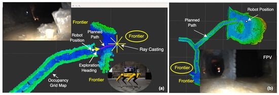
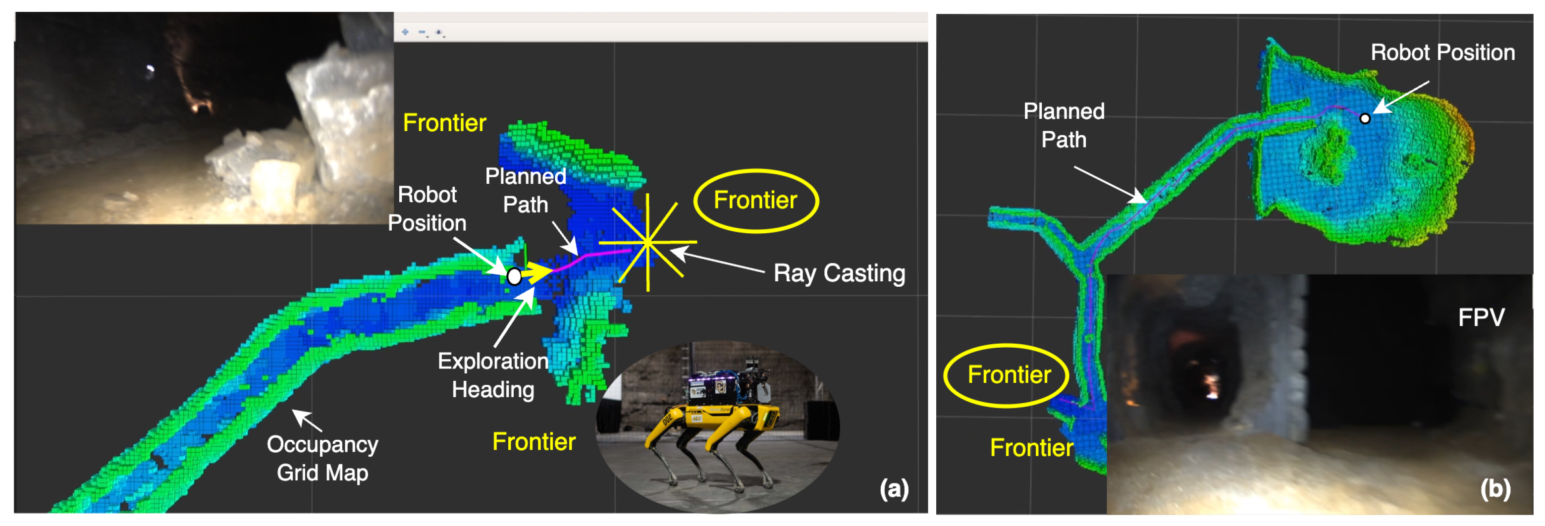
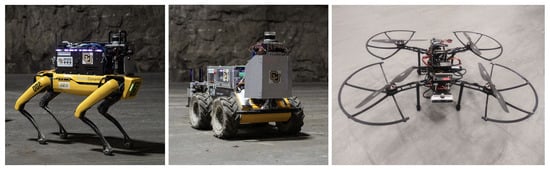
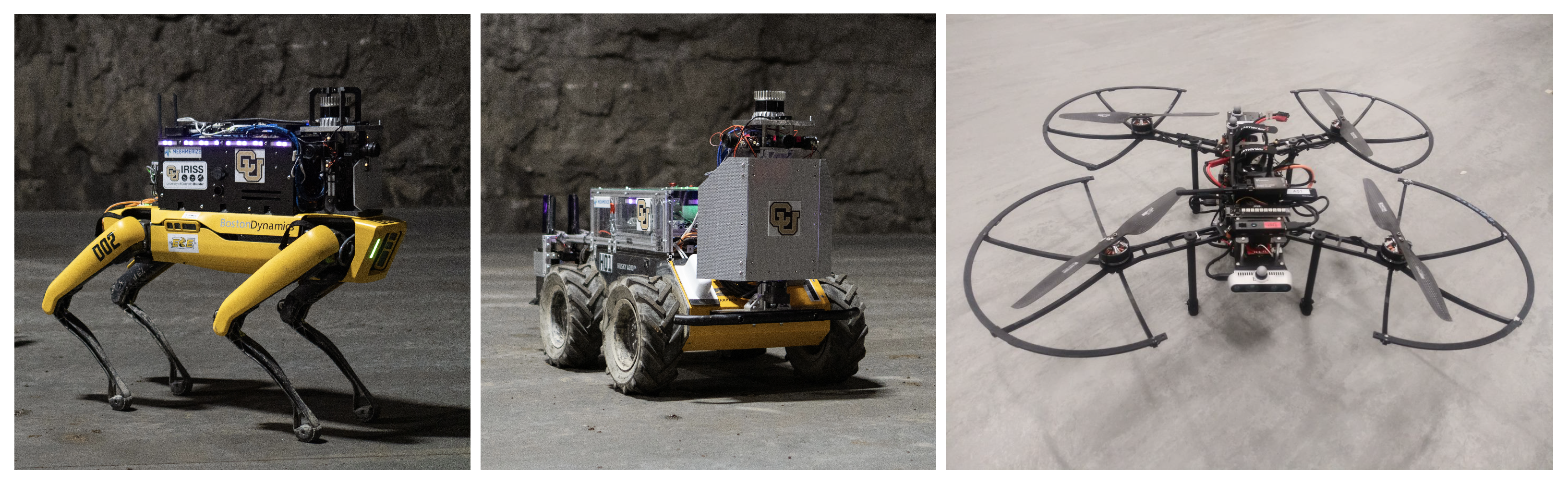
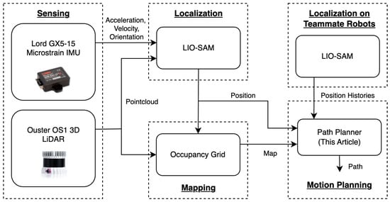
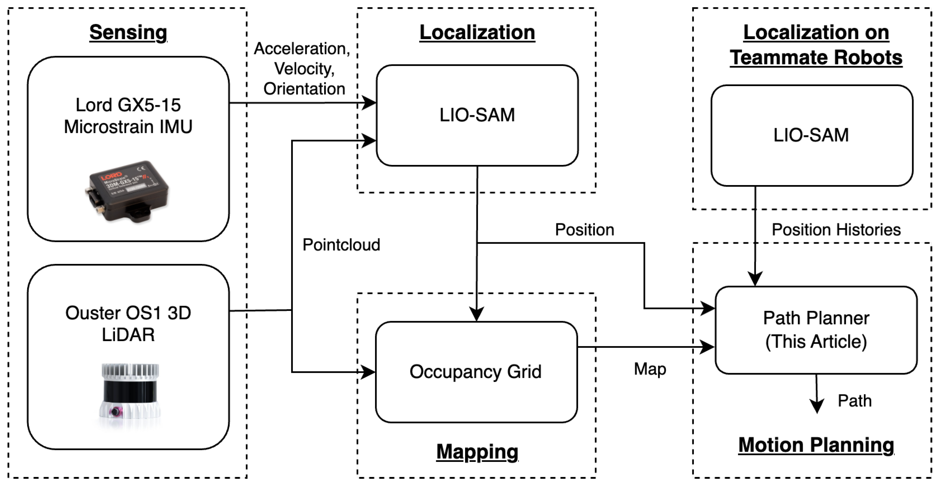
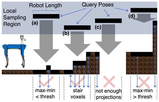
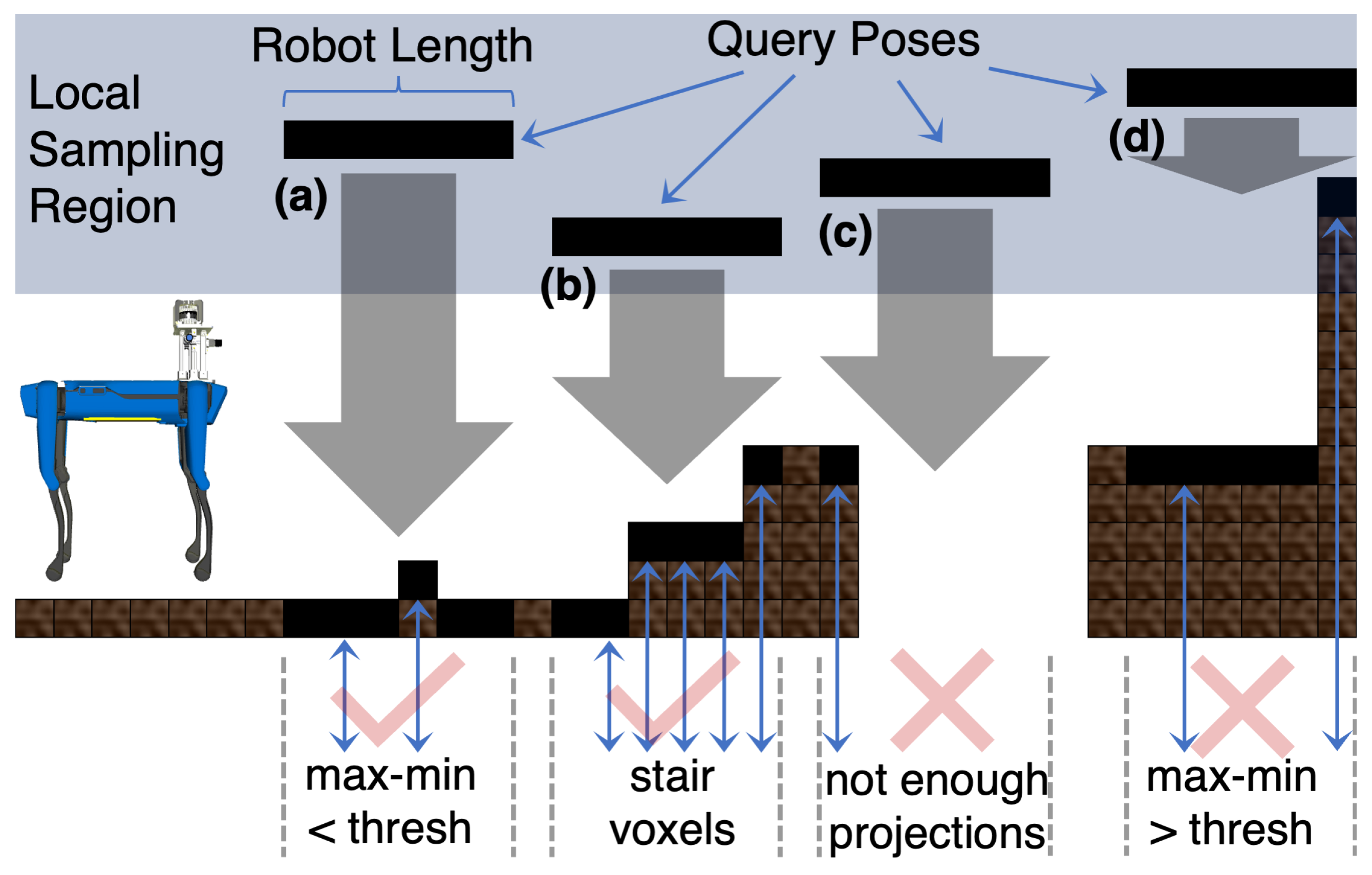
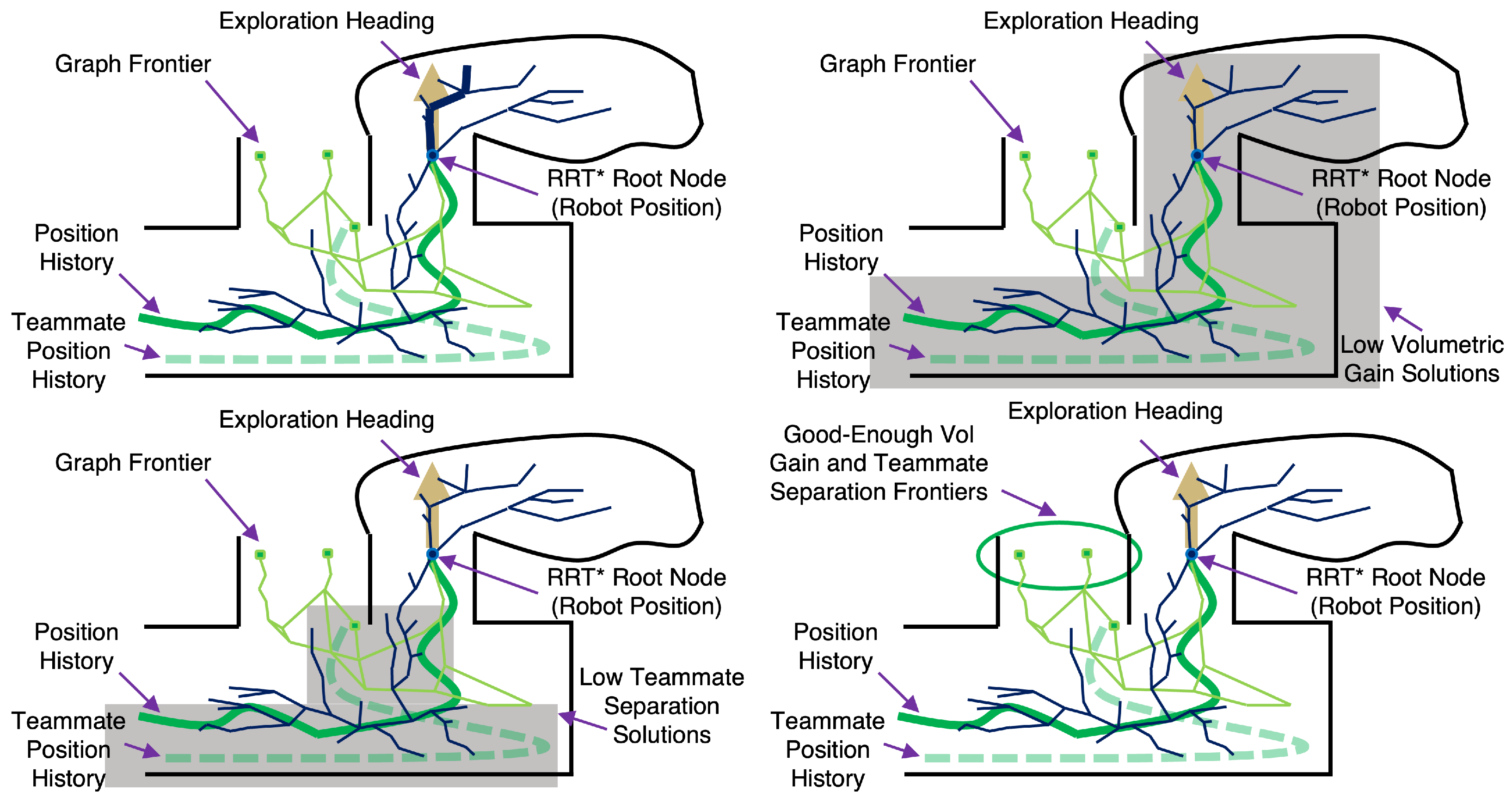
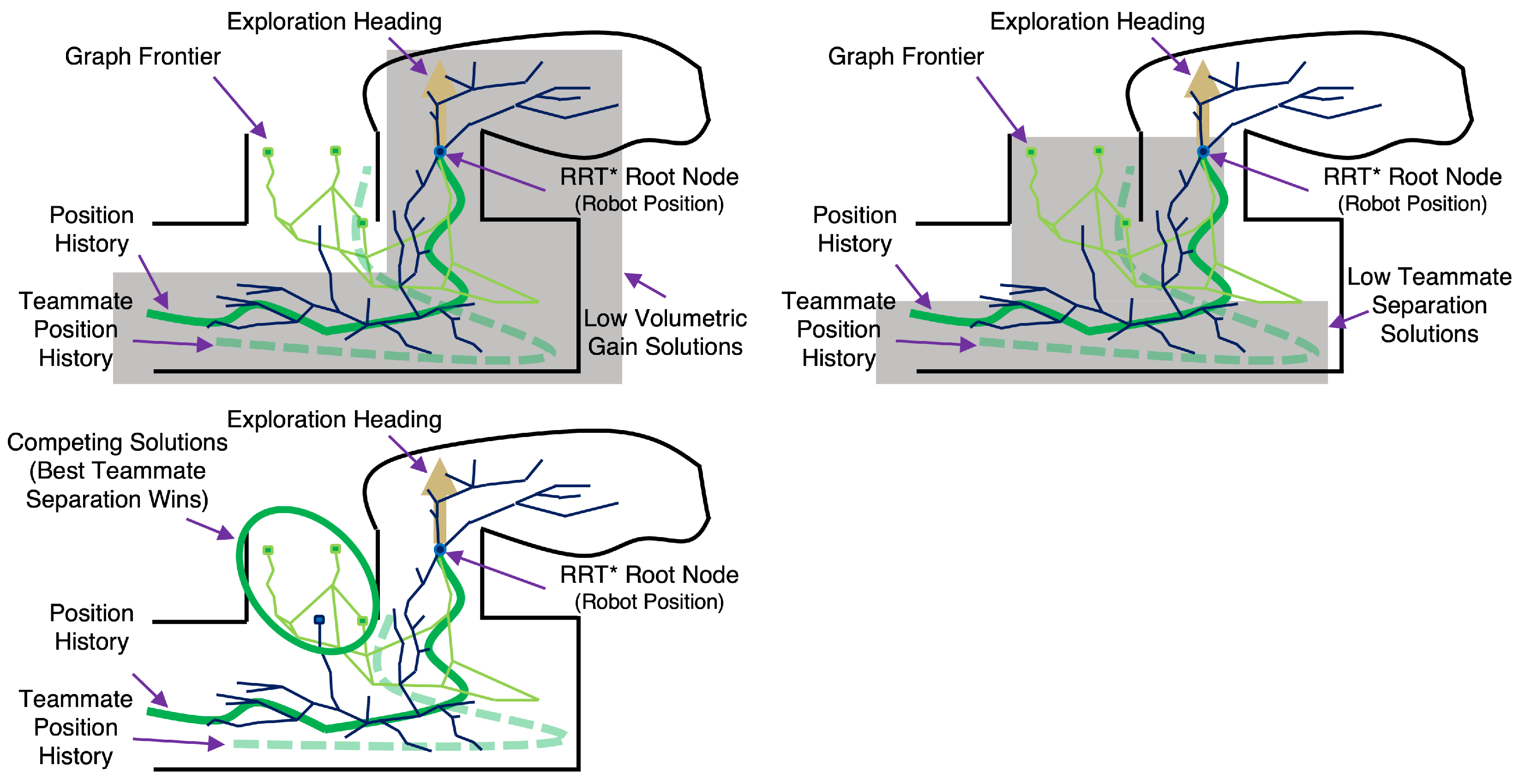
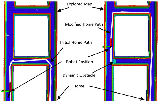
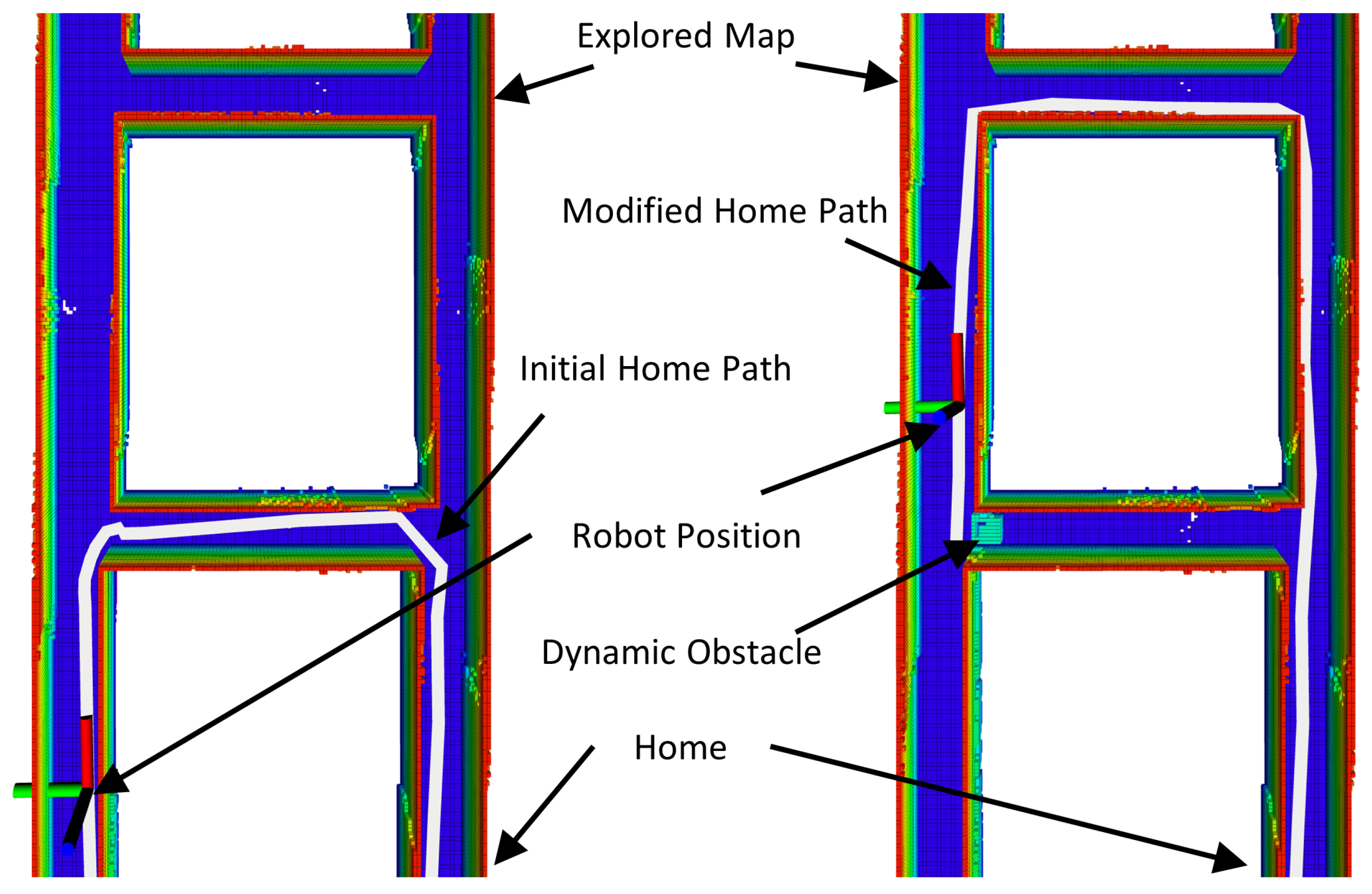
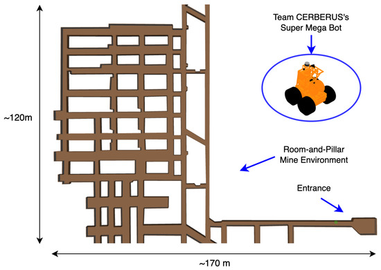
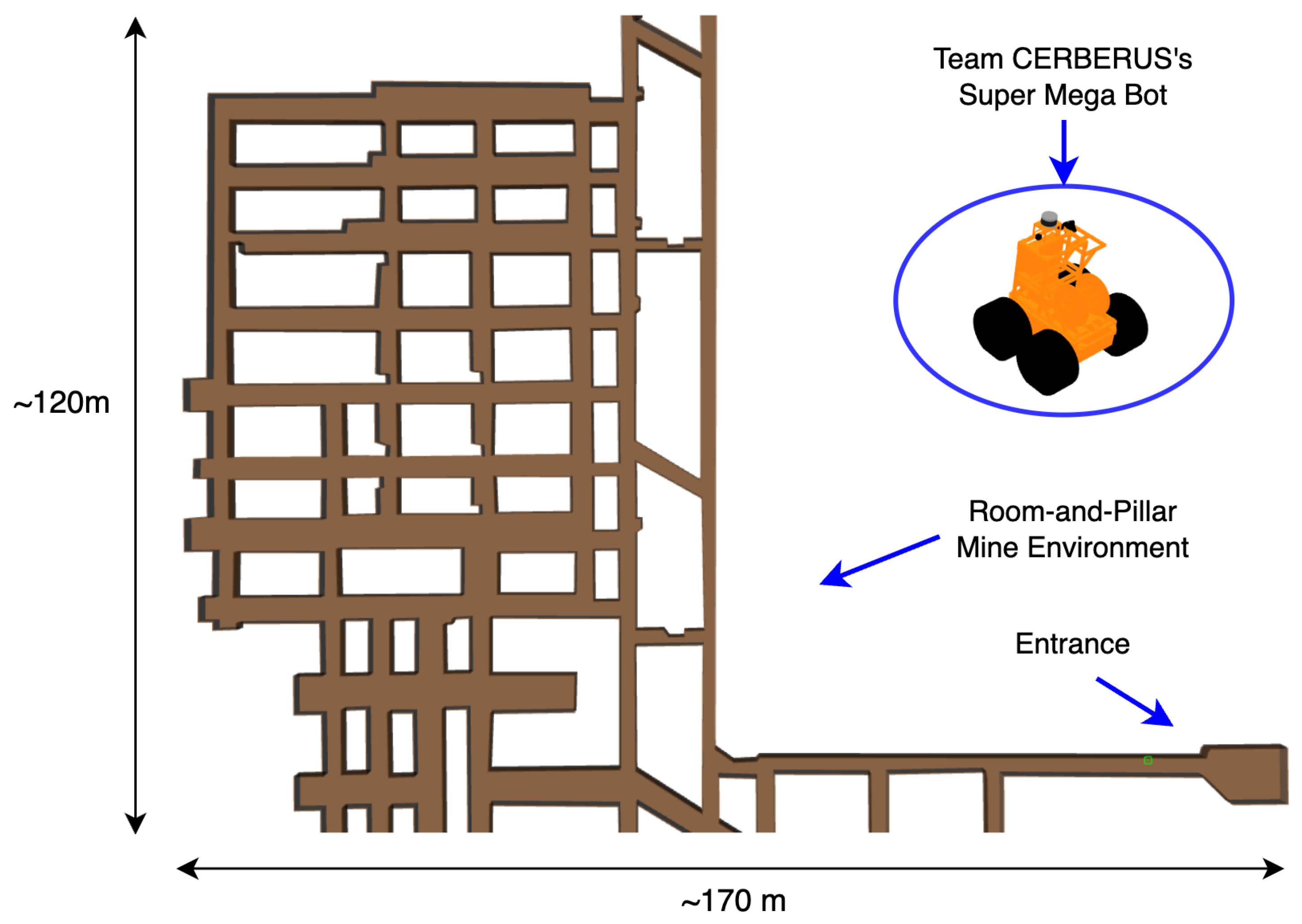
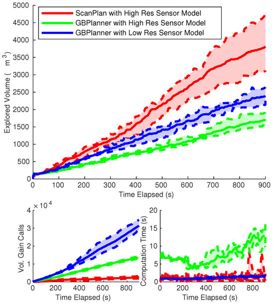
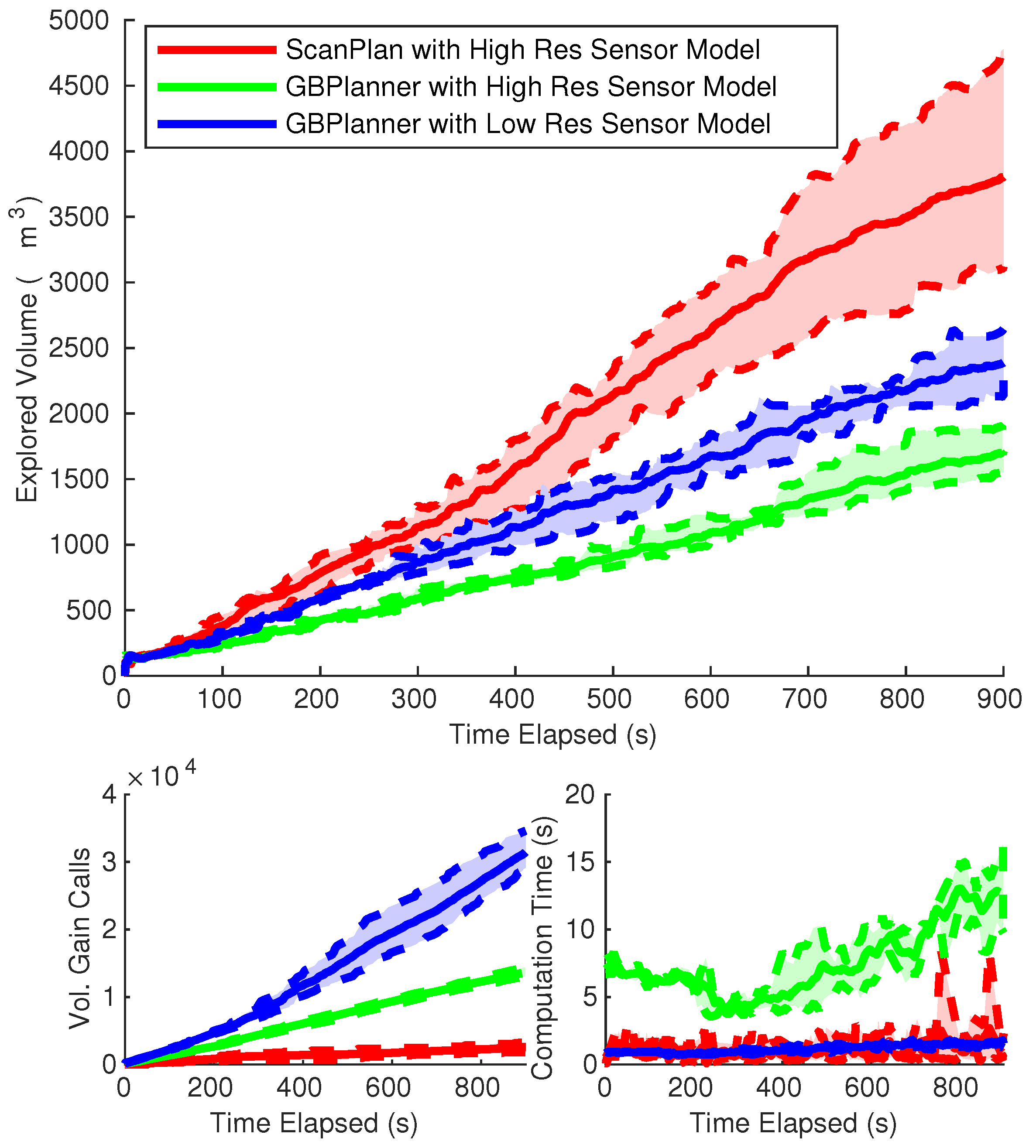
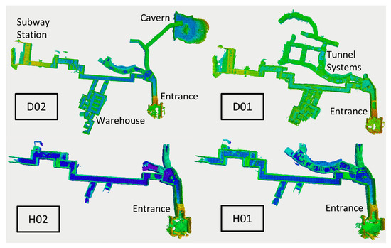
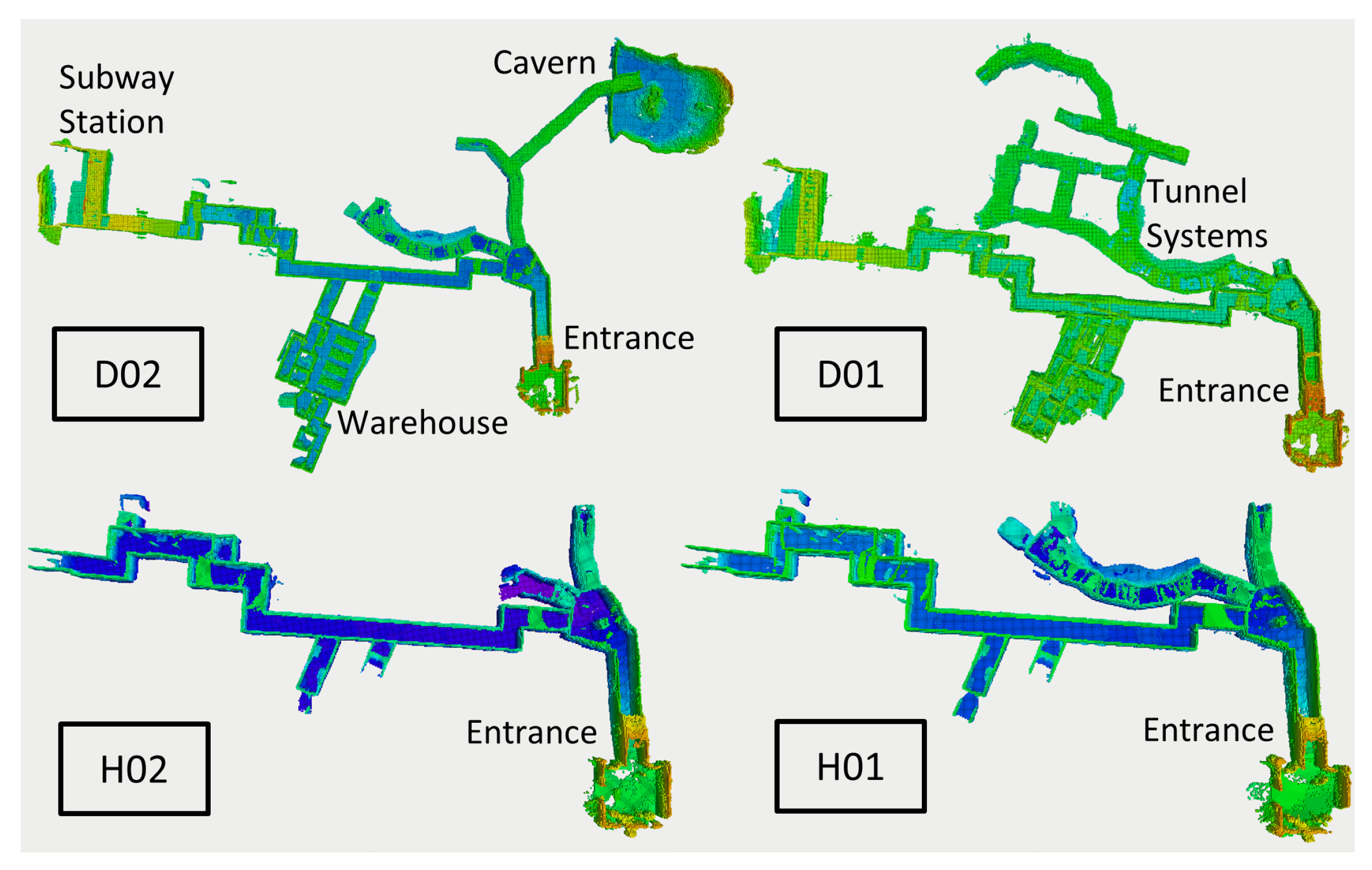
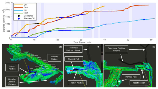
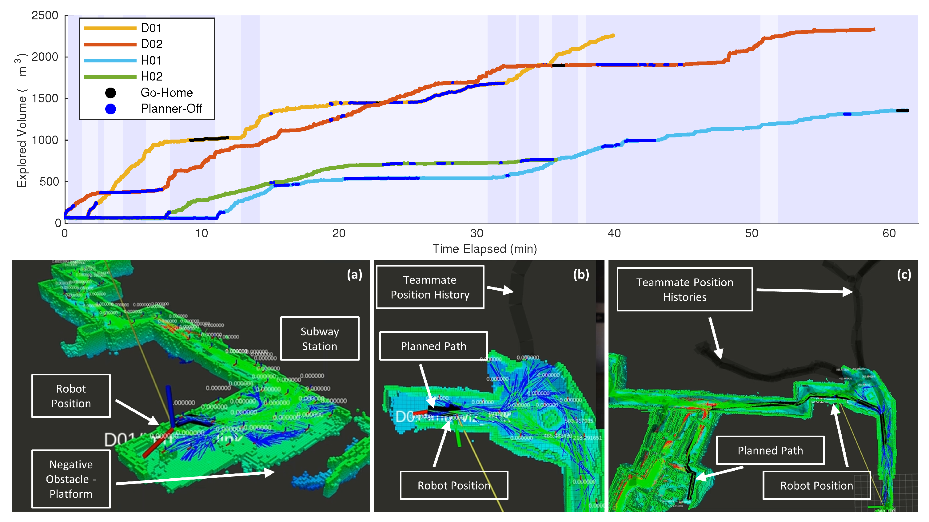
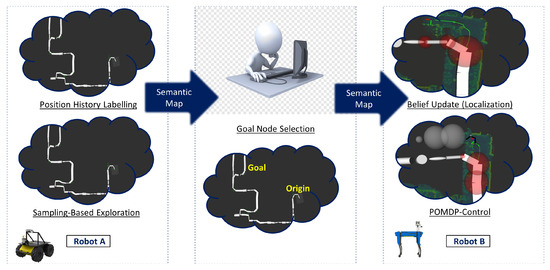
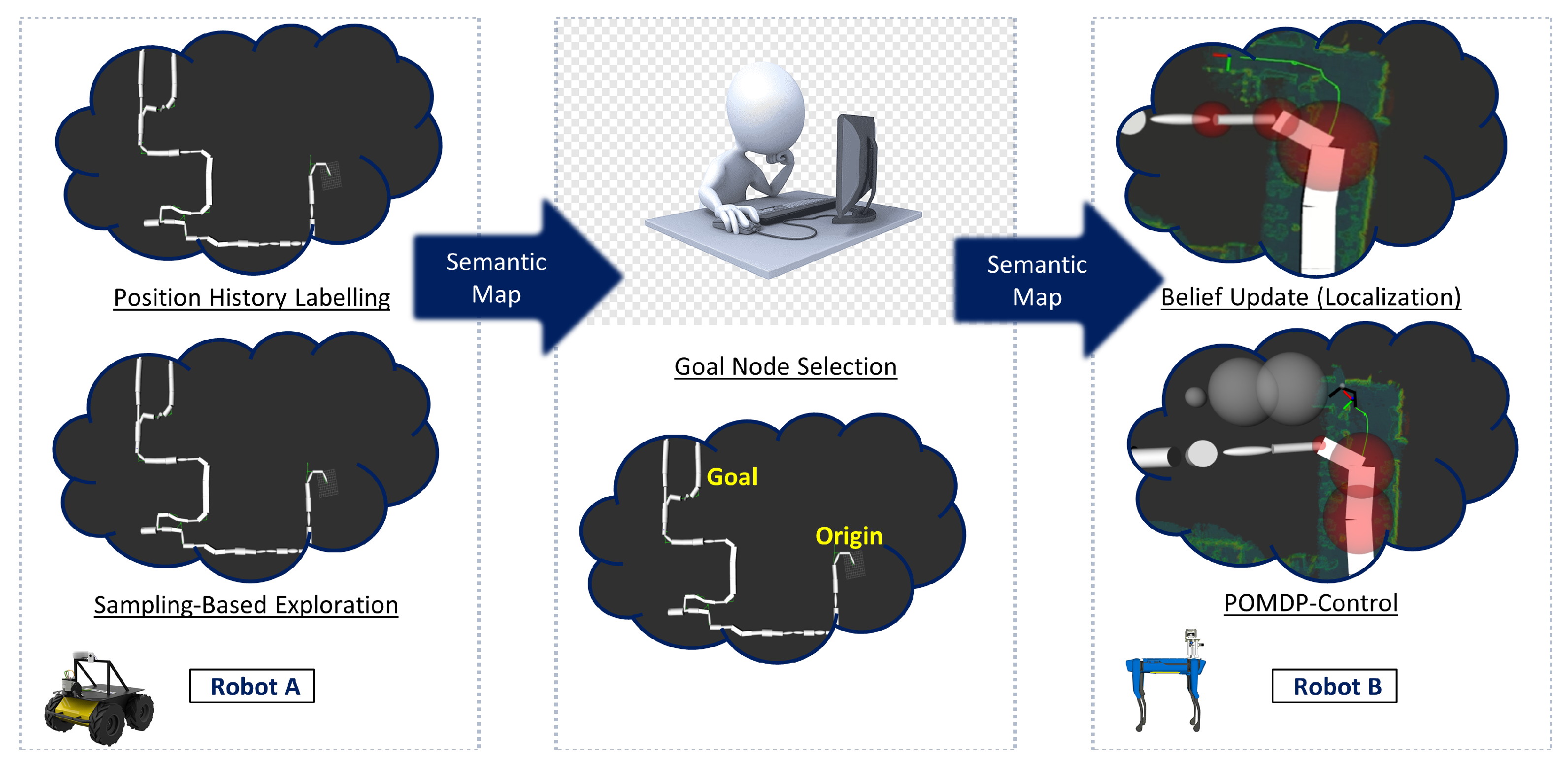
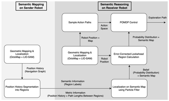
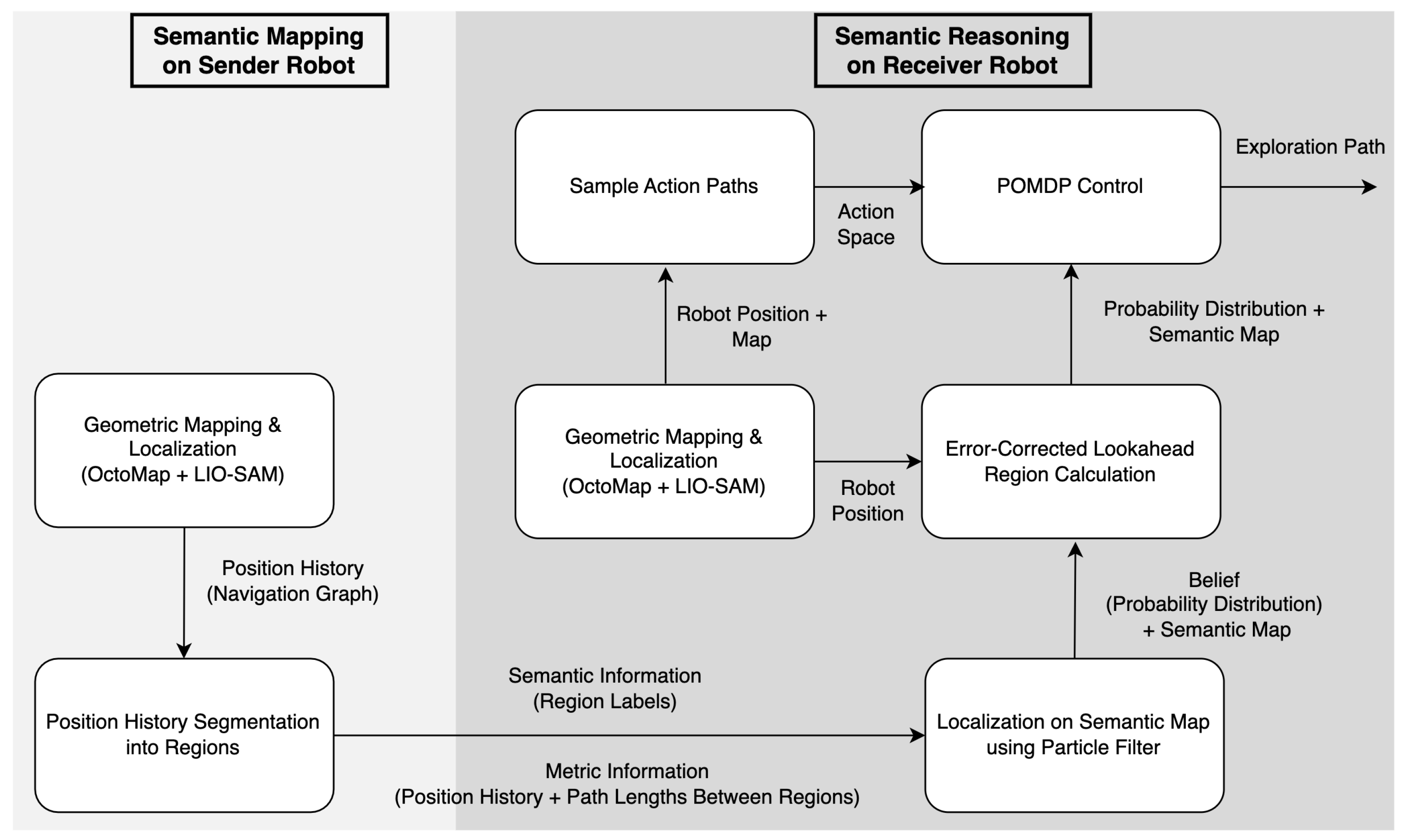
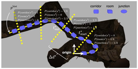
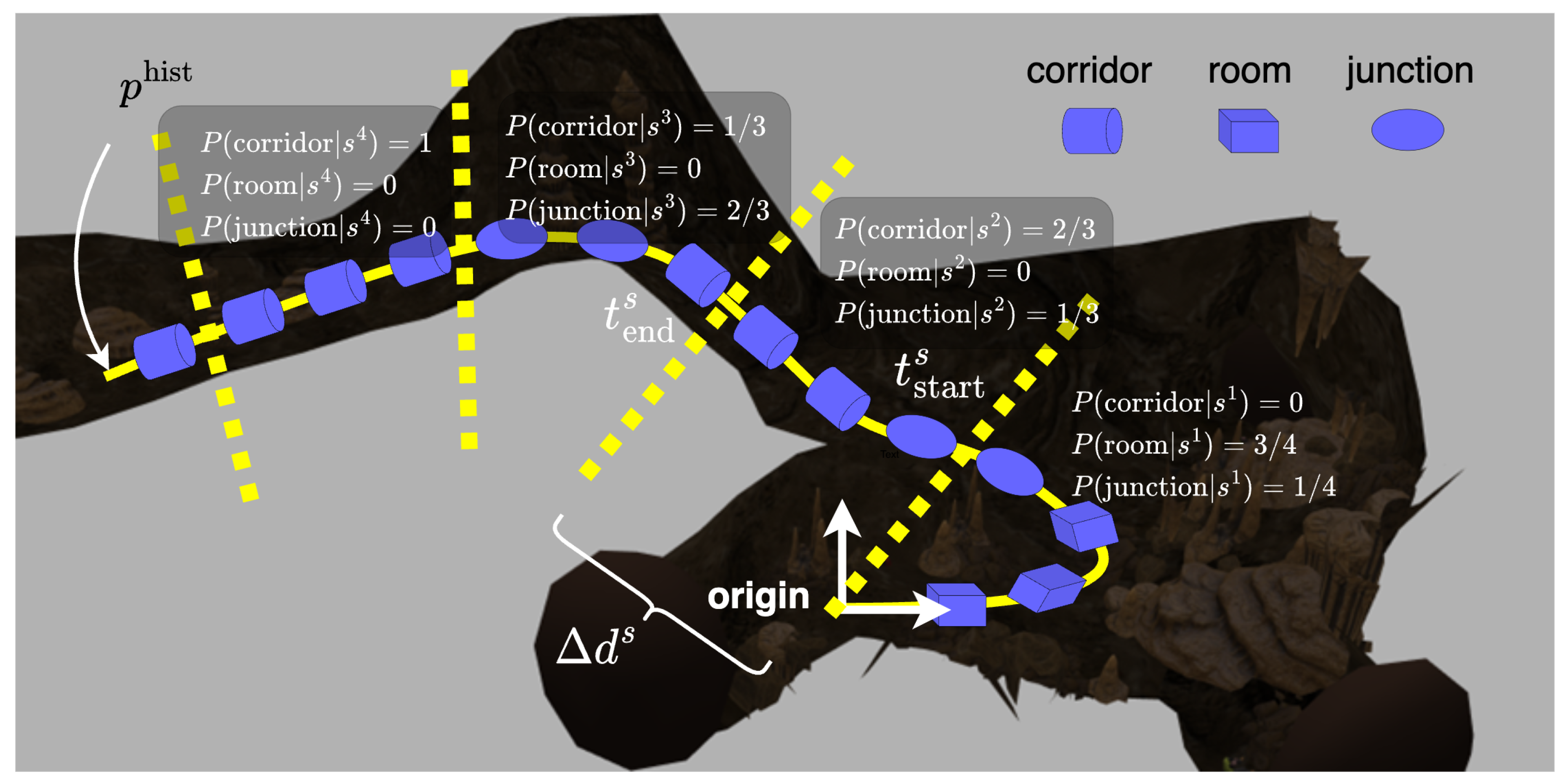
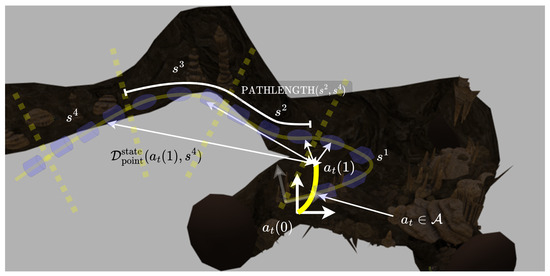
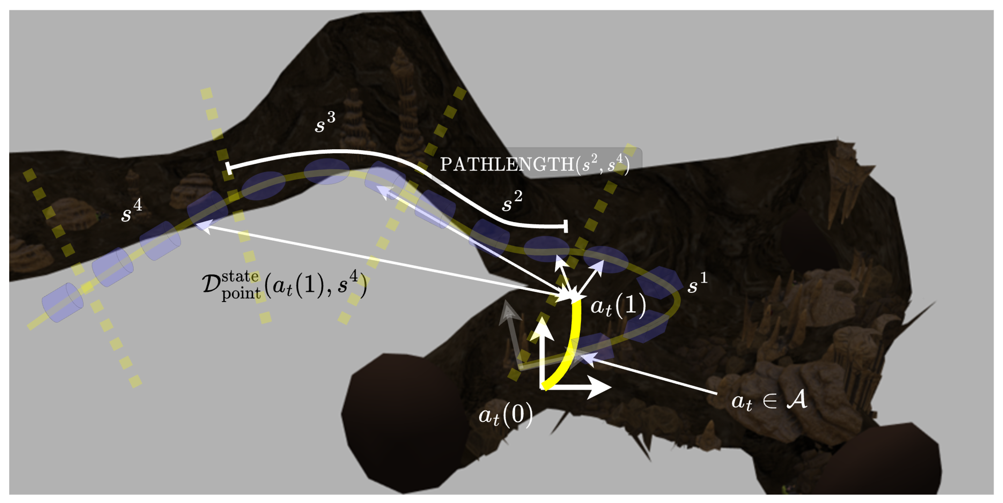


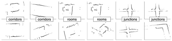
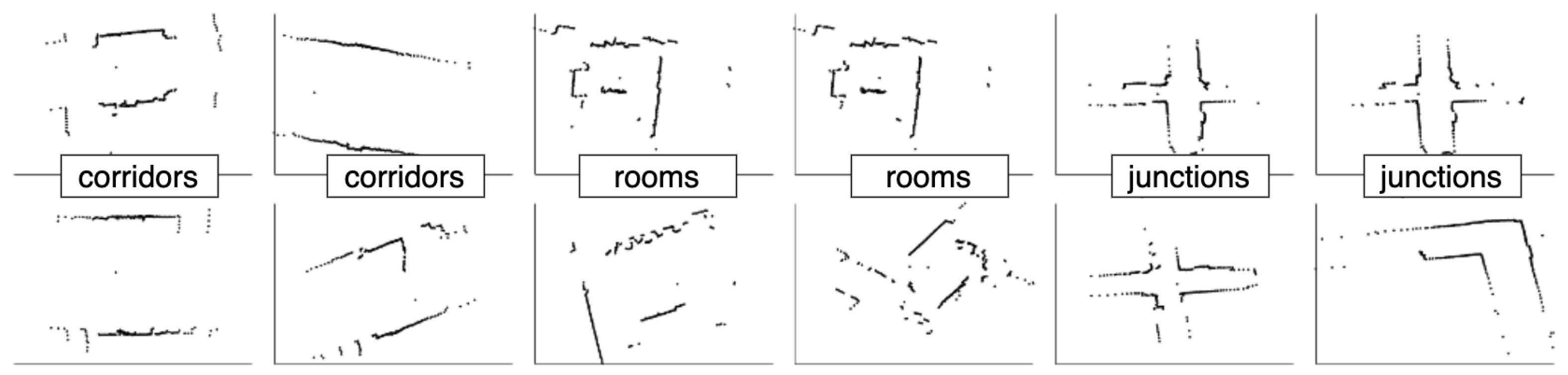
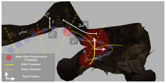
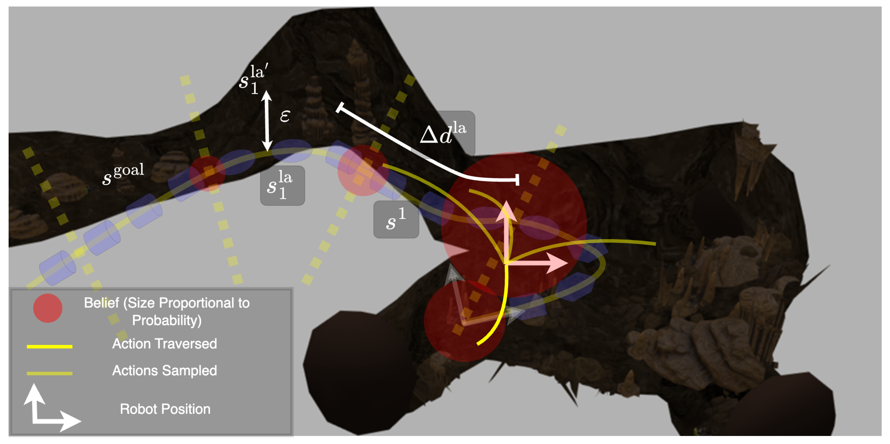
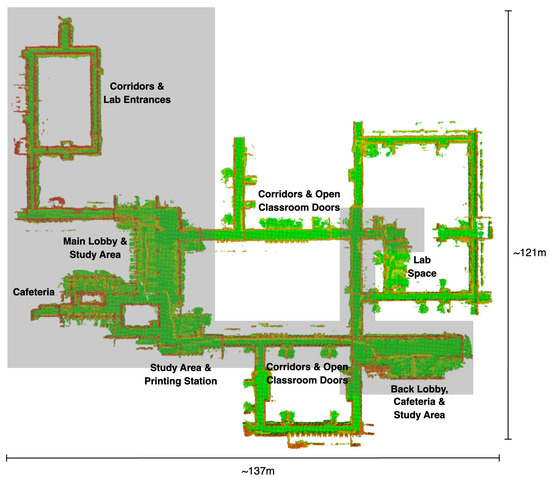
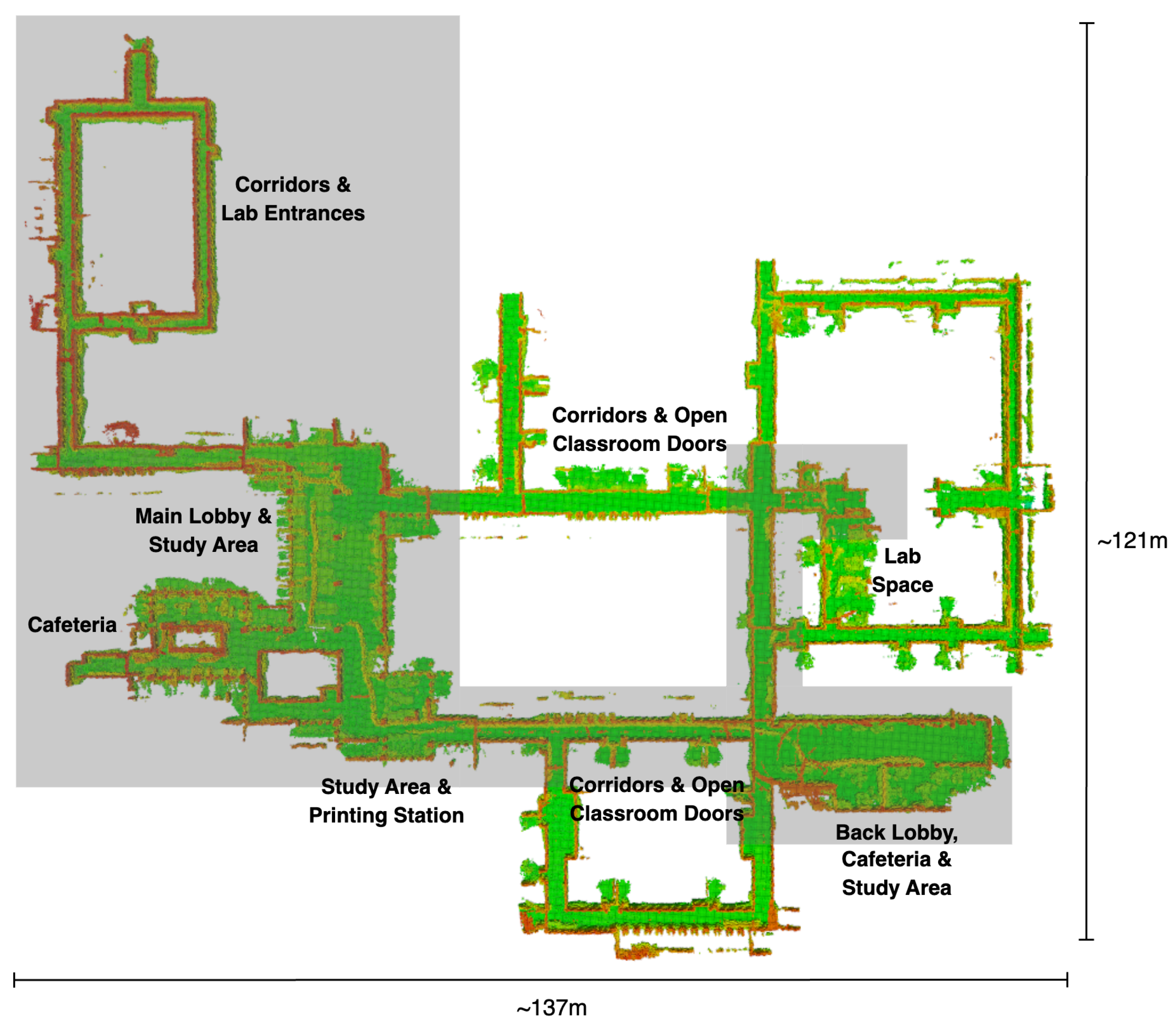
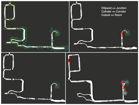
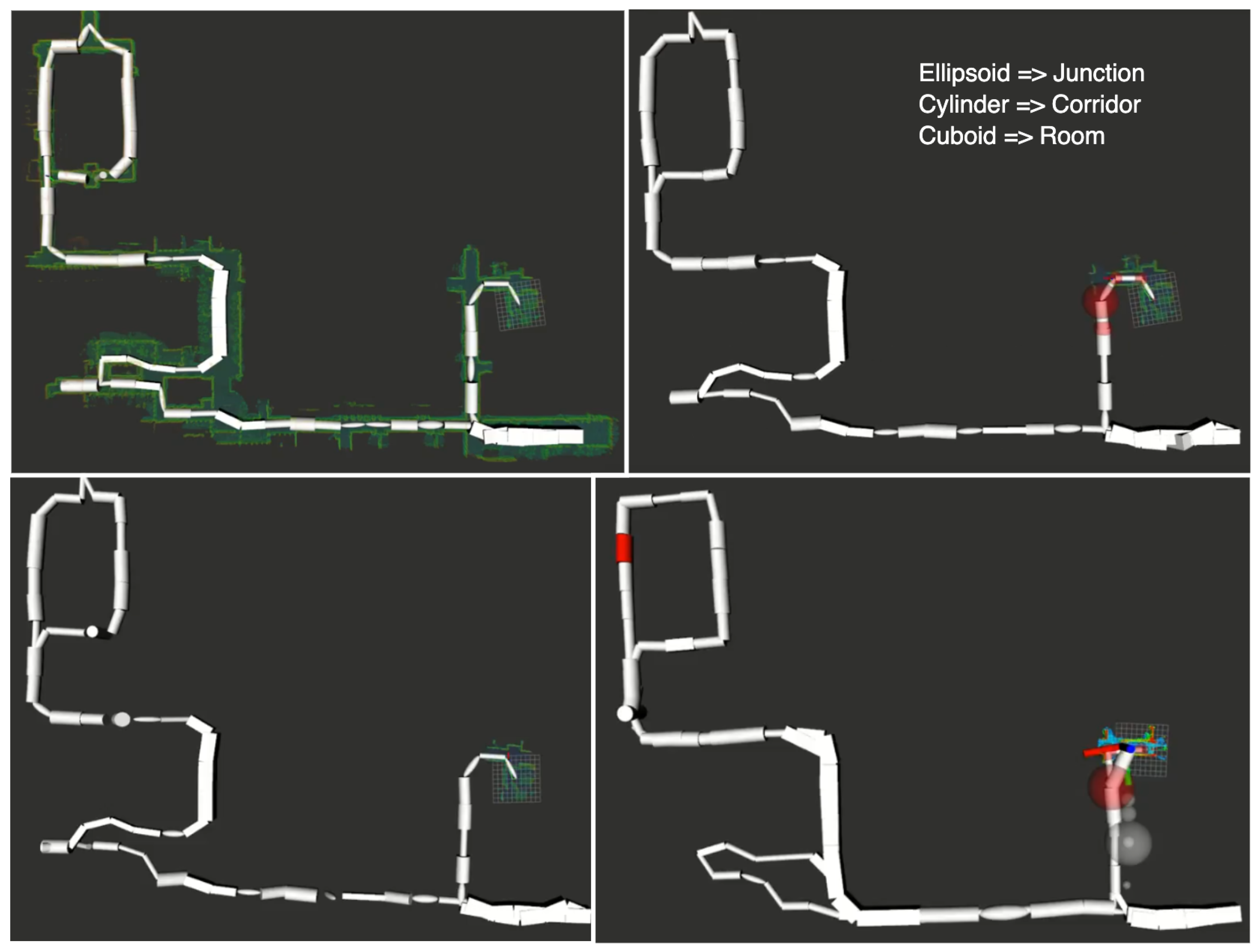
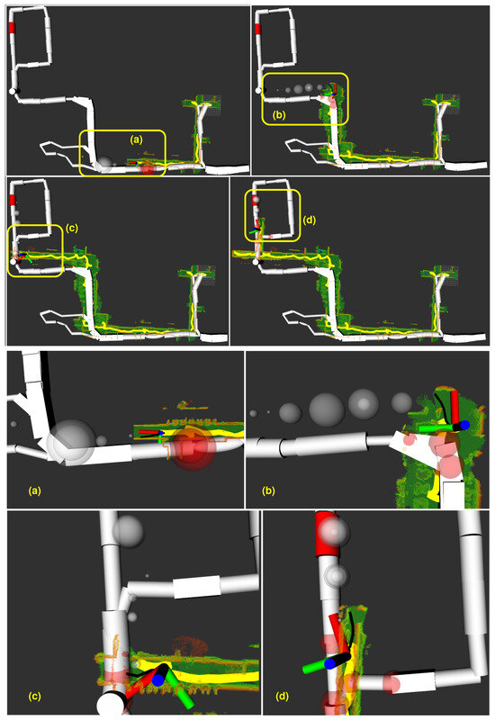
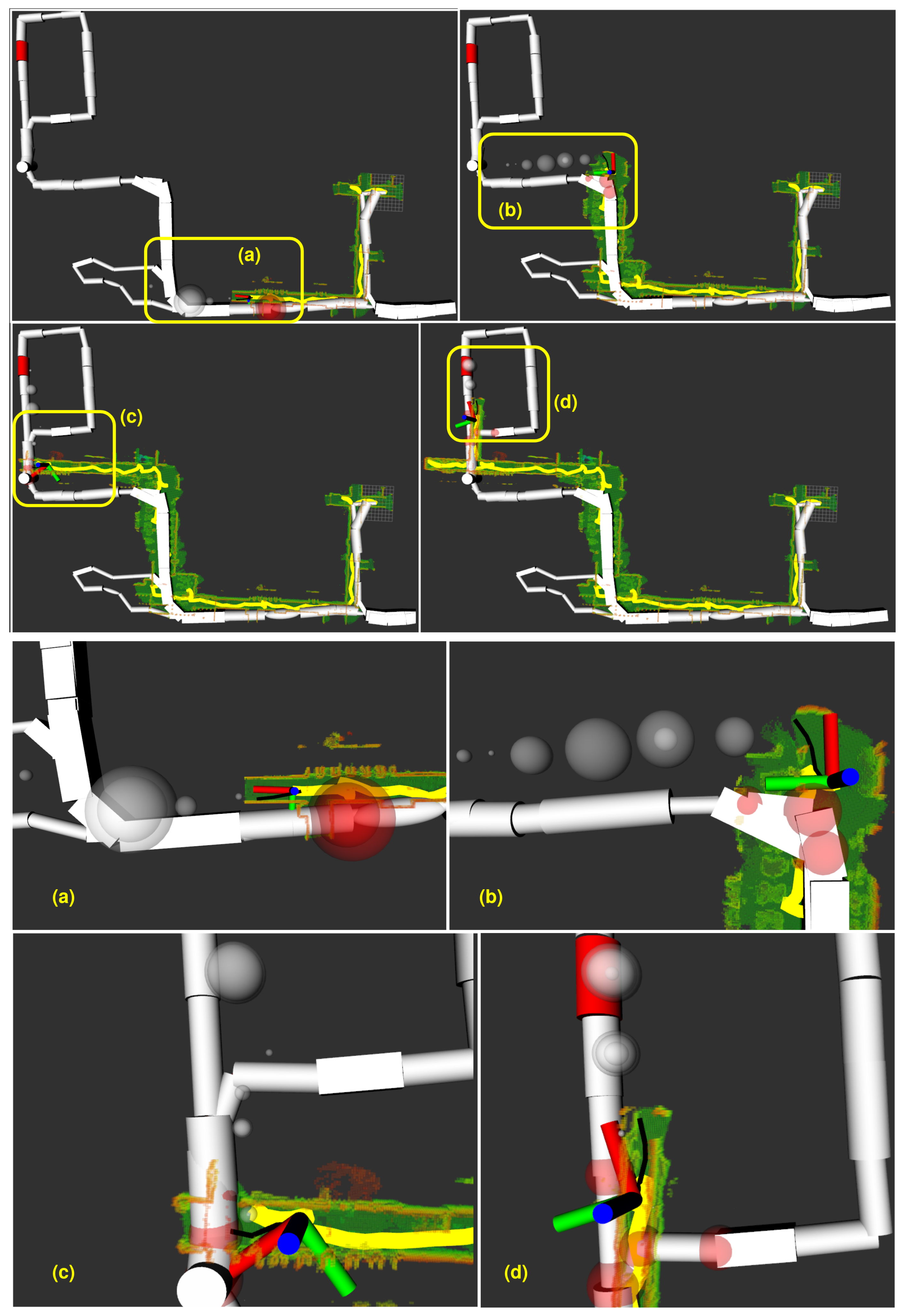

Disclaimer/Publisher’s Note: The statements, opinions and data contained in all publications are solely those of the individual author(s) and contributor(s) and not of MDPI and/or the editor(s). MDPI and/or the editor(s) disclaim responsibility for any injury to people or property resulting from any ideas, methods, instructions or products referred to in the content. |
© 2025 by the authors. Licensee MDPI, Basel, Switzerland. This article is an open access article distributed under the terms and conditions of the Creative Commons Attribution (CC BY) license (https://creativecommons.org/licenses/by/4.0/).