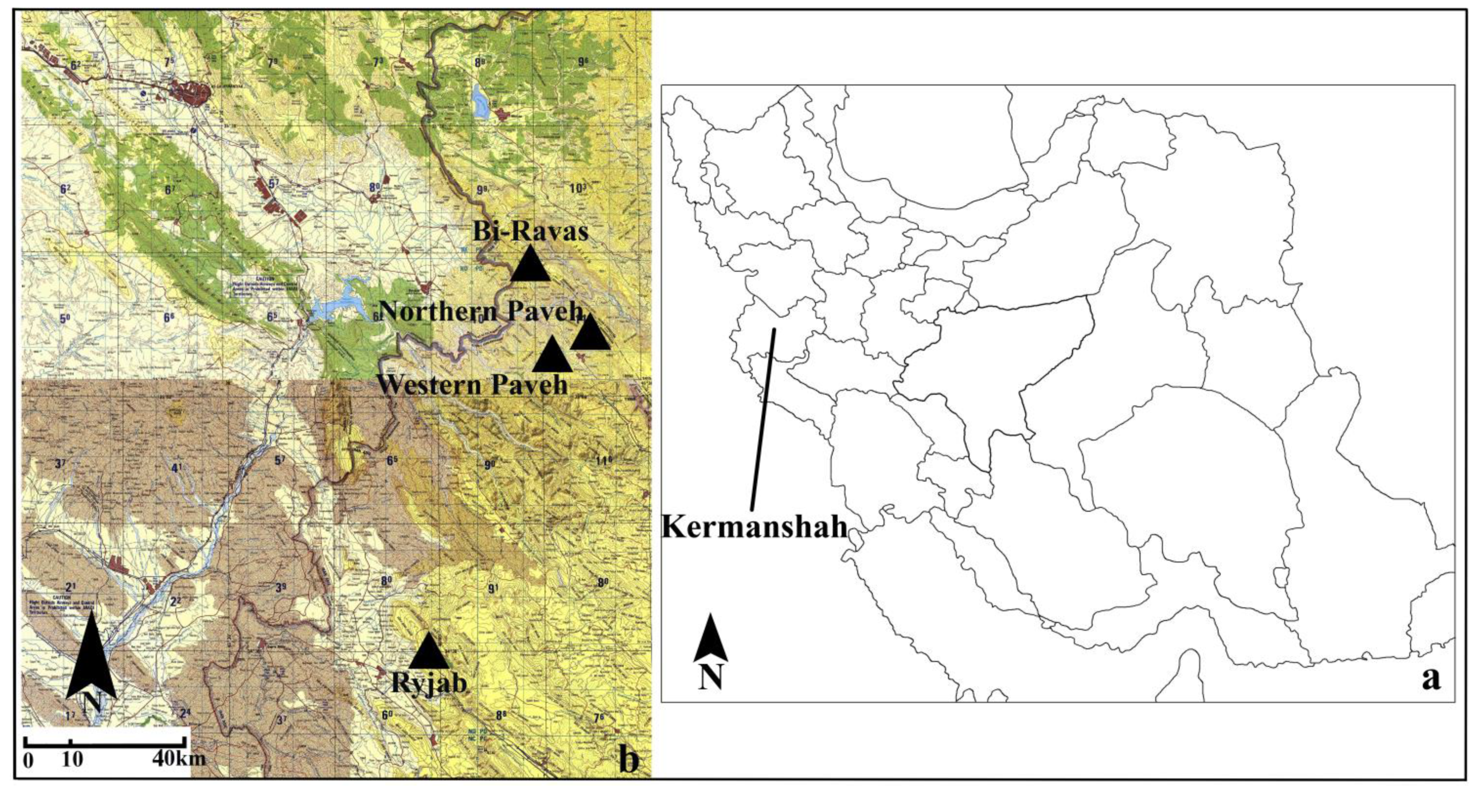
2.1. The Rock Art of Bi-Ravas Village
Hawrāmān is a vast mountainous region between the provinces of Kurdistan and Kermanshah in Iran and Kurdistan Province in Iraq [
7], and its people have the same culture. Bi-Ravas village is located at about 160 km to the northwest of Kermanshah and also the zero point of Hooraman in Kurdistan of Iraq. At a distance of 300 m from the northeast of the village, petroglyphs and a considerable number of cupules, have been identified on a rock surface (
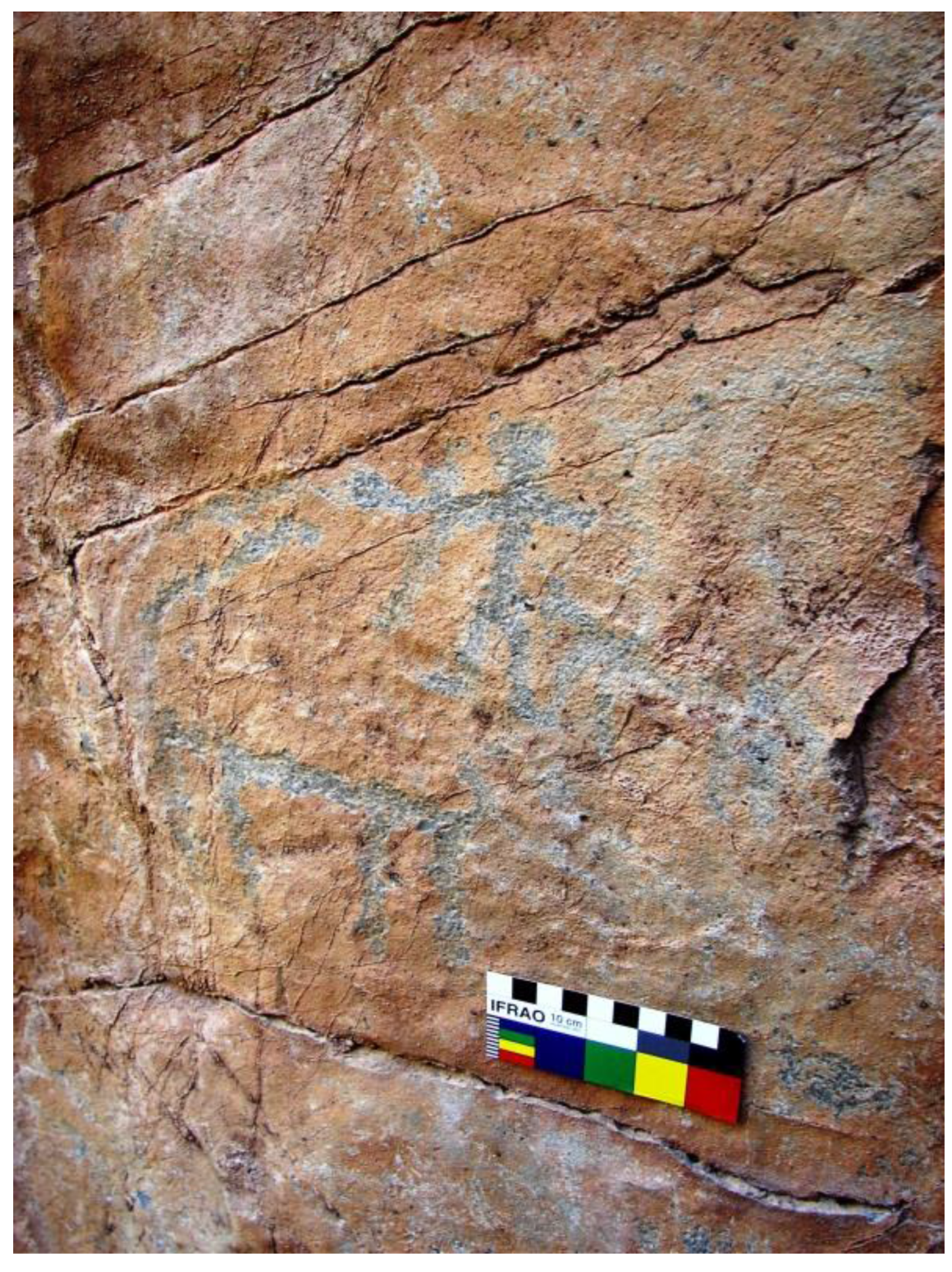
Figure 2). The image of anthropomorphs supposedly hunting ibexes using bow and arrow (
Figure 3 and
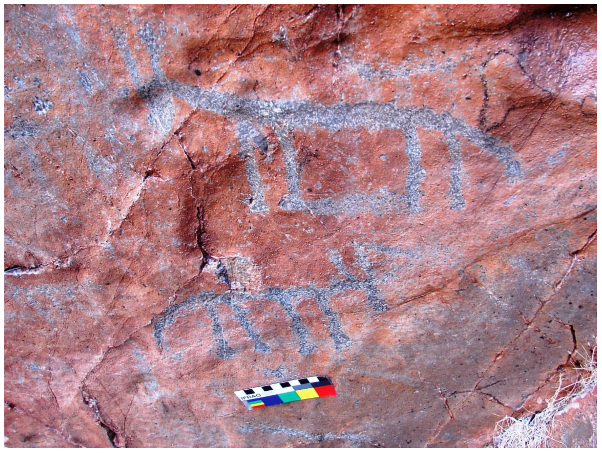
Figure 4) as well as a geometric form is found (
Figure 5). In this place, there is also the picture of a “horse with harness”, which seems to be younger than other designs and cupules (
Figure 6). This depiction probably cannot be older than the second millennium BCE, when Aryan immigrants brought horses to the Iranian plateau for the first time [
8].
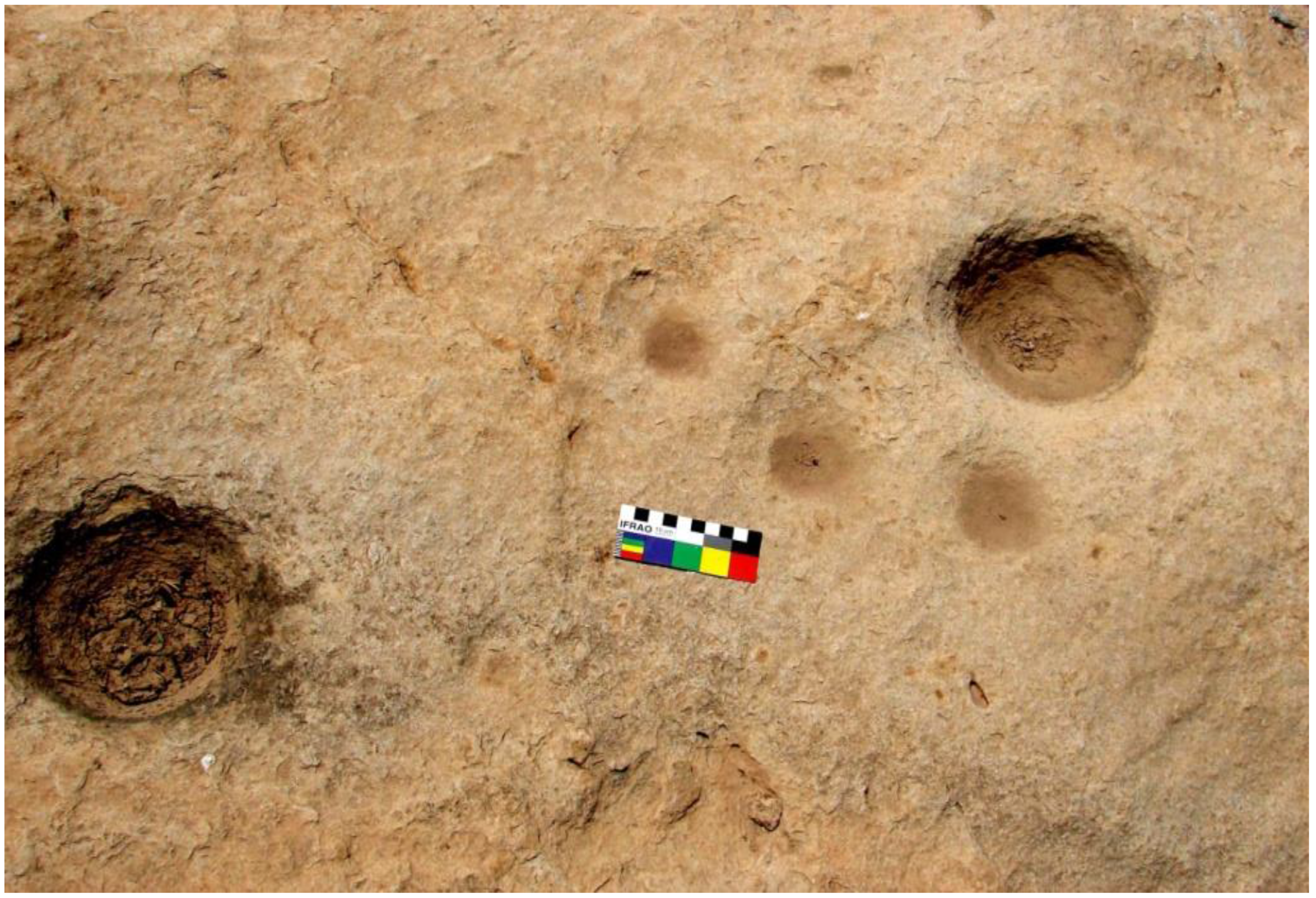
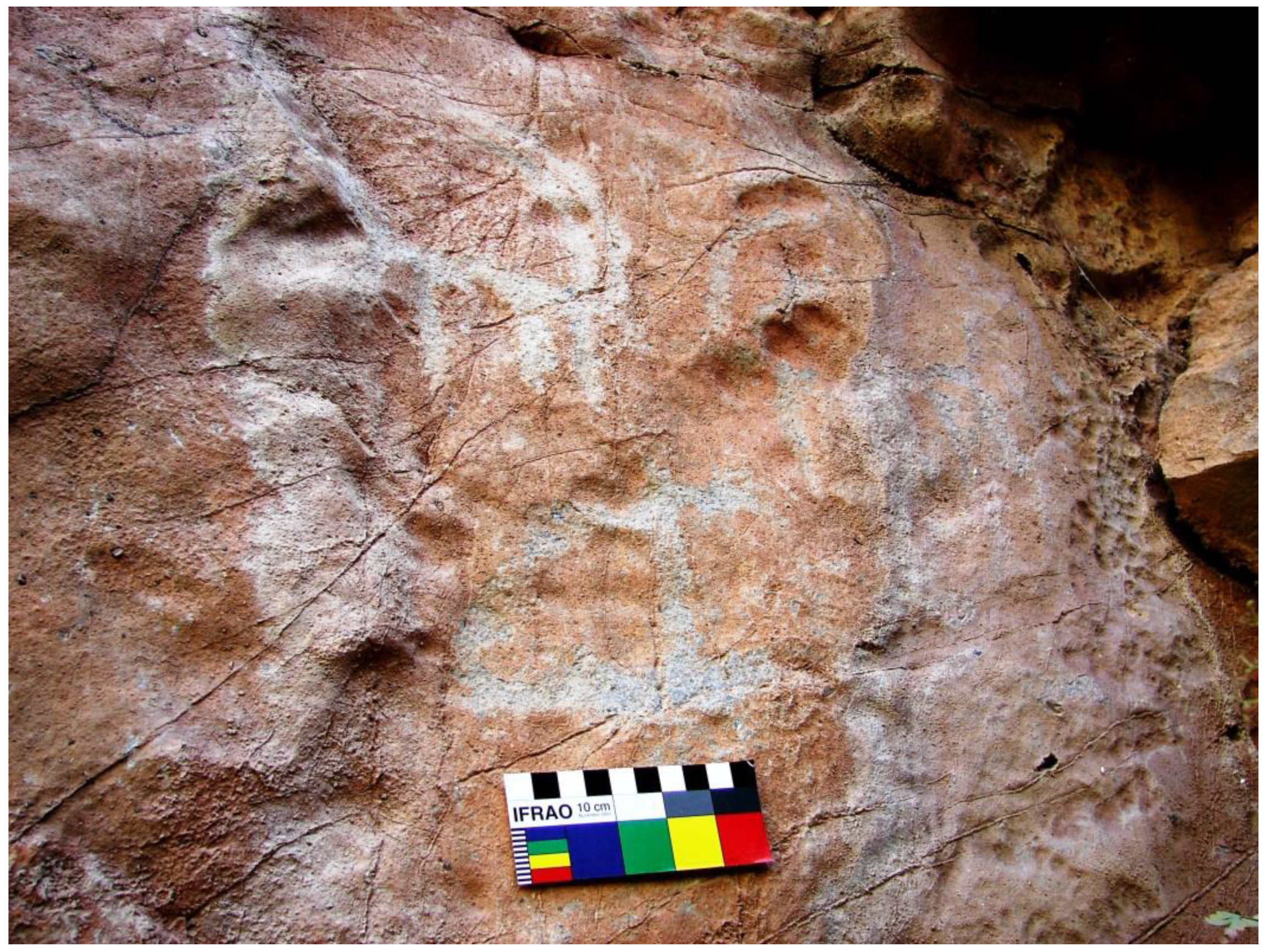
Figure 2.
Images of horned animals and cupules on the vertical surface of Bi-Ravascliff at a height of 5 m.
Figure 2.
Images of horned animals and cupules on the vertical surface of Bi-Ravascliff at a height of 5 m.
Figure 3.
A possible hunting scene showing zoomorphs and an anthropomorph with “bow and arrow”.
Figure 3.
A possible hunting scene showing zoomorphs and an anthropomorph with “bow and arrow”.
Figure 4.
Depiction of zoomorphs with short “horns”.
Figure 4.
Depiction of zoomorphs with short “horns”.
Figure 5.
The Images of zoomorphs and an oval-resembling symbol divided into two parts.
Figure 5.
The Images of zoomorphs and an oval-resembling symbol divided into two parts.
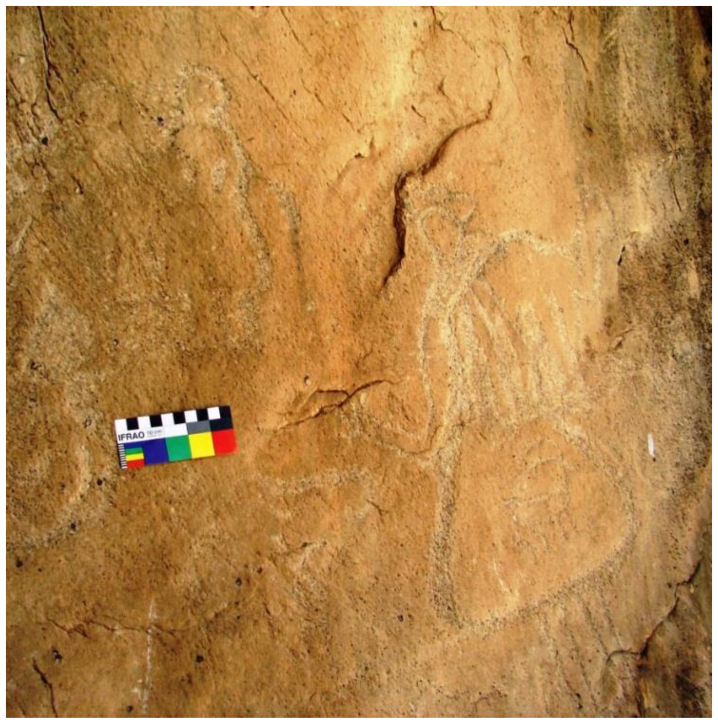
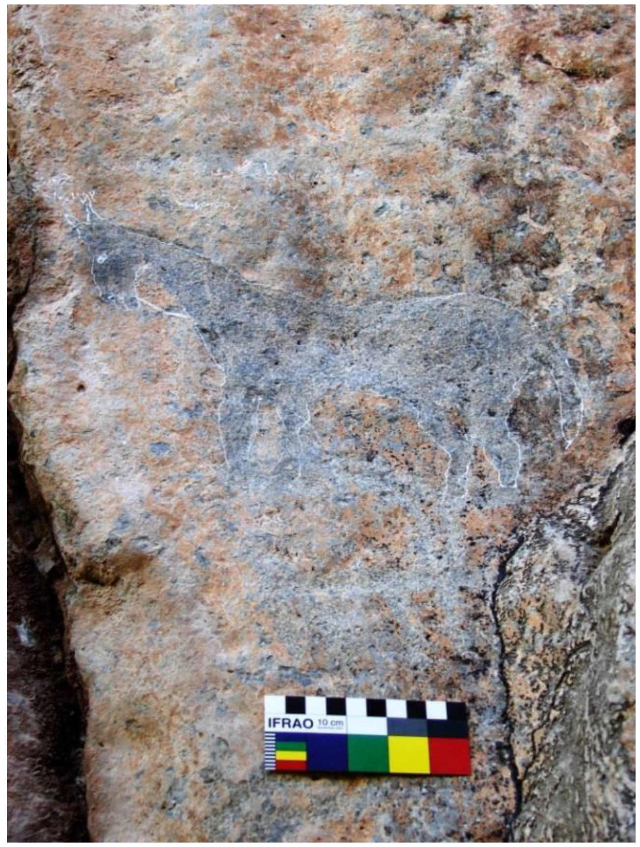
Figure 6.
The image of an “ibex” and a “horse with harness” in Bi-Ravas.
Figure 6.
The image of an “ibex” and a “horse with harness” in Bi-Ravas.
The valleys and foothills of Bi-Ravas, Kymaneh, and Hanne Gormalehin had a lot of petroglyphs until 40 years ago, especially on the portable rocks, which unfortunately have been pilfered or vandalized.
During recent Islamic centuries, the local inhabitants of the region have used the boulders bearing ancient single engraved motifs in order to make Islamic gravestones. Remarkably, some of the recent Islamic gravestones even have been designed using depictions inspired by ancient petroglyphs of the area.
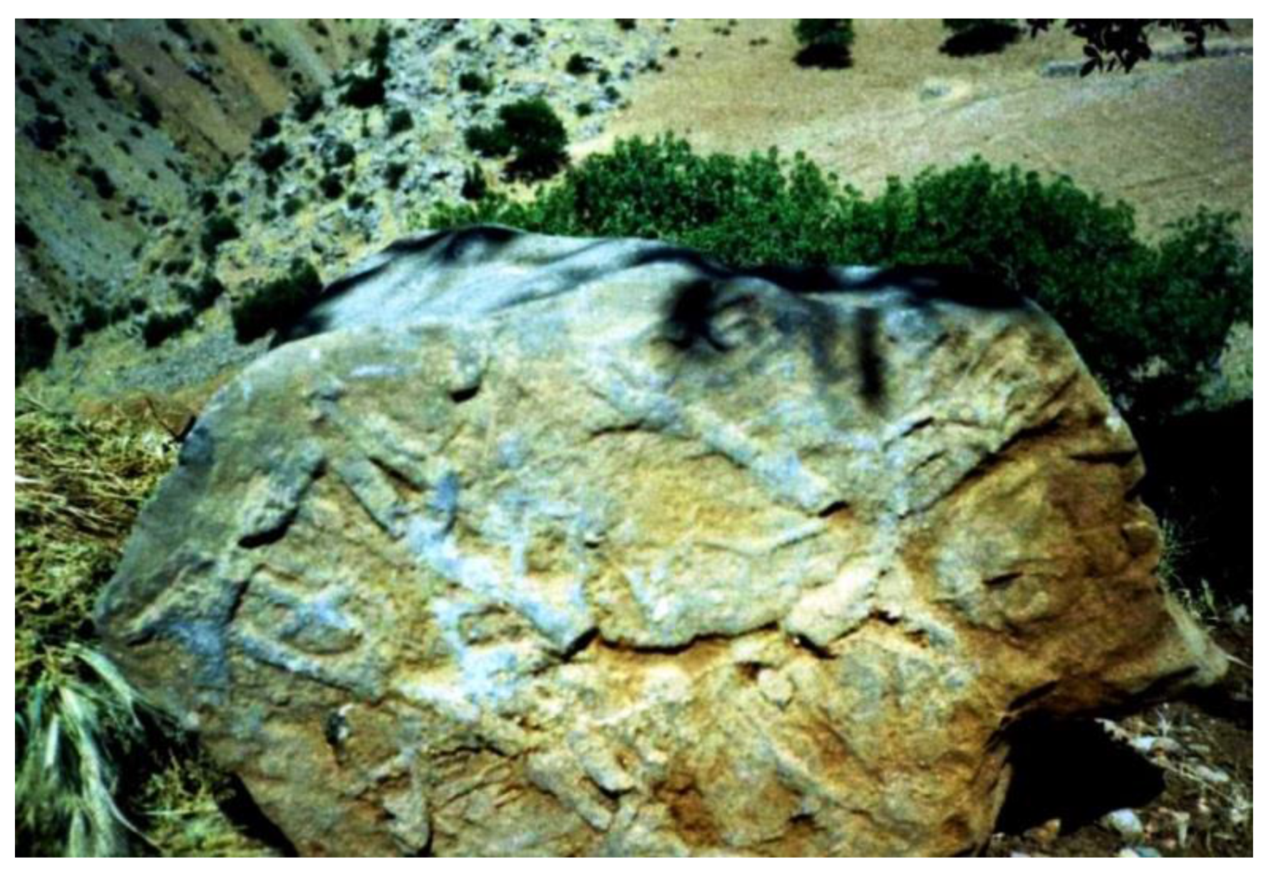
2.2. Petroglyph in the North of Paveh
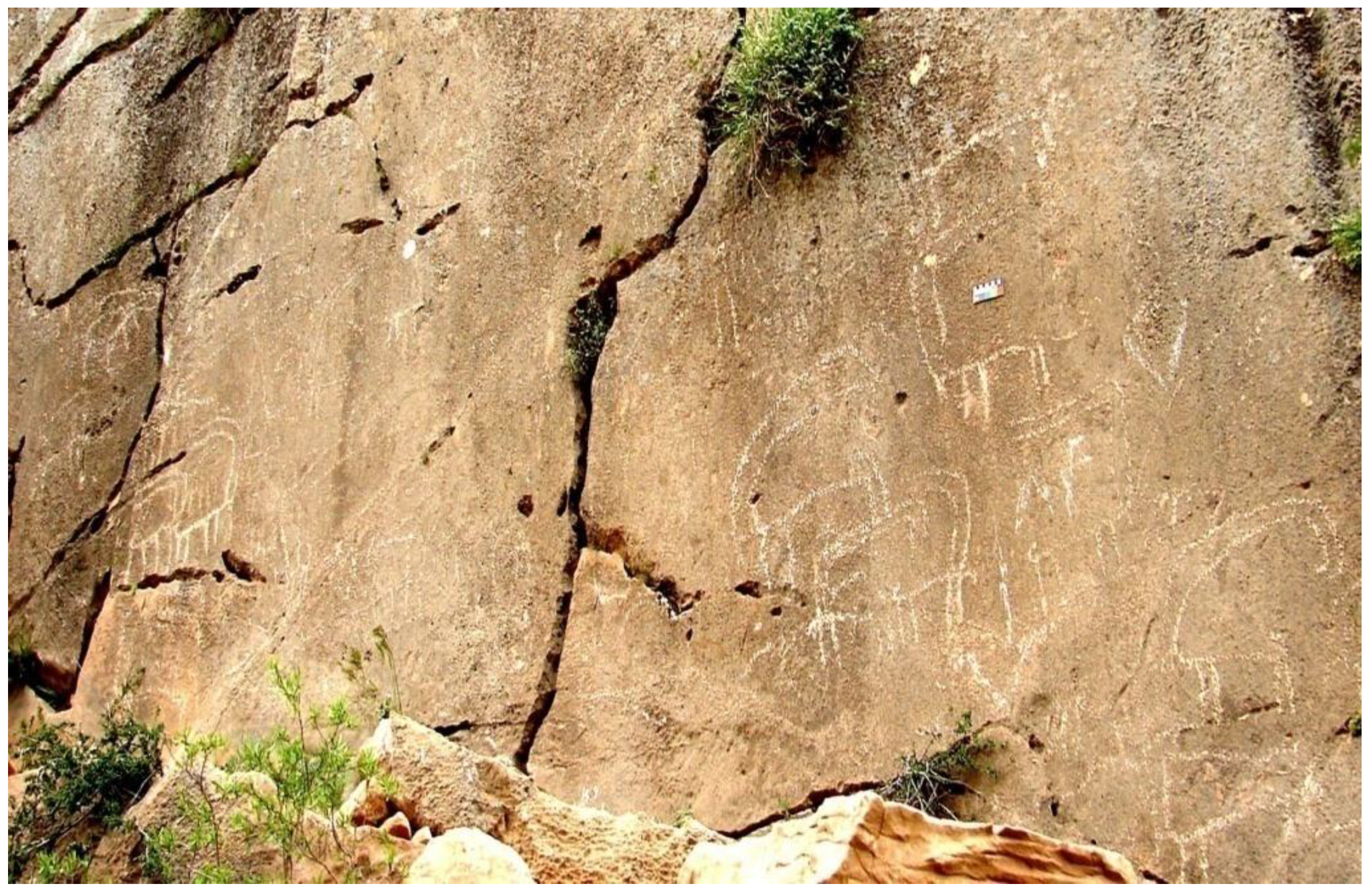
Paveh is a city located 124 km northwest of Kermanshah city at an altitude of 1540 m above sea level. North of this city, limestone walls have posed a 3 km long mountain named Talan Ghamar. The hillside of the mountain contains vast valleys that extend to the river of Galal Valley at the south of Paveh. Above of the valley that Havar Poinrhis is located in, the rock art is facing to the north. On the vertical side of a limestone cliff about 50 “ibex” depictions facing west and east have been pounded (
Figure 7). One of the unique pictures that only contain “antelopes” of a large scale has dimensions of 40 cm and its highest image is 55 cm long. It mostly shows four legs and two horns of an animal in two-dimensional perspective. There are also many cupules pounded individually on the cliffs. No other image, including zoomorphs, anthropomorphs or geometric markings, is shown on this cliff. On the left side of the rock, the image of a large “antelope” is executed and in the back of it and among its horns, a small “antelope” is apparent. This style has also been shown in the petroglyph of Sarab-Qamiysh and Sang-Sefid and Soren in Kurdistan (
Figure 6) [
7]. The heights overlooking the valley featuring rock art are a perfect place for groups of pre-Historic human hunters, who lived in this region. Because of the diversity and abundance of plants already in the area, it is still a suitable habitat for farmers. Until about 40 years ago, the area had a large variety of wildlife.
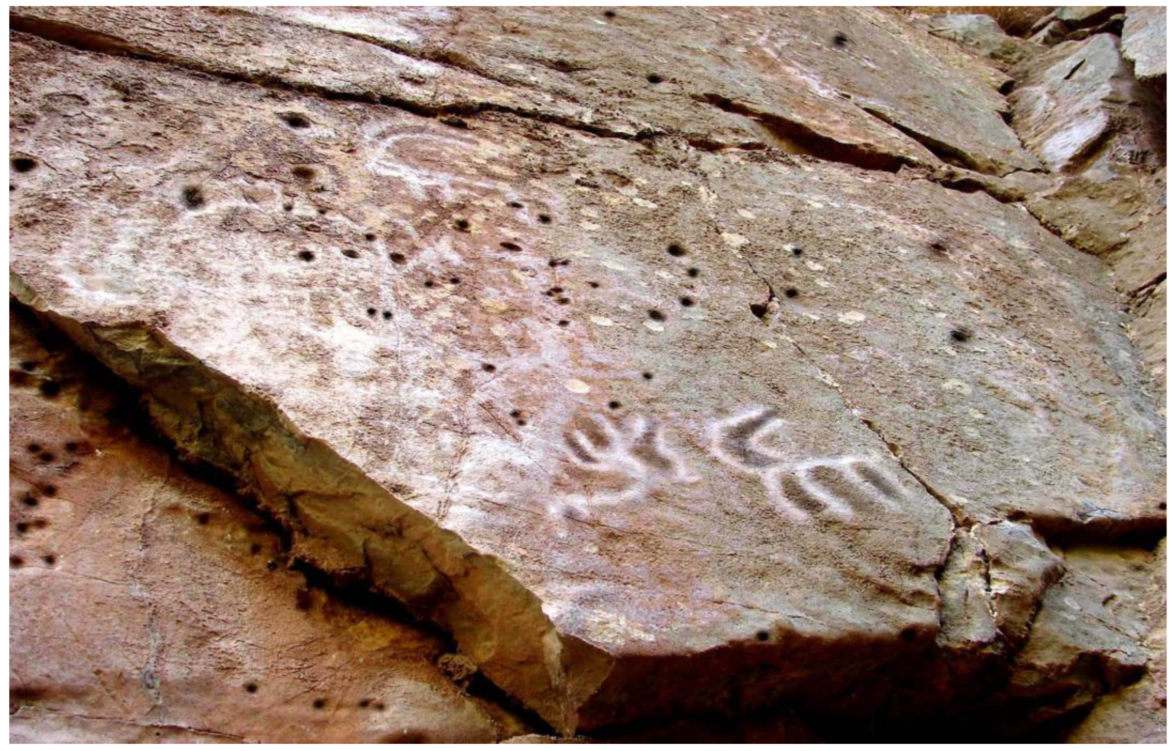
Figure 7.
“Antelopes” with long horns on Havar Poineh rock at Paveh.
Figure 7.
“Antelopes” with long horns on Havar Poineh rock at Paveh.
2.4. The Rock Art of Ryjab Village (Ryzhav)
The route from West Islamabad to Sarpol-e Zahab features a considerable number of rock art sites, but due to several reasons it was not possible to survey and identify the petroglyphs of these mountains and valleys, which show great potential. Therefore, the path to the valley north of the Ryzhav village, to the old mosque, was studied and several rock art sites were identified. On the way to the entrance of the valley to the right side of the vertical wall of the cliff (next to the electrical system and cables and at a height of 3 m above the ground), three old cupules have been made. Probably 30 years ago, many other cupules and other examples of rock art were obvious on the walls, which have been destroyed due to the construction of the electrical system and tourism facilities. These three cupules are the last examples of the ancient art in the entrance of valley. There are also four geometric shapes at a distance of a few centimeters from the earth level that are probably related to the Historical or Islamic era (
Figure 9). The valley contains a considerable number of archaeological remains, which mostly have been dated to the Partian period [
9].
Figure 9.
Four small geometric shapes, which were probably made during Historic or Islamic periods.
Figure 9.
Four small geometric shapes, which were probably made during Historic or Islamic periods.
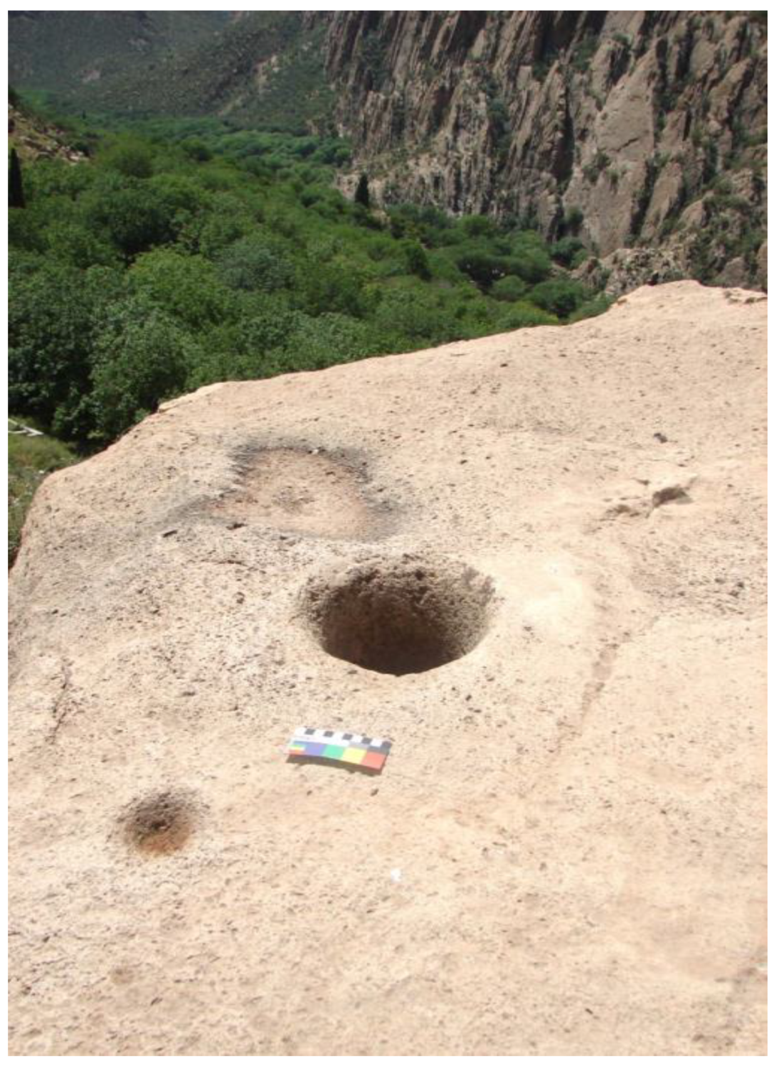
In this valley, there is a picture of the same geometric figure engraved. Pieces of large stones and rocks occur in the entire valley to the old mosque. Much of the remains of a rural ancient dry-stone structure are also preserved in the valley. Stone mortars that were used to prepare food are abundant in this valley. Mortars have been carved on the horizontal surface of huge stones, individually and in groups. In one case, a mortar is located near a rectangular recess of 70 x 50 cm, which was used to store water. Mortars and water storage pits are not considered rock art [
10]. As Bednarik says, there are many cupule-like features besides mortars [
10]. Different interpretations have been proposed about cupules in different regions of the world. But the cupules with mortar shots have been discovered, as in some other area of Kurdistan [
11] and the world [
10]. The author suggests that the location of cupules in the same panel with mortars may show a conceptual relation with fertility purposes, possibly in order to wish abundance and bless for their foods [
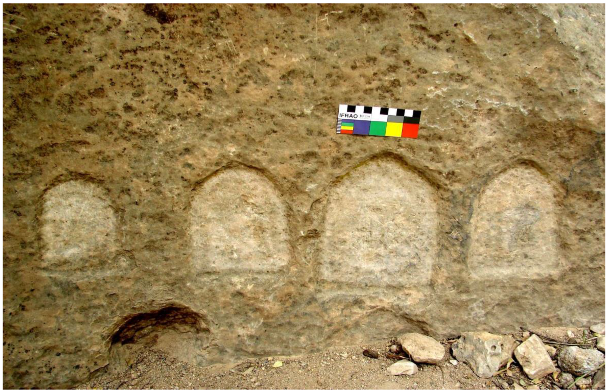
10]. However, ethnographic documents are required to support this interpretation. In this valley, three cupules between two mortars have been shown on the horizontal surface of the facade (
Figure 10). One cupule and a mortar are also shown on the horizontal surface of a huge stone (
Figure 11). On a horizontal surface of another cliff, there are two cupules occurring together (
Figure 12).
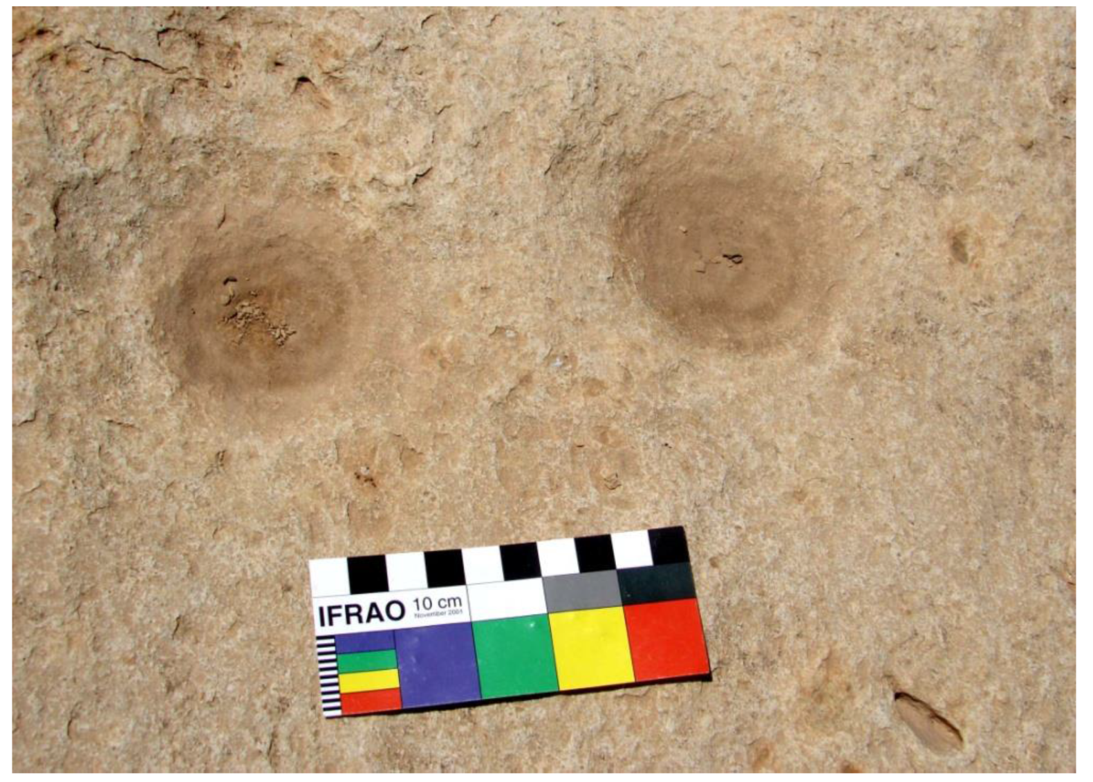
Figure 10.
Mortars and cupules in the rock art of Ryjab village.
Figure 10.
Mortars and cupules in the rock art of Ryjab village.
Figure 11.
On the horizontal surface of a huge cliff there are a cupule and a mortar.
Figure 11.
On the horizontal surface of a huge cliff there are a cupule and a mortar.
Figure 12.
On the horizontal surface of a piece of huge stone, two cupules.
Figure 12.
On the horizontal surface of a piece of huge stone, two cupules.
On the vertical surface of the rocks that make up the small sanctuary, rock art faces west. There is another panel, which shows two or three anthropomorphs and zoomorphs. The first anthropomorph on the right side of the group has been depicted embracing an ibex-resembling motif. Another “ibex” motif has also been depicted on the “skirt” or the body of the human shape. The second anthropomorph, possibly illustrates a female bearing a stick in hand. Another anthropomorph, perhaps depicts a child and a zoomorph, probably an “ibex”, are of the other depictions on the panel (
Figure 13).
Figure 13.
Anthropomorphs and ibex-resembling depictions in the rock art of Ryjab village.
Figure 13.
Anthropomorphs and ibex-resembling depictions in the rock art of Ryjab village.

