Article

Tall Herb Fringe Vegetation on Banks of Montenegrin Rivers as a Habitat Type of European Importance

by
Monika Myśliwy
1,* and
Vladimir Pešić
2
1
Department of Environmental Ecology, Institute of Marine and Environmental Sciences, University of Szczecin, 70-383 Szczecin, Poland
2
Department of Biology, University of Montenegro, 81000 Podgorica, Montenegro
*
Author to whom correspondence should be addressed.
Water 2023, 15(20), 3684; https://doi.org/10.3390/w15203684
Submission received: 28 August 2023 / Revised: 17 October 2023 / Accepted: 19 October 2023 / Published: 21 October 2023

Abstract

:
River valleys are known to be of high natural value; however, they are exposed to a strong human influence. Anthropogenic changes are evident in the structure and species composition of plant assemblages; therefore, vegetation is a very good indicator of the state of the environment. Convolvuletalia sepium tall herb communities are a natural component of riverside vegetation; they are protected in the EU (habitat 6430), yet have been very poorly studied, especially in SE Europe. Information regarding the geographical distribution of these communities, and their floristic composition and threats, along with effective conservation and restoration strategies, remains insufficient; therefore, this study was aimed at a comprehensive investigation of tall herbs. The paper presents results of the first detailed study of this group of communities in Montenegro. Classification of 70 vegetation samples (relevés) using the UPGMA produced six clusters corresponding to plant communities which were included in the Dorycnio recti-Rumicion conglomerati. Two of them were ranked as associations: Mentho longifolii-Pulicarietum dysentericae and Rubo sancti-Eupatorietum cannabini, the latter new to science. Others (communities of Rubus caesius, Rubus caesius-Eupatorium cannabinum, Helianthus ×laetiflorus, and Helianthus tuberosus) were left without a syntaxonomic rank. The ordination analysis with the CANOCO software confirmed the authors’ hypothesis that the variability of the vegetation patches studied was related to the land use type and river size. Relevés taken in watercourses flowing through built-up areas were dominated by invasive alien species (IAS). Vegetation samples taken in heavily flooded areas, along the Zeta, one of the largest rivers surveyed, had a simplified species composition. Studies in Montenegro should be continued. Moreover, comparative studies of the Convolvuletalia sepium communities described in the Mediterranean region are also necessary. Attention is drawn to the overly narrow interpretation of habitat 6430 in the lowlands, as it lacks a representation of Mediterranean tall herbs.

1. Introduction

High natural value, habitat diversity, and the continuity of similar ecosystems render river valleys significant hotspots of local biodiversity. Additionally, they function as distinct ‘ecological corridors’ which facilitate species migration and dispersal [1,2]. However, human economic activities have significantly transformed the environment of most European river valleys. In particular, changes in water flow regimes, combined with the intensification of agricultural practices on floodplains, have diminished the diversity of river landscapes [3,4,5]. This makes river valleys an important object of study in the context of nature monitoring and conservation. Riparian vegetation deserves special attention, as plant communities are good indicators of environmental conditions, and any natural and anthropogenic changes are reflected in the species composition and biological condition of phytocenoses. Moreover, the phytosociological approach in the study of vegetation is a fundamental tool with which to identify habitats of conservation significance in alignment with the Council Directive 92/43/EEC [6].
The riparian plant communities assigned to the order Convolvuletalia sepium Tx. ex Moor 1958 constitute an essential component of the natural vegetation of river valleys and are protected within the European Union as habitat 6430, “Hydrophilous tall-herb fringe communities of plains” [7]. They are usually formed by dense communities of tall herbs and climbing plants, forming narrow strips situated between rushes and floodplain forests or scrub, and between rush and meadow communities. As they prefer sites with fertile and moist soils, that are periodically flooded, they are mainly found along river banks and the shores of lakes and other water bodies [8,9,10]. Anthropogenic changes in river valleys result in the loss of sensitive communities as well as the transformation of the structure and species composition of remaining phytocenoses. Valuable typical species disappear, making space for common nitrophilous plants and geographically alien species [11]. An invasion of non-native species often results in the displacement of indigenous plants, whereby distinct plant communities comprising mainly alien species become commonplace [12,13,14,15].
The primary goal of managing Natura 2000 sites is to ensure that species and habitat types of the community’s interest are maintained at a favourable conservation status. Every six years, the responsible national authority is required to submit a thorough monitoring report to the EU. The report should include an evaluation of the conservation status of each of the species and habitats [16]. Accurate phytosociological identification of the habitat earmarked for protection is crucial for crafting effective monitoring approaches and implementing conservation measures. However, phytosociological and ecological characteristics of plant communities of the order Convolvuletalia sepium in Europe have been very poorly studied so far. These communities usually cover small areas, for which reason they are often overlooked in studies on vegetation. Information about them is scant and scattered. Knowledge on the geographical distribution of these communities and their structure and the direction of changes they undergo, as well as threats and effective methods of protection and restoration, is lacking. This is especially true for the area of south-eastern Europe and the Adriatic Sea region where basic surveys of tall herb vegetation are needed [17,18]. At the same time, habitat 6430 is considered rare and of high conservation significance, for example in Greece [19]. Therefore, this study was aimed at an exploration of the diversity, physiognomy, structure, and floristic composition of the riparian tall herb fringe communities along river valleys in Montenegro. It was hypothesised that the variability of the vegetation patches studied would be related to the river size and land use type. To verify the hypothesis, we asked the following research questions: (1) what is the floristic composition and diversity of tall herb fringe vegetation in Montenegro?; (2) are invasive alien species (IAS) important for the structure of the communities studied?; (3) is river size an important factor in distinguishing between the individual plant communities examined?; (4) does land use type affect tall herb fringe vegetation in river valleys? This is the first detailed study of the plant communities that are identifiers of habitat 6430 in the plains (code 37.7). So far, mainly montane communities of this habitat have been identified in Montenegro (code 37.8; Mulgedio-Aconitetea Hadač et Klika in Klika et Hadač 1944) [20].

2. Materials and Methods
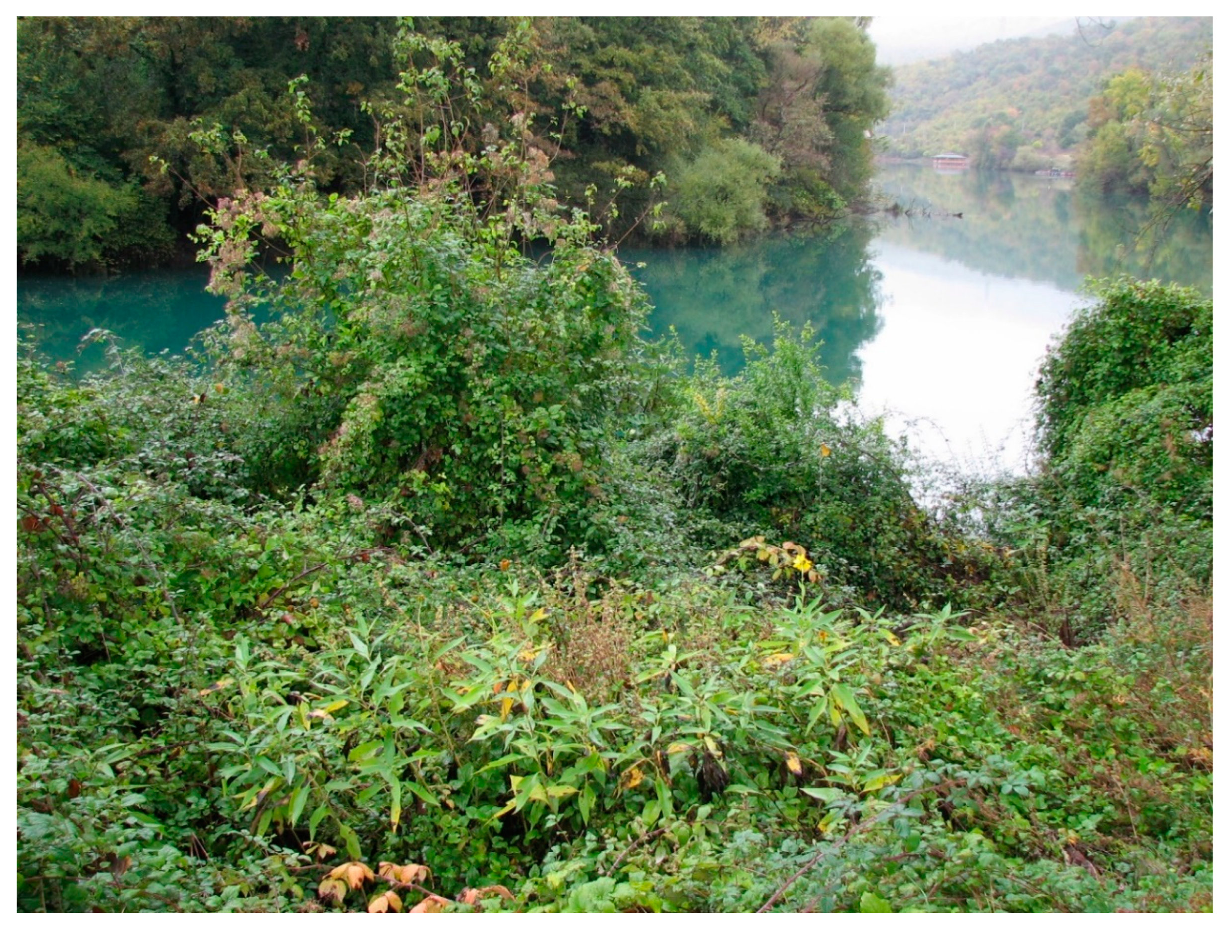
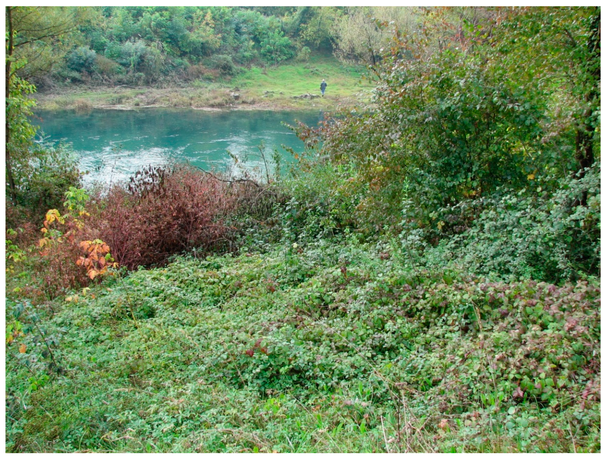
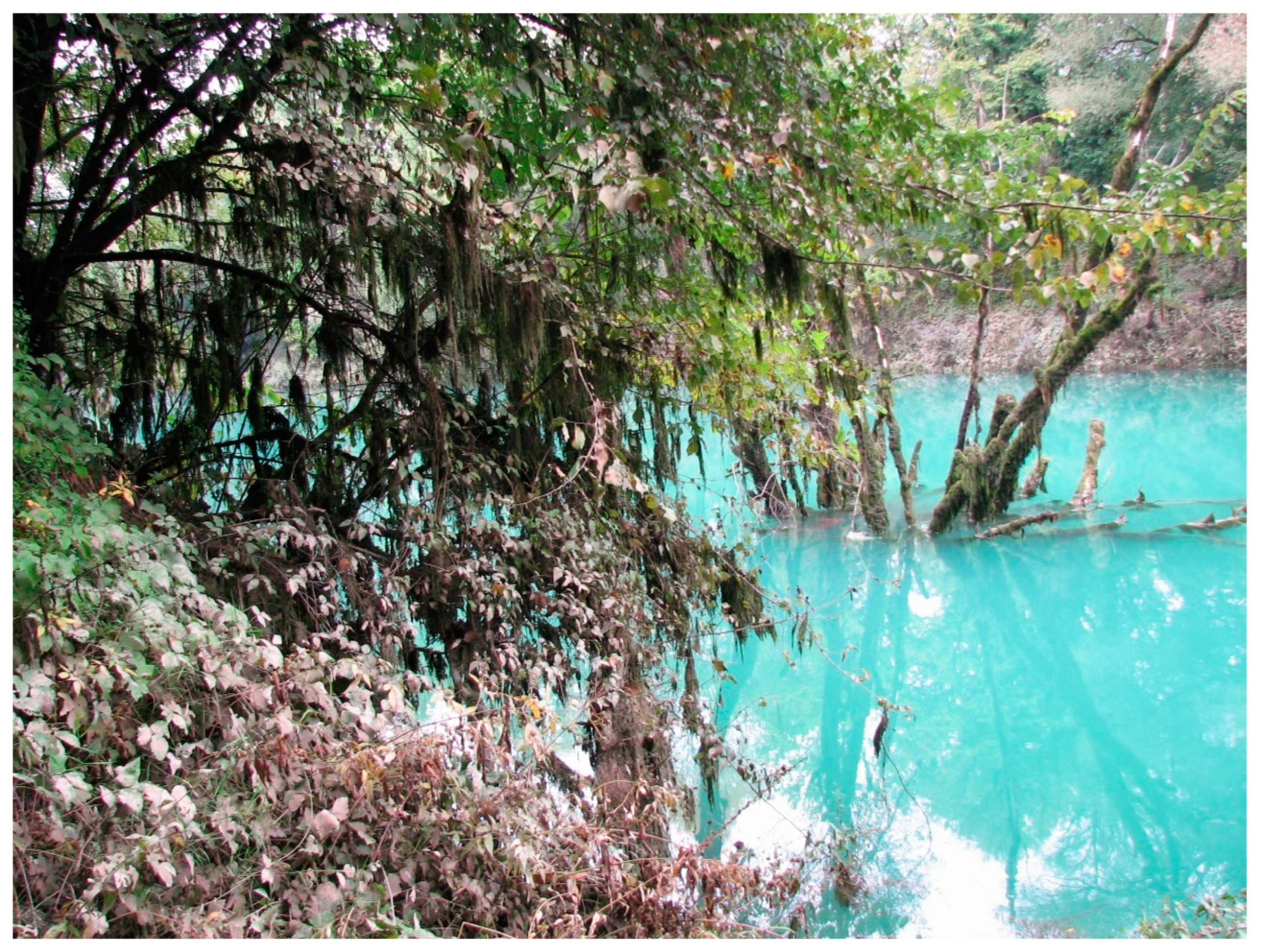
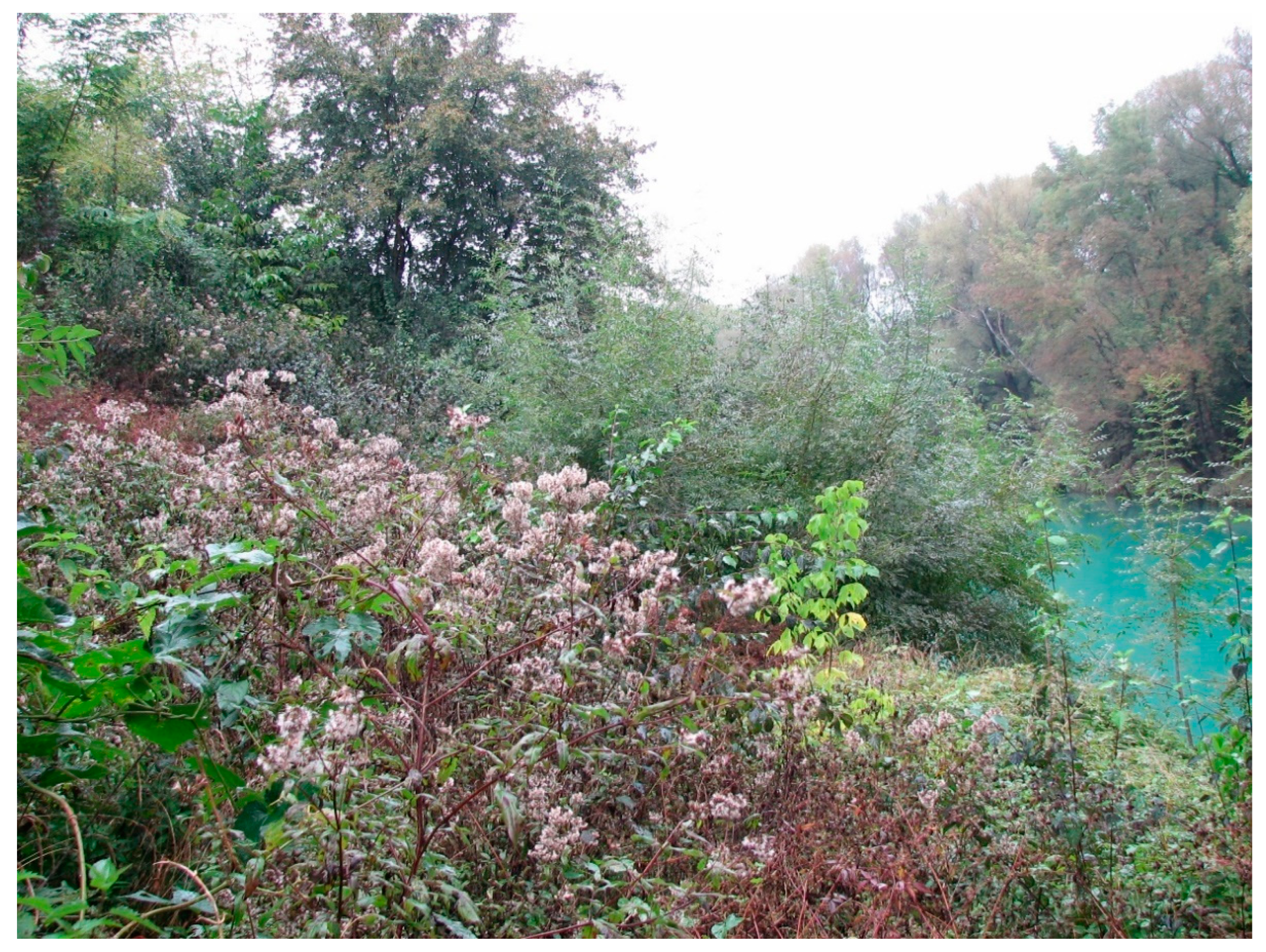
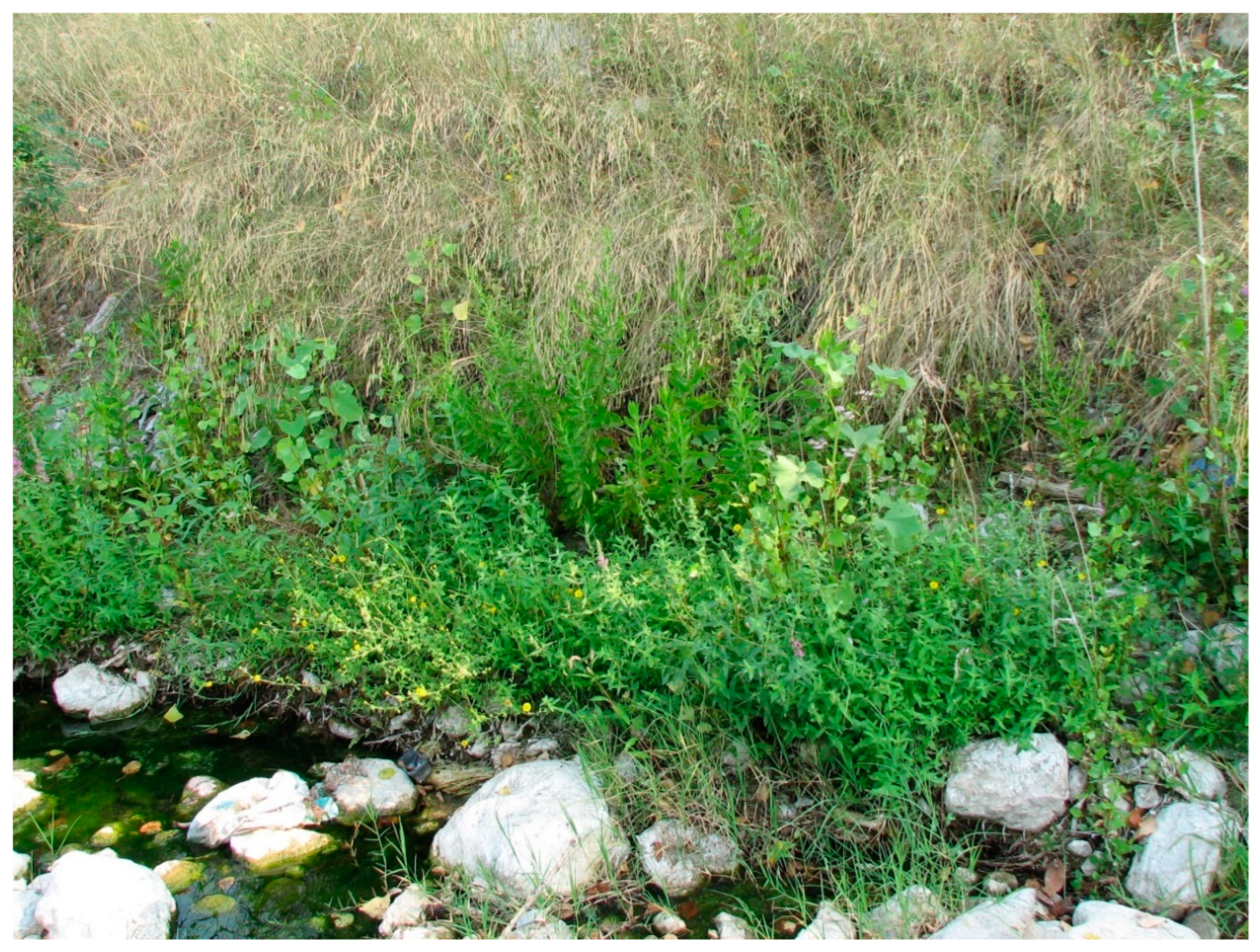
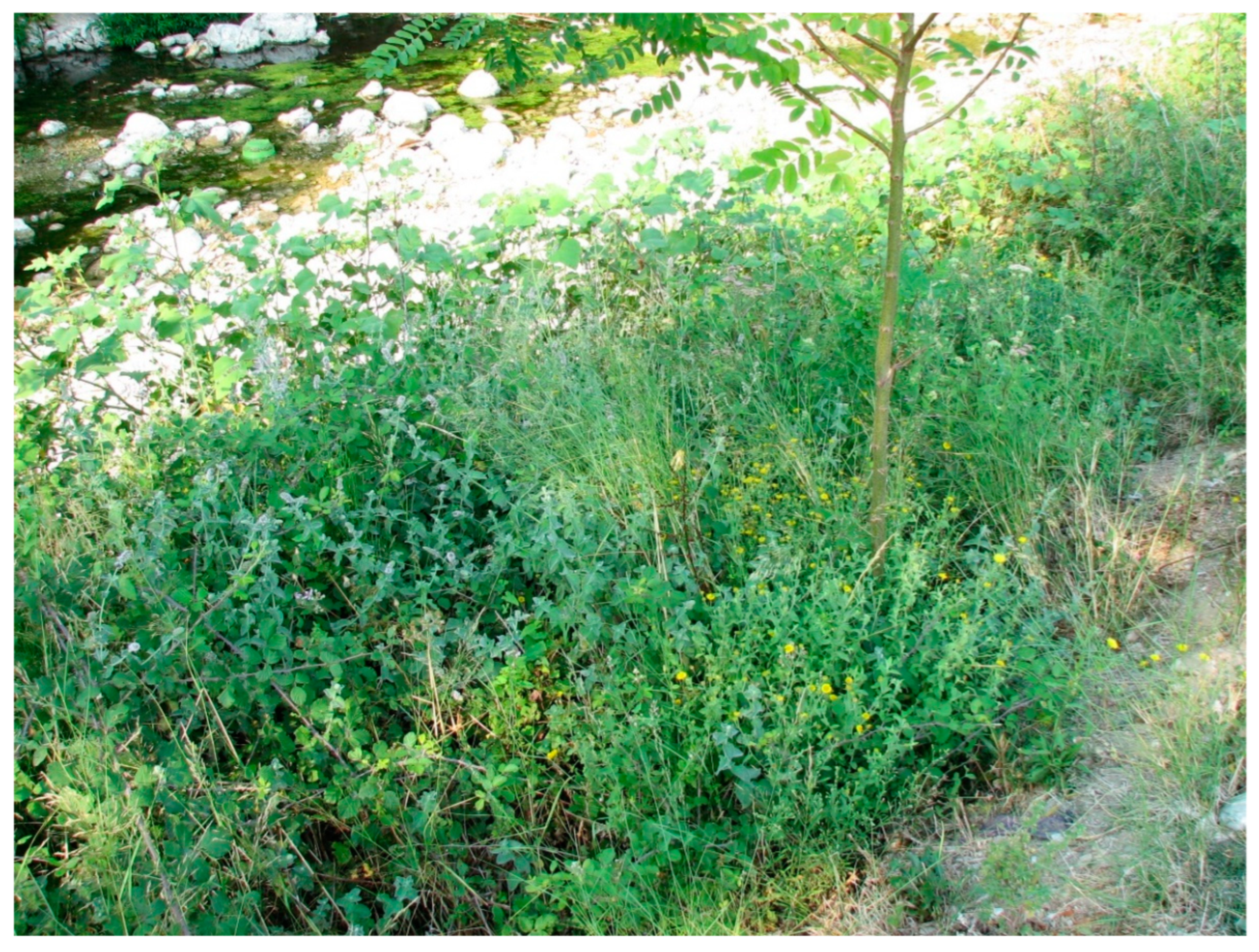
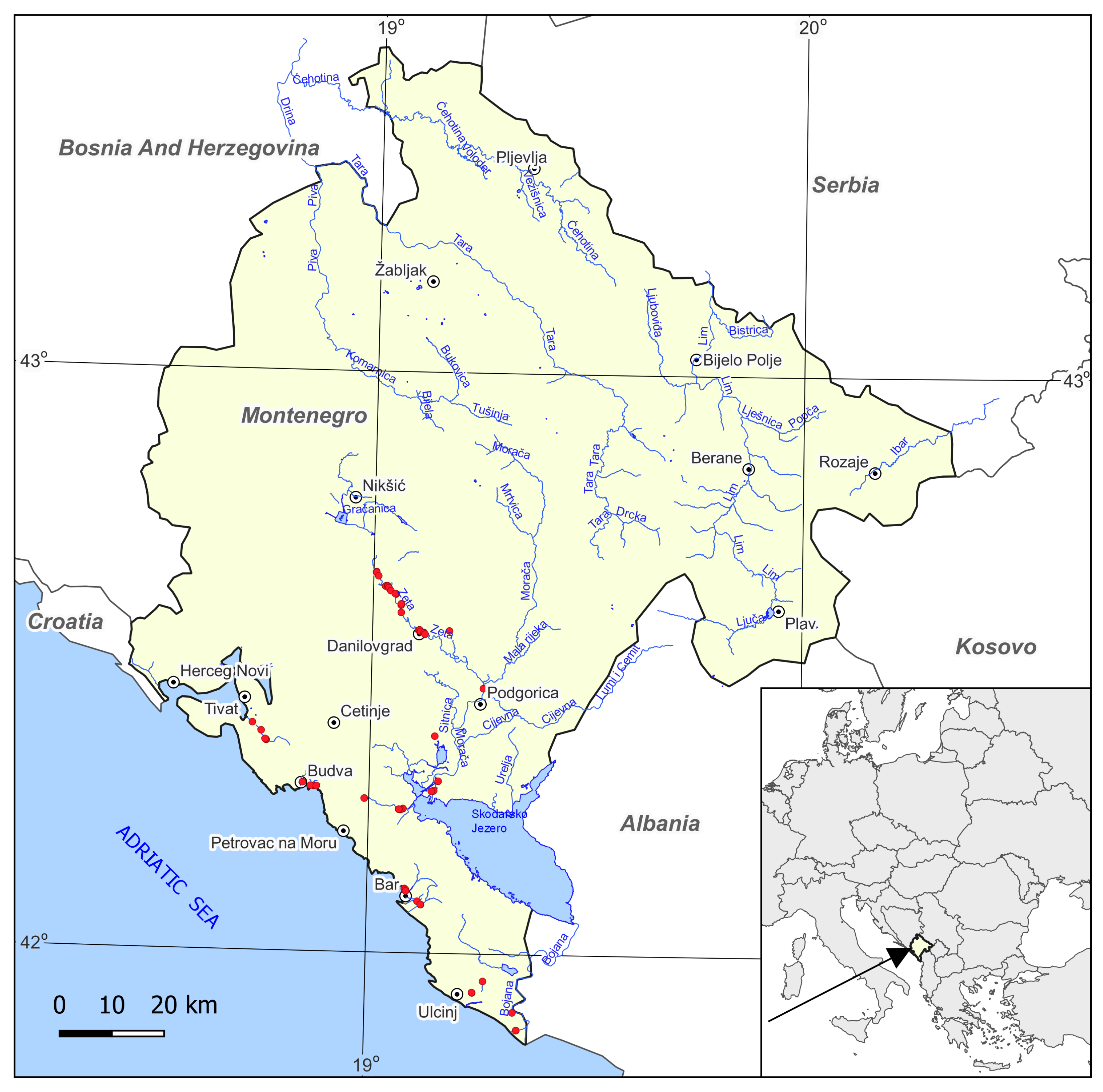
2.1. Study Area

Montenegro is situated in the central part of the Balkan Peninsula and covers 13,812 km2. The configuration of the river network is closely associated with the latitudinal alignment of landforms, particularly the orientation of the Dinarides mountain chain, which alters the course of the river flows. The hydrographic system of Montenegro consists of two almost equal catchments: that of the Adriatic Sea, with approximately 45.4% of the surface, and that of the Black Sea (the Danube), with around 54.6% of the surface [21]. The principal rivers and streams of the Adriatic Sea catchment include Morača, Zeta, Cijevna, Rijeka Crnojevića, and Orahovištica. Initially, they feed into Lake Skadar, and subsequently, the water flows with the Bojana river into the Adriatic Sea. In addition to the Bojana, the Adriatic is also fed by other rivers such as Građevica, Bečićka, Željeznica, Rikavac, and Brdela, and several other small streams. The principal rivers within the Danube catchment include Piva, Tara, Lim, Ibar, and Ćehotina [22].
Montenegro features three climate types based on Köppen criteria, including two variants of warm-temperate climate prevalent in the lower-lying regions of the country (Cs, the Mediterranean climate with hot summers, and Cf, the humid temperate climate with warm summers), and one type of cold-temperate climate in higher-lying inland mountain regions (Df, the wet boreal climate) [23]. In the Adriatic catchment, the climate is typically characterized as “Mediterranean”, marked by predominantly hot and dry summers. On the other hand, the Black Sea catchment experiences a “continental” climate, featuring relatively cool and humid summers along with harsh winters. Most of small rivers and streams within the Adriatic catchment dry up during the summer months [21].

2.2. Data Collection and Analysis

The studies were conducted in 2010 and 2012, along randomly chosen sections of Montenegrin rivers of the Adriatic catchment (Figure 1). Phytosociological samples (relevés) were set up in homogenous patches of all types of plant communities of the order Convolvuletalia sepium. The sampling plot (relevé) size ranged from 3 to 30 m2 (average 8 m2). For each plot, all the vascular plants were recorded using the Braun-Blanquet method [24] with three additional categories [25] for the cover abundance scale: r (one or few individuals); + (rare and less than 1% cover); 1 (more or less abundant with less than 5% cover); 2m (very abundant with approximately 5% cover); 2a (5–12.5% cover); 2b (12.5–25% cover); 3 (25–50% cover); 4 (50–75% cover); 5 (75–100% cover). At each sampling plot, additional ecological information, including riverbed width as a proxy of river size and the predominant land use type, was collected. The land use type was determined with respect to eight major types: urban area, village area, arable land, intensive grassland, extensive meadow/wetland, shrubland, forest, and road network (a proxy of the type and degree of anthropopressure). A database of 70 relevés was generated with Turboveg for Windows 2.9 software [26].
In all numerical analyses, the plant cover abundance data from relevés, originally recorded on the Braun-Blanquet scale, were transformed into the ordinal scale [27] using the following conversions: r = 1; + = 2; 1 = 3; 2m = 4; 2a = 5; 2b = 6; 3 = 7; 4 = 8; 5 = 9. Agglomerative hierarchical cluster analysis (UPGMA with average distance) was applied, using the software MVSP 3.2 [28], to explore the similarity of the species composition of the relevés and to identify plant community types. The identified units were subsequently consolidated into a synoptic table, which contains information on the percentage frequency of individual taxa in the relevés (Table 1). The newly described syntaxon was documented in a phytosociological table relative to the original relevés and the detailed location of sampling plots (Table 2).
The overall vegetation patterns were examined using detrended correspondence analysis (DCA), an indirect ordination method, with the CANOCO 4.5 software [29]. The unimodal ordination method was chosen due to the length of the first DCA axis surpassing 4 standard deviation units (SD). A DCA ordination plot was created to visualize the relationships between samples based on their species composition and to depict the main environmental gradients. Supplementary variables, namely riverbed width and land use type, were used in the post hoc interpretation of environmental gradients [30]. The selection of these environmental variables was based on previous experience in studying vegetation in river valleys [14], through which it was demonstrated that river size is the most significant factor in shaping the variability of tall herb fringe vegetation. The integration of land use types as supplementary variables on the DCA plot helped to understand the influence of anthropogenic pressure on the variability of species composition in the samples.
The species nomenclature followed that of Euro + Med PlantBase [31]. The higher syntaxonomic units (classes, orders, and alliances) were adopted after Mucina et al. [32]. Each species listed in the phytosociological and synoptic tables was assigned to a phytosociological class, following Appendix S6 in Mucina et al. for classification [32].
Table 1. Synoptic table of clusters produced via UPGMA-based classification of 70 relevés of tall herb fringe communities from Montenegro. The species are arranged as follows: species diagnostic of individual plant communities, species characteristic for particular classes, and other species.
Column Number123456
ClusterABC1C2DE
Number of Relevés822116203
Diagnostic species
Helianthus ×laetiflorus Pers.100140000
Pastinaca sativa L.50500100
Rubus sanctus Schreb.75732701567
Clematis vitalba L.385500033
Xanthium orientale subsp. italicum (Moretti) Greuter38140000
Cirsium creticum (Lam.) d’Urv.131800533
Eupatorium cannabinum L.3810036100250
Rubus caesius L.131410083200
Bidens frondosa L.097310030100
Rumex conglomeratus Murray0186450300
Agrostis capillaris L.096483300
Galium palustre L.004567100
Aristolochia clematitis L.05365050
Pulicaria dysenterica (L.) Bernh.0180671000
Mentha longifolia (L.) L.131800400
Helianthus tuberosus L.00000100
Epilobietea angustifolii Tx. et Preising ex von Rochow 1951
Calystegia sepium (L.) R. Br.2532181755100
Urtica dioica L.1390171567
Humulus lupulus L.1391817100
Parietaria officinalis L.255181750
Sambucus ebulus L.13093350
Epilobium hirsutum L.2500050
Torilis japonica (Houtt.) DC.0900533
Alno glutinosae-Populetea albae P. Fukarek et Fabijanić 1968
Hedera helix L.132301700
Ulmus minor Mill.13918000
Brachypodium sylvaticum (Huds.) P. Beauv.25233650033
Clematis viticella L.0564331533
Fraxinus angustifolia Vahl0093300
Molinio-Arrhenatheretea Tx. 1937
Galium mollugo L.385055332033
Agrostis stolonifera L. 25181802033
Verbena officinalis L.1314001033
Dactylis glomerata L.25149000
Paspalum distichum L.130002033
Centaurea jacea L.014017250
Ranunculus repens L.0145583200
Plantago major L.0141833150
Prunella vulgaris L.0181833250
Carex hirta L.09270450
Potentilla reptans L.005533450
Lysimachia nummularia L.001833300
Poa trivialis L.091801533
Rumex crispus L.05901033
Paspalum dilatatum Poir.05001533
Epilobium tetragonum L.0590033
Trifolium pratense L.00001533
Cyperus eragrostis Lam.0000533
Phragmito-Magnocaricetea Klika in Klika et Novák 1941
Lythrum salicaria L.13413683850
Mentha aquatica L.251836834033
Lycopus europaeus L.1314933300
Phragmites australis (Cav.) Steud.13500567
Lysimachia vulgaris L.001817100
Leersia oryzoides (L.) Sw.00271700
Cyperus longus L.05180200
Carex acuta L.0590033
Gratiola officinalis L.0000250
Artemisietea vulgaris Lohmeyer et al. in Tx. ex von Rochow 1951
Daucus carota L.13501803533
Equisetum arvense L.25180171067
Cichorium intybus L.3892717250
Artemisia verlotiorum Lamotte25991700
Melissa officinalis L.2532017033
Piptatherum miliaceum (L.) Coss.381800100
Dittrichia viscosa (L.) Greuter25140000
Picris hieracioides L.032901033
Artemisia vulgaris L.09001033
Elytrigia repens (L.) Nevski05901067
Other species
Setaria viridis (L.) P. Beauv.2500000
Chenopodium album L.13000033
Persicaria maculosa Gray251800533
Bidens tripartita L.13591700
Cynodon dactylon (L.) Pers.131490150
Setaria pumila (Poir.) Roem. & Schult. 259017100
Cornus sanguinea L.0324517200
Periploca graeca L.09270200
Amorpha fruticosa L.0927000
Euphorbia sp.0990300
Xanthium strumarium L.09901533
Euonymus europaeus L.00185050
Persicaria dubia (Stein) Fourr.0093300
Notes: A, Helianthus ×laetiflorus community; B, Rubo sancti-Eupatorietum cannabini Myśliwy ass. nov. hoc loco; C1, Rubus caesius community; C2, Rubus caesius-Eupatorium cannabinum community; D, Mentho longifolii-Pulicarietum dysentericae Slavnić 1958; E, Helianthus tuberosus community. The data presented indicate the frequency (%) of a species’ occurrence in relevés; only species with a frequency of at least 25% in one or more columns or of at least a minimum of 40% across all columns collectively are included. Each species was assigned to a phytosociological class following Appendix S6, published by Mucina et al. [32].
Table 2. The relevé table of Rubo sancti-Eupatorietum cannabini Myśliwy ass. nov. hoc loco (holotypus: relevé 66, column 3). Data on cover abundance for species in each relevé are presented. Sporadic species, recorded in only one sampling plot, are listed beneath the table.
Column Number12345678910
Relevé Number *2646663985218205
Year2010201220122010201220102012201020102010
Month1088108108101010
Day8303082292713138
Relevé area (m2)4863544945
Slope (degree)40000602000050
AspectSW---SNW---W
Shrub layer coverage (%)200010011055
Herb layer coverage (%)100501008585908010095100
Moss layer coverage (%)0000100500
No. of species13181412102015171519
Characteristic and differential* species of association Rubo sancti-Eupatorietum cannabini Myśliwy ass. nov. hoc loco
Eupatorium cannabinum L.33442b3342a3
Rubus sanctus Schreb.2a.2a+2a2a+11+
* Clematis vitalba L.2a+2a..+.+2a+
* Cirsium creticum (Lam.) d’Urv.1.1..+...+
* Xanthium orientale subsp. italicum (Moretti) Greuter.....+1..+
Characteristic species of alliance Dorycnio recti-Rumicion conglomerati Gradstein et Smittenberg 1977
Dittrichia viscosa (L.) Greuter...2a.+....
Pulicaria dysenterica (L.) Bernh.+....2b....
Scirpoides holoschoenus (L.) Soják.+...+....
Poa trivialis L...+....2m..
Rumex conglomeratus Murray.+........
Euphorbia hirsuta L....+......
Convolvuletalia sepium Tx. ex Moor 1958 et Epilobietea angustifolii Tx. et Preising ex von Rochow 1951
Calystegia sepium (L.) R. Br.2a.1+.2a....
Lythrum salicaria L.2a2a.....+.3
Mentha aquatica L.2b2a+.......
Helianthus ×laetiflorus Pers.+....+...+
Humulus lupulus L...2b.....+.
Rubus caesius L........2a2a.
Artemisia verlotiorum Lamotte......+..1
Molinio-Arrhenatheretea Tx. 1937
Galium mollugo L.1...+..++.
Agrostis capillaris L.........+2m
Agrostis stolonifera L. ..+..1....
Dactylis glomerata L.....+....+
Other species
Daucus carota L..+++.++...
Brachypodium sylvaticum (Huds.) P. Beauv.....2a+..2a1
Cornus sanguinea L. (b)...+...2a2a2a
Melissa officinalis L......+2a1.+
Equisetum ramosissimum Desf.1..+......
Robinia pseudoacacia L. (b)2b.....+...
Cynodon dactylon (L.) Pers..2m1.......
Persicaria maculosa Gray.+....1...
Amorpha fruticosa L. (c).r.....r..
Picris hieracioides L...+.1.....
Piptatherum miliaceum (L.) Coss......2m+...
Equisetum arvense L.......12a..
Vicia sp....+.+....
Hedera helix L........++.
Sporadic species: Acer campestre L. (b) 18 (2a), Aristolochia clematitis L. 20 (+), Berteroa mutabilis (Vent.) DC. 8 (+), Bidens frondosa L. 20 (+), Bidens subalternans DC. 8 (+), Bidens tripartita L. 52 (2a), Carduus crispus L. 39 (+), Carex hirta L. 18 (2a), Carex rostrata Stokes 20 (1), Centaurea jacea L. 64 (+), Cichorium intybus L. 52 (+), Clematis flammula L. 39 (3), Clematis viticella L. 6 (+), Convolvulus arvensis L. 6 (+), Cruciata laevipes Opiz 66 (+), Cyperus longus L. 64 (+), Digitaria sanguinalis (L.) Scop. 52 (2m), Dioscorea communis (L.) Caddick & Wilkin 18 (+), Dorycnium pentaphyllum subsp. herbaceum (Vill.) Bonnier & Layens 39 (+), Elytrigia repens (L.) Nevski 5 (1), Equisetum telmateia Ehrh. 66 (2a), Ficus carica L. (c) 64 (1), Galium elongatum C. Presl 18 (+), Galium verum L. 5 (1), Lactuca serriola L. 39 (+), Ligustrum vulgare L. (c) 64 (r), Melilotus albus Medik. 8 (2a), Paspalum dilatatum Poir. 8 (1), Pastinaca sativa L. 2 (+), Periploca graeca L. 64 (+), Persicaria lapathifolia (L.) Delarbre 64 (+), Phragmites australis (Cav.) Steud. 6 (2a), Polygonum aviculare aggr. 52 (+), Prunella vulgaris L. 20 (+), Prunus spinosa L. (b) 18 (+), Rumex crispus L. 52 (+), Salix alba L. (b) 5 (+), Scirpus sylvaticus L. 5 (2a), Setaria pumila (Poir.) Roem. & Schult. 64 (+), Sonchus oleraceus L. 64 (+), Torilis arvensis (Huds.) Link 5 (+), Urtica dioica L. 20 (3), Verbena officinalis L. 5 (2b).
Notes: the lowercase letters (b) and (c), written in brackets following the species names, denote shrub and herb layers, respectively. Each species was assigned to a phytosociological class following Appendix S6, published by Mucina et al. [32]. Sporadic species were arranged in alphabetical order; relevé number was given, followed by cover abundance in parentheses. * Geographical coordinates of relevés: 2, locality Radanovici, river Koložun, N42.360810, E18.758785; 5, locality Lješevići, river Koložun, N42.377135, E18.746527; 6, locality Tivat, river Koložun, N42.390738, E18.725743; 8, locality Bečići, river Bečićka, N42.284055, E18.871765; 18, locality Potočilo, river Zeta, N42.653678, E19.005890; 20, locality Potočilo, river Zeta, N42.647400, E19.011133; 39, locality Podgor, river Velika, N42.264104, E18.989711; 52, locality Čeluga, river Rikavac, N42.083542, E19.124854; 64, locality Virpazar, river Orahovištica, N42.247565, E19.079702; 66, locality Virpazar, river Orahovištica, N42.245722, E19.074465.

3. Results

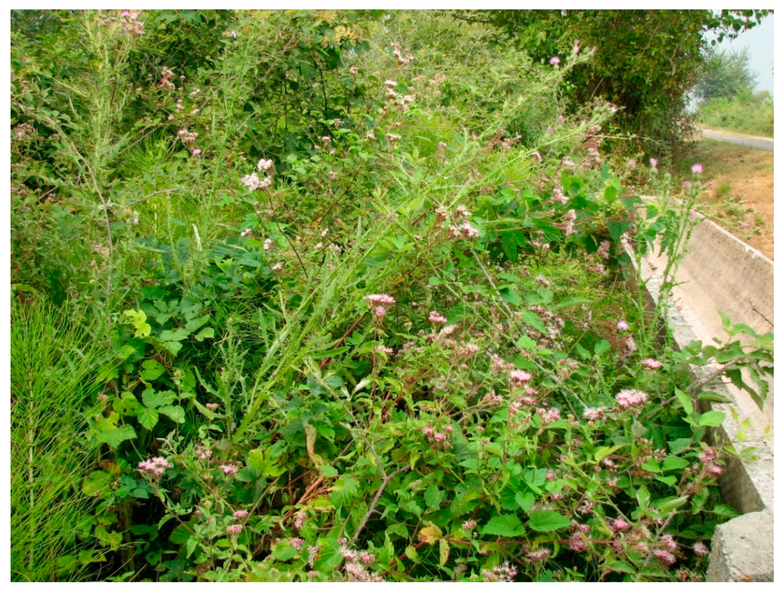
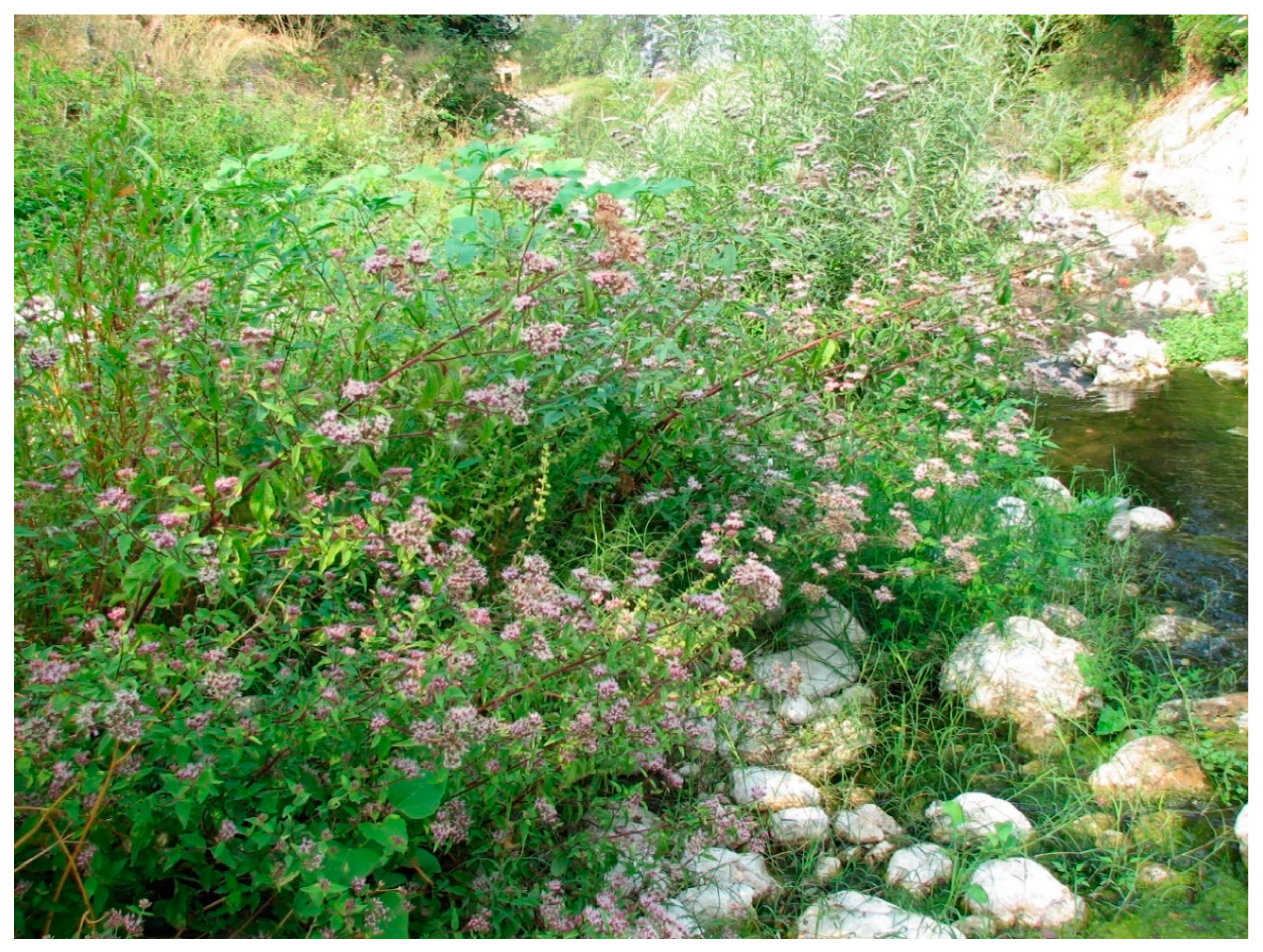
3.1. Characteristics of Plant Communities and the Contribution of IAS

The dendrogram resulting from the numerical classification allowed to distinguish six clusters corresponding to six plant communities (Figure 2).
The plant communities identified were incorporated into a hierarchical phytosociological classification system as follows:
Class Epilobietea angustifolii Tx. et Preising ex von Rochow 1951
Order Convolvuletalia sepium Tx. ex Moor 1958
  • Helianthus tuberosus community (Convolvuletalia sepium)
Alliance Dorycnio recti-Rumicion conglomerati Gradstein et Smittenberg 1977
  • Helianthus × laetiflorus community (Dorycnio recti-Rumicion conglomerati)
  • Rubo sancti-Eupatorietum cannabini Myśliwy ass. nov. hoc loco
  • Rubus caesius community (Dorycnio recti-Rumicion conglomerati)
  • Rubus caesius-Eupatorium cannabinum community (Dorycnio recti-Rumicion conglomerati)
  • Mentho longifolii-Pulicarietum dysentericae Slavnić 1958
The Helianthus tuberosus community was represented by only three vegetation patches (Table 1, column 6) located in Bar, on the river Željeznica and other small watercourses. The samples examined contained between 8 and 23 plant species (average 14.3), and were characterized by a diverse floristic composition. The physiognomy and structure of the community in two patches was decided according to the dominant species Helianthus tuberosus, the third patch featuring a higher coverage of Urtica dioica. The constant companion species were Calystegia sepium and Bidens frondosa. Other frequently recorded species included Elytrigia repens, Rubus sanctus, Equisetum arvense, and Phragmites australis. It is difficult to assign the community to a specific alliance due to the research material being too scant. It is possible that the documented patches represent two different alliances (Dorycnio recti-Rumicion conglomerati and Senecionion fluviatilis).
The Helianthus ×laetiflorus community was represented by eight vegetation patches (Table 1, column 1; Figure A1 and Figure A2) located on the rivers Građevica, Koložun, Bečićka, Vještica, Zeta, and Morača. The unit grouped 8–23 species per sample (average 13.25). The dominant species, covering 50–80%, were key for the physiognomy and structure of the plant community. The constant companion species which could be considered distinguishing species were Rubus sanctus and Pastinaca sativa. Calystegia sepium, Dittrichia viscosa, Piptatherum miliaceum, and Galium mollugo were frequent as well. The community was further distinguished by Clematis vitalba, Xanthium orientale subsp. Italicum, and Cirsium creticum. The characteristic species composition of the patches was clearly related to that of the next plant community, which may indicate that Helianthus ×laetiflorus, a geographically alien species, occupies the same habitats, displacing native species combinations.
Rubo sancti-Eupatorietum cannabini Myśliwy ass. nov. hoc loco was represented by 22 vegetation patches (Table 1, column 2; Type: Table 2, relevé 66, column 3, holotypus hoc loco; Figure A3, Figure A4 and Figure A5; characteristic species of association: Eupatorium cannabinum and Rubus sanctus; differential species of association: Clematis vitalba, Cirsium creticum, and Xanthium orientale subsp. italicum) located on the rivers Koložun, Bečićka, Velika, Rikavac, Orahovštica, and sporadically the Zeta. Samples representing the association featured 9 to 21 plant species (14 on average). The community was characterised by the dominance of Eupatorium cannabinum, and was distinguished by the constant contribution of Rubus sanctus and an occasional presence of Cirsium creticum and Xanthium orientale subsp. italicum. Among other frequently recorded species, worth mentioning are the creepers Clematis vitalba and Calystegia sepium, species belonging to the class Artemisietea vulgaris Lohmeyer et al. in Tx. ex von Rochow 1951, such as Daucus carota, Melissa officinalis, and Picris hieracioides, as well as meadow and rush species Galium mollugo and Lythrum salicaria. The association was also characterised by the presence of a considerable number of sporadic species occurring at a low constancy. The rare shrub layer, with a cover of 5–20%, was mainly composed of Cornus sanguinea.
The Rubus caesius community was represented by 11 vegetation patches (Table 1, column 3; Figure A6 and Figure A7) located on the rivers Zeta and Morača, and sporadically on the Orahovštica. Most of the sites surveyed showed clear signs of flooding. The unit featured 12 to 22 species per sample (average 15.9). The physiognomy and structure of the community was decided according to the dominant species Rubus caesius and the constant contribution of Agrostis capillaris, Bidens frondosa, and Rumex conglomeratus, which, along with Galium palustre and Aristolochia clematitis, can be considered the distinguishing species. Frequently recorded species included Clematis viticella, Galium mollugo, Potentilla reptans, Ranunculus repens, Mentha aquatica, Lythrum salicaria, and others. The shrub layer, usually present and covering 5–35%, was composed of Cornus sanguinea and Amorpha fruticosa, and less frequently of Fraxinus angustifolia, Euonymus europaea, and Sambucus ebulus. The characteristic species composition of the patches shows a clear affinity to that of the next community, which may indicate that these were simplified, species-depleted patches of that community that had been disturbed due to flooding.
The Rubus caesius-Eupatorium cannabinum community was represented by six vegetation patches (Table 1, column 4; Figure A8) located on the Zeta river. The samples examined grouped 15–27 species (average 17.7). The plant community was made up of two co-dominant species, Eupatorium cannabinum and Rubus caesius, as well as of Agrostis capillaris, Galium palustre, Pulicaria dysenterica, Rumex conglomeratus, Aristolochia clematitis, and the geographically alien, invasive species Bidens frondosa. Frequently recorded species were Ranunculus repens, Lythrum salicaria, Brachypodium sylvaticum, and Mentha aquatica. The shrub layer, if present, was made up of Sambucus ebulus, Fraxinus angustifolia, and Euonymus europaea, and less frequently made up of Cornus sanguinea.
Mentho longifolii-Pulicarietum dysentericae was represented by 20 vegetation patches (Table 1, column 5; Figure A9 and Figure A10) located on the rivers Zeta, Rikavac, and Bojana, and other small watercourses. The samples representing the association showed the presence of 9–22 species (average 15.9). The community was characterised by the dominance of Pulicaria dysenterica, which was accompanied by Calystegia sepium, Mentha longifolia, and Lythrum salicaria. In addition, the community contained a group of meadow species such as Carex hirta, Potentilla reptans, Agrostis capillaris, Rumex conglomeratus, and Lysimachia nummularia, and a group of rush species, including Mentha aquatica, Lycopus europaeus, and Cyperus longus. The association showed also an abundant group of sporadic species occurring at a low constancy. The rarely present shrub layer was mainly composed of Cornus sanguinea.
The surveys of tall herb vegetation patches in Montenegro revealed the presence of the following 16 IAS (listed in decreasing order of frequency): Bidens frondosa L., Helianthus ×laetiflorus Pers., Artemisia verlotiorum Lamotte, Erigeron canadensis L., Paspalum distichum L., Robinia pseudoacacia L., Xanthium orientale subsp. italicum (Moretti) Greuter, Amorpha fruticosa L., Paspalum dilatatum Poir., Erigeron annuus (L.) Pers. subsp. annuus, Helianthus tuberosus L., Symphyotrichum squamatum (Spreng.) G. L. Nesom, Acer negundo L., Ailanthus altissima (Mill.) Swingle, Amaranthus retroflexus L., and Bidens subalternans DC. The highest abundance was shown by species of the genus Helianthus which formed their own communities. Other alien species that were important for the structure of the communities studied and were distinguishing among the floristic composition of some of them included Bidens frondosa and Xanthium orientale subsp. italicum.

3.2. The General Pattern of Tall Herb Vegetation and Its Relationships with Land Use Type and River Size

The DCA plot (Figure 3) showed the vegetation patches dominated by alien invasive species of the genus Helianthus to cluster in the upper left quadrant of the ordination space. These phytocenoses were primarily recorded in urban built-up areas, and in the diagram, they cluster around the variable ‘Urban’. The samples located in the central section of the ordination diagram represent the Rubo sancti-Eupatorietum cannabini Myśliwy ass. nov. hoc loco. These patches were also exposed to a strong anthropopressure, as they had developed along the watercourses rolling through built-up areas (‘Urban’ and ‘Village’), near road networks (‘Roads’) and in the vicinity of intensively used grasslands (‘Grassland’) or arable lands (‘Arable’). Patches of the Mentho longifolii-Pulicarietum dysentericae clustered in the upper right quadrant of the ordination plot. They were mainly associated with extensive meadows and wetlands (‘Meadow’). The lower right quadrant of the ordination plot is occupied by patches of vegetation dominated by Rubus caesius or Rubus caesius and Eupatorium cannabinum. The dominant land use type in their surroundings was riparian forests (‘Forest’).
The eigenvalue of the first DCA axis was quite high (0.552), which indicated that the environmental gradient it represented clearly differentiated the vegetation samples studied. The distribution of samples along the horizontal axis corresponded, on the one hand, with the decreasing degree of anthropopressure (land use type: from urban areas to extensive meadows and forests) and, on the other, to their occurrence along rivers of different size; the riverbed width increases from left to right in the plot, the maximum being found in the part of the ordination space grouping together samples representing the Rubus caesius and Rubus caesius-Eupatorium cannabinum communities (Figure 3). The patches located along the largest rivers surveyed in Montenegro: the Zeta and the Morača, often bore traces of large-scale flooding (Figure A7).

4. Discussion

4.1. The Position of Riparian Tall Herb Communities of Montenegro in the Classification Scheme

Mucina et al. [32], who studied European vegetation, mentioned two groups of alliances: the group of temperate alliances, with Senecionion fluviatilis Tx. ex Moor 1958, Archangelicion litoralis Scamoni et Passarge 1963 and Nardosmion laevigatae Klotz et Köck 1986 (the latter limited to the Southern Urals), and the group of Macaronesian–Mediterranean alliances, with Cynancho-Convolvulion sepium Rivas Goday et Rivas-Mart. ex Rivas-Mart. 1977, Dorycnio recti-Rumicion conglomerati Gradstein et Smittenberg 1977, and Ipomoeo acuminatae-Ageratinion adenophorae Espírito-Santo et al. 2004 (the latter Canarian-Madeirean). The tall herb fringe vegetation found on nutrient-rich river banks and in ditches within Central Europe was assigned to Senecionion fluviatilis. Archangelicion litoralis is defined as tall herb fringe vegetation along river banks of Central and Eastern Europe. The validity of the division of Central European communities belonging to the order Convolvuletalia sepium into these two alliances has been recently confirmed via ecological and phytosociological studies by Myśliwy [14]. She demonstrated substantial differences between tall herb fringe communities linked to large rivers (Senecionion fluviatilis) and those associated with small rivers (Archangelicion litoralis), the difference involving the floristic composition of patches and the proportion of the moss layer. Furthermore, habitat differences included many physical and chemical soil characteristics [14].
Tall herb vegetation in nutrient-rich riparian habitats within the Western Mediterranean region is assigned to Cynancho-Convolvulion sepium, whereas the Dorycnio recti-Rumicion conglomerati alliance is assigned as tall herb vegetation of the Central and Eastern Mediterranean regions [32]. Comparative studies on a supra-regional scale in south-eastern Europe are lacking, except for some scattered information in the literature on the Convolvuletalia sepium communities and natural habitat 6430 in the Balkans. On the scale of South-Eastern Europe, a single alliance only, Senecionion fluviatilis (syn. Convolvulion sepium), has been reported from Albania [33], Bosnia and Herzegovina [34], Croatia [35], Serbia [36], and Slovenia [37]. The same is true for Hungary [38] and Eastern Transylvania [39]. In Bulgaria, the presence of plant assemblages from Senecionion fluviatilis is expected, but a new association from Archangelicion litoralis has also been documented, extending the range of this alliance to south-eastern Europe [18].
The Dorycnio recti-Rumicion conglomerati alliance is known mainly from Italy, France, Spain, and Greece [40,41,42]. According to Gradstein and Smittenberg [43], the characteristic species of the alliance include Rumex conglomeratus, Poa trivialis subsp. sylvicola (Guss.) H. Lindb., Trifolium repens L., Anacamptis laxiflora (Lam.) R. M. Bateman & al. (syn. Orchis laxiflora Lam.), and Pulicaria dysenterica and Dittrichia viscosa (syn. Inula viscosa (L.) Aiton). According to other authors, the diagnostic species of the alliance include also Cirsium creticum, Dorycnium rectum (L.) Ser., Scirpoides holoschoenus (L.) Soják, Epilobium hirsutum, Euphorbia hirsuta L., and Eupatorium cannabinum [40]. The presence of most of the species listed in the riparian herbaceous vegetation patches surveyed in Montenegro justifies their inclusion in the alliance discussed. The association of Mentho longifolii-Pulicarietum dysentericae was already recorded in Montenegro when the vegetation of Skadar Lake was described [44], but it was included in the Senecionion fluviatilis alliance. However, the species combination of the patches studied and the absence of several temperate zone taxa are more fitting to the alliance Dorycnio recti-Rumicion conglomerati. Patches of this association were often found in a mosaic with meadow communities, including the seasonally flooded Mediterranean meadows of Molinio-Holoschoenion Br.-Bl. ex Tchou 1948 (habitat 6420).

4.2. Floristic Composition of Plant Communities and the Contribution of IAS

Communities of tall herb fringes along river banks are relatively poorly understood. They are found in ecotones, i.e., areas where different plant communities overlap and engage in active interaction [45]. As a result, not only do their phytocenoses consist of their own characteristic species, but they also include species from adjacent communities, reflecting the composition of the surrounding patches. This complexity renders them challenging research objects. Their species composition is highly variable and a proportion of less frequent species is high as well [14]. This was also been documented in the present study. Particularly important in shaping the structure of the communities examined were species from the following classes: Molinio-Arrhenatheretea, Phragmito-Magnocaricetea, and Artemisietea vulgaris. A similar pattern was also described from other riparian small-scale communities of the class Bidentetea Tx. Et al. ex von Rochow 1951 [46]. Furthermore, as individual patches of tall herbs were observed to be dominated by different species, descriptions of multiple associations and subassociations are on record [10,40].
The species composition of vegetation patches included here in the newly defined association Rubo sancti-Eupatorietum cannabini somewhat resembles that of the Picrido hieracioidis-Eupatorietum cannabini Loidi & Navarro 1988 association, described from Spain [47] and originally assigned to the Senecionion fluviatilis alliance. However, the latter association contains a number of species that are missing from the vegetation patches surveyed in Montenegro, such as, most notably, two characteristic species, Angelica sylvestris L. and Mentha suaveolens Ehrh., as well as Hypericum androsaemum L., Teucrium scorodonia L., Geranium robertianum L., Holcus lanatus L., and Brachypodium rupestre (Host) Roem. & Schult. [47,48]. The new association described here from Montenegro also exhibits floristic similarities to the association Cirsio cretici-Eupatorietum cannabini Brullo et Spampinato 1990 described from Italy [49,50] and included in tall herb, intermittently flooded, nutrient-rich meadow fringes of Mentho longifoliae-Juncion inflexi T. Müller et Görs ex de Foucault 2009. In this case, too, some important community-building species are missing, such as Dorycnium rectum (L.) Ser., as well as Epilobium angustifolium L., Angelica sylvestris, and Carex pendula Huds. In addition, the patches of vegetation from Montenegro are not typical meadow inhabitants, but are rather typical hygrophilous tall herb fringes of the order Convolvuletalia sepium. For this reason, the vegetation patches studied were included in a newly described association and in the alliance described from Crete.
The patches of vegetation described from Montenegro, with a significant proportion of Rubus caesius, bear a relationship to the association Hedero helicis-Rubetum caesii recently described by de Foucault [51], and particularly to its more hygrophilous variant, distinguished by the presence of Eupatorium cannabinum. Unfortunately, in the vegetation patches examined here, the eponymic species, Hedera helix, is relatively rare, and several species characteristic of the class Alno glutinosae-Populetea albae are missing, including Carex pendula, Circaea lutetiana L., Geum urbanum L., Scrophularia nodosa L., and Stachys sylvatica L. The patches of vegetation described here had rarely developed under the tree canopy, hence the lack of more shade-tolerant species. For this reason, it was decided to leave this community, for the time being, without a syntaxonomic rank. More extensive comparative studies are needed. The same approach was applied to patches dominated by alien Helianthus species. In the authors’ opinion, caution is needed when describing new associations if they are formed by geographically alien species of a wide ecological amplitude, including, as in the present case, hygrophilous communities of the order Convovuletalia sepium as well as mesophilous or even xerophilous communities of the class Artemisietea vulgaris [14].
The presence of IAS adversely affects the riparian tall herb fringe communities and reduces the natural value of the entire vegetation complex of river valleys and streams. The vegetation patches surveyed revealed the presence of 16 alien plant species, considered invasive in Montenegro [52]. The first European Red List of Habitats [4], which assessed the extinction risk of EUNIS-based habitats in Europe, classified lowland moist or wet tall herb and fern fringes (EUNIS E5.4), partially corresponding to habitat 6430, as vulnerable in both the European Union (EU28) and neighbouring regions (EU28+). The average current quantitative and qualitative trend of the habitat has been assessed as decreasing, and a lack of IAS has been considered one of the key indicators of the good quality of the habitat [53].

4.3. Comments Regarding the Definition of Habitat 6430

Per the Interpretation Manual of European Union Habitats [7], habitat 6430 “Hydrophilous tall-herb fringe communities of plains” (code 37.7) encompasses plant communities of the orders Glechometalia hederaceae and Convolvuletalia sepium, but only the associations of the alliances Senecionion fluviatilis, Aegopodion podagrariae, Convolvulion sepium, and Filipendulion are listed there. According to the current state of phytosociological knowledge, this interpretation is unclear, and perhaps incomplete. The names Senecionion fluviatilis and Convolvulion sepium are now treated as synonyms. The Aegopodion podagrariae alliance is now included in the order Impatienti noli-tangere-Stachyion sylvaticae Görs ex Mucina 1993, while Filipendulion ulmariae is included in another phytosociological class, Molinio-Arrhenatheretea. At the same time, the interpretation of habitat 6430 lacks the Archangelicion litoralis alliance, and there are no alliances typical of the Mediterranean region, such as Cynancho-Convolvulion sepium and Dorycnio recti-Rumicion conglomerati [32]. The conservation value of riparian herbaceous vegetation is unquestionable, as it is part of the natural vegetation of river valleys, develops in a mosaic with other valuable natural habitats, including priority habitats, and its state of preservation and species composition are good indicators of the degree of anthropogenic transformation of the entire riparian vegetation complex. Therefore, a clarification and extension of the definition of habitat 6430 seem warranted, especially since, as already pointed out, habitat classification is biased towards Central and Northern Europe [54].

5. Conclusions

Hydrophilous tall herb fringe communities of the order Convolvuletalia sepium are still among the poorly studied plant communities in Europe. They are usually small-scale assemblages with a highly variable floristic composition, and thus are difficult to study and often overlooked in vegetation surveys. At the same time, the data indicate that habitat 6430 is vulnerable and deserves the development of principles and methodologies for its monitoring and effective protection.
Results of the first comprehensive study of these assemblages in Montenegro showed the presence of six communities. Two of them (Mentho longifolii-Pulicarietum dysentericae and Rubo sancti-Eupatorietum cannabini) were described as associations (the latter being a new association to science), while four communities were left without a phytosociological rank due to the comparative material being too small (the Rubus caesius community and Rubus caesius-Eupatorium cannabinum community) or also because of the wide ecological amplitude and foreign geographical origin of the species dominant in the patches (the Halianthus ×laetiflorus community and Helianthus tuberosus community). Ordination analysis confirmed the authors’ hypothesis that the variability of the vegetation patches studied was related to the land use type and river size. Relevés taken from the most transformed watercourses, flowing through urban areas, were dominated by invasive alien species (IAS). Vegetation samples taken in heavily flooded areas, along Zeta and Morača, the largest rivers surveyed, had a simplified species composition. The floristic composition of the patches examined allowed them to be included in the Dorycnio recti-Rumicion conglomerati alliance. Only the latter community could not be classified any further.
More research on Montenegro’s riparian vegetation is needed and should be extended to the Black Sea catchment rivers. At the same time, a phytosociological revision of all Mediterranean plant communities of the order Convolvuletalia sepium is urgent in view of the data scattered in the literature which need to be sorted out to update the list of communities as well as to estimate the diagnostic value of species from the different alliances of the order.

Author Contributions

Conceptualization, M.M.; methodology, M.M.; formal analysis, M.M. and V.P.; investigation, M.M. and V.P.; data curation, M.M.; writing—original draft preparation, M.M. and V.P.; writing—review and editing, M.M.; visualization, M.M. All authors have read and agreed to the published version of the manuscript.

Funding

The research received financial backing from the University of Szczecin’s statutory funds.

Data Availability Statement

Not applicable.

Acknowledgments

Authors extend their sincere gratitude to Jerzy Zieliński for identifying plants of the genus Rubus, Helena Więcław for identifying plants of the genus Carex, and Danijela Stešević and Sandro Bogdanović for their valuable help in identifying some other species of Balkan plants. Special thanks are also extended to Stephan Hennekens for supplying the TURBOVEG 2.9 software.

Conflicts of Interest

The authors declare no conflict of interest.

Appendix A

Figure A1. Helianthus ×laetiflorus community by the river Bečićka (photo: M. Myśliwy, 9 October 2010).
Water 15 03684 g0a1
Figure A2. Helianthus ×laetiflorus community in Zeta valley (photo: M. Myśliwy, 15 October 2010).
Water 15 03684 g0a2
Figure A3. Rubo sancti-Eupatorietum cannabini Myśliwy ass. nov. hoc loco by the river Orahovištica (photo: M. Myśliwy, 30 August 2012).
Water 15 03684 g0a3
Figure A4. Rubo sancti-Eupatorietum cannabini Myśliwy ass. nov. hoc loco by the river Rikavac (photo: M. Myśliwy, 27 August 2012).
Water 15 03684 g0a4
Figure A5. Rubo sancti-Eupatorietum cannabini Myśliwy ass. nov. hoc loco on the edge of the riparian forest in the Zeta valley (photo: M. Myśliwy, 13 October 2010).
Water 15 03684 g0a5
Figure A6. Rubus caesius community in Zeta valley (photo: M. Myśliwy, 12 October 2010).
Water 15 03684 g0a6
Figure A7. Signs of flooding on riverside vegetation on the Zeta river (photo: M. Myśliwy, 12 October 2010).
Water 15 03684 g0a7
Figure A8. Rubus caesius-Eupatorium cannabinum community in Zeta valley (photo: M. Myśliwy, 12 October 2010).
Water 15 03684 g0a8
Figure A9. Mentho longifolii-Pulicarietum dysentericae Slavnić 1958 by the river Rikavac (photo: M. Myśliwy, 27 August 2012).
Water 15 03684 g0a9
Figure A10. Mentho longifolii-Pulicarietum dysentericae Slavnić 1958 by the river Rikavac (photo: M. Myśliwy, 27 August 2012).
Water 15 03684 g0a10

References

  1. Ward, J.V.; Tockner, K.; Schiemer, F. Biodiversity of floodplain river ecosystems: Ecotones and connectivity. Regul. Rivers Res. Manag. 1999, 15, 125–139. [Google Scholar] [CrossRef]
  2. Ward, J.V.; Tockner, K.; Arscott, D.B.; Claret, C. Riverine landscape diversity. Freshw. Biol. 2002, 47, 517–539. [Google Scholar] [CrossRef]
  3. Leyer, I. Predicting plant species’ responses to river regulation. The role of water level fluctuations. J. Appl. Ecol. 2005, 42, 239–250. [Google Scholar] [CrossRef]
  4. Janssen, J.A.M.; Rodwell, J.S.; García Criado, M.; Gubbay, S.; Haynes, T.; Nieto, A.; Sanders, N.; Landucci, F.; Loidi, J.; Symank, A.; et al. European Red List of Habitats. Part 2. Terrestrial and Freshwater Habitats; Publications Office of the European Union: Luxembourg, 2016. [Google Scholar] [CrossRef]
  5. Stępień, E.; Zawal, A.; Buczyński, P.; Buczyńska, E.; Szenejko, M. Effects of dredging on the vegetation in a small lowland river. PeerJ 2019, 7, e6282. [Google Scholar] [CrossRef] [PubMed]
  6. Evans, D. Interpreting the habitats of Annex 1: Past, present and future. Acta Bot. Gall. 2010, 157, 677–686. [Google Scholar] [CrossRef]
  7. Interpretation Manual of European Union Habitats—Version EUR 28; European Commission DG-ENV: Brussels, Switzerland, 2013.
  8. Müller, T. Klasse: Artemisietea vulgaris Lohm., Prsg. et Tx. in Tx. 50. In Süddeutsche Pflanzengesellschaften; Oberdorfer, E., Ed.; Gustav Fischer Verlag: Stuttgart, Germany, 1983; Volume 3, pp. 135–177. [Google Scholar]
  9. Brzeg, A. Przegląd systematyczny zbiorowisk okrajkowych dotąd stwierdzonych i mogących występować w Polsce. Fragm. Florist. Et Geobot. 1989, 34, 385–423. [Google Scholar]
  10. Mucina, L. Galio-Urticetea. In Die Pflanzengesellschaften Österreichs; Mucina, L., Grabherr, G., Ellmauer, T., Eds.; I. Anthropogene Vegetation; Fisher: Jena, Germany, 1993; pp. 203–251. [Google Scholar]
  11. Richardson, D.M.; Holmes, P.M.; Esler, K.J.; Galatowitsch, S.M.; Stromberg, J.C.; Kirkman, S.P.; Pyšek, P.; Hobbs, R.J. Riparian vegetation: Degradation, alien plant invasions, and restoration prospects. Divers. Distrib. 2007, 13, 126–139. [Google Scholar] [CrossRef]
  12. Medvecká, J.; Jarolímek, I.; Zaliberová, M. Ruderal vegetation of the Horná Orava Region 2. Galio-Urticetea Epilobietea Angustifolii Thaiszia 2010, 20, 17–52. [Google Scholar]
  13. Pattison, Z.; Minderman, J.; Boon, P.J.; Willby, N. Twenty years of change in riverside vegetation: What role have invasive plants played? Appl. Veg. Sci. 2017, 20, 422–434. [Google Scholar] [CrossRef]
  14. Myśliwy, M. Diversity and environmental variability of riparian tall herb fringe communities of the order Convolvuletalia sepium in Polish river valleys. Monogr. Bot. 2019, 108, 1–129. [Google Scholar] [CrossRef]
  15. Myśliwy, M. Senecionetum fluviatilis in Poland from a European perspective—Diversity, distribution and threats. Plant Biosyst. —Int. J. Deal. All Asp. Plant Biol. 2020, 154, 814–826. [Google Scholar] [CrossRef]
  16. Stanciu, E. Establishment of NATURA 2000 Network. Guidelines for the Management of Natura 2000 Sites—Montenegro. Final Document, Submitted to the Steering Committee. ProPark Foundation for Protected Areas, Romania. 2019. Available online: https://propark.ro/en/publicatii/natura-2000-management-guidelines-for-montenegro-608.html (accessed on 8 August 2023).
  17. Angiolini, C.; Viciani, D.; Bonari, G.; Lastrucci, L. Habitat conservation prioritization: A floristic approach applied to a Mediterranean wetland network. Plant Biosyst. 2017, 151, 598–612. [Google Scholar] [CrossRef]
  18. Tzonev, R.T. Two new associations from the herbaceous riparian vegetation in the Central Danubian Plain, Bulgaria. Phytol. Balc. 2017, 23, 271–280. [Google Scholar]
  19. Dimopoulos, P.; Tsiripidis, I.; Xystrakis, F.; Kallimanis, A.; Panitsa, M. Methodology for Monitoring and Conservation Status Assessment of the Habitat Types in Greece; National Center of Environment and Sustainable Development, Ministry of Environment and Energy: Athens, Greece, 2018.
  20. Petrović, D.; Hadžiablahović, S.; Vuksanović, S.; Mačić, V.; Lakušić, D. Catalogue of Habitat Types of EU Importance of Montenegro; Version 3; Environmental Protection Agency of Montenegro, Podgorica, Montenegro & Faculty of Forestry, University of Banja Luka, Banja Luka, Bosnia and Herzegovina. 2019. Available online: https://www.ucg.ac.me/skladiste/blog_41660/objava_79477/fajlovi/KATALOG%20NATURA%202000%20STANI%C5%A0TA%20FINAL%202019.pdf (accessed on 25 August 2023).
  21. Pešić, V.; Paunović, M.; Kostianoy, A.G. The Rivers of Montenegro: Introductory Remarks. In The Rivers of Montenegro. The Handbook of Environmental Chemistry; Pešić, V., Paunović, M., Kostianoy, A.G., Eds.; Springer Nature Switzerland AG: Cham, Switzerland, 2020; Volume 93, pp. 1–12. [Google Scholar]
  22. Bošković, M.; Bajković, I. Quantitative characteristics of surface runoff of waters in Montenegro. BALWOIS 2006–403. 2006. Available online: https://balwois.com/wp-content/uploads/old_proc/ffp-870.pdf (accessed on 1 August 2023).
  23. Burić, D.; Ducić, V.; Mihajlović, J. The climate of Montenegro: Modificators and types—Part two. Bull. Serb. Geogr. Soc. 2014, 94, 73–90. [Google Scholar] [CrossRef]
  24. Braun-Blanquet, J. Pflanzensoziologie, 3rd ed.; Springer: New York, NY, USA, 1964. [Google Scholar]
  25. Barkman, J.J.; Doing, H.; Segal, S. Kritische Bemerkungen und Vorschläge zur quantitativen Vegetationanalyse. Acta Bot. Neerl. 1964, 13, 394–419. [Google Scholar] [CrossRef]
  26. Hennekens, S.M.; Schaminee, J.H.J. Turboveg, a comprehensive database management system for vegetation data. J. Veg. Sci. 2001, 12, 589–591. [Google Scholar] [CrossRef]
  27. van der Maarel, E. Transformation of cover-abundance values for appropriate numerical treatment—Alternatives to the proposals by Podani. J. Veg. Sci. 2007, 18, 767–770. [Google Scholar]
  28. Kovach, W.L. MVSP—A MultiVariate Statistical Package for Windows. Version 3.2. In Users’ Manual; Kovach Computing Services: Pentraeth, UK, 2010. [Google Scholar]
  29. ter Braak, C.J.F.; Šmilauer, P. CANOCO Reference manual and CanoDraw for Windows User’s guide. In Software for Canonical Community Ordination (Version 4.5); Microcomputer Power: Ithaca, NY, USA, 2002. [Google Scholar]
  30. Jongman, R.H.G.; ter Braak, C.J.F.; van Tongeren, O.F.R. (Eds.) Data Analysis in Community and Landscape Ecology; Cambridge University Press: Cambridge, UK, 1995. [Google Scholar]
  31. Euro+Med 2006+ [Continuously Updated]: Euro+Med PlantBase—The Information Resource for Euro-Mediterranean Plant Diversity. Available online: http://www.europlusmed.org (accessed on 17 July 2023).
  32. Mucina, L.; Bültmann, H.; Dierßen, K.; Theurillat, J.; Raus, T.; Čarni, A.; Šumberová, K.; Willner, W.; Dengler, J.; García, R.G.; et al. Vegetation of Europe: Hierarchical floristic classification system of vascular plant, bryophyte, lichen, and algal communities. Appl. Veg. Sci. 2016, 19 (Suppl. S1), 3–264. [Google Scholar] [CrossRef]
  33. Dring, J.; Hoda, P.; Mersinllari, M.; Mullaj, A.; Pignatti, S.; Rodwell, J. Plant communities of Albania—A preliminary overview. Ann. Di Bot. N.S. 2002, 2, 7–30. [Google Scholar]
  34. Petronic, S.; Bratic, N.; Jakisic, T.; Tunguz, V. Habitat types of European importance in the area of wetlands Gromizelj (Bosnia and Hercegovina). AGROFOR Int. J. 2017, 2, 10–18. [Google Scholar] [CrossRef]
  35. Škvorc, Ž.; Jasprica, N.; Alegro, A.; Kovačić, S.; Franjić, J.; Krstonošić, D.; Vraneša, A.; Čarni, A. Vegetation of Croatia: Phytosociological classification of the high-rank syntaxa. Acta Bot. Croat. 2017, 76, 200–224. [Google Scholar] [CrossRef]
  36. Tabašević, M.I. Ecological and Syntaxonomic Characterization of Ruderal Vegetation in Serbia. Ph.D. Thesis, University of Belgrade, Faculty of Biology, Belgrade, Serbian, 2022. [Google Scholar]
  37. Šilc, U.; Čarni, A. Conspectus of vegetation syntaxa in Slovenia. Hacquetia 2012, 11, 113–164. [Google Scholar] [CrossRef]
  38. Borhidi, A.; Kevey, B.; Varga, Z. Checklist of the higher syntaxa of Hungary. Ann. Bot. 1999, 57, 159–166. [Google Scholar]
  39. Kovács, A.J. Syntaxonomical checklist of the plant communities of Szeklerland (Eastern Transylvania). Kanitzia 2004, 12, 75–149. [Google Scholar]
  40. de Foucault, B. Contribution au prodrome des végétations de France: Les Filipendulo ulmariae-Convolvuletea sepium Géhu et Géhu-Franck 1987. J. Bot. 2011, 53, 73–137. [Google Scholar] [CrossRef]
  41. Biondi, E.; Blasi, C.; Allegrezza, M.; Anzellotti, I.; Azzella, M.M.; Carli, E.; Casavecchia, S.; Copiz, R.; Del Vico, E.; Facioni, L.; et al. Plant communities of Italy: The Vegetation Prodrome. Plant Biosyst. 2014, 148, 728–814. [Google Scholar] [CrossRef]
  42. Preislerová, Z.; Jiménez-Alfaro, B.; Mucina, L.; Berg, C.; Bonari, G.; Kuzemko, A.; Landucci, F.; Marcenò, C.; Monteiro-Henriques, T.; Novák, P.; et al. Distribution maps of vegetation alliances in Europe. Appl. Veg. Sci. 2022, 25, e12642. [Google Scholar] [CrossRef]
  43. Gradstein, S.R.; Smittenberg, J.H. The hydrophilous vegetation of western Crete. Vegetatio 1977, 34, 65–86. [Google Scholar] [CrossRef]
  44. Hadžiablahović, S. The diversity of the flora and vegetation of Lake Skadar/Shkodra. In The Skadar/Shkodra Lake Environment; Pešić, V., Karaman, G., Kostianoy, A.G., Eds.; The Handbook of Environmental Chemistry 80; Springer Nature Switzerland AG: Cham, Switzerland, 2018; pp. 203–238. [Google Scholar]
  45. Kark, S. Ecotones and ecological gradients. In Ecological Systems: Selected Entries from the Encyclopedia of Sustainability Science and Technology; Leemans, R., Ed.; Springer Science + Business Media: New York, NY, USA, 2013; pp. 147–160. [Google Scholar]
  46. Stępień, E.; Rosadziński, S. Communities of the Bidentetea class of small coastal river valleys of the Western Pomerania (Poland). Ecol. Montenegrina 2020, 28, 8–19. [Google Scholar] [CrossRef]
  47. Loidi, J.; Navarro, C. Datos sobre las alianzas Dauco-Melilotion Görs 1966 y Convolvulion sepii R. Tax. 1947 en el País Vasco. Acta Bot. Barcinon. 1988, 37, 257–264. [Google Scholar]
  48. Loidi, J.; Berastegi, A.; Biurrun, I.; García-Mijangos, I.; Herrera, M. Perennial nitrophilous vegetation of the northerm Iberian Peninsula. J. Veg. Sci. 1996, 7, 575–584. [Google Scholar] [CrossRef]
  49. Brullo, S.; Spampinato, G. La vegetazione dei corsi d’acqua della Sicilia. Boll. Accad. Gioenia Sci. Nat. 1990, 23, 119–252. [Google Scholar]
  50. Minissale, P.; Sciandrello, S.; Spampinato, G. Analisi della biodiversità vegetale e relativa cartografia della Riserva Naturale Orientata “Pantalica, Valle dell’Anapo e Torrente Cava Grande ” (Sicilia sudorientale). Quad. Bot. Amb. Appl. 2007, 18, 145–207. [Google Scholar]
  51. de Foucault, B. Quelques données phytosociologiques sur les ripisylves languedociennes et certains de leurs satellites. Carnets Bot. 2021, 42, 1–14. [Google Scholar] [CrossRef]
  52. Stešević, D.; Petrović, D. Preliminary list of plant invaders in Montenegro. Biol. Nyssana 2010, 1, 35–42. [Google Scholar]
  53. Reports on European Red List of Habitats. E5.4 Lowland Moist or Wet Tall-Herb and Fern Fringe. 2016. Available online: https://forum.eionet.europa.eu/european-red-list-habitats/library/terrestrial-habitats/e.-grasslands/e5.4-lowland-moist-or-wet-tall-herb-and-fern-fringe (accessed on 12 August 2023).
  54. Fois, M.; Bacchetta, G.; Caria, M.C.; Cogoni, D.; Farris, E.; Fenu, G.; Manca, M.; Pinna, M.S.; Pisanu, S.; Rivieccio, G.; et al. Proposals for improvement of Annex I of Directive 92/43/EEC: Sardinia. Plant Sociol. 2021, 58, 65–76. [Google Scholar] [CrossRef]
Figure 1. Location of vegetation sampling sites (indicated by red circles) along the rivers studied in Montenegro.
Water 15 03684 g001
Figure 2. Numerical classification of 70 relevés from rivers of Montenegro (UPGMA and average distance). Explanations: 1–69, relevé numbers; A, Helianthus ×laetiflorus community; B, Rubo sancti-Eupatorietum cannabini Myśliwy ass. nov. hoc loco; C1, Rubus caesius community; C2, Rubus caesius-Eupatorium cannabinum community; D, Mentho longifolii-Pulicarietum dysentericae Slavnić 1958; E, Helianthus tuberosus community.
Water 15 03684 g002
Figure 3. DCA ordination plot with 70 vegetation samples (colour-coded circles) and supplementary variables: land use type (red triangles) and riverbed width (red arrow) along the first two axes. The distances between samples indicate how similar or dissimilar they are in terms of species composition. The position of samples in relation to supplementary variables indicates their preference for certain environmental conditions. Explanations: 1–69, relevé numbers; brown circles, Helianthus ×laetiflorus community; dark pink circles, Rubo sancti-Eupatorietum cannabini Myśliwy ass. nov. hoc loco; green circles, Rubus caesius community; blue circles, Rubus caesius-Eupatorium cannabinum community; yellow circles, Mentho longifolii-Pulicarietum dysentericae Slavnić 1958; black circles, Helianthus tuberosus community.
Water 15 03684 g003
Disclaimer/Publisher’s Note: The statements, opinions and data contained in all publications are solely those of the individual author(s) and contributor(s) and not of MDPI and/or the editor(s). MDPI and/or the editor(s) disclaim responsibility for any injury to people or property resulting from any ideas, methods, instructions or products referred to in the content.

