
Conceptual and Methodological Foundations for the Articulation of Geospatial Data on Water Resources in South America’s Cross-Border Hydrographic Basins

 and
and
Abstract
:
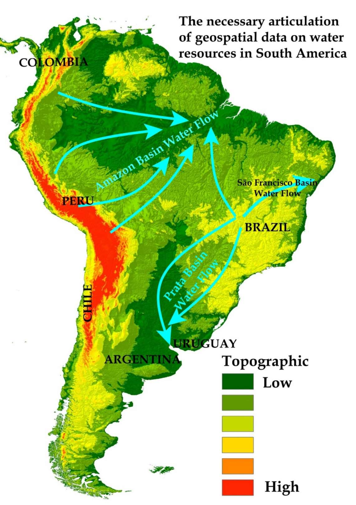
1. Introduction
2. Materials and Methods
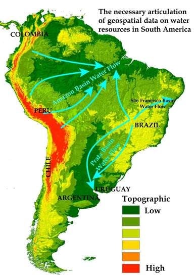
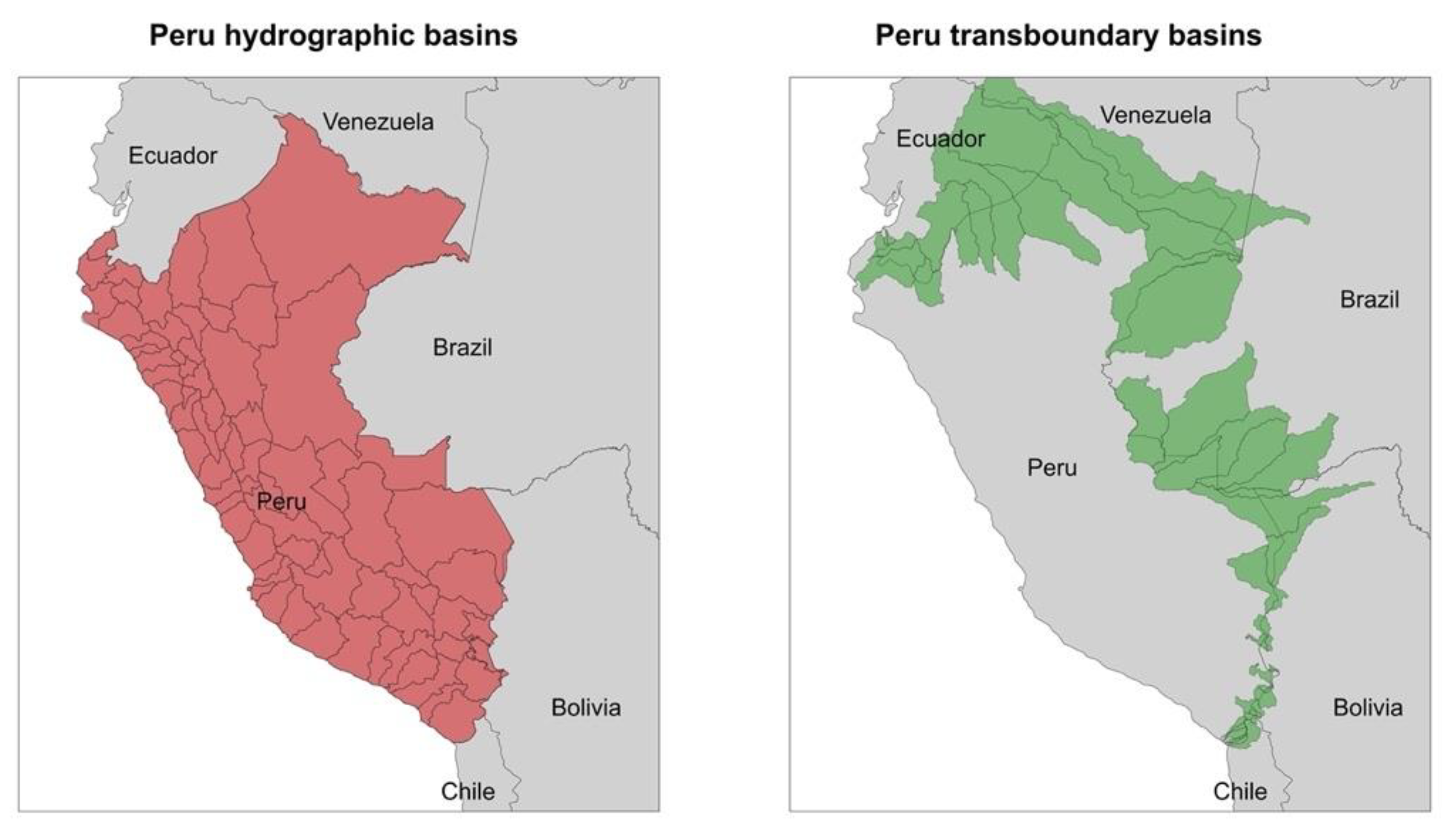
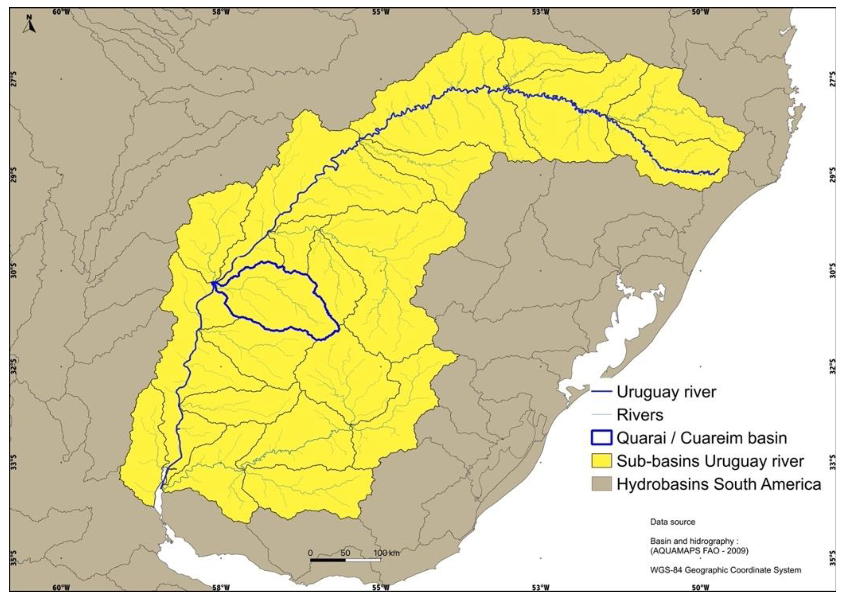
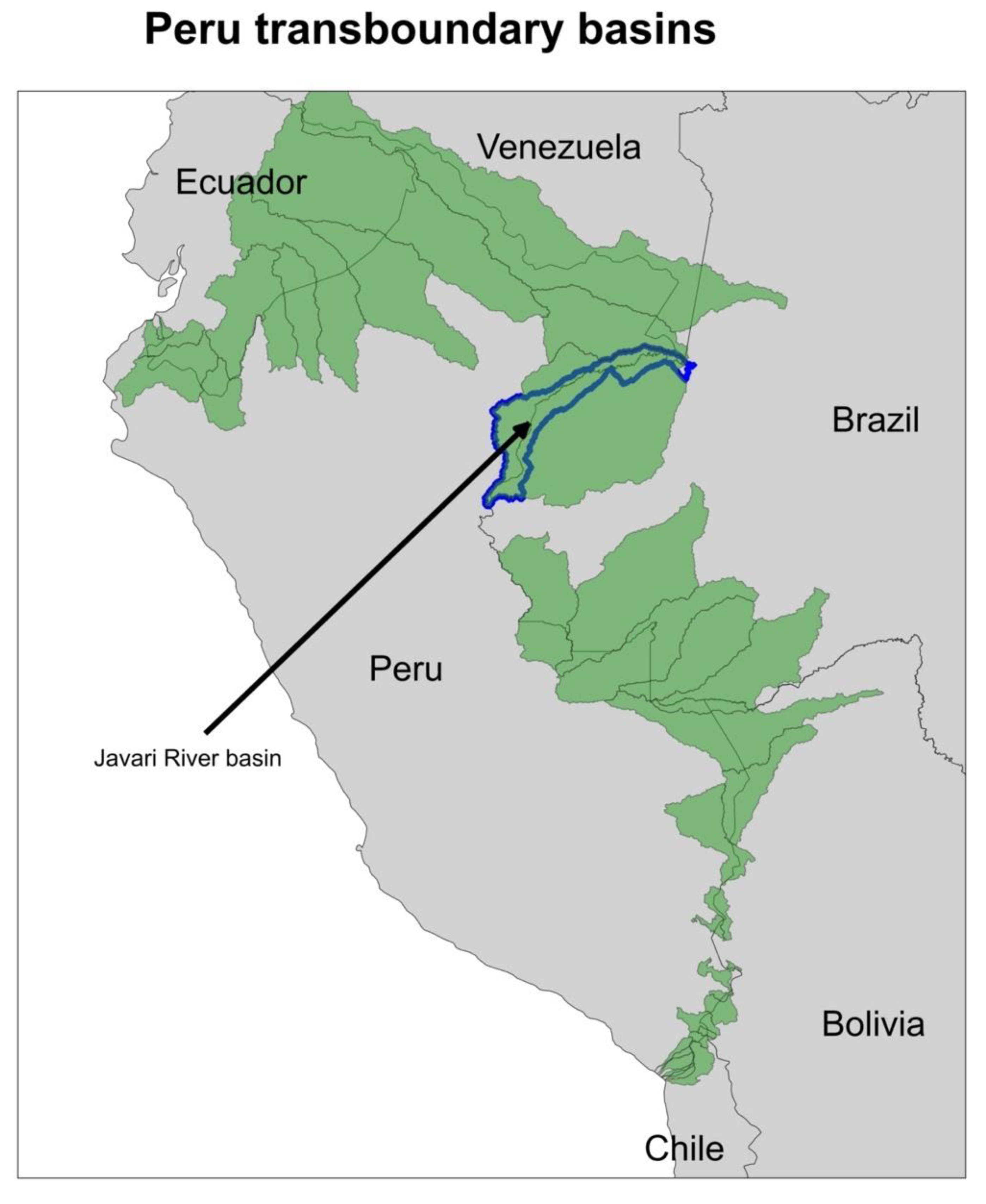
2.1. Study Area
- (A)
- Level 0: River Plate Basin
- (B)
- Level 1: Uruguay River Basin
- (C)
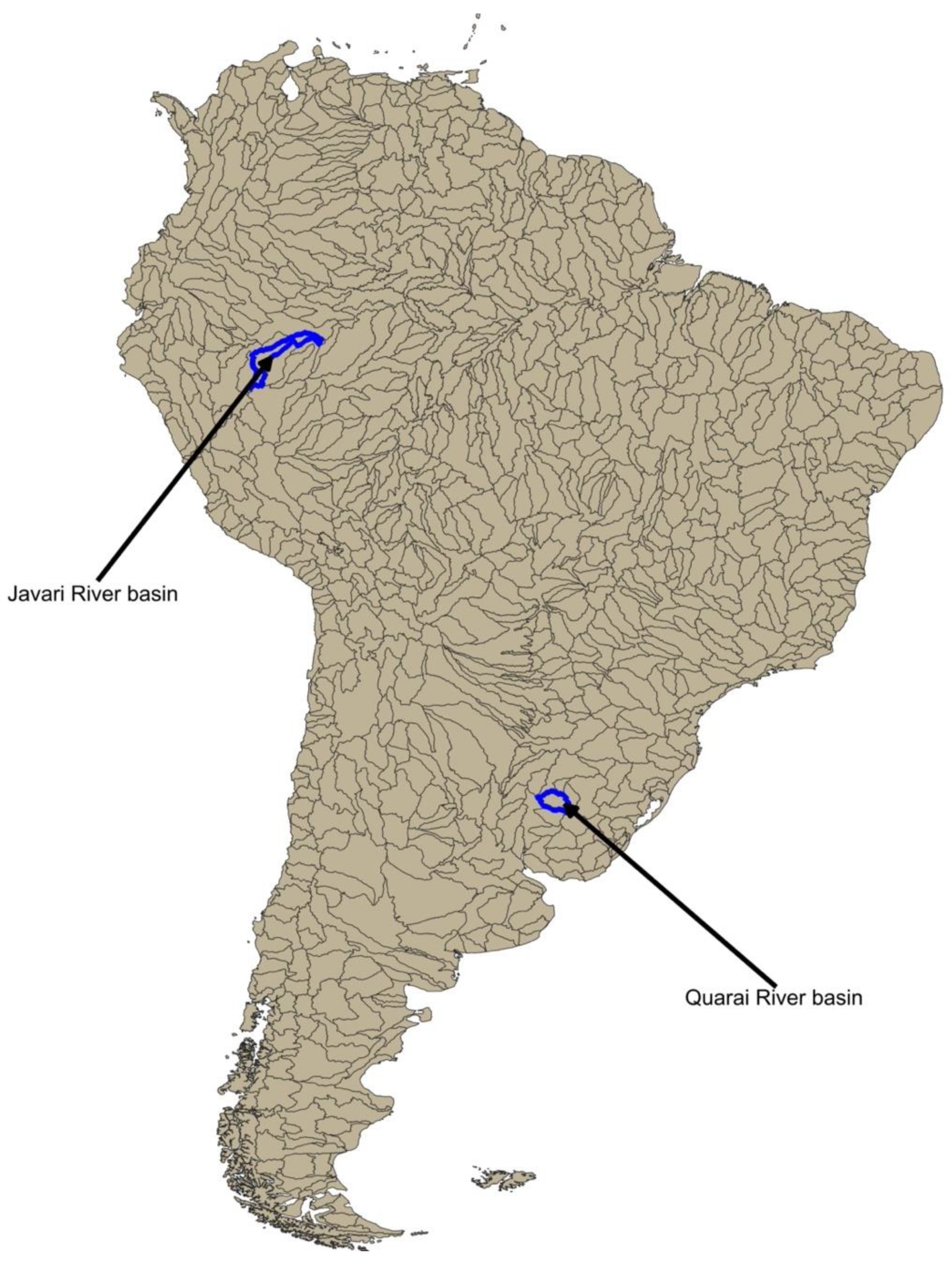
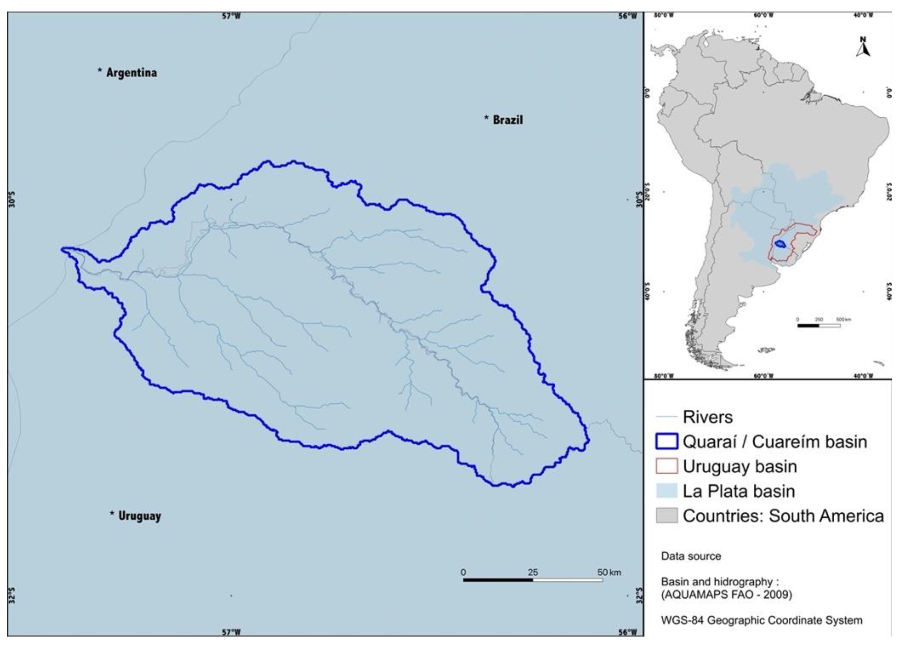
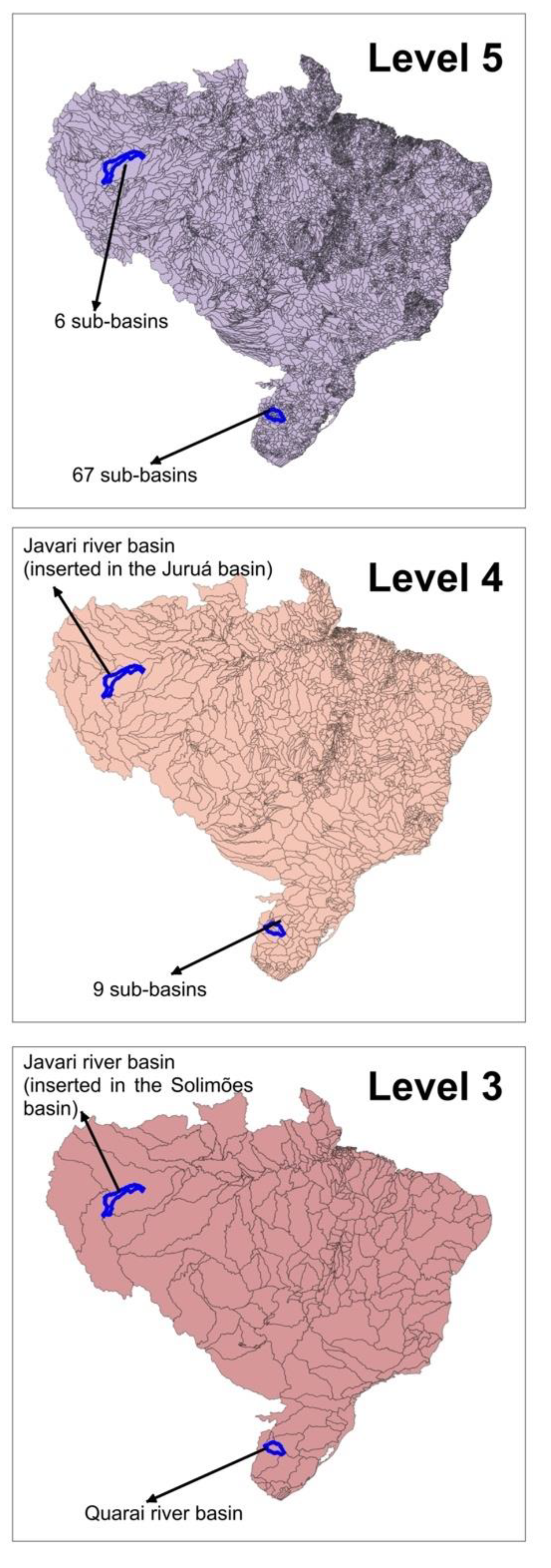
- Level 2: Quaraí/Cuareím River Basin
- (A)
- Level 0: Amazon River Basin
- (B)
- Level 1: Solimões River Basin
- (C)
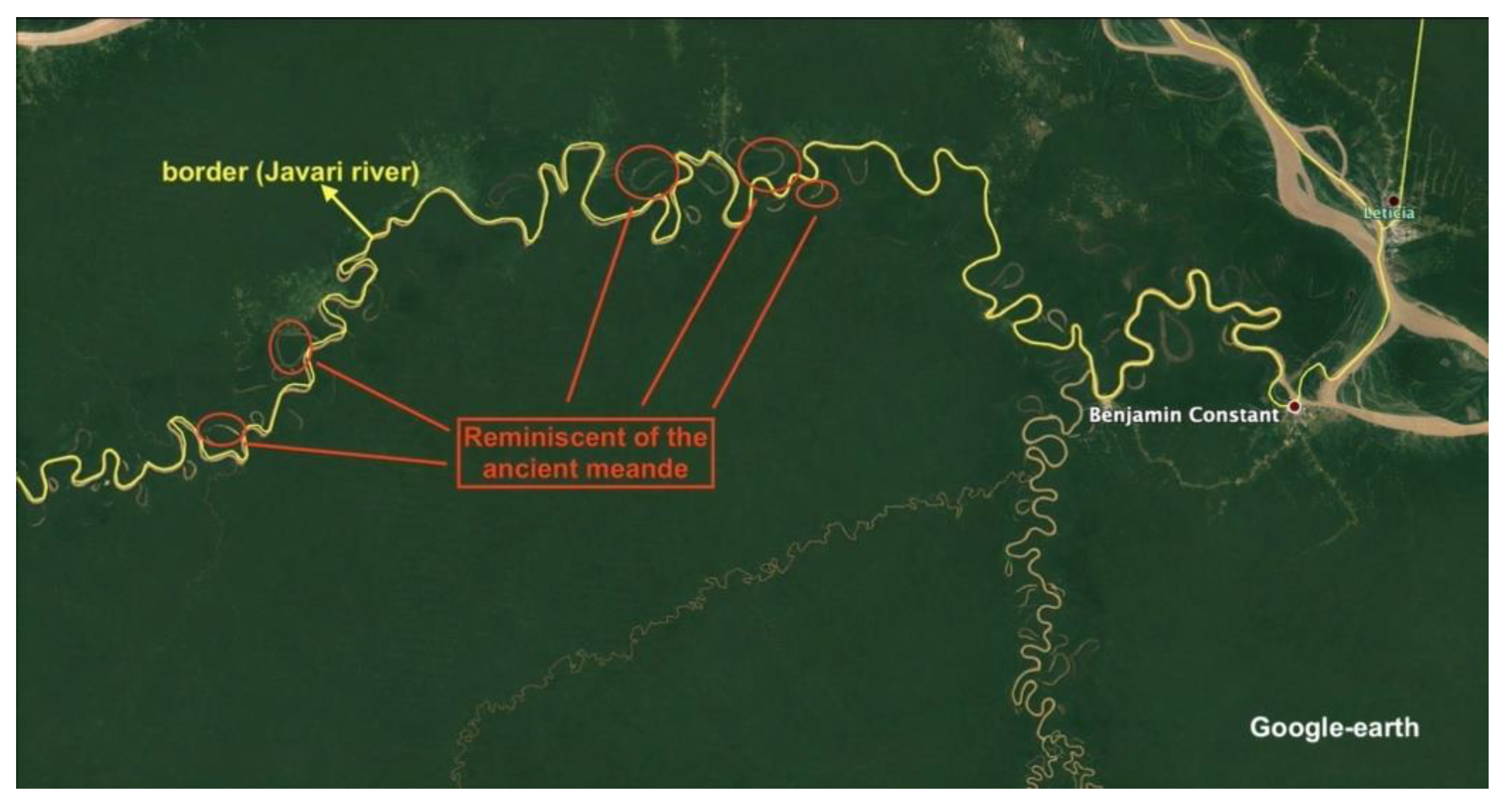
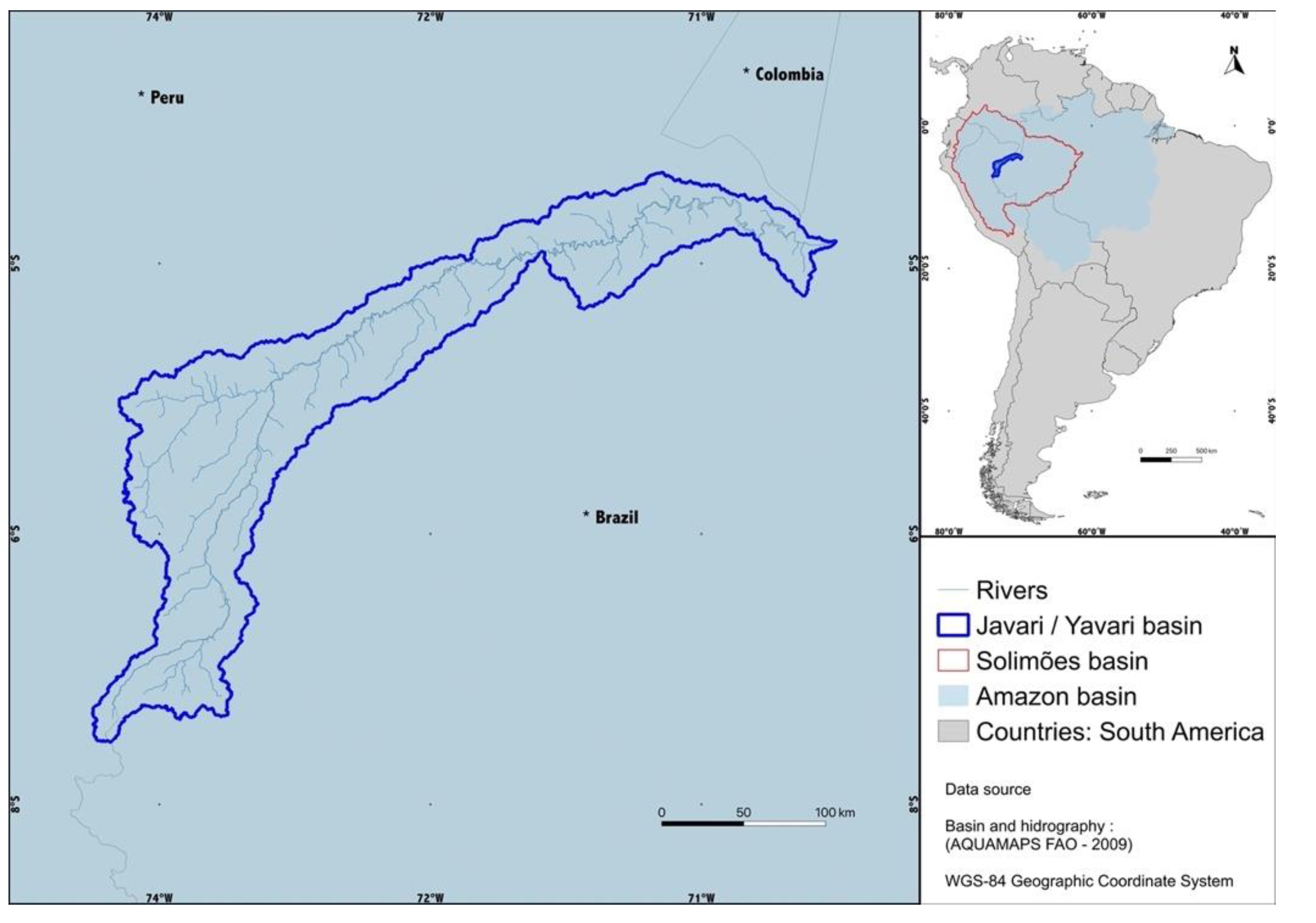
- Level 2: The transboundary Javari/Yavarí River basin
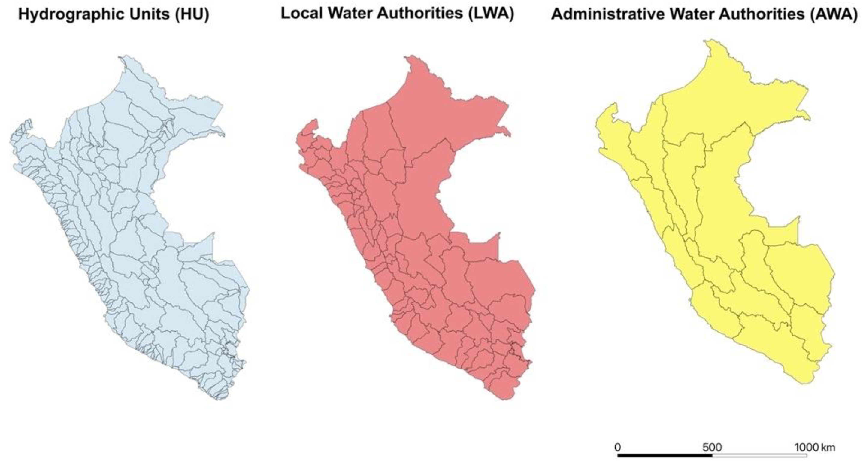
2.2. Materials
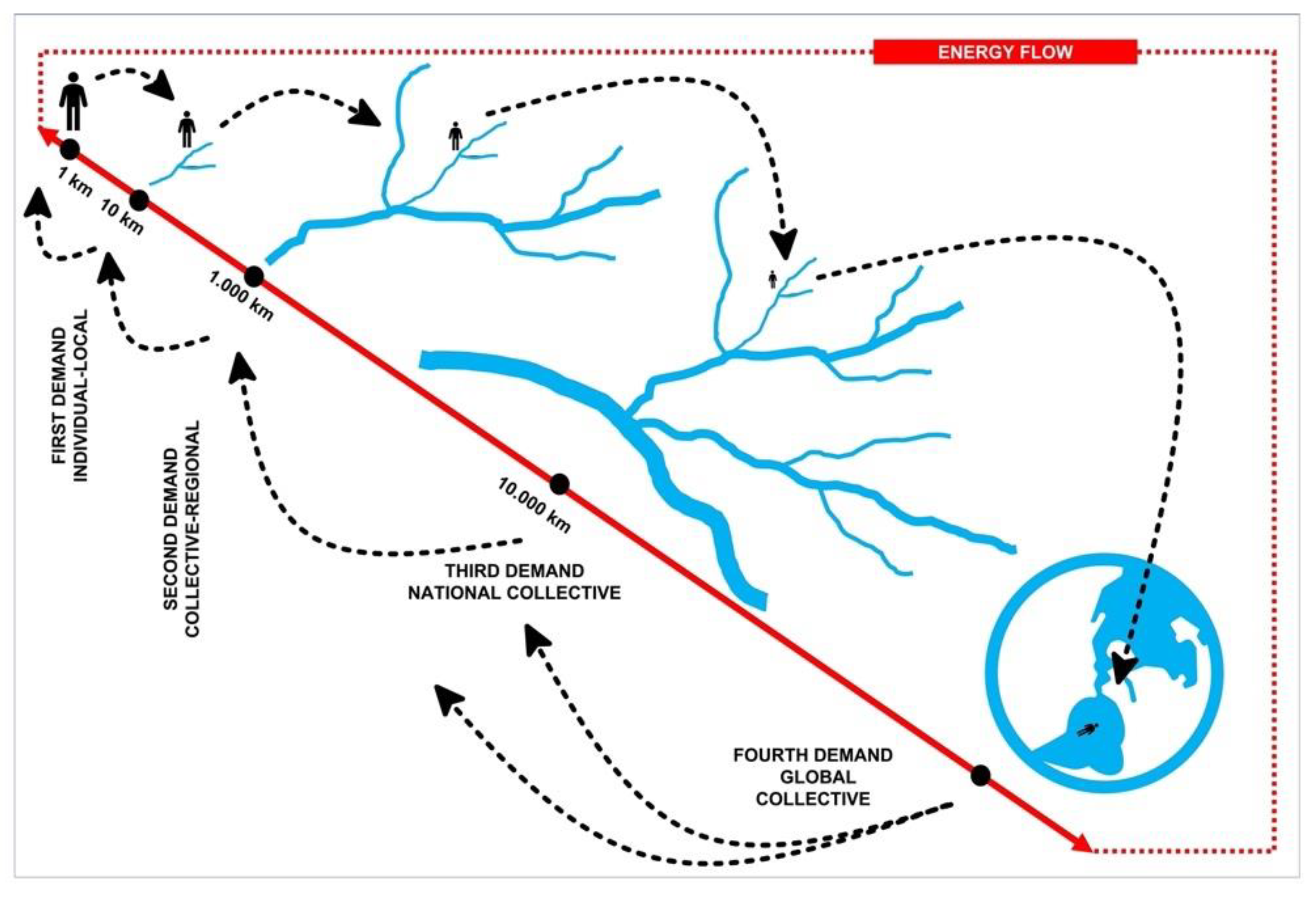
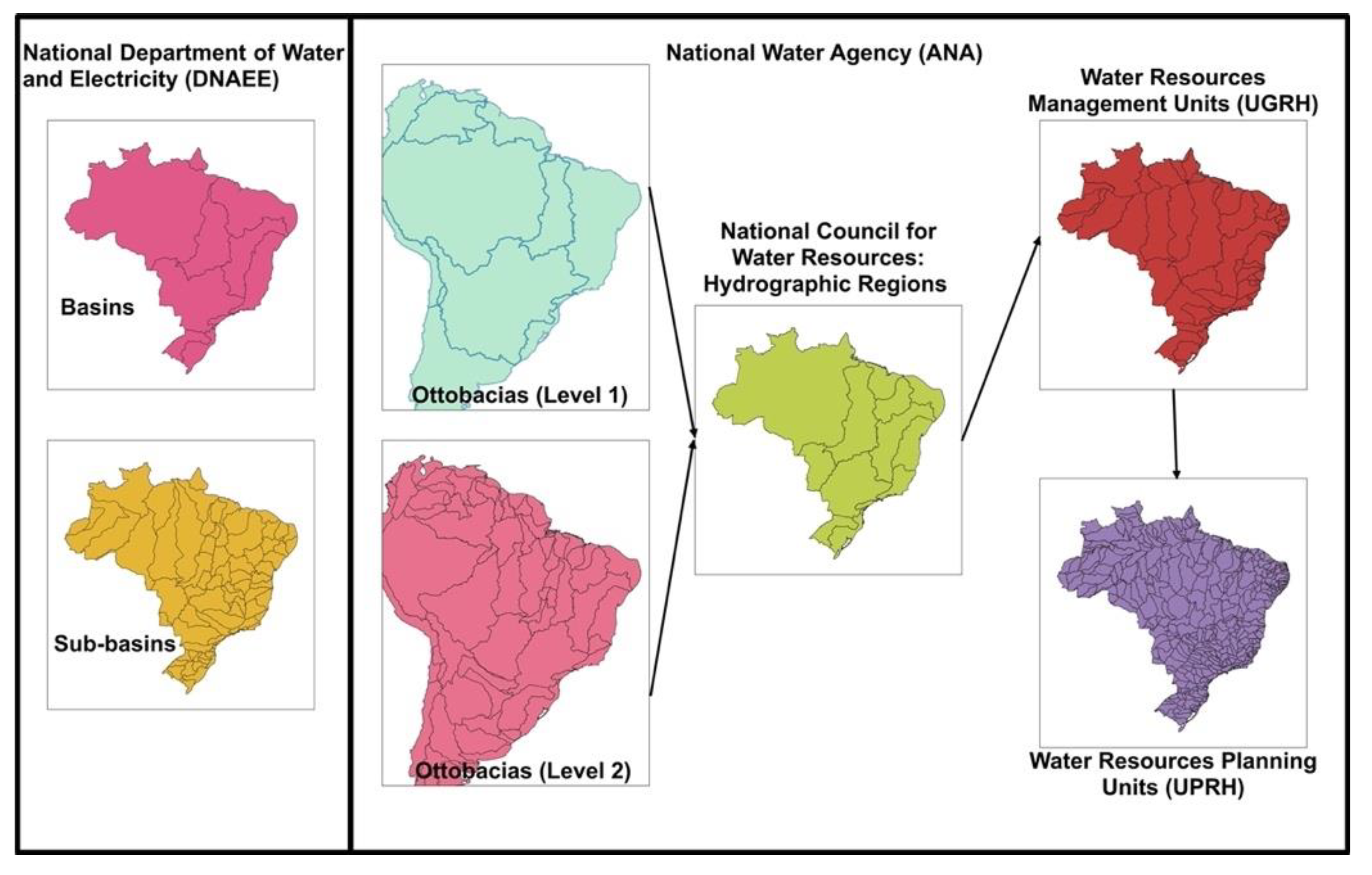
2.3. Methods
3. Results
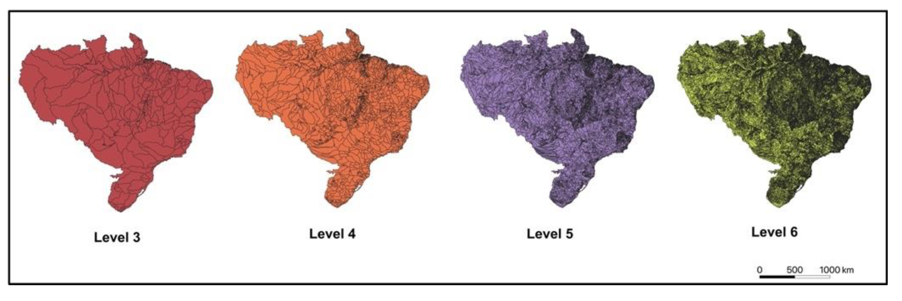
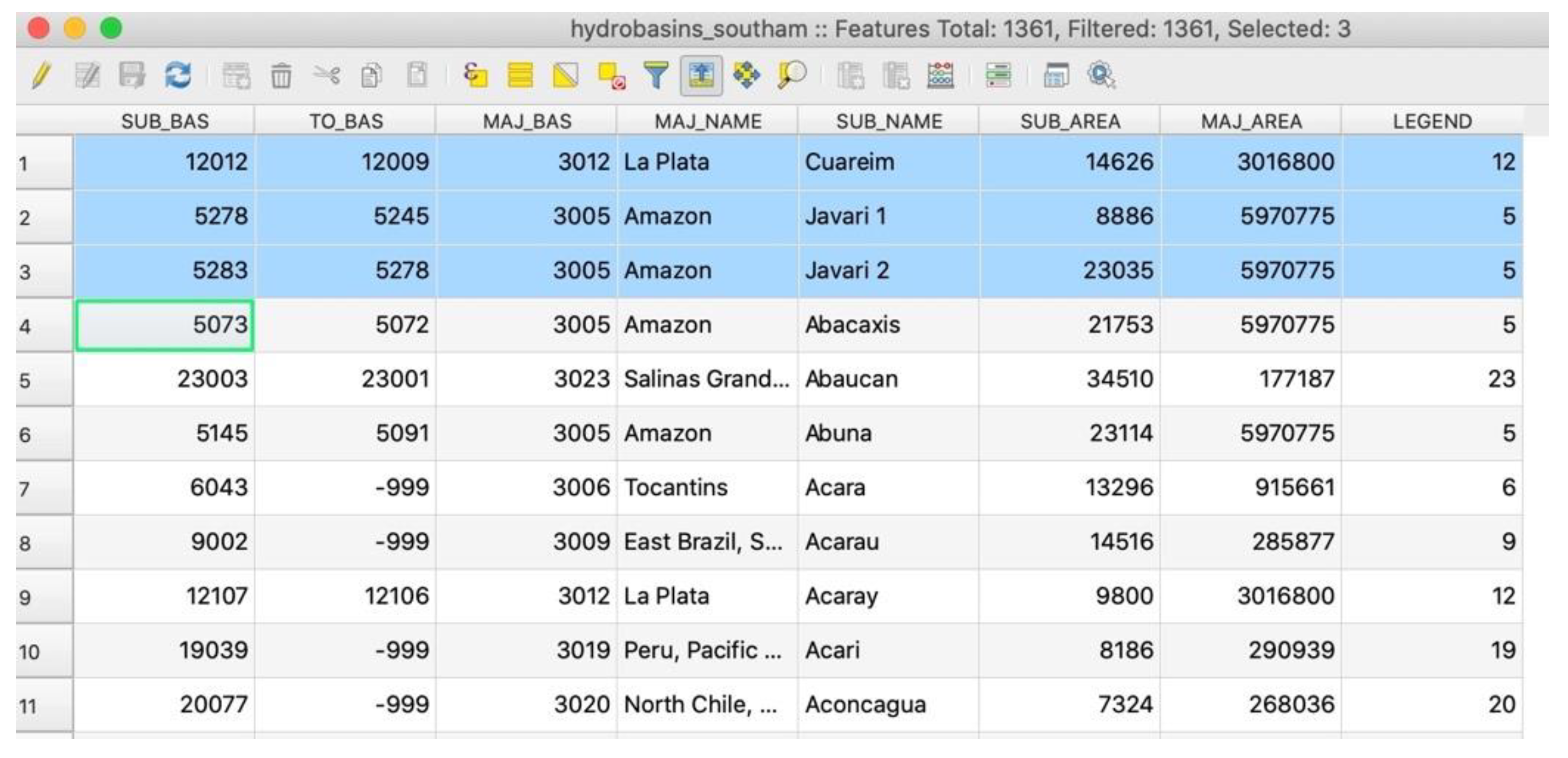
3.1. Analysis of the Official Databases
3.2. Complementarity of Transboundary Basin’ Data
4. Discussion
5. Conclusions
- A coordinating body capable of working with each country’s representatives and idiosyncrasies is required to build an articulated database and make transboundary basin management in South America more feasible. The primary goal of this coordinating body would be to develop a standard method and scale that would apply to all patriating countries while respecting each country’s unique water management strategies. The Otto–Pfafstetter method is recommended here, with a common scale of 1:100,000 structured in three hierarchical levels.
- Accurate database organization is required to avoid problems such as mismatched borders caused by overlapping national databases or scale issues. Accuracy also includes the presentation of complementary alphanumeric data (such as basin names or the names of its main rivers) to aid in the identification of transboundary basins delimitations.
- Historical data on river morphology is required because river meanders can change, affecting country borders and national surface area in a specific water basin.
Author Contributions
Funding
Institutional Review Board Statement
Informed Consent Statement
Data Availability Statement
Acknowledgments
Conflicts of Interest
References
- Saito, C.H. Quais seriam as Questões Globais que desafiam a Educação Ambiental? Para além do modismo, uma análise sistemática e uma visão sistêmica. REMEA-Rev. Eletrôn. Mestr. Educ. Ambient. 2017, 1, 4–24. [Google Scholar] [CrossRef] [Green Version]
- Sadoff, C.W.; Borgomeo, E.; Uhlenbrook, S. Rethinking water for SDG 6. Nat. Sustain. 2020, 3, 346–347. [Google Scholar] [CrossRef]
- Bouwer, H. Integrated Water Management for the 21st Century: Problems and Solutions. J. Irrig. Drain. Eng. 2002, 128, 193–202. [Google Scholar] [CrossRef]
- Falkenmark, M. Water resilience and human life support—Global outlook for the next half century. Int. J. Water Resour. Dev. 2020, 36, 377–396. [Google Scholar] [CrossRef] [Green Version]
- Global Water Partnership. Towards Water Security: A Framework for Action; GWP: Stockholm, Sweden, 2000. [Google Scholar]
- UNEP. Transboundary Waters Systems—Status and Trends: Crosscutting Analysis; United Nations Environment Programme (UNEP): Nairobi, Kenya, 2016. [Google Scholar]
- UNDEP. Human Development Report 2006; UNDEP: New York, NY, USA, 2000. [Google Scholar]
- Wolf, A. Conflict and cooperation along international waterways. Water Policy 1998, 1, 251–265. [Google Scholar] [CrossRef]
- Steinke, V.A.; Hessel, F.D.O.; Saito, C.H. Considerações sobre o Brasil e a geopolítica das bacias hidrográficas transfronteiriças. Geosul 2013, 28, 89. [Google Scholar] [CrossRef] [Green Version]
- Steinke, V.A.; Saito, C.H. Priority wetlands for conservation of waterbird´s diversity in the Mirim lagoon catchement area (Brazil-Uruguay). Pan-Am. J. Aquat. Sci. 2013, 8, 221–239. [Google Scholar]
- Budds, J.; Hinojosa, L. Restructuring and rescaling water governance in mining contexts: The co-production of waterscapes in Peru. Water Altern. 2012, 5, 119–137. [Google Scholar]
- Norman, E.S.; Bakker, K. Transgressing Scales: Water Governance Across the Canada–U.S. Borderland. Ann. Assoc. Am. Geogr. 2009, 99, 99–117. [Google Scholar] [CrossRef]
- Rokkan, S. The comparative study of political participation: Notes toward a perspective on current research. In Essays on the Behavioral Study of Politics; Ranney, A., Ed.; Urbana: University of Illinois, IL, USA, 1962; pp. 47–90. [Google Scholar]
- Bana e Costa, C.A. Readings in Multiple Criteria Decision Aid; Bana e Costa, C.A., Ed.; Springer: New York, NY, USA, 1990. [Google Scholar]
- Maystre, L.; Pictet, J.; Simos, J. Méthodes Multicritères ELECTRE—Description, Conseils Pratiques et Cas d’Application à la Gestion Environnementale; Presses Polytechniques et Universitaires Romandes: Lausanne, Switzerland, 1994. [Google Scholar]
- Munda, G.; Parruccini, M.; Rossi, G. Multicriteria evaluation methods in renewable resource management: Integrated water management under drought conditions. In Multicriteria Analysis for Land-Use Management; Beinat, E., Nijkamp, P., Eds.; Environment & Management; Springer: Dordrecht, The Netherlands, 1998; Volume 9. [Google Scholar] [CrossRef]
- Munda, G. Multi-criteria decision analysis and sustainable development. In Multiple-Criteria Decision Analysis. State of the Art Surveys; Figueira, J., Greco, S., Ehrgott, M., Eds.; Springer International Series in Operations Research and Management Science; Springer: Berlin/Heidelberg, Germany, 2005; pp. 953–986. [Google Scholar]
- Roy, B. Méthodologie Multicritère d’Aide à la Décision; Ediciones Economica: Barcelona, Spain, 1985. [Google Scholar]
- Tucci, C.E.M.; Clarke, R.T. Environmental Issues in the la Plata Basin. Int. J. Water Resour. Dev. 1998, 14, 157–173. [Google Scholar] [CrossRef]
- Abreu, R.C.; Cunningham, C.; Rudorff, C.M.; Rudorff, N.; Abatan, A.A.; Tett SF, B.; Dong, B.; Lott, F.C.; Sparrow, S.N. Contribution of Anthropogenic Climate Change to April–May 2017 Heavy Precipitation over the Uruguay River Basin. Bull. Am. Meteorol. Soc. 2019, 100, S37–S41. [Google Scholar] [CrossRef]
- Suertegaray, D.M.A. Deserto Grande do Sul: Controvérsia; Universidade Federal do Rio Grande do Sul Publisher: Porto Alegre, Brazil, 1998. [Google Scholar]
- Calhman, O.K.B.; da Hora, M. Shared management of water resources among sovereign states in Latin America: The case of the River Plate basin. J. Environ. Prot. 2016, 7, 1089–1095. [Google Scholar] [CrossRef] [Green Version]
- Goulding, M.; Barthem, R.; Ferreira, E.J.G. The Smithsonian Atlas of the Amazon; Smithsonian Books: Washington, DC, USA, 2003. [Google Scholar]
- Marengo, J.A. On the hydrological cycle of the Amazon Basin: A historical review and current state-of-the-art. Rev. Bras. De Meteorol. 2006, 21, 1–19. Available online: http://mtc-m16b.sid.inpe.br/col/sid.inpe.br/mtc-m15@80/2007/04.23.17.52/doc/Marengo_RBM.pdf (accessed on 5 December 2020).
- Paiva, R.C.D. Modelagem Hidrológica e Hidrodinâmica de Grandes Bacias: Estudo de Caso: Bacia do Rio Solimões. Master’s Thesis, Federal University of Rio Grande do Sul, Porto Alegre, Brazil, 2009. [Google Scholar]
- Hess, L.L.; Melack, J.M.; Novo, E.M.; Barbosa, C.C.; Gastil, M. Dual-season mapping of wetland inundation and vegetation for the central Amazon basin. Remote Sens. Environ. 2003, 87, 404–428. [Google Scholar] [CrossRef]
- Becker, B. Amazônia: Geopolítica na Virada do III Milênio; Garamond: São Paulo, Brazil, 2009. [Google Scholar]
- Balieiro, L.F.d.V.D.; Nascimento, I.R. Tríplice fronteira Brasil, Peru e Colômbia e as implicações com o narcotráfico. Textos Debates 2015, 2, 85–98. [Google Scholar] [CrossRef] [Green Version]
- Linke, S.; Lehner, B.; Ouellet Dallaire, C.; Ariwi, J.; Grill, G.; Anand, M.; Beames, P.; Burchard-Levine, V.; Maxwell, S.; Moidu, H.; et al. Global hydro-environmental sub-basin and river reach characteristics at high spatial resolution. Sci. Data 2019, 6, 283. [Google Scholar] [CrossRef] [PubMed] [Green Version]
- Pfafstetter, O. Classificação de Bacias Hidrográficas—Metodologia de Codificação; Departamento Nacional de Obras de Saneamento (DNOCS): Rio de Janeiro, Brazil, 1989. [Google Scholar]
- Agência Nacional de Águas (ANA). Codificação de Bacias Hidrográficas Pelo Método de Otto-Pfafstetter. Agência Nacional de Águas, Brasil. 2014. Available online: https://capacitacao.ana.gov.br/conhecerh/handle/ana/104 (accessed on 10 December 2020).
- Galvão, W.S.; Meneses, P.R. Avaliação dos Sistemas de Classificação e Codificação das Bacias Hidrográficas Brasileiras para Fins de Planejamento de Redes Hidrométricas [Conference paper]. In Proceedings of the Anais XII Simpósio Brasileiro de Sensoriamento Remoto, Goiânia, Brazil, 16–21 April 2005; Available online: http://marte.dpi.inpe.br/col/ltid.inpe.br/sbsr/2004/11.21.01.26/doc/2511.pdf (accessed on 16 December 2020).
- Marinho, B.C. Principais Obstáculos no Combate aos Crimes Ambientais no Rio Javari, na Fronteira Entre Brasil e Peru. Master’s Thesis, State University of Amazonas, Manuas, Brazil, 2016. [Google Scholar]
- Carneiro, D.S. Morfodinâmica Fluvial do Rio Solimões, Trecho Tabatinga a Benjamin Constant—AM e suas Implicações para o Ordenamento Territorial/Deize de Souza Carneiro. Niterói: [s.n.], 2009. 151 f. Dissertação (Mestrado em Geografia). Master’s Thesis, Universidade Federal Fluminense, Rio de Janeiro, Brazil, 2009. [Google Scholar]


| Country | Name | Level | Method | Year | Scale |
|---|---|---|---|---|---|
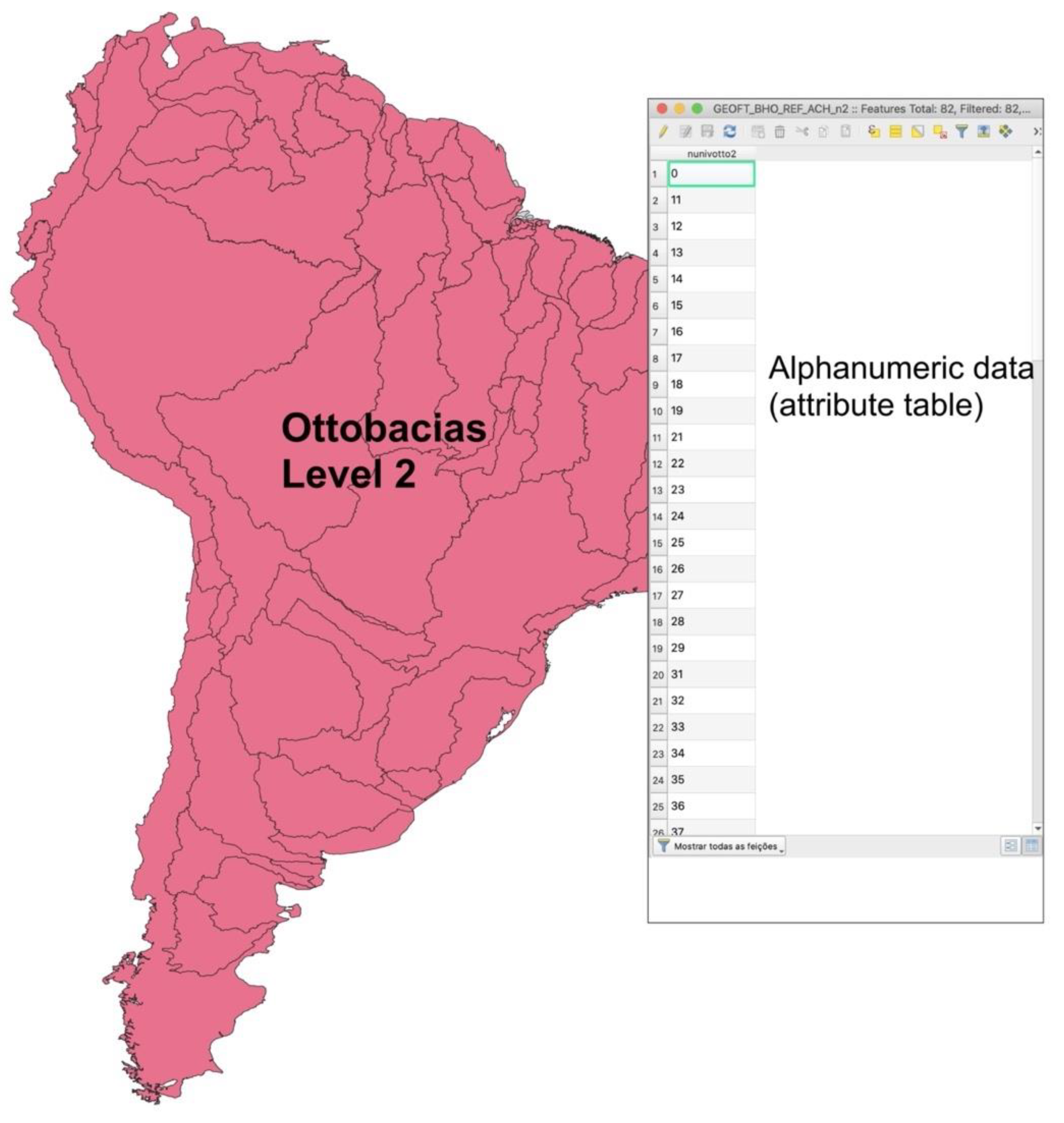
| Brazil | Basins and sub-basins | 1 to 6 | Otto–Pfafstetter | 2012 | 1:1,000,000 |
| Peru | Hydrographic units | 1 to 8 | Otto–Pfafstetter | 2007 | 1:100,000 |
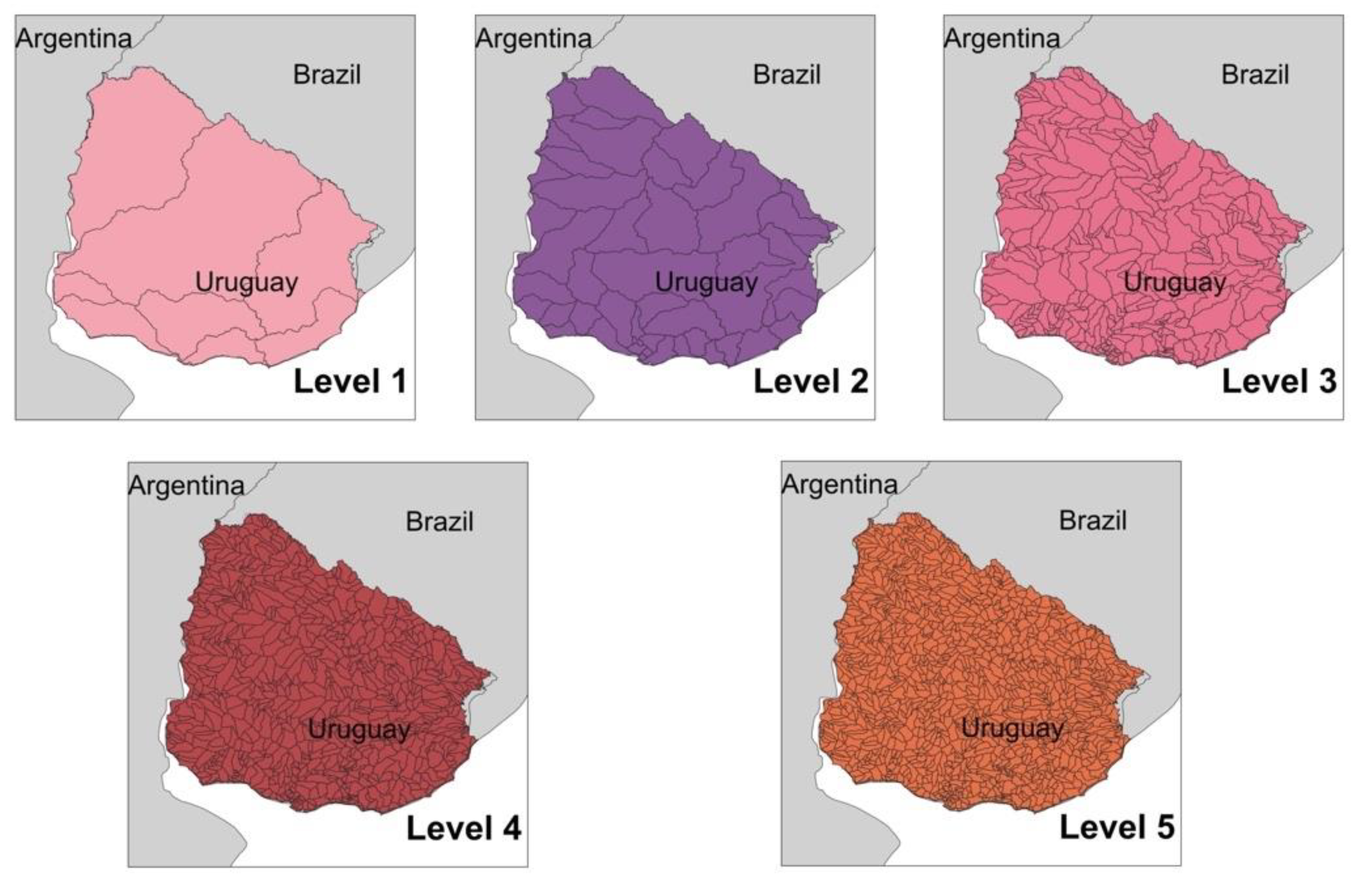
| Uruguay | Basins and sub-basins | 1 to 5 | Derived from topographic maps | 2009 | 1:50,000 |
Publisher’s Note: MDPI stays neutral with regard to jurisdictional claims in published maps and institutional affiliations. |
© 2022 by the authors. Licensee MDPI, Basel, Switzerland. This article is an open access article distributed under the terms and conditions of the Creative Commons Attribution (CC BY) license (https://creativecommons.org/licenses/by/4.0/).
Share and Cite
Steinke, V.A.; Pessoa, G.E.; Silva, R.G.P.d.; Saito, C.H. Conceptual and Methodological Foundations for the Articulation of Geospatial Data on Water Resources in South America’s Cross-Border Hydrographic Basins. Water 2022, 14, 2427. https://doi.org/10.3390/w14152427
Steinke VA, Pessoa GE, Silva RGPd, Saito CH. Conceptual and Methodological Foundations for the Articulation of Geospatial Data on Water Resources in South America’s Cross-Border Hydrographic Basins. Water. 2022; 14(15):2427. https://doi.org/10.3390/w14152427
Chicago/Turabian StyleSteinke, Valdir Adilson, Gabriella Emilly Pessoa, Romero Gomes Pereira da Silva, and Carlos Hiroo Saito. 2022. "Conceptual and Methodological Foundations for the Articulation of Geospatial Data on Water Resources in South America’s Cross-Border Hydrographic Basins" Water 14, no. 15: 2427. https://doi.org/10.3390/w14152427